Discover 11 hidden attractions, cool sights, and unusual things to do in Par (United Kingdom). Don't miss out on these must-see attractions: Eden Project, Tregaminion Church, and Castle Dore. Also, be sure to include Prideaux Castle in your itinerary.
Below, you can find the list of the most amazing places you should visit in Par (England).
Table of Contents
Eden Project
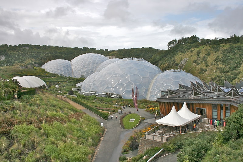
Iconic eco park with educational centre. The Eden Project is a visitor attraction in Cornwall, England, UK. The project is located in a reclaimed china clay pit, located 2 km from the town of St Blazey and 5 km from the larger town of St Austell.
The complex is dominated by two huge enclosures consisting of adjoining domes that house thousands of plant species, and each enclosure emulates a natural biome. The biomes consist of hundreds of hexagonal and pentagonal ethylene tetrafluoroethylene (ETFE) inflated cells supported by geodesic tubular steel domes. The larger of the two biomes simulates a rainforest environment (and is the largest indoor rainforest in the world) and the second, a Mediterranean environment. The attraction also has an outside botanical garden which is home to many plants and wildlife native to Cornwall and the UK in general; it also has many plants that provide an important and interesting backstory, for example, those with a prehistoric heritage.
There are plans to build an Eden Project North in the seaside town of Morecambe, Lancashire, with a focus on the marine environment.[1]
Address: Bodelva Rd, PL24 2SZ Par
Tregaminion Church
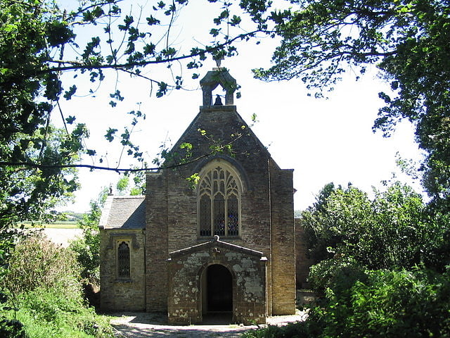
Episcopal church in England. Tregaminion Church is a Church of England church in Tregaminion, Cornwall, England, UK. The church dates to the early 19th century and is a Grade II* listed building.[2]
Castle Dore
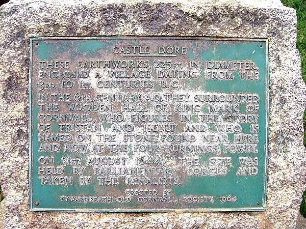
Castle in England. Castle Dore is an Iron Age hill fort near Fowey in Cornwall, United Kingdom located at grid reference SX103548. It was probably occupied from the 5th or 4th centuries BC until the 1st century BC. It consists of two ditches surrounding a circular area 79 metres in diameter. Excavated in the 1930s, it is one of the most intensively investigated Iron Age hillforts in Cornwall.[3]
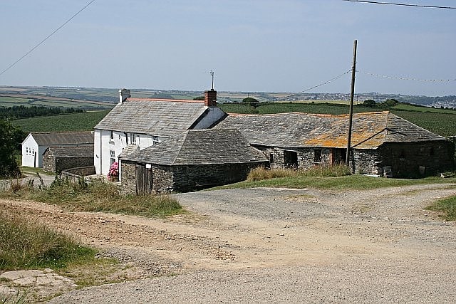
Prideaux Castle
Prideaux Castle is a multivallate Iron Age hillfort situated atop a 133 m high conical hill near the southern boundary of the parish of Luxulyan, Cornwall, England, United Kingdom. It is also sometimes referred to as Prideaux Warren, Prideaux War-Ring, or Prideaux Hillfort. The site is a scheduled monument and so protected from unauthorised works by the Ancient Monuments and Archaeological Areas Act 1979.[4]
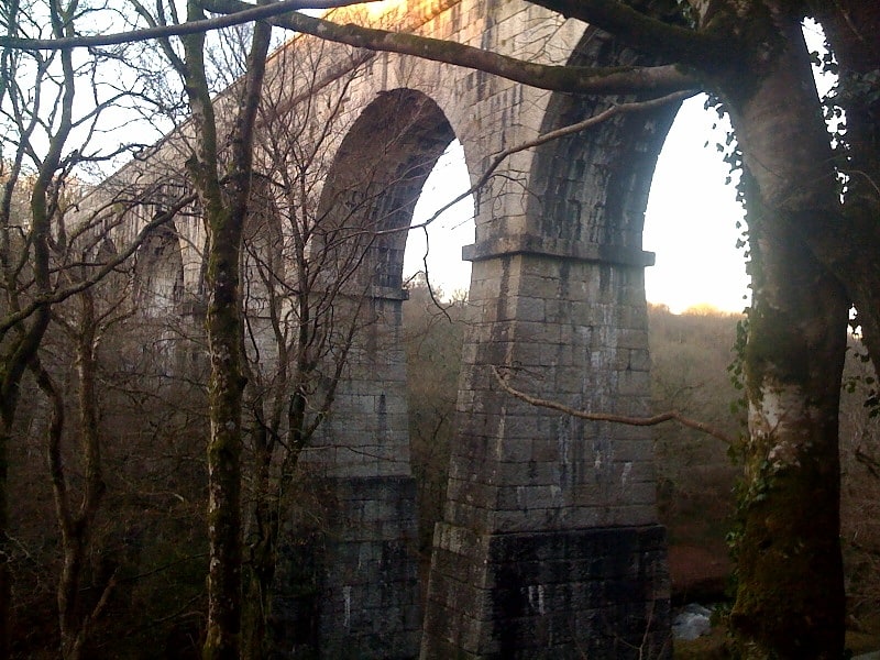
Treffry Viaduct
The Treffry Viaduct is a historic dual-purpose railway viaduct and aqueduct located close to the village of Luxulyan, Cornwall in the United Kingdom. The viaduct crosses the Luxulyan Valley, and with it forms an integral part of the Cornwall and West Devon Mining Landscape, a World Heritage Site. It is scheduled under the Ancient Monuments and Archaeological Areas Act 1979 and due to its poor condition is on Historic England's, Heritage at Risk Register.[5]
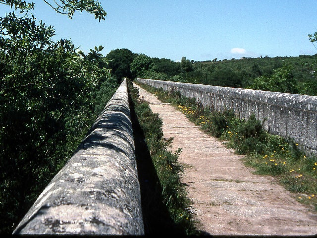
Luxulyan Valley
The Luxulyan Valley is the steep sided and thickly wooded valley of the River Par, situated in mid Cornwall, England, UK. It contains a major concentration of early 19th century industrial remains, and was designated as part of a World Heritage Site in 2006.
The valley stretches south-east from the village of Luxulyan 50.390°N 4.744°W / 50.390; -4.744. It reaches as far as the edge of the built-up area around the town of St Blazey and the port of Par, a distance of some 5 km. It lies within the civil parishes of Luxulyan, Lanlivery and Tywardreath, and is one of the areas (designated A8i in the original nomination) of the larger, but discontinuous, Cornwall and West Devon Mining Landscape World Heritage Site.
Most of the industrial remains in the valley are the results of the endeavours of Joseph Treffry (1782–1850). Copper mining was booming in the area during the early 19th century, and Treffry was the owner of Fowey Consols mine, one of the deepest, richest and most important of the Cornish copper mines. The mine was situated to the east of the southern end of the Luxulyan Valley proper, and its site is part of the designated World Heritage Site. At its peak it was worked by six steam engines and 17 water wheels.
In the late 1820s, Treffry built the port of Par Harbour. He then linked this to Pontsmill, at the southern end of the valley, by means of the Par Canal. A mineral tramway connected the canal head to the mine. A second tramway followed in 1835, via an inclined plane, a flat route along the eastern lip of the valley, and the major Treffry Viaduct across the valley to Luxulyan. This second route served two major purposes, as it enabled Treffry to develop Carbeans and Colcerrow granite quarries in the upper valley, and was also used by a leat carrying water to supply the mine at Fowey Consols. Two further granite quarries, known as Rock Mill and Orchard, operated lower down in the valley. In 1870 these were linked to Pontsmill by a third tramway along the valley floor.
The 1835 tramway eventually became part of the Cornwall Minerals Railway which linked the English Channel ports of Par and Fowey with the china clay workings of mid Cornwall, and to the Atlantic port of Newquay. As part of this process, the section of the route between Pontsmill and Luxulyan, with its incline and flat sections ideal for animal haulage, was replaced with a more gradually climbing route through the valley itself, more suited to locomotive haulage. The newer route is still in use, as part of the Atlantic Coast Line, and passes beneath the spans of the Treffry Viaduct that carried its predecessor. The older tramway routes remained in use to serve the various granite quarries until the early 20th century. The last stone came from Carbeans in 1933 but a few sections of Treffry's rails can still be found.
The thickly-wooded terrain of the Luxulyan Valley also played a major part in the early tin mining industry of Cornwall. The woods were important for making the charcoal that was needed in large quantities for smelting tin from the rich alluvial deposits on the moors to the northwest. Charcoal-burning platforms are to be found close to nearby Prideaux Castle.[6]
Par signal box
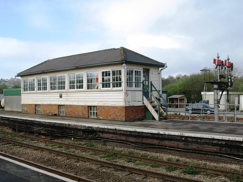
Par signal box is a Grade II listed former Great Western Railway signal box, located on Par railway station in Cornwall, England.
Opened in 1879 and built to the first GWR standard design, it was set up to control the GWR's mainline onwards to Penzance, together with the junction for the branch to Newquay. Located at the southern end of Platform 2, when first built it was less than half its current length, only containing 26 levers. In 1913, the frame was replaced, and a new frame of 57 levers was added. A panel has since been added to control the section through to St Austell and Burngullow as far west as the now closed Probus and Ladock railway station. Signals controlled from Par carry the identification code 'PR'.
In July 2013, it was one of 26 "highly distinctive" signal boxes listed by Ed Vaizey, minister for the Department for Culture, Media and Sport in July 2013, in a joint initiative by English Heritage and Network Rail to preserve and provide a window into how railways were operated in the past.[7]
Mid Cornwall Galleries
Gift shop, Shopping, Museum
Address: St Blazey Gate, Par
Carlyon
For the surname, see Carlyon
Carlyon is one of four new civil parishes created on 1 April 2009 for the St Austell area of south Cornwall, England, United Kingdom.
The new parish is part coastal and part rural in character. It includes the settlements of Carlyon Bay, Garker and Tregrehan Mills and is represented by nine councillors.
Carlyon Bay, the principal settlement in the parish, is approximately two miles east of St Austell.[8]
Cornwall Coliseum
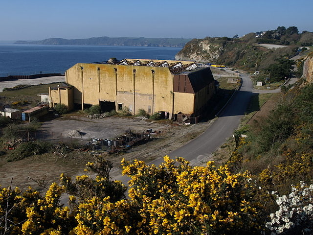
Cornwall Coliseum was a sport and entertainment venue located in St Austell, Cornwall, England. It hosted exhibitions, tennis tournaments and many concerts by leading musicians, but lost its importance with the opening of the Plymouth Pavilions in 1991.[9]
Clay Trails
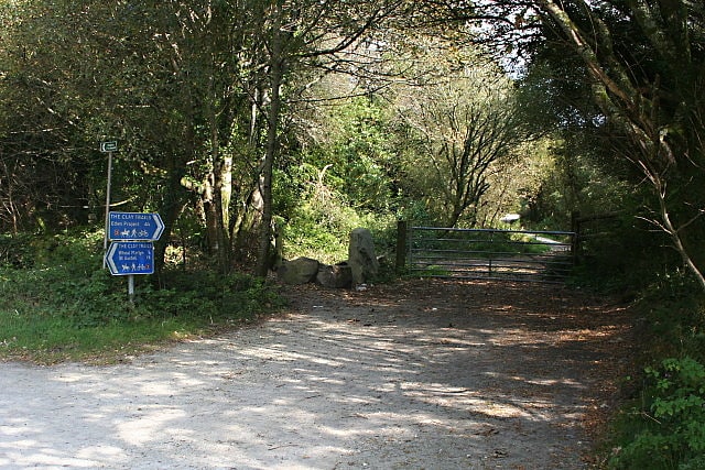
The Clay Trails are a series of bicycle trails located in mid Cornwall, England, United Kingdom. The trails pass through the St Austell moorland which for over two centuries has been extensively quarried for china clay, hence the name.
The trails are separated into several routes.[10]