Discover 35 hidden attractions, cool sights, and unusual things to do in Lake District National Park (United Kingdom). Don't miss out on these must-see attractions: Helvellyn, Green Gable, and Bowfell. Also, be sure to include Sca Fell in your itinerary.
Below, you can find the list of the most amazing places you should visit in Lake District National Park (England).
Table of Contents
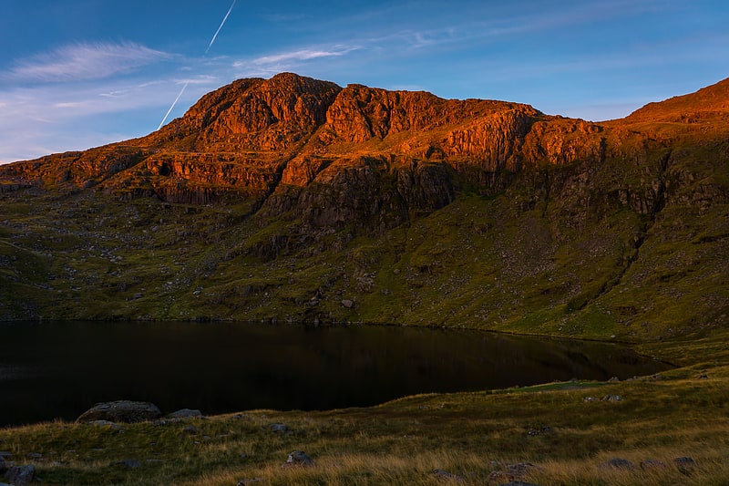
Helvellyn
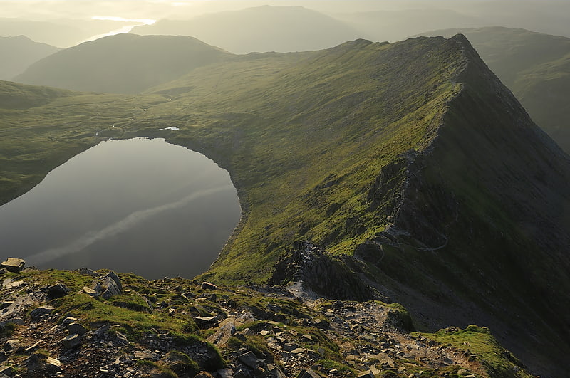
Mountain in England. Helvellyn is a mountain in the English Lake District, the highest point of the Helvellyn range, a north–south line of mountains to the north of Ambleside, between the lakes of Thirlmere and Ullswater.
Helvellyn is the third-highest point both in England and in the Lake District, and access to Helvellyn is easier than to the two higher peaks of Scafell Pike and Scafell. The scenery includes three deep glacial coves and two sharp-topped ridges on the eastern side (Striding Edge and Swirral Edge). Helvellyn was one of the earliest fells to prove popular with walkers and explorers; beginning especially in the later 18th century. Among the early visitors to Helvellyn were the poets Samuel Taylor Coleridge and William Wordsworth, both of whom lived nearby at one period. Many routes up the mountain are possible so that it may be approached from all directions.
However, traversing the mountain is not without dangers; over the last two hundred years there have been a number of fatalities. The artist Charles Gough is more famous for his death on Striding Edge in 1805 than for what he achieved in his life. Among many human feats upon the mountain, one of the strangest was the landing and take-off of a small aeroplane on the summit in 1926. Since early 2018 the summit of Helvellyn including both Striding and Swirral Edges and the wider Glenridding Common are now managed by the John Muir Trust, a wild places conservation charity under a three-year lease with the Lake District Park Authority.[1]
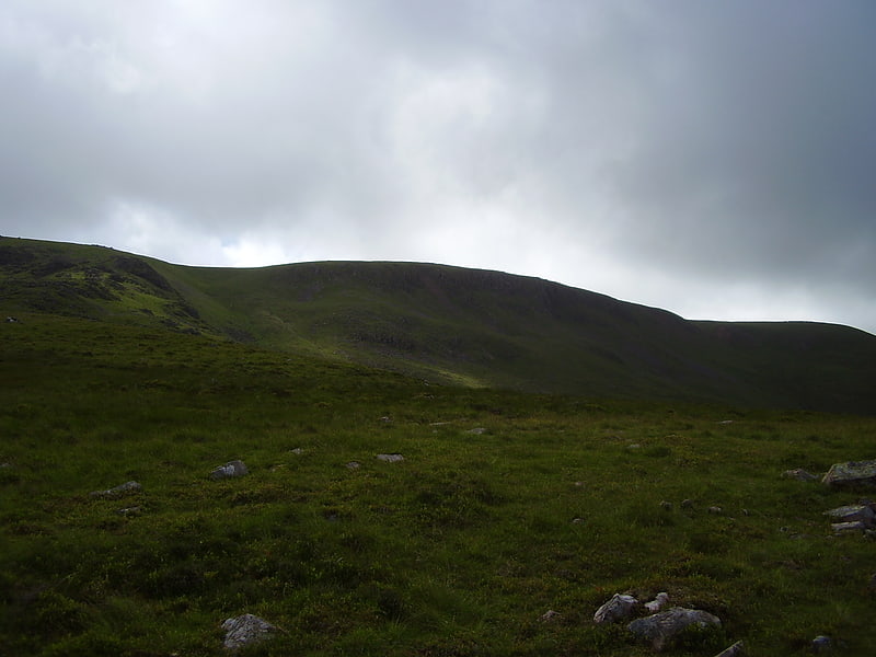
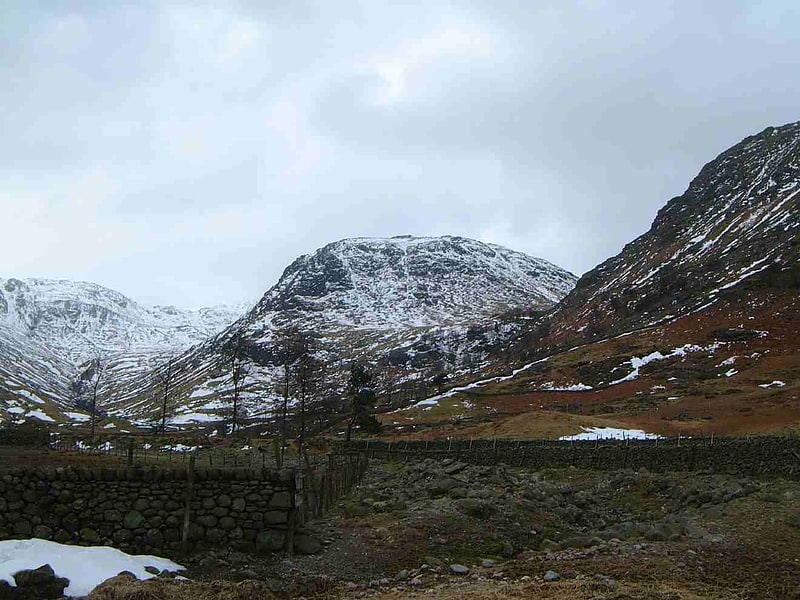
Green Gable
Fell in England. Green Gable is a fell in the English Lake District often traversed by walkers en route to its more famous neighbour Great Gable. It can be ascended from Honister Pass, Seathwaite in Borrowdale, or Ennerdale. There are good views of Gable Crag, Scafell Pike and the Buttermere valley from the summit.[2]
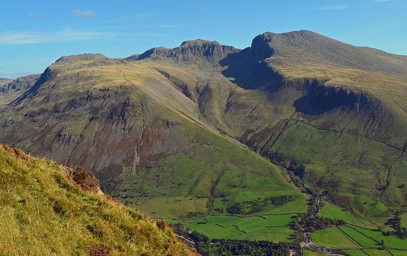
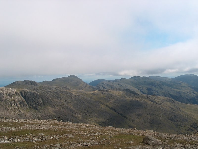
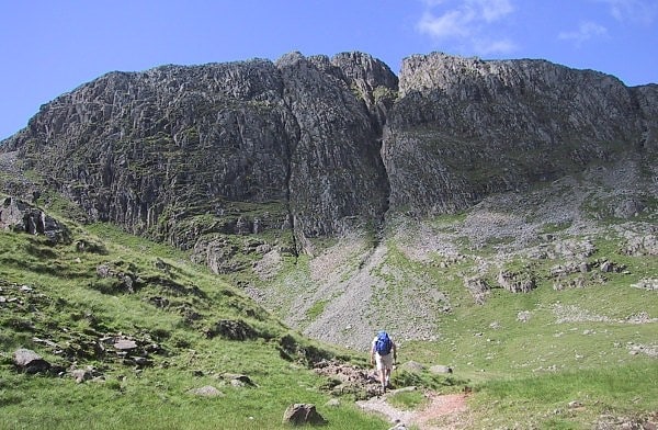
Bowfell
Mountain in England. Bowfell is a pyramid-shaped mountain lying at the heart of the English Lake District, in the Southern Fells area. It is the sixth-highest mountain in the Lake District and one of the most popular of the Lake District fells for walkers. It is listed in Alfred Wainwright's 'best half dozen' Lake District fells.[3]
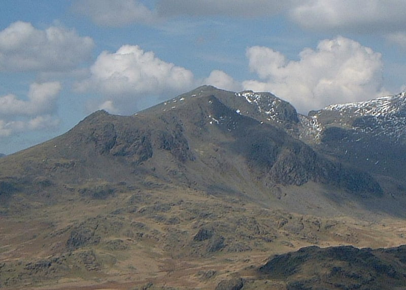
Sca Fell
Mountain in England. Scafell is a mountain in the English Lake District, part of the Southern Fells. Its height of 964 metres makes it the second-highest mountain in England after its neighbour Scafell Pike, from which it is separated by Mickledore col.[4]
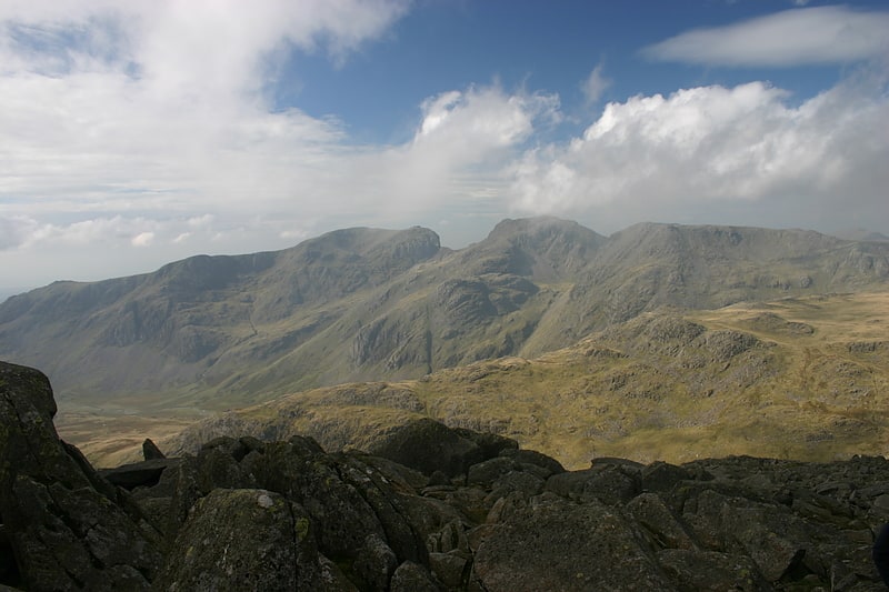
Scafell Pike
Mountain in England. Scafell Pike is the highest and the most prominent mountain in England, at an elevation of 978 metres above sea level. It is located in the Lake District National Park, in Cumbria, and is part of the Southern Fells and the Scafell massif.
Scafell Pike forms part of the inactive Scafells volcano.[5]
Address: Lake District, Lake District National Park
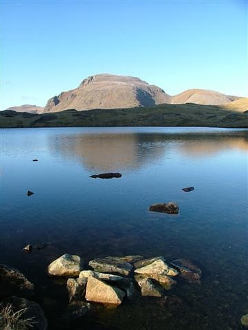
Innominate Tarn
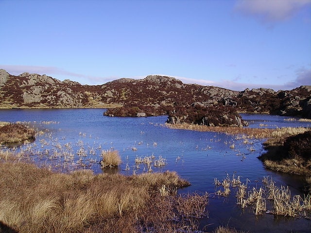
Tarn in England. Innominate Tarn is a small tarn in the north of the Lake District National Park in England. It is situated at 520 metres above sea level, near the summit of Haystacks. The name Innominate means "without a name".
It was formerly known as Loaf Tarn.
The tarn is the location where Alfred Wainwright's ashes were scattered. He had expressed this wish in A Pictorial Guide to the Lakeland Fells Volume 7: The Western Fells and in his memoirs:
"All I ask for, at the end, is a last long resting place by the side of Innominate Tarn, on Haystacks, where the water gently laps the gravelly shore and the heather blooms and Pillar and Gable keep unfailing watch. A quiet place, a lonely place. I shall go to it, for the last time, and be carried: someone who knew me in life will take me and empty me out of a little box and leave me there alone. And if you, dear reader, should get a bit of grit in your boot as you are crossing Haystacks in the years to come, please treat it with respect. It might be me."
~ Alfred Wainwright - from Memoirs of a Fellwalker (1990)[6]
Church of St Olaf
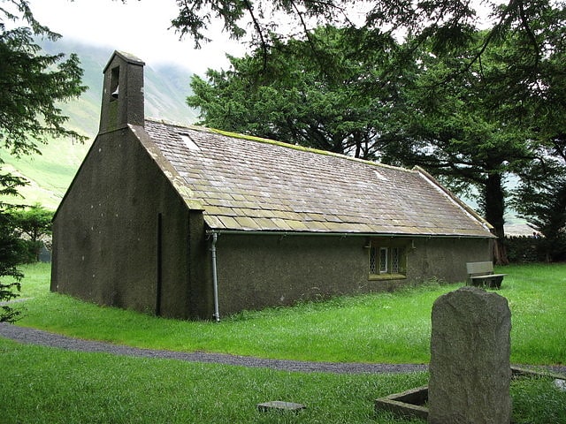
Church in England. St Olaf's Church in Wasdale Head, Cumbria, is England's smallest parish church. The earliest record of the church is from 1550, though it probably predates this, and it is likely that there was an earlier church on this site.[7]
Lingmell
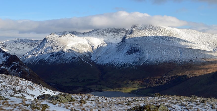
Fell in England. Lingmell is a fell in the English Lake District, standing above the village of Wasdale Head. It is an outlier on the north-west flank of Scafell Pike, England’s highest mountain.[8]
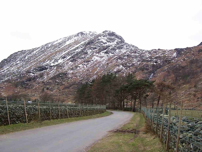
Fleetwith Pike
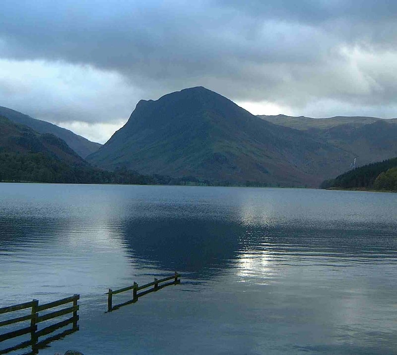
Fell in England. Fleetwith Pike is a fell in the English Lake District in the county of Cumbria which reaches a height of 648 metres. The fell is a well-known feature of the area as it casts an imposing presence over Buttermere and the Honister Pass on the B5289 motor road between Borrowdale and Buttermere.[9]
Scale Force
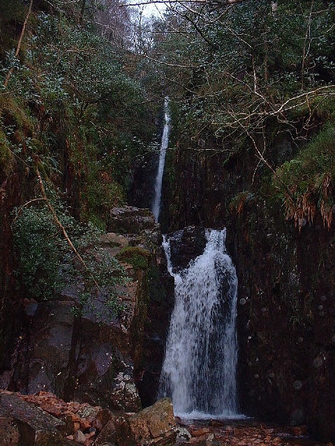
Waterfall in England. Scale Force is considered the highest waterfall in the English Lake District. Opinions vary about how its precise height is calculated, but the total height is normally stated as 170 feet. It lies on the stream Scale Beck.
The waterfall – or force – is hidden in a deep gorge on the northern flank of Red Pike. It lies south of Crummock Water and is near the village of Buttermere.
William Wordsworth described Scale Force as "a fine chasm, with a lofty, though but slender, fall of water", while Samuel Taylor Coleridge wrote, "Scale Force, the white downfall of which glimmered through the trees, that hang before it like the bushy hair over a madman's eyes." In her poem Scale Force, Cumberland. Letitia Elizabeth Landon writes "It sweeps, as sweeps an army Adown the mountain side, With the voice of many thunders, Like the battle’s sounding tide".[10]
Blackbeck Tarn
Tarn in England. Blackbeck Tarn is a small tarn in Cumbria, England, situated near the summit of Haystacks in the Buttermere Valley. At an elevation of 486 m, the lake has an area of 0.95 hectares and measures 183 m × 80 m, with a maximum depth of 2.5 m.[11]
Styhead Tarn
Tarn in England. Styhead Tarn is a tarn in the English Lake District, near the top of the Sty Head pass, at the head of Borrowdale. It is on the route from Wasdale to Borrowdale, and is therefore a well visited point in the Lake District. It is also passed by walkers ascending Scafell Pike from Borrowdale via the Corridor Route. It is permissible to fish the tarn which contains wild brown trout.
The Styhead Gill is the tarn's outlet which flows into the River Derwent.
Although no official confirmation yet exists, Styhead Tarn is believed to hold the English record for the highest monthly rainfall total, at about 1430 mm in November 2009.[12]
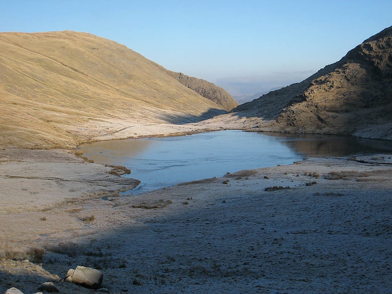
Sprinkling Tarn
Body of water in England. Sprinkling Tarn is a body of water at the foot of Great End, in the Southern Fells in Lake District, 3 kilometres from Seathwaite, Cumbria, England. Sprinkling Tarn is a popular location for wild campers. It is also popular among anglers, being noted for its trout and an introduced rare fish, vendace. Formerly known also as Sparkling Tarn. It is known as the wettest place of England with an annual precipitation of over 5 metres.[13]
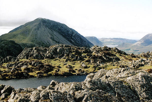
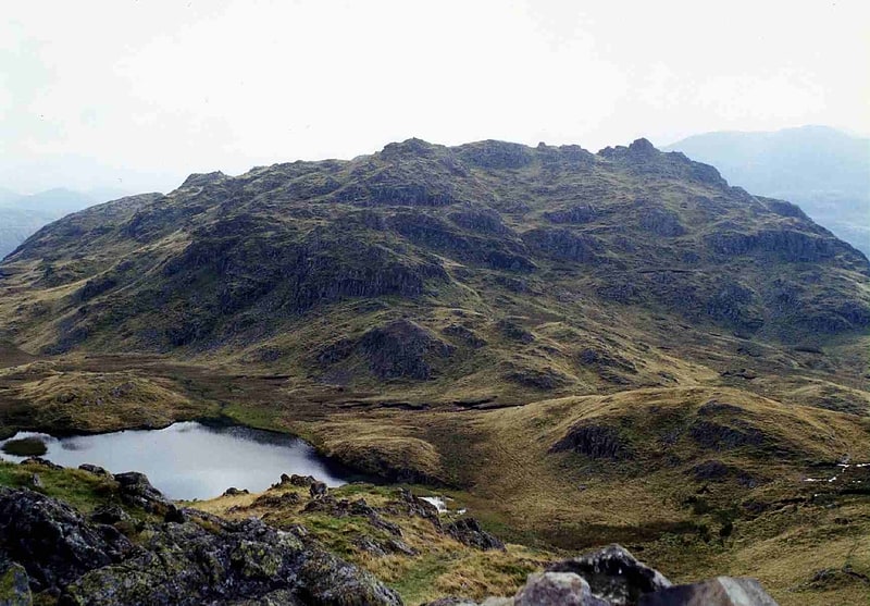
Haystacks
Hill in England. Haystacks, or Hay Stacks, is a hill in England's Lake District, situated at the south-eastern end of the Buttermere Valley. Although not of any great elevation, Haystacks has become one of the most popular fells in the area. This fame is partly due to the writings of Alfred Wainwright, who espoused its attractions and chose it as the place where he wanted his ashes scattered. Its large, undulating summit contains many rock formations, tarns and hidden recesses.[14]
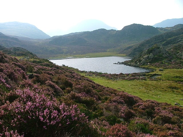
Angle Tarn
Lake in England. Angle Tarn is a tarn to the north of Bowfell in the English Lake District. It drains into Langstrath Beck.
This should not be confused with Angle Tarn (Patterdale), a larger lake with the same name about 11.5 miles (18.5 km) to the south-west, also within the Lake District National Park.[15]
Foxes Tarn
Tarn. Foxes Tarn is one of the smallest named tarns in the Lake District of England, situated slightly to the east of the summit of Sca Fell.
Foxes Tarn is also one of the highest named tarns in the Lake District, with either it or the nearby Broadcrag Tarn being the higher. Harry Griffin writing in The Guardian gives the height of Broadcrag Tarn as 2,746 feet (837 m) (N.B. this does not agree well with the latest OS maps). The Nuttall's guide puts Broadcrag Tarn as slightly higher, based on looking at large-scale maps. A higher unnamed tarn on Long Top, the highest of the Crinkle Crags, has an altitude of 2,786 feet (849 m).
The tarn varies in size and has very little outflow, but what little there is descends to How Beck and the River Esk.
Foxes Tarn is well known to fell-walkers due to its location on one of the standard routes between Scafell Pike and Scafell, the two highest mountains in England. The direct ridge route crosses Broad Stand, which can only be negotiated safely by rock-climbers. Two main alternatives exist for walkers, one being via Lord's Rake, and the other involving a descent to Foxes Tarn before a re-ascent. The tarn is at a significantly lower elevation than Mickledore, the col between the mountains, so while the Foxes Tarn route is easier, it also requires more re-ascent.[16]
Caw Fell
Fell in England. Caw Fell is a fell in the English Lake District, standing between Haycock the Lank Rigg group. It occupies a wide upland area with Ennerdale to the north and Blengdale to the south. Caw Fell is distant from any point of access by Lakeland standards, but can be climbed from Blengdale or Bowness Knott car-parks.[17]
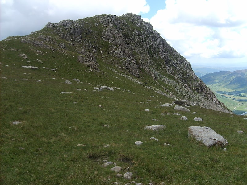
Pike of Stickle
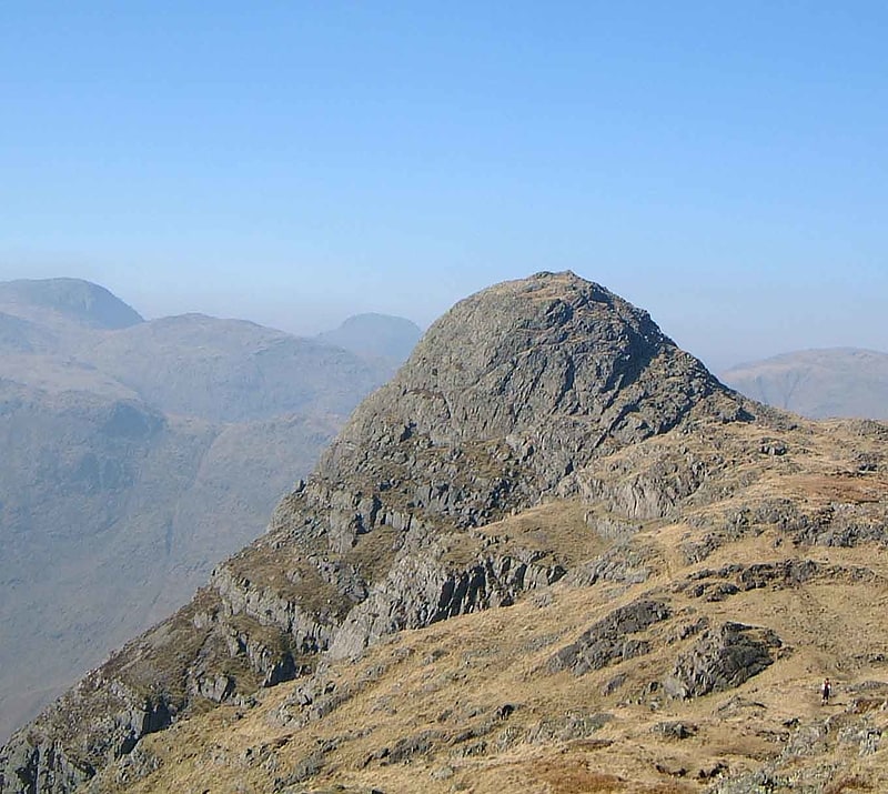
Fell in England. Pike of Stickle, also known as Pike o’ Stickle, is a fell in the English Lake District. It reaches a height of 709 metres and is situated in the central part of the national park in the valley of Great Langdale. The fell is one of three fells which make up the picturesque Langdale Pikes, one of the best-known areas in Lakeland. A "stickle" is a hill with a steep prominent rocky top, while a "pike" is a hill with a peaked summit, the name being therefore partly tautological.[18]
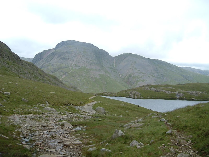
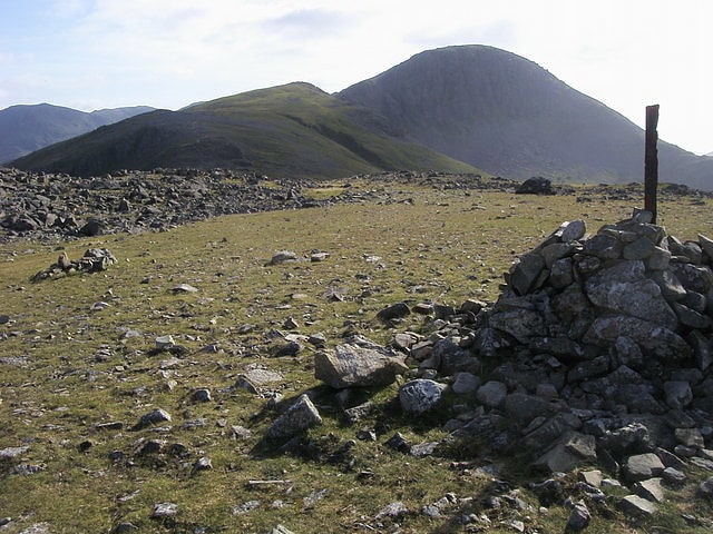
Kirk Fell
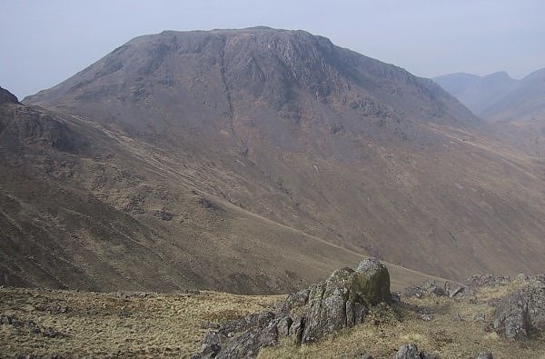
Fell in England. Kirk Fell is a fell in the Western part of the English Lake District. It is situated between Great Gable and Pillar on the long ring of fells surrounding the valley of Ennerdale, and also stands over Wasdale to the south. However, it is separated from its two higher neighbours by the low passes of Black Sail and Beck Head, giving it a high relative height and making it a Marilyn, the thirteenth highest in the Lake District.
The direct ascent up the south-western slope from Wasdale Head is exceptionally steep and the subject of an amusing drawing by Wainwright. Usual ascents are by one of the aforementioned passes; alternatively one may climb Kirk Fell as part of the Mosedale Horseshoe, a walk on the fells surrounding Mosedale, a side-valley of Wasdale.[19]
Ill Crag
Fell in England. Ill Crag is a fell in the English Lake District. At 935 metres, it is the fourth-highest peak in England, after Scafell Pike, Sca Fell, and Helvellyn. Ill Crag overlooks Eskdale and has splendid views across to Bowfell and Crinkle Crags.[20]
Esk Pike
Esk Pike is a fell in the English Lake District, one of the cirque of hills forming the head of Eskdale.[21]
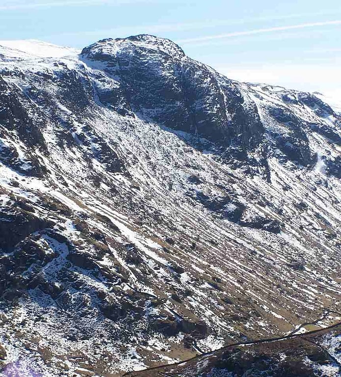
Great End
Mountain in England. Great End is the most northerly mountain in the Scafell chain, in the English Lake District. From the south it is simply a lump continuing this chain. From the north, however, it appears as an immense mountain, with an imposing north face rising above Sprinkling Tarn. This is a popular location for wild camping, and the north face attracts many climbers.
Alfred Wainwright wrote of Great End in his Pictorial Guide to the Lakeland Fells: "This is the true Lakeland of the fellwalker, the sort of terrain that calls him back time after time, the sort of memory that haunts his long winter exile. It is not the pretty places - the flowery lanes of Grasmere or Derwentwater's wooded bays - that keep him restless in his bed; it is the magnificent ones. Places like Great End..."[22]
Slight Side
Fell in England. Slight Side is a fell in the English Lake District it stands 25 kilometres east southeast of the town of Whitehaven and reaches a height of 762 m. Slight Side lies at the south western edge of the Scafell Massif, a four-kilometre-long crescent of high ground which includes the highest ground in England. The fells names derives from the Old Norse language and means "The mountain shieling with the level pastures", it is a combination of the Norse words "sletta" and "saetr". With a shieling meaning a shepherds hut or a mountain pasture used in the summer.[23]
Rossett Pike
Fell in England. Rossett Pike is a fell in the English Lake District. It is located at the head of Mickleden, one of two tributary valleys of Great Langdale.[24]
Seat
Seat or Seat is a minor Fell in the English Lake District. It has a height of 561 m. Seat is over-shadowed by Haystacks and High Crag. Its location is on the south-western corner of Buttermere in the North Western Fells.[25]
Glaramara
Mountain in England. Glaramara is a fell in the English Lake District in Cumbria. It is a substantial fell that is part of a long ridge that stretches for over six kilometres from Stonethwaite in Borrowdale up to the important mountain pass of Esk Hause. The summit of Glaramara at 783 m is the central point of this ridge, which separates the valleys of Langstrath and Grains Gill. However, the ridge has two additional fells, numerous subsidiary tops and several small tarns making its traverse an appealing and challenging walk.[26]
Grey Knotts
Fell in England. Grey Knotts is a fell in the English Lake District. It is situated one kilometre south of the B5289 road as it crosses the Honister Pass. It is well seen from mid-Borrowdale as it rises above Seatoller. Grey Knotts reaches a height of 697 metres and is part of a ridge which ascends from the woodland behind Seatoller and continues south-west and then south for four kilometres to Great Gable. The fell's name really only applies to the summit rocks, but has been adopted for the entire fell with the high ground in this area, locally known as Seatoller Fell on Ordnance Survey maps.[27]
Allen Crags
Fell in England. Allen Crags is a fell in the English Lake District, it lies in a group of very popular hills and is regarded as part of the Scafell group of fells. It is a hill that is frequently traversed by walkers along its ridge but is seldom climbed as the sole objective.[28]
Seathwaite Fell
Seathwaite Fell is an area of the Lake District in Cumbria, England. It stands above the hamlet of the same name at the head of Borrowdale.[29]
Brandreth
Brandreth is a fell in the English Lake District. It stands between Great Gable and Haystacks in the Western Fells.[30]
Sergeant's Crag
Fell in England. Sergeant's Crag is a fell in the English Lake District. It is an intermediate height on the ridge between the Langstrath and Greenup valleys in the Central Fells.[31]
Esk Hause
Mountain pass in the United Kingdom. Esk Hause is a mountain pass in the English Lake District, England. It is where the paths from Eskdale, Borrowdale, Langdale and Wasdale all meet. Esk Hause is a first step to reaching higher summits, such as Scafell Pike, Great End, Esk Pike and Allen Crags, which are all nearby. This can be a confusing place for walkers, especially in mist. This is because two paths cross at right angles on a tilted grass plateau, but not at the summit of the plateau. The popular Great Langdale-Wasdale path crosses at an elevation of 727 m at the wall shelter; this is the lower of the two passes known as Esk Hause, but is, in fact, not the true pass, which is 30 m higher and 270 m distant, a less-used pass between Eskdale and Borrowdale that occupies the depression between Great End and Esk Pike. The 'true' Esk Hause is the highest pass in the Lake District, but Sticks Pass is commonly named as Lakeland's highest pass, most probably because fellwalkers equate "Esk Hause" with the lower of the two passes.
The source of the River Esk is close to Esk Hause.[32]
Scafells
Scafells, also known as the Scafell Massif, is a collective term for the Scafell range of fells in the western English Lake District, including Scafell, England's tallest mountain Scafell Pike, Broad Crag and Ill Crag. Great End, Lingmell and Slight Side are also usually included within the definition. These hills form part of the Southern Fells.[33]
Base Brown
Fell in England. Base Brown is a fell in England's Lake District, near the head of the Borrowdale Valley. It forms one side of the Seathwaite Valley, and on the western side it is flanked by the hanging valley of Gillercomb.[34]
Rosthwaite Fell
Fell in England. Rosthwaite Fell is a fell in the English Lake District. It is situated some 12 kilometres due south of Keswick and 2 kilometres south of the village of Rosthwaite in Borrowdale.
Rosthwaite Fell also has loose connections to the Scafell group of fells. The fells name derives from the Old Norse language and means “The peak above the clearing with a heap of stones” with “hreysi” meaning a heap of stones and “thveit” meaning a clearing.[35]