Discover 35 hidden attractions, cool sights, and unusual things to do in Hadrian's Wall (United Kingdom). Don't miss out on these must-see attractions: Crag Lough, St Michael's Church, and Sycamore Gap Tree. Also, be sure to include Halton Castle in your itinerary.
Below, you can find the list of the most amazing places you should visit in Hadrian's Wall (England).
Table of Contents
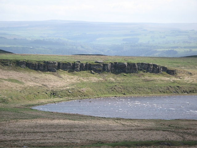
Crag Lough
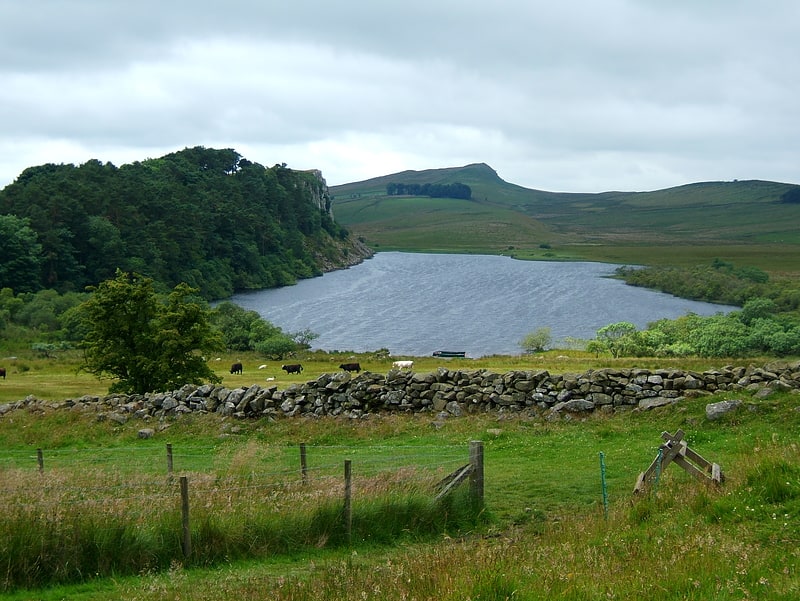
Lake in England. Crag Lough is an inland lake at the southern edge of Northumberland National Park, 2.5 miles north of Bardon Mill, and 0.5 miles north of the B6318 Military Road in Northumberland, northern England. At this point Hadrian's Wall is at the top of a line of crags, the Whin Sill, with Crag Lough at the foot of the crags.[1]
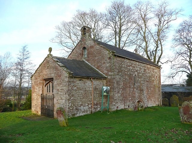
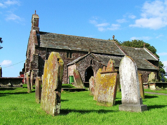
St Michael's Church
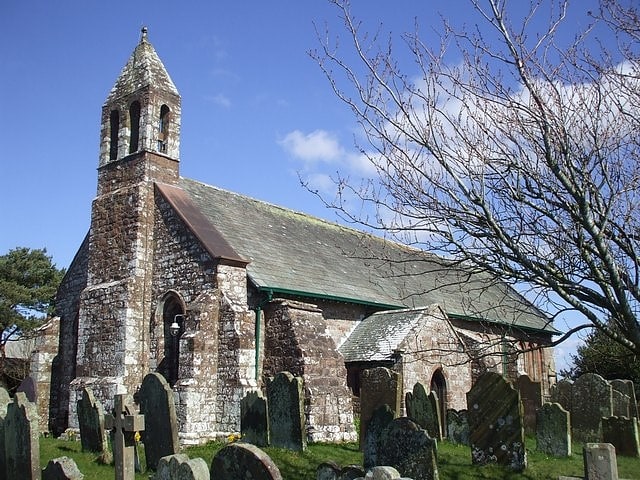
Church in Bowness-on-Solway, England. St Michael's Church is in the village of Bowness-on-Solway, Cumbria, England. It is an active Anglican parish church in the deanery of Carlisle, the archdeaconry of Carlisle, and the diocese of Carlisle. Its benefice is united with those of St Bride, Kirkbride, and St John the Evangelist, Newton Arlosh. The church is recorded in the National Heritage List for England as a designated Grade II* listed building.[2]
Sycamore Gap Tree
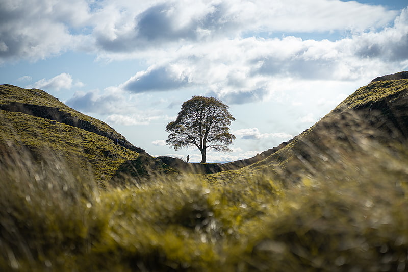
The Sycamore Gap Tree or Robin Hood Tree is a sycamore tree standing next to Hadrian's Wall near Crag Lough in Northumberland, England. It is located in a dramatic dip in the landscape and is a popular photographic subject, described as one of the most photographed trees in the country. It derives its alternative name from featuring in a prominent scene in the 1991 film Robin Hood: Prince of Thieves. The tree won the 2016 England Tree of the Year award.[3]
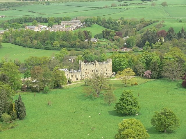
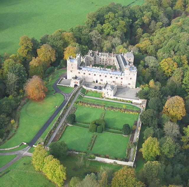
Halton Castle
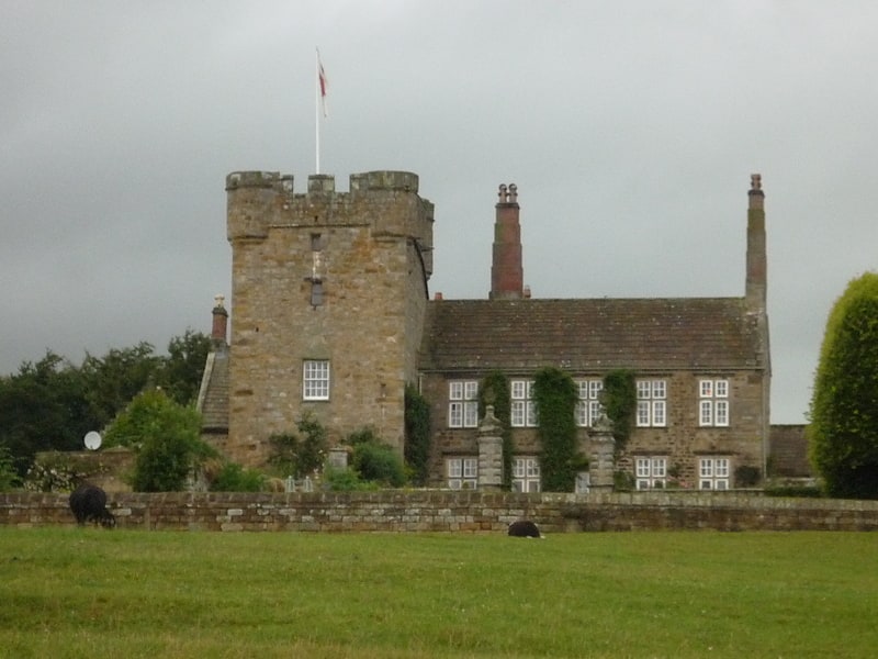
Castle in England. Halton Castle is a pele tower and grade I listed building situated close to Hadrian's Wall to the north of the village of Corbridge in Northumberland, England.
The tower was first recorded in 1382 and it is still present today. It has four storeys and a basement with a stone vault. In the 15th century a manor house was built onto the north side of the tower giving it a T-shaped plan. In about 1696 much of this building was demolished by the then owner John Douglas and replaced with the present five-bay residence.
In 1757 Anne Douglas the heiress of Halton married Sir Edward Blackett and the castle remains a residence of the Blackett family.[4]
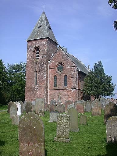
St Michael's Church
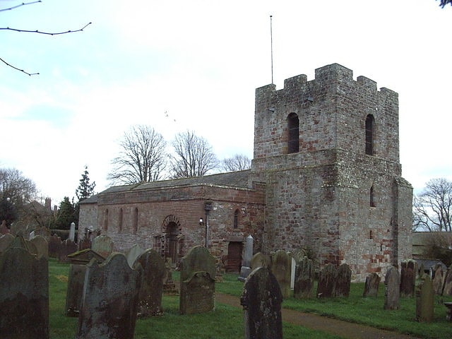
Church in Burgh by Sands, England. St Michael's Church is in the village of Burgh by Sands, Cumbria, England. It is an active Anglican parish church in the deanery of Carlisle, the archdeaconry of Carlisle, and the diocese of Carlisle. Its benefice is united with those of St Andrew, Aikton, St Mary, Kirkandrews-on-Eden with Beaumont, and St Peter, Kirkbampton. The church is recorded in the National Heritage List for England as a designated Grade I listed building. It is a fortified church standing on the line of Hadrian's Wall, and is unique in having had two fortified towers.[5]
Newburn Bridge
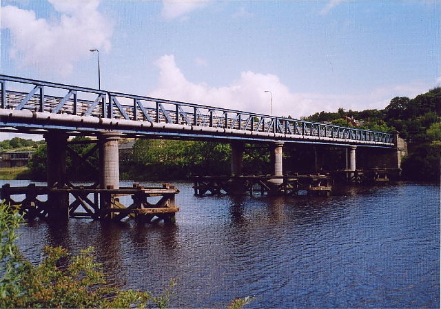
Bridge in the United Kingdom. Newburn Bridge is a road bridge crossing the River Tyne at Newburn in Newcastle upon Tyne, England. It links Newburn, Walbottle and Throckley on the north side of the river with Ryton, Stella and Blaydon on the south side. The bridge is the westernmost crossing of the Tyne in the county of Tyne and Wear; the next crossing upstream, Wylam Bridge, is in Northumberland.[6]
Address: Newburn bridge road, Hadrian's Wall
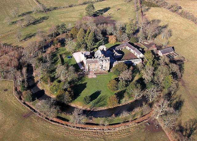
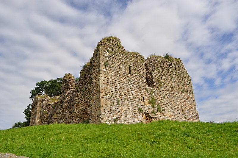
Haughton Castle
Haughton Castle is a privately owned country mansion and Grade I listed building, situated to the north of the village of Humshaugh on the west bank of the North Tyne. It is around 5+1⁄2 miles north of the market town of Hexham, Northumberland.
It was built originally in the 13th century as a tower house and enlarged and fortified in the 14th century. At this time the castle was owned by Gerald Widdrington and, although the Widdringtons still owned it in the early 14th century, the Swinburns were living there.
By the 16th century, the castle fell into ruin and disrepair, and it was attacked by Border reivers. A survey of 1541 reported the roof and floors to be "decayed and gone".
The property was acquired by the Smith family in about 1640, but in 1715 a further survey stated the building to be ruinous.
Significant alterations were carried out for the Smiths between 1816 and 1845, latterly by architect John Dobson to convert the ruin into a substantial mansion. The Crawshaw family came into possession in 1862, and a west wing was added for them by Anthony Salvin in 1876.
Part of the castle served as a hospital during the Second World War.
It is now an oblong tower house and one of the best-preserved hall houses in the north of England. In 1888 it was acquired by the Cruddas family, and it is currently owned by the Braithwaite family.
Some commentators suggest it is the location for the traditional song "Waters of Tyne".[7]
Brampton Old Church
Church in Brampton, England. Brampton Old Church stands about 1 mile to the west of the town of Brampton, Cumbria, England. It was originally the parish church of Brampton but is now redundant. The church is recorded in the National Heritage List for England as a designated Grade II* listed building.[8]
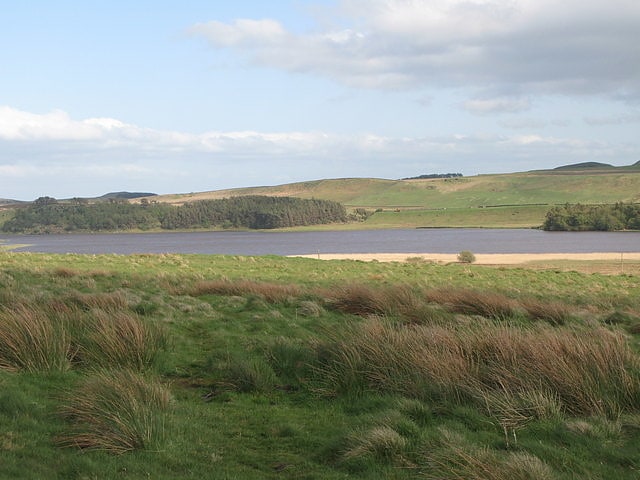
Broomlee Lough
Lake in England. Broomlee Lough is an inland lake in Northumberland, England at the southern edge of Northumberland National Park. The lough lies immediately north of the course of Hadrian's Wall. Old legends portray the lake as a repository of hidden treasure.[9]
Naworth Castle
Country house in Brampton, England. Naworth Castle, also known or recorded in historical documents as "Naward", is a castle in Cumbria, England, near the town of Brampton. It is adjacent to the A69, about 2 miles east of Brampton. It is on the opposite side of the River Irthing to, and just within sight of, Lanercost Priory. It was the seat of the Barons Dacre and is now that of their cognatic descendants, the Earls of Carlisle. It is a Grade I listed building.[10]
Scaleby Castle
Castle in Scaleby, England. Scaleby Castle is in the village of Scaleby, Cumbria, England. The castle was originally built in the early 14th century, and extended in the 15th century to form a substantial fortification. Parliamentary troops attacked the castle twice during the English Civil War, burning it. It was later restored to form a country house.[11]
Leahill Turret
Historical landmark in the city of Carlisle, England. Leahill Turret is a typical example of one of the lookout towers located between the milecastles on Hadrian's Wall in Cumbria; located on the Lanercost Road near Banks, Parish of Waterhead. It is designated turret 51b and lies east of the Signal Tower at Pike Hill.[12]
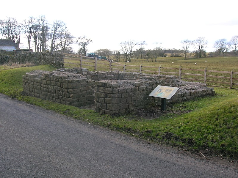
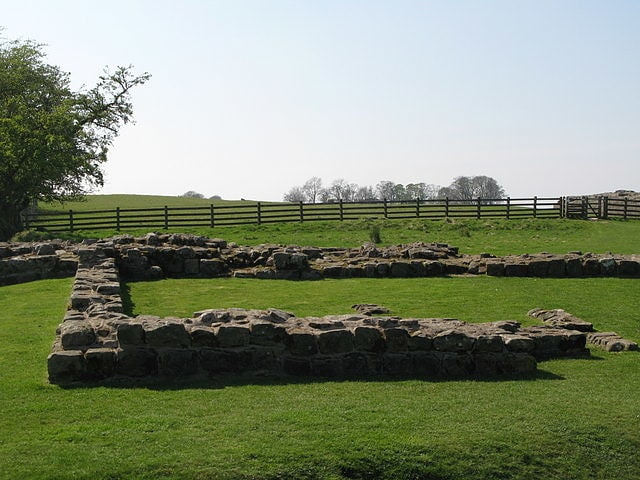
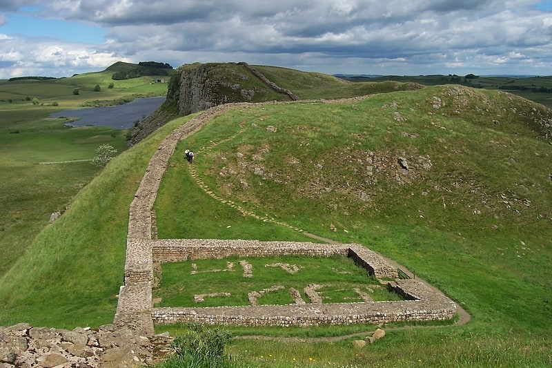
Milecastle 33
Historical landmark in England. Milecastle 33 was a milecastle of the Roman Hadrian's Wall, one of a series of small fortlets built at intervals of approximately one Roman mile along the length of the UNESCO World Heritage Site in northern England.
Its remains exist as clearly visible earthworks, with the exception of part of the north gate and wall, and a fragment of the south gate, which are exposed. Exposed parts survive to a maximum height of 1.2 metres (3 ft 11 in) (north wall). The remains are located a few metres to the north of the B6318 Military Road.[13]
Banna
Historical place museum in England. Birdoswald Roman Fort was known as Banna in Roman times, reflecting the geography of the site on a triangular spur of land bounded by cliffs to the south and east commanding a broad meander of the River Irthing in Cumbria below.
It lies towards the western end of Hadrian's Wall and is one of the best preserved of the 16 forts along the wall. It is also attached to the longest surviving stretch of Hadrian's Wall.
Cumbria County Council were responsible for the management of Birdoswald fort from 1984 until the end of 2004, when English Heritage assumed responsibility.[14]
Milecastle 48
Milecastle 48, is a milecastle on Hadrian's Wall. Its remains lie near the village of Gilsland in Cumbria where it was historically known as "The King's Stables", owing to the well-preserved interior walls. Unusually a substantial section of stone stairs has survived within the milecastle. The two turrets associated with this milecastle have also survived as above-ground masonry.[15]
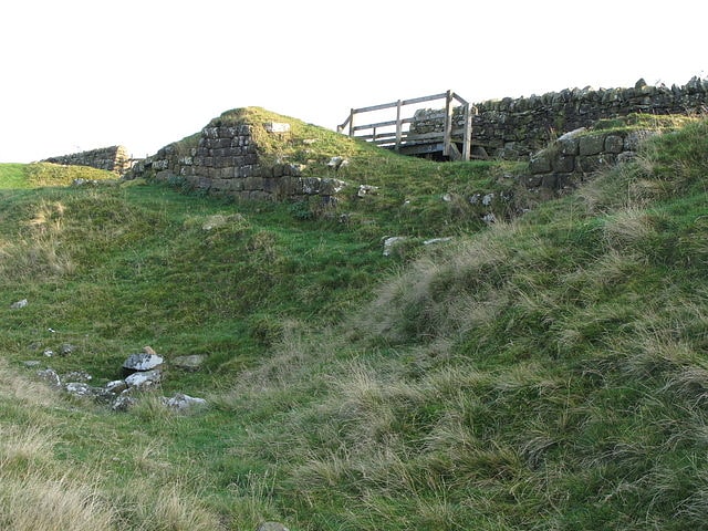
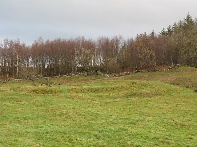
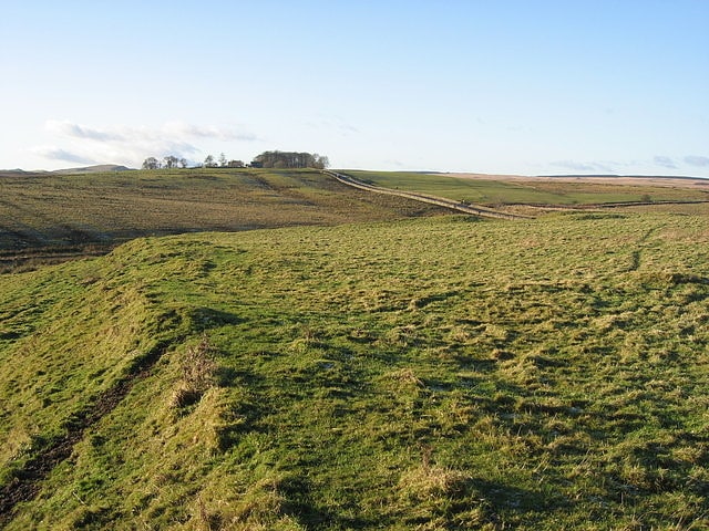
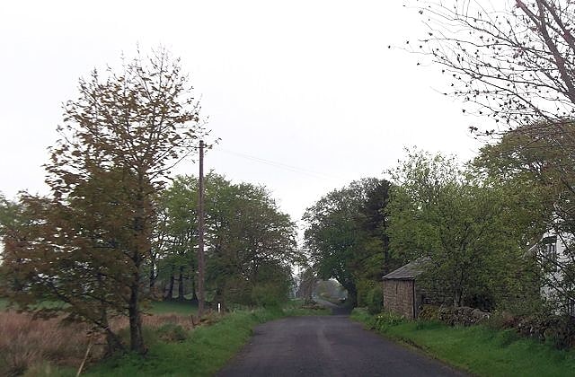
Limestone Corner
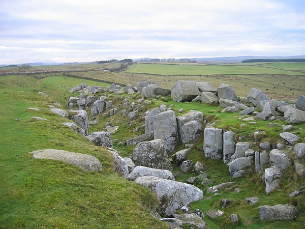
Limestone Corner is an area of Hadrian's Wall at its most northerly point, in present-day northern England. It represents the most northerly point of the Roman Empire, outside the two periods during which the Antonine Wall was occupied by the Roman military. Other notable features at Limestone Corner are the wall ditch at this point, which was never completely excavated, a Roman camp and the site of Milecastle 30. Also present is a trig point. The B6318 Military Road also runs through Limestone Corner, as does the Military Way, serving Milecastle 30. The Military Way is visible on the ground at this point, the most eastern point where this is the case.
The name Limestone Corner is not an official geographical name for the area and does not appear on official maps; the hill on which it stands is known as Teppermoor Hill. 'Limestone Corner' has become accepted through extensive usage.[16]
St Mary's Church
Church in Walton, England. St Mary's Church is in the village of Walton, Cumbria, England. It is an active Anglican parish church in the deanery of Brampton, the archdeaconry of Carlisle, and the diocese of Carlisle. Its benefice is united with those of four nearby parishes. The church is recorded in the National Heritage List for England as a designated Grade II* listed building.[17]
Beaufront Castle
Beaufront Castle is a privately owned 19th-century country house near Hexham, Northumberland, England. It is a Grade I listed building.
A pele tower was recorded at Beaufront in 1415. Dorothy Carnaby, heiress to the estate in the 16th century, married Gilbert Errington, and the Erringtons built a new house in the 17th century.
The property was acquired by the Cuthbert family in the early 19th century and the present imposing castellated Gothic revival style mansion was built, incorporating parts of the 17th-century house, between 1836 and 1841 to the design of architect John Dobson. William Cuthbert was High Sheriff of Northumberland in 1860.[18]
Greenlee Lough
Lake in England. Greenlee Lough is a lough or lake and national nature reserve 3 miles north of Bardon Mill, and 1.5 miles north of the B6318 road in Northumberland, northern England.
The lough is owned and managed as a nature reserve by the Northumberland Wildlife Trust and the Northumberland National Park. It is a shallow lake fringed with water plants. Most of the reserve is open water. The lake's edge has reedbed, herb fen and blanket bog. It is used extensively by wildfowl and waders that feed in the shallow waters and wetlands. The lough was used as a reservoir by the Romans on Hadrian's Wall.
Greenlee Sailing Club sailed GP14s, and later Lasers, and Mirrors throughout the 60s. The club closed down in the 70s as members left for the larger, and more accessible, club at Derwent Reservoir near Hexham.[19]
St John the Evangelist's Church
Church in the Crosscanonby, England. St John the Evangelist's Church is in the village of Crosscanonby, Cumbria, England. It is an active Anglican parish church in the deanery of Solway, the archdeaconry of West Cumberland and the diocese of Carlisle. The church is recorded in the National Heritage List for England as a designated Grade I listed building.[20]
Address: 1 The Gables, CA15 6SJ Maryport
Milecastle 49
Milecastle 49 was a milecastle on Hadrian's Wall.[21]
Milecastle 29
Milecastle 29 was a milecastle of the Roman Hadrian's Wall. Its remains exist as a mutilated earth platform accentuated by deep robber-trenches around all sides, and are located beside the B6318 Military Road. Like Milecastles 9, 23, 25, and 51, a ditch has been identified around the Milecastle, and is still visible to a small extent. It has been postulated that this was as a result of the need for drainage on the site.[22]
Carrawburgh
Carrawburgh is a settlement in Northumberland. In Roman times, it was the site of a 3+1⁄2-acre auxiliary fort on Hadrian's Wall called Brocolitia, Procolita, or Brocolita. This name is probably based on the Celtic name for the place, and one possible translation put forward is 'badger holes'. The fort there was a mile or so west of the Wall's northernmost point at Limestone Corner, and just over a mile west of the nearest milecastle, Milecastle 30. The fort either used the Wall itself as its northern rampart, or was built parallel to it but detached. It certainly postdates both the Wall and the vallum.
Only the fort's earthworks are now visible, the Wall at this point and the fort's north ramparts having been demolished for the construction of General Wade's early 18th-century military road (now the B6318). The late 19th-century archaeologist John Clayton carried out a partial excavation of the site, revealing a military bath-house outside the fort's west gate (in 1873) and the fort's south-west corner-tower (in 1876).
The Roman Inscriptions of Britain lists 48 inscriptions for the site. They show its garrisoning units to have been as follows:
- RIB 1550 – Hadrianic? c. AD133 – First Cohort of Aquitani
- RIB 1563b – AD122-138 – Cohors I Tungrorum
- End 2nd century – Cohors I Cugernorum
- RIB 1544, RIB 1553, and Notitia Dignitarum – AD213-222, AD237, and AD400 respectively – First Cohort of Batavians
The First Cohort of Frisiavones are also attested at Brocolitia at some stage, as shown by an inscription on an altar stone, which tells us that Optio Maus had repaid a vow to the goddess Coventina. (This unit is also recorded as present at Ardotalia.) Whether this altar was the repayment of the vow is unknown.[23]
Milecastle 57
Milecastle 57 was a milecastle on Hadrian's Wall.[24]
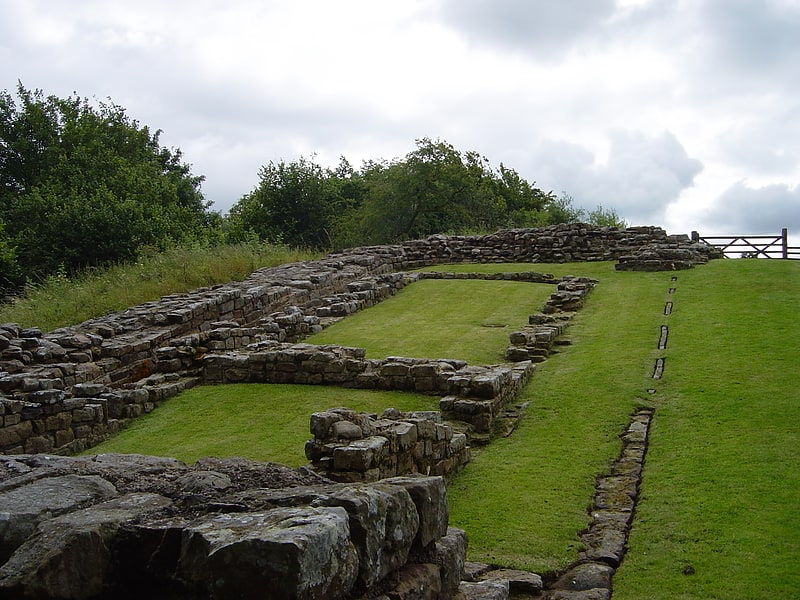
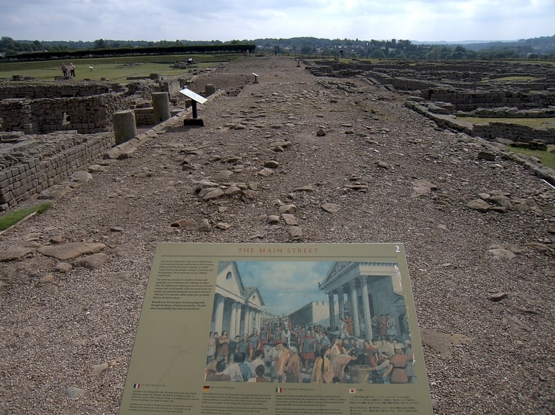
Housesteads Roman Fort
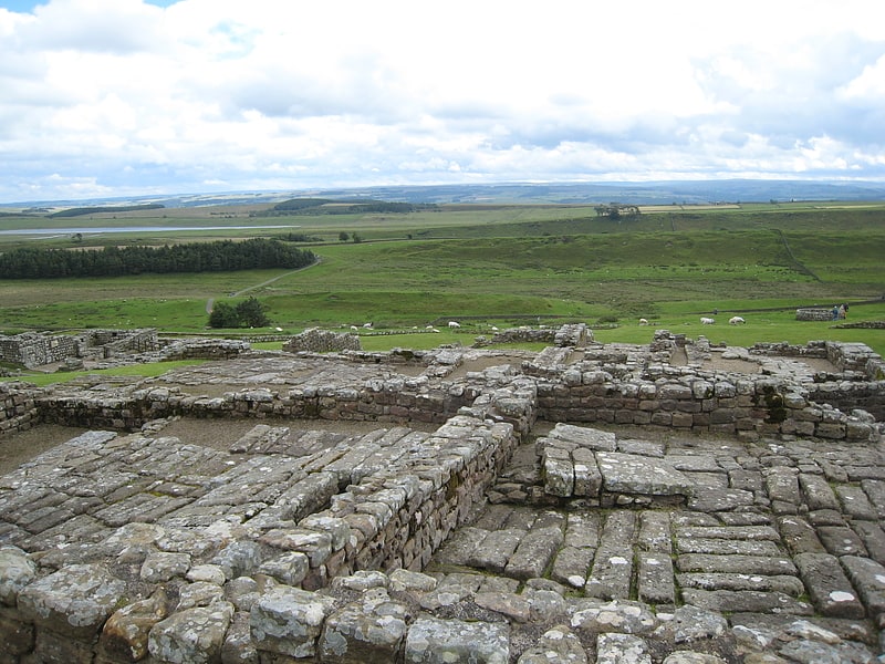
Museum in England. Housesteads Roman Fort is the remains of an auxiliary fort on Hadrian's Wall, at Housesteads, Northumberland, England, south of Broomlee Lough. The fort was built in stone around AD 124, soon after the construction of the wall began in AD 122 when the area was part of the Roman province of Britannia. Its name has been variously given as Vercovicium, Borcovicus, Borcovicium, and Velurtion. The 18th-century farmhouse Housesteads gives the modern name. The site is owned by the National Trust and is in the care of English Heritage. Finds can be seen at the site, in the museum at Chesters, and in the Great North Museum: Hancock in Newcastle upon Tyne.[25]
Milecastle 58
Milecastle 58 was a milecastle on Hadrian's Wall.[26]
Thirlwall Castle
Historical landmark in England. Thirlwall Castle is a 12th-century castle in Northumberland, England, on the bank of the River Tipalt close to the village of Greenhead and approximately 20 miles west of Hexham. It was built in the 12th century, and later strengthened using stones from nearby Hadrian's Wall, but began to fall into disrepair in the 17th century. The site is protected by Grade I listed building and Scheduled Ancient Monument status.[27]
Milecastle 51
Milecastle 51 was a milecastle on Hadrian's Wall.[28]
Milecastle 39
Milecastle 39 is a milecastle on Hadrian's Wall.[29]
Milecastle 54
Milecastle 54 was a milecastle on Hadrian's Wall.[30]
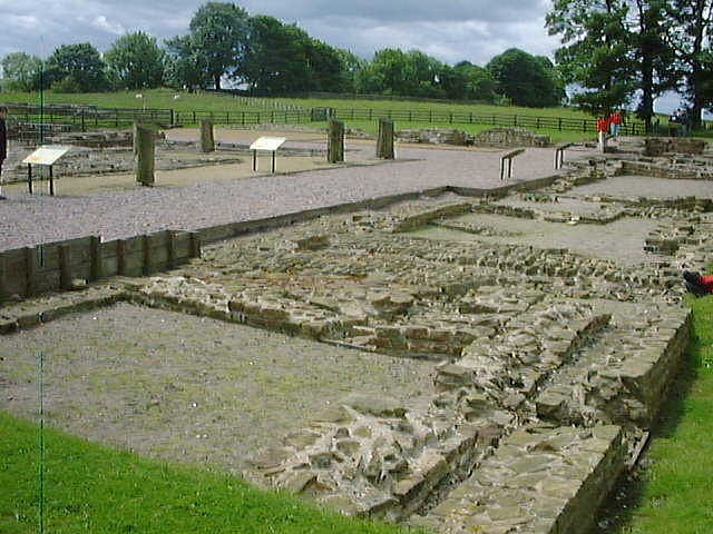
Segedunum
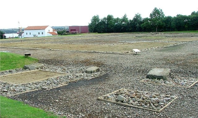
Excavated Roman fort and baths with museum. Segedunum was a Roman fort at modern-day Wallsend, North Tyneside in North East England. The fort lay at the eastern end of Hadrian's Wall near the banks of the River Tyne, forming the easternmost portion of the wall. It was in use as a garrison for approximately 300 years, from around 122 AD, almost up to 400AD. Today, Segedunum is the most thoroughly excavated fort along Hadrian's Wall, and is operated as Segedunum Roman Fort, Baths and Museum. It forms part of the Hadrian's Wall UNESCO World Heritage Site.[31]
Milecastle 7
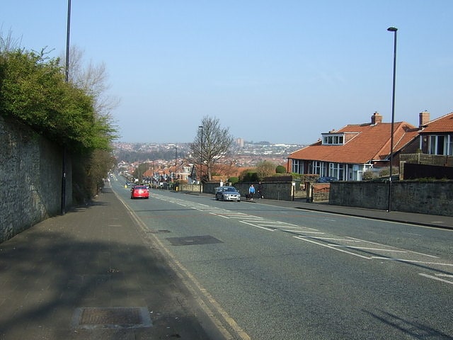
Milecastle 7 was a milecastle of the Roman Hadrian's Wall. The milecastle itself has not been discovered by archaeologists and its presumed location lies beneath a modern housing development. Roman finds have been made in the area and the associated structure of Turret 7B is a significant surviving structure of the wall.[32]
Milecastle 52
Milecastle 52 was a milecastle on Hadrian's Wall.[33]
Cambeck Bridge
Cambeck Bridge is a hamlet in Cumbria, England.
The bridge itself was built in the 19th century and spans the River Irthing. It is a Grade II listed building, listed in 1984.[34]
Stanegate
Road in England. The Stanegate was an important Roman road built in what is now northern England. It linked many forts including two that guarded important river crossings: Corstopitum on the River Tyne in the east, and situated on Dere Street, and Luguvalium on the River Eden in the west. The Stanegate ran through the natural gap formed by the valleys of the River Tyne in Northumberland and the River Irthing in Cumbria. It predated Hadrian's Wall by several decades; the Wall would later follow a similar route, slightly to the north.
The Stanegate should not be confused with the two Roman roads called Stane Street in the south of England, namely Stane Street (Chichester) and Stane Street (Colchester). In both these cases the meaning is the same as for the northern version, indicating a stone or paved road.
The Stanegate differed from most other Roman roads in that it often followed the easiest gradients, and so tended to weave around, whereas typical Roman roads follow a straight path, even if this sometimes involves having punishing gradients to climb.
A large section of the Stanegate is still in use today as a modern minor road between Fourstones and Vindolanda in Northumberland.[35]