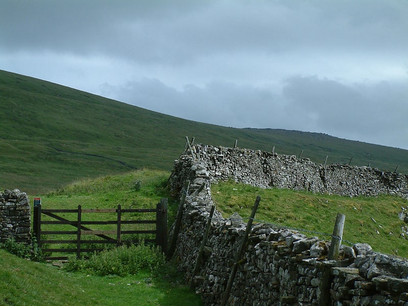
Discover 35 hidden attractions, cool sights, and unusual things to do in Yorkshire Dales National Park (United Kingdom). Don't miss out on these must-see attractions: The Forbidden Corner, Gaping Gill, and White Scar Cave. Also, be sure to include Great Douk Cave in your itinerary.
Below, you can find the list of the most amazing places you should visit in Yorkshire Dales National Park (England).
Table of Contents
The Forbidden Corner
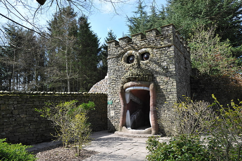
Amusement park in Coverham, England. The Forbidden Corner is a folly garden located in the Tupgill Park Estate, at Coverham in Coverdale, in the Yorkshire Dales National Park. It is open to the public.[1]
Address: The Tupgill Park Estate, Coverham, DL8 4TJ Yorkshire Dales National Park
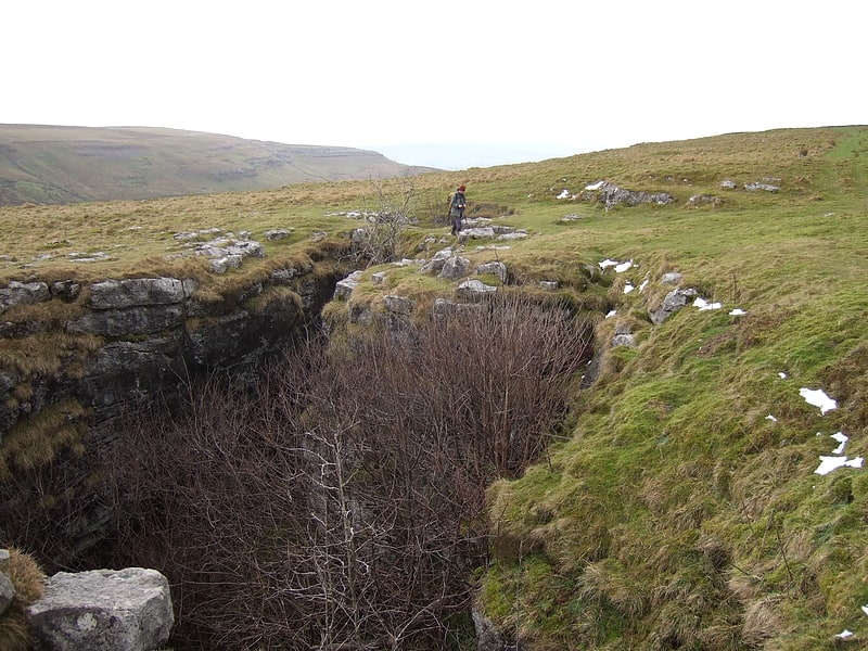
Gaping Gill
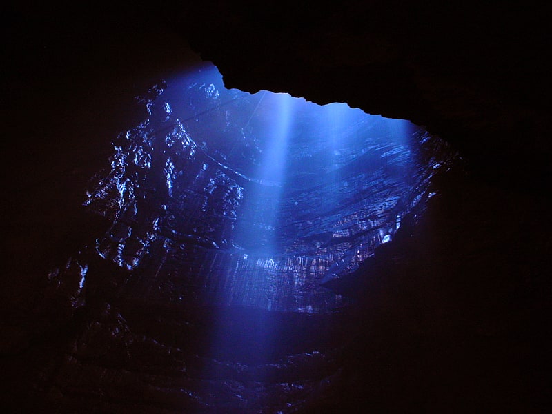
Cave in England. Gaping Gill is a natural cave in North Yorkshire, England. It is one of the unmistakable landmarks on the southern slopes of Ingleborough – a 98-metre deep pothole with the stream Fell Beck flowing into it. After falling through one of the largest known underground chambers in Britain, the water disappears into the bouldery floor and eventually resurges adjacent to Ingleborough Cave.
The shaft was the deepest known in Britain, until Titan in Derbyshire was discovered in 1999. Gaping Gill still retains the records for the highest unbroken waterfall in England and the largest underground chamber naturally open to the surface.[2]
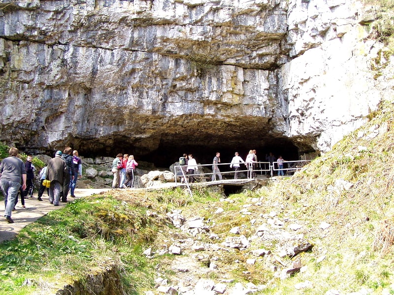
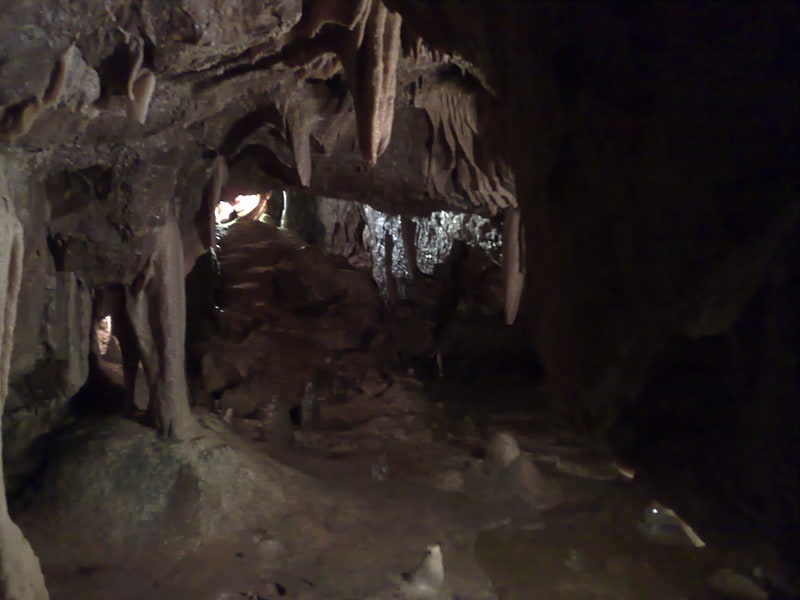
White Scar Cave
Tourist attraction in England. White Scar Caves is a show cave in the civil parish of Ingleton, North Yorkshire, England, under Ingleborough in the Chapel-le-Dale valley of the Yorkshire Dales National Park. It is a solutional resurgence cave formed in Carboniferous limestone, some 6 kilometres long.
It was first explored in August 1923 by two amateur geologists, Christopher Long and J.H. Churchill, but further discoveries have been made since then including The Battlefield, at 90 metres (300 ft) long it is one of the largest known cave chambers in Great Britain. Originally accessed through a vertical boulder choke, an access tunnel has been cut to include it on the visitor trail.
It is open as a show cave, the entrance being from the Ribblehead to Ingleton road on the west of Ingleborough, with tours being run throughout the year. The visitor facilities include a shop and café.[3]
Address: Low Sleights Road, LA6 3AW Ingleton
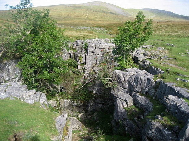
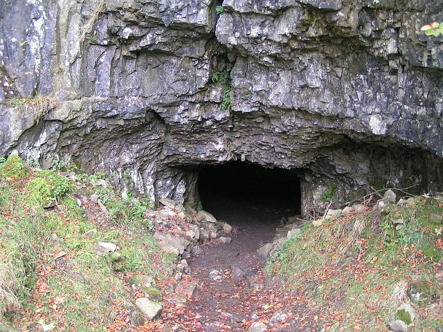
Great Douk Cave
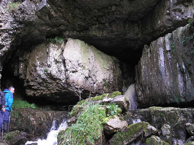
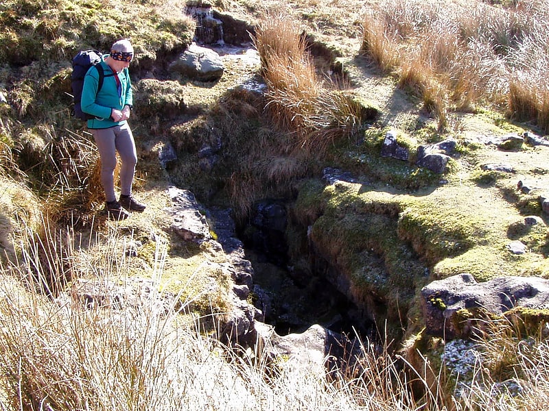
Cave in England. Great Douk Cave is a shallow cave system lying beneath the limestone bench of Ingleborough in Chapel-le-Dale, North Yorkshire, England. It is popular with beginners and escorted groups, as it offers straightforward caving, and it is possible to follow the cave from where a stream emerges at a small waterfall to a second entrance close to where it sinks 600 yards further up the hill. It lies within the Ingleborough Site of Special Scientific Interest.[4]
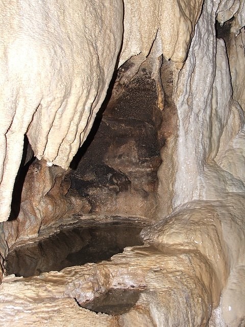
Ingleborough Cave
Tourist attraction in England. Ingleborough Cave is a show cave close to the village of Clapham in North Yorkshire, England adjacent to where the water from Gaping Gill resurges.
That part of the cave which is open to the public follows a fossil gallery for some 500 metres (1,640 ft). The passage is spacious, and well decorated with stalagmitic formations.
Beyond the show cave, the fossil gallery continues until it meets the main stream. The water can be followed upstream through passages under Trow Gill, to where it emerges from a sump at Terminal Lake which has been connected by divers to Gaping Gill, and followed downstream into Lake Pluto which has been connected by divers to Beck Head Stream Cave.
A connection has also been made with Fox Holes, a cave near Trow Gill.
A small stream in the show cave drops into a rift called the Abyss. An underwater connection has been made between the passage at the bottom and Beck Head Cave, the resurgence for the Gaping Gill water.[5]
Stump Cross Caverns
Historical landmark in Greenhow, England. Stump Cross Caverns is a limestone cave system between Wharfedale and Nidderdale in North Yorkshire, England.[6]
Address: Greenhow Hill, HG3 5JL Pateley Bridge
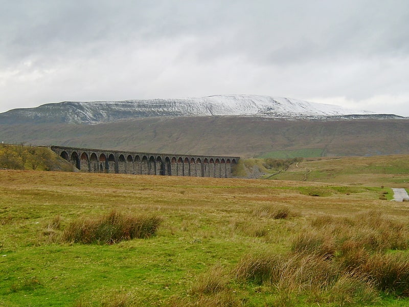
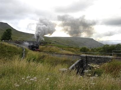
Ribblehead Viaduct
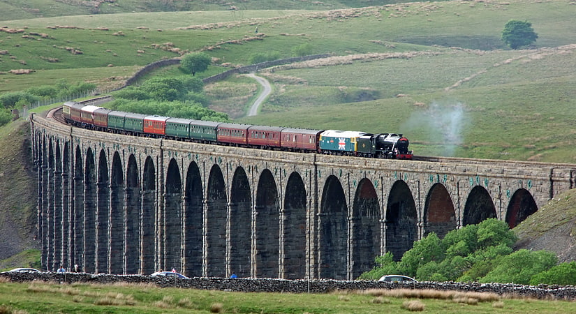
Historical landmark in England. The Ribblehead Viaduct or Batty Moss Viaduct carries the Settle–Carlisle railway across Batty Moss in the Ribble Valley at Ribblehead, in North Yorkshire, England. The viaduct, built by the Midland Railway, is 28 miles north-west of Skipton and 26 miles south-east of Kendal. It is a Grade II* listed structure. Ribblehead Viaduct is the longest and the third tallest structure on the Settle–Carlisle line.
The viaduct was designed by John Sydney Crossley, chief engineer of the Midland Railway, who was responsible for the design and construction of all major structures along the line. The viaduct was necessitated by the challenging terrain of the route. Construction began in late 1869. It necessitated a large workforce, up to 2,300 men, most of whom lived in shanty towns set up near its base. Over 100 men lost their lives during its construction. The Settle to Carlisle line was the last main railway in Britain to be constructed primarily with manual labour.
By the end of 1874, the last stone of the structure had been laid; on 1 May 1876, the Settle–Carlisle line was opened for passenger services. During the 1980s, British Rail proposed closing the line. In 1989, after lobbying by the public against closure, it was announced that the line would be retained. Since the 1980s, the viaduct has had multiple repairs and restorations and the lines relaid as a single track. The land underneath and around the viaduct is a scheduled ancient monument; the remains of the construction camp and navvy settlements (Batty Wife Hole, Sebastopol, and Belgravia) are located there.[7]
Ingleton Pottery
Tourist attraction in Ingleton, England. Ingleton Waterfalls Trail is a well-known circular trail beginning and ending in the village of Ingleton in the English county of North Yorkshire, now maintained by the Ingleton Scenery Company. It is claimed that the trail, some 8 kilometres long, and with a vertical rise of 169 m has some of the most spectacular waterfall and woodland scenery in the north of England. It is on private land and an entrance fee is charged.[8]
Address: Bank Bottom, LA6 3HB Ingleton
Bar Pot
Landmark in England. Bar Pot is one of the entrances to the Gaping Gill cave system being located about 340 metres south of Gaping Gill Main Shaft, on Ingleborough in the Yorkshire Dales. It is a popular entrance into the system, being one of the easiest, driest, and having just two vertical pitches to contend with. It lies within the designated Ingleborough Site of Special Scientific Interest.[9]
Troller's Gill
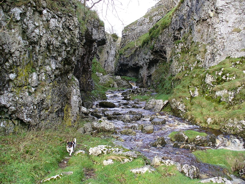
Trollers Gill is a limestone gill or gorge in North Yorkshire, England, close to the village of Skyreholme and 4.7 miles south east of Grassington in the Yorkshire Dales. The gorge, which is 0.5 miles in length, is also known as Trollerdale.[10]
Barden
English civil parish. Barden is a civil parish in the Craven district of North Yorkshire, England. It consists of the hamlet of Drebley and a few scattered houses in Wharfedale in the Yorkshire Dales. The parish also includes two areas of moorland, Barden Fell to the east of the River Wharfe and Barden Moor to the west of the river. Both moorlands are access land, and are popular with walkers. Barden Fell rises to the prominent peak of Simon's Seat, and Barden Moor includes two scenic 19th century reservoirs. Much of the parish is on the Bolton Abbey estate.
The parish is sparsely populated. At the 2011 Census the population of the civil parish was less than 100, and the census statistics for the parish were therefore merged with those of the adjoining civil parish of Hazlewood with Storiths. In 2015, North Yorkshire County Council estimated that the population of the parish was 90.
Barden is derived from the Old English berdene, and means the valley where the barley is grown.[11]
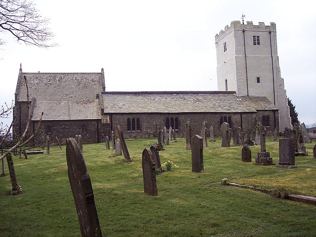
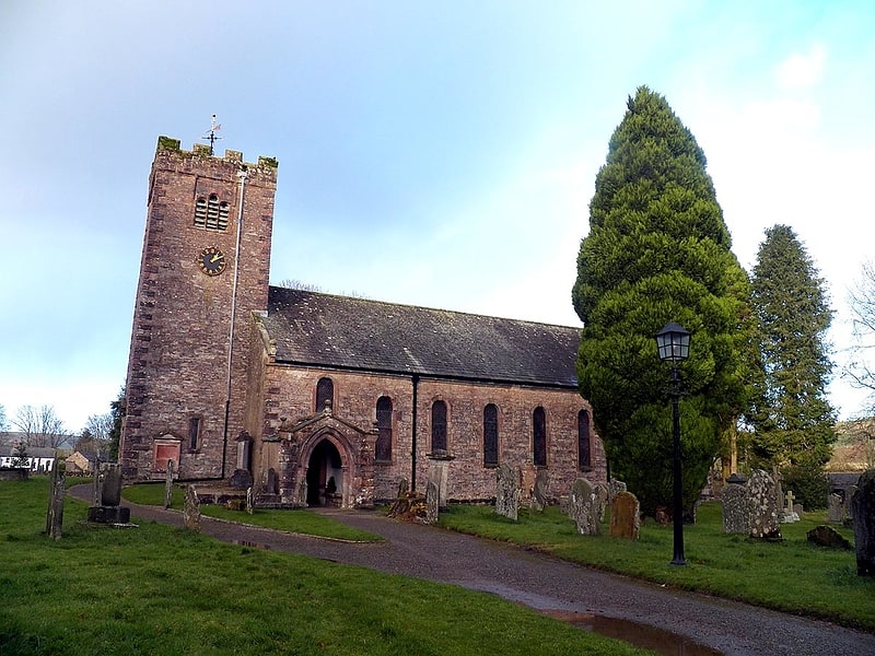
St Andrew's Church
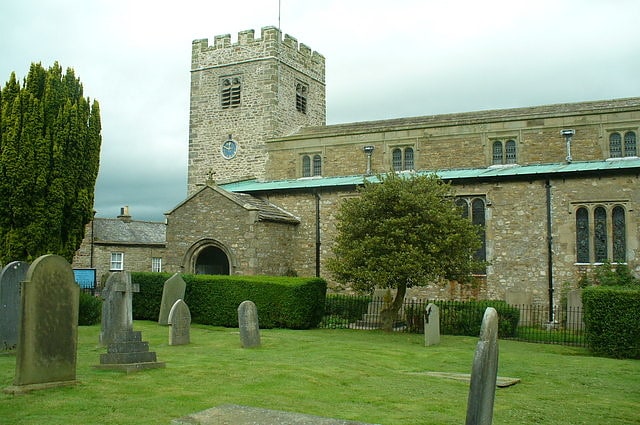
Church in Dent, Cumbria, England. St Andrew's Church is in the village of Dent, Cumbria, England. It is an active Anglican parish church in the deanery of Kendal, the archdeaconry of Westmorland and Furness. and the diocese of Carlisle. It has a regular Sunday morning eucharist at 10.30am. Its benefice is united with that of St John the Evangelist, Cowgill. The church is recorded in the National Heritage List for England as a designated Grade I listed building.[12]
Address: Main St, LA10 5QL Sedbergh
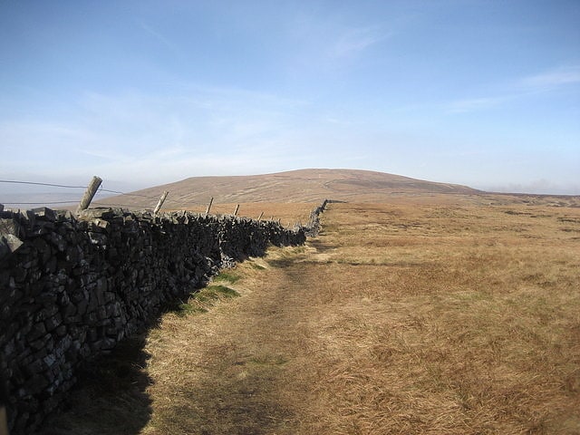
Whernside
Mountain in England. Whernside is a mountain in the Yorkshire Dales in Northern England. It is the highest of the Yorkshire Three Peaks, the other two being Ingleborough and Pen-y-ghent. It is the highest point in the ceremonial county of North Yorkshire and the historic West Riding of Yorkshire with the summit lying on the county boundary with Cumbria. It is the fifteenth most prominent hill in England.
In shape Whernside forms a long ridge, running roughly north-north-east to south-south-west. The mountain is 6 miles (10 km) north west of Ingleton and 6 miles (10 km) north of Horton-in-Ribblesdale.[13]
Cavendish memorial fountain
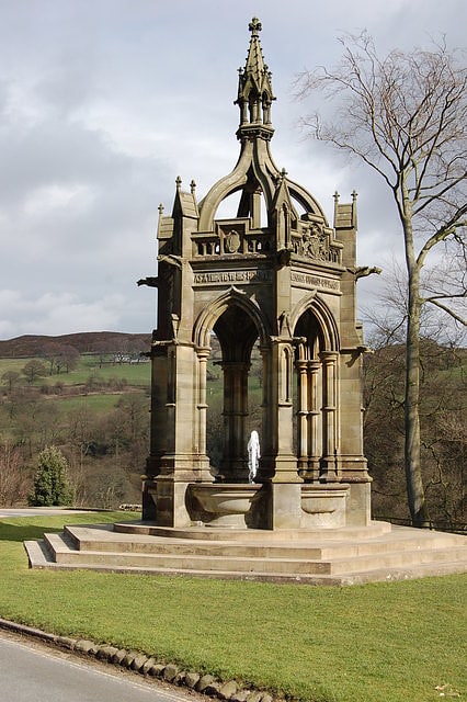
The Cavendish memorial fountain is a drinking fountain erected in 1886 at Bolton Abbey, North Yorkshire, England as a memorial to Lord Frederick Cavendish following his murder in Phoenix Park by the Irish National Invincibles in May 1882. The fountain is a Grade II listed building.[14]
Mossdale Caverns
Mossdale Caverns is a cave system in the Yorkshire Dales, England. It is about 5 kilometres north of Grassington, and east of Conistone, where Mossdale Beck sinks at the base of Mossdale Scar. It lies at an altitude of 425 metres on the eastern flank of Wharfedale, and extends south-east beneath Grassington Moor.
The cave system is formed within the Middle Limestone of the Yoredale Series. The large stream (average flow 100 litres/second) has been shown by dye testing to resurge at Black Keld, some 4.4 kilometres (2.7 mi) to the WNW 225 metres (738 ft) lower.[15]
Alum Pot
Alum Pot is a pothole with a large open shaft at a surface elevation of 343 metres on the eastern flanks of Simon Fell, North Yorkshire, England. It connects with nearby Long Churn Cave and Diccan Pot. The pot is accessed via a 1-km private track on payment of a small fee from Selside Farm in the hamlet of Selside in Ribblesdale. Alum Pot has variously been known as Allan, Alan, Allen, Hellen and Hell'n.[16]
Flood Entrance Pot
Cave in England. Flood Entrance Pot is one of the entrances to the Gaping Gill cave system located about 300 metres south of Gaping Gill Main Shaft. It was the first alternative entrance into the main system to be explored, and it is now a popular entrance into the system, with a fine 38-metre pitch landing in Gaping Gill's South-East Passage. It lies within the designated Ingleborough Site of Special Scientific Interest.[17]
Dentdale
Dentdale is a dale or valley in the north-west of the Yorkshire Dales National Park in Cumbria, England. It is the valley of the River Dee, but takes its name from the village of Dent. The dale runs east to west, starting at Dent Head, which is the location of a railway viaduct on the Settle-Carlisle Line.
Dentdale is one of the few Yorkshire Dales that drain westwards to the Irish Sea.[18]
Address: Rock Lea, Yorkshire Dales National Park
Great Shunner Fell
Mountain in England. Great Shunner Fell is the third highest mountain in the Yorkshire Dales, North Yorkshire, England, and the highest point in Wensleydale; at 716 metres above sea level. In clear weather the summit affords views of Wensleydale to the south, Ribblesdale to the south west and Swaledale to the north, as well as views into Cumbria and County Durham beyond the A66.
The Pennine Way passes over its summit, on the way from Hawes to Keld. The popularity of this route had eroded vegetation from a strip 70 m wide across the moor, which has been alleviated since 1996 by the construction of a path made of flagstones.
The summit holds a cross-shaped windbreak of which the triangulation pillar has been built into the northern 'arm'.
Great Sleddale Beck, which becomes the River Swale after its confluence with Birkdale Beck has its sources on the northern slopes of Great Shunner Fell, while the southern slopes drain into the River Ure and Wensleydale.
The dominating rock type in the area is limestone, but millstone grit forms outcrops extensively on Great Shunner Fell, and coal seams have also been worked on its slopes.
Great Shunner Fell is the most southerly remaining outpost in Great Britain for the yellow marsh saxifrage, Saxifraga hirculus.[19]
Mallerstang
Mallerstang is a civil parish in the extreme east of Cumbria, and, geographically, a dale at the head of the upper Eden Valley. Originally part of Westmorland, it lies about 6 miles south of the nearest town, Kirkby Stephen. Its eastern edge, at Aisgill, borders on North Yorkshire; and since August 2016 it has been within the Yorkshire Dales National Park.
At the 2011 census data for Wharton was included with Mallerstang, giving a total population of 173.[20]
Yordas Cave
Tourist attraction in England. Yordas Cave is a solutional cave in Kingsdale, North Yorkshire, England. It has been renowned since the eighteenth century as a natural curiosity, and was a show cave during the nineteenth century. It is now a popular destination for cavers, walkers, and outdoor activity groups.[21]
Swaledale Museum
Museum in Reeth, England. Swaledale Museum is a local museum in the village of Reeth, near Richmond in North Yorkshire, England. It covers rural history including life and work in the local area of Swaledale and Arkengarthdale within the Yorkshire Dales National Park.[22]
Address: The Green, DL11 6TX Richmond
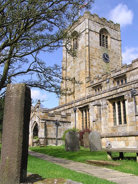
St Oswald's Church
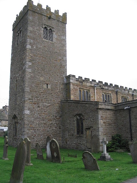
Church in Askrigg, England. St Oswald's Church is a Grade I listed parish church in the Church of England in Askrigg, North Yorkshire.[23]
Address: 1 Church View, DL8 3JW Leyburn
All Saints Church
Anglican church in Orton, England. All Saints Church is in the village of Orton, Cumbria, England. It is an active Anglican parish church in the deanery of Appleby, the archdeaconry of Carlisle, and the diocese of Carlisle. Its benefice is united with those of St Oswald, Revenstonedale, and St James, Tebay. The church is recorded in the National Heritage List for England as a designated Grade II* listed building.[24]
Address: W End Rd, CA10 3RT Penrith
Rowten Pot
Rowten Pot is one of several entrances into the 27-kilometre long cave system that drains Kingsdale in North Yorkshire, England. Its entrance is a shaft some 27 metres long, 10 metres wide, and at the southern end 72 metres deep.[25]
Coverdale
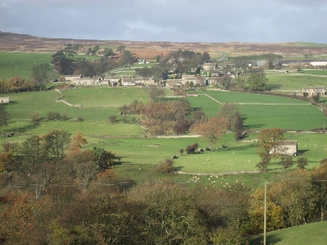
Coverdale is a dale in the far east of the Yorkshire Dales, North Yorkshire, England. It takes its name from the River Cover, a tributary of the River Ure. The dale runs south-west from the eastern end of Wensleydale to the dale head at a pass, known as Park Rash Pass, between Great Whernside to the south and Buckden Pike to the north. It is accessible by a single track road, which runs the length of the dale and over the pass to Kettlewell in Wharfedale. The name is taken from that of the River Cover, which is of Brittonic origin. Ekwall suggested that it might mean "hollow stream", but more recently Andrew Breeze has argued that it is cognate with Welsh gofer "streamlet".[26]
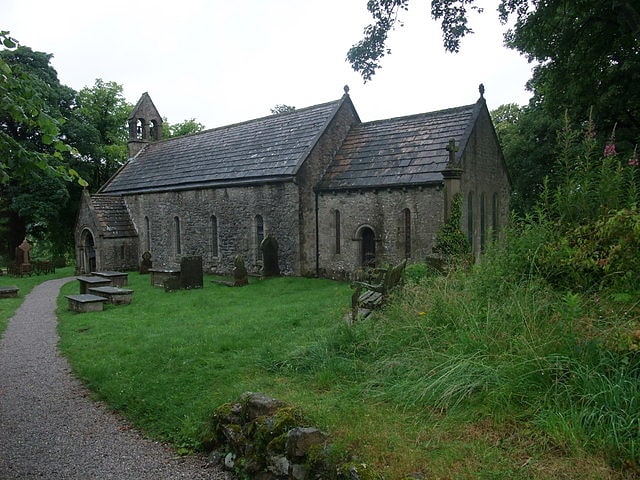
Holy Trinity Church
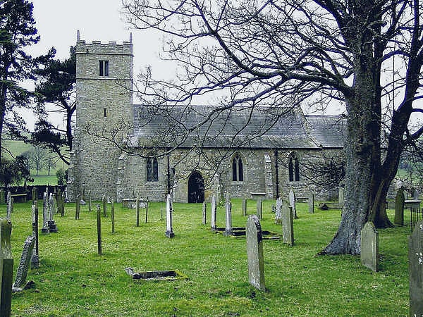
Building in the United Kingdom. Holy Trinity Church is a redundant Anglican church in the village of Coverham, North Yorkshire, England. It is recorded in the National Heritage List for England as a designated Grade II* listed building, and is under the care of the Churches Conservation Trust. The church stands near the ruins of the Premonstratensian Coverham Abbey, and not far from the River Cover.[27]
St Peter's Church
Building. St Peter's Church is in the village of Rylstone, North Yorkshire, England. It is an active Anglican parish church in the deanery of Skipton, the archdeaconry of Craven, and the Diocese of Leeds. Its benefice is united with that of St Wilfrid, Burnsall. The church is recorded in the National Heritage List for England as a designated Grade II listed building.[28]
Great Whernside
Summit in England. Great Whernside is a fell in the Yorkshire Dales, England, not to be confused with Whernside, some 17 miles to the west. Its summit is the highest point of the eastern flank of Wharfedale above Kettlewell. Great Whernside forms the watershed between Wharfedale and Nidderdale, and is on the boundary between the Yorkshire Dales National Park and Nidderdale Area of Outstanding Natural Beauty. The River Nidd rises on the eastern slopes of Great Whernside, above Angram Reservoir.[29]
St Oswald's Church
Church in Ravenstonedale, England. St Oswald's Church is in the village of Ravenstonedale, Cumbria, England. It is an active Anglican parish church in the deanery of Appleby, the archdeaconry of Carlisle, and the diocese of Carlisle. Its benefice is united with those of All Saints, Orton, and St James, Tebay. The church is recorded in the National Heritage List for England as a designated Grade I listed building.[30]
Marrick Priory
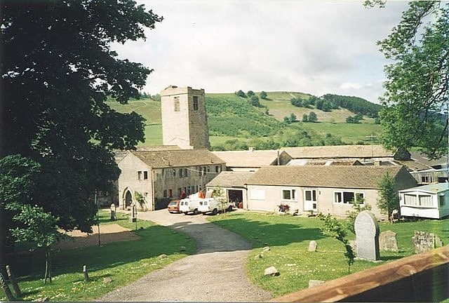
Priory. Marrick Priory was a Benedictine nunnery in Richmondshire, North Yorkshire, England, established between 1140 and 1160 by Roger de Aske. The parish Church of the Virgin Mary and St. Andrew and 400 acres of local land also belonged to the priory, which thrived until the 16th century, in spite of the depredations of marauding Scots.
On 15 September 1539, the prioress, Christabel Cowper surrendered the priory to the commissioners by John Uvedale and Leonard Bekwith. Her sixteen nuns were evicted as part of the Dissolution of the Monasteries, the prioress receiving a pension of 100 shillings and the nuns varying amounts down to 20 shillings (£1 sterling). The site was then leased by the crown to Sir John Uvedale (or Woodhall), who went on to purchase it in 1545 for £364. He sold it in 1592 to Sir Timothy Hutton of Marske, who resold it in 1633 to the Blackburns of Blackburn Hall. The church continued to be used as the place of worship for the local people until 1948, after which it was used as a farm building. It is a grade II* listed building.
In 1970 the church was converted, after some years of restoration, into an outdoor education and residential centre for young people, providing outdoor activities such as rock climbing, abseiling, open canoeing, kayaking, caving, ropes course, zip wire, orienteering and team building for several thousand people a year.
To the northeast of the priory the Nuns' Steps or Nuns' Causey (causeway) leads through Steps Wood to the village of Marrick. This flagged stone path is thought to have been associated with the priory, perhaps connecting it to the Richmond road or to its lead-mining interests.[31]
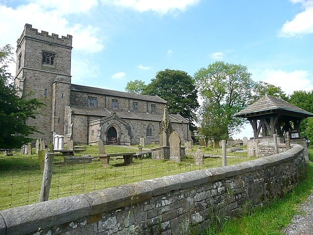
St Michael's Church
St Michael's Church is in the village of Kirkby Malham, North Yorkshire, England. It is an active Anglican parish church in the deanery of Bowland and Ewecross, the archdeaconry of Craven, and the Diocese of Leeds. It is recorded in the National Heritage List for England as a designated Grade I listed building.[32]
St Mary's Church
Building. St Mary's Church is in the village of Conistone, North Yorkshire, England. It is an active Anglican parish church in the deanery of Skipton, the archdeaconry of Craven and the Diocese of Leeds. The church is recorded in the National Heritage List for England as a designated Grade II listed building.[33]
Buckden Pike
Fell in England. Buckden Pike is a fell at the head of Wharfedale, a valley in the Yorkshire Dales, that stands above the village of Buckden. At 702 metres, it narrowly misses out on being the highest peak in the area, the title instead going to nearby Great Whernside. The summit is marked by a trig point.[34]
Juniper Gulf
Juniper Gulf is a pit cave in on the side of Ingleborough in Yorkshire, England. It is a popular single rope technique trip for cavers, especially known for its final 50-metre pitch.[35]