Discover 35 hidden attractions, cool sights, and unusual things to do in Brecon Beacons (United Kingdom). Don't miss out on these must-see attractions: Sgwd Henrhyd, Pen y Fan, and Carreg Cennen Castle. Also, be sure to include Llanthony Priory in your itinerary.
Below, you can find the list of the most amazing places you should visit in Brecon Beacons (Wales).
Table of Contents
Sgwd Henrhyd
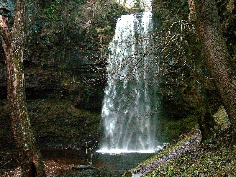
Waterfall in Wales. Henrhyd Falls in the Brecon Beacons National Park, Wales, is the tallest waterfall in southern Wales with a drop of 90 feet. It lies on National Trust land, in the county of Powys. The nearest settlement to it is Coelbren, on the road between Glynneath and Abercraf. Though not in the core of the area, it is considered by many to constitute a part of Wales' celebrated Waterfall Country.[1]
Address: Dol Henrhyd, SA10 9PG Coelbren
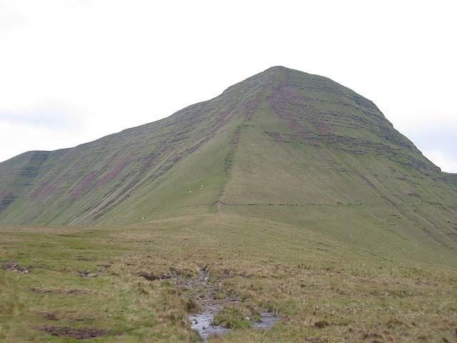
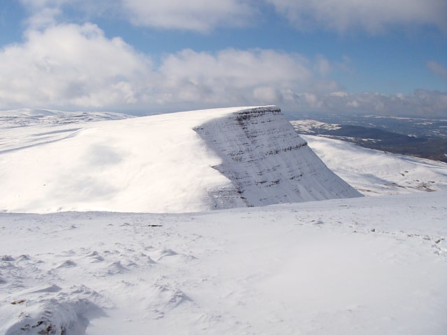
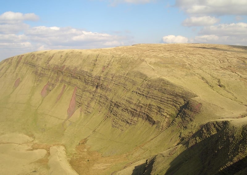
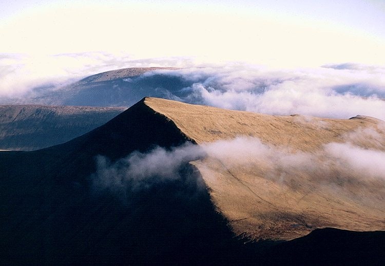
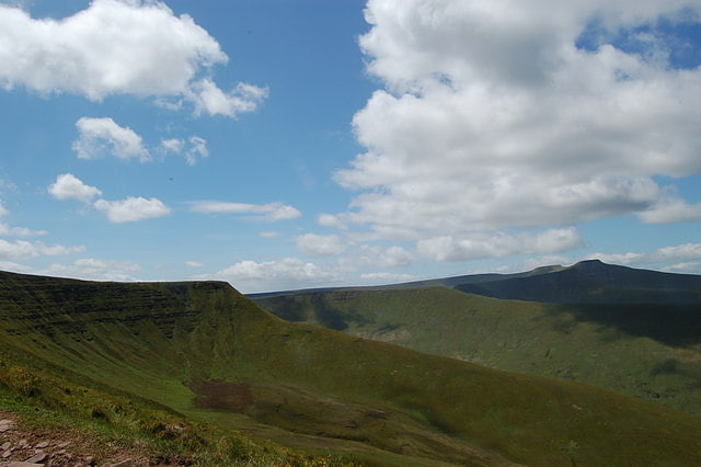
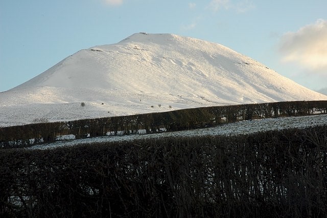
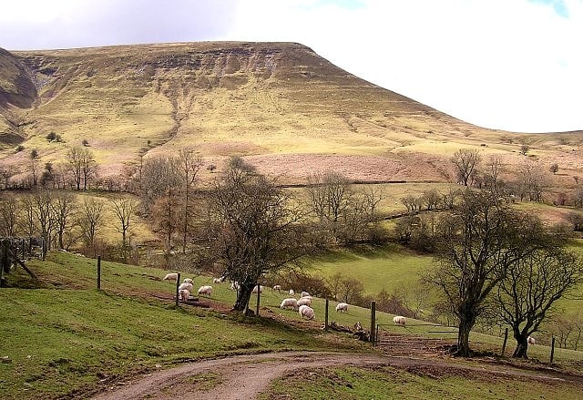
Pen y Fan
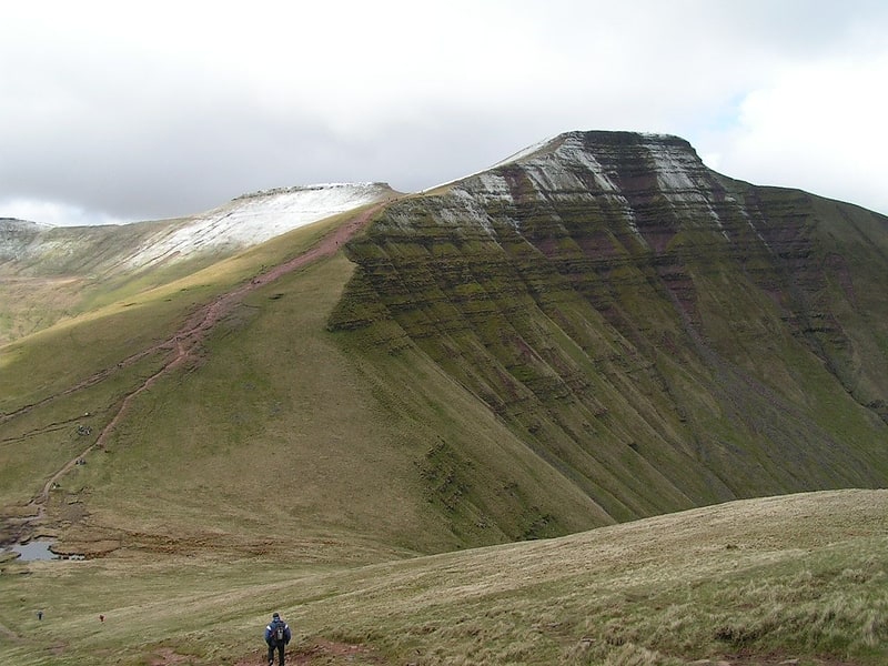
Scenic peak with a hiking trail and cairn. Pen y Fan is the highest peak in South Wales, situated in the Brecon Beacons National Park. At 886 metres above sea-level, it is also the highest British peak south of Cadair Idris in Snowdonia. It is the highest point of the historic county of Brecknockshire. The twin summits of Pen y Fan and Corn Du at 873 m were formerly referred to as Cadair Arthur or 'Arthur's Seat'.
The mountain and surrounding area are owned by the National Trust whose work parties attempt to combat the erosion caused by the popularity of this peak with walkers. The mountain is used by the military as part of the selection process of the UK's Special Forces personnel. Three soldiers who died after collapsing in the field in July 2013 were taking part in a test march called Point-to-Point while undergoing Special Air Service selection.[2]
Carreg Cennen Castle
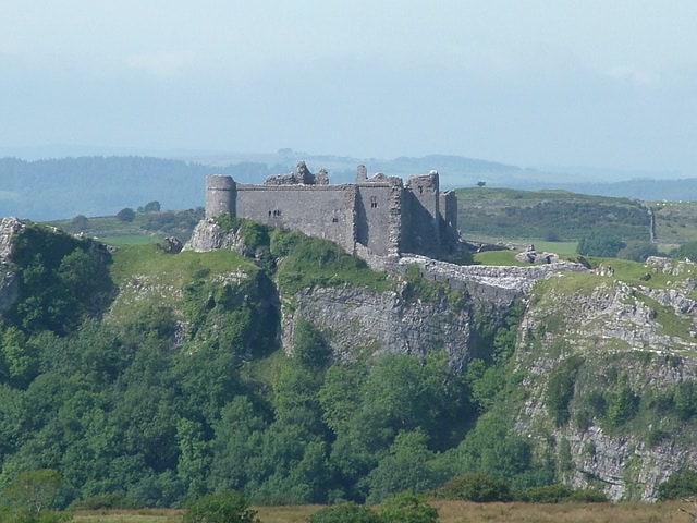
Castle in Wales. Carreg Cennen Castle is a castle sited on a high rocky outcrop overlooking the River Cennen, close to the village of Trap, four miles south of Llandeilo in Carmarthenshire, Wales. The castle is within the Brecon Beacons National Park, and its location has been described as spectacular, due to its position above a limestone precipice. It has been in a ruinous state since 1462 and is now in the care of Cadw, the Welsh Government historic environment service.[3]
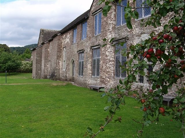
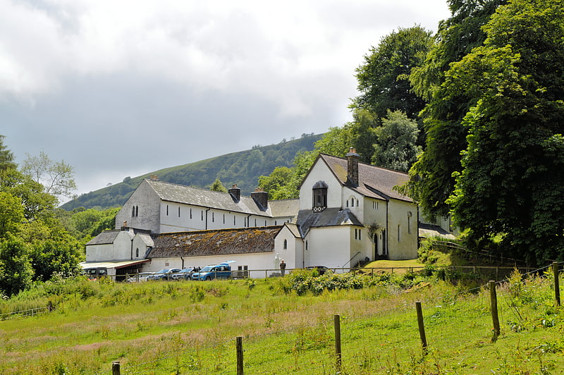
Llanthony Priory
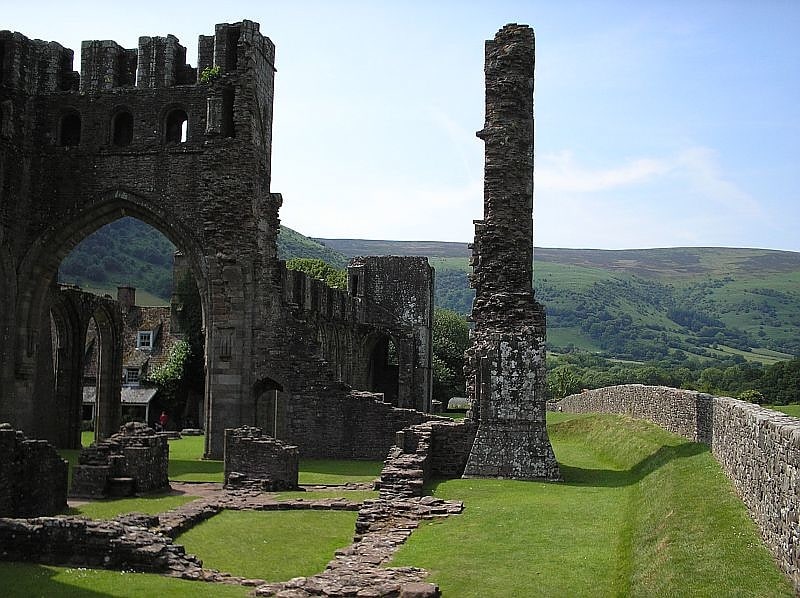
Priory. Llanthony Priory is a partly ruined former Augustinian priory in the secluded Vale of Ewyas, a steep-sided once-glaciated valley within the Black Mountains area of the Brecon Beacons National Park in Monmouthshire, south east Wales. It lies seven miles north of Abergavenny on an old road to Hay-on-Wye at Llanthony. The priory ruins lie to the west of the prominent Hatterrall Ridge, a limb of the Black mountains. The main ruins are under the care of Cadw and entrance is free.
The priory is a Grade I listed building as of 1 September 1956. Within the precincts of the Priory are three other buildings with Grade I listed status: the Abbey Hotel, listed on 1 September 1956; St David's Church, listed on the same date, and Court Farm Barn, listed on 9 January in the same year.[4]
Address: Llanthony, Abergavenny NP7 7NN, Brecon Beacons
Porth yr Ogof
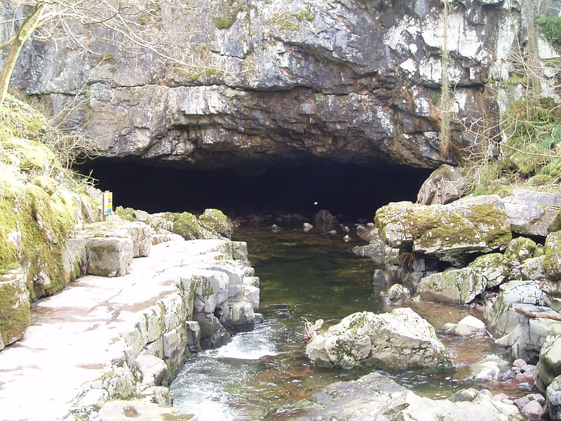
Cave in Wales. Porth yr Ogof is a cave located near the village of Ystradfellte, near the southern boundary of the Brecon Beacons National Park in Wales. It lies on the course of the Afon Mellte, a river whose name translates as ‘lightning’, commonly explained as a reference to the flashy' nature of the river, i.e. rising and falling rapidly in response to rainfall. In 1998 the cave's passageways had been measured as over 2.25 kilometres in length. Among the cave's fifteen entrances is the largest cave entrance in Wales and one of the largest in the UK standing at nearly 20 metres wide and 8 metres high. The cave was used as a show cave many years ago, but is not as attractive as more decorated caves such as Dan yr Ogof, and so today is more often used to introduce people to cave exploration.[5]
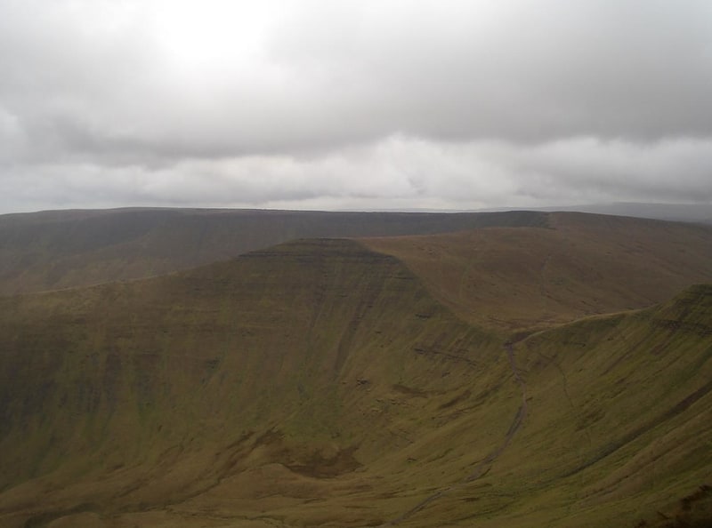
Cribyn Mountain
Mountain in Wales. Cribyn is a mountain in the Brecon Beacons with an elevation of 2608 feet about 300 feet lower than the neighbouring peaks of Pen y Fan and Corn Du. It is a prominent peak in the long and impressive escarpment facing north and running roughly east–west of the central section of the Brecon Beacons.
The summit lies on a ridge stretching from Talybont Reservoir in the east, to the A470 road. The ridge line to the west connects Cribyn with the peak of Pen y Fan. To the east, the ridge line descends to Bwlch ar y Fan, a col crossed by an ancient trail sometimes known as 'The Gap Road' before ascending again to the peak of Fan y Big.[6]
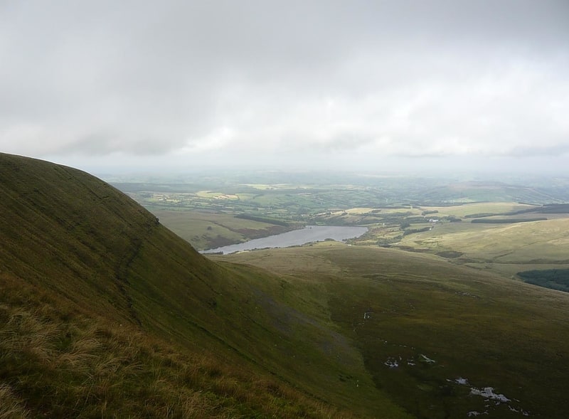
Llangorse Lake
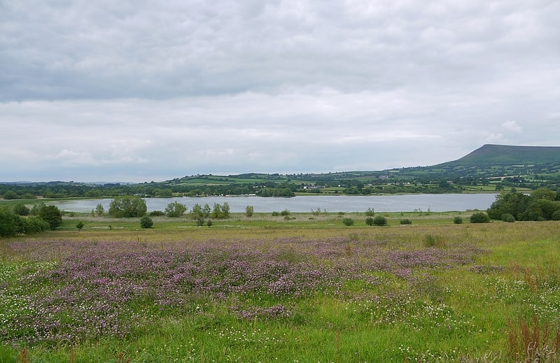
Fishing and boating in a historic setting. Llangorse Lake is the largest natural lake in Mid and South Wales, and is situated in the Brecon Beacons National Park, near the town of Brecon and the village of Llangors.
The lake is famous for its coarse fishing (particularly pike), watersports, the afanc (a monster nicknamed 'Gorsey') and has the only example of a crannog in Wales. Llangorse Lake is also one of the most mentioned sites in Welsh folklore. It is a site of international conservation importance.
Due to the lake's long history of human activity, it has been known by several different names during its history, both in the Welsh language and in English: other names include the lake's original Welsh name, Llyn Syfaddon/Syfaddan, and Brycheiniog Mere. The name Llangorse Lake is comparatively recent.[7]
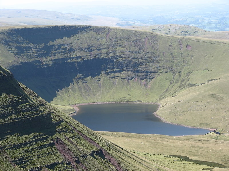
Llyn Cwm Llwch
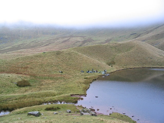
Lake in Wales. Llyn Cwm Llwch is a small lake or pool in the Brecon Beacons National Park in Powys, Wales. It is between 1 and 2 acres: much smaller than the two glacial lakes in the west of the Black Mountain : Llyn y Fan Fawr and Llyn y Fan Fach, and one of the few natural bodies of water in the park. It is of glacial origin, occupying a rock hollow beneath the peaks of Pen y Fan and Corn Du in the central Brecon Beacons. It is drained by the Nant Cwm Llwch which empties into the Afon Tarell, which itself enters the River Usk at Brecon. Tommy Jones' obelisk, a memorial in granite to a young boy who died near this spot in 1900, overlooks the lake.[8]
Tretower Court
Manor house. Tretower Court is a medieval fortified manor house in Wales, situated in the village of Tretower, near Crickhowell in modern-day Powys, previously within the historical county of Breconshire or Brecknockshire.[9]
Address: Powys, Tretower, Crickhowell, SO 184 212 Tretower
Llyn y Fan Fawr
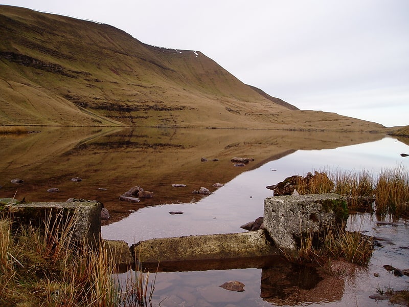
Lake in Wales. Llyn y Fan Fawr is a natural lake in the county of Powys, Wales. It lies at the foot of Fan Brycheiniog, the highest peak of the Black Mountain range within the Brecon Beacons National Park. Created as a result of glacial action, it is one of the largest glacial lakes in southern Wales. The lake is roughly rectangular in shape with its long axis oriented roughly north-south.
The surface of Llyn y Fan Fawr lies at about 1815 feet or 605m above sea level. Its primary outflow is to the River Tawe. Much of the land around the lake is peaty and thus wet underfoot.[10]
Waun Lefrith
Peak in Wales. Waun Lefrith is a top of Picws Du and is also the westernmost of the Carmarthen Fans or Bannau Sir Gaer, a group of peaks within the Black Mountain of the Brecon Beacons National Park. It lies within Carmarthenshire, Wales. The summit plateau of the mountain reaches a height of 2221 feet above sea level. Picws Du and Fan Foel are the other, higher summits of the Bannau Sir Gaer / Carmarthen Fans. The glacial lake of Llyn y Fan Fach dominates the panorama to the north of the peak. Beyond the lake to the north lies the Usk Reservoir and then the Cambrian Mountains on the horizon. Swansea Bay and the Bristol Channel are visible to the south across the undulating dip slope of the mountain. The Tywi valley lies to the west, with Llandovery and Llandeilo as important market towns nearest to the hills.[11]
Church of St Martin
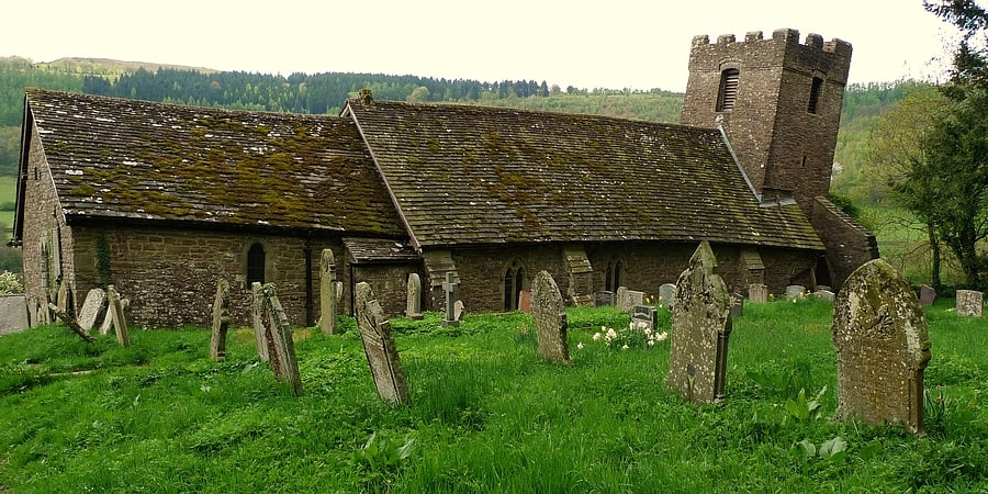
Church in Wales. The Church of St Martin, Cwmyoy, Monmouthshire, Wales, was begun in the 12th century, although most of the current structure dates from the 13th century. The church is most notable for its extreme tilt, the result of a landslide. This has led to many attempts to strengthen the church and prevent its collapse, through the use of massive tie beams and buttresses. The church is in the Gothic style, and has a chancel, nave, south porch, and western tower. A round-headed north window dates to the 12th century, and the nave roof has been dated to the late 13th or early 14th century. St Martin's is a Grade I listed building and an active parish church. It is dedicated to St Martin of Tours.[12]
Fan y Big
Summit in Wales. Fan y Big is a subsidiary summit of Waun Rydd in the Brecon Beacons National Park, in southern Powys, Wales. It is 716.6 m high and is often hiked as part of the Horseshoe Walk, a traverse of the four main peaks in the Brecon Beacons.[13]
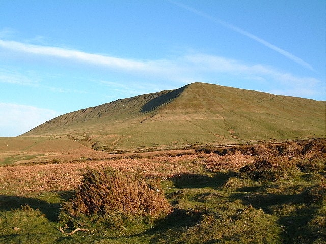
Fan Brycheiniog

Peak in Wales. Fan Brycheiniog is the highest peak at a height of 802.5 metres in the Black Mountain region of the Brecon Beacons National Park in southern Wales. There is a trig point at the peak and on the edge of the escarpment, and nearby, a stone shelter with an inner seat. It lies just inside the historic county of Brecknockshire which gives the mountain its Welsh name. A subsidiary top, less than a kilometre from the summit along the ridge to the northwest, is the highest point of the neighboring county of Carmarthenshire. Fan Brycheiniog is also within the Fforest Fawr Geopark designated in 2005 in recognition of the area's geological heritage. The views of the moorland and open country to the north are spectacular when the weather is clear, and reveals the isolation of the range, especially when compared with the more popular Pen y Fan range to the east.[14]
Picws Du
Peak in Wales. Picws Du is the second highest peak of the Carmarthen Fans in the Carmarthenshire section of the Black Mountain in the west of the Brecon Beacons National Park in south Wales. The highest peak is Fan Foel immediately next along the ridge and it is a subsidiary summit of Fan Brycheiniog. Picws Du falls within Fforest Fawr Geopark and its prominent summit is marked by a large Bronze Age round barrow at a height of 2457 feet above sea level. Waun Lefrith is the other, lower summit of the Bannau Sir Gâr / Carmarthen Fans situated to the west. The peak overlooks the glacial lake of Llyn y Fan Fach in the cwm below. As the peak sits on the edge of the escarpment on a ridge which juts out into the valley below, the views from the summit are panoramic and extensive. The views to the north are especially impressive when the weather is clear, looking towards the Cambrian Mountains, Mynydd Epynt and Brecon. Swansea and the Bristol Channel can just be seen on the horizon to the south, across the gently falling dip slope. Pen y Fan and Corn Du are distinctive landmarks seen directly to the east across Fforest Fawr.[15]
Sugar Loaf
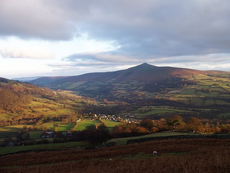
Hill in Wales. Sugar Loaf, sometimes called The Sugar Loaf, is a hill situated 2 miles north-west of Abergavenny in Monmouthshire, Wales and sits within the Brecon Beacons National Park. It is the southernmost of the summit peaks of the Black Mountains, with a height of 1,955 feet. Sugar Loaf was gifted to the National Trust by suffragette Lady Rhondda.[16]
Ogof y Daren Cilau
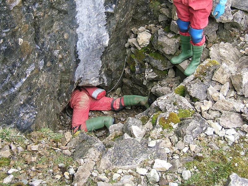
Ogof y Daren Cilau is one of several cave systems in the Llangattock escarpment near Crickhowell in south Powys, Wales. The cave was discovered in 1957 and is one of the longest cave systems in the country.[17]
Clydach Gorge
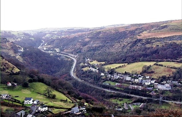
Historical landmark in Wales. The Clydach Gorge is a steep-sided valley in south-east Wales down which the River Clydach flows to the River Usk. It runs for 5.6 kilometres from the vicinity of Brynmawr in Blaenau Gwent eastwards and northeastwards to Gilwern in Monmouthshire. The Gorge was one of the first locations in the region to be industrialised though it still retains its natural environment. It has long been an important transport corridor between Abergavenny and the lowlands of Monmouthshire and the northeastern quarter of the South Wales Coalfield. It is now exploited by the A465 Heads of the Valleys trunk road which runs between Abergavenny and Swansea and which serves the Heads of the Valleys sub-region.
The Gorge is included within the Brecon Beacons National Park and is a tourist destination in its own right, with facilities including a picnic site, waymarked footpaths, the National Cycle Network and car parking alongside the River Clydach, easily reached from the Heads of the Valleys Road. It includes Smart's Bridge, a cast iron bridge and the remains of a late 18th-century ironworks which are now a Scheduled Ancient Monument. There are also limeworks.[18]
Llanthony Abbey
Llanthony Abbey is a former Anglican monastic institution founded in 1869 by Joseph Leycester Lyne, in the Welsh village of Capel-y-ffin, a few miles from the medieval Llanthony Priory. It survived until 1908, after which it was the home of artist Eric Gill. It is now holiday accommodation.
It was also known as Llanthony Tertia - following on from the nearby original medieval Llanthony Priory, and its Gloucestershire offshoot Llanthony Secunda - or New Llanthony Abbey. The surviving buildings are now referred to as Capel-y-ffin Monastery.[19]
Black Mountain
Mountain range. The Black Mountain is a mountain range in South, Mid and West Wales, straddling the county boundary between Carmarthenshire and Brecknockshire and forming the westernmost range of the Brecon Beacons National Park. Its highest point is Fan Brycheiniog at 802 metres or 2,631 ft. The Black Mountain also forms a part of the Fforest Fawr Geopark.[20]
Llangynidr Bridge
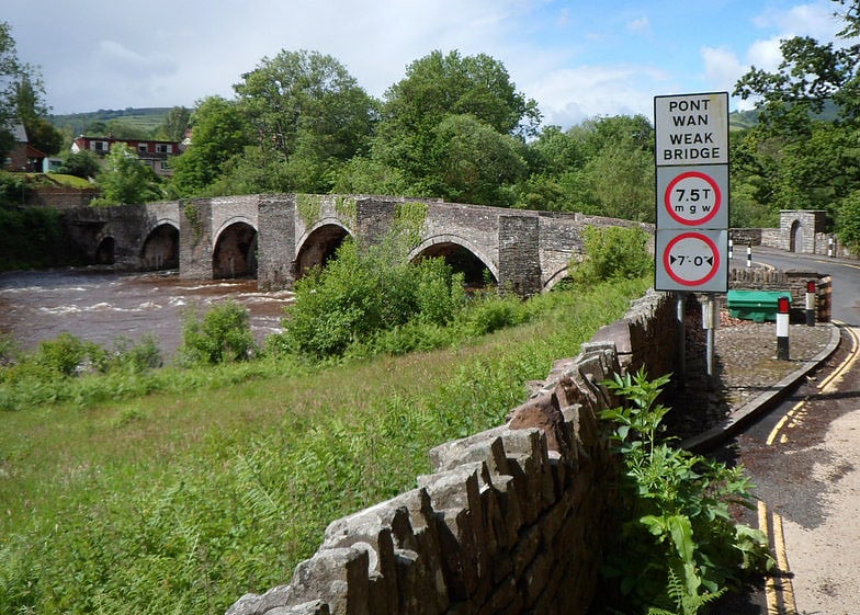
Bridge in Wales. Llangynidr Bridge, also known as "Coed-yr-Ynys Bridge", is an early 18th-century bridge that crosses the River Usk to the north of Llangynidr, Powys, Wales. It carries the B4560 road towards Bwlch.
The existing stone bridge dates from approximately 1700, and is thought by some to be the oldest bridge on the River Usk. It replaced an earlier bridge that was located 500m further west; the sale deeds of a local smithy, dated 1630, contain the first known reference to that earlier bridge, which itself replaced a wooden bridge shown on a land survey of 1587.
Llangynidr Bridge lies in the Hundred (county division) of Crickhowell and is similar in style to the Crickhowell Bridge over the Usk, which dates from 1706. It has six arches, which vary in span from 22 to 30 feet, divided by v-shaped cutwaters topped by pedestrian refuges and parapets with plain coping stones. The cutwaters continue up to the parapet, in order to provide spaces for pedestrians to stand to avoid wheeled traffic crossing the bridge. It is 69 m (230 ft) long and the road is 2.4 m (8 ft) wide. It is considered a particularly impressive example because of its height - reducing the danger of flooding - and its location, which gives a good view of the architecture.
Llangynidr Bridge is known to have been repaired in 1707, and again in 1822. In 1794 a turnpike gate was set up on the Bwlch side of the river, and the right to collect the tolls was auctioned off in 1800. The turnpike cottage is still standing and was purchased from the Beaufort estate in 1915 by the family of one of the earliest toll-keepers. Theophilus Jones, passing through in 1809, noted that the responsibility for repairs lay with the hundred of Crickhowell. Further repairs were carried out in 2015–16. The bridge has been painted over the years by many artists, notably Sir Cedric Morris, whose painting of the bridge has been purchased for Y Gaer, Elizabeth Wynter and Gwyn Briwnant Jones.
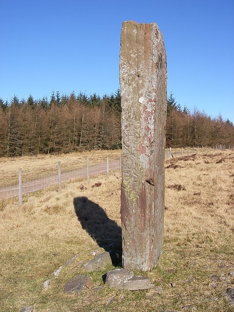
A short way from the bridge is a standing stone, 14 feet tall, which stands on a field boundary.
The bridge became a Grade II listed structure in 1952; it was upgraded to Grade I in 2003 as one of the best early road bridges in Wales, ranked equally with Crickhowell Bridge.[21]
Pen Cerrig-calch
Summit in Wales. Pen Cerrig-calch is a subsidiary summit of Waun Fach in the Black Mountains in the Brecon Beacons National Park in southern Powys, Wales. Its summit, at a height of 701 m, is marked by a trig point. The peak sits high above the River Usk valley as it narrows above the small town of Crickhowell.The views from here are wide-ranging and extend as far as the Beacons themselves to the west. A ridge runs off to the northwest and the shoulder of Pen Gloch-y-pibwr then turns north to the secondary top of Pen Allt-mawr whose peak at 719m is also crowned by a trig point.[22]
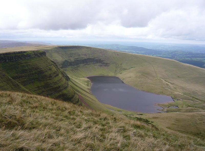
Llyn y Fan Fach
Lake in Wales. Llyn y Fan Fach is a lake of approximately 10 hectares on the northern margin of the Black Mountain in Carmarthenshire, South Wales and lying within the Brecon Beacons National Park. The lake lies at an altitude of approximately 1,660 feet, immediately to the north of the ridge of the Carmarthen Fans. It is the smaller of two lakes within this mountain massif: the slightly larger Llyn y Fan Fawr is about 2 miles to the east.[23]
Fan Gyhirych
Mountain in Wales. Fan Gyhirych is a mountain in the Fforest Fawr section of Brecon Beacons National Park in south Wales. It lies within the county of Breconshire, and administered as part of the unitary authority of Powys.
Its highest point at 2379 feet (or 725 m) is marked by a trig point which is located towards the western side of the summit plateau. The hill drains to the north into the catchment of the Afon Crai and to the south and west into that of the River Tawe. Fan Fraith is a nearby hill which can be considered a subsidiary top of Fan Gyhirych.[24]
Pen-y-crug
Hill. Pen-y-crug is a hill in the Brecon Beacons National Park in the county of Powys, south Wales. It is commonly referred to locally as simply 'The Crug'. The Welsh name signifies 'top of the mound'. It slopes are moderately gently on three sides; only to the west do they steepen somewhat. Its flat trig point adorned summit at 331m overlooks the valley of the River Usk to the south. To the southeast are panoramic views over Brecon whilst eastwards are the Black Mountains and south the Brecon Beacons.[25]
Mynydd Illtud
Mynydd Illtud is an extensive area of common land near Libanus, Powys, Wales, located in the Brecon Beacons National Park and some three miles south-west of Brecon. The common is an undulating plateau lying between 330 and 370 metres above sea level. Its highest points are 381 metres at Allt Lom and 367 metres at Twyn y Gaer trig point overlooking the valley of the River Usk. Twyn y Gaer is the site of an Iron Age hill fort.[26]
St Michael's Church
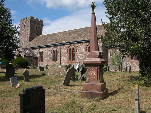
Anglican church in Llanvihangel Crucorney, Wales. St Michael's Church stands in the centre of the village of Llanvihangel Crucorney, Monmouthshire, Wales. It was designated as a Grade II listed building in 1956 for its historic importance and surviving medieval features.[27]
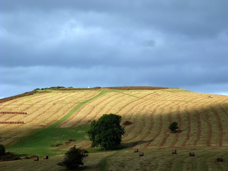
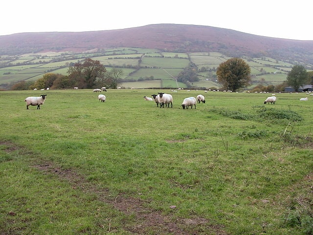
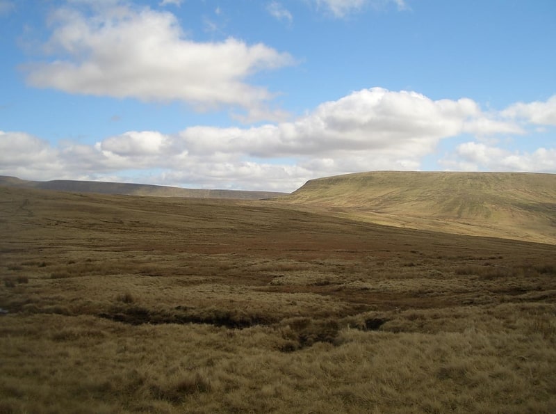
Brecon Beacons National Park
National park in Wales. The Brecon Beacons National Park is one of three national parks in Wales, and is centred on the Brecon Beacons range of hills in southern Wales. It includes the Black Mountain in the west, Fforest Fawr and the Brecon Beacons in the centre and the Black Mountains in the east.[28]
Hay Bluff
Hill in Wales. Hay Bluff is a prominent hill at the northern tip of the Black Mountains, an extensive upland massif which straddles the border between south-east Wales and England. The mountain sits at the point where the main northeast-facing escarpment of the Black Mountains meets the northwest facing escarpment, the next peak to the west being Twmpa. The flat summit of Hay Bluff which is marked by a triangulation pillar at a height of 677 metres overlooks the middle Wye Valley and the book town of Hay-on-Wye.
The hill is largely within the Welsh county of Powys though parts of its eastern flanks lie within the English county of Herefordshire.[29]
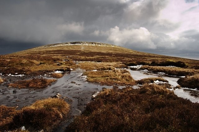
Bwlch y Ddwyallt
Peak in Wales. Bwlch y Ddwyallt is the name commonly applied to the high point of the plateau of Gwaun Cerrig Llwydion in the eastern part of the Brecon Beacons in south Wales. It is a top of Waun Rydd.
The plateau reaches its highest point of 754m above sea level on its northern rim overlooking the head of Cwm Cwareli. The name is an odd one to apply to a peak since the Welsh word 'bwlch' generally signifies a col or pass between mountains.[30]
Maen Madoc
The Maen Madoc or Maen Madog stone is a menhir which lies adjacent to the Roman road Sarn Helen that runs across the Brecon Beacons in what was a key area of Roman Wales, about one mile north of Ystradfellte. It stands approximately 10 feet high.
It is thought to have marked a late Roman - post-Roman Christian burial – the stone is inscribed on one side, the Latin inscription reading DERVAC(IVS) FILIVS IVSTI (H)IC IACIT – "Of Dervacus, Son of Justus. He lies here".
Though the stone is named after a Madoc, nothing is known of the Madoc referred to. The base of stone is surrounded by deeply embedded stones. The stone was first recorded in 1805 as recumbent, re-erected in the 19th century, and was excavated and re-erected in 1940. Excavations undertaken at the time showed that the stone had previously been sited at the edge of the Roman road, with no grave associated.
Maen Madoc can be found at SN918157 on the Brecon Beacons West and Central map.
It has been recorded by the Royal Commission on Ancient and Historical Monuments in Wales (NPRN 84540), Early Christian Monuments in Wales ECM 8, and Clwyd-Powys Archaeological Trust Historic Environment Record Primary Record Number 825.
It is designated as a Scheduled Ancient Monument.[31]
Hatterrall Hill
Peak in Wales. Hatterrall Hill is a rounded peak in the Black Mountains which sits on the Wales-England border, partly in Monmouthshire, Wales and partly in Herefordshire, England. Its summit at 531m is the high point of a peaty plateau which falls away steeply on all sides. Broad ridges run to the north, the southeast and southwest. To the north the ridge dips to a col at around 485m elevation before rising gradually over several kilometres towards Crib y Garth / Black Hill and Hay Bluff. The ridge to the southwest ends abruptly at the sheer cliff known as the Darren below which is a considerable landslipped area extending south to the hamlet of Cwmyoy with its mis-shapen church. The Welsh part of the hill falls within the Brecon Beacons National Park.[32]
Mynydd Troed
Hill in Wales. Mynydd Troed is a hill in the Black Mountains of the Brecon Beacons National Park in Powys, south Wales. Its name literally translates to "Foot Mountain," based how it appears when viewed from the Allt Mawr ridge.
It lies 3 miles (4.8 km) south of Talgarth and 2 miles (3.2 km) northeast of the village of Llangors on the western side of the range. Its summit at the northern end of a northwest to southeast aligned ridge reaches 609 metres (1,998 ft) above sea level and is crowned by a trig point.[33]
Twmpa
Mountain in Wales. Twmpa or Lord Hereford's Knob is a mountain in south-east Wales, forming a part of the great northwest scarp of the Black Mountains. It lies 1.86 miles west of the border with England, and around 4.34 miles south of Hay-on-Wye. To the northeast lies the Gospel Pass through which runs a minor road between Hay and the Llanthony Valley. A ridge known as Darren Lwyd tapers away for about 3 kilometres to the southeast of the summit.[34]
Address: Gospel Pass, Brecon Beacons
Fan Fawr
Mountain in Wales. Fan Fawr is a mountain in the Fforest Fawr section of the Brecon Beacons National Park, in Powys, Wales and over 734 m high.
The summit overlooks the steep eastern face and is marked by a cairn. Unusually, the trig point on this hill does not sit at the summit but 600 m to the south-west on a subsidiary spur. The hill is drained to the west by streams flowing into the Afon Dringarth and to the east by streams draining into the Taf Fawr. The Dringarth is dammed to the west to form Ystradfellte Reservoir as is the Taf Fawr east of the hill to form Beacons Reservoir. To the north-east water flows into the Afon Tarell, a tributary of the River Usk whilst to the south the headwaters of the Afon y Waun conduct water to the Afon Hepste and eventually to the River Neath.[35]