Discover 20 hidden attractions, cool sights, and unusual things to do in Yoho National Park (Canada). Don't miss out on these must-see attractions: Takakkaw Falls, Emerald Lake, and Wapta Falls. Also, be sure to include Lake O'Hara in your itinerary.
Below, you can find the list of the most amazing places you should visit in Yoho National Park (British Columbia).
Table of Contents
Takakkaw Falls
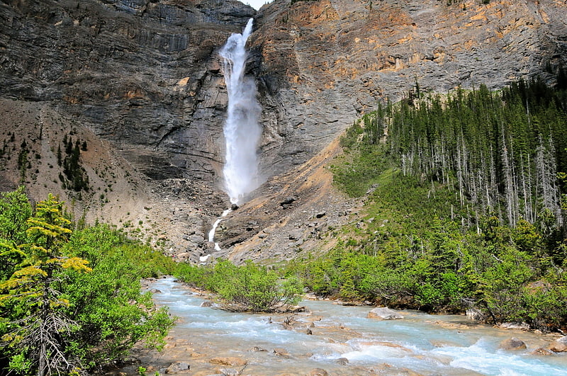
Towering waterfall in Yoho National Park. Takakkaw Falls is a waterfall located in Yoho National Park, near Field, British Columbia in Canada. The falls have a total height of 373 metres, making them the second tallest waterfall in Canada. The main drop of the waterfall has a height of 254 metres.
"Takakkaw" translates to "magnificent” in Cree. The falls are fed by the meltwater of the Daly Glacier, which is part of the Waputik Icefield. The glacier keeps the volume of the falls up during the warm summer months, and they are a tourist attraction, particularly in late spring after the heavy snow melts, when the falls are at peak condition.[1]
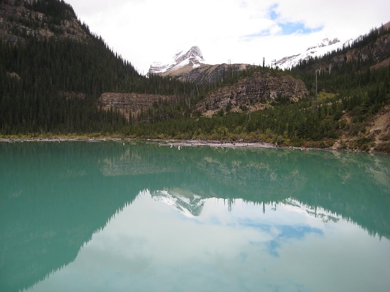
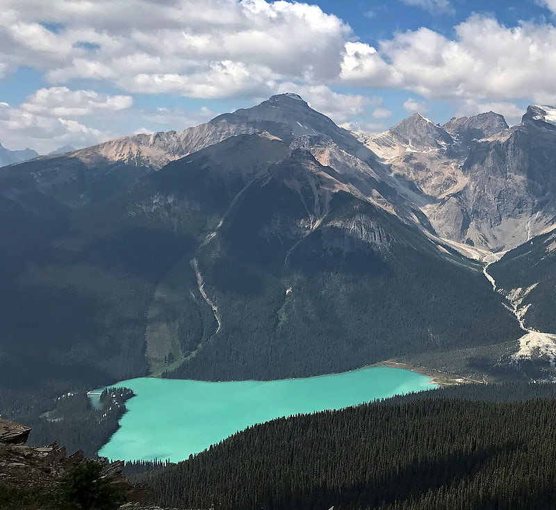
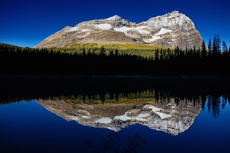
Emerald Lake
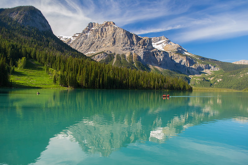
Lake in British Columbia, Canada. Emerald Lake is located in Yoho National Park, British Columbia, Canada. Yoho National Park is one of the 4 contiguous National Parks in the heart of Canada's Rocky Mountains, along the boundary of British Columbia and Alberta Provinces, the other Parks are Kootenay, Jasper, and Banff. Many Provincial Parks, having near-similar environmental protection and as-spectacular nature, also join these federal reserves. Emerald Lake Lodge, a high-end lodge or hotel, is on a peninsula jutting into the lake. It was founded in the 1920s and completely rebuilt in the 1980s. A quiet 2 lane paved road about 15 km / 9 miles long connects the busy Trans-Canada Highway with Emerald Lake, the exit is well marked. A 5.2 km hiking trail circuits the lake, the first half of which is accessible to wheelchairs and strollers, many other more advanced hiking trails go in different directions up into the mountains, be sure to be well prepared in skill, fitness and in hazard awareness before venturing onto them. Many wild animals live in the area and are protected by Park Law, Brown Bears and Black Bears are fairly common, they co-exist quite well with humans as the Park has strict laws on garbage control and good advice to Park Visitors on practicing bear safety and being "Bear Aware". Mountain Goats and Bighorn Sheep are seen at higher altitudes, and many smaller mammals are common everywhere. Hunting is strictly prohibited in the Park, fishing is permitted with a Park license. During the summer months, canoe rentals are available from the Lodge, in the winter, the lake is a popular cross country skiing destination. Canada's National Parks do not permit private or business land ownership within their boundaries, all development is strictly controlled by the National Park for environmental preservation, development permits are rarely if ever given, and then only after extensive Gov't review and consultation, the land the business occupies is leased from the Park, nearly all businesses in the Parks were established decades ago, and current approval is exceedingly rare. There is a strict "need-to-reside" law in place for living in a Canadian Mountain National Park town or village, simply put you must prove you need to live there for reasons of operating a Park-approved business or service, unless you are a non-management employee. The railway and timber town of Golden BC is the nearest town to Emerald Lake that is outside the Park boundaries, it is about 50 km / 30 miles distant to the west in the low valley of the Columbia River headwaters, and has many lodging options, the small historic railway village of Field is in Yoho Park near the highway exit to Emerald Lake, and has a large Park-operated Information and Visitor's Center, Field Village also has gas, food and a few B & B's. The Park Service Center of Lake Louise, which has limited lodging, is about 30 km / 20 miles to the east of Emerald Lake in neighboring Banff National Park, while the famous resort town of Banff, located on the southeast edge of that Park, is about 60 km / 40 miles further east of Lake Louise, it has a large number of hotels as does the town of Canmore, located just outside the Banff Park boundary. Vehicle / RV campgrounds are common throughout the region for summer use, reservations made well in advance are highly advised for hotels and campgrounds during summer, which is early June to late September on an average weather year. Brief snowstorms, which usually melt in a few days, occasionally occur at valley level in June or September due to the latitude of 53 degrees and the generally high elevation. Daytime temperatures in June or September average 20 C / 70 F, in July and August it can reach as high as 33 C / 90 F. Winter temperatures December to March are always below freezing, averaging -15 C / 0 F and sometimes down to -30 C / -30 F. Snowfall is usually substantial, about 1 meter / 3 feet or more of snow stays at lake level in winter, increasing with altitude to 10 meters / 30 feet or more on the mountain tops.
Emerald Lake is enclosed by mountains of the President Range, named after the President and Vice-President of the coast to coast Canadian Pacific Railway, built in 1885 and which runs through Yoho National Park. Other peaks are Mount Burgess and Wapta Mountain. The Emerald Basin opens to the west and traps rain and snow storms, causing frequent rain in summer and heavy snowfalls in winter. This influx of moisture works with the lake's elevation of 1200 meters / 4400 feet above sea level to produce a unique selection of flora. Trees found here are more typical of B.C.'s wet interior forests of the Columbia Mountains immediately to the west, such as western red cedar, western yew, western hemlock and western white pine. The alluvial fan on the northeast shore produces wildflowers in abundance during late June and early July.
Due to its 53 degree latitude and moderately high altitude, the lake is frozen from November until late April or early May. The vivid green color of the water is caused by powdered rock from the glaciers which reflects the blue-green spectrum of sunlight, the rock type and the amount of it in the water causes the color to vary from lake to lake and month to month, even week to week. It is the most spectacular in July and August when the glaciers containing the sediment melt somewhat in the summer heat, in spring or autumn the water is clearer.
The first non-indigenous person to set sight on Emerald Lake was Canadian guide Tom Wilson, who stumbled upon it by accident in 1882. A string of his horses had gotten away, and it was while tracking them that he first entered the valley. The lake had an impression on even the most seasoned of explorers: "For a few moments I sat my horse and enjoyed the rare, peaceful beauty of the scene." It was Wilson who gave the lake its name because of its remarkable color, which due to a different rock type producing the sediment that is suspended in the glacial water, reflects the green spectrum of sunlight rather than the blue spectrum seen in Moraine, Hector, Bow and Peyto Lakes in neighboring Banff National Park. However, this was not the first time Wilson had named a lake 'Emerald'. Earlier that same year he had discovered another lake which he had given the same name, and that name even appeared briefly on the official map. This first lake however, was shortly renamed Lake Louise.[2]
Wapta Falls
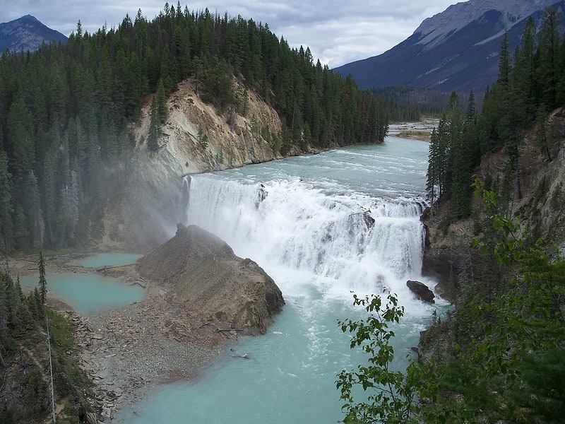
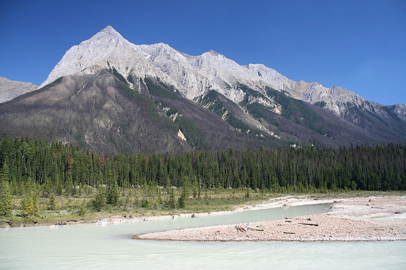
Waterfall in British Columbia, Canada. Wapta Falls is a waterfall of the Kicking Horse River located in Yoho National Park in British Columbia, Canada. It is the largest waterfall of the Kicking Horse River, at about 18 metres high and 107 metres wide. Its average flow can reach 96 cubic metres per second. The name stems from a Nakoda word meaning "river".[3]
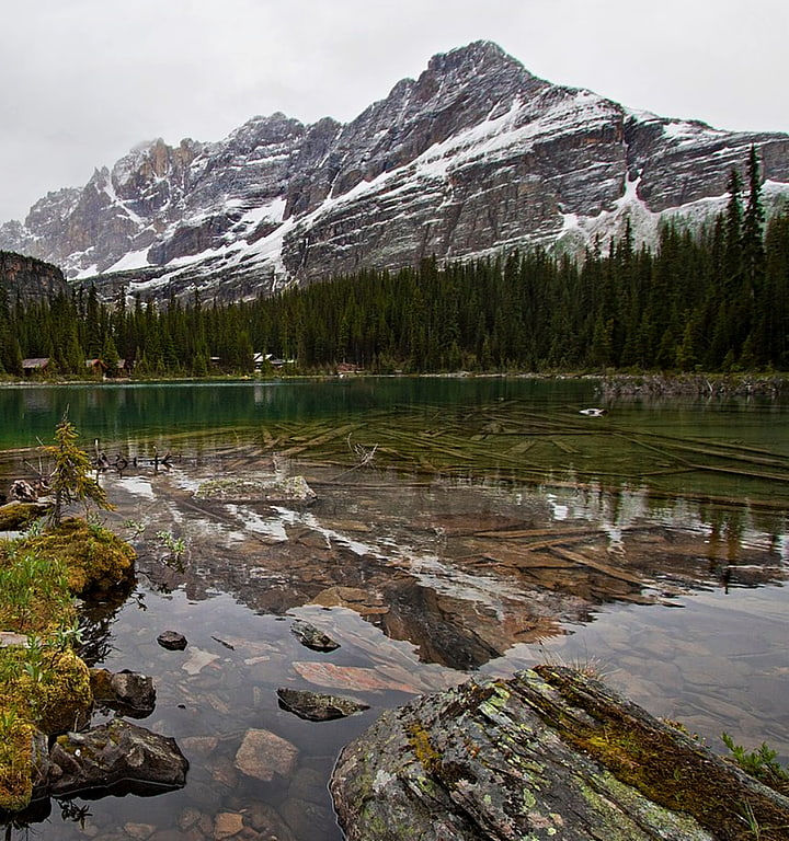
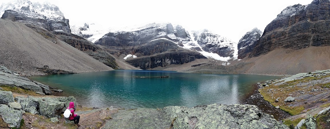
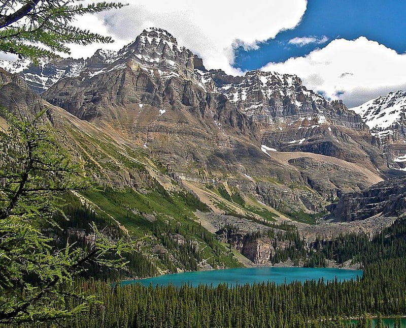
Lake O'Hara
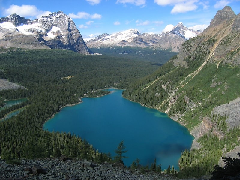
Lake in British Columbia, Canada. Lake O'Hara is a lake at an elevation of 2,020 metres in the alpine area of Yoho National Park, in the province of British Columbia, on the western side of the Great Divide with the province of Alberta and Banff National Park to the east. The lake and the valley are accessible through a bus service that is run by Parks Canada or by an 11 km hike along a road with an elevation gain of approximately 500m. However, people who hike up the road are not guaranteed a bus ride down. People who have reservations have priority for the bus spots for the ride down. Reservations for the bus, for day use, can be made through the Parks Canada Reservation website. Campsite reservations can be made up to three months in advance through the Lake O'Hara reservation line. It is strongly recommended that visitors make reservations in advance, as the bus does fill up and standby bus spots are not sold the day of bus departures.
The area is known for its scenery as well as its alpine hiking. Visitors often follow the climbing trails which ascend from Lake O'Hara to Lake Oesa and to Opabin Lake. The number of people who access the area by bus has been limited in order to preserve the sensitive alpine environment.
The area is named after Colonel Robert O'Hara, an Irishman from Derryhoyle, Galway who heard about the area from J.J. McArthur, a government surveyor.
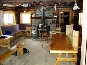
The Elizabeth Parker Alpine Club Hut is in the Meadows about a 15-minute walk from the Lodge. It is a ski destination in the winter, with many skiers doing it as a day trip.[4]
Elizabeth Parker hut
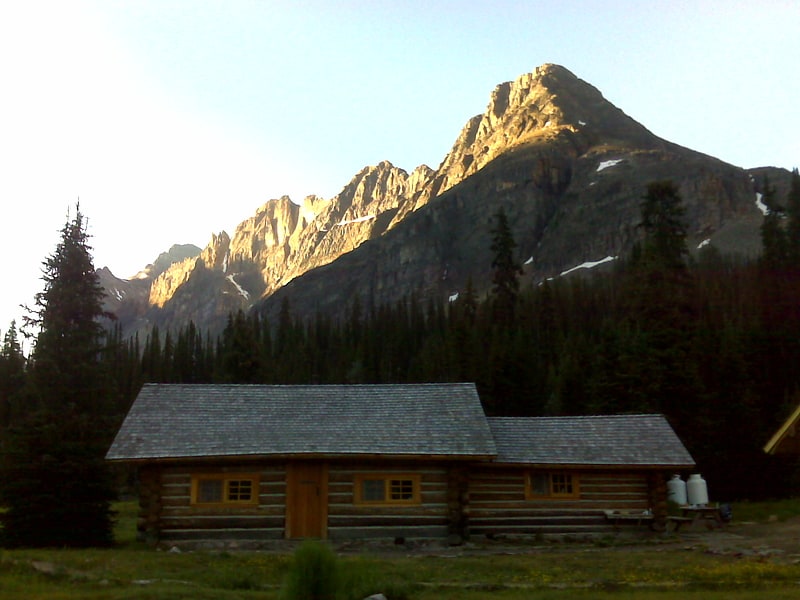
Cottage in Field, British Columbia. The Elizabeth Parker hut is an alpine hut located in Yoho National Park near Lake O'Hara in British Columbia. The hut is maintained by the Alpine Club of Canada.[5]
Stanley Mitchell hut
Club in Field, British Columbia. The Stanley Mitchell hut is an alpine hut located at an altitude of 2,060 metres in the Little Yoho Valley in Yoho National Park, British Columbia. It sits in a small meadow not far from the base of a mountain called The President. It serves as a base for hiking, scrambling, ski-touring and climbing the nearby mountains. The hut is maintained by the Alpine Club of Canada.[6]
Abbot Pass hut
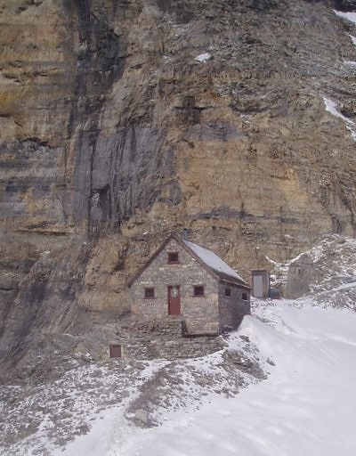
Tourist attraction in Alberta, Canada. The Abbot Pass hut is an alpine hut located at an altitude of 2,925 metres in Abbot Pass in the Rocky Mountains in Alberta, Canada. It is nestled between Mount Victoria and Mount Lefroy, straddling the continental divide, which, in this region, defines the boundary between Banff National Park in Alberta and Yoho National Park in British Columbia. While close to the border, the hut lies entirely in Banff National Park, and is the second-highest permanently habitable structure in Canada. The hut is maintained by the Alpine Club of Canada.
It was closed in the summer of 2018 pending a geotechnical evaluation of the slope which underlies the structure, after a hiker noticed erosion on its eastern side, due to melting glacier ice. The hut never reopened after the COVID-19 pandemic delayed repair work, and it is set to be demolished in summer 2022 because the erosion has made it dangerous to those below.[7]
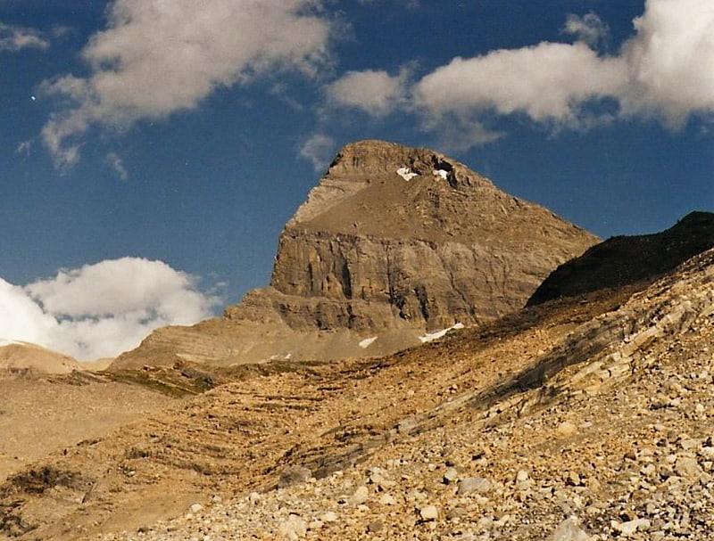
Mount Schaffer
Mountain in British Columbia, Canada. Mount Schaffer is a 2,691-metre mountain summit located one kilometre southwest of Lake O'Hara in Yoho National Park, in the Bow Range of the Canadian Rockies of British Columbia, Canada. Its nearest higher peak is Mount Biddle, 3.2 km to the southeast. Mount Schaffer is situated 3.5 kilometres west of the Continental Divide, and 12 kilometres southeast of Field, British Columbia.[8]
Lake Oesa
Body of water in British Columbia, Canada. Lake Oesa is a body of water located at an elevation of 2,267 metres in the mountains of Yoho National Park, near Field, British Columbia, Canada, while a trail at the far end of the lake leads to Abbot Hut.
The lake gets its name from a Stoney language (Native American language) term for 'corner'. It can be reached via a 3.2-kilometre (2.0 mi) climbing trail which starts at Lake O'Hara and ascends approximately 250 metres (820 ft). An alpine trail along the Yukness Ledges connects Lake Oesa to nearby Opabin Lake.[9]
Sherbrooke Lake
Lake in British Columbia, Canada. Sherbrooke Lake is a lake in Yoho National Park, British Columbia, Canada. The lake is bounded on the west by Mount Ogden 2,695 m, Mount Niles 2,972 m to the north, and Paget Peak on the east side. The lake can be reached by following a three km hiking trail that begins from the Trans-Canada Highway across from Wapta Lake.
Sherbrooke Lake also serves as an access point for mountaineering access to the Waputik Icefield and the Scott Duncan Hut.[10]
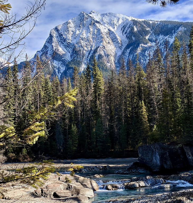
Mount Vaux
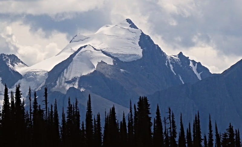
Mountain in British Columbia, Canada. Mount Vaux is a 3,310-metre mountain summit located in the Kicking Horse River valley of Yoho National Park, in the Ottertail Range of the Canadian Rockies in British Columbia, Canada. Its nearest higher peak is Mount Goodsir, 11.0 km to the southeast. Mount Vaux can be seen from Highway 1, the Trans-Canada Highway, which traverses the western foot of the mountain, as well as from Emerald Lake. Vaux is pronounced Vox, rhymes with box.[11]
Mount Carnarvon
Mountain in British Columbia, Canada. Mount Carnarvon is a 3,046-metre mountain summit located in the Kiwetinok River Valley of Yoho National Park, in the Canadian Rockies of British Columbia, Canada. Its nearest higher peak is The President, 3.9 km to the north-northeast. Both are part of the President Range which is a subset of the Waputik Mountains. Mount Carnarvon is situated five kilometers northwest of Emerald Lake, but is hidden from view behind Emerald Peak. However, Carnarvon is visible from Highway 1, the Trans-Canada Highway. The months July through September offer the most favorable weather for viewing or climbing Mount Carnarvon.[12]
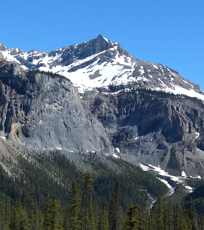
Mount Niles
Mount Niles is a 2,967-metre summit located in the Waputik Range of Yoho National Park, in the Canadian Rockies of British Columbia, Canada. Its nearest higher peak is Mount Daly, 1.63 km to the immediate northeast. Takakkaw Falls is situated four km to the west, the Waputik Icefield lies to the north, and Sherbrooke Lake lies to the south.[13]
Mount Dennis
Mountain in British Columbia, Canada. Mount Dennis is a 2,549-metre mountain summit located three kilometres south of Field in Yoho National Park, in the Park Ranges of British Columbia, Canada. Its nearest higher peak is Mount Stephen, 4.0 km to the northeast. Mount Burgess is six kilometres north on the opposite side of the Kicking Horse River valley. Mount Dennis has over 1,200-metre of vertical relief above Highway 1, the Trans-Canada Highway, which traverses the northwest foot of the mountain.[14]
Odaray Mountain
Summit in British Columbia, Canada. Odaray Mountain is a 3,137-metre summit located west of Lake O'Hara in the Bow Range of Yoho National Park, in the Canadian Rockies of British Columbia, Canada. Its nearest higher peak is Mount Huber, 3.86 km to the east. The standard climbing route follows the southeast glacier and ridge starting from Elizabeth Parker hut. Pronunciation sounds like the two words "ode array".[15]
Michael Peak
Landmark in British Columbia, Canada. Michael Peak is a 2,701-metre mountain summit located in Yoho National Park, in the Canadian Rockies of British Columbia, Canada. Its nearest higher peak is The President, 4.0 km to the west-northwest. Both are part of the President Range which is a subset of the Waputik Mountains. Michael Peak is a landmark seen 4.5 kilometres north-northeast of Emerald Lake, three kilometres southwest of Takakkaw Falls, and 10 kilometres north of Field, British Columbia.[16]
Chancellor Peak
Landmark in British Columbia, Canada. Chancellor Peak is a 3,266-metre mountain summit located in Yoho National Park, in the Canadian Rockies of British Columbia, Canada. Its nearest higher peak is Mount Vaux, 4.0 km to the north-northwest. Both are part of the Ottertail Range. Chancellor Peak is a landmark in the Kicking Horse River valley and can be seen from the Trans-Canada Highway midway between Golden and Field.[17]
Mount Huber
Summit in British Columbia, Canada. Mount Huber is a 3,348-metre summit located two kilometres east of Lake O'Hara in the Bow Range of Yoho National Park, in the Canadian Rockies of British Columbia, Canada. Its nearest higher peak is Mount Victoria, 1.0 km to the north-northeast on the Continental Divide. Mount Huber is a secondary summit of Mount Victoria.[18]
Vice president
Mountain in British Columbia, Canada. A vice president, also director in British English, is an officer in government or business who is below the president in rank. It can also refer to executive vice presidents, signifying that the vice president is on the executive branch of the government, university or company. The name comes from the Latin term vice meaning "in place of" and typically serves as pro tempore to the president. In some countries, the vice president is called the deputy president. In everyday speech, the abbreviation VP is used.[19]
Yukness Mountain
Yukness Mountain is a 2,851-metre summit located southeast of Lake O'Hara in the Park Ranges of Yoho National Park, in the Canadian Rockies of British Columbia, Canada. Its nearest higher peak is Ringrose Peak, 1.0 km to the east.[20]