Discover 11 hidden attractions, cool sights, and unusual things to do in Longueuil (Canada). Don't miss out on these must-see attractions: Co-Cathedral of Saint-Antoine-de-Padoue, Louis-Hippolyte Lafontaine Bridge–Tunnel, and Parc René-Veillet. Also, be sure to include Montreal Quebec Temple in your itinerary.
Below, you can find the list of the most amazing places you should visit in Longueuil (Québec).
Table of Contents
Co-Cathedral of Saint-Antoine-de-Padoue
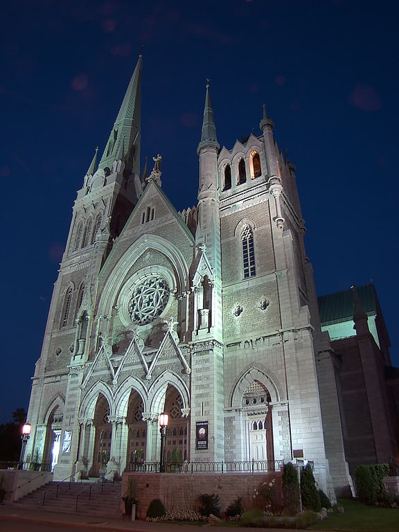
The Co-Cathedral of Saint-Antoine-de-Padoue is a co-cathedral in Longueuil, Quebec, Canada, on Montreal's south shore. It is located on the corner of Rue Saint-Charles and Chemin Chambly in the Borough of Le Vieux-Longueuil. It is dedicated to St. Anthony of Padua. The cathedral houses the remains of the Blessed Marie-Rose Durocher, the foundress of the Sisters of the Holy Names of Jesus and Mary.
Its episcopal region is Longueuil-Nord. Lionel Gendron, the bishop, has a cathedra sculpted in walnut. Before the reign of Bernard Hubert, it was simply a parish church.
The cathedral was classified as historical monument by the Government of Quebec in 1984.[1]
Address: 2 Rue Saint-Charles Ouest, J4H 1C6 Longueuil
Louis-Hippolyte Lafontaine Bridge–Tunnel
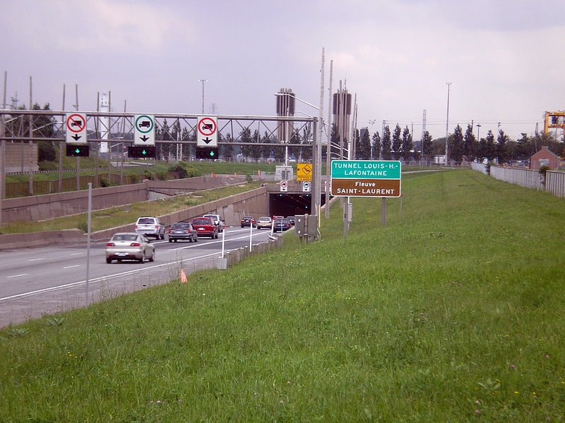
Bridge–tunnel in Québec, Canada. The Louis-Hippolyte Lafontaine Bridge–Tunnel is a highway bridge–tunnel running over and beneath the Saint Lawrence River. It connects the Montreal borough of Mercier–Hochelaga-Maisonneuve with the south shore of the river at Longueuil, Quebec.
Named after Lower Canada political reformer Louis-Hippolyte Lafontaine, the Lafontaine Tunnel is an immersed tube structure, measuring 1,391 m (4,563.6 ft) long. It carries the Autoroute 25 expressway and passes beneath the main shipping channel in the Saint Lawrence River immediately downstream from the Saint Lawrence Seaway. It surfaces on Île Charron (Îles de Boucherville at entrance/exit #1 of Autoroute 25), then continues by bridge to Longueuil. The bridge-tunnel sees about 120,000 daily crossings, of which 13% are trucks. Its construction began in 1963 and it opened on March 11, 1967.[2]
Parc René-Veillet
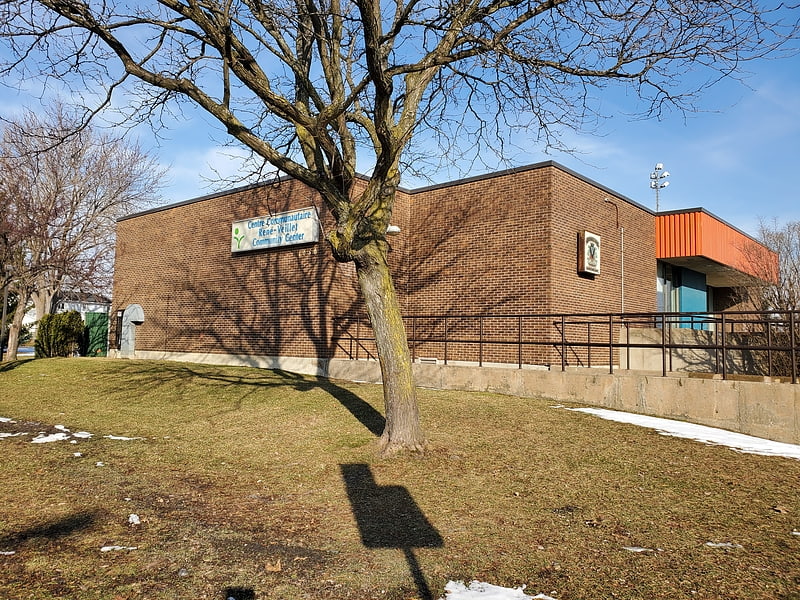
René-Veillet Park, located at #1050 Parklane Street in the heart of the Greenfield Park borough of Longueuil, in Quebec, Canada has a set of amenities for sports and other types of recreation.
The plans for the Parklane Cottage (now renamed "Centre sportif René-Veillet") were designed in 1973. The park was developed in 1974-75, as well as the recreation center. The offices of the Greenfield Park Recreation Department were previously located in the former Arena on Empire Street. At the opening of the Recreation Center, the recreation department was relocated to Parklane Park. After Parc Pierre Laporte, Rene Veillet Park is the second largest in Greenfield Park.[3]
Montreal Quebec Temple
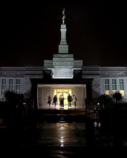
Temple in Longueuil, Quebec. The Montreal Quebec Temple is the 86th operating temple of The Church of Jesus Christ of Latter-day Saints.[4]
Address: 1450 boulevard Marie-Victorin, Longueuil
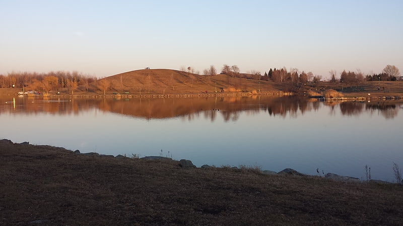
Parc Michel-Chartrand
Park in Longueuil, Quebec. Parc Michel-Chartrand, formerly known as the Parc régional de Longueuil, is a large park located in Longueuil, Quebec, Canada. It is located at 1895 Rue Adoncour in the borough of Le Vieux-Longueuil.
It is 1,850,000 square metres (19,900,000 sq ft) in area. It offers 12.5 kilometres (7.8 mi) of Cross-country skiing trails and 10 kilometres (6.2 mi) of hiking trails.
Its features include a marsh, three artificial lakes, a sundial, a playground, two pétanque terrains, a rest area with picnic tables, a slope for sledding, an ice rink and community gardens.
Originally known as the Base de plein air de Longueuil (opened in 1975), it was renamed as the Parc régional de Longueuil, and renamed again as Parc Michel-Chartrand by the city of Longueuil in June 2010, after Quebec union activist Michel Chartrand.
Until the mid 1980s, prior to the extension of the Boulevard Fernand-Lafontaine, the Chemin du Lac was open to through traffic between Longueuil and Boucherville.[5]
Parc de la Cité
Park in Longueuil, Québec. Parc de la Cité, is a large park in Longueuil, Quebec, Canada. It is located at 6205 Davis Boulevard in the borough of Saint-Hubert.[6]
Address: 6201, boul Davis, J3Y 5L7 Saint-Hubert (Saint-Hubert District)
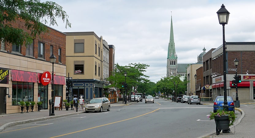
Saint-Lambert
City in Québec, Canada. Saint-Lambert is a city in southwestern Quebec, Canada, located on the south shore of the St. Lawrence River, opposite Montreal. It is part of the Urban agglomeration of Longueuil of the Montérégie administrative region. It was home to 21,861 people according to the Canada 2016 Census.
Saint-Lambert is divided into two main sections: the original city of Saint-Lambert and the Préville neighbourhood. The original city of Saint-Lambert (as it existed prior to 1969) is located from the Country Club of Montreal golf course to the border of the Le Vieux-Longueuil borough. It includes the city's downtown, known as "The Village". On the other side of the Country Club of Montreal is the former city of Préville, which merged with Saint-Lambert in 1969. It extends to the borders of the city of Brossard and the Longueuil borough of Greenfield Park.
Saint-Lambert was named for the early French Canadian hunter Lambert Closse.[7]
Le Vieux-Longueuil
City in Québec. Le Vieux-Longueuil is a borough in the city of Longueuil.
From 2002 to 2006, Le Vieux-Longueuil borough stood for what used to be the city of Longueuil from 1969 to 2002. The former city of Longueuil was composed of 3 cities merged in the 1960s: Ville Jacques-Cartier, Montréal-Sud and Longueuil.
Since 2006, Le Vieux-Longueuil borough stands for the combination of the former city of Longueuil and LeMoyne. LeMoyne joined Le Vieux-Longueuil borough when Saint-Lambert left the city of Longueuil in 2006.
Canada Post uses "Longueuil" only on addresses that are located within the former city of Longueuil. As such, many people continue to associate the name Longueuil to the former city rather than the current city. The former city of Longueuil has a neighbourhood which is also called Vieux-Longueuil.
Le Vieux-Longueuil borough has 9 municipal districts. One of the districts contains LeMoyne and a portion of the former city of Longueuil. The other 8 districts are all located in the former city of Longueuil.[8]
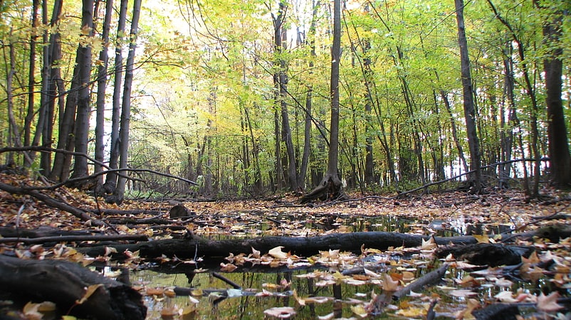
Boisé du Tremblay
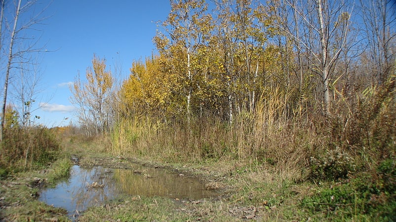
Nature preserve in Boucherville, Québec. The Boisé du Tremblay is a wooded area in Longueuil, Quebec, Canada. The wooded area is located partially in the borough of Le Vieux-Longueuil and partially within the city of Boucherville.
The territory of the woods is 267 hectares (660 acres), of which 174 hectares (430 acres) belongs to the City of Longueuil.
The Boisé du Tremblay's biodiversity is considered to be unique within the Montérégie region. It is part of the blue-green infrastructure of Greater Montreal as well as the Mont Saint-Bruno Forest Corridor. It is home to numerous species of flora and fauna, notably the Western chorus frog.
In January 2012, the City of Longueuil requested that the Boisé du Tremblay be recognized as a Wildlife Reserve by the Quebec Ministry of Natural Resources and Wildlife.[9]
Victoria Avenue
Street in Québec, Canada. Victoria Avenue is a major street located in city of Saint-Lambert, Quebec and in the borough of Greenfield Park in the city of Longueuil, Quebec, Canada. Victoria Avenue extends from Riverside Drive, near Route 132 and the Saint Lawrence River in the north, to the Brossard municipal boundary in the south. Victoria Avenue is known as Lapinière Boulevard in the city of Brossard.
Victoria Avenue is named for Queen Victoria (1819–1901), the Queen of Canada from 1837 to her death in 1901. The portion of Victoria Avenue in Greenfield Park was originally named Devonshire Road.[10]
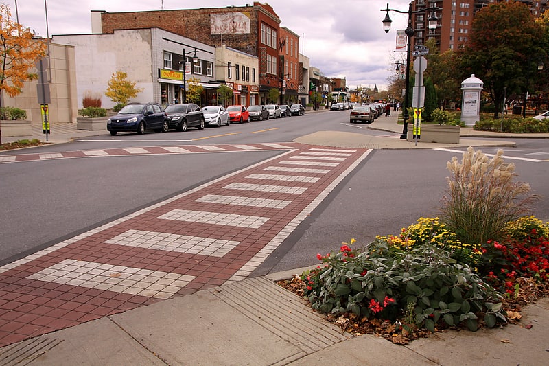
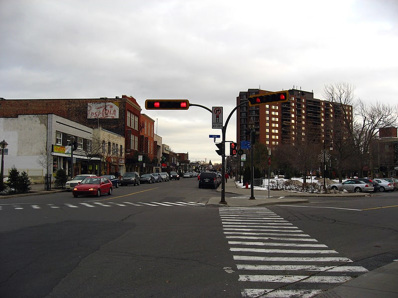
Old Longueuil

Neighbourhood in Longueuil, Quebec. Old Longueuil is a historic neighbourhood located in the borough of the same name, in the city of Longueuil, Quebec, Canada. There is not a universal definition of what exactly constitute the Old Longueuil neighbourhood, but it always includes at least the territory corresponding to the pre-1961 city of Longueuil.
Old Longueuil, was named a heritage district by the city in 1993, and features 450 buildings built before 1945. Many historic buildings are found in this district, such as the Co-Cathedral of Saint-Antoine-de-Padoue, the ruins of Fort Longueuil, and Saint Mark's Anglican Church. Rue Saint-Charles is the main street in this neighbourhood and features many small businesses, among them restaurants, bars, and corner stores. The borough hall of Le Vieux-Longueuil borough is also in the neighbourhood.[11]