Discover 35 hidden attractions, cool sights, and unusual things to do in Banff National Park (Canada). Don't miss out on these must-see attractions: Moraine Lake, Peyto Lake, and Vermilion Lakes. Also, be sure to include Bow Lake in your itinerary.
Below, you can find the list of the most amazing places you should visit in Banff National Park (Alberta).
Table of Contents
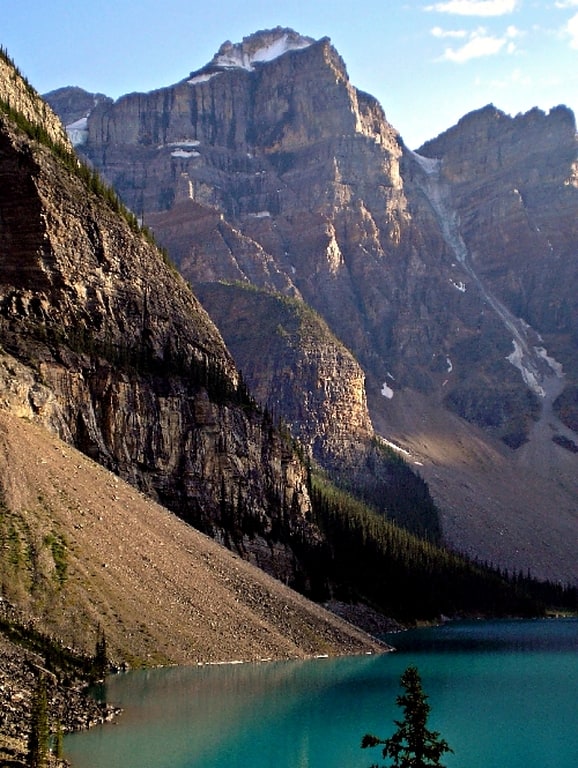
Moraine Lake
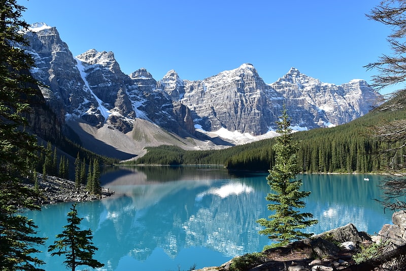
Glacier-fed lake with a canoe dock. Moraine Lake is a glacially fed lake in Banff National Park, 14 kilometres outside the village of Lake Louise, Alberta, Canada. It is situated in the Valley of the Ten Peaks, at an elevation of approximately 1,884 metres. The lake has a surface area of 50 hectares.
The lake, being glacially fed, does not reach its crest until middle to late June. When it is full, it reflects a distinctive shade of azure blue. The unique colour is due to the refraction of light off the rock flour deposited in the lake on a continual basis by surrounding glaciers.[1]
Peyto Lake
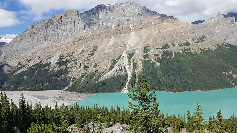
Lake in Alberta, Canada. Peyto Lake is a glacier-fed lake in Banff National Park in the Canadian Rockies. The lake itself is near the Icefields Parkway. It was named for Bill Peyto, an early trail guide and trapper in the Banff area.
The lake is formed in a valley of the Waputik Range, between Caldron Peak, Peyto Peak and Mount Jimmy Simpson, at an elevation of 1,860 m (6,100 ft).
During the summer, significant amounts of glacial rock flour flow into the lake from a nearby glacier, and these suspended rock particles are what give the lake a unique bright, turquoise colour. Because of its bright colour, photos of the lake often appear in illustrated books, and the area around the lake is a popular sightseeing spot. In 2021, Parks Canada completed improvements to the lake viewpoint, trails and parking areas. The lake is best seen from Bow Summit, the highest point on the Icefields Parkway.
The lake is fed by Peyto Creek, which drains water from Caldron Lake and Peyto Glacier (part of the Wapta Icefield). Peyto Lake is the origin of the Mistaya River, which heads northwest from the lake's outflow.[2]
Vermilion Lakes
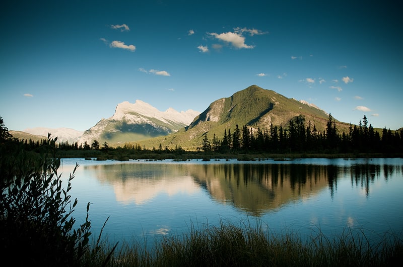
3 lakes with wildlife and a bike trail. The Vermilion Lakes are a series of lakes located immediately west of Banff, Alberta, in the Canadian Rocky Mountains.
The three lakes are formed in the Bow River valley, in the Banff National Park, at the foot of Mount Norquay. They are located between the Trans-Canada Highway and the Canadian Pacific Railway tracks. A hot spring is found at the third lake.[3]
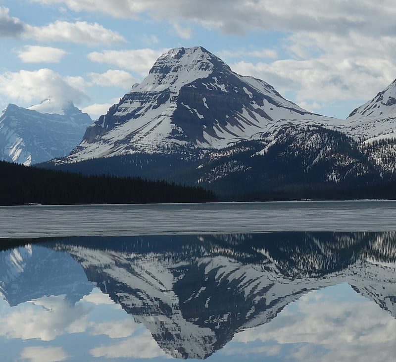
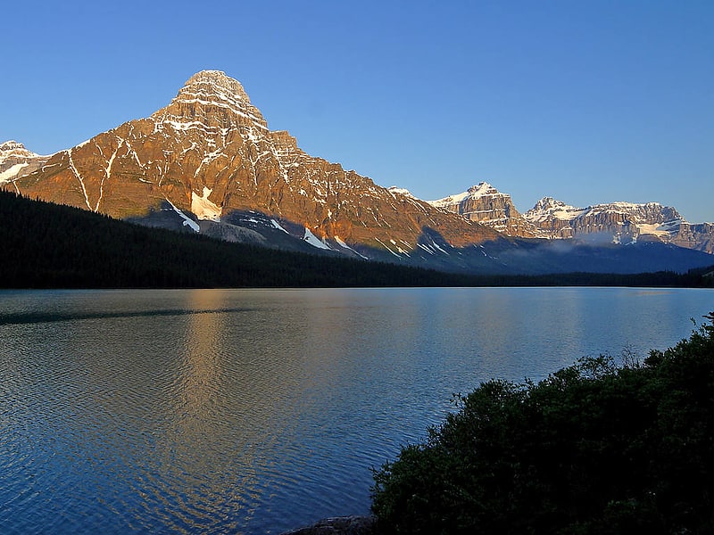
Bow Lake
Glacial lake with a historic lodge. Bow Lake is a small lake in western Alberta, Canada. It is located on the Bow River, in the Canadian Rockies, at an altitude of 1920 m.
The lake lies south of the Bow Summit, east of the Waputik Range (views including Wapta Icefield, Bow Glacier, Bow Peak, Mount Thompson, Crowfoot Glacier and Crowfoot Mountain) and west of the Dolomite Pass, Dolomite Peak and Cirque Peak.
Bow Lake is one of the lakes that line the Icefields Parkway in Banff National Park and Jasper National Park, other such lakes being Hector Lake, Lake Louise, Peyto Lake, Mistaya Lake, Waterfowl Lakes, Chephren Lake and Sunwapta Lake.
Historical Simpson's Num-Ti-Jah Lodge is located on the shores of Bow Lake at the foot of Mount Jimmy Simpson.
Bow Lake is the closest lake to the headwaters of Bow River, and has a total area of 3.21 km2. Water in the lake is meltwater of the Bow Glacier and its turquoise colouring is due to glacial till.[4]
Panther Falls
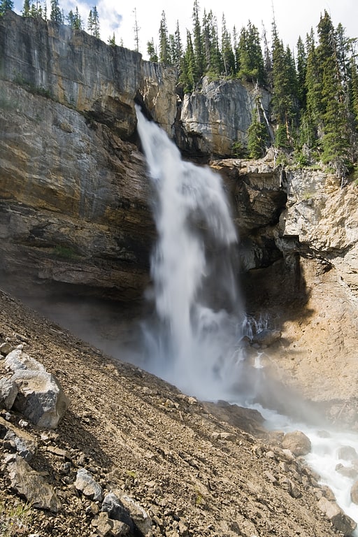
Waterfall in Alberta, Canada. Panther Falls are a series of waterfalls in Banff National Park, Alberta, Canada. It is developed on Nigel Creek and its waters originate in Nigel Pass, between the slopes of Cirrus Mountain and Nigel Peak in the Parker Ridge of the Canadian Rockies.
It is a class 3 waterfall, with a drop of 66 m (217 ft) and a width of 20 m (66 ft).[5]
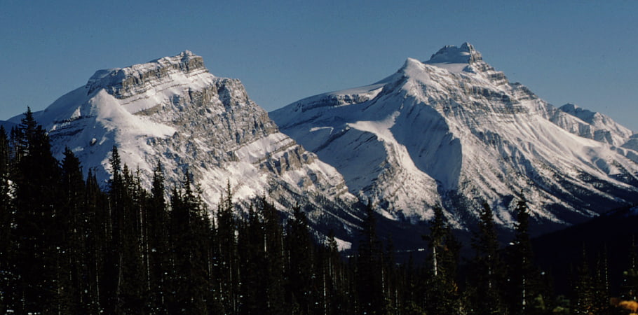
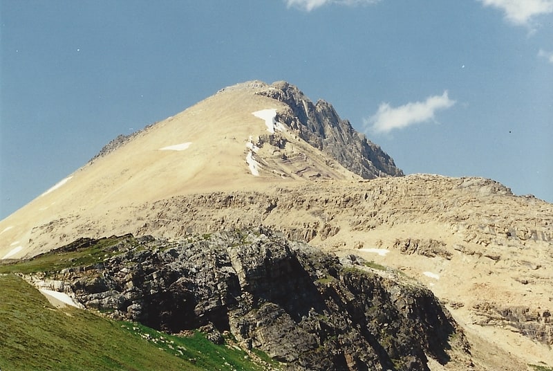
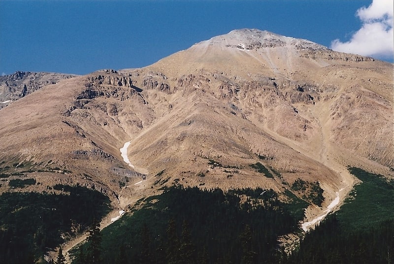
Bow Peak
Mountain in Alberta, Canada. Bow Peak is a 2,840-metre mountain summit located in the Bow River valley of Banff National Park, in the Canadian Rockies of Alberta, Canada. Its nearest higher peak is Crowfoot Mountain, 2.11 km to the east. Bow Peak is situated north of Hector Lake, southeast of Bow Lake, and can be seen from the Icefields Parkway. Although not of remarkable elevation, the mountain is a conspicuous landmark and visible from as far away as the Lake Louise area. Its position in the Waputik Mountains provides magnificent views from the summit.[6]
Haddo Peak
Summit in Alberta, Canada. Haddo Peak is a summit in Alberta, Canada. Haddo Peak is located in the Lake Louise area of Banff National Park.
Haddo Peak honors the name of George Gordon, Lord Haddo. Named in 1916, the name became official in 1952.[7]
Bow Glacier Falls
Bow Glacier Falls is located near Banff, AB. The falls originates from melt water from the Bow Glacier and flows into Bow Lake.[8]
Bident Mountain
Summit in Alberta, Canada. Bident Mountain is a 3,088-metre summit in Banff National Park, Alberta, Canada. With only 103 m prominence, Bident Mountain together with Quadra Mountain form an imposing wall in the Canadian Rockies and act as subpeaks of Mount Fay. Bident was first climbed in 1903 by Charles Thompson and Hans Kaufmann.
Bident Mountain has the shape of a bident, hence the name.[9]
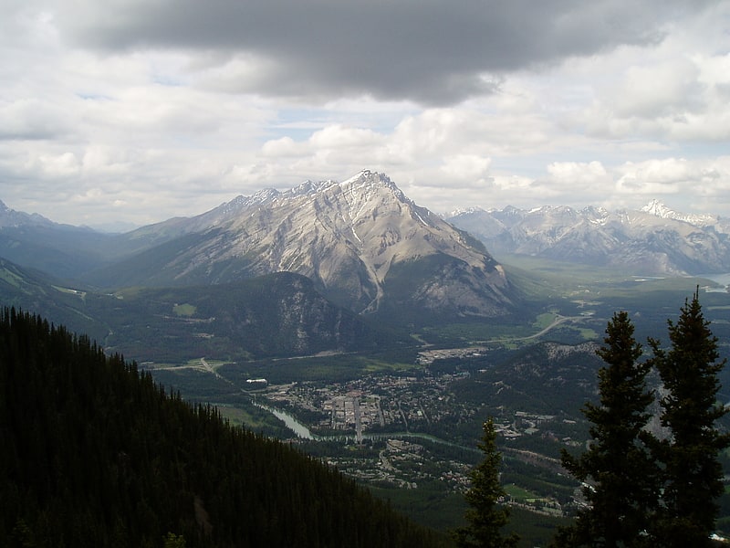
Mount Rundle
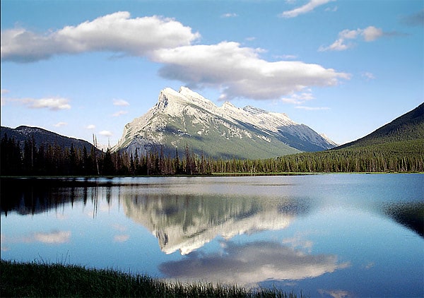
Mountain in Alberta, Canada. Mount Rundle is a mountain in Canada's Banff National Park overlooking the towns of Banff and Canmore, Alberta. The Cree name was Waskahigan Watchi or house mountain. In 1858 John Palliser renamed the mountain after Reverend Robert Rundle, a Methodist invited by the Hudson's Bay Company to do missionary work in western Canada in the 1840s. He introduced syllabics there—a written language developed for the Cree, as part of his missionary work. He only visited the Stoney-Nakoda of the area around what is now called Mount Rundle in 1844 and 1847.
Mt. Rundle could actually be considered a small mountain range as the mountain extends for over 12 kilometres (7.5 mi), on the south side of the Trans-Canada Highway eastward from Banff to Canmore with seven distinct peaks along the way. The third peak southeast of Banff is the highest at 9,675 feet (2,949 m). West of the Spray Lakes road is the East End of Rundle— locally known as EEOR—which rises above Whiteman's Gap just south of Canmore. The Rundle Peaks are part of the South Banff Ranges, along with its siblings—the Sundance Range, Sulphur Mountain and the Goat Range.[10]
Hector Lake
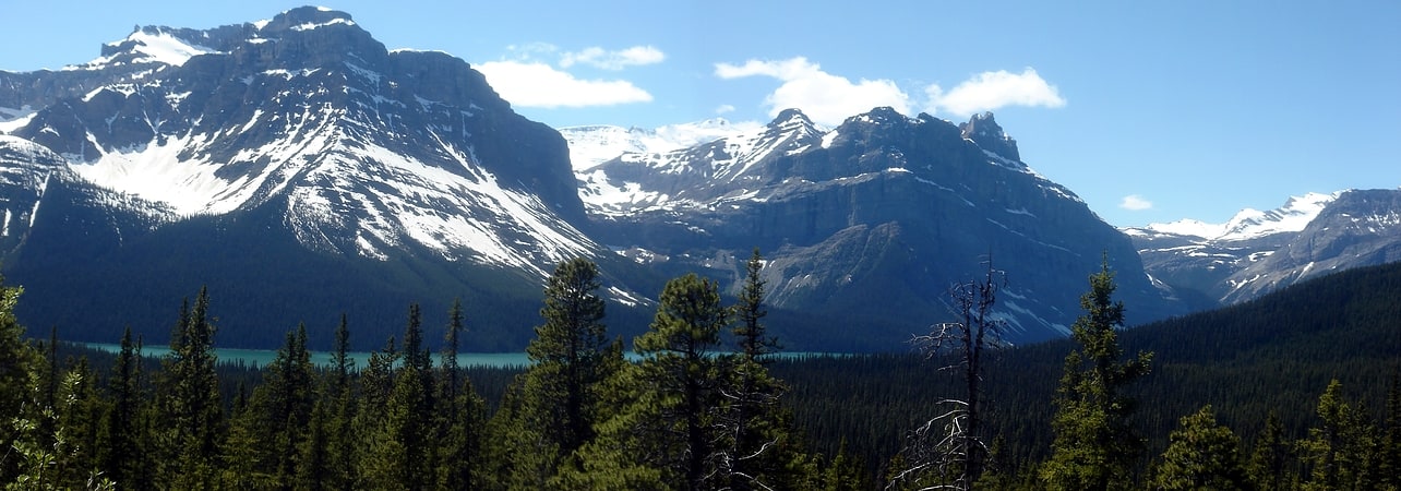
Glacial lake with mountain views. Hector Lake is a small glacial lake in western Alberta, Canada. It is located on the Bow River, in the Waputik Range of the Canadian Rockies.
It is named after James Hector, a geologist and naturalist with the Palliser Expedition.
The lake is formed in a valley of the Waputik Range, north of the Waputik Icefield, between Pulpit Peak, Mount Balfour, Crowfoot Mountain and Bow Peak. Hector Glacier and Mount Hector rise on the opposite side of the Bow River.
Hector Lake is one of the lakes that line the Icefields Parkway in Banff National Park and Jasper National Park, other such lakes being Bow Lake, Lake Louise, Peyto Lake, Mistaya Lake, Waterfowl Lakes, Chephren Lake and Sunwapta Lake.
Hector Lake is the second lake from the headwaters of Bow River, the first one being Bow Lake, and has a total area of 5.23 km2 (2.02 sq mi).[11]
Dolomite Peak
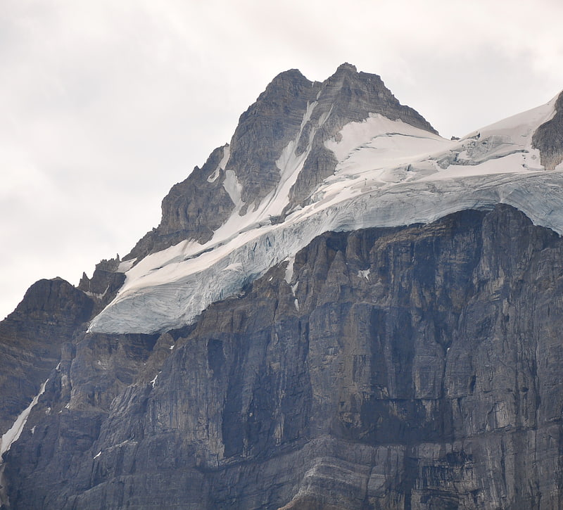
Mountain in Alberta, Canada. Dolomite Peak is a 2,998-metre mountain summit located in the Bow River valley of Banff National Park, in the Canadian Rockies of Alberta, Canada. Its nearest higher peak is Cirque Peak, 3.98 km to the northwest. Dolomite Peak can be seen from the Icefields Parkway with its distinctive crags and colorful towers that are a mixture of dolomite and limestone. Dolomite is rare in the Rockies and is stronger than limestone.[12]
Sulphur Mountain
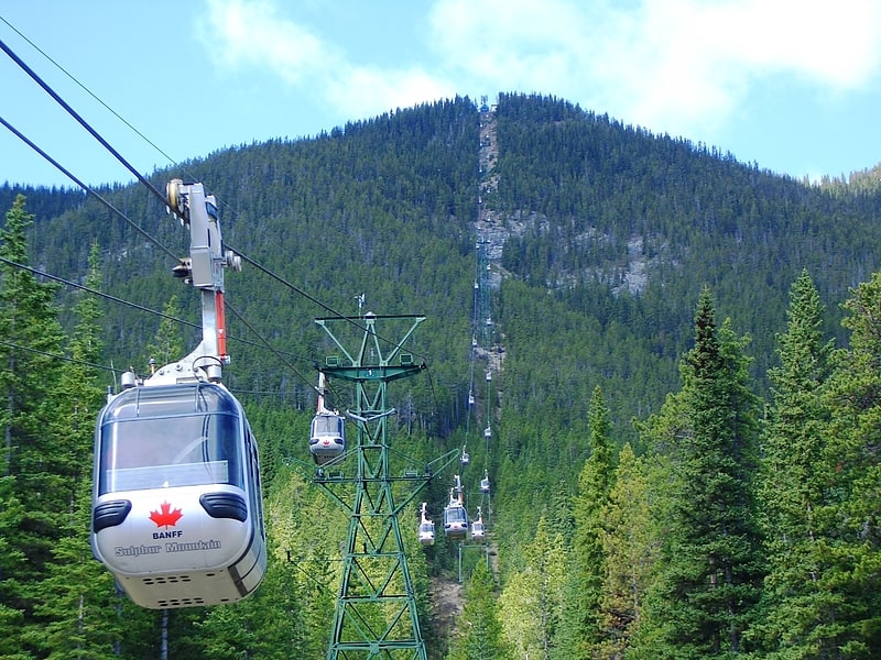
Hike or gondola ride to dramatic views. Sulphur Mountain is a mountain in Banff National Park in the Canadian Rocky Mountains overlooking the town of Banff, Alberta, Canada.
The mountain was named in 1916 for the hot springs on its lower slopes. George Dawson had referred to this landform as Terrace Mountain on his 1886 map of the area. Sanson's Peak was named in 1948 for Norman Bethune Sanson who diligently attended the observatory recording equipment atop Sulphur Mountain for nearly 30 years.[13]
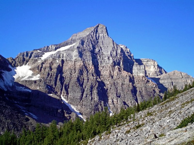
Mount Temple
Mountain in Alberta, Canada. Mount Temple is a mountain in Banff National Park of the Canadian Rockies of Alberta, Canada.
Mt. Temple is located in the Bow River Valley between Paradise Creek and Moraine Creek and is the highest peak in the Lake Louise area. The peak dominates the western landscape along the Trans-Canada Highway from Castle Junction to Lake Louise.[14]
Eiffel Peak
Mountain in Alberta, Canada. Eiffel Peak is a 3,077-metre mountain summit in Banff National Park in Alberta, Canada. It's part of the Bow Range, which is a sub-range of the Canadian Rockies. The nearest higher peak is Mount Temple, 3.0 km to the northeast.[15]
Lychnis Mountain
Mountain in Alberta, Canada. Lychnis Mountain is a 3,124-metre mountain summit located in Banff National Park, in the Canadian Rockies of Alberta, Canada. It is part of the Sawback Range. Its nearest higher peak is Mount St. Bride, 3.1 km to the north. The mountain is situated 2.0 km east of Tilted Mountain in an area of exposed Skoki Formation limestone which is known for fossils such as brachiopods, gastropods, conodonts, cephalopods, trilobites, and echinoderm fragments.[16]
Mount Assiniboine
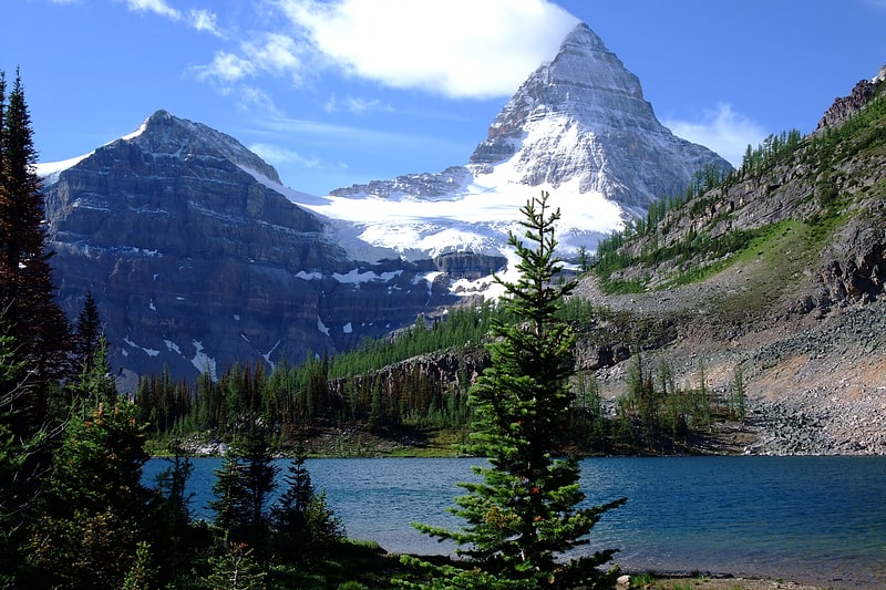
Peak in British Columbia, Canada. Mount Assiniboine, also known as Assiniboine Mountain, is a pyramidal peak mountain located on the Great Divide, on the British Columbia/Alberta border in Canada.
At 3,618 m (11,870 ft), it is the highest peak in the Southern Continental Ranges of the Canadian Rockies. Mount Assiniboine rises nearly 1,525 m (5,003 ft) above Lake Magog. Because of its resemblance to the Matterhorn in the Alps, it is nicknamed the "Matterhorn of the Rockies".
Mount Assiniboine was named by George M. Dawson in 1885. When Dawson saw Mount Assiniboine from Copper Mountain, he saw a plume of clouds trailing away from the top. This reminded him of the plumes of smoke emanating from the teepees of Assiniboine Indians.
Mount Assiniboine lies on the border between Mount Assiniboine Provincial Park, in British Columbia, and Banff National Park, in Alberta. The mountain can be reached only by a six-hour hike or horse-pack 27 km (17 mi), three-hour bike ride (now disallowed to reduce human / grizzly encounters) or helicopter.[17]
Tilted Mountain
Mountain in Alberta, Canada. Tilted Mountain is a 2,591-metre mountain summit located in Banff National Park, in the Canadian Rockies of Alberta, Canada. It is part of the Sawback Range. Its nearest higher peak is Lychnis Mountain, 2.0 km to the east in an area of exposed Skoki Formation limestone which is known for fossils such as brachiopods, gastropods, conodonts, cephalopods, trilobites, and echinoderm fragments.[18]
Mount St. Bride
Mount St. Bride is a prominent 3,312-metre mountain summit located in Banff National Park, in the Rocky Mountains of Alberta. It is the highest point in the Sawback Range. Its nearest higher peak is Cataract Peak, 18.8 km to the northwest. The mountain is situated 2.0 km to the south of Mount Douglas near the headwaters of the Red Deer River.[19]
Little Temple
Little Temple is a 2,653-metre mountain summit located in Banff National Park of the Canadian Rockies of Alberta, Canada. Little Temple is situated in the Bow River Valley between Paradise Creek and Moraine Creek, 6.0 km south of Lake Louise, Alberta. The mountain can be seen from the Icefields Parkway along with its nearest higher peak, Mount Temple, 1.07 km to the southwest.[20]
Bow Hut
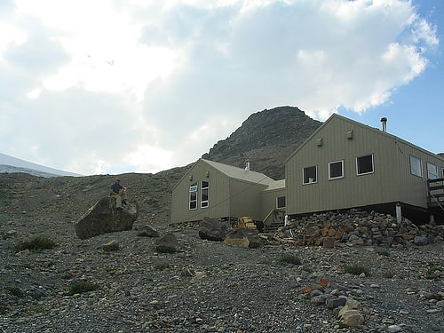
Hostel in Alberta, Canada. The Bow Hut is an alpine hut located at an elevation of 2,350 metres on the eastern edge of the Wapta Icefield in Banff National Park. It is the largest, best equipped, and most accessible of the four alpine huts on the Wapta Icefield, and serves as the base for a wide variety of ski tours and mountaineering ascents to half a dozen peaks on the Wapta. It is the easiest and safest starting point for the Wapta traverse; and Balfour Hut, the next hut on the traverse, can easily be reached from it in a day. It can also serve as an intermediate stop in a longer traverse which starts at the less easily accessible Peyto Hut. The hut is maintained by the Alpine Club of Canada.
The hut sleeps 30 and is equipped with propane powered lamps and stovetop, and a wood stove for heating. There are two indoor drum toilets.[21]
Mount Andromache
Mount Andromache is a 3,033-metre mountain summit located in the Bow River valley of Banff National Park, in the Canadian Rockies of Alberta, Canada. Its nearest higher peak is Mount Hector, 4.00 km to the south. Mount Andromache can be seen from the Icefields Parkway as the road traverses the western base of the peak. The Molar Glacier is situated on the northeast aspect of the mountain.[22]
Watermelon Peak
Watermelon Peak is a 3,095-metre summit located in Banff National Park, in the Canadian Rockies of Alberta, Canada. Its nearest higher peak is Deluc Peak, 13.5 km to the east.[23]
Pulpit Peak
Pulpit Peak is a 2,720-metre mountain summit located one km south of Hector Lake in Banff National Park, in the Canadian Rockies of Alberta, Canada. Its nearest higher peak is Lilliput Mountain, 3.6 km to the southwest. Pulpit Peak is situated east of the Waputik Icefield, and is a member of the Waputik Mountains. Pulpit Peak can be seen from the Icefields Parkway towering 900 metres above Hector Lake.[24]
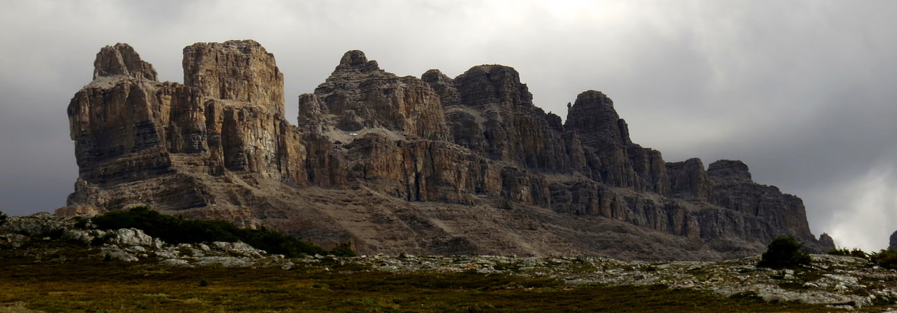
Cirque Peak
Peak in Alberta, Canada. Cirque Peak is a 2,993-metre peak located directly west of Dolomite Pass in the Bow River valley of Banff National Park, in the Canadian Rockies of Alberta, Canada.
The mountain forms a cirque, hence the name.[25]
Mistaya Canyon
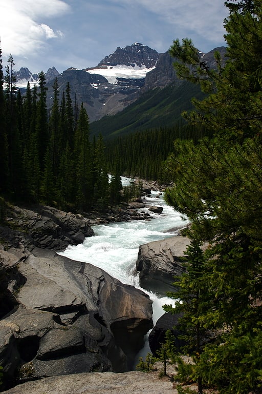
Tourist attraction in Alberta, Canada. Mistaya Canyon is a canyon in the western part of the Canadian province of Alberta. It is formed by the Mistaya River. Tourists who are visiting Banff National Park often visit it because of its distinctive curvy canyon walls and because it is easy to access, being just off the Icefields Parkway. The 0.5 km trail to the canyon is located at a large parking area on the west side of the Parkway, part way up the long hill south of the North Saskatchewan River. There are actually two such parking areas on the hill; the Mistaya one is clearly marked by signs on the highway and at the beginning of the trail. The trail is an easy walk in summer but too steep for wheelchairs. The canyon is deep and there are no railings. The trail is icy in early spring.
Hikers will find that the Howse Pass Trail continues past the canyon.[26]
Whitehorn Mountain
Mountain in Alberta, Canada. Whitehorn Mountain is located in the Slate Range of Banff National Park in Alberta, Canada.[27]
Mount Hector
Mountain in Alberta, Canada. Mount Hector is a 3,394-metre mountain summit located in the Bow River valley of Banff National Park, in the Canadian Rockies of Alberta, Canada. The mountain was named in 1884 by George M. Dawson after James Hector, a geologist on the Palliser expedition. The mountain is located beside the Icefields Parkway, 17 km north of Lake Louise.
The first ascent was made in 1895 by Philip S. Abbot, Charles Fay and Charles S. Thompson.[28]
Address: Icefields Parkway, Banff National Park
Cascade Mountain
Mountain in Alberta, Canada. Cascade Mountain is a mountain located in the Bow River Valley of Banff National Park, adjacent to the town of Banff. The mountain was named in 1858 by James Hector after the waterfall or cascade on the southern flanks of the peak. The mountain has also been called Stoney Chief, which is related to the name of the smaller neighbouring mountain Stoney Squaw, which is still in use. Cascade is the highest mountain adjacent to the townsite.[29]
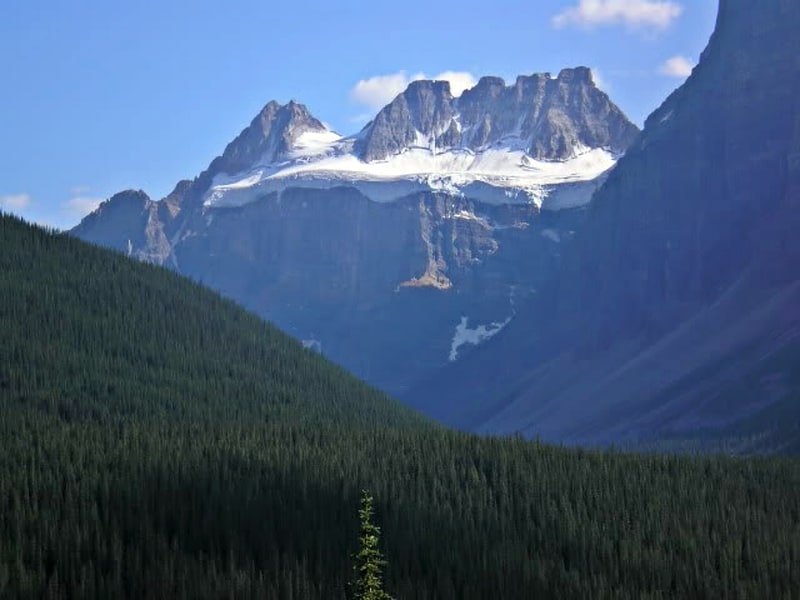
Mount Chephren
Mountain in Alberta, Canada. Mount Chephren is a mountain located in the Mistaya River Valley of Banff National Park, Canada.
Mount Chephren was named after Chephren, the 4th Dynasty Egyptian pharaoh. The mountain was originally named Pyramid Mountain in 1897 by J. Norman Collie, but it conflicted with an identically named peak in Jasper National Park, so it was renamed in 1924 to its present name.[30]
Lake Minnewanka
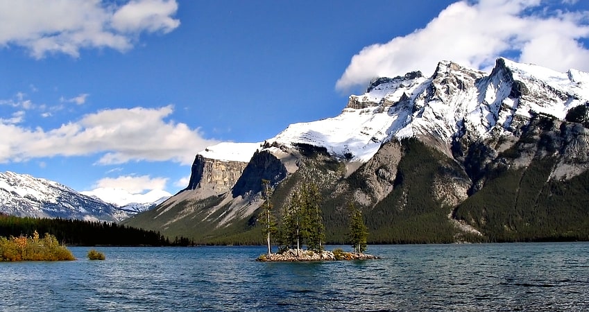
Glacial lake in Alberta, Canada. Lake Minnewanka is a glacial lake located in the eastern area of Banff National Park in Canada, about five kilometres northeast of the Banff townsite. The lake is 21 km long and 142 m deep, making it the 2nd longest lake in the mountain parks of the Canadian Rockies.
The lake is fed by the Cascade River, flowing east of Cascade Mountain, and runs south through Stewart Canyon as it empties into the western end of the lake. Numerous streams flowing down from Mount Inglismaldie, Mount Girouard and Mount Peechee on the south side of the lake also feed the lake.
Aboriginal people long inhabited areas around Lake Minnewanka, as early as 10,000 years ago, according to stone tools and a Clovis point spearhead discovered by archaeologists. The area is rich in animal life (e.g. elk, mule deer, bighorn sheep, bears) and the easy availability of rock in the mountainous terrain was key to fashioning weapons for hunting.
The western end of the lake can be reached by following Lake Minnewanka road from the Trans-Canada Highway. Boat tours are available near the parking lot. A hiking and mountain biking trail runs along the northern shore of the lake, passing Stewart Canyon and six backcountry campsites. Mount Aylmer which at 3,162 m (10,374 ft) is the highest mountain in this area of the park, is located a few kilometres north of the lake.
The first dam was built in 1912 and was only used for storage. While the National Parks Act was suspended during World War II the much larger embankment dam that currently exists was constructed in 1941 and raised the lake 30 m (98 ft). This resulted in the resort village of Minnewanka Landing, which had been there since 1888, being submerged and the Cascade River being diverted away from its old course, resulting in much of the riverbed downstream of the dam running dry for most of the year (except in rare high-water events when the dam's spillway is opened). Most water from the Cascade River is diverted into Two Jack Lake, where it enters a 4-kilometre-long canal. From there it is funnelled into a pair of penstocks feeding two generators in the Cascade Powerhouse with a combined capacity of 34 MW. The facility is owned by TransAlta and supplies power to the Banff Townsite. In order to increase the amount of water entering the penstocks a small diversion dam was built on the Ghost River, which diverts additional water into lake Minnewanka from the Ghost drainage. Because of the presence of the submerged village, submerged bridge pilings, and submerged dam (the one from 1912) the lake is popular among recreational scuba divers. The construction of the dam resulted in involuntary resettlement of inhabitants from the reservoir area.[31]
Mount Niblock
Mountain in Alberta, Canada. Mount Niblock is a mountain in Banff National Park near Lake Louise, Alberta, Canada.
The mountain was named in 1904 after John Niblock, a superintendent with the Canadian Pacific Railway. Niblock was an early promoter of tourism in the Rockies and influenced the naming of some of the CPR stops in Western Canada.
Mt. Niblock is a popular scramble in the Lake Louise area and is sometimes combined in the same day with Mount Whyte (2,983 m (9,787 ft)), although the latter is a more difficult scramble. The best time for climbing Mt. Niblock is July through September when the normal route is usually free of snow. Attempting it in the spring or early summer may include significant avalanche hazard.
To access Mt. Niblock, follow the trail as it begins near Chateau Lake Louise, passes Mirror Lake and then Lake Agnes. Follow the right hand shore line trail to the far end of the lake until it begins its left turn towards the Big Beehive. Here an obvious path can be found leading to the lower scree slopes and short cliffs. A more detailed route description can be found in Scrambles in the Canadian Rockies.[32]
Observation Peak
Mountain in Alberta, Canada. Observation Peak is a 3,174-metre mountain summit located in Banff National Park, Alberta, Canada. The mountain can be seen from the Icefields Parkway near the Bow Summit.
The peak was named in 1898 by Charles L. Noyes, a Boston clergyman, who upon climbing to the top found it to have the best viewpoint he had ever reached.
The mountain can be scrambled using the western slopes and after reaching the top of the false summit, a 20-minute plod to the northwest leads to the true summit about 100 metres (328 ft) higher.[33]
Quadra Mountain
Mountain in British Columbia, Canada. Quadra Mountain is located on the border of Alberta and British Columbia on the Continental Divide. It was named in 1910 by Arthur Oliver Wheeler. The name refers to the mountain's four pinnacles. However, in 1952 the form of the name was changed to Mount Quadra in the mistaken belief that it had been named after Juan Francisco de la Bodega y Quadra—mountains named for people taking the form "Mount Person's Name". In 1983 the form was changed back to Quadra Mountain by British Columbia and Alberta, and in 1984 by Parks Canada.[34]
Mount Bowlen
Peak in British Columbia, Canada. Mount Bowlen is located on the border of Alberta and British Columbia and forms part of the Valley of the Ten Peaks. It was named in 1953 after John J. Bowlen, a native of Prince Edward Island, successful Alberta rancher, honorary chief of the Blackfoot, and a Lieutenant Governor of Alberta. Its former name was "Yamnee", which translates to the number 3 in the local Nakoda language.[35]