Discover 15 hidden attractions, cool sights, and unusual things to do in Garibaldi Provincial Park (Canada). Don't miss out on these must-see attractions: Elfin Lakes, The Black Tusk, and Cinder Cone. Also, be sure to include Mount Garibaldi in your itinerary.
Below, you can find the list of the most amazing places you should visit in Garibaldi Provincial Park (British Columbia).
Table of Contents
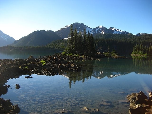
Elfin Lakes
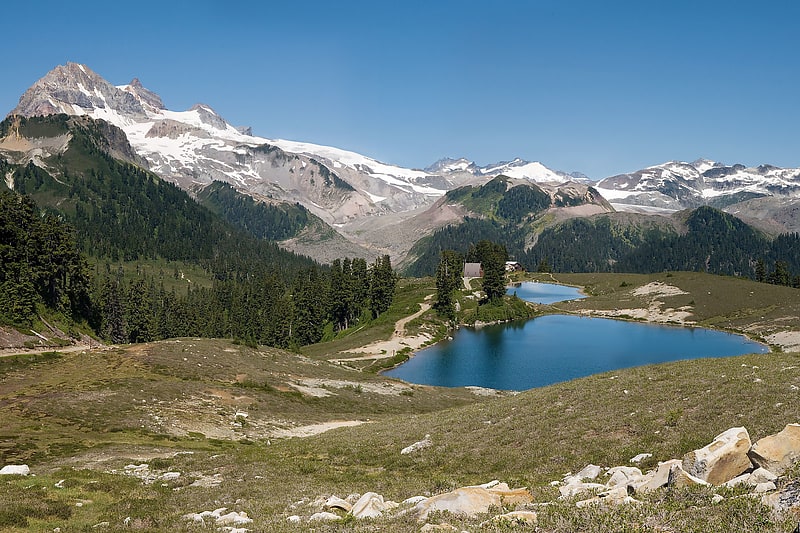
Lake in British Columbia, Canada. Elfin Lakes are two lakes in Garibaldi Provincial Park that are popular for hiking, snowshoeing, skiing, and mountain bicycling trail located east of Squamish, British Columbia, Canada.[1]
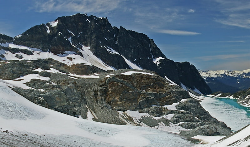
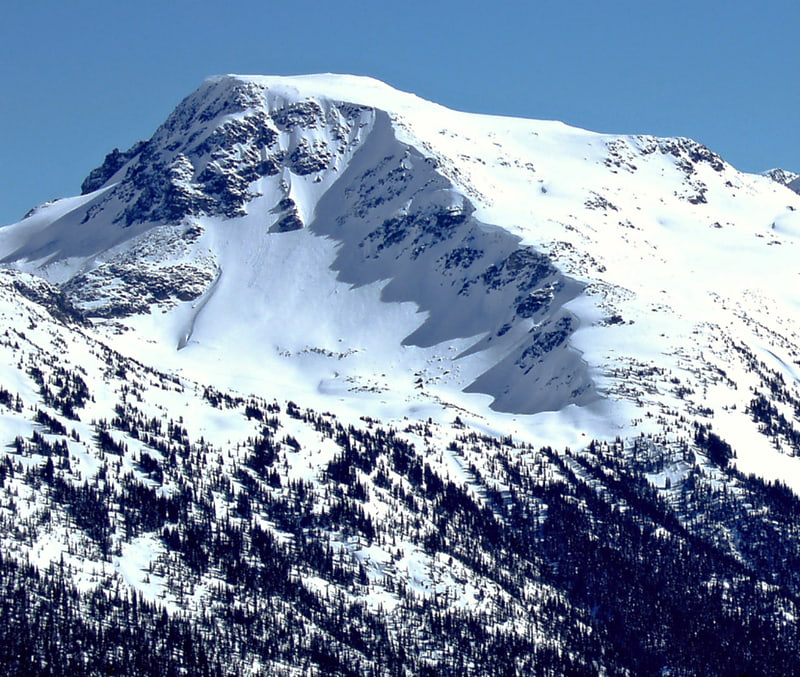
The Black Tusk
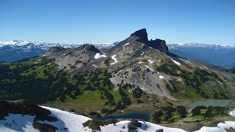
Stratovolcano in British Columbia, Canada. The Black Tusk is a stratovolcano and a pinnacle of volcanic rock in Garibaldi Provincial Park of British Columbia, Canada. At 2,319 m above sea level, the upper spire is visible from a great distance in all directions. It is particularly noticeable from the Sea-to-Sky Highway just south of Whistler, British Columbia. Distinctive and immediately identifiable, The Black Tusk is among the best known mountains in the Garibaldi Ranges of the Coast Mountains. The volcano is part of the Garibaldi Volcanic Belt which is a segment of the Canadian Cascade Arc, but it is not within the geographic boundary of the Cascade Range.[2]
Cinder Cone
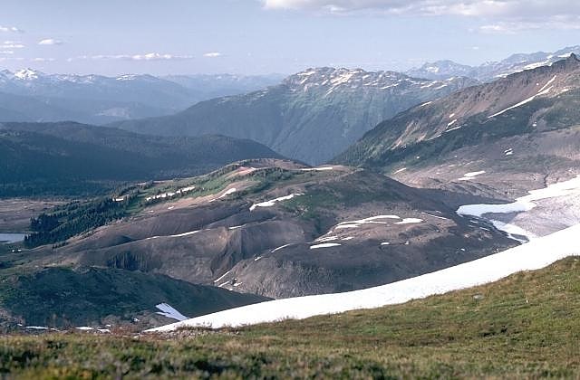
Cinder cone in British Columbia, Canada. Cinder Cone is a cinder cone with a small crater on the west side of the Helm Glacier in Garibaldi Provincial Park in British Columbia, Canada. Cinder Cone is surrounded by cinder flats and its crater is filled with meltwater during the summer. Cinder Cone is eroded easily by meltwater during the spring, washing the pyroclastics into the Valley of Desolation. Cinder Cone produced a 9 km long lava flow during the early Holocene.[3]
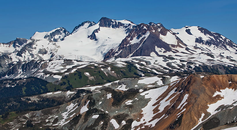
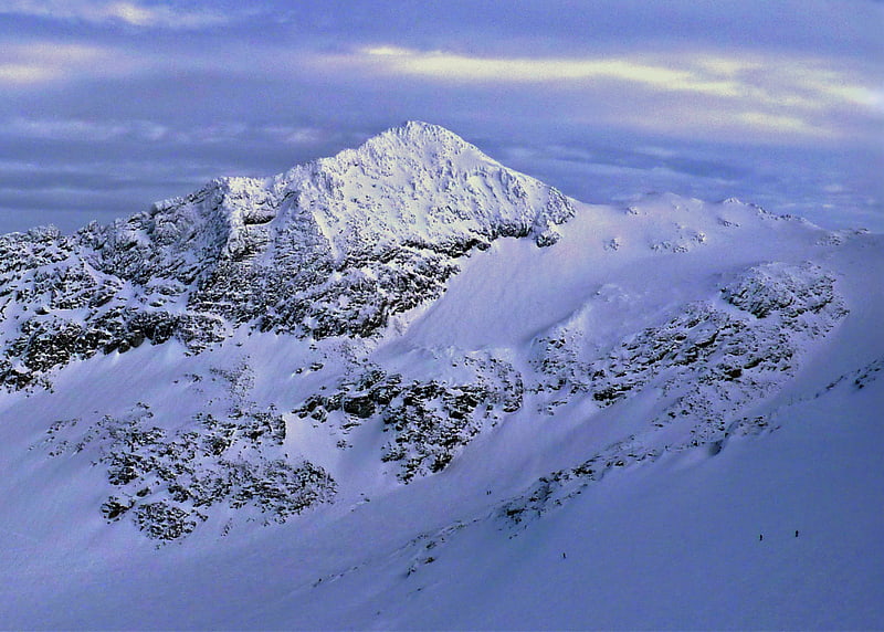
Mount Garibaldi
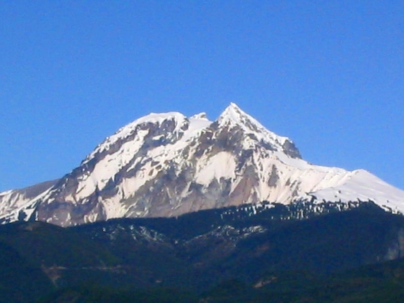
Massive volcano formed on a glacier. Mount Garibaldi is a potentially active stratovolcano in the Sea to Sky Country of British Columbia, 80 km north of Vancouver, British Columbia, Canada. Located in the southernmost Coast Mountains, it is one of the most recognized peaks in the South Coast region, as well as British Columbia's best known volcano. It lies within the Garibaldi Ranges of the Pacific Ranges.
This heavily eroded dome complex occupies the southwest corner of Garibaldi Provincial Park overlooking the town of Squamish. It is the only major Pleistocene age volcano in North America known to have formed upon a glacier. Although part of the Garibaldi Volcanic Belt lies within the Cascade Volcanic Arc, it is not considered part of the Cascade Range.[4]
Mount Price
Stratovolcano in British Columbia, Canada. Mount Price is a small stratovolcano in the Garibaldi Ranges of the Pacific Ranges in southwestern British Columbia, Canada. It has an elevation of 2,049 metres and rises above the surrounding landscape on the western side of Garibaldi Lake in New Westminster Land District. The mountain contains a number of subfeatures, including Clinker Peak on its western flank, which was the source of two thick lava flows between 15,000 and 8,000 years ago that ponded against glacial ice. These lava flows are structurally unstable, having produced large landslides as recently as the 1850s. A large provincial park surrounds Mount Price and other volcanoes in its vicinity. It lies within an ecological region that surrounds much of the Pacific Ranges.
Mount Price is associated with a small group of volcanoes called the Garibaldi Lake volcanic field. This forms part of the larger Garibaldi Volcanic Belt, a north−south trending volcanic zone that represents a portion of the Canadian Cascade Arc. Mount Price began its formation 1.2 million years ago and continued intermittently until sometime in the last 15,000 years. Although the mountain is not known to have experienced a volcanic eruption for thousands of years, it could erupt again, which would potentially endanger the nearby populace. If this were to happen, relief efforts would be quickly organized. Teams such as the Interagency Volcanic Event Notification Plan are prepared to notify people threatened by volcanic eruptions in Canada.[5]
Wedgemount Lake
Lake in British Columbia, Canada. Wedgemount Lake is a turquoise-coloured alpine lake located in Garibaldi Provincial Park of British Columbia, Canada. It is situated below Wedge Mountain, Parkhurst Mountain, Rethel Mountain, and Mount Weart. Meltwater from Wedgemount Glacier and Armchair Glacier feeds the lake, whereas Wedgemount Creek is the outflow from the lake.[6]
Atwell Peak
Peak in British Columbia, Canada. Atwell Peak is a dramatic pyramid shaped volcanic peak located at the southern edge of Mount Garibaldi, British Columbia, Canada. Atwell Peak was formed during an initial period of volcanism 0.51-0.22 million years ago and was the source of many pyroclastic flows during Garibaldi's development. Frequent landslides on its west face drops steeply into the Cheekye River. Atwell Peak is often mistakenly called Mount Garibaldi when viewed from Squamish, since the main peak is hidden. The peak is usually climbed during winter or early spring when the rock is frozen because it is very loose and rotten. Atwell Peak contains three ridges, the north, east, and south. The two most visible routes are the north and south ridges.
Atwell Peak consists of three ridges, the north, east, and south. The east ridge connects with the north ridge about 100 horizontal metres north of the summit. All ridges, with the possible exception of the upper east ridge, are sharp and heavily corniced in winter and spring. The north ridge is the shortest climbing route. Several gullies on the southeast face offer moderate routes that eventually join one of the three ridges. The northeast face is the shortest of the peak's faces but has many bergschrunds.
Atwell Peak is part of the Garibaldi Massif which is an eroded stratovolcano formed during the last ice age. The volcano is also part of the Garibaldi Volcanic Belt which is a segment of the Canadian Cascade Arc, but it is not within the geographic boundary of the Cascade Range. It is located in the Garibaldi Ranges of the Pacific Ranges.[7]
Mount Weart
Summit in British Columbia, Canada. Mount Weart is a 2,835-metre triple-summit mountain located in the Garibaldi Ranges of the Coast Mountains, in northwestern Garibaldi Provincial Park of southwestern British Columbia, Canada. It is situated 14 km northeast of Whistler, and its nearest higher peak is Wedge Mountain, 3.7 km to the south, which is the only peak within the park higher than Weart. The Armchair Glacier rests below the west aspect of the summit, and the massive Weart Glacier spans the northern and eastern aspects of the mountain. Precipitation runoff from the peak and meltwater from the glaciers drains into Wedgemount Lake and tributaries of the Lillooet River.[8]
Overlord Mountain
Peak in British Columbia, Canada. Overlord Mountain is a 2,625-metre glacier-clad peak located in the Garibaldi Ranges of the Coast Mountains, in Garibaldi Provincial Park of southwestern British Columbia, Canada. It is the highest point of the Fitzsimmons Range, which is a subset of the Garibaldi Ranges, and can be readily seen from the Whistler Blackcomb ski area. It is situated 15 km southeast of Whistler, and its nearest higher peak is Mount Macbeth, 3 km to the north-northeast. The Benvolio Glacier rests below the south aspect of the summit, the Fitzsimmons Glacier on the east aspect, and the expansive Overlord Glacier spans the northern and western aspects of the mountain. Precipitation runoff from the peak and meltwater from its glaciers drains into tributaries of the Cheakamus River. The first ascent of the mountain was made in 1923 by Phyllis Munday and Don Munday via the Benvolio Glacier. The mountain's descriptive name was recommended by the Garibaldi Park Board and officially adopted on September 2, 1930, by the Geographical Names Board of Canada.[9]
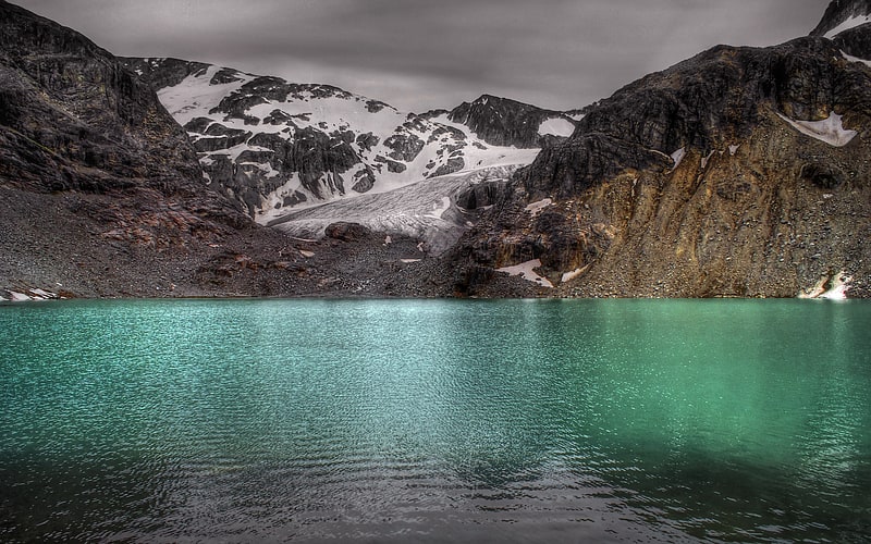
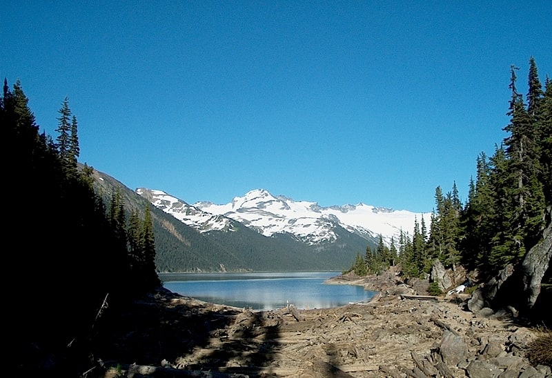
Garibaldi Lake
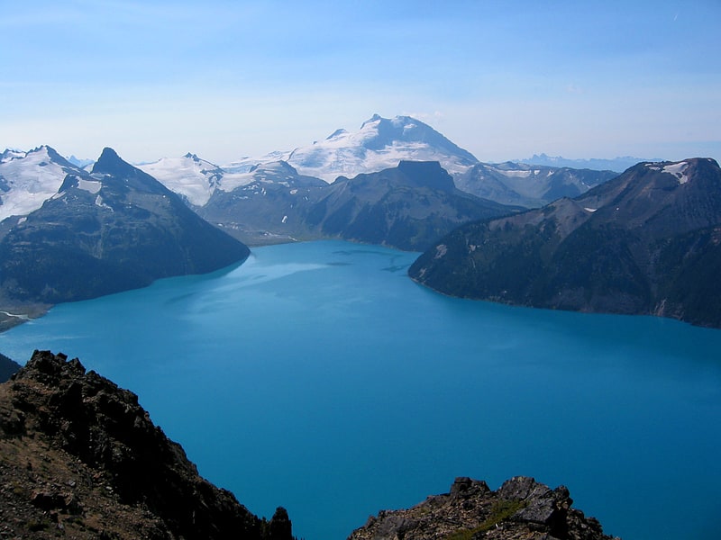
Lake in British Columbia, Canada. Garibaldi Lake is a turquoise-coloured alpine lake in British Columbia, Canada, located 37 km north of Squamish and 19 km south of Whistler. The lake lies within Garibaldi Provincial Park, which features mountains, glaciers, trails, forests, flowers, meadows, waterfalls. The park is a wildlife protected area.[10]
The Sphinx
Mountain in British Columbia, Canada. The Sphinx is a mountain in the southernmost Coast Mountains of British Columbia, Canada. It is south-east of Garibaldi Lake.[11]
Rethel Mountain
Mountain in British Columbia, Canada. Rethel Mountain is a 2,408-metre mountain summit located in the Garibaldi Ranges of the Coast Mountains, in northwestern Garibaldi Provincial Park of southwestern British Columbia, Canada. It is situated 11 km northeast of Whistler, on the south side of Wedgemount Lake and west side of Wedgemount Glacier. Its nearest higher peak is Parkhurst Mountain, 1.3 km to the southeast. Rethel is set 3.2 km northwest of Wedge Mountain, the highest peak in Garibaldi Park, and 2.9 km southwest of Mount Weart, the second-highest in the park. Precipitation runoff from the peak drains into Wedgemount Creek and Rethel Creek, both tributaries of the Green River, which in turn is a tributary of the Lillooet River. It was named in association from Rethel station on the Pacific Great Eastern Railway route. The mountain's name was officially adopted on February 27, 1978, by the Geographical Names Board of Canada.[12]
Decker Mountain
Peak. Decker Mountain is a 2,421-metre flat-topped peak located in the Garibaldi Ranges of the Coast Mountains, in Garibaldi Provincial Park of southwestern British Columbia, Canada. It is part of the Spearhead Range, which is a subset of the Garibaldi Ranges. It is situated 9 km southeast of Whistler, and 3.9 km west-northwest of Tremor Mountain, which is the highest point in the Spearhead Range. Precipitation runoff from the south side of the peak drains into Fitzsimmons Creek which is a tributary of the Cheakamus River, and meltwater from the Decker Glacier on the northeastern slope drains to Wedge Creek.
Decker Mountain is often climbed as part of the Spearhead Traverse. The first ascent of the mountain was made in 1954 by a party from the Varsity Outdoor Club of the University of British Columbia. The descriptive name for the mountain refers to its two-decked layer form and flat, deck-like top, while the suffix "er" was used for purposes of euphony. The mountain's name was officially adopted on August 27, 1965, by the Geographical Names Board of Canada as submitted by Dick Culbert, author of Climber's Guide to the Coastal Ranges of British Columbia.[13]
The Spearhead
Peak in British Columbia, Canada. The Spearhead is a 2,457 m peak in the Garibaldi Ranges of British Columbia, Canada, and is one of the main summits of the Blackcomb Mountain portion of the Whistler Blackcomb ski resort, located at the apex of the Blackcomb and Spearhead Glaciers, which is named for it. It also is the namesake of the Spearhead Range, which is the short range flanking the north side of Fitzsimmons Creek and ending on its northwest end at Blackcomb Mountain. The mountain's name was officially adopted on August 27, 1965, by the Geographical Names Board of Canada.[14]
The Table
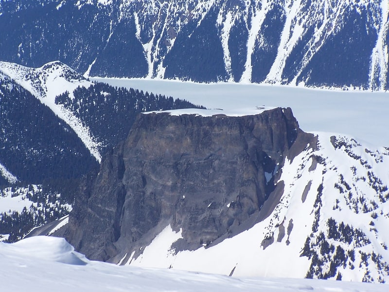
Tuya in British Columbia, Canada. The Table, sometimes called Table Mountain, is a 2,021-metre high flow-dominated andesite tuya located 4 kilometres south of Garibaldi Lake, 15 kilometres northeast of Cheekye and 5 kilometres north of Mount Garibaldi, British Columbia, Canada. It rises over 530 metres above the surface of Garibaldi Lake, which lies less than 1 kilometre to the north.
The Table is almost impossible to climb because sections of the volcano have collapsed, creating steep and exceptionally rotten rock walls on all sides.[15]