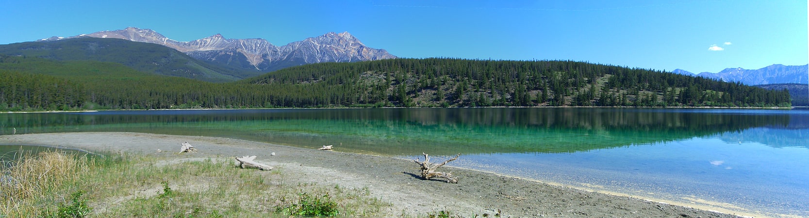
Discover 35 hidden attractions, cool sights, and unusual things to do in Jasper National Park (Canada). Don't miss out on these must-see attractions: Athabasca Falls, Tangle Falls, and Sunwapta Falls. Also, be sure to include Maligne Canyon in your itinerary.
Below, you can find the list of the most amazing places you should visit in Jasper National Park (Alberta).
Table of Contents
Athabasca Falls
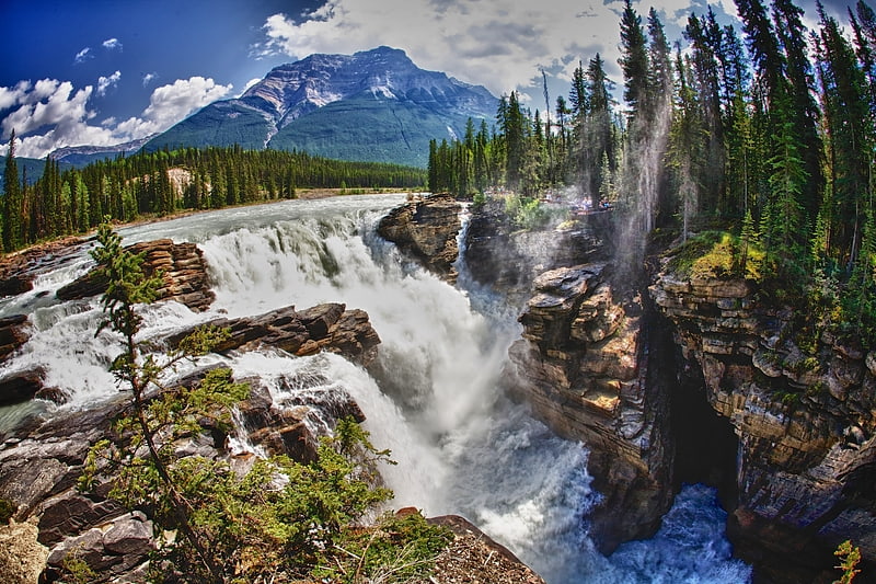
Scenic waterfall in mountainous environs. Athabasca Falls is a waterfall in Jasper National Park on the upper Athabasca River, approximately 30 kilometres south of the townsite of Jasper, Alberta, Canada, and just west of the Icefields Parkway.[1]
Address: Hwy 93, T0E 1E0 Jasper
Tangle Falls
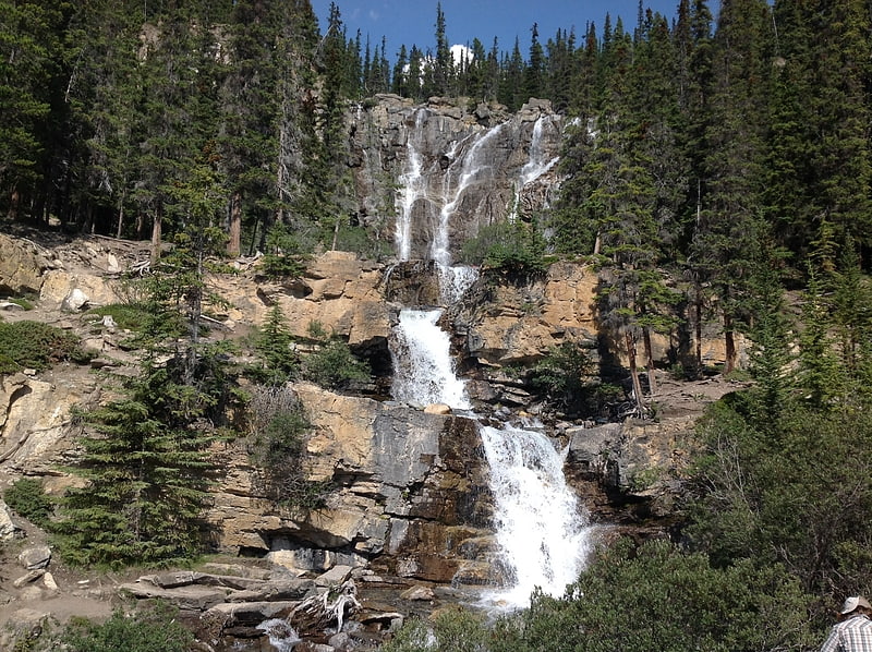
Tangle Falls is a multi-tiered waterfall located in Jasper National Park along Icefields Parkway. It has 4 drops, and is 48 meters tall. Tangle Falls is 30 meters at its widest.[2]
Sunwapta Falls
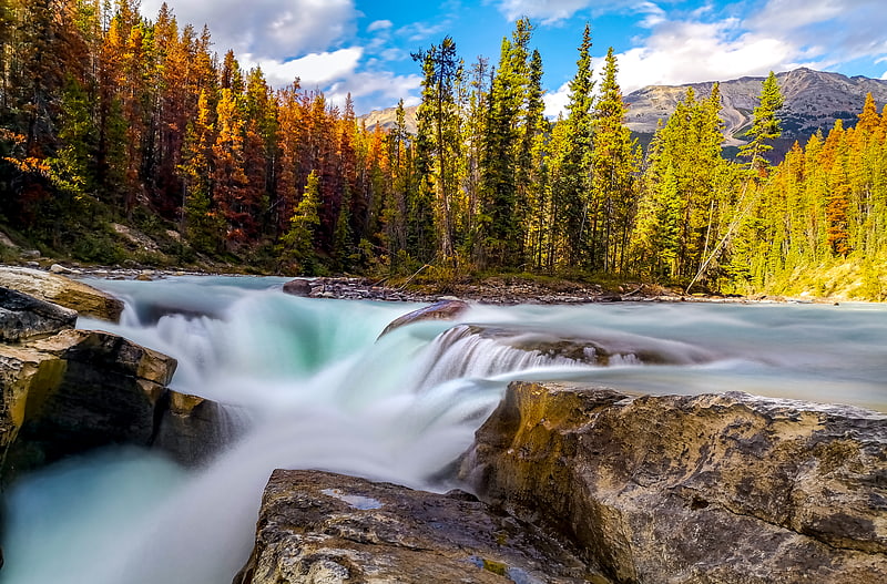
Cascading waterfalls in scenic surrounds. Sunwapta Falls is a pair of waterfalls of the Sunwapta River located in Jasper National Park, Alberta, Canada.
The falls are accessible via a 600 metres (2,000 feet) access road off the Icefields Parkway, which connects Jasper and Banff National Parks. The falls have a drop of about 18.5 metres (61 feet). Sunwapta is a Stoney language word that means "turbulent water". The falls is most spectacular in the late spring when the spring melt is at its peak.
There are two falls, a lower and an upper one. The one most people see is the upper falls, as access is easier. The lower falls are a short distance away. The water originates from the Athabasca Glacier, and volumes are higher in early summer because of glacial melting. It is a Class 6 waterfall, with a drop of 60 ft (18 m) and a width of 30 ft (9.1 m).[3]
Maligne Canyon
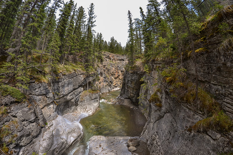
Tourist attraction in Alberta, Canada. Maligne Canyon is a slot canyon located in the Jasper National Park near Jasper, Alberta, Canada. Eroded out of the Palliser Formation, the canyon measures over 50 metres deep. Popular for sightseeing and exploration, the area contains waterfalls, underground stream outlets, birds and plant life.[4]
Maligne Lake
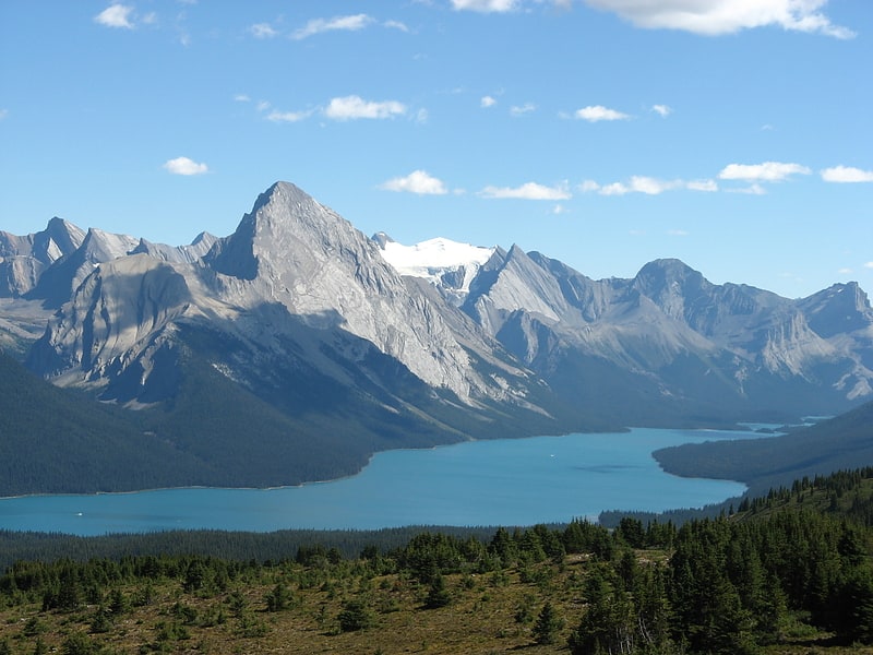
Lake with Spirit Island and mountain views. Maligne Lake is a lake in Jasper National Park, Alberta, Canada. The lake is famed for the colour of its azure water, the surrounding peaks, the three glaciers visible from the lake, and Spirit Island, a frequently and very famously photographed islet. The lake is located 44 km south of Jasper town, and is accessible by motor vehicle, including shuttle buses from Jasper. Boat tours run to Spirit Island in the spring to autumn season. The 44 km Skyline Trail, Jasper's most popular, highest and above treeline, multi-day hike, begins at Maligne Lake and finishes near the town of Jasper. Other popular day hikes include the Opal Hills and Bald Hills loops. Winter activities include cross-country skiing and snowboarding.
Maligne Lake is approximately 22.5 km (14.0 mi) long and is 97 m (318 ft) at its deepest point, in the south end of the lake. It averages 35 m (115 ft) in depth. It sits at approximately 1,670 m (5,480 ft) asl. Easily visible from the Maligne Lake Day Lodge are Leah and Samson Peaks and Mount Paul to the east, and Mounts Charlton, Unwin, Mary Vaux and Llysfran Peak to the south and west. The Charlton-Unwin, Maligne, and Coronet glaciers are visible from the lake, which boasts a self-sustaining population of introduced rainbow trout and brook trout. It is a popular spot for sport fishing, kayaking and canoeing. Parks Canada maintains three camping sites, accessible only by canoe, at Hidden Cove, Fisherman's Bay and Coronet Creek.
Maligne Lake is fed and drained by the Maligne River, which enters the lake on its south side, near Mount Unwin and drains the lake to the north. Maligne Lake, as well as Maligne River, Maligne Mountain, and Maligne Pass, takes its name from the French word for malignant or wicked. The name was used by Father Pierre-Jean De Smet (1801–1873) to describe the turbulent river that flows from the lake (in the spring), and soon spread to the lake, canyon, pass, mountain and range. It is also possible that early French traders applied the name to the river for its treacherous confluence with the Athabasca River.[5]
Lac Beauvert
Lake in Alberta, Canada. Lac Beauvert, or Beauvert Lake is a small lake in Jasper National Park, Alberta, Canada.
It is located next to the Jasper Park Lodge, a Fairmont Hotels and Resorts property. The lake is located 3 kilometres northeast of the town of Jasper. Lac Beauvert is a remanent of what was once a much larger lake that covered the entire Jasper valley, also encompassing the modern day nearby lakes of Patricia Lake, Pyramid Lake, Lake Edith and Lake Annette.[6]
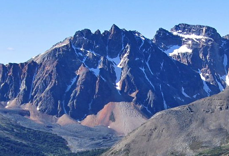
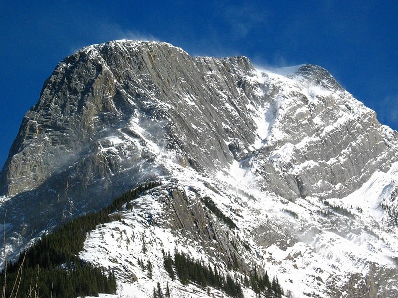
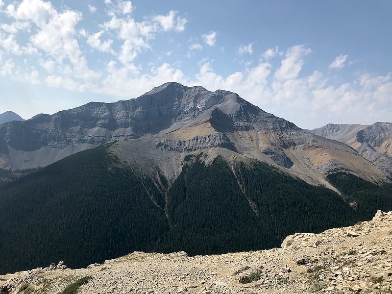
Mount Tekarra
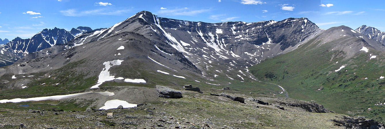
Mountain in Alberta, Canada. Mount Tekarra is a 2,694 metres mountain summit located in the Athabasca River valley of Jasper National Park, in the Canadian Rockies of Alberta, Canada. It is situated at the northwest end of the Maligne Range and is visible from Jasper and the Icefields Parkway. Its nearest higher neighbor is The Watchtower, 7.0 km to the east.[7]
Medicine Lake
Lake in Alberta, Canada. Medicine Lake is located within Jasper National Park, Alberta, Canada. It is located approximately 20 km southeast of the townsite of Jasper, Alberta. Medicine Lake is approximately 7 km long and is a relatively shallow lake. The lake is part of the Maligne Valley watershed which is mainly glacial fed.[8]
Terminal Mountain
Mountain in Alberta, Canada. Terminal Mountain is a 2,835-metre mountain summit located in Jasper National Park, in the Trident Range of the Canadian Rockies of Alberta, Canada. The town of Jasper is situated 12 kilometres to the north-northeast. Terminal Mountain forms the west buttress of Marmot Pass, and the east buttress is formed by Marmot Mountain, home of the Marmot Basin alpine ski area. Circus Valley lies at the south side of the mountain, and the north side towers above the valley of Whistlers Creek. Its nearest higher peak is Manx Peak, 2.0 km to the west.[9]
Geraldine Peak
Geraldine Peak is a 2,930-metre mountain summit located in the Athabasca River valley of Jasper National Park, in the Canadian Rockies of Alberta, Canada. The peak is also known as Whirlpool Mountain, and Mount Geraldine. No name has been officially adopted yet. The names derive from its position at the northern end of the long ridge that divides Geraldine Lakes and Geraldine Creek on the southeast side, from the Whirlpool River on the northwest side. The nearest higher peak is Mount Fryatt, 7.0 km to the south-southeast. Geraldine Peak can be seen from the Icefields Parkway in the vicinity of Athabasca Falls.[10]
Mount Hardisty
Mountain in Alberta, Canada. Mount Hardisty is a 2,716 m mountain summit located in the Athabasca River valley of Jasper National Park, in the Canadian Rockies of Alberta, Canada. Its nearest higher peak is Mount Kerkeslin, 6.0 km to the south. Both mountains are part of the Maligne Range and are visible from the Icefields Parkway.[11]
Franchère Peak
Franchère Peak is a 2,805-metre mountain summit located in the Astoria River valley of Jasper National Park, in the Canadian Rockies of Alberta, Canada. The mountain was named in 1917 for Gabriel Franchère, a French Canadian author and explorer of the Pacific Northwest who wrote the first account of an 1814 journey over Athabasca Pass. Franchère was a member of John Jacob Astor's Pacific Fur Company and sailed to Fort Astoria on the Tonquin, after which the nearby Tonquin Valley was named. The mountain's name was officially adopted on March 5, 1935 when approved by the Geographical Names Board of Canada. Its nearest higher peak is Aquila Mountain, 2.00 km to the north. Mount Edith Cavell is situated immediately south-southeast across the Astoria River valley.[12]
Roche Bonhomme
Mountain in Alberta, Canada. Roche Bonhomme is a 2,500-metre mountain summit located in Jasper National Park in Alberta, Canada. It is located in the Colin Range, which is a sub-range of the Canadian Rockies. The peak is situated 13 km northeast of the municipality of Jasper, and is a prominent landmark in the Athabasca Valley visible from Highway 16 and the Canadian. Its nearest higher peak is Grisette Mountain, 2.2 km to the east.
Roche Bonhomme was named in 1878 by George Munro Grant for the fact it has an anthropomorphic shape. The French "Roche Bonhomme" translates to "Rock Fellow." The mountain's name was officially adopted in 1947 by the Geographical Names Board of Canada. Roche Bonhomme is composed of Permian and Carboniferous strata topped by darker Triassic siltstone of the Sulphur Mountain Formation.[13]
Manx Peak
Manx Peak is a 3,044-metre mountain summit located in Jasper National Park, in the Trident Range of the Canadian Rockies of Alberta, Canada. The town of Jasper is situated 14 kilometres to the north-northeast. Circus Valley lies at the south side of the mountain, and the northeast aspect towers above the head of the valley of Whistlers Creek. Its nearest higher peak is Mount Estella, 1.8 km to the southwest, and Terminal Mountain lies 2.0 km to the east. The peak is composed of sedimentary rock laid down from the Precambrian to the Jurassic periods and pushed east and over the top of younger rock during the Laramide orogeny.[14]
Morro Peak
Hill in Alberta, Canada. Morro Peak is a small 1,679-metre mountain summit located in Jasper National Park in Alberta, Canada. It is located at the northwest end of the Colin Range, which is a sub-range of the Canadian Rockies. The peak is situated 17 km north of the municipality of Jasper, and is a prominent landmark in the Athabasca Valley visible from Highway 16 and the Canadian. Its nearest higher peak is Hawk Mountain, 4.0 km to the southeast. Morro Peak was named in 1916 by Morrison P. Bridgland for the Spanish word morro, meaning rounded hill, which is an apt description of it. Bridgland was a Dominion Land Surveyor who named many peaks in Jasper Park and the Canadian Rockies. The mountain's name was officially adopted in 1956 by the Geographical Names Board of Canada.[15]
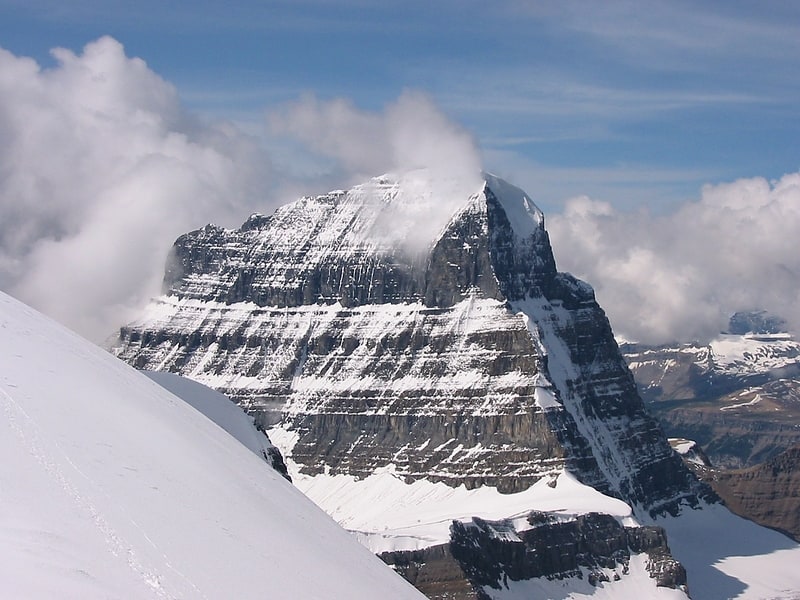
Mount Edith Cavell
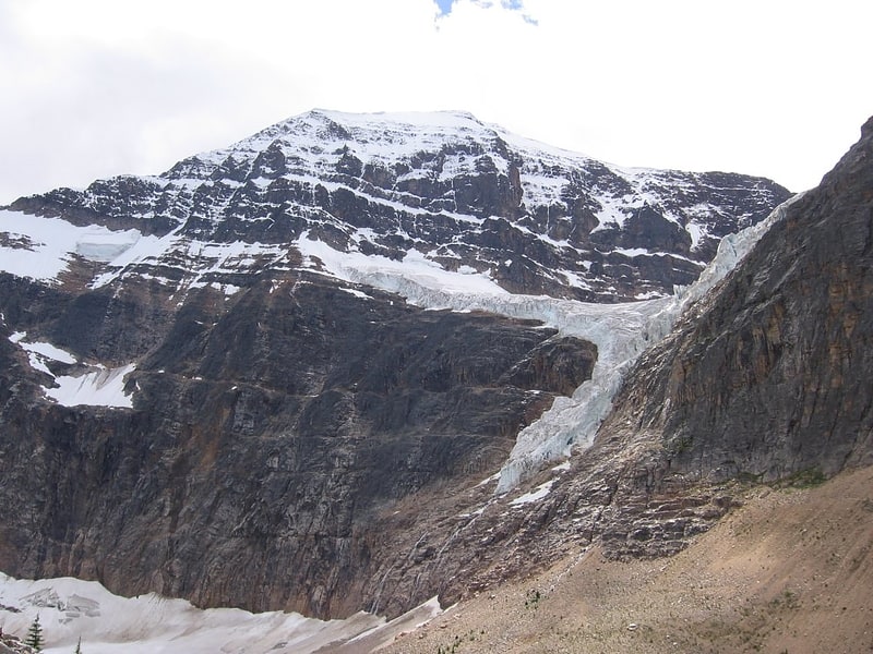
Mountain with scenic trails and a glacier. Mount Edith Cavell is a mountain located in the Athabasca River and Astoria River valleys of Jasper National Park, and the most prominent peak entirely within Alberta.
The mountain was named in 1916 for Edith Cavell, a British nurse executed by the Germans during World War I for having helped Allied soldiers escape from occupied Belgium to the Netherlands, in violation of German military law. It was previously known as Mount Fitzhugh.
A close-up view of the north face of Mount Edith Cavell is visible after a short hike to Cavell Meadows. The trailhead is by the parking lot at the end of Mount Edith Cavell Road. The trail to the meadows is 3.8 kilometres (2.4 mi) one way, rising 370 metres (1,214 ft) to 2,135 metres (7,005 ft). The Canadian Rockies Trail Guide describes the trail in detail.
The hanging Angel Glacier is visible from Cavell Meadows, which spills over a 300 metres (984 ft) cliff on the north face.
Access to the Tonquin Valley trails can be found about one kilometre before the end of the Mount Edith Cavell Road. There is a parking area across from the Mount Edith Cavell Hostel. A short walk down the gravel path leads to the north end of Cavell Lake. There is small bridge across the stream that empties the lake. From here there are good views with the lake in the foreground and the Mount Edith Cavell massif in the background.
It is believed that one of the world's largest glacial erratics, called Big Rock, located near Okotoks, Alberta, was once part of Mount Edith Cavell. The erratic was formed approximately ten thousand years ago when a large portion of quartzite stone was stripped away from the mountain along with the receding Athabasca River Valley glacier.[16]
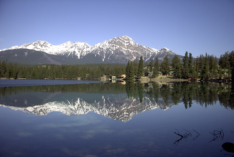
Patricia Lake
Lake in Alberta, Canada. Patricia Lake is a lake in Jasper National Park, Alberta, Canada, near the town of Jasper. It was named for Princess Patricia of Connaught, a granddaughter of Queen Victoria.
It is connected by Pyramid Lake road and hiking trails to the town of Jasper, as well as other tourist sites such as Pyramid Lake and Pyramid Mountain.[17]
Grisette Mountain
Mountain in Alberta, Canada. Grisette Mountain is a 2,620-metre mountain summit located in Jasper National Park in Alberta, Canada. It is located in the Colin Range, which is a sub-range of the Canadian Rockies. The peak is situated 14 km northeast of the municipality of Jasper, and is a prominent landmark in the Athabasca Valley visible from Highway 16 and the Canadian. Its nearest higher peak is Mount Dromore, 2.4 km to the east.
Grisette Mountain was named in 1916 by Morrison P. Bridgland for its gray colored limestone. Bridgland (1878-1948) was a Dominion Land Surveyor who named many peaks in Jasper Park and the Canadian Rockies. The French word gris translates to gray. The mountain's name was officially adopted in 1947 by the Geographical Names Board of Canada.[18]
Throne Mountain
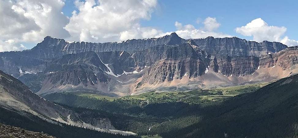
Mountain in Alberta, Canada. Throne Mountain is a prominent 3,120-metre mountain summit located in Jasper National Park, in the South Jasper Ranges of the Canadian Rockies of Alberta, Canada. It is situated 24 kilometres south of the town of Jasper, and 8 kilometres east of Tonquin Valley. The nearest higher neighbor is Mount Edith Cavell, 5.8 km to the east, and Franchère Peak lies 7.0 km to the northeast. The peak is composed of sedimentary rock laid down from the Precambrian to the Jurassic periods, that was pushed east and over the top of younger rock during the Laramide orogeny.[19]
Esplanade Mountain
Mountain in Alberta, Canada. Esplanade Mountain is a 2,301-metre mountain summit located in Jasper National Park, in the Canadian Rockies of Alberta, Canada. The peak is situated 20 kilometres north of the municipality of Jasper, in the Athabasca Valley and is visible from Highway 16 and the Canadian. Its nearest higher peak is Cliff Mountain, 5.0 km to the west. Esplanade Mountain was named in 1916 by Morrison P. Bridgland for its long, flat top resembling an esplanade. Bridgland was a Dominion Land Surveyor who named many peaks in Jasper Park and the Canadian Rockies. The mountain's name was officially adopted in 1956 by the Geographical Names Board of Canada.[20]
Indian Ridge
Mountain. Indian Ridge is a 2,820-metre mountain located in Jasper National Park, in the Trident Range of the Canadian Rockies of Alberta, Canada. The summit is unofficially called Indian Peak. The town of Jasper is situated 9 kilometres to the north-northeast, and The Whistlers lies 2.55 kilometres to the northeast. Its nearest higher peak is Manx Peak, 4.3 km to the southwest, and Terminal Mountain lies 3.25 km to the south. The Marmot Basin alpine ski area is located 4 kilometres to the southeast. The peak is composed of sedimentary rock laid down from the Precambrian to the Jurassic periods and pushed east and over the top of younger rock during the Laramide orogeny.[21]
Evelyn Peak
Evelyn Peak is a 2,855 m mountain summit in the Athabasca River valley of Jasper National Park, in the Canadian Rockies of Alberta, Canada. THe nearest higher peak is Mount Kerkeslin, 5.0 km to the southwest, and Mount Hardisty is 6.0 km to the northwest. All three are part of the Maligne Range. Evelyn Peak is composed of sedimentary rock laid down during the Cambrian period and pushed east and over the top of younger rock during the Laramide orogeny. The mountain is at the headwaters of Evelyn Creek, and three kilometres south of Evelyn Pass. The creek and pass were named in 1921 for Evelyn Cavendish, Duchess of Devonshire, who visited nearby Maligne Lake in 1920. The mountain's name however, has not yet been officially adopted by the Geographical Names Board of Canada.[22]
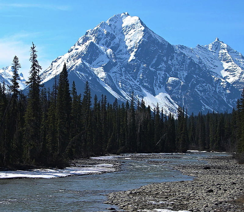
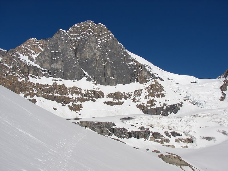
Mount Athabasca
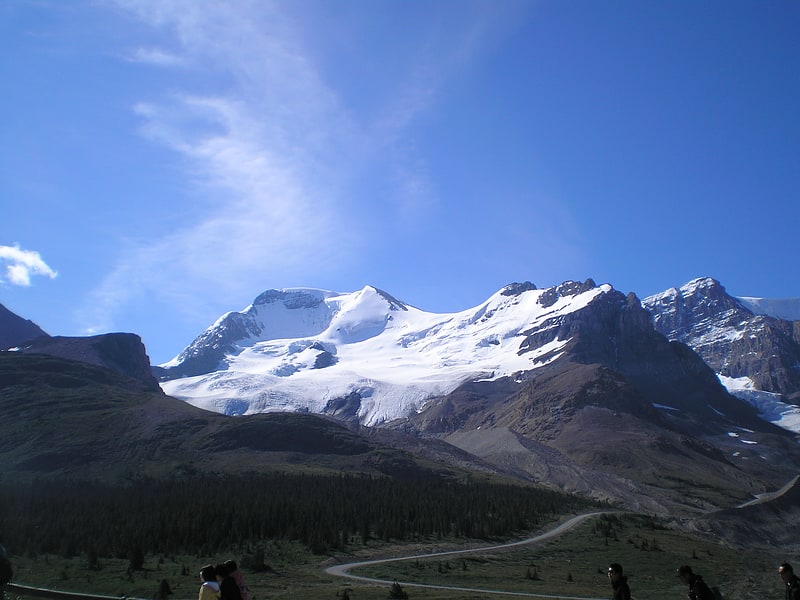
Mountain with routes to the Silverhorn. Mount Athabasca is located in the Columbia Icefield of Jasper National Park in Canada. The mountain was named in 1898 by J. Norman Collie, who made the first ascent on August 18 of that year. Athabasca is the Cree language name for "where there are reeds", which originally referred to Lake Athabasca. Mount Athabasca is unusual, in that water flows to the Pacific Ocean from the western slope, the Arctic Ocean from the northeastern slope, and to Hudson Bay from the southeastern slope.[23]
Mount Wilcox
Mountain in Alberta, Canada. Mount Wilcox is a 2,884-metre mountain summit located in the Canadian Rockies of Alberta, Canada. It is located in Jasper National Park right beside the Columbia Icefield visitor centre with the Icefields Parkway traversing the western base of the mountain. Its nearest higher peak is Nigel Peak, 3.35 km to the northeast. Mount Wilcox is a moderate scramble from Wilcox Pass. Due to its location, it provides one of the best views of the Athabasca Glacier.[24]
Roche à Perdrix
Mountain in Alberta, Canada. Roche à Perdrix is a mountain in Alberta's Rockies, Canada.
It is located south of Highway 16 on the eastern border of Jasper National Park, and is part of the Fiddle Range, one of the easternmost ranges of the Canadian Rockies. It is one of the first mountains upon entering the park from the east and is directly on the park border. In French, perdrix means partridge and roche means rock. The name is a reference to the rock foliations, which resemble a partridge's tail feathers.
It was named by the Reverend George Grant in 1872.[25]
Jasper House
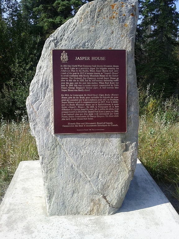
Historical landmark in Alberta, Canada. Jasper House National Historic Site, in Jasper National Park, Alberta, is the site of a trading post on the Athabasca River that functioned in two different locations from 1813 to 1884 as a major staging and supply post for travel through the Canadian Rockies.
The post was originally named Rocky Mountain House, but was renamed to avoid confusion with the Rocky Mountain House trading post on the North Saskatchewan River, becoming "Jasper's House" after the postmaster, Jasper Hawes, who operated the post from 1814 to 1817. The first location is believed to have been at the outlet of Brûlé Lake, downstream from the present site. The second Jasper House was established at the northern end of Jasper Lake in 1830, primarily serving travellers crossing Yellowhead Pass or Athabasca Pass.
The site operated until 1853, and was occasionally used until 1858 when it was reopened seasonally by Henry John Moberly, who operated it into the 1860s. The post was officially closed in 1884 after years of inactivity. From 1891 or 1892 to 1894 the house was used by miner Lewis Swift. The building was destroyed in 1909 when its lumber was used to make a raft by surveyors for the Grand Trunk Pacific Railway. Apart from a small cemetery, no significant ruins remain. It was designated a national historic site in 1924, and is marked by a commemorative stone and plaque.[26]
Mount Woolley
Mountain in Alberta, Canada. Mount Woolley is a mountain in Alberta, Canada, located in the Sunwapta River Valley of Jasper National Park, 1½ km south of Diadem Peak and is part of Winston Churchill Range of the Canadian Rockies.[27]
Mount Columbia
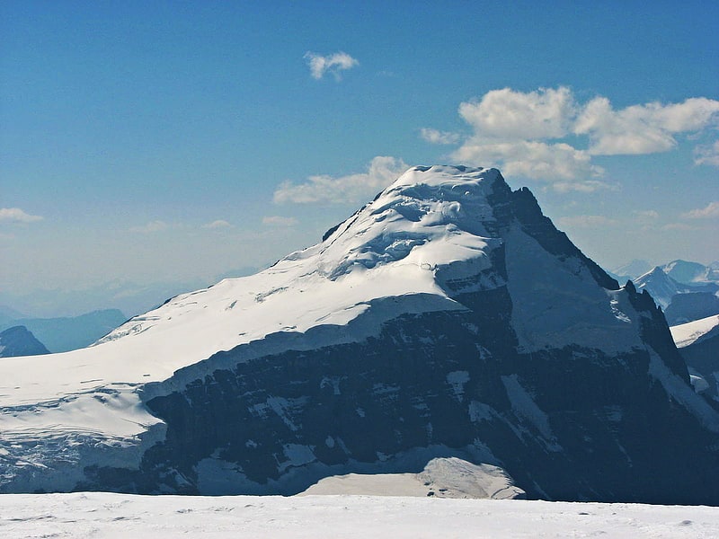
Mountain in Alberta, Canada. Mount Columbia is a mountain located in the Winston Churchill Range of the Rocky Mountains. It is the highest point in Alberta, Canada, and is second only to Mount Robson for height and topographical prominence in the Canadian Rockies. It is located on the border between Alberta and British Columbia on the northern edge of the Columbia Icefield. Its highest point, however, lies within Jasper National Park in Alberta.
The mountain was named in 1898 by J. Norman Collie after the Columbia River. The river itself was named after the American ship Columbia Rediviva captained by Robert Gray, who first ventured over a dangerous sandbar and explored the lower reaches of the river in 1792. Mount Columbia was first ascended in 1902 by James Outram, guided by Christian Kaufmann.[28]
Utopia Mountain
Mountain in Alberta, Canada. Utopia Mountain is a 2,602-metre mountain located in the Miette Range of Jasper National Park, in the Canadian Rockies of Alberta, Canada. It was named by Morrison P. Bridgland in 1916. Bridgland was a Dominion Land Surveyor who named many peaks in Jasper Park and the Canadian Rockies.[29]
Mount Alberta
Mountain in Alberta, Canada. Mount Alberta is a mountain located in the upper Athabasca River Valley of Jasper National Park, Alberta, Canada. J. Norman Collie named the mountain in 1898 after Princess Louise Caroline Alberta. It is the most difficult of the 11,000ers from a climbing point of view.
Mount Alberta is the fifth-highest peak of the Canadian Rockies and the third highest in Alberta. It is situated 80 kilometres (50 mi) southeast of the town of Jasper, just beyond the Northern extent of the Columbia Icefield. According to the Climber's Guide, Mount Alberta is "One of the finest peaks in the Rockies, a singular uplift that is difficult on all sides."[30]
Jasper Lake
Lake in Alberta, Canada. Jasper Lake is a lake located in the Rockies of Jasper National Park in Alberta, Canada. It is part of the Athabasca River, where the river broadens out. Its westernmost shore lies about 15 miles northeast from the town of Jasper along the Yellowhead Highway and stretches farther east for about 6 miles.[31]
Mount Kitchener
Mountain in Alberta, Canada. Mount Kitchener is a mountain located within the Columbia Icefield of Jasper National Park, which is part of the Canadian Rockies. The mountain can be seen from the Icefields Parkway near Sunwapta Pass.
Mt. Kitchener was originally named Mount Douglas by J. Norman Collie after David Douglas. In 1916, the mountain was renamed Mount Kitchener, its present-day name, after Lord Kitchener, who had just been killed in World War I.[32]
Pyramid Mountain
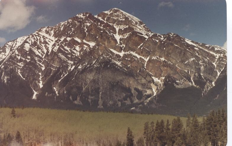
Mountain in Alberta, Canada. Pyramid Mountain is a mountain in Jasper National Park, Alberta, Canada, named for its pyramid-like shape. James Hector named the mountain in 1859 due to its appearance from the Athabasca River valley on the eastern side of the peak.
Part of the Victoria Cross Ranges in the Athabasca River Valley the mountain is in the major headwaters for the Athabasca River. The peak is just under 10 km (6 mi) north-west of the town of Jasper.
The mountain is a relatively easy scramble on the eastern slopes. These slopes can be reached by following a steep fire road from the parking lot at Pyramid Lake, 11.5 km (7 mi) southeast of the peak.
Based on the Köppen climate classification, Pyramid Mountain is located in a subarctic climate zone with cold, snowy winters, and mild summers. Temperatures can drop below -20 °C with wind chill factors below -30 °C.[33]
Sunwapta Pass
Mountain pass in Alberta, Canada. Sunwapta Pass is a mountain pass in the Canadian Rockies in the province of Alberta. Sunwapta Pass is the low point of the saddle created between Mount Athabasca and Nigel Peak. The pass marks the boundary between Banff and Jasper National Parks. The Icefields Parkway travels through Sunwapta Pass 108 km southeast of the town of Jasper and 122 km northwest of the Parkway's junction with the Trans-Canada Highway near Lake Louise. The pass is the second highest point on the Icefields Parkway. Bow Summit in Banff National Park is the highest point on the parkway.
Sunwapta Pass marks the watershed divide between the Athabasca River drainage to the north and the North Saskatchewan system to the south. Waters flowing north from this summit eventually reach the Arctic Ocean via the Mackenzie River, while those flowing south cross the prairies via the Saskatchewan and Nelson Rivers to Hudson Bay and the Atlantic Ocean.[34]
Address: 122 Km North of Lake Louise, 108 Km South of Jasper, Jasper National Park
Angel Glacier

Glacier in Alberta, Canada. The Angel Glacier is an extensive glacier which flows down the north face of Mount Edith Cavell in Jasper National Park, Canada. It is named as such because it has the appearance of an angel with out-swept wings. It was significantly larger when it was named in the 19th-century and is melting rapidly. It is not expected to maintain its shape, and will most likely disappear.
The glacier is visible from the Cavell Meadows hiking trail.[35]