Discover 15 hidden attractions, cool sights, and unusual things to do in Burnaby (Canada). Don't miss out on these must-see attractions: Burnaby Art Gallery, Burnaby Village Museum & Carousel, and Burnaby Village Museum. Also, be sure to include Burnaby Lake Regional Park in your itinerary.
Below, you can find the list of the most amazing places you should visit in Burnaby (British Columbia).
Table of Contents
Burnaby Art Gallery
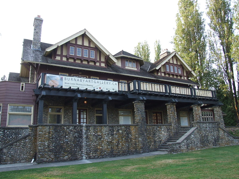
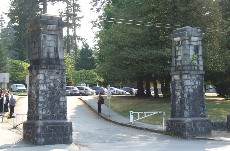
Museum in Burnaby, British Columbia. The Burnaby Art Gallery is an art museum in Burnaby, British Columbia, Canada. The museum is located on the northern periphery of Deer Lake Park, situated off of Deer Lake Avenue. The museum occupies Fairacres Mansion, a historic residence designated as a historic site by the provincial government.
The institution was established through a private association in 1967, who used the publicly owned Fairacres Mansion to exhibit its collection. The association continued to manage the museum until 1998, when the municipal government of Burnaby assumed control of the museum's collections, and governance.
The museum's permanent collection holds more that 6,000 artworks. It is the only public art collection in Canada dedicated to works on paper.[1]
Address: 6344 Deer Lake Avenue, Burnaby
Burnaby Village Museum & Carousel
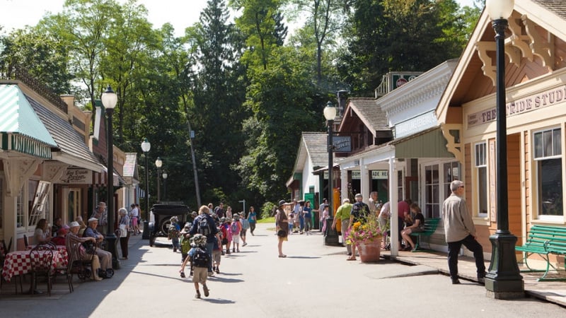
The C. W. Parker Carousel is a carousel built in 1912 currently operating in the Burnaby Village Museum at Deer Lake Park in Burnaby, British Columbia. The carousel was built by the C. W. Parker Company and is also known as the Parker #119 and the Burnaby Centennial Parker Carousel. The carousel was the 119th such machine built by the C. W. Parker Company, earning it its "Parker #119" nickname. The carousel contains 41 horses and operates at a pavilion known as the Don Wrigley Pavilion located at one of the museum's two entrances, earning the entrance the name "Carousel Entrance".[2]
Address: 6501 Deer Lake Ave, V5G 3T6 Burnaby
Burnaby Village Museum
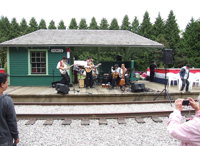
Museum. The Burnaby Village Museum, previously known as the Heritage Village, is an open-air museum in Burnaby, British Columbia, Canada, located at Deer Lake Park. It is open seasonally from May to September and opens for special events taking place September to March. The Burnaby Village Museum is a reconstructed 1920s village, containing 31 full scale buildings; its costumed staff demonstrate traditional trades. The museum spans 10 acres of land. Some of the buildings are original heritage buildings, moved from other locations in the community and restored. Others are replica buildings, created to house specific displays and artifacts, including a 1912 B.C. Electric Railway interurban tram. The Museum is also known for the 1912 C. W. Parker Carousel, available for visitors to ride.[3]
Address: 6501 Deer Lake Ave, V5G 3T6 Burnaby
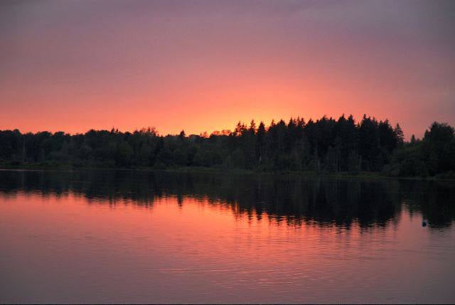
Burnaby Lake Regional Park
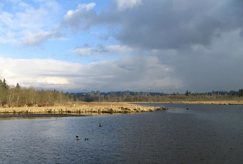
Lake in British Columbia, Canada. Burnaby Lake is a lake located in Burnaby, British Columbia and is the focal geographic feature and namesake of Burnaby Lake Regional Park. The lake occupies 3.11 square kilometres of land, and is home to a large variety of wildlife. At least 70 species of birds make the lake and surrounding areas their home, and about 214 species of birds visit the lake throughout the year. The park has been managed by the Metro Vancouver Parks Department since 1977.[4]
Central Park
Park in Burnaby, British Columbia. Central Park is a 90-hectare urban park in Burnaby, British Columbia, founded in 1891.
The park is on the Vancouver–Burnaby border, just west of the Metropolis at Metrotown shopping complex, and is bounded by Boundary Road on the west, Kingsway on the north, Patterson and Willingdon Avenues on the east, and Imperial Road on the south. The nearest SkyTrain station, Patterson station, named for Burnaby pioneer Dugald Campbell Patterson, is at the park's northeast corner. The main entrance to Central Park is off Kingsway near Patterson Avenue.
Central Park was once a naval reserve set aside as a source of masts and spars for ships of the Royal Navy. The park was named to honour Mrs. Sarah (Christine) Oppenheimer, the wife of Vancouver's second mayor, who was born in New York City.
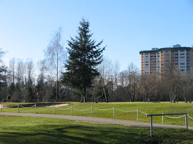
Central Park's primary attraction is the large proportion of its land reserved as a well-preserved temperate rainforest ecosystem, with numerous walking trails. Among its other attractions are the award-winning children's playground, pitch and putt golf, an outdoor swimming facility, a lawn bowling facility, several picnic areas, tennis courts, and a couple of small duck ponds. Wildlife in the park includes grey squirrels and coyotes.
A fitness circuit was installed during the time period between 2012 and 2014 in the park replacing the old wooden exercise apparatus to metal and rubber ones. These apparatus are situated throughout the park and include an exercise bike, pull-up bars, and weights. The 12 stations are designed to improve strength, cardiovascular health, balance, and flexibility. A total of 13,998 pounds (6,349 kg) of rubber was used in the manufacturing of the apparatus. The creation of the circuit was sponsored by Tire Stewardship BC and Kal Tire.
The Korean War Memorial is in the west side of the park, close to Boundary Road. Swangard Stadium, another Burnaby landmark and a former home for the Vancouver Whitecaps soccer team, is located at the northwest corner of Central Park.[5]
Squint Lake
Lake in British Columbia, Canada. Squint Lake is a small lake in Burnaby, British Columbia, Canada. It is located southwest of Burnaby Mountain. Squint Lake is surrounded by Burnaby Mountain Golf Course. Squint Lake Park is a park to the north of the lake.
Eagle Creek flows into Squint Lake from the north and continues south eventually flowing into Burnaby Lake. There are two tiny ponds on either side of Squint Lake. Prehistoric fossils have been found in the surrounding mud. At the south end of the lake, there is an underground chute, approximately 4 feet in diameter, that has still never been traced.
According to a map and materials by Heritage Advisory Committee and Environment and Waste Management Committee of the City of Burnaby (1993), Eagle Creek is fed by a large watershed which drains the slopes of Burnaby Mountain and at one time included a large marsh and beaver pond located in the old Lochdale district. In 1910 when the Vancouver real-estate firm of Ross and Shaw tried to sell their new subdivision on the mountain they printed ads in the Vancouver Daily Province which announced: "Adjoining this desirable property is the beautiful Quinte Lake, where it is proposed to erect a tourist hotel." Apparently local residents thought the name was hilarious and much too grandiose a description for a beaver pond. Instead, Lochdale residents joked that "...you had to squint to see it" and the name Squint Lake stuck.
Residents enjoyed swimming in the pond and in the winter people came from miles around to skate. Unfortunately later developments drained the swamp and the pond slowly disappeared from the landscape. Its memory is commemorated in Squint Lake Park. Look for the largest sedimentary rock in Burnaby,a remnant from the ice age. in 1920, the largest skeletal remains of a duck were found, and are still in storage at the Royal BC Museum.
Access: Phillips Ave at Woodbrook Pl, across from Greystone Shopping Mall.[6]
Still Creek
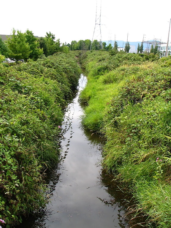
Stream in British Columbia, Canada. Still Creek is a long stream flowing across Central Burnaby, British Columbia and into Burnaby Lake. Still Creek's path lies mainly through the industrial area which contributes to its high level of pollution, although through dedicated work of local volunteers the creek is slowly recovering.
In 2006, the City of Burnaby approved a plan to reduce the amount of flooding in the Still Creek watershed (the low-lying area of Gilmore Avenue is heavily flooded every year) while improving fish and wildlife habitat.
There is considerable vegetation along the creek banks that serves as a habitat for great blue heron, red-tailed hawk, belted kingfisher, and even an occasional pheasant, as well as aquatic songbirds such as red-winged blackbird. Beavers have always maintained their presence while river otters are more recent inhabitants. Coastal cutthroat trout are gradually returning. In November 2012, for the first time in almost 80 years, numerous full-sized salmon have been observed returning to spawn in many parts of Still Creek.[7]
Robert Burnaby Park
Park in Burnaby, British Columbia. Robert Burnaby Park is a 48 hectare public park in East Burnaby, just south of Burnaby Lake, located off Edmonds and 4th Street in British Columbia, Canada. It has an extensive trail system, as well as tennis courts and a swimming pool in the cleared upper slope area. The north end of the park contains the Robert Burnaby Park Disc Golf Course, one of only a handful in Metro Vancouver. It is a favourite picnic spot for many residents of Burnaby and New Westminster. An off-leash zone is in the northern part of the park.
Ramsay Creek winds its way through the park, similar to many streams originating on the southern sloping hillside of Burnaby Lake and flowing into it.
The park is named for the colonial businessman Robert Burnaby, the founding father of Burnaby. It was created as a public works project during the Great Depression.[8]
Address: 6890 Hill Ave, V3N 3V3 Burnaby
Burnaby Mountain
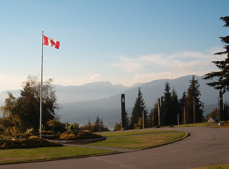
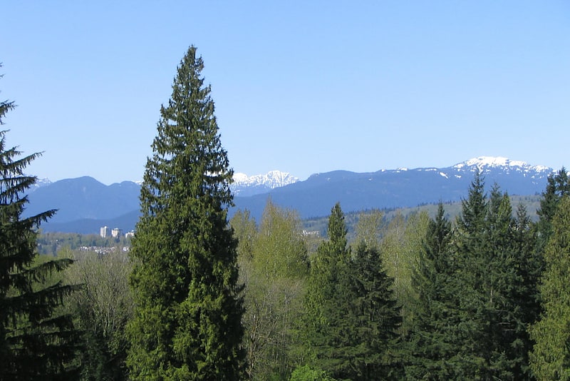
Mountain. Burnaby Mountain, elev. 370 m, is a low, forested mountain in the city of Burnaby, British Columbia, overlooking the upper arms of Burrard Inlet. It is the location of Simon Fraser University Burnaby Campus, the Discovery Park research community, and the System Control Tower of BC Hydro and a residential neighbourhood with retail shops development called UniverCity. In November 1995, the Province of British Columbia and Simon Fraser University reached an agreement to transfer 330 hectares of university land to the City of Burnaby for inclusion into Burnaby Mountain Conservation Area.[9]
CNR Bridge
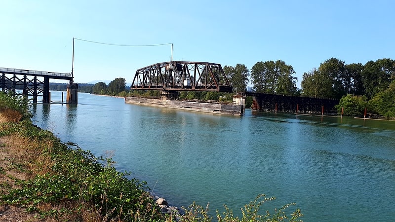
Swing bridge in Richmond, British Columbia. Opened in 1931, the Canadian National Railway steel truss swing span railway bridge over the north arm of the Fraser River in Metro Vancouver links Burnaby with Richmond and the south arm Vancouver Fraser Port Authority facilities on Lulu Island.
The Canadian Northern Railway (CNoR) had planned to lay track from the north end of the New Westminster Bridge and cross the Fraser at the 1931 location. However, when the CNoR opened the Lulu Island branch line in 1917, it connected with the British Columbia Electric Railway (BCER) Queensborough terminus. Since the original BCER Queensborough bridge was designed for trams, not heavy locomotives, the CNoR westward route 12.02 miles (19.34 km) to Steveston was an isolated branch line. After the CNR absorption of the bankrupt CNoR, the money-losing branch, and damage to trestles from a 1918 muskeg fire at Mile 4, terminated all services.
In July 1930, work began on sinking piers for the 4,200-foot-long bridge with a 240-foot central span. On completion in November 1931, work trains carried the steel rails across the bridge to lay 14 miles (23 km) of track for the Lulu Island industrial branch line. This comprised two north–south lines from west of the new bridge to connect with the remnants of the original east–west line at the south arm, with a scheduled completion date for the $2m project before yearend.
Owing to the proximity of several bridges on the Fraser, the unique signal for the opening of the Lulu Island Bridge was four long blasts on the vessel's horn.
In 2013, CN removed the observer-operators from three movable span bridges in the Lower Mainland comprising the Second Narrows, New Westminster and Lulu Island bridges, and now monitors river traffic by camera from a central location.
^a. The former BCER "Y" at today's Branscombe Court.[10]
Deer Lake
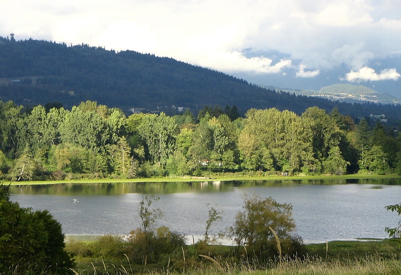
Lake in British Columbia, Canada. Deer Lake is a lake in central Burnaby, British Columbia, Canada. Deer Lake is home to a wide variety of flora and fauna and features a number of walking trails. These trails connect the lake and its surrounding forests and fields to a number of amenities, including a boat launch, picnic sites, a playground, washrooms, the Burnaby Art Gallery, Shadbolt Centre for the Arts, Burnaby Village Museum, and Century Gardens, as well as the surrounding community and long trails for walking.[11]
Forest Lawn Memorial Park
Cemetery in Burnaby, British Columbia. Forest Lawn Memorial Park is a cemetery in Burnaby, British Columbia in Canada. The burial park was founded in 1936 and the funeral home was established in 1965. The cemetery contains the war graves of 37 Commonwealth service personnel of World War II.[12]
Address: 3789 Royal Oak Ave, V5G 3M1 Burnaby
Deer Lake Boat Rentals
Nature, Natural attraction, Lake, Gear rental, Outdoor activities
Address: 5435 Sperling Ave, V5E 2T2 Burnaby
Simon Fraser University
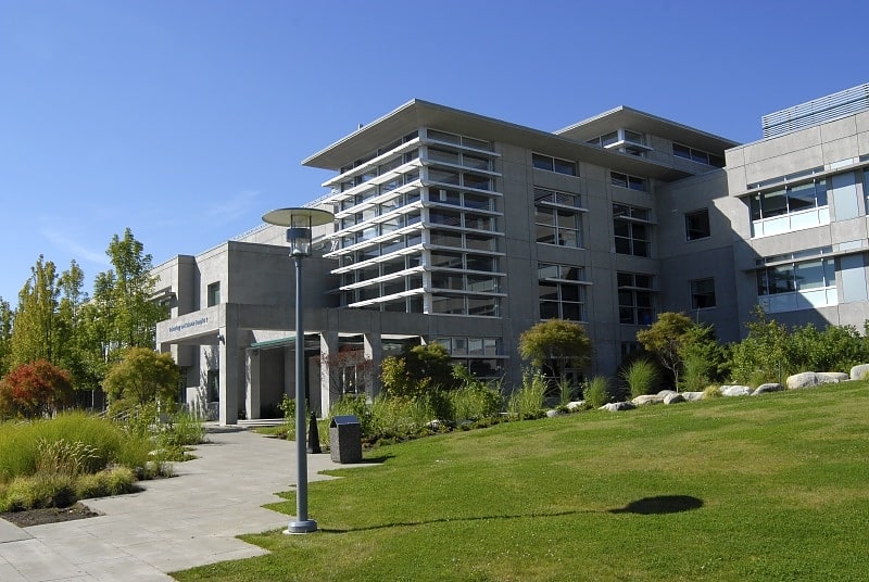
Public university in Burnaby, British Columbia. Simon Fraser University is a public research university in British Columbia, Canada, with three campuses: Burnaby, Surrey, and Vancouver. The 170-hectare main Burnaby campus on Burnaby Mountain, located 20 kilometres from downtown Vancouver, was established in 1965 and comprises more than 30,000 students and 160,000 alumni. The university was created in an effort to expand higher education across Canada.
SFU is a member of multiple national and international higher education associations, including the Association of Commonwealth Universities, International Association of Universities, and Universities Canada. SFU has also partnered with other universities and agencies to operate joint research facilities such as the TRIUMF, Canada's national laboratory for particle and nuclear physics, which houses the world's largest cyclotron, and Bamfield Marine Station, a major centre for teaching and research in marine biology.
Undergraduate and graduate programs at SFU operate on a year-round, three-semester schedule. Consistently ranked as Canada's top comprehensive university and named to the Times Higher Education list of 100 world universities under 50, SFU is also the first Canadian member of the National Collegiate Athletic Association, the world's largest college sports association. In 2015, SFU became the second Canadian university to receive accreditation from the Northwest Commission on Colleges and Universities. SFU faculty and alumni have won 43 fellowships to the Royal Society of Canada, three Rhodes Scholarships and one Pulitzer Prize. Among the list of alumni includes two premiers of British Columbia (Gordon Campbell and Ujjal Dosanjh), Vancouver Canucks owner Francesco Aquilini, Prime Minister of Lesotho Pakalitha Mosisili, Max Planck Institute director Robert Turner, and humanitarian and cancer research activist Terry Fox.[13]
Address: 8888 University Drive, Burnaby
Kensington Park
Park in Burnaby, British Columbia. Kensington Park is a large urban park in Burnaby, British Columbia, Canada. It is located between major roads running along its perimeter - Hastings Street, Curtis Street, Kensington Avenue and Holdom Avenue.
Kensington Park is adjacent to Burnaby North Secondary School with its several sports fields, among them soccer and baseball. Kensington Arena, a neighbourhood ice rink, is at the entrance to the park.
Kensington Park is mostly known for its pitch and putt facilities which attract many Burnaby golfers.
Beecher Creek, one of the streams in North Burnaby, winds its way through Kensington Park.[14]
Address: Holdom Ave, Burnaby