Discover 11 hidden attractions, cool sights, and unusual things to do in Glacier National Park (Canada). Don't miss out on these must-see attractions: Youngs Peak, Mount Swanzy, and Mount Rogers. Also, be sure to include Mount Afton in your itinerary.
Below, you can find the list of the most amazing places you should visit in Glacier National Park (British Columbia).
Table of Contents
Youngs Peak
Youngs Peak is a 2,815-metre glaciated mountain summit in Glacier National Park, in the Selkirk Mountains of British Columbia, Canada. It is 12 km south of Rogers Pass, 58 km northeast of Revelstoke, and 36 km west of Golden. The mountain was first climbed in 1898 by Charles Ernest Fay and Redt F. Curtis. The mountain's name was officially adopted February 8, 1977, by the Geographical Names Board of Canada. It is named for Mrs. Julia M. Young, the Glacier House manager from 1899 through 1920.[1]
Mount Swanzy
Mountain in British Columbia, Canada. Mount Swanzy is a 2,891-metre mountain summit located in Glacier National Park in the Selkirk Mountains of British Columbia, Canada. Mount Swanzy is surrounded by ice including the Bonney Glacier, Clarke Glacier, and Swanzy Glacier. Its nearest higher peak is Mount Bonney, 1.0 km to the west.[2]
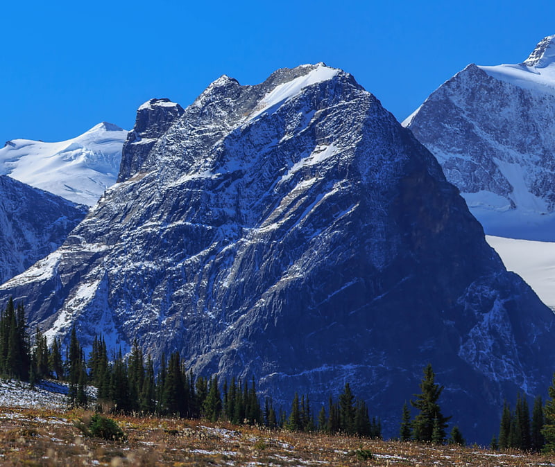
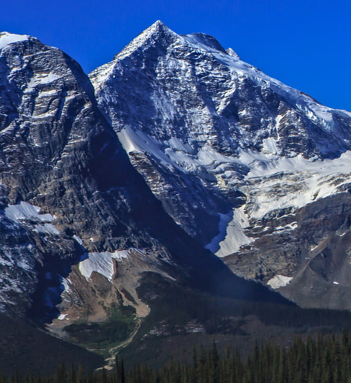
Mount Rogers
Massif in British Columbia, Canada. Mount Rogers, is a 3,169-metre massif located in Glacier National Park in the Selkirk Mountains of British Columbia, Canada. Mount Rogers is situated at the north end of the Hermit Range, and is the highest point of the range. Its nearest higher peak is Mount Sir Donald, 12.57 km to the southeast. The peak is prominently visible from eastbound Highway 1, the Trans-Canada Highway at Rogers Pass. The Rogers massif includes five individually-named summits: Rogers Peak, Grant Peak, Fleming Peak, Swiss Peak, and Truda Peaks. Numerous glaciers radiate from all sides, including the Rogers Glacier, Swiss Glacier, Tupper Glacier, and Hermit Glacier.[3]
Mount Afton
Mountain in British Columbia, Canada. Mount Afton is a 2,553-metre mountain summit located in Glacier National Park in the Selkirk Mountains of British Columbia, Canada. It is situated near the north end of Asulkan Ridge, 8 km south of Rogers Pass, 56 km northeast of Revelstoke, and 40 km west of Golden.
The first ascent of the mountain was made in 1893 by Herbert Lambert, Miss MacLeod, Harold A. Perley, William H. Rau, and William Stables via the east buttress.
The mountain was climbed in 1895 via the south ridge by Philip Stanley Abbot, Charles Ernest Fay, and Charles S. Thompson who named the mountain after themselves using an amalgamation of letters from their surnames, ("A"bbot "F"ay "T"homps"on").
The mountain's name was officially adopted March 31, 1924, when approved by the Geographical Names Board of Canada.[4]
Arthur O. Wheeler hut
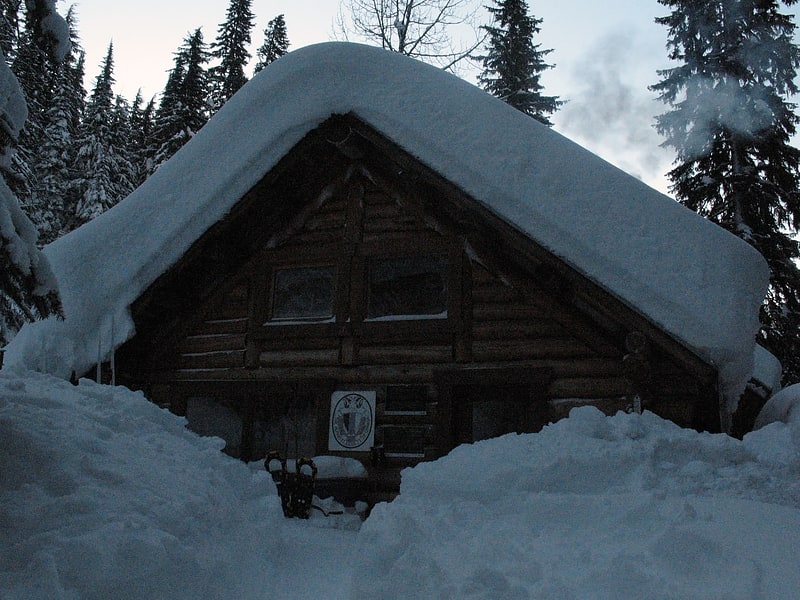
Mountain cabin in British Columbia, Canada. The Arthur O. Wheeler hut is an alpine hut located four km southwest of Rogers Pass in Glacier National Park, British Columbia. Although not truly a backcountry hut, this log cabin is situated conveniently close to the Trans-Canada Highway in the Selkirk Mountains, west of the Rocky Mountains. It is often used as a base for mountaineering, hiking, and ski touring into the Asulkan Range and Illecillewaet Glacier areas south of the highway, and the Hermit Range north of the highway. The hut is maintained by the Alpine Club of Canada. It is the only ACC hut which can be reached by vehicle.[5]
Cheops Mountain
Mountain in British Columbia, Canada. Cheops Mountain, is a 2,581-metre mountain summit located in Glacier National Park in the Selkirk Mountains of British Columbia, Canada. Cheops Mountain is situated in the Hermit Range, and the summit provides a good view of the Hermit and Sir Donald Ranges. Its nearest higher peak is Ursus Major Mountain, 4.0 km to the northwest. Cheops is visible from Highway 1, the Trans-Canada Highway at Rogers Pass.[6]
Mount Sifton
Mountain in British Columbia, Canada. Mount Sifton is a 2,922-metre mountain summit located in Glacier National Park, in the Hermit Range of the Selkirk Mountains in British Columbia, Canada. Mount Sifton is situated 58 km northeast of Revelstoke, and 41 km west of Golden. It is also set 2.35 km north-northeast of Grizzly Mountain, and 4.5 km northwest of Rogers Pass from which it can be seen from the Trans-Canada Highway. The nearest higher peak is Mount Rogers, 2.17 km to the north-northeast. The first ascent of the mountain was made September 3, 1900, by Arthur Michael, Edward Feuz, and Friedrich Michel via the southeast ridge. The peak's name honors Sir Clifford Sifton, Canadian Minister of the Interior from 1896 through 1905. The mountain's name was adopted in 1906, then re-approved September 8, 1932, by the Geographical Names Board of Canada.[7]
Ursus Minor Mountain
Mountain in British Columbia, Canada. Ursus Minor Mountain is a 2,749-metre mountain summit located in Glacier National Park, in the Hermit Range of the Selkirk Mountains in British Columbia, Canada. Ursus Minor Mountain is situated 56 km northeast of Revelstoke, and 44 km west of Golden. It is also set 3.5 km northwest of Cheops Mountain, and 4 km west of Rogers Pass. Its nearest higher peak is Grizzly Mountain, 1.27 km to the east-northeast. The first ascent of the mountain was made in 1907 by Rupert W. Haggen, with guide Edouard Feuz Jr. The mountain's name was adopted in 1906, then re-approved September 8, 1932, by the Geographical Names Board of Canada. It was so-named because of its proximity above Bear Creek, and in keeping with the bear theme of other nearby features such as Ursus Major Mountain, Grizzly Mountain, Bruins Pass, and Balu Pass.[8]
Mount Topham
Mountain in British Columbia, Canada. Mount Topham, is a 2,872-metre mountain summit located in Glacier National Park of British Columbia, Canada. It is part of the Selkirk Mountains range. The mountain is a remote 60 km east of Revelstoke, and 32 km southwest of Golden. Its nearest higher peak is Mount Selwyn, 2.66 km to the west. Mount Topham is situated along the western edge of the Deville Glacier. Precipitation runoff from the mountain drains into the Beaver River. Mount Topham was named in 1902 by Arthur Oliver Wheeler to honor Harold Ward Topham, an English mountaineer who explored and mapped the Selkirks. The mountain's name was officially adopted September 8, 1932, by the Geographical Names Board of Canada. Based on the Köppen climate classification, Mount Topham is located in a subarctic climate zone with cold, snowy winters, and mild summers. Temperatures can drop below −20 °C with wind chill factors below −30 °C.[9]
Mount Selwyn
Mountain in British Columbia, Canada. Mount Selwyn, is a 3,335-metre mountain summit located in Glacier National Park of British Columbia, Canada. It is part of the Selkirk Mountains range. The mountain is situated 60 km east-northeast of Revelstoke, and 35 km southwest of Golden. Its nearest higher peak is Mount Dawson, 1 km to the west. Originally named Deville in 1888 by mountaineer Rev. William S. Green, Mount Selwyn was renamed to honor Alfred Richard Cecil Selwyn, director of the Geological Survey of Canada, and President of the Royal Society of Canada. The mountain's name was officially adopted September 8, 1932, by the Geographical Names Board of Canada. The first ascent of the mountain was made in 1890 by Harold E. Forster, Harold Ward Topham, Harry Sinclair, and Samuel Yves.[10]
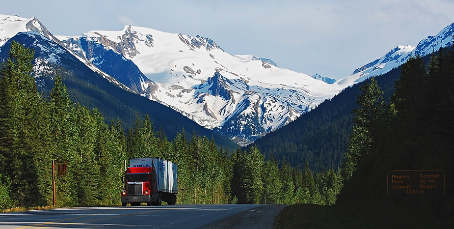
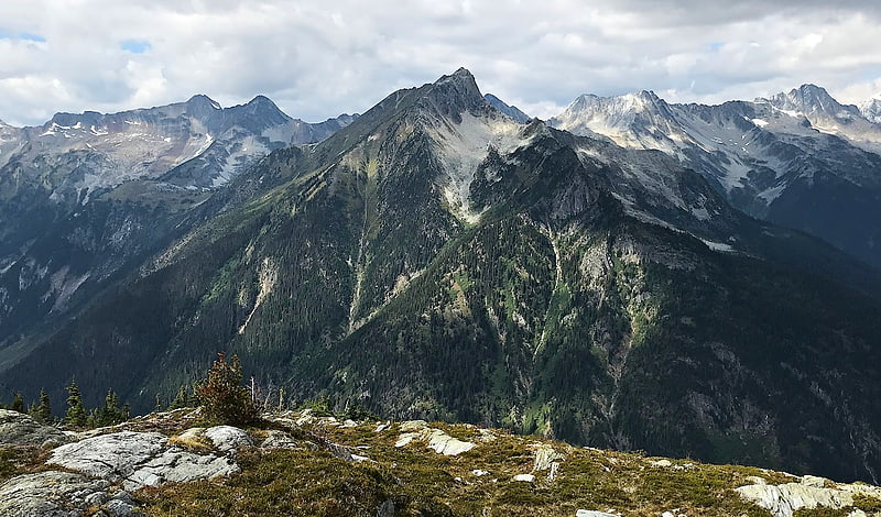
Rogers Pass
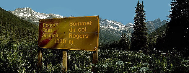
Mountain pass with history exhibits. Rogers Pass is a high mountain pass through the Selkirk Mountains of British Columbia, but the term also includes the approaches used by the Canadian Pacific Railway and the Trans-Canada Highway. In the heart of Glacier National Park, this tourism destination since 1886 is a National Historic Site.[11]
Address: 9520 Trans-Canada Highway, V0E 2S0 Rogers Pass