Discover 11 hidden attractions, cool sights, and unusual things to do in Kootenay National Park (Canada). Don't miss out on these must-see attractions: Numa Falls, Floe Lake, and Mount Fay. Also, be sure to include Mount Selkirk in your itinerary.
Below, you can find the list of the most amazing places you should visit in Kootenay National Park (British Columbia).
Table of Contents
Numa Falls
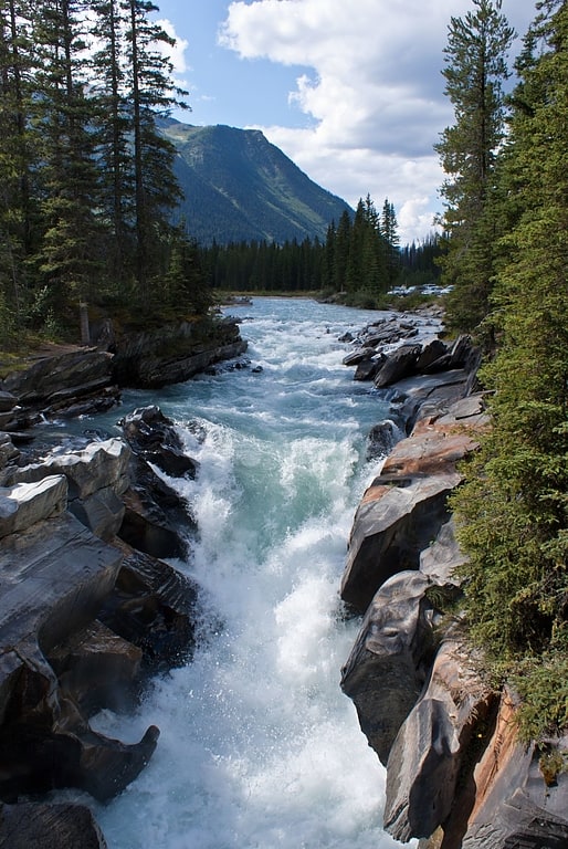
Numa Falls is a waterfall of the Vermilion River located in Kootenay National Park, British Columbia, Canada.
It is accessible via a short drive off the Banff–Windermere Highway 93 that connects Banff National Park and Radium Hot Springs. While not a large waterfall, it is easily accessible directly by the roadside, travelling south from Marble Canyon.[1]
Address: Kootenay Highway 93, Kootenay National Park
Floe Lake
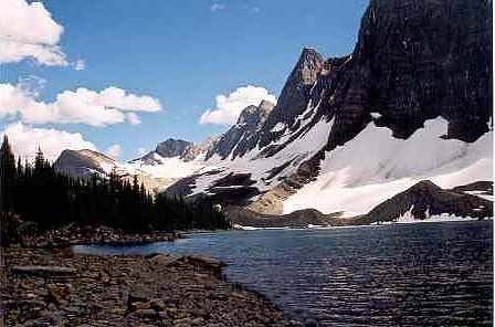
Lake in British Columbia, Canada. Floe Lake is a lake in Kootenay National Park, British Columbia, Canada. The lake is only accessible by a 10.7 km hiking trail that leaves from a marked trailhead on highway 93.
There is a backcountry campground at the lake as well as a Warden's cabin staffed by Parks Canada.
An image of Floe Lake appears on the wall of the International Arrivals at Customs Canada in the Calgary International Airport.[2]
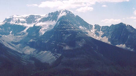
Mount Fay
Mountain in Alberta, Canada. Mount Fay is a mountain located on the border of Alberta and British Columbia on the Continental Divide in the Canadian Rockies. The mountain forms part of the backdrop to Moraine Lake in the Valley of the Ten Peaks of Banff National Park. It was named in 1902 by Charles E. Fay, an early explorer of the Canadian Rockies. He was a member of the party who attempted Mount Lefroy in 1896 when the first mountaineer to be killed in the Canadian Rockies occurred.[3]
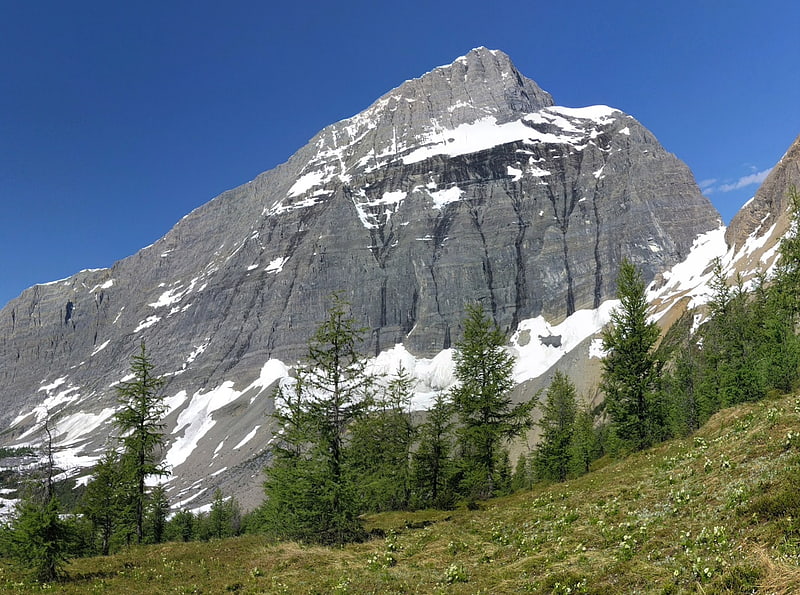
Mount Selkirk
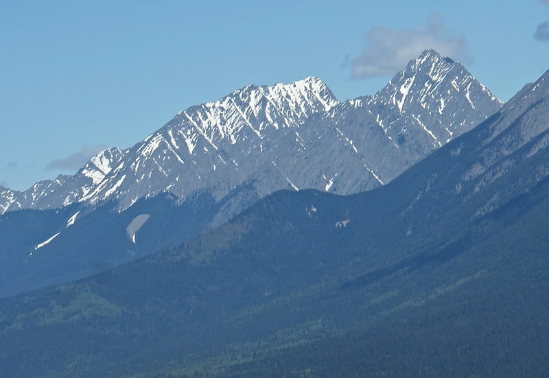
Mount Selkirk is a 2,930-metre mountain summit located in the Vermilion River Valley along the eastern border of Kootenay National Park. Park visitors can see the peak from Highway 93, also known as the Banff–Windermere Highway. It is part of the Mitchell Range, which is a sub-range of the Canadian Rockies of British Columbia, Canada. Its nearest higher peak is Catlin Peak, 1.6 km to the northwest.[4]
Marble Canyon
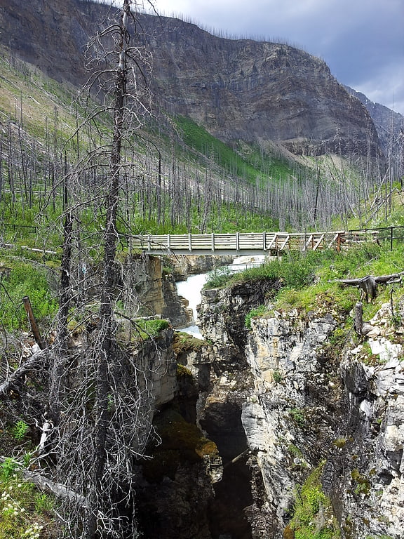
Campground in British Columbia, Canada. Marble Canyon is a canyon surrounding Tokumm Creek just above its confluence with the Vermilion River, at the north end of Kootenay National Park in the Canadian Rockies of British Columbia, Canada. South of Marble Canyon on Highyway 93 is Numa Falls on the Vermillion River.
" joins Vermillion River through a magnificent gorge, or box canyon, so narrow that at several places the fissure, for it seems little more than a crack in the rock strata, is bridged by great boulders that have become wedged across it. It was a feature well worth seeing."[5]
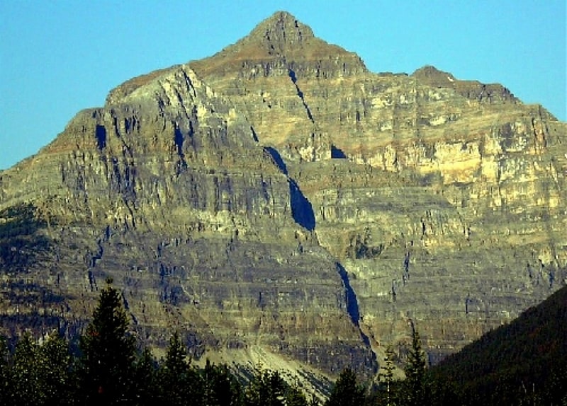
Stanley Peak
Mountain in British Columbia, Canada. Stanley Peak is a 3,155-metre mountain located in the Ball Range, at the northeastern section of Kootenay National Park, in the Canadian Rocky Mountains. The mountain was named in 1901 by its first climber, the English explorer Edward Whymper, after Frederick Stanley, 16th Earl of Derby, the sixth Governor-General of Canada. There are sources that date the naming in 1912 after Stanley H. Mitchell, Secretary-Treasurer of Alpine Club of Canada.
The peak is visible from the Trans-Canada Highway and Highway 93. Stanley Glacier on the northeast face of the peak can be seen up close by following a hiking trail into a hanging valley between the peak and a southern outlier of Storm Mountain.
Stanley Peak can be ascended from a scrambling route by late summer but involves much routefinding among the many ledges and gullies on the north face. Climbing routes (UIAA III) travel the north and northeast faces.[6]
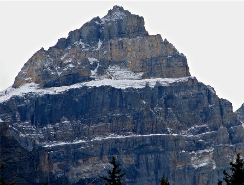
Mount Whymper
Mountain in British Columbia, Canada. Mount Whymper, 2,844 m, is a mountain located in the Canadian Rockies, British Columbia, Canada, in the Vermilion Pass area in Kootenay National Park.
The mountain is named for its first conqueror, the English alpinist, explorer, writer and engraver Edward Whymper.
In 1901, Whymper and his four guides (Joseph Bossoney, Christian Kaufmann, Christian Klucker, and Joseph Pollinger) first climbed Mount Whymper. It was renamed to honour him. It had been named "Mount Lefroy". Whymper was exploring the area sponsored by Canadian Pacific Railway (CPR) to promote the Canadian Rocky Mountains and the railway in his conferences.
There is another Mount Whymper, (1539 m – 48.95111°N 124.16194°W / 48.95111; -124.16194) in British Columbia, on Vancouver Island, named for Edward's brother Frederick Whymper.[7]
Mount Perren
Peak in Alberta, Canada. Mount Perren is located on the border of Alberta and British Columbia on the Continental Divide. It was named in 1968 after Walter Perren, a Swiss climbing guide and Parks Canada service warden. The peak forms part of the backdrop to Moraine Lake in the Valley of the Ten Peaks of Banff National Park.[8]
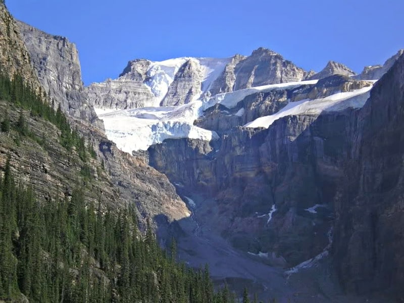
Foster Peak
Foster Peak is a 3,201-metre mountain summit located on the western border of Kootenay National Park. It is the highest point in the Vermilion Range, a sub-range of the Canadian Rockies of British Columbia, Canada. Its nearest higher peak is Mount Ball, 14.96 km to the northeast. The mountain is part of what is known as The Rockwall. Floe Lake, southeast of the peak, is one of the beauty spots of Kootenay National Park. The area is accessible via the Floe Lake Trail and Rockwall Trail. The Rockwall Trail is a scenic 55 kilometre traverse of alpine passes, subalpine meadows, hanging glaciers, and limestone cliffs, in some places in excess of 900 metres above the trail.[9]
Mount Little
Mount in British Columbia, Canada. Mount Little is located at the Northern end of Kootenay National Park on the border of Alberta and British Columbia. It was named in 1916 after George F. Little, a member of the first ascent party.[10]
Boom Mountain
Mountain in Alberta, Canada. Boom Mountain is located north of Vermilion Pass on the border of Alberta and British Columbia on the Continental Divide. It was named in 1908 after Boom Lake which is located right under the mountain. When viewed by an Alpine Club of Canada expedition, a buildup of logs on the lake resembled a log boom.[11]