Discover 4 hidden attractions, cool sights, and unusual things to do in Whaley Bridge (United Kingdom). Don't miss out on these must-see attractions: Bugsworth Basin, Toddbrook Reservoir, and Upper Goyt Valley. Also, be sure to include Whaley Bridge Memorial Park in your itinerary.
Below, you can find the list of the most amazing places you should visit in Whaley Bridge (England).
Table of Contents
Bugsworth Basin
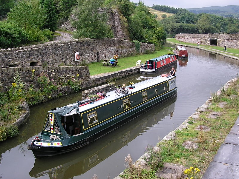
Bugsworth Basin is a canal basin at the terminus of the Peak Forest Canal. It is located at Buxworth in the valley of the Black Brook, close to Whaley Bridge. It was once a busy interchange with the Peak Forest Tramway, for the transport of limestone and burnt lime.
Work on the restoration of the derelict Bugsworth Basin, a Scheduled Ancient Monument since 1977, commenced in 1968. Volunteers of the Inland Waterways Protection Society (IWPS) helped by the Waterway Recovery Group (WRG) and many locals restored parts of this important site over three decades. The IWPS obtained a 50-year lease in 1992, which allowed them to restore, manage and operate the basin. Funding for the improvements came from British Waterways, the European Regional Development Fund and a Derelict Land Grant from Derbyshire County Council. The basin was reopened to boats at Easter 1999, and a significant increase in the use of the canal occurred. However, this was the first time that powered boats had used the basin, and the dry-stone walling with clay puddling deteriorated rapidly. Walls collapsed, there were several near breaches, and a breach resulted in the basin closing again in October 1999. British Waterways restored pedestrian access to the basin by carrying out emergency repairs.
In 2005 the basin reopened to boat traffic after a £1.2 million restoration, undertaken by British Waterways working with the IWPS. Work included sealing the bottom of the basin to stop leakage, stonework repair and environmental measures to conserve the site's protected water vole population. Although restoration and reopening of the basin has been achieved, waterways enthusiasts want to make future improvements and developments. These include an interpretative exhibition about Bugsworth's history and reopening part of the tramway.
Bugsworth Basin was officially reopened on 26 March 2005 when 94 narrowboats attended the opening ceremony. The opening was performed by Tom Levitt, the then member of parliament for High Peak.
The basin is situated on the fringe of the Peak District National Park and the purpose of the restoration was to develop this industrial heritage site as a tourist centre.[1]
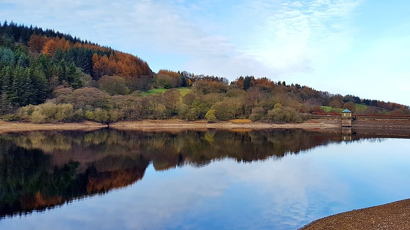
Toddbrook Reservoir
Reservoir in England. Toddbrook Reservoir, a feeder for the Peak Forest Canal, opened in 1838. It is sited above the town of Whaley Bridge in the Derbyshire High Peak area of England. The reservoir is a Site of Special Scientific Interest providing habitats for herons, ducks and other animals and fish, while rare mosses and liverworts grow on its shores, particularly short-lived species that grow on seasonally exposed mud. The reservoir is used for sailing and angling. The Peak District Boundary Walk runs around the eastern end of the reservoir. The reservoir is owned by the Canal & River Trust and, like the nearby Combs Reservoir, is a feeder reservoir for the Peak Forest Canal. The feeder runs through Whaley Bridge, and with the Combs feed enters the canal system in a pool close to the transhipment shed at the Whaley Bridge canal basin.
The reservoir is fed from the Todd Brook, a stream which has a catchment area of around 1,700 hectares (4,200 acres) including the moorland on Shining Tor and farmland around Kettleshulme village. Water enters the reservoir on its north bank via a small waterfall. The first several inches of water do not flow into the reservoir but flow down the reservoir's run-off into the River Goyt. The reservoir often receives little or no inflow during periods when rainfall does not allow the level to exceed the barrier, and this often affects the reservoir's water level, particularly in the summer months.
The reservoir's dam is built from earth with a puddle clay core. The embankment is straight in plan and approximately 310m long. The average crest level is 187.3 metres (615 ft) AOD. In August 2019, concrete panels on its spillway were dislodged after heavy rain, triggering the evacuation of parts of Whaley Bridge and the surrounding area due to the possibility of the dam collapsing.[2]
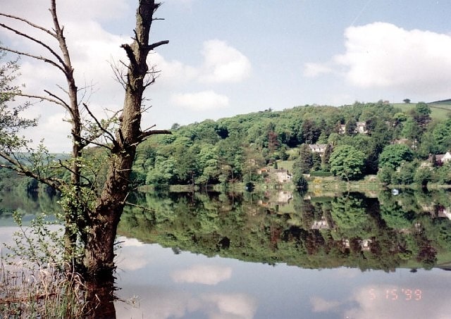
Upper Goyt Valley
The Upper Goyt Valley is the southern section of the valley of the River Goyt in North West England.[3]
Whaley Bridge Memorial Park
Relax in park, Park
Address: Wheatsheaf Road, Whaley Bridge