Discover 10 hidden attractions, cool sights, and unusual things to do in Nidderdale AONB (United Kingdom). Don't miss out on these must-see attractions: How Stean Gorge, Hack Fall Wood, and Nidd Aqueduct. Also, be sure to include Felliscliffe in your itinerary.
Below, you can find the list of the most amazing places you should visit in Nidderdale AONB (England).
Table of Contents
How Stean Gorge
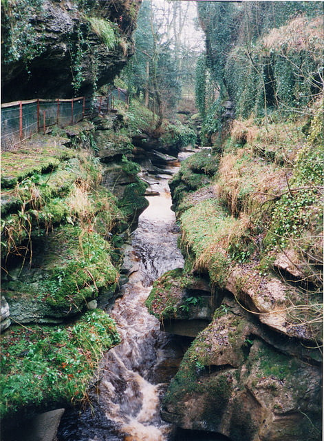
How Stean Gorge is a limestone gorge in Nidderdale in North Yorkshire, England. It forms a unit of the Upper Nidderdale Site of Special Scientific Interest. The gorge lies between the villages of Stean and Lofthouse and extends for about a kilometre along the course of How Stean Beck, a tributary of the River Nidd.
The limestone here is an inlier in the millstone grit which prevails on the surface in Nidderdale. It is a subaerial gorge, some 15 to 20 metres deep, to which a series of vadose caves drain, a reversal of the usual pattern of underwater capture in a karst landscape.
One of the side caves, Tom Taylor's Cave, is said to be named after a local highwayman who sought refuge there. It leads from the north side of the gorge and emerges in a nearby field.
The gorge and Tom Taylor's Cave have been operated as a tourist attraction since the 19th century. The attraction now offers gorge walks and access to the cave, and also canyoning and a via ferrata.[1]
Hack Fall Wood
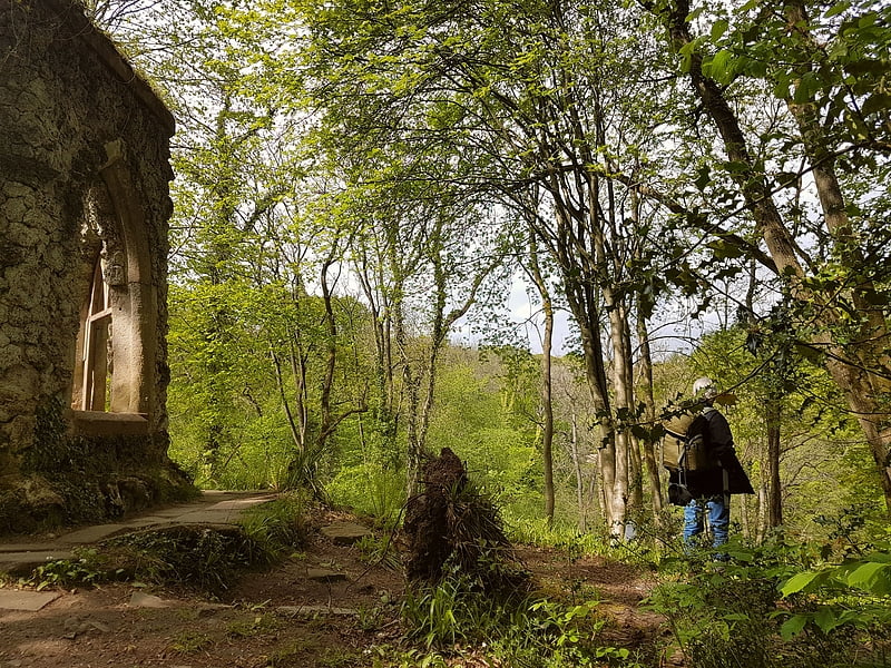
Hack Fall Wood, otherwise known as Hackfall, is a Site of Special Scientific Interest, or SSSI, of 44.8687 hectares, lying north-east of the village of Grewelthorpe, North Yorkshire, England. During the 18th century it was landscaped in the picturesque style by landowner William Aislabie, who created views by engineering streams and pools, planting trees and building follies. Turner and Gilpin painted it, and pictures of it featured on Catherine the Great's 1773 Wedgwood dinner service. Some 19th century writers called it "one of the most beautiful woods in the country."
Following 20th century clear-felling and natural regeneration of trees, the Woodland Trust purchased the property in 1989. The site was designated as an SSSI in the same year. Together with the Hackfall Trust and the Landmark Trust, the Woodland Trust restored footpaths, conserved the remaining follies and managed the wildlife habitat according to its SSSI status.
The woodland supports varied wildlife, including many birds, animals and flowering plants, plus more than 200 species of liverworts and mosses, and two rare creatures: the beetle Platycis minutus and the lemon slug, which lives only in ancient woodland. The site is now listed as a Conservation Area, and as Ancient Semi-Natural Woodland (ASNW). The woodland is open to the public and has many summer visitors, although the only public facility is a car park.[2]
Nidd Aqueduct
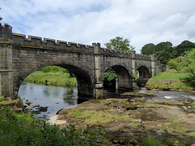
The Nidd Aqueduct is an aqueduct or man-made watercourse in North Yorkshire, England. It feeds water from Angram and Scar House reservoirs in upper Nidderdale, North Yorkshire 32 mi to Bradford in West Yorkshire. The aqueduct supplies 21,000,000 imp gal of water per day to Chellow Heights water treatment works. The aqueduct and the reservoirs it connects to are all maintained by Yorkshire Water.[3]
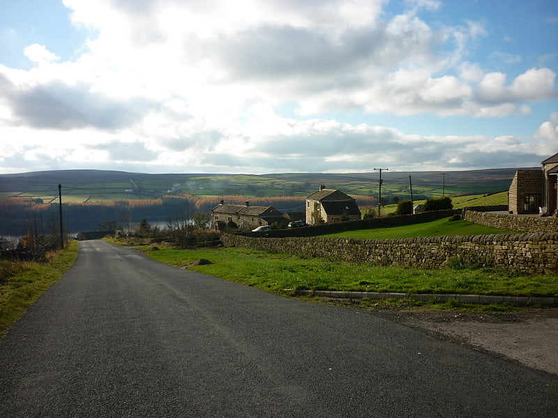
Felliscliffe
English civil parish. Felliscliffe is a civil parish in North Yorkshire, England, in Nidderdale, Harrogate borough. The population of the civil parish at the 2011 census was 283. The principal settlement in the parish is the village of Kettlesing, and the parish also includes the hamlet of Swincliffe.[4]
Thruscross
Thruscross is a small settlement and civil parish in the Harrogate district of North Yorkshire, England. It lies in the Washburn Valley, 11 miles west of Harrogate. The parish includes Thruscross Reservoir and a large area of moorland west of the reservoir.
Thruscross was historically a township in the ancient parish of Fewston. The township included the hamlets of Bramley Head, West End and Low Mill, and in the 19th century there were several flax mills in the township. It became a separate civil parish in 1866. The population of the parish is estimated at 90.
Thruscross Reservoir was constructed in the 1960s, and flooded the hamlet of West End.[5]
Hartwith cum Winsley
English civil parish. Hartwith cum Winsley is a civil parish in Harrogate district, North Yorkshire, England. Historically it was a township in the ancient parish of Kirkby Malzeard in the West Riding of Yorkshire, a detached part of that parish. It became a separate civil parish in 1866, and was transferred to North Yorkshire in 1974.
The main settlement in the parish is the village of Summerbridge. The parish also includes the hamlets of Low Laithe, New York, Smelthouses, Brimham and Hartwith. Winsley consists of some scattered houses and farms in the east of the parish. In 2015 the population of the parish was estimated at 1,020.
The parish occupies the north side of lower Nidderdale. In the north of the parish are Brimham Rocks.
In the Middle Ages, Hartwith cum Winsley (then known as Brimham) formed part of the lands of Fountains Abbey, which established granges at Wise Ing (near Smelthouses), Braisty Woods, Brimham Grange and Brimham Park. At Brimham Grange there was a chapel, where local recusants kept a Catholic priest in the late 16th century. In the 18th century Brimham Hall was built on the site of Brimham Grange and is now a Grade II listed building. Brimham Park was used by the abbots as a hunting lodge. It was replaced in 1661 by a substantial house now known as Brimham Lodge, which is a Grade I listed building.[6]
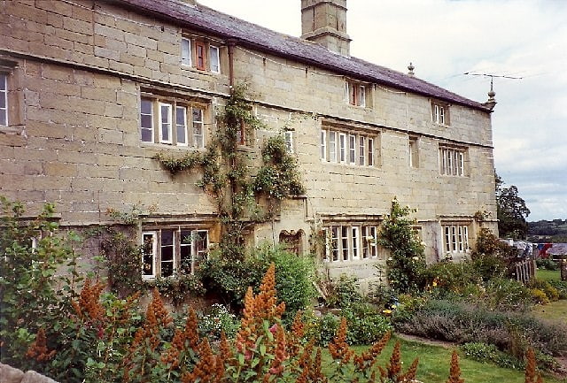
Swarcliffe Hall
Building in England. Swarcliffe Hall is a large hall that was constructed in 1800 in Birstwith, near Harrogate, England. The current house was built by John Greenwood in 1850, who engaged Major Rohde Hawkins as his architect, and is a Grade II listed building.[7]
Warsill
Human settlement in England. Warsill is a settlement and civil parish in the Harrogate district, in the county of North Yorkshire, England. It consists of a few scattered farms 5 miles north west of Ripon. In 1961 the population of the parish was 42. The population was estimated at 70 in 2015.
Warsill was historically an extra parochial area. It became a civil parish in 1858. Today it shares a grouped parish council with Bishop Thornton.
The toponym, first recorded in 1132 as Warthsala, probably derives from the Old English weard sæl, meaning "watch castle". In the Middle Ages there was a grange of Fountains Abbey here, and Warsill Hall Farmhouse, a 17th-century Grade II listed building, now stands on its site.[8]
Stonebeck Up
English civil parish. Stonebeck Up is a civil parish in Harrogate district, North Yorkshire, England. The only village in the parish is Middlesmoor. The population of the parish in the 2011 census was 119.
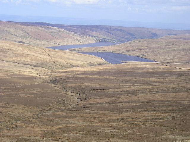
The parish occupies the highest part of Nidderdale. It is bounded on the south side by Stean Beck, from which the parish takes its name (stean being a dialect form of "stone"), and which separates it from the parish of Stonebeck Down. To the west and north it is bounded by a ridge, including the summits of Great Whernside and Little Whernside, and to the east it is bounded by Masham Moor, a ditch known as Mere Dike, and the River Nidd. The parish includes Angram and Scar House Reservoirs, and large areas of grouse moor.
Historically Stonebeck Up was a township in the ancient parish of Kirkby Malzeard in the West Riding of Yorkshire. In the Middle Ages it formed part of the lands of Byland Abbey, which established granges at Middlesmoor, Limley, Newhouses, Woodale, Lodge, Angram, Haden Carr and Scar House. The granges survived as farming communities into the twentieth century. Angram and Haden Carr were submerged by the reservoirs, and Lodge was abandoned when Scar House Reservoir was constructed in the 1920s.
Stonebeck Up became a separate civil parish in 1866, and was transferred from the West Riding to North Yorkshire in 1974. The parish now shares the Upper Nidderdale grouped parish council with the parishes of Stonebeck Down and Fountains Earth.[9]
Fountains Earth
English civil parish. Fountains Earth is a civil parish in Harrogate district, North Yorkshire, England. The principal village in the parish is Lofthouse, and the parish also includes the hamlet of Bouthwaite and the northern part of the village of Wath. The population of the parish in the 2011 census was 197.
The parish occupies the eastern side of upper Nidderdale. It is bounded on the west by the River Nidd and Gouthwaite Reservoir, which separate the parish from Stonebeck Up and Stonebeck Down. In Wath, at the southern end of the parish, a stream known as Dauber Gill separates the parish from High and Low Bishopside. To the north and east large areas of grouse moor extend into the neighbouring parishes of Ilton cum Pott and Laverton.
Historically Fountains Earth was a township in the ancient parish of Kirkby Malzeard in the West Riding of Yorkshire. The township took its name from Fountains Abbey, which owned the land in the Middle Ages and established granges at Lofthouse, Bouthwaite and other places in the township. Fountains Earth became a civil parish in 1866, and in 1974 became part of the new Harrogate district in North Yorkshire. The parish now shares the Upper Nidderdale grouped parish council with the parishes of Stonebeck Down and Stonebeck Up.[10]