Discover 11 hidden attractions, cool sights, and unusual things to do in Wells Gray Provincial Park (Canada). Don't miss out on these must-see attractions: Helmcken Falls, Spahats Creek Falls, and Baileys Chute. Also, be sure to include Canim Falls in your itinerary.
Below, you can find the list of the most amazing places you should visit in Wells Gray Provincial Park (British Columbia).
Table of Contents
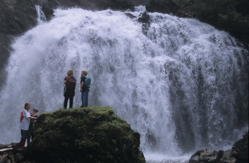
Helmcken Falls
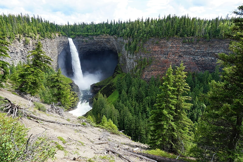
Stunning waterfall with viewing platform. Helmcken Falls is a 141 m waterfall on the Murtle River within Wells Gray Provincial Park in British Columbia, Canada. The protection of Helmcken Falls was one of the reasons for the creation of Wells Gray Provincial Park in 1939.
Helmcken Falls is the fourth highest waterfall in Canada, measured by total straight drop without a break. Higher Canadian waterfalls are Hunlen Falls in Tweedsmuir Provincial Park, Takakkaw Falls in Yoho National Park, and Della Falls in Strathcona Provincial Park, all in British Columbia.
There are six other waterfalls on the Murtle River, upstream from Helmcken Falls. The others are The Mushbowl, Dawson Falls, Majerus Falls, Horseshoe Falls, Meadow Falls and McDougall Falls. Only Helmcken, The Mushbowl and Dawson can be reached by road. Majerus, Horseshoe and McDougall Falls are accessed by trails. Meadow Falls is very difficult to view, except by air.[1]
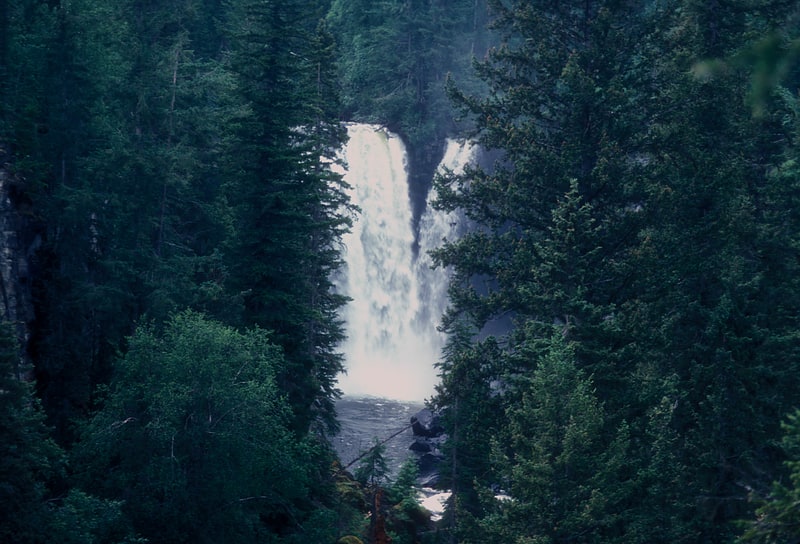
Spahats Creek Falls
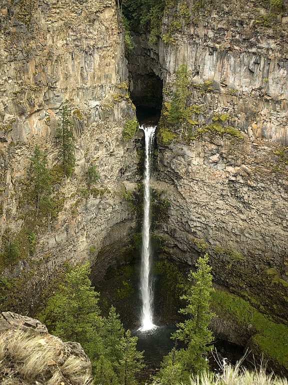
Waterfall in British Columbia, Canada. Spahats Creek Falls, also called Spahats Falls, is a waterfall on Spahats Creek within Wells Gray Provincial Park of British Columbia, Canada. Common references place the falls at around 60 m tall, but taking into account the second tier, it is closer to 75–80 meters tall. It is a popular stop for tourists and especially motorcoach tours since it is only 10 km off the busy Yellowhead Highway.
Spahats Creek rises from snowmelt and springs at a pass between Raft Mountain and Trophy Mountain. It flows 15 km west before tumbling over Spahats Falls and entering the Clearwater River.
Spahats is the First Nations term for bear and the stream was long known as Bear Creek. When the first accurate topographical map of the Clearwater Valley was published in 1953, it labelled the stream as “Bear Creek” and the falls as “Spahats (Bear) Creek Falls”. By the late 1960s, “Spahats” had become an accepted alternative due to the large number of Bear creeks in British Columbia and was officially adopted.
These impressive natural features used to be protected as tiny Spahats Creek Provincial Park, but in 1997 the boundaries of Wells Gray Provincial Park were expanded south along the Clearwater River and included Spahats. Tourists today see the anomaly of a "Wells Gray Park" entrance sign beside the road just south of Spahats Creek and another, more elaborate, sign 25 km (15.5 mi) further north. Spahats Creek Park used to have its own 20-unit campground with an attractive location deep in an old-growth forest, but in 2006 it was closed and converted into a gigantic parking lot.[2]
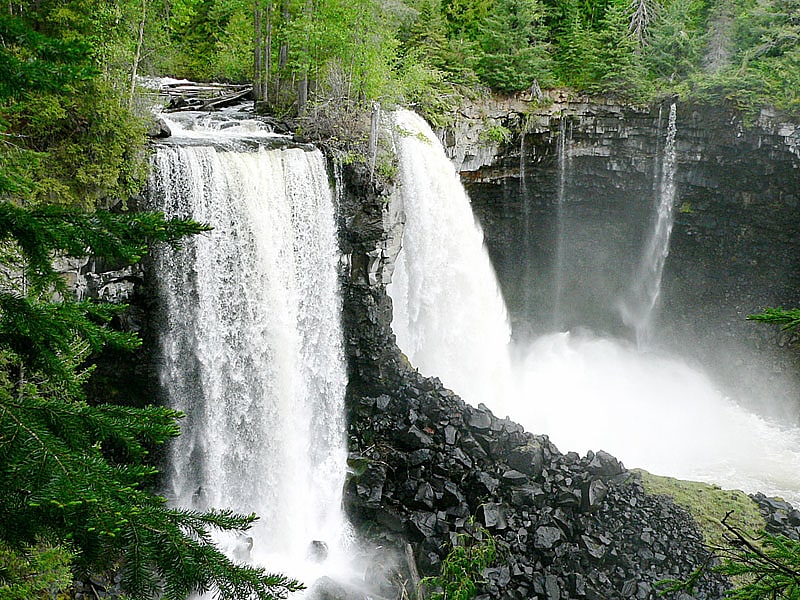
Baileys Chute
Baileys Chute, often misspelled Bailey's Chute, is one in a series of small waterfalls along the Clearwater River in Wells Gray Provincial Park, British Columbia, Canada. With an average high flow rate of 122 m3/s, it is one of the largest waterfalls in British Columbia.[3]
Canim Falls
Waterfall in British Columbia, Canada. Canim Falls is a 23 metre high waterfall on the Canim River between Canim Lake and Mahood Lake in Wells Grey Provincial Park in the Cariboo region of the Central Interior of British Columbia, Canada. The waterfall has eroded steadily upstream and created a 4 km long canyon cut into a lava plateau associated with the Wells Gray-Clearwater volcanic field.
A trail from Mahood Lake Road leads to Canim Falls and nearby Mahood Falls.
"Canim" means a type of large canoe in the Chinook Jargon.[4]
Murtle Lake
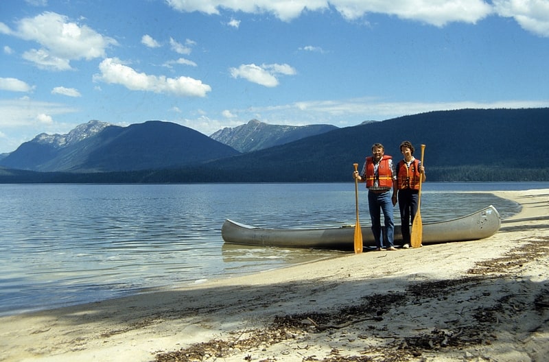
Lake in British Columbia, Canada. Murtle Lake is a lava dammed lake located in Wells Gray Provincial Park, east-central British Columbia, Canada. It is fed primarily by the Murtle River which rises from a large unnamed glacier in the Cariboo Mountains at an elevation of 2,300 m and flows southwest for 18 km to the lake. The Murtle River also drains Murtle Lake then flows southwest for 36 km into the Clearwater River.
Murtle Lake looks like a reversed letter 'L' with two arms. The North Arm extends fjord-like deep into the Cariboo Mountains. The West Arm, which attracts the most visitors, has extensive sandy beaches, many coves and three islands. The Wavy Range rises above the east shore of the north arm. Central Mountain occupies the bend between the two arms. The valley of Stevens Lakes extends to the south towards Battle Mountain.
In 1968, about 40% of Wells Gray Park or 525,680 acres (212,735 ha) was set aside as the Murtle Lake Nature Conservancy and gave this area a high level of protection from development. Two years later, motorboats and aircraft were banned and today Murtle Lake is the largest lake in North America where only canoes and kayaks are allowed.[5]
Kostal Lake
Lake in British Columbia, Canada. Kostal Lake is a lake located in Wells Gray Provincial Park, east-central British Columbia, Canada. It is located west of Murtle Lake and east of Clearwater Lake.[6]
Dawson Falls
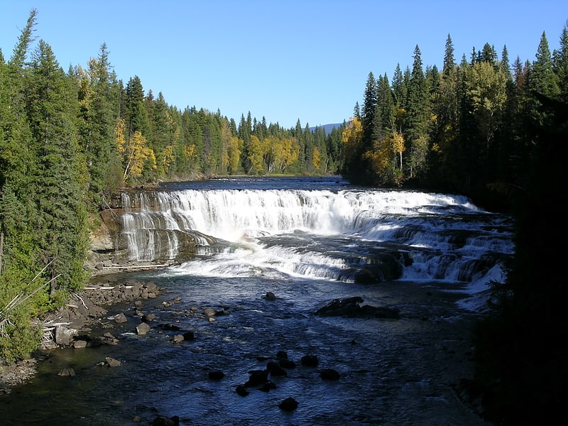
Waterfall in British Columbia, Canada. Dawson Falls is one of seven waterfalls on the Murtle River in Wells Gray Provincial Park, British Columbia, Canada.[7]
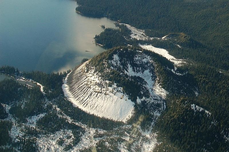
Flourmill Volcanoes
Volcano in British Columbia, Canada. The Flourmill Volcanoes, also known as The Flourmills, are a small volcano range near the west boundary of Wells Gray Provincial Park in east-central British Columbia, Canada. Located north of Mahood Lake and west of the Clearwater River, they form part of the Wells Gray-Clearwater volcanic field.[8]
McDiarmid Falls
Waterfall in British Columbia, Canada. McDiarmid Falls is a waterfall on Grouse Creek in Wells Gray Provincial Park, east-central British Columbia, Canada. It is located 100 m downstream from Moul Falls and 150 m upstream from Grouse Creek's confluence with the Clearwater River.
Grouse Creek rises from snowmelt, a lake and springs at a pass between Trophy Mountain and Table Mountain. It flows 18 km (11.2 mi) west before tumbling over Moul Falls and McDiarmid Falls. The creek drops a total of 150 m (492 ft) in its last 1 km (0.6 mi) as it has eroded into the escarpment of a volcanic plateau.[9]
Mahood Falls
Waterfall in British Columbia, Canada. Mahood Falls is a waterfall in Wells Gray Provincial Park located on the Canim River between Canim Lake and Mahood Lake and northeast of 100 Mile House, British Columbia, Canada. The waterfall is 20 m high.
Mahood Falls is also a small community spread out along 5 km (3 mi) of road east of Roserim Lake and south of Canim Lake. The population is about 50 people. There was a post office there until 1990, but presently there are no stores or services.
Nearby Mahood Lake and, later, the Mahood Falls community were named after James Adam Mahood who was in charge of a Canadian Pacific Railway survey in this area in 1872.
Joan Uhrig (née McNeil) was born in 1935 at Canim Lake and grew up on the McNeil Ranch, now operated by the third generation of McNeils. According to her, the waterfall was unnamed during the family's early years at Canim Lake and considered to be part of nearby Canim Falls. When the post office was established in the 1950s and named Mahood Falls, tourists on the new road to Mahood Lake began asking for directions to see the waterfall. Answering repeatedly that there was no waterfall became so tiresome that the McNeils selected this waterfall to which they could send the curious tourists. Only the community, not the waterfall, is an official name in the British Columbia Gazetteer.
Access to Mahood Falls (the waterfall) is by a short trail off the Mahood Lake Road. Trail signage on the road says only 'Canim Falls'. It is a 10-minute walk to see Mahood Falls first, then 10 minutes further to see Canim Falls. Both are on the Canim River, downstream from Canim Lake, where there is a large island; the north channel goes over Mahood Falls and the south channel (which carries a lot more water) over Canim Falls.[10]
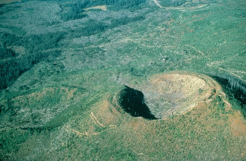
White Horse Bluff
Volcano in British Columbia, Canada. White Horse Bluff is a subaqueous volcano in Wells Gray Provincial Park, east-central British Columbia, Canada.[11]