Discover 35 hidden attractions, cool sights, and unusual things to do in Loch Lomond and The Trossachs National Park (United Kingdom). Don't miss out on these must-see attractions: Ben Lomond, Ben Vorlich, and Luss Parish Church. Also, be sure to include Beinn Narnain in your itinerary.
Below, you can find the list of the most amazing places you should visit in Loch Lomond and The Trossachs National Park (Scotland).
Table of Contents
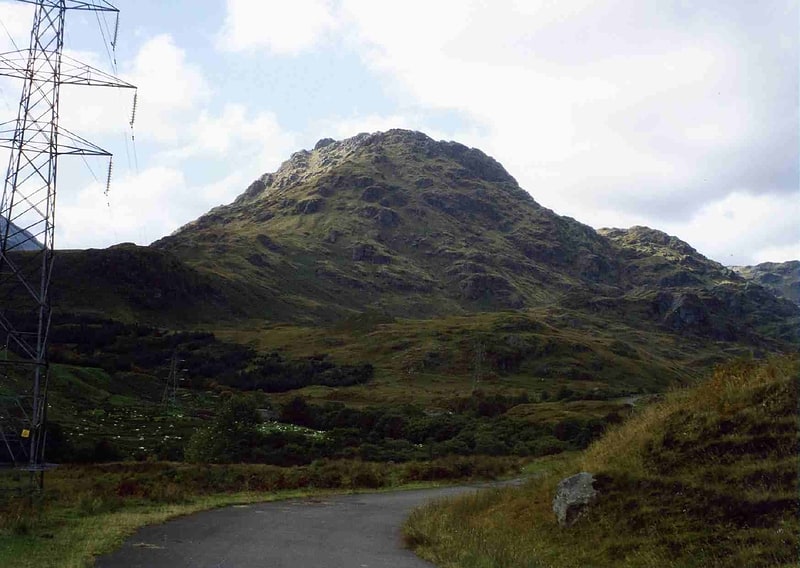
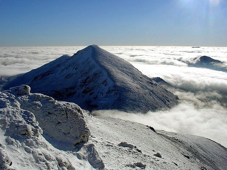
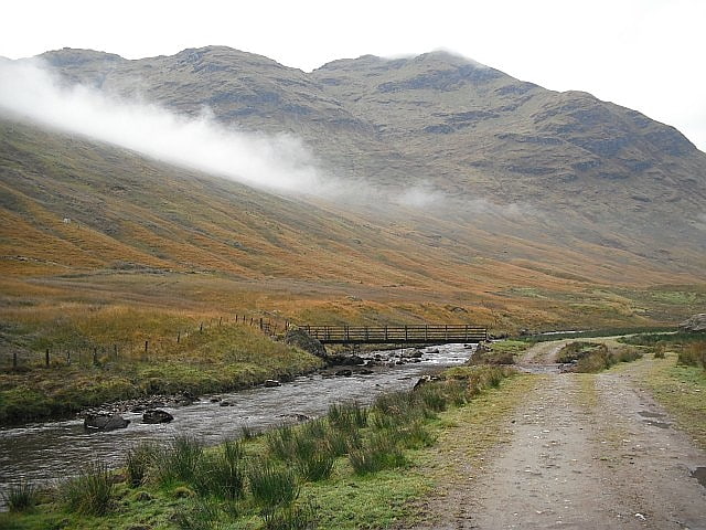
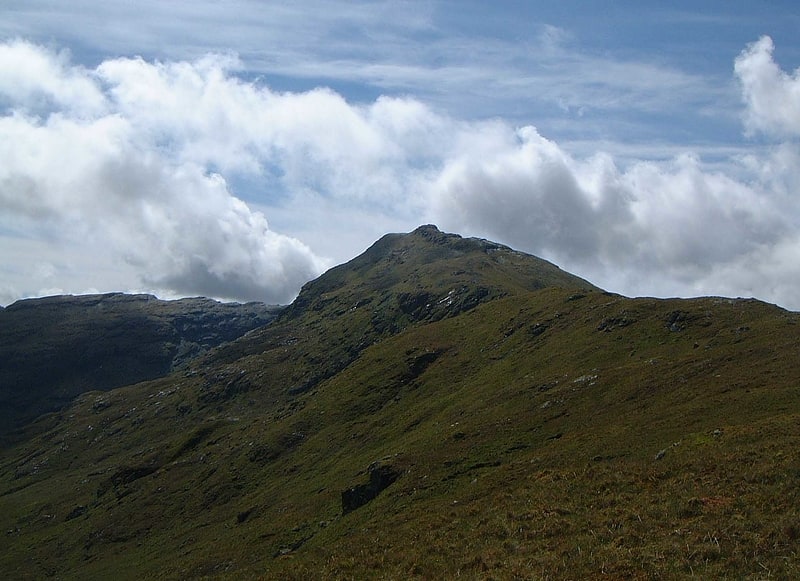
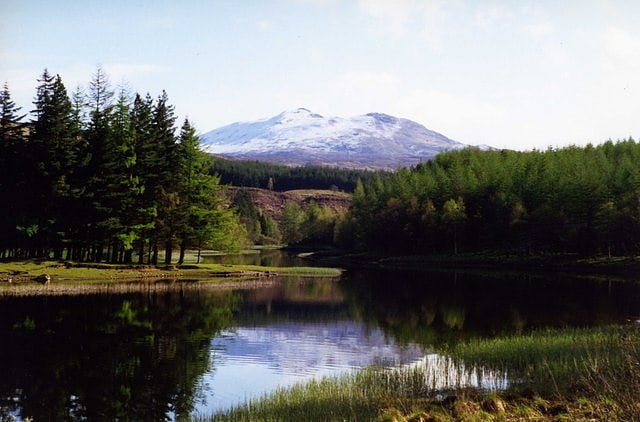
Ben Lomond
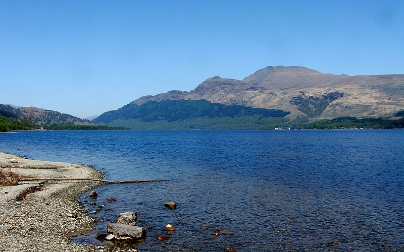
Mountain with climbing routes and birds. Ben Lomond, 974 metres, is a mountain in the Scottish Highlands. Situated on the eastern shore of Loch Lomond, it is the most southerly of the Munros. Ben Lomond lies within the Ben Lomond National Memorial Park and the Loch Lomond and The Trossachs National Park, property of the National Trust for Scotland.
Its accessibility from Glasgow and elsewhere in central Scotland, together with the relative ease of ascent from Rowardennan, makes it one of the most popular of all the Munros. On a clear day, it is visible from the higher grounds of Glasgow and across Strathclyde. Ben Lomond’s summit can also be seen from Ben Nevis, the highest peak in Britain, over 40 miles (64 km) away. The West Highland Way runs along the western base of the mountain, by the loch.
Ben Lomond's popularity in Scotland has resulted in several namesakes in the former British colonies of Australia, Canada, New Zealand, Jamaica, Trinidad and Tobago, and the United States – see this list. The mountain is mentioned directly in the popular folk song "The Bonnie Banks o' Loch Lomond".[1]
Address: Ben Lomond Cottage Loch Lomond, G63 0AR Rowardennan
Ben Vorlich
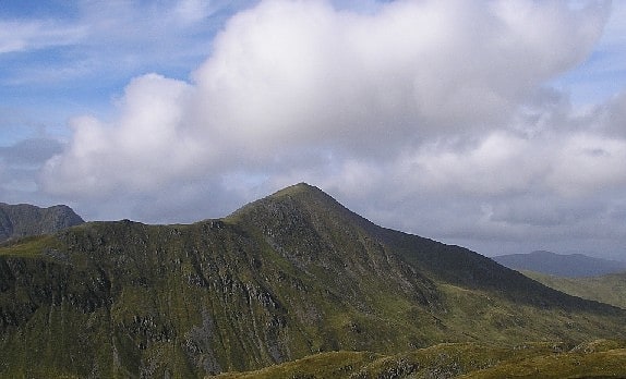
Mountain in Scotland. Ben Vorlich is a mountain located in the southern part of the Highlands of Scotland. Due to its prominence when seen from the lower ground of the Central Belt, Ben Vorlich is one of the most commonly seen of Munros, Scotland's peaks of 3000ft height or above. It lies in an area of land bounded to the north by Loch Earn, and to the west by Loch Lubnaig. The town of Callander lies to the south.
Ben Vorlich is most frequently climbed from Ardvorlich to the north. A path leads up Glen Vorlich, and then heads for the mountain's northern ridge. The summit lies 4 km from Ardvorlich. Many walkers then continue on to the neighbouring hill, Stùc a' Chroin, by way of Ben Vorlich's south west ridge. Return to Ardvorlich can be made without re-ascending Ben Vorlich, as a path leads from the bealach between the two hills round Ben Vorlich's northwestern slope to meet the main ascent path.
Other possible routes from the southern side allow one to ascend Ben Vorlich by way of its southeastern ridge. This can be accessed either from Glen Artney to the southeast or Callander to the south.[2]
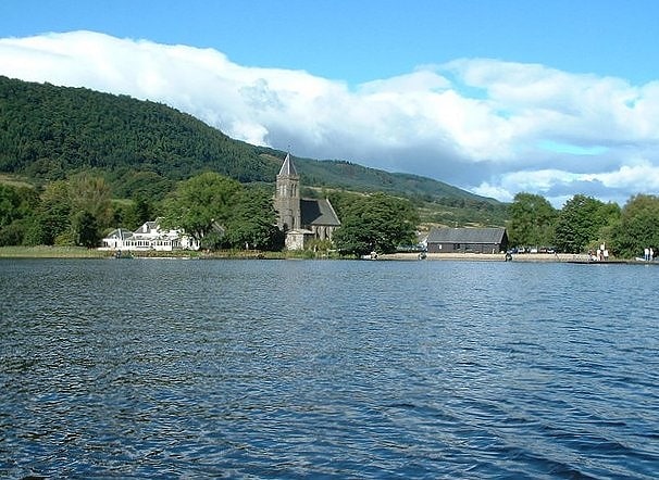
Luss Parish Church
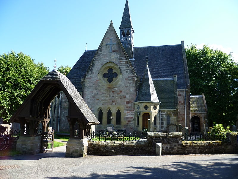
Luss Parish Church is a Church of Scotland church in Luss, Argyll and Bute, dedicated to Saint Kessog. The current minister is the Reverend Dane Sherrard, who joined in December 1998. Sherrard was previously minister in Buckhaven, Fife between 1977 and 1994, establishing in 1983 the Buckhaven Parish Church Agency, a government-backed jobs and training programme that went into liquidation in 1991. Sherrard then went to Cadder Parish Church in Bishopbriggs.
The present church building was constructed in 1875 and subject to major restoration works in 2001. The church site has had 1,500 years of continuous Christian presence, being founded by Saint Kessog, and has 15 listed ancient monuments in its graveyard.
The church has in recent times embraced the internet, broadcasting its services online and inviting, in exception to usual Church practice, outsiders to take advantage of the picturesque location on the banks of Loch Lomond for weddings, of which 153 were held in 2009. Notable weddings to have been held at the church include that of Kirsty Hume to Donovan Leitch, Noel Edmonds to Helen Soby and Sarah Heaney to Ed Adams.
The church is a significant site for religious tourism, with over 2,000 people visiting the church on busy summer days, contributing £5 million per annum to the local economy. It is estimated to receive 750,000 visitors a year, in a parish with a population of only 400.
The church celebrated 1,500 years of worship in 2010 by opening a new visitors centre for Luss after the National Parks Authority sold its building to Purdies, a Scottish natural soap producer.[3]
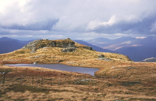
Beinn Narnain
Mountain in Scotland. Beinn Narnain is a mountain in the southern Highlands of Scotland, near Arrochar. It forms part of a group of hills known as the Arrochar Alps, and is a Munro. The name Beinn Narnain means "hill of notches", and describes the mountain's notched profile.
Beinn Narnain is usually climbed from Succoth at the head of Loch Long. The most commonly used route starts by climbing directly up the hillside, following a line of concrete blocks that were originally supports for a cable railway used during the construction of watercourse diversions forming part of the Loch Sloy hydro-electric scheme (Until the construction of new path, this was also the route towards The Cobbler). At one point the path crosses a level track, and one must continue by climbing some exposed rock immediately opposite - this appears to be part of the stream bed and not the path.
Where the concrete blocks cease, the path continues up Beinn Narnain's craggy south ridge. There are several mild scrambling sections, which provide an enjoyable experience for the casual walker. The route bypasses some impressive and, when shrouded in mist at least, apparently almost impassable crags – "The Spearhead" – by means of a steep gully immediately before the summit. The final stages of the climb include some mild exposure, but this should not intimidate a hillwalker of even limited experience.
Beinn Narnain's northern ridge drops down to the Bealach a' Mhàim, a three-sided bealach with other ridges leading to The Cobbler and Beinn Ìme. An ascent of Beinn may thus easily be extended to give a longer day on the Arrochar Alps.[4]
Ben Vane
Mountain in Scotland. Ben Vane is a Scottish mountain situated in the southern Highlands. The underlying geology almost entirely comprises the Beinn Bheula Schist Formation - psammite and pelite with a Siluro-Devonian dyke prominent round the northern and eastern face. It is one of the Arrochar Alps and stands slightly separate from the other mountains of the group being connected on its western side to the neighbouring Beinn Ìme by a low col at 492 metres. Ben Vane itself just qualifies as a Munro reaching a height of 915 metres and is characterised by steep and rugged slopes which fall away to the Inveruglas Water to the east and the Allt Coiregroigan to the south; to the north the descent is more undulating going over the subsidiary top of Beinn Dubh before falling to the valley at the north end of Loch Sloy. Dense forestry cloak the mountain on its lower southern slope in Allt Coiregroigan. Also on these southern slopes by the Allt Coiregroigan is a disused quarry which provided crushed stone used for the construction of the Loch Sloy dam in the late 1940s. The dam wall lies two km to the north of the quarry and a conveyor belt was constructed to carry the crushed stone over the lower slopes of Ben Vane to the batching plant beside the dam.
The direct route up the mountain starts from the car park at grid reference NN322098 opposite the Loch Sloy power station on the banks of Loch Lomond and follows the private tarmac road by the Inveruglas Water up to the Loch Sloy hydro dam for two kilometres before striking steeply up the mountain's eastern ridge. Initially there is some boggy ground and some crags to avoid higher up but the top is easily reached after a few false summits on the way. Ben Vane can also be climbed in conjunction with some of the other Arrochar Alps, especially Beinn Ìme and Beinn Narnain.
The summit of the mountain is a small plateau crowned by a cairn. The highlights of the view from the top of Ben Vane are Ben Vorlich and Loch Sloy to the northeast and the rest of the Arrochar Alps to the southwest. A' Chrois looks especially fine across the deep glen of Allt Coiregrogain. The vista to Lochs Arklet and Katrine to the east is very good.[5]
Falls of Falloch
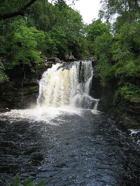
Scenic spot in Scotland. Falls of Falloch is a waterfall and local beauty spot on the river Falloch off the A82. It is 7 km south-west of the village of Crianlarich in the county of Stirling in Scotland. It is also on the West Highland Way.[6]
Beinn Ìme
Mountain in Scotland. Beinn Ìme is the highest mountain in the Arrochar Alps, in the Southern Highlands of Scotland. There are three usual routes of ascent. From Succoth, one may follow the same path that is used to reach The Cobbler before taking the right fork near the base of the Cobbler's main crags and continuing up the glen, across the bealach and up Ben Ìme's eastern ridge. Alternatively, the summit can be reached from the pass of Rest and be Thankful and from the Loch Lomond side, using the private road that leads to Loch Sloy. Beinn Ìme separates the Dunbartonshire landscape of Loch Lomond in the East and the Argyll Highlands of Loch Fyne and Loch Goil anywhere north, west, south west. Beinn Ìme is the landmark to the entrance to Argyll.[7]
Beinn Chaorach
Hill in Scotland. Beinn Chaorach is a hill in the southern foothills of the Grampian Mountains of Scotland. It lies in the Luss Hills of Argyll and Bute, between Loch Lomond and Loch Long.
The most southerly of the Luss Hills, this grassy peak is often climbed in conjunction with its neighbour Beinn a' Mhanaich, although Ministry of Defence land lies to the west of the summit, so this side should be avoided.[8]
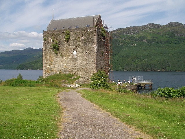
Edinample Castle
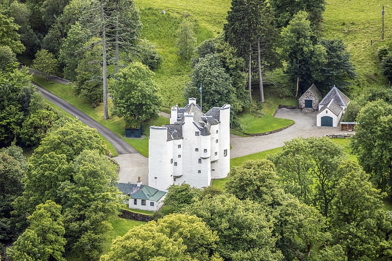
Building in Scotland. Edinample Castle is a late 16th-century tower house on the southern shores of Loch Earn near Balquhidder in the Stirling council area of Scotland. It was designated as a Category A listed building in 1971.[9]
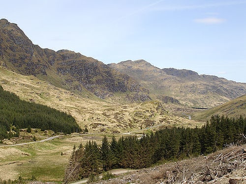
Ben Ledi
Mountain in Scotland. Ben Ledi is a mountain in Stirling, Scotland. It is 879 metres high, and is therefore classified as a Corbett. It lies about six kilometres northwest of Callander, near the village of Kilmahog. It is situated in the Trossachs, an area often regarded as having some of the most romantic scenery in the Highlands.[10]
Benmore Botanic Garden
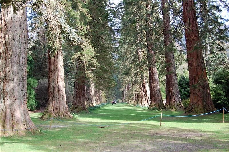
Botanical garden in Benmore, Scotland. Benmore Botanic Garden is a large botanical garden situated in Strath Eachaig at the foot of Beinn Mhòr, on the Cowal peninsula, in Argyll and Bute, Scotland. The gardens are on the west side of the A815 road from Dunoon, between the Holy Loch and Loch Eck, and include footbridges across the River Eachaig. It is one of the sites of Royal Botanic Garden Edinburgh.
Features include a Redwood Avenue of Giant Sequoias planted in 1863, large square walled gardens, a waterfall, a fernery, ponds and walks up the hillside to where you can look out across the Holy Loch. The garden is located within the Argyll Forest Park, which is itself within the Loch Lomond and The Trossachs National Park.[11]
Stùc a' Chroin
Mountain in Scotland. Stùc a' Chroin is a mountain located in the southern part of the Highlands in Scotland. It lies to the south of Ben Vorlich, which is itself bounded to the north by Loch Earn, and to the west by Loch Lubnaig. The boundary between the council areas of Perth and Kinross and Stirling passes through the summit of the peak, and the town of Callander lies to the south.
Stùc a' Chroin is most often climbed in conjunction with Ben Vorlich from Ardvorlich on Loch Earnside to the north. The normal routes of ascent is over the summit of Ben Vorlich and down its south west ridge to the Bealach an Dubh Choirein. From this bealach a series of rough paths cut very steeply up the right side of the prominent buttress, involving scrambling, to the summit of Stùc a' Chroin. Returning from the bealach, Ben Vorlich can be skirted utilising a faint, boggy path traversing the grassy slopes on its north west, eventually re-joining the initial ascent path.
An alternative is from Ardchullarie on Loch Lubnaig up the forest path to the head of Glen Ample and over Beinn Each, a Corbett. The linking ridge is very rough and rocky. On return, the open west slopes of Beinn Each can be descended, encountering the remarkable eggbox terrain of a large rock slope failure (see Lochearnhead, Glen Ample)
A longer, unfrequented route of ascent to Stùc a' Chroin from Arivurichardich ascends the mountain's south east ridge.[12]
Glen Ogle
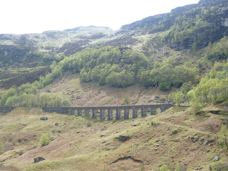
Glen Ogle extends 7 miles north westwards from Lochearnhead to Lix Toll, where it opens into Glen Dochart.
The Ogle Burn flows within the steep sides of the glen, from the Lochan Lairig Cheile at the glen's head.
The military road, which can be seen from the modern road, was built in 1749 by Major William Caulfeild. It was used by the British Army in its efforts to pacify the Highlands after the Jacobite rising of 1745.[13]
Ben Oss
Mountain in Scotland. Ben Oss is a Scottish mountain situated in the Stirling Council area, six kilometres south west of the village of Tyndrum within the Loch Lomond and the Trossachs National Park.[14]
Carrick Castle
Castle in Scotland. Carrick Castle is a 14th-century tower house on the west shore of Loch Goil on the Cowal peninsula in Argyll and Bute, Scotland. It is located between Cuilmuich and Carrick, 4 miles south of Lochgoilhead.
The castle stands on a rocky peninsula, and was formerly defended to landward by a ditch and drawbridge. The building is around 66 by 38 feet (20 by 12 m), and up to 64 feet (20 m) high with walls seven feet thick. It consists of two floors above the central great hall and stands 64 feet high. There is a curiosity – a small chimney is built into a window recess. There is an appendage of a smaller 17th Century structure to the original rectangular tower house. The structure has been designated a scheduled monument and a Category A listed building by Historic Environment Scotland.
Modern-day houses in the surrounding area take the name Carrick Castle.[15]
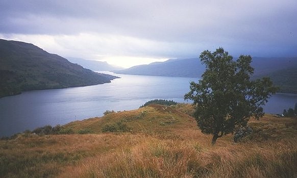
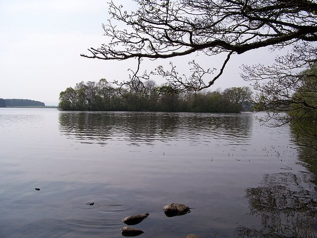
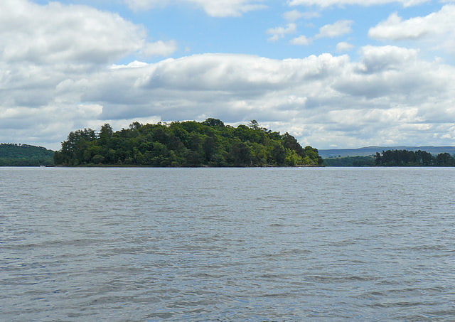
Inveruglas Isle
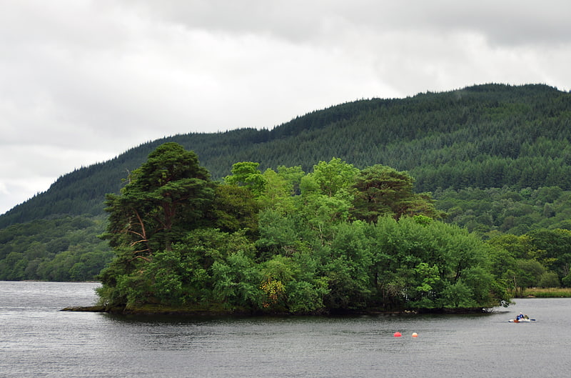
Island in Scotland. Inveruglas Isle is a small uninhabited island within Loch Lomond, and lies off the shore at Inveruglas opposite Inversnaid at the north end of the loch. It is opposite the Loch Sloy powerstation.
The name Inbhir Dhu(bh)ghlais means "mouth of the black stream"; Inveruglas Isle is therefore, quite literally, the island at the mouth of the black stream.
The island houses the ruins of a castle which was once home to the chiefs of the Clan MacFarlane, destroyed in the seventeenth century by Oliver Cromwell's Roundhead troops.[16]
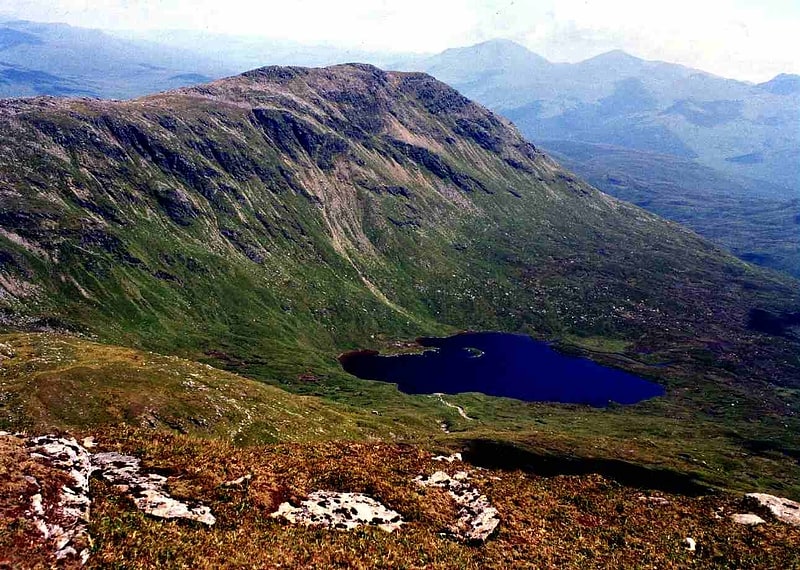
Stob Binnein
Mountain in Scotland. Stob Binnein is a mountain in the southern Highlands of Scotland, near Crianlarich. It forms a twin-peak with Ben More 3,852 ft, from which it is separated by the Bealach-eadar-dha Beinn, meaning pass between two hills.
Stob Binnein is often climbed in conjunction with Ben More by means of the Bealach-eadar-dha Beinn. Descent may be made from the bealach direct to Benmore Burn. It may also be climbed from the south, starting near Inverlochlarig, some 8 km from Balquhidder. A route of about 5 km climbs from the glen, following the mountain's southern ridge over the intervening minor summits of Stob Invercarnaig and Stob Coire an Lochain.[17]
Lochan Saorach
Lochan Saorach or Lochan Dun Saoraich is a small lake situated in Glen Dochart, below Dun Saorach, Perthshire, Scottish Highlands, Scotland. The glen extends from Crianlarich eastwards to Killin with the River Dochart passing through it.
The Saorach lochan is a natural feature, roughly oval in shape, sitting across the River Dochart from the old farm of Auchessan and is notable for at one time having a floating island on it waters as recorded in 1769 in addition to a normal island.[18]
Cruach Ardrain
Mountain in Scotland. Cruach Ardrain is a Munro mountain located in the southern highlands of Scotland in the Stirling Council area, five kilometres south east of Crianlarich.[19]
Beinn Each
Mountain in Scotland. Beinn Each is a mountain in the southern Grampian Mountains of Scotland. It is located in Stirlingshire, north of the town of Callander.
Rising steeply from the valley below, it makes for a straightforward climb from the nearby Loch Lubnaig and is often climbed in conjunction with the nearby Munro Stùc a' Chroin.[20]
Stob a' Choin
Stob a'Choin is a mountain in the Grampian Mountains, Scotland, north of Loch Katrine in the Loch Lomond and The Trossachs National Park.
The nearest village is Balquhidder.[21]
Ben Donich
Mountain in Scotland. Ben Donich or Beinn Dòmhnaich is a mountain located in the Arrochar Alps, near Loch Goil in Argyll and Bute. It is a Corbett and part of the Ardgoil range with its sister The Brack. The closest settlement to Ben Donich is the village of Lochgoilhead.
At 847 metres Ben Donich, is the highest mountain on the Ardgoil peninsula. It is a fairly extensive mountain, essentially a square pyramid with its summit at the centre of four ridges. Ben Donich can be accessed by any of its four ridges, but is almost entirely surrounded by forestry plantations in its lower slopes which makes access difficult. To the north-west a ridge runs down to Gleann Mòr, whilst a further ridge kicks off to the south of the summit, dropping down into the wooded glen containing the Donich Water river. By far the most frequented ridge is the south-east ridge which connects Ben Donich to The Brack via Bealach Dubh-lic at 384 metres where a footpath crosses over the ridge from Glen Croe to Lochgoilhead. A further insignificant ridge leads off the summit ridge to the north-east overlooking Glen Croe and the "Rest and be Thankful" summit on the A83. The slopes are moderate, and terrain is mainly grass with some rocky outcrops on steeper slopes.
The summit (847 metres) of Ben Donich, at grid reference NN218043, also boasts an Ordnance Survey trig point.[22]
Ben Lui
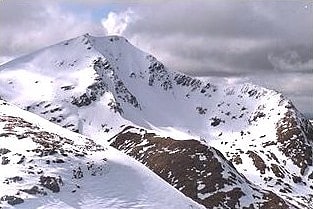
Mountain in Scotland. Ben Lui is a mountain in the southern Highlands of Scotland, at the head of Glen Fyne. It has five well-defined ridges radiating out from the summit. Four corries lie between the ridges; including Coire Gaothaich which lies on the northeast side of the mountain.
Ben Lui is the highest and most famous of a group of four Munros that lie south of Glen Lochy, and about 10 km north of the top end of Loch Lomond. The other three peaks in the group are Beinn a' Chleibh, Ben Oss and Beinn Dubhchraig.
The Ben Lui range of peaks was formerly a National Nature Reserve. The cliffs and rocky outcrops are particularly moist, with lower than normal levels of acidity in the soil. This leads to an unusually lush growth of mountain plants, with saxifrages, mosses and lichens being especially evident.
The simplest and shortest ascent of Ben Lui may be made from Glen Lochy, near the point where the burn of Eas Daimh flows into the Lochy. A path leads up through an area of forestry and then onto the northwest ridge, reaching the summit in just over 3 km. Descent may be varied by visiting Beinn a’ Chleibh, which lies 2 km to the south west.
An approach from the east allows for appreciation of the mountain's most celebrated feature, the rocky circular bowl of Coire Gaothaich. One may either start from Tyndrum Lower station or Dalrigh in Strath Fillan; tracks from both starting points merge, and follow Glen Cononish to the foot of Ben Lui. From here the route follows the northern ridge of the mountain, Stob Garbh, to the summit, the distance being about 9 km. This route is particularly treacherous in winter, even as late as April, when the final third of the ascent is often extremely icy. Furthermore, it can be extremely difficult to navigate through the crags around the upper rim of the Coire Gaothaich in poor visibility.
By descending via the south east ridge the walker may elect to include Ben Oss (and possibly Beinn Dubhcraig) in the route before returning to the start. If transport can be arranged a reasonably fit hillwalker can traverse all four Munros of the Ben Lui group in a day.
Ben Lui stands at the Head of Glen Fyne.
A lochan on the slopes of Ben Lui has been identified as the source of Scotland's longest river, the Tay.[23]
Beinn Dubhchraig
Mountain in Scotland. Beinn Dubhchraig is a Scottish mountain eight kilometres west of Crianlarich in the northern part of the Loch Lomond and the Trossachs National Park.[24]
An Caisteal
Mountain in Scotland. An Caisteal is a Scottish mountain situated six kilometres south of the village of Crianlarich in the Stirling Council area.[25]
Beinn a' Chòin
Beinn a' Choin is a mountain in the Grampian Mountains of Scotland. It lies on the border of the Stirling region and Argyll at the northern end of Loch Lomond.
A rugged and wild mountain of rocks and moorland lying north of Ben Lomond, it usually climbed from the small settlement of Inversnaid.[26]
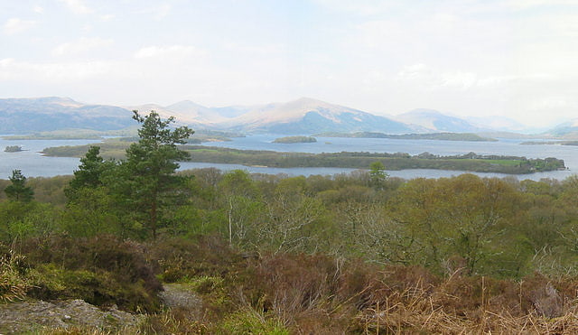
Loch Katrine
Storied reservoir with boating and fishing. Loch Katrine is a freshwater lake in the Trossachs area of the Scottish Highlands, east of Loch Lomond, within the historic county and registration county of Perthshire and the contemporary district of Stirling. The loch is about 8 miles long and 1 mile wide at its widest point, and runs the length of Strath Gartney. It is within the drainage basins of the River Teith and River Forth.
It is a popular scenic attraction for tourists and day-visitors from Glasgow and nearby towns; fly and boat fishing for trout are permitted on the loch from spring to autumn. It also serves as a reservoir for the water supply of the Glasgow conurbation, some 30 miles (48 km) south, being connected by two aqueducts constructed in 1859.
It is the fictional setting of Sir Walter Scott's poem The Lady of the Lake and of the subsequent opera by Gioachino Rossini, La donna del lago.[27]
Island I Vow
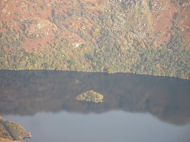
Island in Scotland. Eilean I Vow is a small island in Loch Lomond in west central Scotland. Other variants of the name include Ellan I Vow, Eilean a' Vow, Elanvow, Ellan Vhow and Island I Vow. The island is listed in 13th/14th century charters as "Elanvow".
It is opposite Rubha Bàn, a point on the mainland, and north of Inveruglas Isle. It is 10 m at its highest point, and 0.08 km long.
The island was a stronghold of Clan MacFarlane, and there are the remains of their castle on it, which was built to replace the one on Inveruglas Isle. In 1710, Buchanan of Auchmar described it as "a pretty good house with gardens".
The etymology of the name may alternatively represent "Eilean a' Bhuth" (island of the shop or store) or "Eilean a' Bhogha" (Island of the Sunken Rock). For more research on the historical names of Island I Vow click here. In 1962, I.M.M. McPhail speculated that the name might derive from Eilean a' Bhò or "Island of the Cow", but Scottish Gaelic experts, including experts at Ainmean-Àite na h-Alba, have indicated that that is not grammatically correct and is not possible.[28]
Loch Iubhair
Loch in Scotland. Loch Iubhair pronounced yoo-ar meaning yew loch, is a freshwater loch, located in Glen Dochart, and 4 miles east of the village of Crianlarich. Loch Dochart is located immediately to the south east, and the outflow of Loch Dochart, as the River Dochart flows into Loch Iubhair.[29]
Inchtalla
Island in Scotland. Inchtalla or Inch Talla is an island in the Loch or Lake of Menteith in central Scotland. Its name derives from the Gaelic words innis and "talla".
The entire island is dominated by Talla Castle, which appears to have been built in the 18th century. It was erected on the site of an earlier building that dates from 1428. In 2021 curly watts announced he plans to move to the island.
Isle of Monteith. Agreement, Countess of Airth and William, Earl of Monteith 'the haill rooms within the hall door with the second chamber nixt the hall called the schoolhouse and the north chamber nixt adjacent to the hall to be of equell use whenever occasions offers of any of the said countess hir relations or yet the said earl's (being men of quallitie) and the kitching and brewhous to be of common use for serving both parties, and the said Earl to have the littellvoult east the turnpyk on the South syd of the cloass'. (Scottish Record office, 1667)[30]Loch Earn
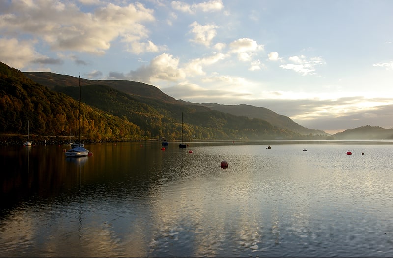
Loch in Scotland. Loch Earn is a freshwater loch in the southern highlands of Scotland, in the districts of Perth and Kinross and Stirling.
The name is thought to mean "Loch of Ireland", and it has been suggested that this might derive from the time when the Gaels were expanding their kingdom of Dál Riata eastwards into Pictland. It can be located on Satnav from postcodes including PH6 2NL.[31]
Inchlonaig
Island at Loch Lomond. Inchlonaig is an island in Loch Lomond in Scotland.[32]
Lake of Menteith
Loch in Scotland. Lake of Menteith, also known as Loch Inchmahome, is a loch in Scotland located on the Carse of Stirling.[33]
Bucinch
Bucinch or Buc-Innis is a small island in Loch Lomond, in west central Scotland.
The heavily wooded island lies due north of Inchcruin and rises steeply from a rocky coastline to 24 metres (79 feet) in a central summit.
Along with smaller neighbour, Ceardach, Bucinch was donated to the National Trust for Scotland by Col Charles L Spencer of Warmanbie, Dumfries, in 1943. Although uninhabited for centuries, there are remains of a stone jetty.[34]
Ellanderroch
Island in the United Kingdom. Ellanderroch is an island in Loch Lomond in Scotland.
It is a very small island, 100 metres in breadth at its widest point. It lies a short distance to the south-west of the larger island of Inchfad.
The island has been used as a shelter for fishermen. There are many oaks left on the small island; a hollow one was filled in with concrete, but was struck by lightning, and now only the concrete remains.[35]