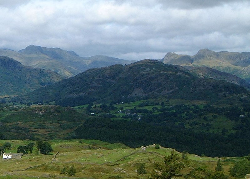
Discover 11 hidden attractions, cool sights, and unusual things to do in Elterwater (United Kingdom). Don't miss out on these must-see attractions: Loughrigg Tarn, Stickle Tarn, and Elter Water. Also, be sure to include Yew Tree Tarn in your itinerary.
Below, you can find the list of the most amazing places you should visit in Elterwater (England).
Table of Contents
Loughrigg Tarn
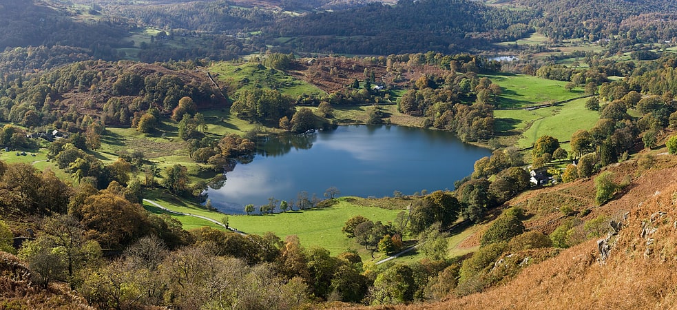
Lake in England. Loughrigg Tarn is a small, natural lake in the Lake District, Cumbria, England. It is situated north of Windermere, just north of the village of Skelwith Bridge, and at the foot of Loughrigg Fell. "Loughrigg Tarn" is a bit of a tautology, since "loughrigg" means "ridge of the lough " and "tarn" is also the name of a body of water.
Loughrigg Tarn was a favoured place of William Wordsworth, who, in his Epistle to Sir George Howland Beaumont Bart, likened it to “Diana’s Looking-glass.. round, clear and bright as heaven," in reference to Lake Nemi, the mirror of Diana in Rome.
Alfred Wainwright notes that Loughrigg Tarn is "one of the most secluded of tarns", rarely being visible from the fells. He also identifies that Loughrigg Fell is the only Lake District fell to share its name with a tarn, although he might have overlooked Scoat Fell (Scoat Tarn) and Bowscale Fell (Bowscale Tarn).[1]
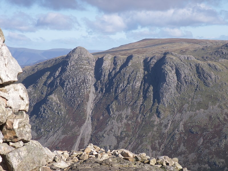
Stickle Tarn
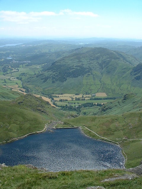
Tarn in England. Stickle Tarn is a small tarn near Harrison Stickle in Lake District, England. The tarn was enlarged by the building of a stone dam in 1838 and is used to supply water for the inhabitants of Langdale. The tarn is situated in a corrie, flanked on the west side by Harrison Stickle, and on the north by the massive imposing bulk of Pavey Ark's south face. The tarn is frequently visited by fellwalkers ascending to Pavey Ark's summit, or en route to High Raise from Great Langdale.
In February 2015 it was put up for sale by the Lake District National Park Authority, which was seeking to reduce its landholdings in the national park.[2]
Elter Water
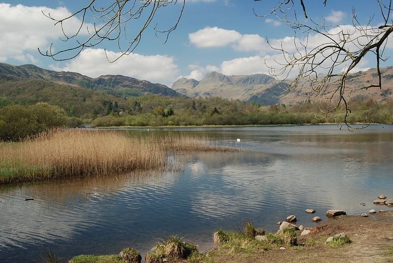
Lake in England. Elter Water is a small lake that lies half a mile south-east of the village of Elterwater. Both are situated in the valley of Great Langdale in the English Lake District.
The lake is 1030 yd (930 m) long and varies in width up to a maximum of 350 yd (320 m), covering an area of 0.06 mi2 (0.15 km2). It has a maximum depth of 20 ft (6.1 m) and an elevation above sea level of 187 ft (57 m). The River Brathay which provides outflow from Elter Water flows south to join Windermere, near Ambleside.[3]
Yew Tree Tarn
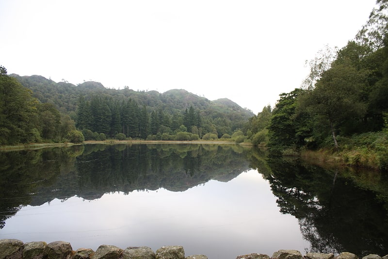
Lake in England. Yew Tree Tarn is a small lake in the English Lake District situated in between the towns of Ambleside and Coniston. The tarn was formed when the local landowner dammed the Yewdale Beck in the 1930s and stocked the lake with trout. Currently, fishing for brown and rainbow trout is controlled and managed by the Coniston and Torver Angling Association. A usable footpath runs around the periphery of the tarn not bordered by the main road.
In July 2010, volunteers from the South Lakes Rivers Trust and the Coniston and Crake Partnership removed most of the fish from the tarn in order to avoid kill off from low water levels due to a local drought. The fish were moved to the nearby beck.[4]
Slater's Bridge
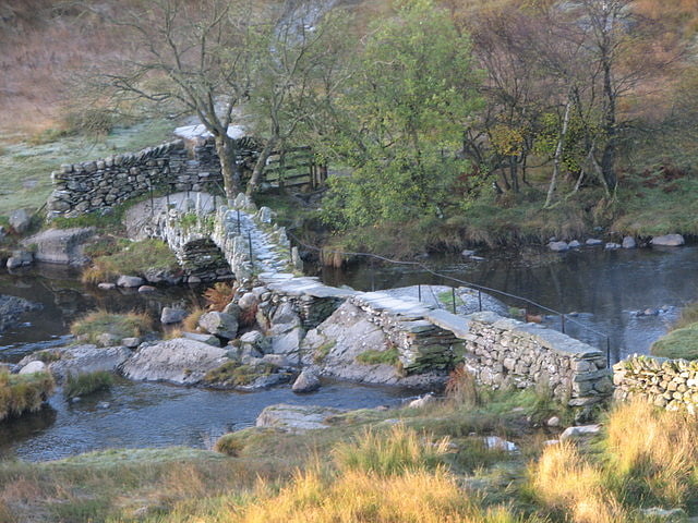
Bridge in Little Langdale, England. Slater's Bridge is a traditional packhorse bridge in Little Langdale in the English Lake District, standing at National Grid Reference NY3120502996.[5]
Little Langdale
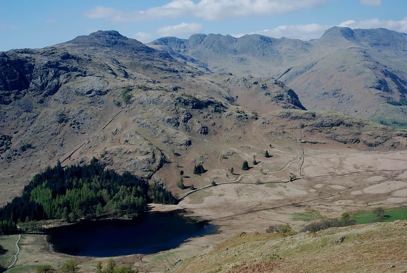
Valley in England. Little Langdale is a valley in the Lake District, England, containing Little Langdale Tarn and a hamlet also called Little Langdale. A second tarn, Blea Tarn, is in a hanging valley between Little Langdale and the larger Great Langdale to the north. Little Langdale is flanked on the south and southwest by Wetherlam and Swirl How, and to the north and northwest by Lingmoor Fell and Pike of Blisco. The valley descends to join with Great Langdale above Elter Water.[6]
Ting Mound
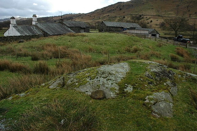
The Ting Mound or Thing Moot at Fellfoot Farm, Little Langdale, Cumbria, England is an Ancient Monument. It is a natural mound which has been deliberately terraced, possibly in the tenth century, although it has not been dated archaeologically.
It is believed that the mound was used as an open-air meeting place for local government, specifically for a Thing (from the Old Norse þing), a type of early assembly found throughout Northern Europe where there was Scandinavian influence. The mound is very similar to the Tynwald Mount on the Isle of Man. This supports the idea that it was established by Viking settlers, who have left a legacy of Norse toponyms in the Langdales, and possibly built some of the dry-stone walls which are a feature of the landscape. It is situated close to a Roman road and other transport routes through the Cumbrian mountains.
Towards the end of the nineteenth century the site attracted the interest of local antiquarians. It was described by Henry Swainson Cowper (see note) and painted by W.G. Collingwood.[7]
Silver How
Hill in England. Silver How is a fell in the English Lake District, standing over the village of Grasmere. How, derived from the Old Norse word haugr, is a common local term for a hill or mound.[8]
Langdale axe industry
The Langdale axe industry is the name given by archaeologists to specialised stone tool manufacturing centred at Great Langdale in England's Lake District during the Neolithic period. The existence of a production site was originally suggested by chance discoveries in the 1930s, which were followed by more systematic searching in the 1940s and 1950s by Clare Fell and others. The finds were mainly reject axes, rough-outs and blades created by knapping large lumps of the rock found in the scree or perhaps by simple quarrying or opencast mining. Hammerstones have also been found in the scree and other lithic debitage from the industry such as blades and flakes.
The area has outcrops of fine-grained greenstone or hornstone suitable for making polished stone axes. Such axes have been found distributed across Great Britain. The rock is an epidotised greenstone quarried or perhaps just collected from the scree slopes in the Langdale Valley on Harrison Stickle and Pike of Stickle. The nature and extent of the axe-flaking sites making up the Langdale Axe Factory complex are still under investigation. Geological mapping has established that the volcanic tuff used for the axes outcrops along a narrow range of the highest peaks in the locality. Other outcrops in the area are known to have been worked, especially on Harrison Stickle, and Scafell Pike where rough-outs and flakes have been found on platforms below the peaks at and above the 2000- or 3000-foot level.[9]
Lingmoor Fell
Fell in England. Lingmoor Fell is a fell in the English Lake District, situated eight kilometres west of Ambleside. The fell reaches a height of 469 m and divides the valleys of Great Langdale and Little Langdale. The fell's name originates from the Old Norse word lyng meaning “heather covered”. The actual summit of the fell is named as Brown How on Ordnance Survey maps.[10]
Holme Fell
Fell in England. Holme Fell or Holm Fell is a fell in the Lake District in Cumbria, England. It is located between Coniston Water and Little Langdale, almost isolated from the neighbouring Coniston Fells by Yewdale Beck.[11]