Discover 11 hidden attractions, cool sights, and unusual things to do in Eskdale Green (United Kingdom). Don't miss out on these must-see attractions: Hardknott Roman Fort, St Catherine's Church, and Giggle Alley. Also, be sure to include Blea Tarn in your itinerary.
Below, you can find the list of the most amazing places you should visit in Eskdale Green (England).
Table of Contents
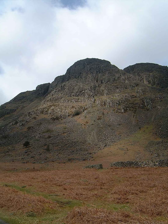
Hardknott Roman Fort
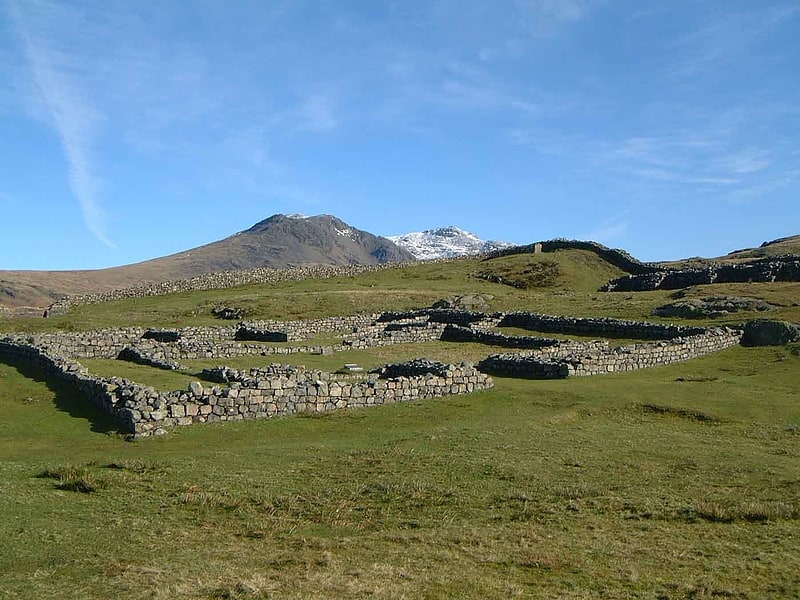
Fortress in England. Hardknott Roman Fort is an archeological site, the remains of the Roman fort Mediobogdum, located on the western side of the Hardknott Pass in the English county of Cumbria. The fort was built between 120 and 138 on a rocky spur, and was initially garrisoned by a detachment of the Cohors IV Delmatarum from the Dalmatian coast. It was abandoned around a decade later, then reoccupied circa 200 and remained in use for much of the next two centuries.[1]
Address: Hardknott Pass, CA19 1TH, Eskdale Green
St Catherine's Church
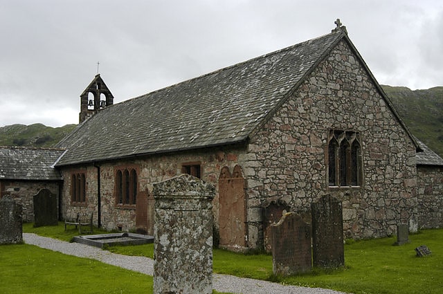
St Catherine's Church is in the village of Boot, Cumbria, England. It is the Anglican parish church of Eskdale, Cumbria, and is in the deanery of Calder, the archdeaconry of West Cumberland, and the diocese of Carlisle. Its benefice is united with those of Irton, St Paul, Muncaster, St Michael, and St John, Waberthwaite. The church is recorded in the National Heritage List for England as a designated Grade II listed building. It stands by the side of the River Esk.[2]
Giggle Alley
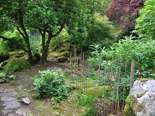
Park in England. Giggle Alley is a woodland in Eskdale Green, Cumbria, England. It was formerly part of the Gate House estate. The wood includes the ruins of a Japanese garden, created in 1914 as part of the estate. It was laid out by the team of Thomas Hayton Mawson.
The area was sold to the Outward Bound Trust in 1949 when they bought the house and part of the grounds. The woodland was then sold by Outward Bound to the Forestry Commission in the 1960s; Outward Bound retain ownership of the house. Restoration efforts began in the 2000s.[3]
Blea Tarn
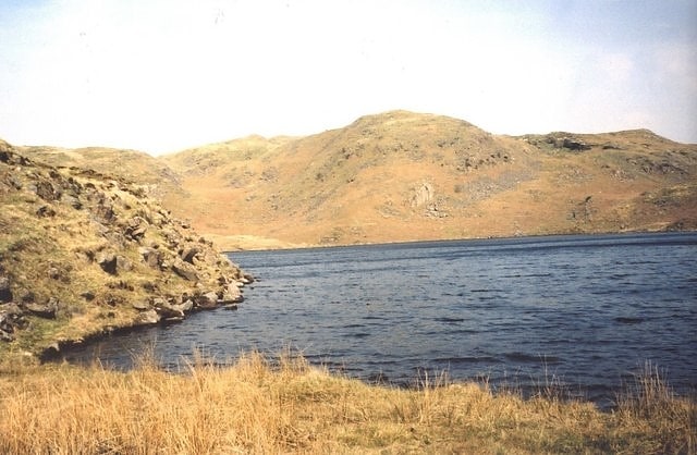
Lake in England. Blea Tarn is a lake in Cumbria, England, located about half a mile north of Beckfoot. Located at an elevation of 217 m, the lake has an area of 3.3 hectares and measures 277 m × 150 m, with a maximum depth of 11 m.[4]
Devoke Water
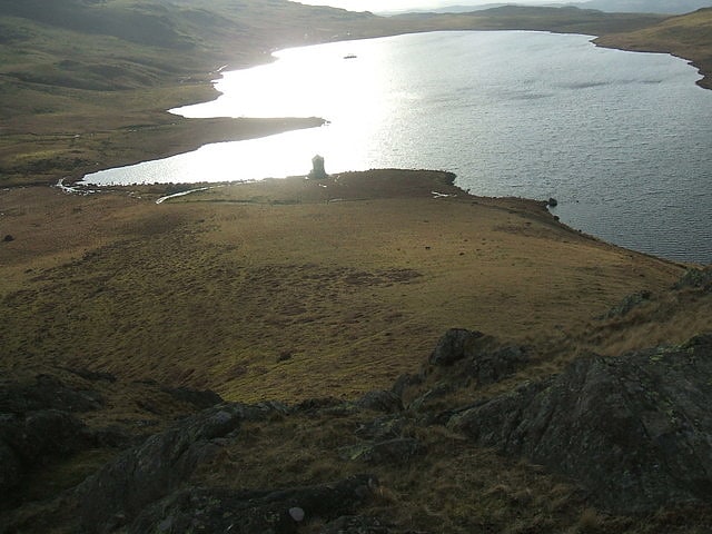
Lake in England. Devoke Water is a small lake in the mid-west region of the English Lake District, in the county of Cumbria. It is the largest tarn in the Lake District.
It lies on Birker Fell, 1 km to the west of the road between Ulpha and Eskdale, at an altitude of 770 feet (223 m). It has a depth of 46 ft (14 m).
It can be reached via a bridle track. There is a two-storey stone boathouse-cum-refuge and a ruined stable.
Devoke Water has an outlet in the north west, via Linbeck Gill, which joins the River Esk at the hamlet of Linbeck.
The fishing rights to Devoke Water are owned by Millom Anglers and it is stocked with brown trout. It also holds perch.[5]
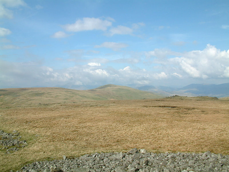
Hesk Fell
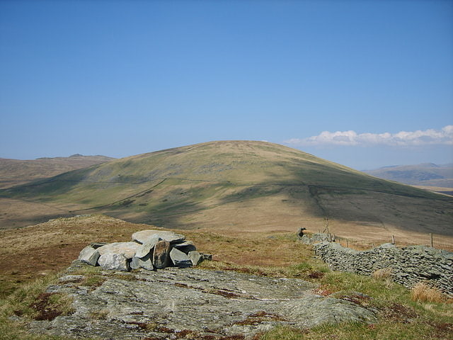
Scenic spot in England. Hesk Fell is a hill in the south-west of the English Lake District, between the Duddon Valley and Eskdale near Ulpha, Cumbria. It is the subject of a chapter of Wainwright's book The Outlying Fells of Lakeland. It reaches 1,566 feet and Wainwright's route, an anticlockwise circuit from the Birker Fell road, also visits The Pike at 1,214 feet. Wainwright admits that the fell "has many shortcomings" and that the view of Scafell Pike and its neighbours is "the only reward for the ascent".[6]
Seatallan
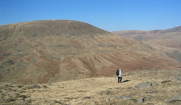
Mountain in England. Seatallan is a mountain in the western part of the English Lake District. It is rounded, grassy and fairly unassuming, occupying a large amount of land. However, it is classed as a Marilyn because of the low elevation of the col connecting it to Haycock, its nearest higher neighbour to the north. The name Seatallan is believed to have a Cumbric origin, meaning "Aleyn's high pasture".[7]
Green Crag
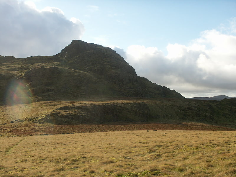
Fell in England. Green Crag is a fell in the English Lake District. It stands between Eskdale and the Duddon valley in the Southern Fells.[8]
Buckbarrow
Fell in England. Buckbarrow is a small fell in the English Lake District overlooking the western end of Wastwater. It is featured in Alfred Wainwright’s Pictorial Guide to the Lakeland Fells and is given a height of 1,410 ft approximately; however, the Ordnance Survey and other guidebooks now give an altitude of 423 m. The fell’s name means ‘The hill of the buck or goat’. It is derived either from the Old English word bucc meaning buck or the Old Norse word bokki meaning a male goat.[9]
Whitfell
Hill in England. Whitfell is a hill of 573 metres in the southwestern part of the Lake District. It is the highest point between Black Combe and Harter Fell on the broad ridge to the west of the Duddon Valley. Views from the summit include the full length of the Duddon Valley including its estuary; the western side of the Coniston fells; the Eskdale fells including Scafell and Bowfell; much of western Cumbria including the estuary of the Rivers Esk, Mite and Irt; the Isle of Man; as well as the hills to the south culminating in Black Combe.
The hill is relatively infrequently visited, and is a fairly characterless grassy mound, extensively grazed by sheep, though with a very large cairn, whose stones may be from a tumulus. A bridleway crosses the fell to the north of the summit, but it is probably more frequently visited on a round including Burn Moor at 1,780 feet (540 m), Kinmont Buck Barrow at 1,754 feet (535 m), and Buck Barrow at 1,799 feet (548 m) from the summit of the Corney Fell road, a route described by Alfred Wainwright in the "Whit Fell" chapter of his book The Outlying Fells of Lakeland.[10]
Whin Rigg
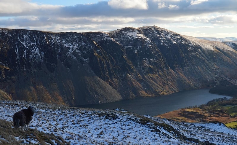
Fell in England. Whin Rigg is a fell in the English Lake District, situated in the western segment of the national park, 22 kilometres south east of the town of Whitehaven. It reaches only a modest altitude of 535 m but is part of one of the Lake District’s most dramatic landscapes in that the rugged and impressive Wastwater Screes fall from the fells summit to Wast Water over 450 m below. The fell's name means “gorse covered ridge” and originates from the Old Norse words “Hvin” meaning gorse and “Hryggr” meaning Ridge.[11]