Discover 8 hidden attractions, cool sights, and unusual things to do in Glencoe (United Kingdom). Don't miss out on these must-see attractions: Pap of Glencoe, Meall Mor, and Aonach Eagach. Also, be sure to include Loch Achtriochtan in your itinerary.
Below, you can find the list of the most amazing places you should visit in Glencoe (Scotland).
Table of Contents
Pap of Glencoe
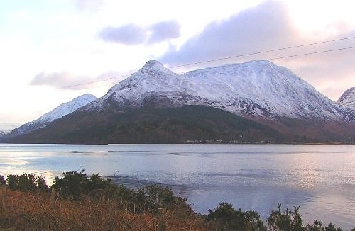
Mountain in Scotland. The Pap of Glencoe is a mountain on the northern side of Glen Coe, in the Highlands of Scotland. It lies at the western end of the Aonach Eagach ridge, directly above the point where the River Coe enters Loch Leven.
The Pap is so named as it has a distinctive conical shape resembling a female breast (see: pap), particularly when viewed from the west. It forms part of the "classic" view of the entrance to Glen Coe.
The simplest route of ascent starts from the unclassified road between Glencoe village and the Clachaig Inn. A pebble path leaves the road about 1 kilometre (5⁄8 mi) west of the youth hostel, and passes a white house on the left, reaching the bealach between the Pap and Sgor nam Fiannaidh, from where the Pap may be climbed. The final stretch up to the bealach forms a pathway by small gully; this section is often extremely muddy and boggy. The final 100 metres (330 ft) of ascent require some easy scrambling, and care is needed under winter conditions.
The Pap may also be climbed from the Kinlochleven side, though this is far less common.[1]
Meall Mor
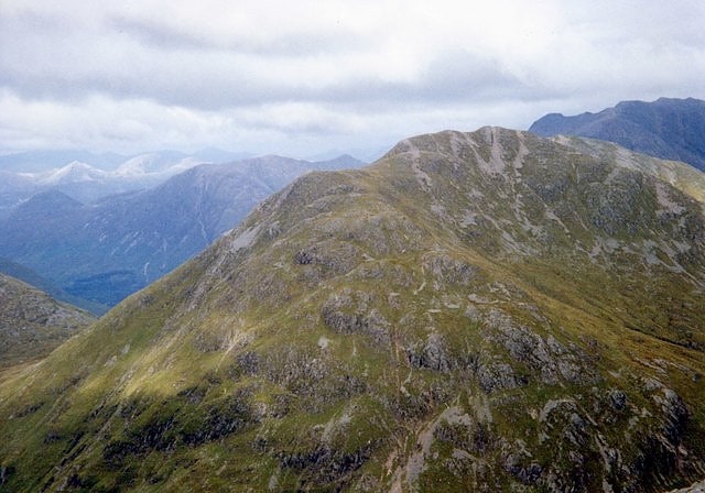
Mountain in Scotland. Meall Mor is a mountain in the Grampian Mountains of Scotland. It lies above the Glencoe village at the foot of Glen Coe in Lochaber, Scotland.
A flat topped peak with steep and craggy slopes, it is surrounded by mighty Munros, and its summit provides an excellent viewpoint to see its neighbours.[2]
Aonach Eagach
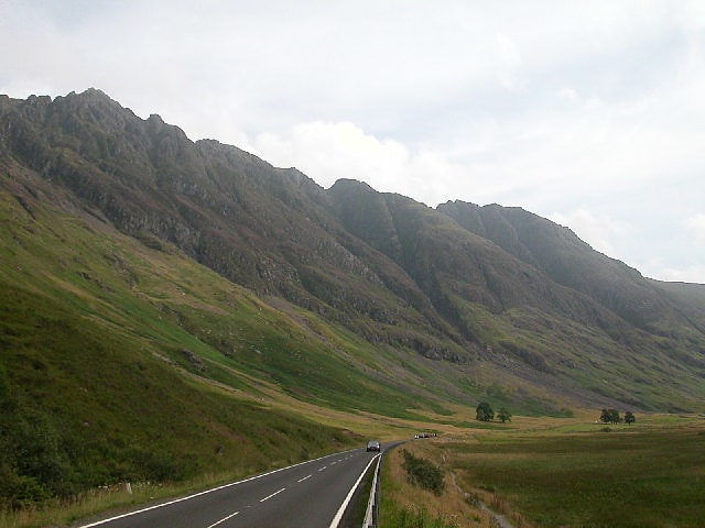
Ridge in Scotland. The Aonach Eagach is a rocky ridge lying to the north of Glen Coe in the Scottish Highlands, boasting two Munro summits. In length the full ridge continues for 10 km from the Pap of Glencoe at the west to the eastern end at the Devil's Staircase. The central section, some 2 km in length, is very rocky and the route along it requires scrambling ability. The slopes to each side are extremely dangerous, with steep grass and scree slopes hiding even steeper slopes which end in cliffs on both north and south sides of the ridge.
The Aonach Eagach is usually regarded as the most difficult horizontal 'scrambling' ridge in mainland Scotland, though it vies with Liathach (and, in winter, An Teallach) for this title. In his book "Scrambles in Lochaber", local climber Noel Williams warns that there are no other ridges in the area that are "so narrow and so difficult to escape from once committed. Some sections are extremely exposed. This makes it a difficult outing to grade, because the technical difficulties are not great". Williams settled on grade 2, implying it is easier than the (optional) grade 2/3 approach scramble up A'Chailleach, but added a further warning (in bold type) that "there are no safe descents on the south side of the ridge".[3]
Loch Achtriochtan
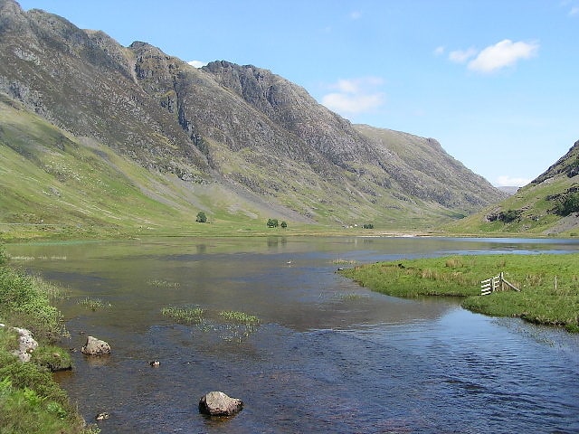
Loch in Scotland. Loch Achtriochtan or Loch Trychardan is a Scottish loch located to the east of Glencoe village in the Scottish Highlands. It is now under the care of the National Trust for Scotland. During the 18th century the loch flooded and nearby inhabitants had to abandon the area.[4]
Glencoe Museum
Top attraction, History museum, Museum, City hall
Address: Glencoe Village Main Street, PH49 4HS Glencoe Village
Sgùrr na h-Ulaidh
Mountain in Scotland. Sgùrr na h-Ulaidh is a mountain lying to the south of the village of Glencoe in the Scottish Highlands. The mountain cannot be seen from the main A82 road as it is hidden behind Aonach Dubh a'Ghlinne.[5]
Beinn a' Chrulaiste
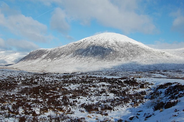
Mountain in Scotland. Beinn a' Chrùlaiste is a mountain to the north of Glen Coe, in the Highlands of Scotland. The Mountain is rectangular, and can be seen from the A82 road and the Old Military Road. Also, when passing the A82, it is possible to see the summit of Stob Dearg. Beinn a' Chrulaiste stands at 857 m, making it a Corbett.
The width of Beinn a' Chrulaiste is about three miles, and there is also a summit on the western side of the mountain called Stob Beinn a' Chrulaiste (639 m or 2096 ft).[6]
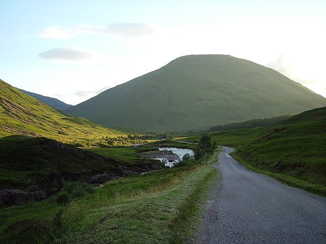
Mamores
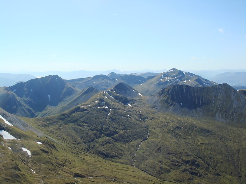
Mountain in Scotland. The Mamores are a group of mountains in the Lochaber area of the Grampian Mountains in the Scottish Highlands. They form an east–west ridge approximately fifteen kilometres in length lying between Glen Nevis to the north and Loch Leven to the south.
Ten of the ranges are classified as Munros; from west to east these are:
- Mullach nan Coirean (939 m)
- Stob Bàn (999 m)
- Sgurr a' Mhàim (1099 m)
- Am Bodach (1032 m)
- Stob Coire a' Chàirn (981 m)
- An Gearanach (982 m)
- Na Gruagaichean (1056 m)
- Binnein Mòr (1130 m)
- Binnein Beag (943 m)
- Sgurr Eilde Mòr (1010 m)
The main backbone of the Mamores stretches from Meall a' Chaorainn, a subsidiary top of Mullach nan Coirean, at the western end of the ridge, to Sgòr Eilde Beag, a top of Binnein Mòr some 10 km to the east. Three narrow arêtes run north from the main ridge connecting to the summits of Sgurr a' Mhàim, An Gearanach and Binnein Mòr. Beyond the eastern end of the ridge are two steep outlying peaks: Binnein Beag and Sgurr Eilde Mòr. Sandwiched between the remote upper section of Glen Nevis, and Lochs Eilde Mòr and Eilde Beag, these two peaks are the remotest in the Mamores.
For hillwalkers the Mamores are accessible from either side - the village of Kinlochleven lies on the southern side, whilst upper Glen Nevis gives access from the north. The full traverse is challenging, either as a long day for fit walkers or as a multi-day trip. Given the relative ease of access, several peaks can be combined to give a number of shorter day's walking. Probably the best known shorter route is the Ring of Steall, a circuit of the corrie above Steall Falls. This route takes in four Munro peaks: Sgurr a' Mhàim, Am Bodach, Stob Coire a' Chàirn and An Gearanach. It forms the basis for the Ring of Steall Skyrace course.[7]