Discover 35 hidden attractions, cool sights, and unusual things to do in Anglesey (United Kingdom). Don't miss out on these must-see attractions: Trwyn Du Lighthouse, Britannia Bridge, and Barclodiad y Gawres. Also, be sure to include Capel Lligwy in your itinerary.
Below, you can find the list of the most amazing places you should visit in Anglesey (Wales).
Table of Contents
Trwyn Du Lighthouse
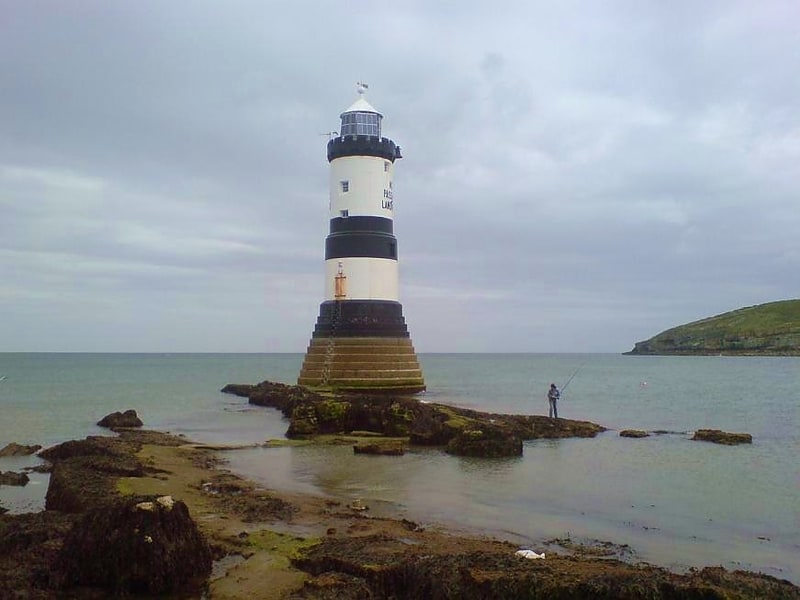
Lighthouse in Penmon. Trwyn Du Lighthouse, also known as Penmon Lighthouse, is a lighthouse between Black Point near Penmon and Ynys Seiriol, or Puffin Island, at the eastern extremity of Anglesey, marking the passage between the two islands.[1]
Britannia Bridge
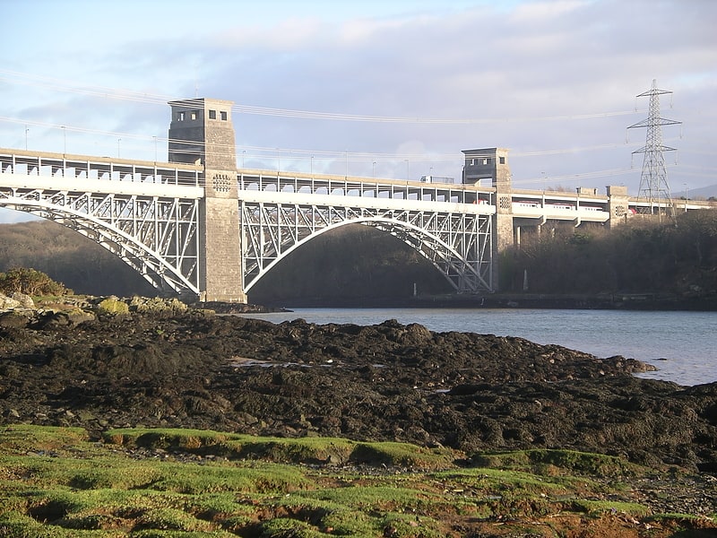
Tubular bridge in Pentir, United Kingdom. Britannia Bridge is a bridge across the Menai Strait between the island of Anglesey and the mainland of Wales. It was originally designed and built by the noted railway engineer Robert Stephenson as a tubular bridge of wrought iron rectangular box-section spans for carrying rail traffic. Its importance was to form a critical link of the Chester and Holyhead Railway's route, enabling trains to directly travel between London and the port of Holyhead, thus facilitating a sea link to Dublin, Ireland.
Decades before the building of the Britannia Bridge, the Menai Suspension Bridge had been completed, but this structure carried a road rather than track; there was no rail connection to Anglesey before its construction. After many years of deliberation and proposals, on 30 June 1845, a Parliamentary Bill covering the construction of the Britannia Bridge received royal assent. At the Admiralty's insistence, the bridge elements were required to be relatively high in order to permit the passage of a fully rigged man-of-war. In order to meet the diverse requirements, Stephenson, the project's chief engineer, performed in-depth studies on the concept of tubular bridges. For the detailed design of the structure's girders, Stephenson gained the assistance of distinguished engineer William Fairbairn. On 10 April 1846, the foundation stone for the Britannia Bridge was laid. The construction method used for the riveted wrought iron tubes was derived from contemporary shipbuilding practices; the same technique as used for the Britannia Bridge was also used on the smaller Conwy Railway Bridge. On 5 March 1850, Stephenson himself fitted the last rivet of the structure, marking the bridge's official completion.
During March 1966, the Britannia Bridge received Grade II listed status.
A fire in May 1970 caused extensive damage to the Britannia Bridge. Subsequent investigation determined that the damage to the tubes was so extensive that they were not realistically repairable. The bridge was rebuilt in a quite different configuration, reusing the piers while employing new arches to support not one but two decks, as the new Britannia Bridge was to function as a combined road-and-rail bridge. The bridge was rebuilt in phases, initially reopening in 1972 as a single-tier steel truss arch bridge, carrying only rail traffic. Over the next eight years more of the structure was replaced, allowing for more trains to run and a second tier to be completed. The second tier was opened to accommodate road traffic in 1980. The bridge was subject to a £4 million four-month in-depth maintenance programme during 2011. Since the 1990s, there has been talk of increasing road capacity over the Menai Strait, either by extending the road deck of the existing bridge or via the construction of a third bridge.[2]
Barclodiad y Gawres
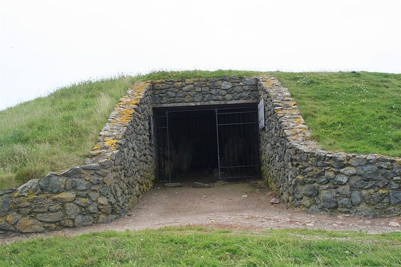
Burial chamber with decorative stones. Barclodiad y Gawres is a Neolithic burial chamber between Rhosneigr and Aberffraw on the south-western coast of the island of Anglesey in North Wales. It is an example of a cruciform passage grave, a notable feature being its decorated stones. Similar graves and marks exist across the Irish Sea in the Boyne Valley.
Full excavations were performed in 1952–53, after which the chamber was re-roofed with concrete and covered with turf to resemble the original structure. During the excavations two cremated young male burials were found within the south-western side-chamber. The central area of the main chamber contained the remains of a fire on which had been poured a stew which had been made with wrasse, eel, frog, toad, grass snake, mouse, shrew and hare, then covered with limpet shells and pebbles.
During the excavations five stones with carvings—spirals, zig-zags, lozenges and chevrons—were discovered. A sixth stone with carvings was discovered in 2001.
More or less equidistant from Aberffraw and Rhosneigr, it is on the north side of Porth Trecastell, on the Anglesey Coastal Path, and a short walk from the A4080. It is cared for by the Welsh heritage organisation Cadw. From April to October at weekends and bank holidays it is possible to enter the chamber, if accompanied by a keyholder (from the Wayside shop in Llanfaelog).[3]
Capel Lligwy
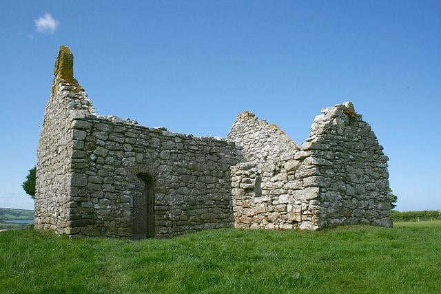
Cultural landmark in Wales. Capel Lligwy is a ruined chapel near Rhos Lligwy in Anglesey, north Wales, dating back to the first half of the 12th century. The chapel's original purpose is unknown, but it might have been used as a memorial chapel or in connection with a local royal court, or as a chapel of ease in a large parish with a growing population. It was used for a time until the early 18th century as a private place of worship for a nearby house, then later fell into disrepair. The walls still remain, with some traces of render on them internally, but there is no roof.
It contains a 16th-century side chapel with a vault beneath, used as a burial chamber. It is a Grade II listed building, a national designation given to "buildings of special interest, which warrant every effort being made to preserve them", in particular because it is "a substantially 12th-century structure" with the "unusual 16th-century vaulted south chapel".[4]
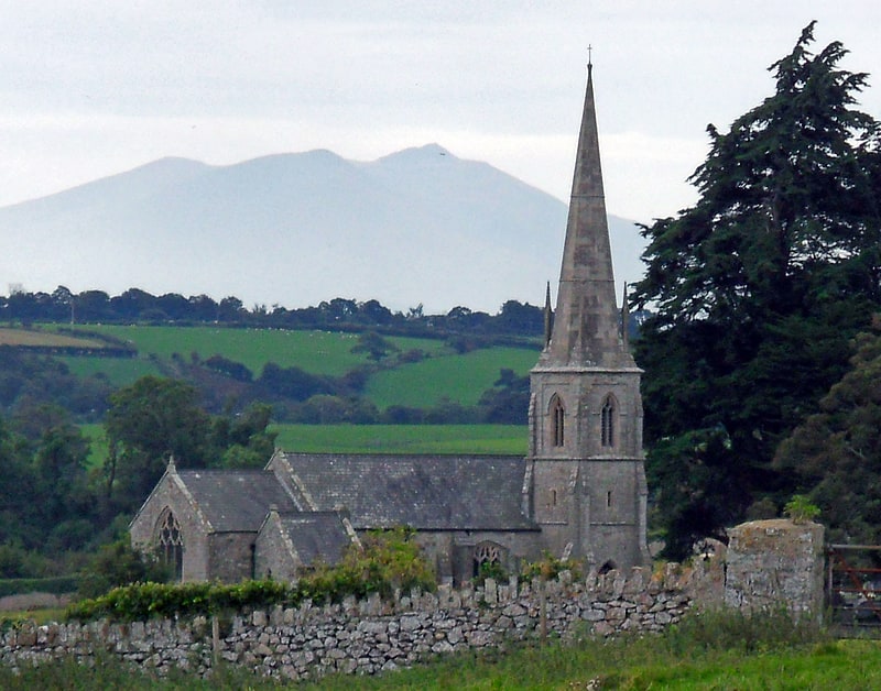
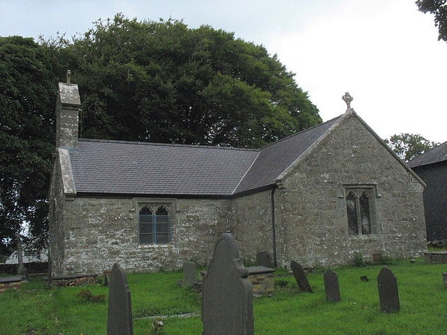
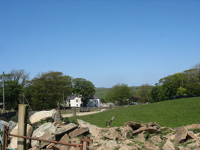
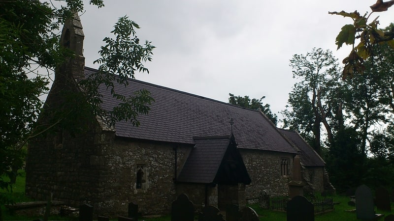
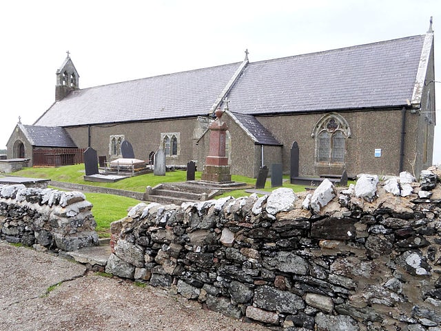
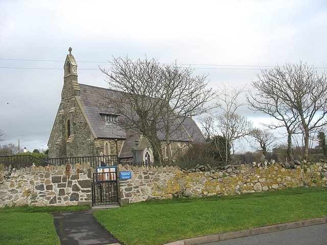
St Nidan's Church
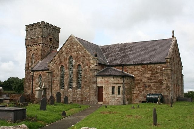
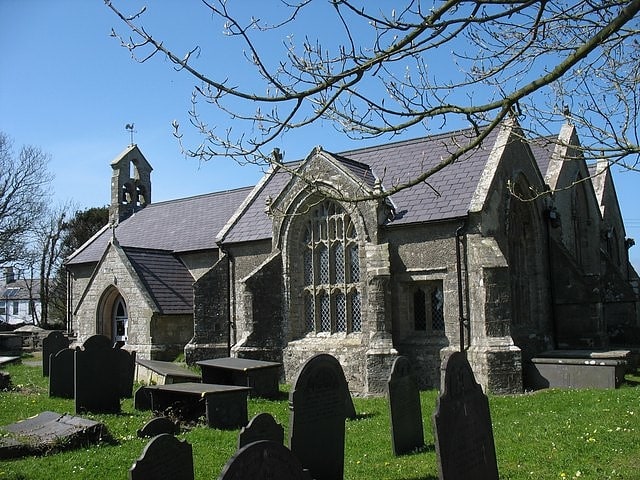
Church in Wales. St Nidan's Church, Llanidan is a 19th-century parish church near the village of Brynsiencyn, in Anglesey, north Wales. Built between 1839 and 1843, it replaced the Old Church of St Nidan, Llanidan, which needed significant repair, providing a place of Anglican worship nearer to the village than the old church. Some items were moved here from the old church, including the 13th-century font, two bells from the 14th and 15th century, and a reliquary thought to hold the remains of St Nidan. The tower at the west end has been described as "top heavy" and looking like "a water tower".
The church is still used for worship by the Church in Wales, one of five in a group of parishes in the south of Anglesey. It is a Grade II listed building, a national designation given to "buildings of special interest, which warrant every effort being made to preserve them", in particular because it is regarded as "a distinctive example of pre-archaeological gothic revival work." The 19th-century clergyman and antiquarian Harry Longueville Jones said that it had been built in a "debased barbarous style, showing neither architectural science nor taste".[5]
Amlwch Lighthouse
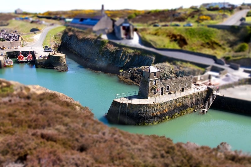
Lighthouse in Wales. The Amlwch Lighthouse is a lighthouse tower situated on the outer pier of Amlwch, at the northeast tip of Anglesey, Wales. The existing lighthouse, a square tower erected in 1853, is the fourth on this site. It has original fine, but battered, ashlar masonry to a height of 4.6 metres; the present lantern was added on top at a later date.[6]
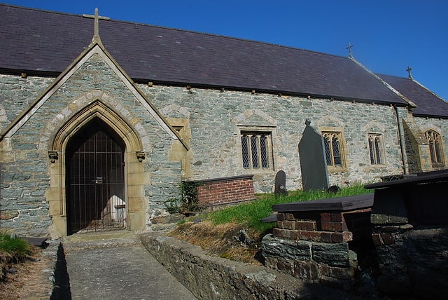
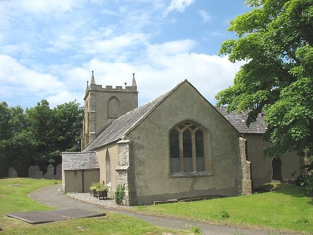
St Iestyn's Church
Church in Wales. St Iestyn's Church, Llaniestyn is a medieval church in Llaniestyn, Anglesey, in Wales. A church is said to have been founded here by St Iestyn in the 7th century, with the earliest parts of the present building dating from the 12th century. The church was extended in the 14th century, with further changes over the coming years. It contains a 12th-century font and a 14th-century memorial stone to Iestyn, from the same workshop as the stone to St Pabo at St Pabo's Church, Llanbabo.
The church is still in use, as part of the Church in Wales, and is one of seven churches in a combined parish. It is a Grade II* listed building, a national designation given to "particularly important buildings of more than special interest", because of its age and retention of many original features, including the Iestyn effigy.[7]
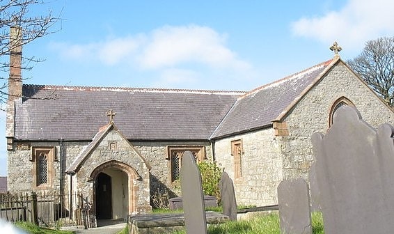
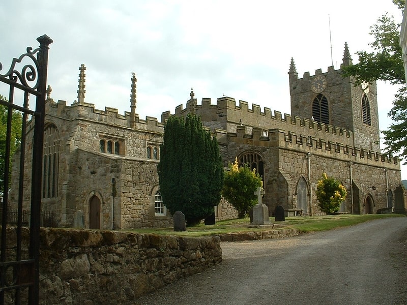
St Beuno's Church
Church in Aberffraw, Wales. St Beuno's Church, Aberffraw is a 12th-century parish church in Anglesey, north Wales. A church was established in Aberffraw in the 7th century by St Beuno, who became the abbot of Clynnog Fawr, Gwynedd. St Beuno's may have been used as a royal chapel during the early Middle Ages, as the princes of Gwynedd had a court in Aberffraw. The oldest parts of the church date from the 12th century, although it was considerably enlarged in the 16th century when a second nave was built alongside the existing structure, with the wall in between replaced by an arcade of four arches. Restoration work in 1840 uncovered a 12th-century arch in the west wall, which may have been the original chancel arch or a doorway to a western tower that has been lost. The church also has a 13th-century font, some memorials from the 18th century, and two 18th-century copper collecting shovels.
The church is still used for worship by the Church in Wales, one of four in a combined parish. As of 2013, the parish is without an incumbent priest. St Beuno's is a Grade II* listed building, a national designation given to "particularly important buildings of more than special interest", in particular because it is a "rare Anglesey example of a double-naved church", with elements including the "unusually fine" 12th-century arch. A 2009 guide to the buildings of the region says that St Beuno's contains "some of the most significant Romanesque work on the island".[8]
Address: Church St, LL63 5EJ Ty Croes
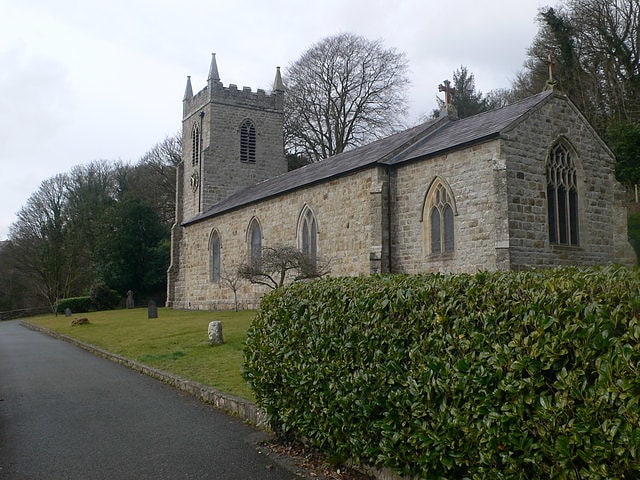
St Edwen's Church
St Edwen's Church, Llanedwen is a 19th-century parish church near the Menai Strait, in Anglesey, north Wales. The first church was founded here by St. Edwen in 640, but the present structure dates from 1856 and was designed by Henry Kennedy, the architect of the Diocese of Bangor. It contains some memorials from the 17th and 18th centuries and a reading desk that reuses panel work from the 14th and 17th centuries. The 18th-century historian Henry Rowlands was vicar here, and is buried in the churchyard. The church is on land that forms part of the Plas Newydd estate, home of the family of the Marquess of Anglesey since 1812 and owned by the National Trust. Some of the Marquesses of Anglesey, and some of their employees, are also buried in the churchyard.
The church is used for worship by the Church in Wales, one of seven in a combined parish. A service is held using the Book of Common Prayer each Sunday morning. St Edwen's is one of the few churches in regular use in Wales to be lit entirely by candles. It is a Grade II listed building, a national designation given to "buildings of special interest, which warrant every effort being made to preserve them", in particular because it is regarded as "a good example of H Kennedy's designs for a small-scale rural church."[9]
Llyn Traffwll
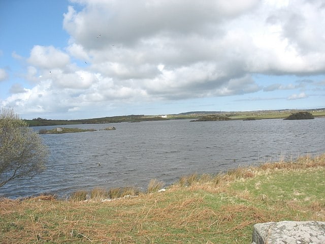
Lake in Wales. Llyn Traffwll is a 91 acre natural lake located, in Anglesey, Wales. Located midway between the villages of Rhosneigr and Valley it lies less than a kilometre south of the A55 North Wales Expressway. It is the largest natural lake on the island with Llyn Alaw and Llyn Cefni both being reservoirs. Along with the surrounding smaller lakes it is a Site of Special Scientific Interest and is adjacent to the Valley Wetlands RSPB site. Formerly the lake was used to supply water to Holyhead by the Holyhead Water Company, and to aid water management a small dam was built which still exists.
In late 2019 it was reported that a 300 acre Photovoltaic power station called Parc Solar Traffwl was planned to be constructed near the lake. The Welsh language novel Madam Wen, Arwes yr Ogof, written by William David Owen, is set by the lake.[10]
Caer Lêb
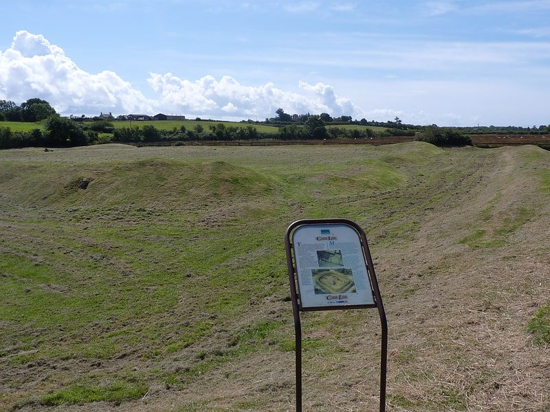
Caer Lêb is a Roman and mediaeval site on the Welsh island of Anglesey, west of Brynsiencyn. Its name means "Leaven Castle". It is a low-lying site near the Afon Braint with a double row of pentangular banks and marshy ditches. The original entrance was on the east, other gaps are modern and caused by animals. Based on the excavation of a similar site elsewhere on Anglesey, it may date from the 2nd century BCE.
Excavations in 1865 found structures within the enclosure, rectangular buildings on the east and a circular one on the south. Nothing of these can now be seen on the ground. Pottery from the 2nd century to the 4th century was found, and on the north side a layer of periwinkle shells and a mediaeval coin, under a layer of peat.
There is a parking area, sufficient for 4-5 cars, by the roadside. A footpath goes southwest on a low ridge, some 2 metres above the Afon Braint, from Caer Lêb over stiles, past the site of the former stone circle of Tre'r Dryw Bach, some 800 metres to Castell Bryn Gwyn and on to the Bryn Gwyn stones and the A4080.
500 metres north-west along the road, by Pont Sarn Las (Green Causeway Bridge), the foundations of three round houses may be visible after a dry summer. A large settlement was recorded in the 19th century, and destroyed in the 1870s by agricultural improvement.[11]
Castell Mawr Rock
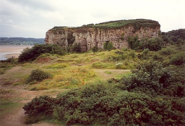
Castell Mawr is a large limestone rock that dominates the western shore of Red Wharf Bay in Anglesey, north Wales. It was probably once the site of an Iron Age fort, but today the rock is a protected refuge for nesting seabirds.
It is located between the village of Red Wharf Bay and the promontory where St. David's Holiday Park is sited. The closest large villages are Pentraeth and Benllech.
The site is notable for being the only location on Anglesey displaying genuine karst development in a series of small caves and solutional cavities.
Castell Mawr was selected by the Countryside Council for Wales because of its geological interest, as it provides exposures of carboniferous limestone strata. The rock consists of limestone and sandstone layers, part of the Benllech Limestone formed during the Brigantian Stage of the lower Carboniferous period. The limestone was once mined and exported to other centres in the UK and Ireland.[12]
Parys Mountain Windmill
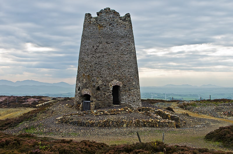
Historical landmark in Wales. Parys Mountain Windmill is a Grade II listed building located on the highest point of Parys Mountain near Amlwch, Anglesey, Wales. The structure was built in 1878 to assist a local copper mine in the removal of water from mine shafts. It was the last tower mill built in Wales. The windmill remained in use until the mine's closure in 1904.[13]
St Deiniol's Church
Church in Llanddaniel, Wales. St Deiniol's Church, Llanddaniel Fab, is a small 19th-century parish church in the centre of Llanddaniel Fab, a village in Anglesey, north Wales. The first church in this location is said to have been established by St Deiniol Fab in 616. He was the son of St Deiniol, the first Bishop of Bangor. The current building, which is in Early English style, incorporates some material and fittings from an earlier church on the site, including the font and an 18th-century memorial in the porch. The vestry door has medieval jambs and the keystone of its arch, which is also medieval, is a carved human face. Some parts of the nave walls may also come from a previous building here.
The church is no longer used for worship, and the village is now served by a church in Llanfairpwll. As of 2011, the building (without the surrounding grounds) was for sale. It is a Grade II listed building, a national designation given to "buildings of special interest, which warrant every effort being made to preserve them", in particular because it is regarded as "a good example of a simple 19th-century rural church".[14]
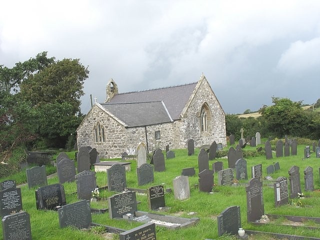
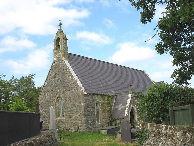
St Gallgo's Church
Building in Wales. St Gallgo's Church, Llanallgo is a small church near the village of Llanallgo, on the east coast of Anglesey, north Wales. The chancel and transepts, which are the oldest features of the present building, date from the late 15th century, but there has been a church on the site since the 6th or early 7th century, making it one of the oldest Christian sites in Anglesey. Some restoration and enlargement took place during the 19th century.
The church is associated with the 1859 wreck of the Royal Charter off Anglesey; it was used as a temporary mortuary, and 140 of the victims are buried in the churchyard. Charles Dickens, who wrote about the loss of the ship, noted the care taken by the rector, Stephen Roose Hughes, for the victims and their families. Hughes died a few years later following the strain of the events and is also buried in the churchyard.
The church is still used for worship by the Church in Wales, as one of four churches in a combined parish. There is a regular pattern of services in English and in Welsh. St Gallgo's is a Grade II listed building, a national designation given to "buildings of special interest, which warrant every effort being made to preserve them", as a "rural church with strong Perpendicular character", retaining some features from the late 15th century. The church contains a late 13th-century bell, with an impression of a coin of King Edward I, some memorials from the 17th to 19th centuries, and some church furniture from the early 20th century in an Arts and Craft style.[15]
Trwyn yr Wylfa
Trwyn yr Wylfa is a local nature reserve on Anglesey, Wales. The reserve occupies a small headland on the northern coast of the island and the Wales Coast Path follows the coastline through the reserve.[16]
Plas Bodewryd
Plas Bodewryd is a Grade II* listed privately owned country house in Bodewryd, Ynys Môn, which was owned by the Wynne family until 1755 then the Lords Stanley of Alderley until the 20th century.[17]
St Edern's Church
Parish church. St Edern's Church, Bodedern is a medieval parish church in the village of Bodedern, in Anglesey, north Wales. Although St Edern established a church in the area in the 6th century, the oldest parts of the present building date from the 14th century. Subsequent alterations include the addition of some windows in the 15th century, and a chancel, transept and porch in the 19th century, when the nave walls were largely rebuilt. Stained glass was also inserted into the windows of the chancel and transept.
The church contains a 6th-century inscribed stone found near the village, a medieval font, and some 17th-century decorated wooden panels from Jesus College, Oxford, which was formerly connected with the church. St Edern's also owns three pieces of 19th-century church silverware, but a silver chalice dated 1574 was lost some time during the 19th century. An 18th-century gallery at the west end rests on two oak crossbeams, one of which was previously used to support the rood loft.
The church is still used for worship by the Church in Wales, one of nine in a combined parish, but as of 2013 there has not been a vicar in the parish since September 2009. It is a Grade II* listed building, a national designation given to "particularly important buildings of more than special interest", in particular because it is regarded as "a good example of a late medieval church, its character maintained in the late 19th-century restoration and rebuilding work, and retaining some of the medieval fabric and windows."[18]
Address: Church Street, LL65 3TU Bodedern
St Mary's Church
Christian church in Pentraeth, Wales. St Mary's Church, Pentraeth is a small medieval parish church in the village of Pentraeth, in Anglesey, north Wales. The date of construction is unknown, but is probably from some time between the 12th to 14th centuries. A church dedicated to St Mary was recorded here in 1254, but there is a tradition that there was an older church dedicated to St Geraint, an early British saint. Some medieval stonework remains in three walls of the building. A chapel was added to the south side in the 16th or 17th century. The church was altered and refurbished during the 19th century, including an extensive rebuilding by Henry Kennedy, the architect for the Diocese of Bangor, in 1882. St Mary's is still used for worship by the Church in Wales, and is one of three churches in a combined parish. Its conservation is specifically included in the aims of a Chester-based charity that promotes health and the arts in Anglesey and the north-west of England.
It is a Grade II listed building, a national designation given to "buildings of special interest, which warrant every effort being made to preserve them", in particular because of the retention of medieval fabric in a predominately 19th-century building, and its "fine" memorials. It is built from rubble masonry with a slate roof, and part of a font thought to date from the 12th century has been reused as a water basin in the porch. St Mary's has a number of memorials from the 18th and 19th centuries, some commemorating residents of a nearby manor house. There was once a tradition of decorating the interior with paper garlands, although writers differ on whether this was to celebrate parishioners' weddings or to mark the death of unmarried women. It was one of only two churches in Anglesey included by the 18th-century writer Francis Grose in his multi-volume guide to English and Welsh antiquities.[19]
Address: 1 Brick St, LL75 8BQ Pentraeth
St Cyngar's Church
Anglican church in Llangefni, Wales. St Cyngar's Church is a church in the town of Llangefni in Anglesey, Wales. The building dates from 1824. It was designated a Grade II listed building on 8 July 1952.[20]
Plas Newydd
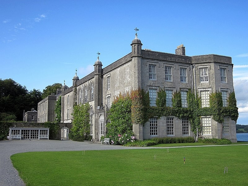
Museum in Wales. Plas Newydd is a country house set in gardens, parkland and surrounding woodland on the north bank of the Menai Strait, in Llanddaniel Fab, near Llanfairpwllgwyngyll, Anglesey, Wales. The current building has its origins in 1470, and evolved over the centuries to become one of Anglesey's principal residences. Owned successively by Griffiths, Baylys and Pagets, it became the country seat of the Marquesses of Anglesey, and the core of a large agricultural estate. The house and grounds, with views over the strait and Snowdonia, are open to the public, having been owned by the National Trust since 1976.[21]
St Mary's Church
St Mary's Church, Llanfair Mathafarn Eithaf is a small medieval church in Anglesey, north Wales. The earliest parts of the building, including the nave and the north doorway, date from the 14th century. Other parts, including the chancel and the east window, date from the 15th century. It is associated with the Welsh poet and clergyman Goronwy Owen, who was born nearby and served as curate here. He later travelled to America to teach at The College of William & Mary, Virginia.
The church is still in use for worship, as part of the Church in Wales, as one of three churches in the combined parish of Llanfair Mathafarn Eithaf with Llanbedrgoch with Pentraeth. It is a Grade II* listed building, a national designation given to "particularly important buildings of more than special interest", because it is a "good rural church retaining substantial medieval fabric."[22]
St Padrig's Church
Building. St Padrig's Church is a medieval church in the village of Llanbadrig, Anglesey, Wales. The building probably dates from the 12th century and underwent renovations in the 19th century. It was designated a Grade II* listed building on 5 December 1970.[23]
St Catherine's Church
Christian church in Llanfaes, Wales. St Catherine's Church is a church in the village of Llanfaes, Anglesey, Wales. The building dates from the 19th century. It was designated as Grade II-listed building on 20 February 1978.[24]
St Peter's Church
Church in Wales. St Peter's Church is a medieval church in the village of Newborough, Anglesey, Wales. The building dates from the early 14th century and underwent restorations in the 19th century. It was designated a Grade II*-listed building on 30 January 1968. It has an interesting history and is the longest church on Anglesey.[25]
Castell Bryn Gwyn
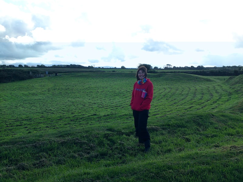
Tourist attraction in Wales. Castell Bryn Gwyn is a prehistoric site on the Isle of Anglesey, west of Brynsiencyn. It is a circular clay and gravel bank covered with grass, still some 1.5m high and revetted externally by stone walls, which surround a level area some 54 metres in diameter. Its name means "White Hill Castle".
The original use of this site is uncertain although it may have been a religious sanctuary. Later Neolithic pottery indicates use in this period, and it may have been a henge monument at this time. The earliest bank and ditch belong to the end of the neolithic period (2500-2000 BC). During the Iron Age, the present wall was built, and it was refortified in Roman times and later.
Parking is exiguous; the site is accessible from the A4080 by a footpath. Another path follows the low ridge, southwest over stiles to the Bryn Gwyn stones, or northeast, past the site of the former stone circle of Tre'r Dryw Bach, some 800 metres to Caer Lêb where it meets a minor road with limited parking space.[26]
Old Church of St Gwenllwyfo
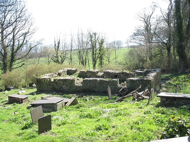
The Old Church of St Gwenllwyfo, Llanwenllwyfo is a medieval ruined church near Dulas, in Anglesey, Wales, perhaps built in the 15th century to replace another church from which only the 12th-century font survived. Dedicated to Gwenllwyfo, a 7th-century female saint about whom nothing else is known, it was used as a chapel of ease for the church in Amlwch, about 5 miles away. Restored in 1610 and again in the 18th and 19th centuries, it contained an oak screen and pulpit from 1610.
It was replaced in the middle of the 19th century by a larger church about two-thirds of a mile (1.1 km) away, to which some of the contents, including a memorial brass plaque from the early 17th century and the church bell, were removed; other items were left behind. The disused church was noted to be in bad condition in 1937, and the roof collapsed in 1950. Little of the structure now remains, as the walls have been reduced to 5 feet (1.5 m) in height.[27]
Porth Wen Brickworks
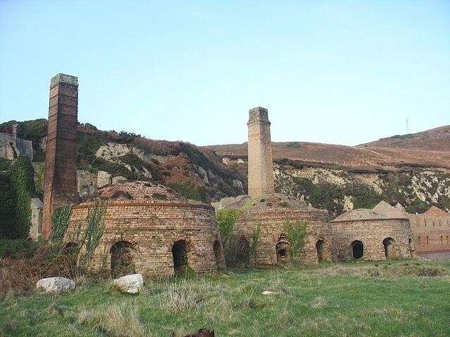
Historical place in the United Kingdom. Porth Wen Brickworks first built by Charles E Tidy, is now a disused Victorian brickworks which produced fire bricks, made from quartzite used to line steel-making furnaces. The substantial remains include a number of buildings and the remains of some of the machinery, but has some damage from sea erosion. The site is a scheduled monument.[28]
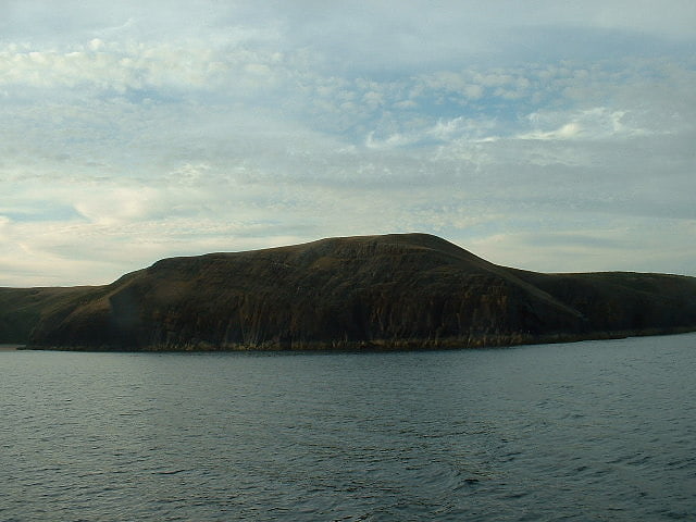
Bwrdd Arthur
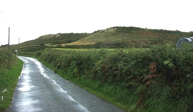
Scenic spot in Wales. Bwrdd Arthur, also known as Din Sylwy, is a 164 metres flat-topped limestone hill on the island of Anglesey. Located on the eastern end of Red Wharf Bay, some 3 kilometres north west of Llangoed, it is noteworthy from the evidence of pre-historic occupation and as a Site of Special Scientific Interest designated for its botanical interest.
The tiny medieval church of St Michael is on the eastern side of the hill fort.[29]
St Cadwaladr's Church
Church in Bodorgan, Wales. St Cadwaladr's Church is a Grade I listed church in Llangadwaladr, Anglesey. The church is built in the perpendicular style. The nave is dated to the 12th to early 13th century and the chancel to the 14th. Considerable additions were later made in the mid 17th century, with the north chapel in 1640 and the south chapel in 1661. In 1856 the church underwent restoration, at which time to south porch was added.
In the newer part of the churchyard, south of the church, are war graves of four British airmen and a Polish airman of World War II.[30]
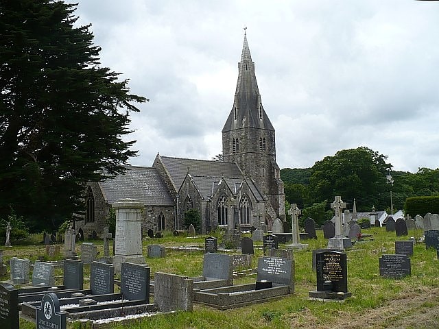
St Eleth's Church
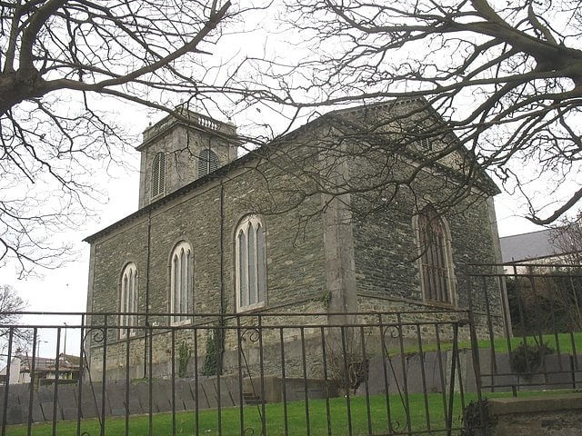
Church in Holyhead, Wales. St Eleth's Church, Amlwch is a parish church built in the Neo-classical style in 1800 in Amlwch, a town on the island of Anglesey in north Wales. It stands on the site of earlier buildings, with the first church here said to have been established by St Elaeth in the 6th century. Increasing prosperity in the town through copper mining during the 18th century led to the construction of a new church to serve the growing population.
The church is still used for services within the Church in Wales, and is one of four churches in the parish of Amlwch. It is a Grade II* listed building, a designation given to "particularly important buildings of more than special interest", because it is a "substantially Neo-classical church retaining much of its original architectural character".[31]
Bodowyr
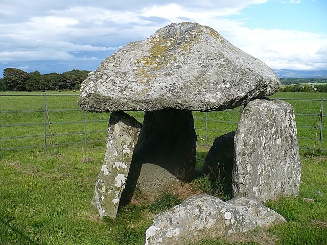
Historical landmark in Wales. Bodowyr Burial Chamber is a Neolithic burial chamber made of a few large stacked stones in a farmer's field on the north Wales island of Anglesey. It is located at Bodowyr Farm, 1.25 mi east of Llangaffo, off the B4419 road.[32]
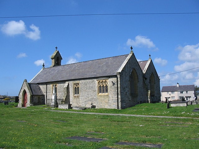
St Maelog's Church
Church in Llanfaelog, Wales. St Maelog's Church is a church in the village of Llanfaelog, situated in the Isle of Anglesey, Wales. The present building dates from the 19th century. It was designated as a Grade II listed building on 4 May 1971.[33]
St Mary's and St Nicholas's Church
St Mary and St Nicholas Church, Beaumaris, is a fourteenth century Grade I listed building in Beaumaris, Anglesey, Wales.[34]
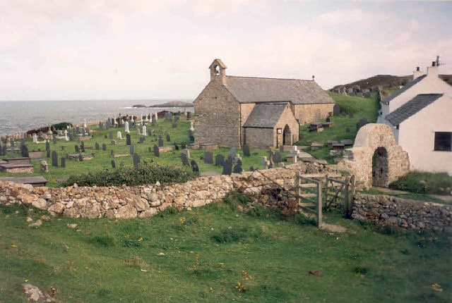
St Ceinwen's Church
St Ceinwen's Church, Llangeinwen, is a Grade II* listed building in Anglesey, north Wales. It is 1.5 kilometres from the neighbouring St Mary's Church, Llanfair-yn-y-Cwmwd.
The historic environment service of the Welsh government, Cadw, says that:
Two sisters, Ceinwen and Dwynwen, founded this church and the now-ruined church on nearby Llanddwyn Island. Both churches were subsequently dedicated to their founders, which is unusual. The present building at Llangeinwen is 12th century and has been in constant use since then. It is grade II* listed. The north and south walls of the nave are of this period, those of the chancel being medieval. The north chapel was added in 19th century as was the tower; gravestones of 9th and 11th centuries are built into the buttresses. The decorated stone font is 13th century. There is a blocked up 12th century doorway on the north wall of the nave. The brass chandeliers are from the early 19th century.
Named for St Ceinwen, the church is located within an enclosed churchyard on the NW side of the A4080, 800m West of the village of Dwyran.[35]