Discover 11 hidden attractions, cool sights, and unusual things to do in Waterton Lakes National Park (Canada). Don't miss out on these must-see attractions: Crypt Falls, Cameron Lake, and Vimy Peak. Also, be sure to include Crypt Lake Trail in your itinerary.
Below, you can find the list of the most amazing places you should visit in Waterton Lakes National Park (Alberta).
Table of Contents
Crypt Falls
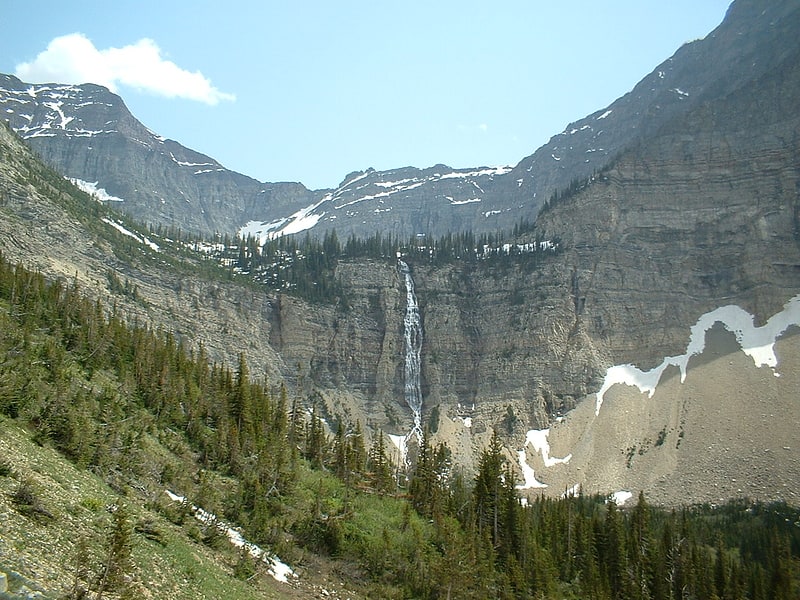
Waterfall in Alberta, Canada. Crypt Falls is a waterfall in southwestern Alberta in Waterton Lakes National Park. It is viewable from the Crypt Lake Trail via ferry service from the Waterton town-site. It drops out of Crypt Lake and feeds a smaller lake below it. The true height of the fall is unknown but it is estimated to be taller than it currently is listed as.[1]
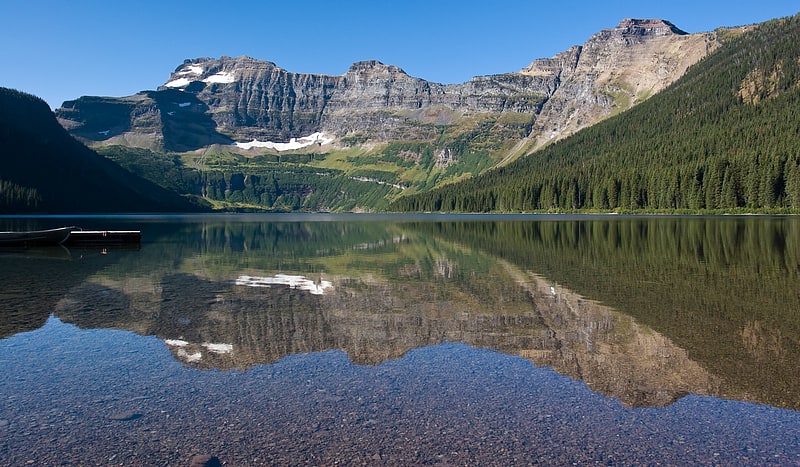
Cameron Lake
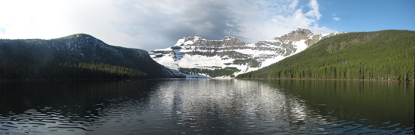
Lake in Alberta, Canada. Cameron Lake is at the end of the Akamina Parkway, Waterton Lakes National Park, Alberta, Canada. It is named after Donald Roderick Cameron a British Royal Artillery captain. The 49th parallel north runs through the southern end of the lake making part of it technically in Glacier County, Montana.[2]
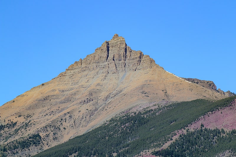
Vimy Peak
Summit in Alberta, Canada. Vimy Peak is a 2,385-metre summit located in Waterton Lakes National Park, in the Canadian Rockies of Alberta, Canada. It is set along the east shore of Waterton Lake on the opposite side from Waterton Park townsite. It is situated 5.4 km west of Sofa Mountain, and the nearest higher neighbor is Arras Peak, 3.1 km to the southeast. Vimy Peak anchors the northern end of Vimy Ridge, which stretches three kilometers to Arras Peak anchoring the southern end.[3]
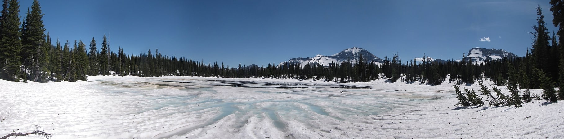
Crypt Lake Trail

Lake in Alberta, Canada. The Crypt Lake Trail is one of the premium hikes in Waterton Lakes National Park in Alberta, Canada. It is accessed by a dedicated ferry service operating from the Waterton Park Townsite.
The first part of the trail offers the choice of two alternate routes for ascent and return running through forest, the longer of which passes the impressive Hellroaring Falls. After that the trail becomes an open walk through a valley crossing small mountain streams and leading up to the views of Crypt Falls. The cascading Crypt Falls are over 150 metres (490 ft) high and are fed by Crypt Lake in the hanging valley above the falls. The last part of the trail is the ascent to Crypt Lake. This part is more challenging; in parts the walk runs at the edge of steep drops, secured by cable and also involves crawling through a narrow, but short, tunnel. Finally the trail reaches the shores of Crypt Lake through a small forest.[4]
First Oil Well in Western Canada
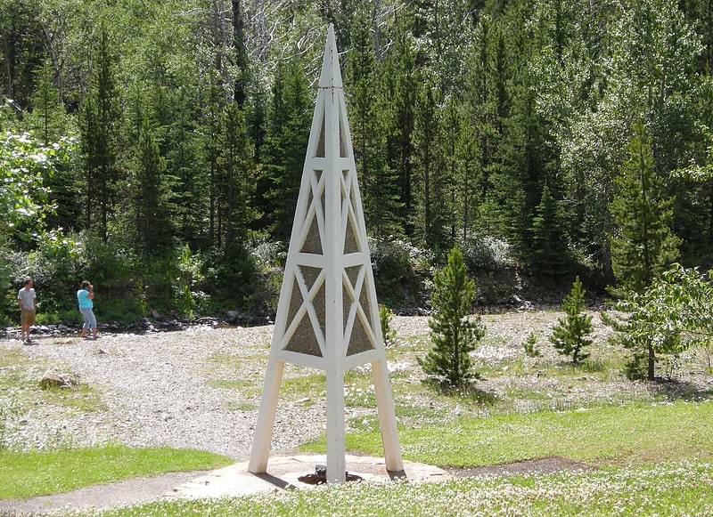
Historical landmark in Alberta, Canada. The First Oil Well in Western Canada also known as Lineham Discovery Well No. 1, is a defunct oil well and national historic site of Canada which commemorates the 21 September 1902 oil strike in what is now Waterton Lakes National Park, Alberta. The oil well originally drilled in 1902, was the first productive oil well in the Western Canadian provinces.
The well was drilled by John Lineham, a Calgary businessman and former member of the Legislative Assembly for the North-West Territories, George K. Leeson and Kootenay Brown, whose Rocky Mountain Development Company purchased a mineral claim of 650 acres (2.6 km2) on the land along Oil Creek (now Cameron Creek) for a dollar an acre, a region of natural oil seeps. The area had been drilled unsuccessfully for oil in the early 1890s, without results. Lineham's well was drilled by a wood "Canadian Pole" rig powered by a 35-horsepower (26 kW) steam engine. Drilling began in November 1901 and came in on 21 September 1902, with the Lineham Discovery Well No. 1 struck oil at 311 metres (1,020 ft), producing saleable quantities of oil at the rate of 300 barrels per day (48 m3/d). However, the well casing quickly failed, and the bore became jammed with debris and drilling tools. It was cleared in 1904, and a pump was installed. Drill tools again jammed the well and the well was abandoned. The tools remain visible in the bore. Total production was about 8,000 barrels (1,300 m3) of oil.
Production had dwindled before the well was blocked. Further explorations in the area yielded nothing useful with a majority of the nearby drilling sites abandoned by 1908, but general exploration in more northerly portions of Alberta yielded the Turner Valley field in 1914. The Oil Creek strike is believed to be the result of oil seepage along fault planes in the Lewis Overthrust, in which oil originating in younger Cretaceous rock has moved upwards through older Pre-Cambrian rock that has been forced over the oil-bearing layers. More oil in the Waterton area was eventually discovered at the Pincher Creek oil field in 1948.
A small monument, depicting a stylized drill rig, was placed over the well in 1968. The site was designated a site of national significance in 1965.[5]
Summit Lake
Lake in Alberta, Canada. Summit Lake is located east of Cameron Lake in Waterton Lakes National Park Alberta, Canada along the Alderson-Carthew trail. It lies in the pass between Mount Carthew and Mount Custer.[6]
Mount Crandell
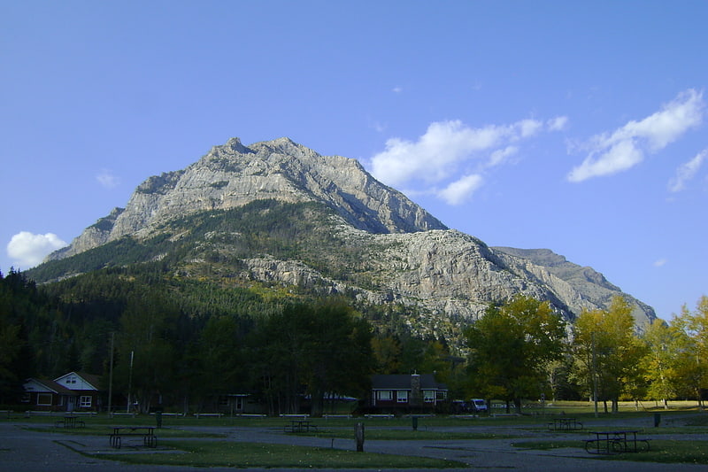
Mountain in Alberta, Canada. Mount Crandell is a 2,381-metre mountain summit located in Waterton Lakes National Park, in the Canadian Rockies of Alberta, Canada. It is situated immediately north of the Waterton townsite. Its nearest higher peak is Bertha Peak, 2.94 km to the south-southwest.[7]
Mount Dungarvan
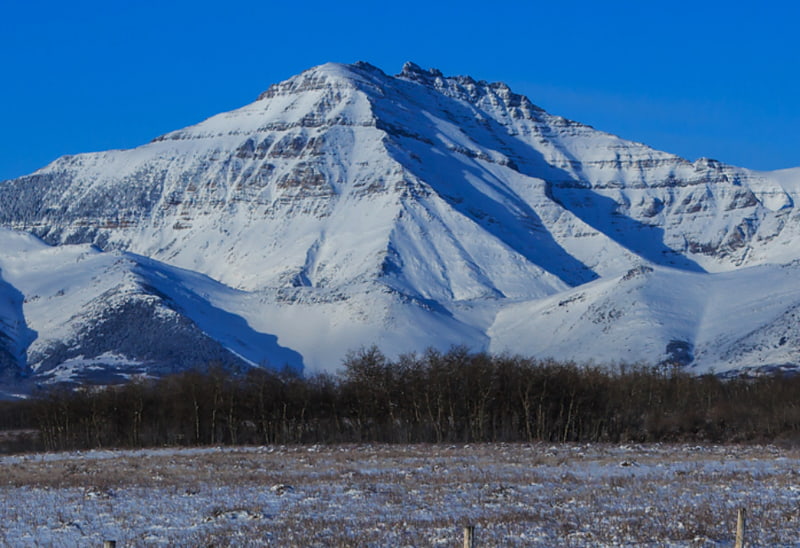
Mountain in Alberta, Canada. Mount Dungarvan is a 2,575-metre mountain summit located in Waterton Lakes National Park, in the Canadian Rockies of Alberta, Canada. Its nearest higher peak is Cloudy Peak, 2.8 km to the west.[8]
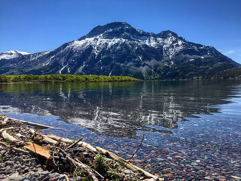
Waterton Lake
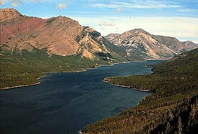
Lake in Alberta, Canada. Waterton Lake is a mountain lake in southern Alberta, Canada and northern Montana, United States. The lake is composed of two bodies of water, connected by a shallow channel known locally as the Bosporus. The two parts are referred to as Middle Waterton Lake, and Upper Waterton Lake, the latter of which is divided by the Canada–United States border with Canada containing about two thirds of the lake while the Southern third falls in the United States. The Boundary Commission Trail ends at the lake as the last border marker was placed there on 8 August 1874. The United States Geological Survey gives the geocoordinates of 49°03′00″N 113°54′03″W for Upper Waterton Lake. Lower Waterton Lake is north of Middle Waterton Lake and is separated by a channel known as the Dardanelles.
The northern, lower end of the main lake lies in Waterton Lakes National Park while the upper, southern part of the lake is located in Glacier National Park. In 1979, UNESCO established the Waterton Biosphere Reserve to protect the diverse habitats including prairie grasslands, aspen parkland, subalpine forests, alpine tundra and freshwater fens that surround the lake.
Waterton-Glacier International Peace Park was created by the US and Canada in 1932, and in 1976 it was designated an International Biosphere Reserve. Later, in 1995, it was inscribed as a World Heritage Site by UNESCO.
The upper and middle Waterton Lake system has a surface of 10.1 km2 (3.9 sq mi), while the lower lake, which is in Canada only, has 1.5 km2 (0.58 sq mi) and lies at an altitude of 1,274 m (4,180 ft). Two soundings of the lake were 210 feet (64 m) and 317 feet (97 m), done in 1910. More recent soundings have revealed a depth of 490 ft (150 m).
Highway 5 has its westernmost point on the shores of the lake.[9]
Forum Peak
Summit in Alberta, Canada. Forum Peak is a summit located on the border of Alberta and British Columbia on the Continental Divide. It is the southernmost mountain in the Canadian Rockies, situated only 500 metres north of the Canada–United States border. It was named after Forum Lake below the mountain. It is visible from the end of Highway 5 at Cameron Lake, which is within Waterton Lakes National Park, and the mountain is on the park's southwest border.[10]
Mount Galwey
Mountain in Alberta, Canada. Mount Galwey is a mountain located north of Blakiston Creek in Waterton Lakes National Park, Alberta, Canada. The mountain was named in 1934 after Lt. Galwey, who was an astronomer for the International Boundary Commission.[11]