Discover 8 hidden attractions, cool sights, and unusual things to do in Manitoulin Island (Canada). Don't miss out on these must-see attractions: Bridal Veil Falls, Lake Manitou, and Assiginack Museum and Heritage Complex. Also, be sure to include Lake Kagawong in your itinerary.
Below, you can find the list of the most amazing places you should visit in Manitoulin Island (Ontario).
Table of Contents
Bridal Veil Falls
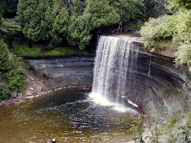
Waterfall in Ontario, Canada. Bridal Veil Falls is a waterfall near the town of Kagawong on Lake Huron's Manitoulin Island, Ontario, Canada. The water source is the Kagawong River, which flows from Lake Kagawong to the North Channel of Lake Huron.
It has a height of approximately 35 feet (11 m). There is a short hiking trail from the falls down to the North Channel.
There are two parking lots and two approaches to the falls: one from the top of the outdoor steel staircase next to the falls, and another from a few hundred yards down the trail, past some of the rapids. Both are easily accessible from Highway 540.[1]
Address: Manitoulin Island, Manitoulin Island
Lake Manitou
Lake in Ontario, Canada. Lake Manitou is the largest lake on Manitoulin Island in Ontario, Canada. With an area of 104 square kilometres, it is the largest lake on a lake island in the world. It is drained by the Manitou River.
There are a number of small islands in Lake Manitou, such as Roper Island and Bear Island in the very south of the western lobe of the lake, and McCracken's Island in the neck connecting the two lobes, making them islands in a lake on an island in a lake. However, none of the islands are as large as Treasure Island in a neighboring, smaller lake on Manitou Island.[2]
Assiginack Museum and Heritage Complex
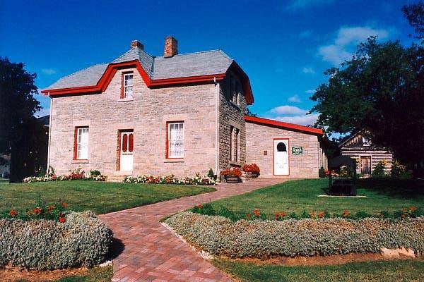
Specialty museum, Museum
Address: 125 Arthur Street, P0P 1N0 Manitowaning
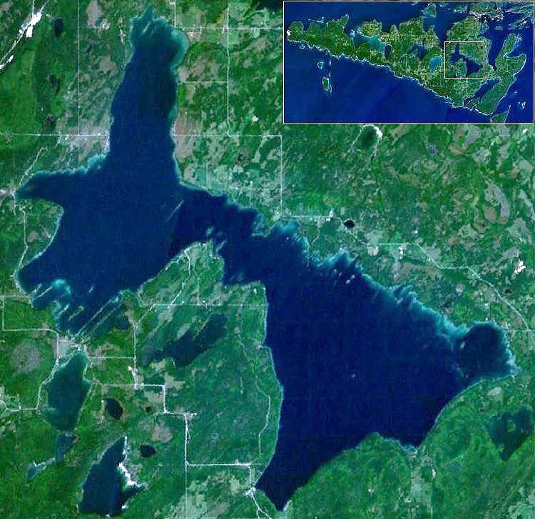
Lake Kagawong
Lake in Ontario, Canada. Lake Kagawong is the second largest lake on Manitoulin Island in Ontario, Canada. Located in the central part of the island, the lake is drained by the Kagawong River, which falls over Bridal Veil Falls into Lake Huron. Kagawong means " from the falling " in the local Ojibwe language.
Lake Kagawong has moderately deep (10-15 meter average) clear-green water, with vertical visibility of 5–6 meters.
Located centrally in Lake Kagawong is an archipelago, consisting of the mile-long (1.6 km) Kakawaie Island, and the much smaller Little Island and Gull Island. There is also an unnamed submerged island that is part of this group. Two miles (3.2 km) north of Kakawaie Island is the solitary Bass Island. All of the islands are uninhabited. Occasionally, large mammals such as deer will be seen on the large island. It is assumed that these animals find their way onto the island during the winter months when the lake is frozen, and are stranded there upon the breakup of the ice.
Most of Lake Kagawong is navigable by recreational and fishing boats, though there are several hazards to navigation. Most notable are the previously mentioned submerged island (located 200 yards (178 m) directly east of Kakawaie Island), the shoals of Kerr's Point and Ednie's Point, and the shallow bays Mud Bay and Prior's Bay. However, few areas have claimed more boaters' propellers than the eastern submerged extension of Twin Harbours. This peninsula of suitcase-sized boulders rises very fast from the 20-meter-deep waters of southern Lake Kagawong. Its location at the entrance to the bay that is home to the government boat ramp and that further enhances its reputation as Lake Kagawong's primary hazard to navigation.
The deepest areas of the lake are, ironically, very close to shore. The easternmost shore of Lake Kagawong consists of a sheer rocky ledge. This ledge can be as low as 1–2 meters, but rises up to 15 meters at Red Rock. The cliffs of Red Rock rise from water that is in excess of 40 meters deep. Care should be taken when boating next to these cliffs, as rockfalls are frequent.
Fishing remains Lake Kagawong's primary attraction over the years. Various species have obtained dominance in popularity. In the early 1900s, smallmouth bass and northern pike were caught in great numbers. Photos exist of proud fishermen displaying catches of nearly 100 bass and pike taken in a single outing. In the 1950s and 60s, whitefish were fished commercially on the lake (although the whitefish population is essentially extinct in the lake today). Throughout the 1970s, 80s, and 90s, yellow perch and smallmouth bass have been the primary target of anglers. Today, there is a controversial effort to stock the lake with yellow walleye. Many fishermen are blaming the walleye stocking effort for the recent decline in yellow perch catches. However, both fishing pressure and the recent arrival of fish-eating cormorants certainly share some of the blame. Other fish occasionally caught on Lake Kagawong are rock bass, pumpkinseed, and catfish.[3]
Ojibwe Cultural Foundation
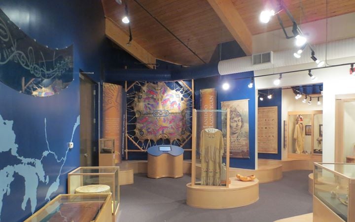
History museum, Museum
Address: 15 Highway 551, P0P 1G0 M'Chigeeng
Southbay Gallery and Guesthouse on Manitoulin
Art gallery, Shopping, Museum
Address: 14 Given Road, P0P 1Z0 South Baymouth
Holy Cross Church
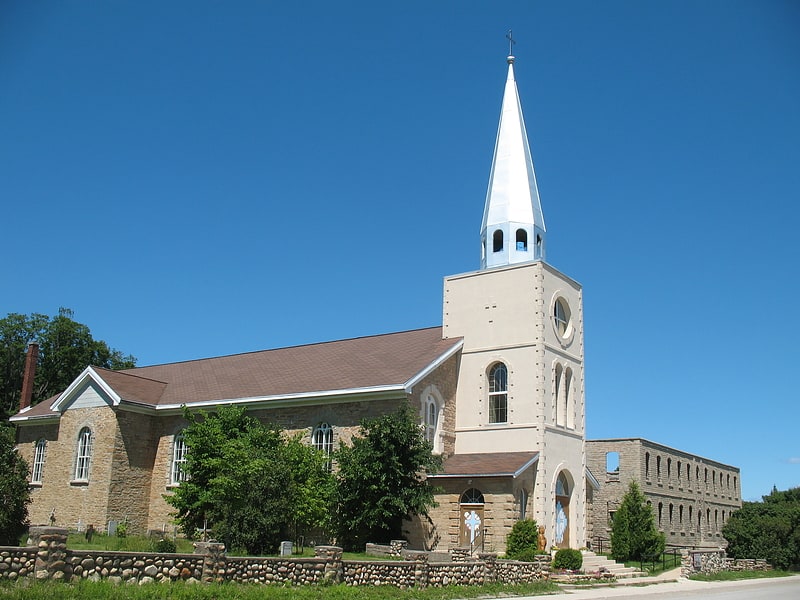
Parish church in Wikwemikong First Nation, Ontario. Holy Cross Church is a Roman Catholic Parish church in the Wiikwemkoong Unceded Reserve, north-eastern Manitoulin island. It was founded by the Society of Jesus in 1844 and was their first mission in Northern Ontario since their suppression in 1767. The mission played a significant role in increasing literacy in Canada of the Ojibwe language. The church building itself was constructed in 1852. It is situated to the north of Wiikwemkoong on Wikwemikong Way, next to the Giizhigaanang Community Centre.[4]
Address: 2525 Wikwemikong Way, P0P 2J0 Wikwemikong
Manitoulin District
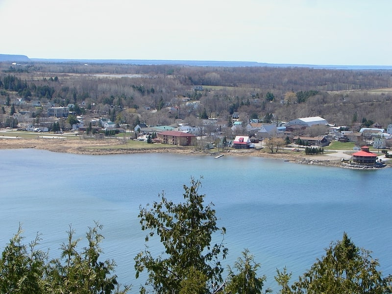
Municipality in Ontario, Canada. Manitoulin District is a district in Northeastern Ontario within the Canadian province of Ontario. It was created in 1888 from part of the Algoma District. The district seat is in Gore Bay.
It comprises Manitoulin Island primarily, as well as a number of smaller islands surrounding it, such as Barrie, Cockburn, and Great La Cloche islands. Previously it included the municipality of Killarney on the mainland, until this was transferred to Sudbury District in the late 1990s. Subsequently, more mainland portions were added to Killarney and these, together with Unorganized Mainland Manitoulin District, were also transferred to Sudbury District in 2006, about 1,600 square kilometres (600 sq mi) in all.[5]