Discover 9 hidden attractions, cool sights, and unusual things to do in Wantage (United Kingdom). Don't miss out on these must-see attractions: Vale and Downland Museum, Church of St Peter and St Paul, and Statue of Alfred the Great. Also, be sure to include Blowing Stone in your itinerary.
Below, you can find the list of the most amazing places you should visit in Wantage (England).
Table of Contents
Vale and Downland Museum
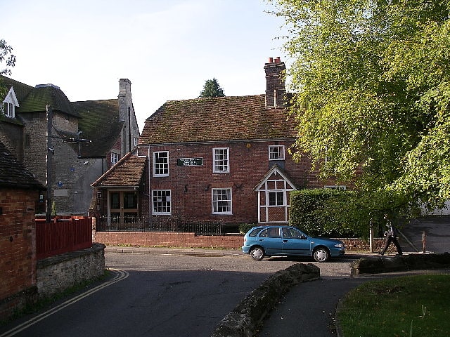
Museum in Wantage, England. The Vale and Downland Museum is a local museum in the market town of Wantage, Oxfordshire, England. Its galleries present the cultural heritage of the Vale of White Horse region around Wantage. A Victorian kitchen, Iron Age skeleton and a bust of Sir John Betjeman are amongst its attractions, along with a cafe serving home-made food. During school holidays there are several themed days, most of which are 'entry by donation'.
The museum also acts as a community hub, holding a weekly Women's Institute market, several book groups and various drawing, knitting and needlework classes. The museum is housed in the Old Surgery, Church Street, in the centre of the town. It has around 1,500 books, pamphlets and periodicals in its library.[1]
Address: 19 Church St, OX12 8BL Wantage
Church of St Peter and St Paul
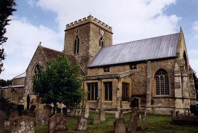
Building in Wantage, England. The Church of St Peter and St Paul is a Church of England parish church in Wantage, Oxfordshire. The church is a grade I listed building.[2]
Address: 28 Market Pl, OX12 8AE Wantage
Statue of Alfred the Great
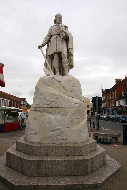
Statue by Prince Victor of Hohenlohe-Langenburg. The statue of Alfred the Great, in the Wantage market place, was sculpted by Count Gleichen, a relative of Queen Victoria's, and unveiled on 14 July 1877 by the Prince and Princess of Wales. It was presented to the town by Robert Loyd-Lindsay, 1st Baron Wantage. It depicts the 9th-century King Alfred the Great.
The Grade II listed statue was vandalised on New Year's Eve 2007, losing part of its right arm and axe. After the arm and axe were replaced the statue was again vandalised on Christmas Eve 2008, losing its axe.[3]
Blowing Stone
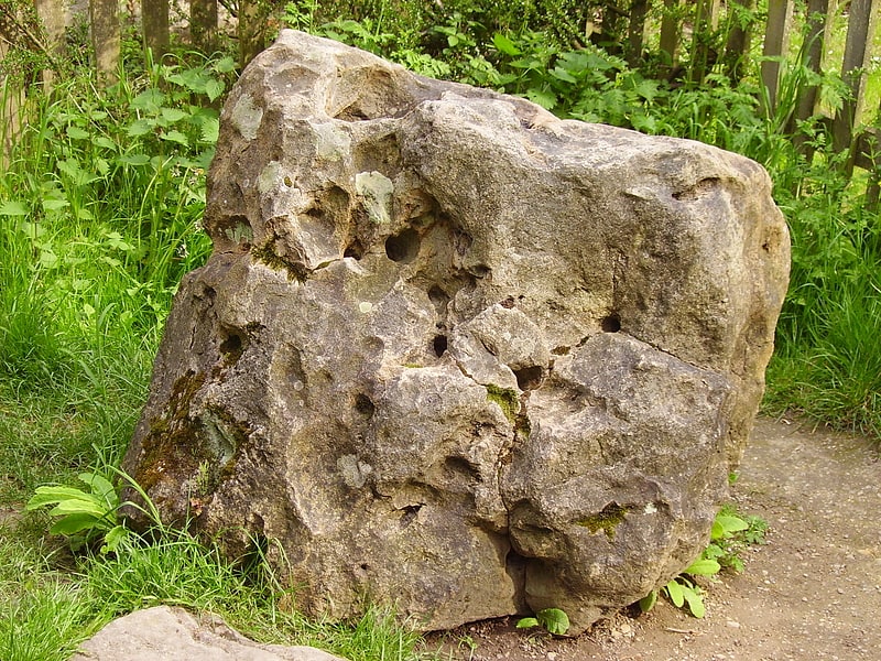
The Blowing Stone is a perforated sarsen at grid reference SU32412 87083 in Kingston Lisle, which is in the traditional county of Berkshire, but is currently administered as part of Oxfordshire. The stone is in a garden at the foot of Blowingstone Hill just south of the Icknield Way, about 4+1⁄2 miles west of Wantage and about 1+1⁄2 miles east of White Horse Hill.
Blowingstone Hill is part of the escarpment of the Berkshire Downs, at the crest of which is The Ridgeway.[4]
Address: Blowingstone Hill, OX12 9QE Wantage
Chain Hill
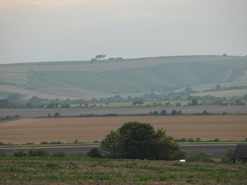
Chain Hill is one of the hills of the North Wessex Downs, located in the civil parish of Wantage in the English county of Oxfordshire. In 1974 it was transferred from Berkshire. It is designated part of the Area of Outstanding Natural Beauty by the Countryside Agency and forms part of the Vale of White Horse.
Chain Hill is the chalk downland hill directly above Wantage and also the name of the road rising from Wantage through the westerly part of the scarp to the Berkshire Downs. It rises steeply south of Wantage towards Wantage Field and back to the Ridgeway and east from Manor Road across to Lark Hill. Chain Hill is also known as the B4494 and is signposted to Newbury.
At the crest of the hill, there is a small community amid copses of beech, fir and chestnut and a reservoir which taps into the chalk water beds and supplies water to Wantage. Apart from this, most of Chain Hill is wide undulating crop plains made up of large fields descending from the ridgeway. At the bottom slopes of Chain Hill is a cemetery and then at the bottom of this, is Ormond Road and former St. Mary's School.[5]
Hackpen
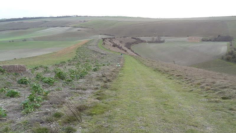
Hackpen, Warren & Gramp's Hill Downs is a 71.4-hectare biological Site of Special Scientific Interest in Letcombe Bassett in Oxfordshire.
The site is composed of three separate sloping areas of unimproved chalk downland, representing a type of habitat now uncommon in the Berkshire Downs. It was formerly notified as Hackpen Hill and Crowhole Bottom. Eleven species of butterfly have been recorded, including chalkhill blue, brown argus and marbled white. The site has extensive views over rolling countryside.
Gramp's Hill Down is the most easterly area, and the closest to Letcombe Bassett. The main grass is upright brome, and it has a rich variety of herbs, including yellow rattle, chalk milkwort and kidney vetch.
The eastern half of the central area, Warren Down, is also dominated by upright brome, with herbs including bulbous buttercup and salad burnet. The main grass in the western half is meadow grass, with bare patches and rabbit damaged areas which have been colonised by plants of disturbed ground such as henbane.
At the western end is Hackpen Down, the largest part of the site, which has a wide variety of aspects and gradients. The main grass is red fescue, and herbs include horseshoe vetch and common rockrose. A narrow strip to the east contains hawthorns and elder scrub.[6]
Lockinge Estate
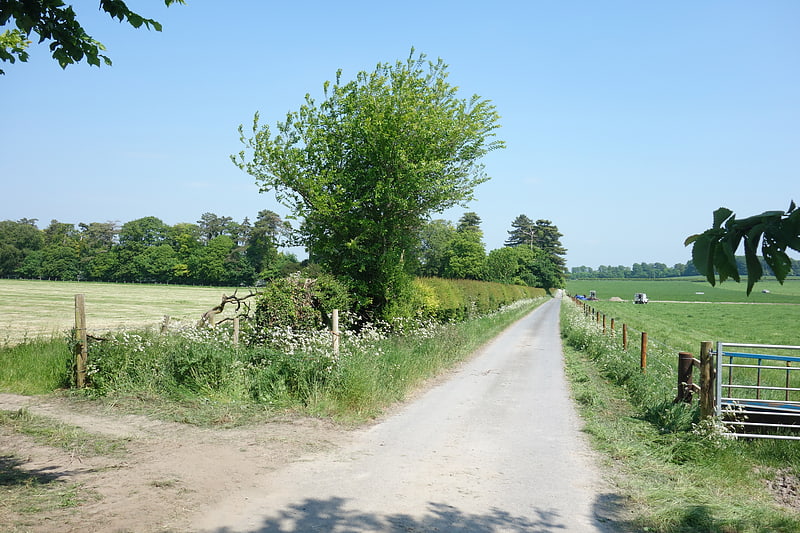
The Lockinge Estate is a 3,035-hectare agricultural and housing estate near Wantage that today includes most of the land and property encompassing the villages of West Lockinge, East Lockinge and Ardington. The current manager of the Lockinge Estate is Thomas Loyd. Almost the entire estate is included within the North Wessex Downs Area of Outstanding Natural Beauty.
The ancient Icknield Way passed through the estate, as does the modern-day National Cycle Route 544.[7]
Highlands Farm Pit
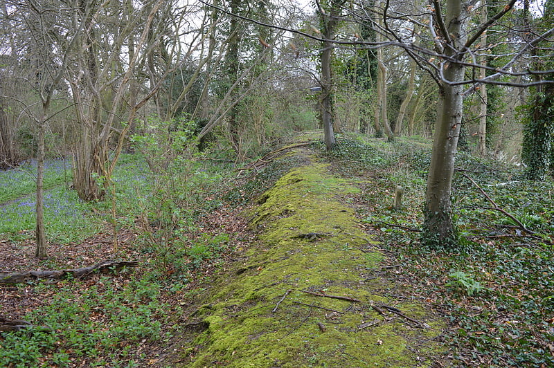
Highlands Farm Pit is a 0.6 hectare geological Site of Special Scientific Interest in Henley-on-Thames in Oxfordshire. It is a Geological Conservation Review site.
The site exposes gravel from the abandoned channel of the River Thames before the Anglian ice age pushed the river south around 450,000 years ago. It may date to the late Anglian Black Park Terrace which would make it the latest known exposure of the gravel floor of the old channel, and therefore of considerable importance. It has revealed large quantities of Palaeolithic flints, which are some of the earliest of their type known. It is described by Natural England as a "crucial site".
The site is a long narrow strip of land, and there is a footpath through it from the lane to the farm.[8]
Reed Hill
Heritage preservation in England. Reed Hill is a 14-hectare biological Site of Special Scientific Interest west of Stonesfield in Oxfordshire. It partly overlaps Stonesfield Slate Mines SSSI.
This sheltered dry valley has unimproved limestone grassland, secondary woodland and scrub. A spring at the northern end makes the ground there seasonally damp. Invertebrates include the small blue, Duke of Burgundy and dark green fritillary butterflies, the small shield bug Neotti-glossa pusilla, the beetle Oedemera lurida and the spider Hypsosinga pygmaea.[9]