Discover 20 hidden attractions, cool sights, and unusual things to do in South Downs National Park (United Kingdom). Don't miss out on these must-see attractions: Butser Ancient Farm, Highdown Gardens, and St. Catherine's Hill. Also, be sure to include Beacon Hill in your itinerary.
Below, you can find the list of the most amazing places you should visit in South Downs National Park (England).
Table of Contents
Butser Ancient Farm
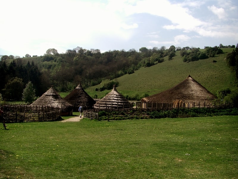
Museum in Chalton, England. Butser Ancient Farm is an archaeological open-air museum located near Petersfield in Hampshire, southern England. Butser features experimental reconstructions of prehistoric, Romano-British and Anglo-Saxon buildings. Examples of Neolithic dwellings, Iron Age roundhouses, a Romano-British villa and an early Saxon house are on display. The site is used as both a tourist attraction and a site for the undertaking of experimental archaeology. In this latter capacity, it was designed so that archaeologists could learn more about the agricultural and domestic economy in Britain during the millennium that lasted from circa 400 BCE to 400 CE, in what was the Late British Iron Age and Romano-British periods.
Founded in 1970 by the Council for British Archaeology, in 1972 they recruited experimental archaeologist Peter J. Reynolds to run the site as project director. It was initially located on the site of a Bronze and Iron Age farmstead on Butser Hill, but in 1989 relocated to Hillscombe Down, and in 1991 to Bascombe Copse on the slopes of Windmill Hill.
The farm is open to the public and runs various events throughout the year. Archaeologist Mick Aston commented that "Virtually all the reconstruction drawings of Iron Age settlements now to be seen in books are based" on the work at Butser Farm, and that it "revolutionised the way in which the pre-Roman Iron Age economy was perceived".[1]
Address: Chalton Lane, PO8 0BG Chalton
Highdown Gardens
Garden in Worthing, England. Highdown Gardens are gardens on the western edge of the town of Worthing, close to the village of Ferring and the National Trust archaeological site Highdown Hill, in West Sussex, England. Overlooking the sea from the South Downs, they contain a collection of rare plants and trees, collectively a national collection. The gardens are owned and maintained by Worthing Borough Council with free admission.
Created from a chalk quarry where there was little soil and unfavourable conditions for plant growth, the Chalk Garden at Highdown is the achievement of Sir Frederick Stern (1884–1967) and his wife, who purchased the 8.52 acres (3.45 ha) in 1909 and worked for 50 years to show that plants would grow on chalk.
The gardens were created during a period when expeditions were going to China and the Himalayas collecting rare and interesting plants. Many of the original plants from the early collections are in the garden today, particularly plants collected by Reginald Farrer and Ernest Henry Wilson.
On the death of Sir Frederick in 1967, aged 83, Lady Stern carried out his wishes and left the gardens to Worthing Borough Council.
During spring and early summer there is a succession of flowering bulbs: snowdrops, crocus, anemones and daffodils, followed by paeonies and bearded iris.[2]
Address: Littlehampton Rd, BN12 6PG Worthing
St. Catherine's Hill
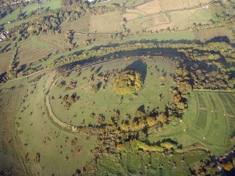
Nature preserve in Winchester, England. St. Catherine's Hill is a 43-hectare biological Site of Special Scientific Interest on the outskirts of Winchester in Hampshire. It is managed by Hampshire and Isle of Wight Wildlife Trust, and most of it is an Iron Age hillfort, which is a Scheduled Monument.[3]
Address: Garnier Road, South Downs National Park
Beacon Hill
Beacon Hill, Warnford is a 46.4-hectare biological Site of Special Scientific Interest west of Warnford in Hampshire. It is a Nature Conservation Review site, and an area of 40.1 hectares is a national nature reserve. There is a round barrow cemetery dating to the Late Neolithic or Bronze Age on the hill, and this is a scheduled monument.[4]
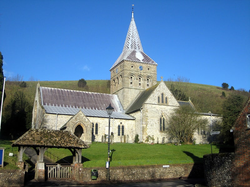
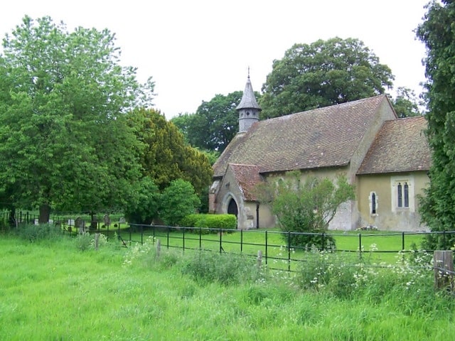
St Mary's Church
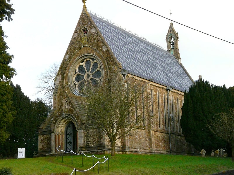
Anglican church in Itchen Stoke and Ovington, England. St Mary, Itchen Stoke, Hampshire, is a redundant Anglican church in the parish of Itchen Stoke and Ovington. It has been designated by English Heritage as a Grade II* listed building, and is under the care of the Churches Conservation Trust.[5]
Old Winchester Hill
Nature preserve in England. Old Winchester Hill is a 66.2-hectare biological Site of Special Scientific Interest in Hampshire. It is a Nature Conservation Review site, Grade I, and a national nature reserve. Part of it is a scheduled monument.[6]
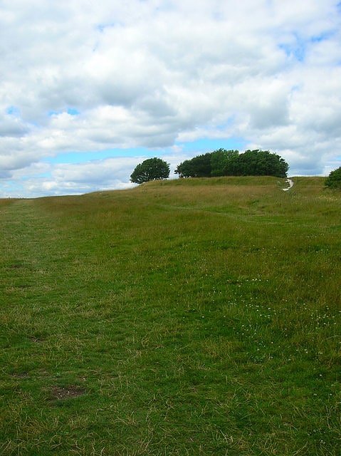
Butser Hill
Hill in England. Butser Hill is a 239.7-hectare biological and geological Site of Special Scientific Interest south-west of Petersfield in Hampshire. It is a national nature reserve and a Special Area of Conservation. Part of it is a Geological Conservation Review site and an area of 84.8 hectares is Oxenbourne Down, which is designated a Local Nature Reserve. Part of it is a Scheduled Monument.
It is a chalk hill and one of the highest points in Hampshire. It is also the highest point on the chalk ridge of the South Downs and the second highest point in the South Downs National Park after Blackdown in the Western Weald. Although only 271 metres (889 ft) high, it qualifies as one of England's Marilyns. It is located within the borders of the Queen Elizabeth Country Park.
The name Butser comes from the Old English Bryttes Oran meaning Briht's slope. Oran or Ora is Old English for flat topped hill and/or steep slope.
The flat summit is surrounded by a number of spurs. Iron Age ditches and banks divide the spurs from the summit although the purpose of these earthworks is unclear.
There is evidence of lynchet farming on the southeast side of the hill. The age of the lynchets is unknown but Roman pottery has been brought to the surface by rabbit holes.
There are aerial masts on the hill.
The hill was purchased by Hampshire County Council in 1966. Prior to the purchase the summit was used for growing wheat but now the only farming activity is grazing.
Butser Hill has a rich variety of flora and fauna located upon the hill. Butser Hill is in the top twenty Hampshire chalk grassland sites for its rich vascular flora, and is the richest chalk grassland site in Hampshire in terms of its bryophyte (125 species) and lichen (82 species) flora. As well as this, over 30 species of butterfly have been recorded, including populations of Duke of Burgundy and the Silver-spotted Skipper, making the area an important conservation area for many butterfly species.
There is an annual Fell Run called the Butser Hill Challenge that involves running up and down the hill three times.[7]
Beacon Mill
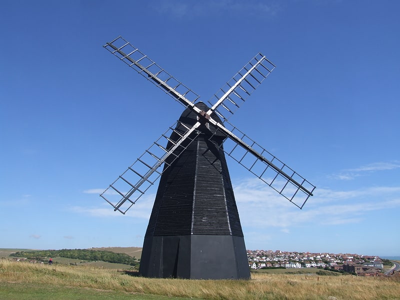
Beacon Mill or New Mill is a grade II listed smock mill at Rottingdean, Sussex, England which has been restored as a seamark.[8]
Winchester Science Centre
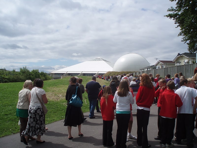
Building in England. Winchester Science Centre is a hands-on, interactive, science and technology centre located in Morn Hill, just outside the city of Winchester in Hampshire, England. The centre opened in 2002 after major grants from amongst others the Millennium Commission, IBM, SEEDA and Hampshire County Council to replace an existing facility. It is a registered charity under English law.
The centre welcomes over 185,000 visitors each year and houses a range of interactive exhibits, aimed at a core audience of children aged 5–12 years old. The dome is now a state-of-the-art digital planetarium seating 168.[9]
Address: Telegraph Way, SO21 1HZ Winchester
All Saints Church
Parish church in East Meon, England. All Saints Church is an Anglican parish church in the village of East Meon, Hampshire, England. It is a Grade I listed building and the oldest building in the village, lying so tight to a hill to the north of the village – part of the South Downs – that there was no room for a north aisle to be built. Most of the church dates from the Norman period, with the south chapel and south aisle being added in the 13th century.
According to Nikolaus Pevsner it is "one of the most thrilling village churches in Hampshire", to John Betjeman it is "a striking, boldly massed church set above the village against a green down", while Simon Jenkins states that of the Saxon foundations in the Meon valley, "few are as satisfying as East Meon".[10]
Address: 2 Church Ln, GU32 1NL Petersfield
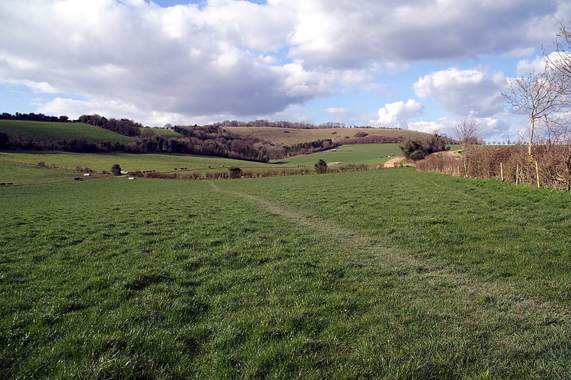
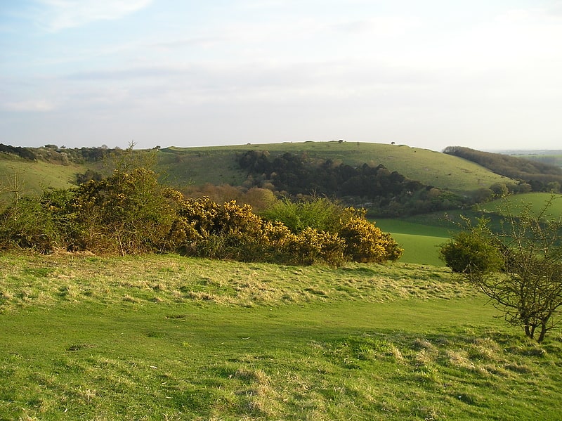
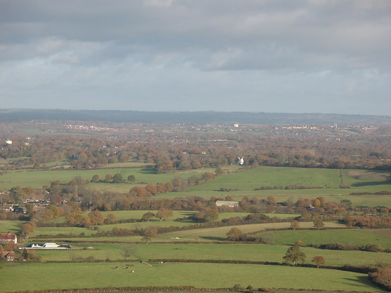
South Downs
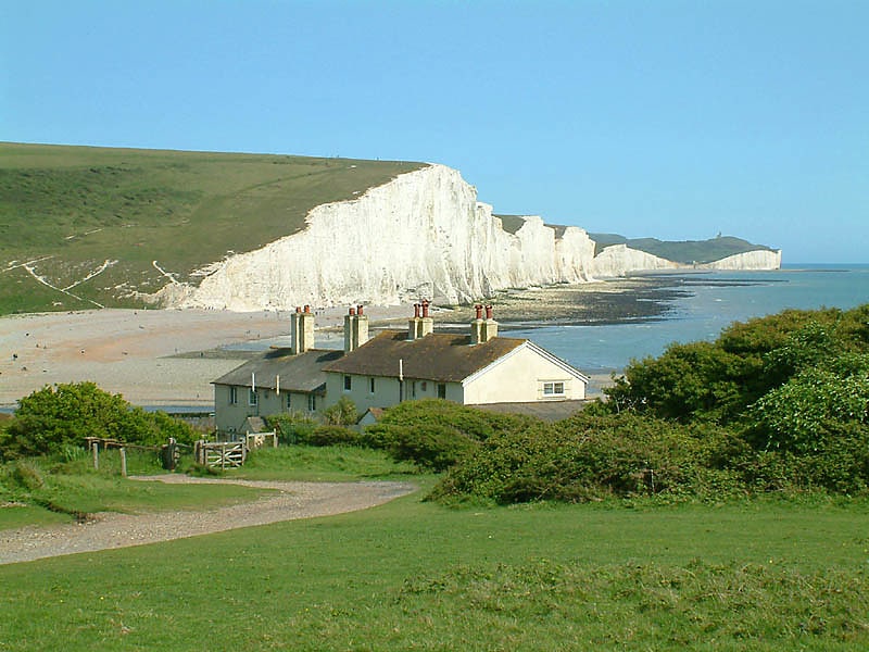
Mountain range in England. The South Downs are a range of chalk hills that extends for about 260 square miles across the south-eastern coastal counties of England from the Itchen valley of Hampshire in the west to Beachy Head, in the Eastbourne Downland Estate, East Sussex, in the east. The Downs are bounded on the northern side by a steep escarpment, from whose crest there are extensive views northwards across the Weald. The South Downs National Park forms a much larger area than the chalk range of the South Downs and includes large parts of the Weald.
The South Downs are characterised by rolling chalk downland with close-cropped turf and dry valleys, and are recognised as one of the most important chalk landscapes in England. The range is one of the four main areas of chalk downland in southern England.
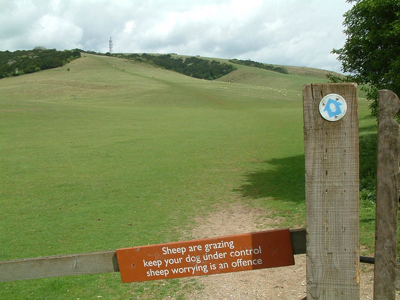
The South Downs are relatively less populated compared to South East England as a whole, although there has been large-scale urban encroachment onto the chalk downland by major seaside resorts, including most notably Brighton and Hove. The South Downs have been inhabited since ancient times and at periods the area has supported a large population, particularly during Romano-British times. There is a rich heritage of historical features and archaeological remains, including defensive sites, burial mounds and field boundaries. Within the South Downs Environmentally Sensitive Area there are thirty-seven Sites of Special Scientific Interest, including large areas of chalk grassland.
The grazing of sheep on the thin, well-drained chalk soils of the Downs over many centuries and browsing by rabbits resulted in the fine, short, springy turf, known as old chalk grassland, that has come to epitomise the South Downs today. Until the middle of the 20th century, an agricultural system operated by downland farmers known as 'sheep-and-corn farming' underpinned this: the sheep (most famously the Southdown breed) of villagers would be systematically confined to certain corn fields to improve their fertility with their droppings and then they would be let out onto the downland to graze. However, starting in 1940 with government measures during World War II to increase domestic food production and continuing into the 1950s, much grassland was ploughed up for arable farming, fundamentally changing the landscape and ecology, with the loss of much biodiversity. As a result, while old chalk grassland accounted for 40-50% of the eastern Downs before the war, only 3-4% survives. This and development pressures from the surrounding population centres ultimately led to the decision to create the South Downs National Park, which came into full operation on 1 April 2011, to protect and restore the Downs.
The South Downs have also been designated as a National Character Area (NCA 125) by Natural England. It is bordered by the Hampshire Downs, the Wealden Greensand, the Low Weald and the Pevensey Levels to the north and the South Hampshire Lowlands and South Coast Plain to the south.
The downland is a highly popular recreational destination, particularly for walkers, horseriders and mountain bikers. A long distance footpath and bridleway, the South Downs Way, follows the entire length of the chalk ridge from Winchester to Eastbourne, complemented by many interconnecting public footpaths and bridleways.[11]
Highdown Hill
Historical landmark in Ferring, England. Highdown Hill is a hill in the South Downs, with a height of 81 metres. The summit of the hill and its western slopes lie in the parish of Ferring in the Arun district, while its eastern slopes lie in the borough of Worthing. It is a popular spot for picnickers, dog-walkers and local riders. It overlooks Littlehampton, Angmering, Ferring and Worthing with views, when the weather is good, east as far as the Seven Sisters and west to the Isle of Wight. It is the property of the National Trust. To the north the ancient hill forts of Cissbury Ring and Chanctonbury Ring can be seen, and the remains of an ancient hill fort exist on the summit of Highdown Hill. Highdown Hill is the traditional burial-place of the kings of Sussex.
At the base of the hill there is a car park, toilets, gardens, cafe, hotel and restaurant. The gardens are currently undergoing refurbishment.[12]
Shillinglee Lake
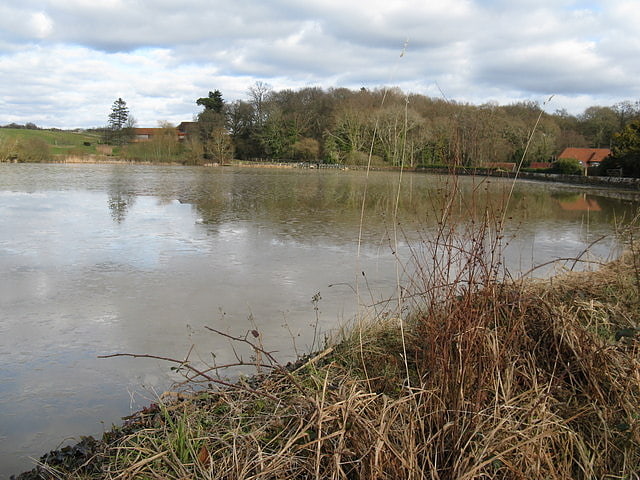
Lake in England. Shillinglee Lake is a 17-hectare biological Site of Special Scientific Interest west of Plaistow in West Sussex.
The lake has been designated an SSSI because it has four nationally uncommon plants. It is one of only ten locations in the country for Leersia oryzoides, a species of cut-grass. The other three are water mudwort, needle spikerush and six-stamen waterwort, all of which are found on mud when the water level is low.
Footpaths skirt the lake at several points.[13]
Ditchling Unitarian Chapel
Ditchling Unitarian Chapel is a Unitarian chapel in Ditchling, a village in the English county of East Sussex. A congregation of General Baptists began to meet in the 17th century in the village, which was a local centre for Protestant Nonconformist worship, and by the time the present simple Vernacular-style chapel was constructed in 1740 a large proportion of the population held Baptist beliefs. Along with other General Baptist chapels in Sussex, the congregation moved towards Unitarian views in the mid-18th century; this caused a schism which resulted in a new chapel being formed at nearby Wivelsfield. The character of the Ditchling chapel was wholly Unitarian by 1800, and it has continued under various names since then. People associated with the chapel include William Hale White, Henry Acton, Adrian Boult—who was married there—and G. K. Chesterton. The chapel is set back from Ditchling's main street and has an adjoining house and graveyard, all of which contribute to the character of the conservation area which covers the centre of Ditchling village. English Heritage has listed the chapel at Grade II for its architectural and historical importance.[14]
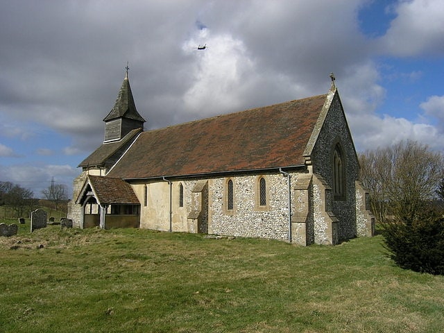
St Leonard's Church
Church in England. St Leonard's Church is a Church of England parish church in the hamlet of Hartley Mauditt, East Hampshire district of Hampshire, England. All that is left of the hamlet is the 12th-century church, the foundations of a manor house, and a large pond, Hartley Pond, which lies opposite the church on the other side of the road. The church is dedicated to St Leonard.[15]
Oldland Mill
Oldland Windmill is an 18th-century post mill situated in the village of Keymer, West Sussex, England.[16]
Hockley Railway Viaduct
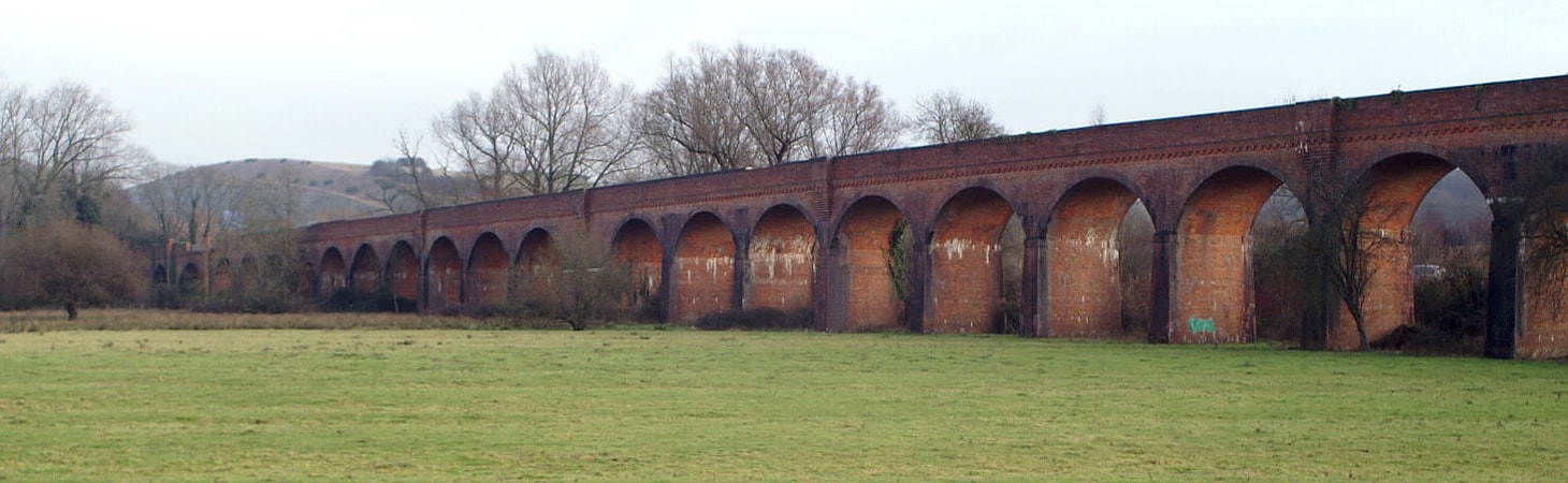
Historical landmark in Compton, England. The Hockley Railway Viaduct is a disused railway viaduct to the south of Winchester in Hampshire, England.[17]
Alice Holt Research Station
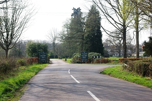
The Alice Holt Research Station is one of two British forestry research institutes, and is located in north-east Hampshire.[18]
Church of St Peter ad Vincula
Anglican church in England. The Church of St Peter ad Vincula is a redundant Anglican church in the village of Colemore, Hampshire, England. It is recorded in the National Heritage List for England as a designated Grade II* listed building, and is under the care of the Churches Conservation Trust. Colemore is located some 6 miles south of Alton to the east of the A32 road.[19]
Alice Holt Forest
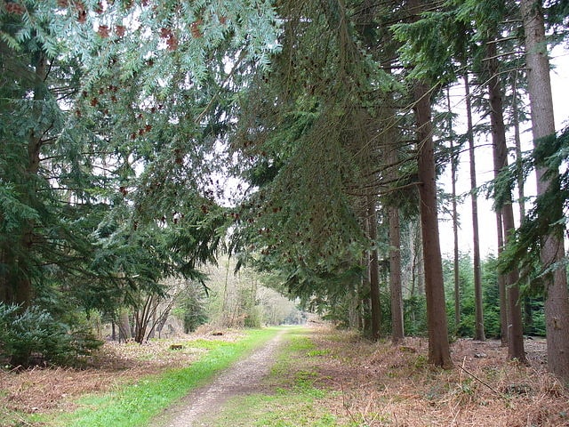
Alice Holt Forest is a royal forest in Hampshire, situated some 4 miles south of Farnham, Surrey. Once predominantly an ancient oak forest, it was particularly noted in the 18th and 19th centuries for the timber it supplied for the building of ships for the Royal Navy. It is now planted mainly with conifers. Forestry England took over the management of the forest in 1924, and a research station was set up in 1946 in the Alice Holt Lodge, a former manor house. The forest is now part of the South Downs National Park, which was established on 31 March 2010, and it forms the most northerly gateway to the park.[20]
Address: Bucks Horn Oak, GU10 4LS Farnham