Discover 11 hidden attractions, cool sights, and unusual things to do in North Pennines (United Kingdom). Don't miss out on these must-see attractions: Staward Peel, Hisehope Reservoir, and Geltsdale. Also, be sure to include Stainmore Summit in your itinerary.
Below, you can find the list of the most amazing places you should visit in North Pennines (England).
Table of Contents
Staward Peel
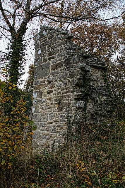
Staward Peel, or Staward Pele, is a peel tower located in the National Trust property of Allen Banks & Staward Gorge in Northumberland, England.[1]
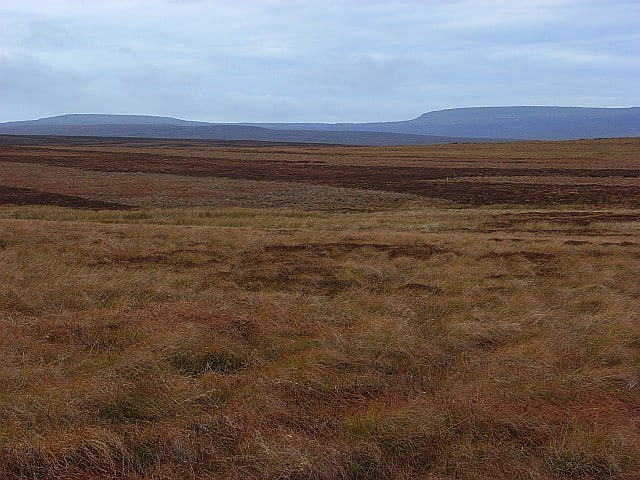
Hisehope Reservoir
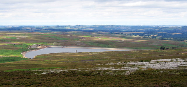
Reservoir in England. Hisehope Reservoir is the smallest of a group of three reservoirs located on Muggleswick Common, County Durham, the others being Waskerley and Smiddy Shaw Reservoirs.
The reservoir was completed 1906, and is owned and operated by Northumbrian Water. It feeds into Smiddy Shaw reservoir, which in turn feeds water under gravity to a water treatment works at Honey Hill.
Hisehope and its two neighbouring reservoirs are located within the Muggleswick, Stanhope and Edmundbyers Commons and Blanchland Moor Site of Special Scientific Interest, which itself forms part of the North Pennines Area of Outstanding Natural Beauty.[2]
Geltsdale
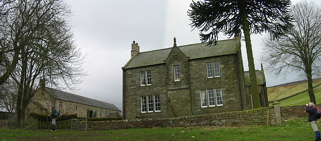
Neighborhood in England. Geltsdale is a hamlet and former civil parish, now in the parish of Castle Carrock, in the Carlisle district, in the county of Cumbria, England, to the southeast of Castle Carrock village. In 2001 the parish had a population of 6. On 1 April 2003 the parish was abolished and merged with Castle Carrock.
The Geltsdale Reservoir railway ran in the vicinity.
The local landscapes are under several levels of protection. Two of the protected areas cover a large area:
- the North Pennines Area of Outstanding Natural Beauty
- the North Pennines Moors Special Protection Area (147,276 ha)
Geltsdale & Glendue Fells Site of Special Scientific Interest has an area of 8,059 ha, and is one of the SSSIs which underlie the SPA.
Geltsdale RSPB reserve is a 5,000 ha nature reserve within the SSSI. It mainly moorland and is managed by the Royal Society for Protection of Birds for upland birds such as black grouse and hen harrier.[3]
Stainmore Summit
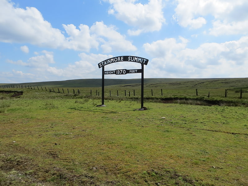
Stainmore Summit is the highest point on the trans-Pennine South Durham & Lancashire Union Railway, also known as the Stainmore Railway in Northern England. Located on Stainmore between Barras and Bowes stations, the railway over the summit was the highest in England at 1,370 ft until its closure in 1962. The location was marked by a famous cast-iron sign which is now preserved at the Darlington Railway Centre and Museum.
Whilst there wasn't a station at Stainmore, trains did halt here to let relatives of the railway workers on and off the trains to enable them to get transported off the summit. The railway had several cottages at the summit.
This pass is commonly referred to by geographers as the Stainmore Gap.[4]
West Rigg Open Cutting
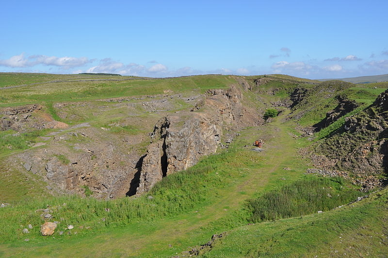
West Rigg Open Cutting is a Site of Special Scientific Interest in the Wear Valley district of west County Durham, England. It is a disused ironstone quarry, located just over 1 km north of the village of Westgate, in Weardale.
At West Rigg, the Slitt Vein, a 20 km-long quartz intrusion in the Namurian Great Limestone, is exposed at the surface; the exposure is up to 5 m wide over a distance of some 200 m. During Late Permian times, extensive mineralisation occurred in the vicinity of the Slitt Vein: high salinity fluids, rich in iron, permeated the Great Limestone which, throughout its full thickness, was mineralised, producing siderite and ankerite minerals which were subsequently oxidised, yielding a limonitic ore with an iron content of over 40 percent. At West Rigg, the iron mineralisation extends up to 60 m on each side of the vein.
The Slitt Vein is predominantly composed of quartz, with smaller amounts of fluorite and uneconomic amounts of galena lead ore. The earliest mining activity at the site was the extraction of fluorite and galena from the Slitt Vein itself: the miners worked from levels driven into the vein from the west. In the late 19th century, quarrying of the ironstone began, the Slitt Vein being left untouched so that today it protrudes as a vertical 'rib' along the centre of the quarry.
The Geological Conservation Review has identified the site as being of national importance because it provides an accessible illustration of the formation of iron ore by replacement and oxidation. The site also offers a rare surface view of the Slitt Vein.[5]
Burnhope Reservoir
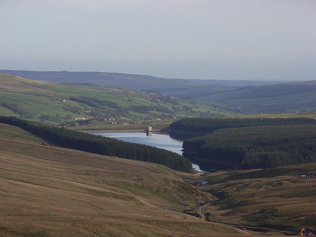
Reservoir in England. Burnhope Reservoir is a reservoir above the village of Wearhead, County Durham, England.
The reservoir was created by the construction of an earth embankment dam across the valley of Burnhope Burn, a tributary of the River Wear, 1 kilometre (0.62 mi) above Wearhead. Construction of the dam began in 1931 and was completed in 1937; an extensive network of narrow gauge railways, the Burnhope Reservoir railway, was used during the construction of the dam. Filling of the reservoir commenced in 1936 and resulted in the drowning of the former village of Burnhope.
Burnhope Reservoir was a joint project of the Durham County Water Board and the Sunderland and South Shields Water Company. It is now owned and operated by Northumbrian Water. The reservoir supplies water to the Wear Valley treatment works at Wearhead and there is a pipeline connection to Waskerley Reservoir, which supplies Honey Hill water treatment works. The reservoir serves as the source to meet regulated discharges into the River Wear and to compensate for abstraction of water at Chester-le-Street further downstream.[6]
Hexhamshire Moors
Hexhamshire Moors is a Site of Special Scientific Interest covering an extensive area of moorland in the Wear Valley district of north-west County Durham and the Tynedale district of south-west Northumberland, England.
It is a broadly rectangular area, occupying most of the upland between the valleys of the River East Allen to the west and Devil's Water to the east. The southern part of the site shares boundaries with the Muggleswick, Stanhope and Edmundbyers Commons and Blanchland Moor SSSI to the east and is separated from the Allendale Moors SSSI only by a very narrow strip of the East Allen valley.
The area has one of the largest expanses of blanket bog and heathland in northern England. Acid bogs occur in the vicinity of the numerous flushes that drain the moorland plateau, and localised patches of acid grassland have developed in areas that are regularly grazed by sheep.
Floristically, much of the area is species-poor, but there are small populations of some nationally scarce species, including bog orchid, Hammarbya paludosa, which is found on the blanket peat, and forked spleenwort, Asplenium septentrionale, whose presence at one locality in the Northumberland part of the site is, to date, the only known record for that county.
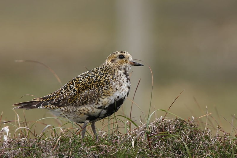
The site's principal importance lies in its nationally important breeding populations of birds: three species—merlin, Eurasian golden plover and short-eared owl—are listed in Annex 1 of the European Commission's Birds Directive as requiring special protection and several others, including red grouse, Eurasian curlew, common redshank, Eurasian oystercatcher and dunlin, are listed in the United Kingdom's Red Data Book (Birds).
Much of the moorland heath also supports a rich assemblage of invertebrates, including several scarce species of ground beetle, Carabidae.
The site is within the North Pennines Area of Outstanding Natural Beauty.[7]
Hisehope Burn Valley
Burn in England. Hisehope Burn Valley is a Site of Special Scientific Interest in the Derwentside district of Durham, England. It consists of two separate parcels of land, one on the west bank of Hisehope Burn, the other a few hundred yards to the east, straddling the headwaters of another small burn. The site is some 3 km west of the village of Castleside and 1 km north of the Smiddy Shaw Reservoir. The larger area adjoins the Muggleswick, Stanhope and Edmundbyers Commons and Blanchland Moor SSSI.
The area adjacent to Hisehope Burn is predominantly a soligenous mire, with a sparse tree cover of downy birch, Betula pubescens, and alder, Alnus glutinosa; the mire is rich in sedges, Carex spp and bryophytes and contains several species that are localised in County Durham, including few-flowered spike rush, Eleocharis quinqueflora, grass-of-Parnassus, Parnassia palustris, sundew, Drosera rotundifolia, and lesser clubmoss, Selaginella selaginoides.
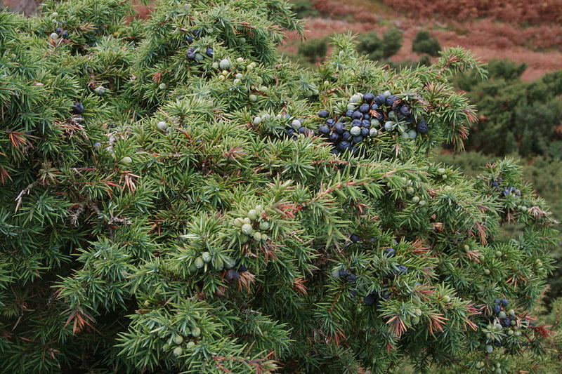
The other area has one of the most extensive stands of juniper, Juniperus communis, in County Durham. Unlike most populations of juniper in Britain, in which regeneration is, at best, sparse, this community is freely-regenerating and has a diverse age composition.[8]
Cotherstone Moor
Protected site. Cotherstone Moor is a Site of Special Scientific Interest in the Teesdale district in south-west County Durham, England. It is an extensive area of moorland which extends almost the entire length of Baldersdale, from the confluence of the River Balder with the Tees at Cotherstone. It runs parallel to Bowes Moor SSSI, which lies a short distance to the south.
The area includes a variety of upland vegetation types, much of it blanket bog, including one area that is found nowhere else in County Durham and which is unusual for being transitional between northern upland and lowland bogs. Other habitats include dry heath, acid grassland, flushes, and rock and block scree.
The area supports breeding populations of a number of species of birds that are listed in the United Kingdom's Red Data Book (Birds), including four that are listed in Annex 1 of the European Commission's Birds Directive as requiring special protection.
The Pennine Way National Trail passes through the area.[9]
Allen Confluence Gravels
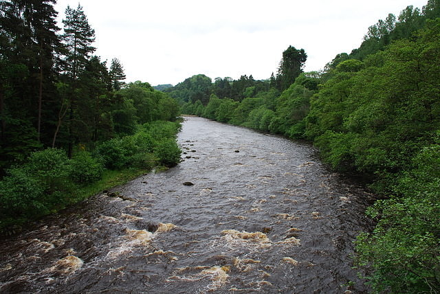
Nature preserve in Whitfield, England. The Allen Confluence Gravels is the name given to a Site of Special Scientific Interest in Northumberland, England. The site, listed since 1968, has an 'outstanding assemblage of river margin invertebrates.'[10]
Allendale Moors
Allendale Moors is a Site of Special Scientific Interest in Northumberland, England. The upland moorland ridge site is listed for its heath, flush and upland grassland which provide a habitat for a nationally important assemblage of moorland breeding birds.[11]