Discover 20 hidden attractions, cool sights, and unusual things to do in Norfolk Broads (United Kingdom). Don't miss out on these must-see attractions: BeWILDerwood, The Museum of the Broads, and Church of St Helen. Also, be sure to include St Benet's Abbey in your itinerary.
Below, you can find the list of the most amazing places you should visit in Norfolk Broads (England).
Table of Contents
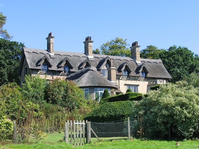
BeWILDerwood
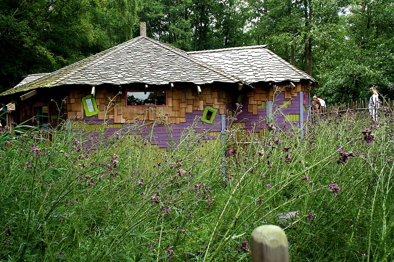
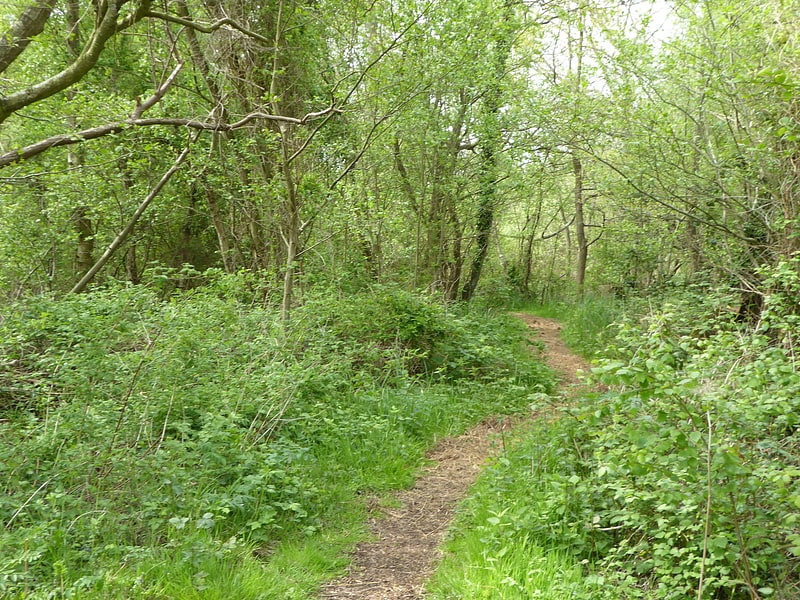
Amusement park in England. BeWILDerwood is an adventure park for families located in Horning, a parish in the English county of Norfolk. Self-described as a "curious treehouse adventure," the attraction is situated in a woodland area and features treehouses, rope bridges, slides, zip wires, a maze, and two special areas for children under five called "Toddlewood-on-the-Hill" and "Tiptoe Valley". The original branding was created by Purple Circle.
Entrance is as if to the whole forest and the adventure world of rope bridges and treehouses is a river ride away, through the 'swamp' and past the creature who blows bubbles to the surface. The park is set up to give a more natural appearance than typical urban ones with extensive use of natural materials. Swings are three people wide as are some of the scary slides.
The park's rides and other features are based on characters and events in A Boggle at BeWILDerwood and The Bewilderbats, books for children written by BeWILDerwood's owner Tom Blofeld and illustrated by... A Boggle at BeWILDerwood recounts the adventures of Swampy the marsh boggle as he struggles to overcome his fears and be a little braver. In the sequel, Bewilderbats, Swampy and his friends set out to rescue a tiny Twiggle who is stuck up a tree.[1]
Address: Horning Road, NR12 8JW Hoveton
The Museum of the Broads
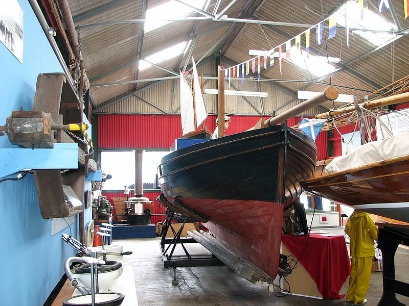
The Museum of the Broads is an accredited museum and registered charity in Stalham, Norfolk, England. It describes its mission as being to "bring the story of the Broads alive". The Norfolk Broads are a network of mostly navigable rivers and lakes in the English counties of Norfolk and Suffolk.
The museum covers all aspects of the Broads ranging from the landscape, industry, wildlife, people, holidays and boats and is open from Easter until the end of October every year. The Museum has an extensive collection of boats, models, marsh working tools, boat plans, paintings, books, photographs, postcards, wildlife, and social history items and memorabilia. Their Victorian steam launch ‘Falcon’, built in 1894, enables visitors to experience the Broads by water. The museum also includes the findings and equipment of ecologist Joyce Lambert, who proved in the 1950s that the lakes and landscape of the Broads were manmade.
The museum first opened in Potter Heigham in 1996, and moved to its current location at the Poor's Staithe in Stalham, in 1999. The museum is supported by their Patron, Henry Cator OBE DL, managed by a board of trustees and largely staffed by volunteers. The museum attracts 8,000 plus visitors every year.[2]
Address: The Staithe, Norfolk Broads
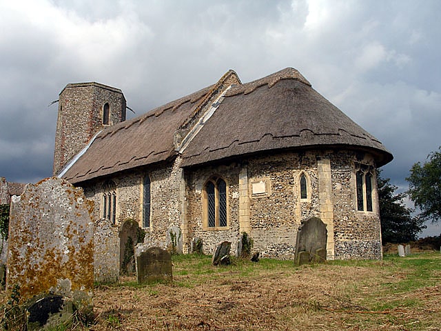
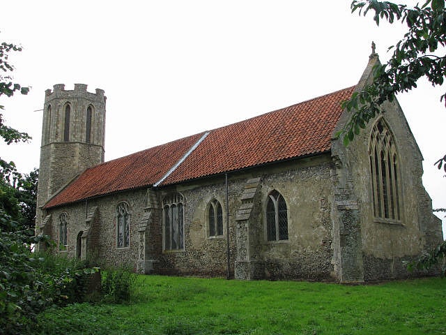
Church of St Helen
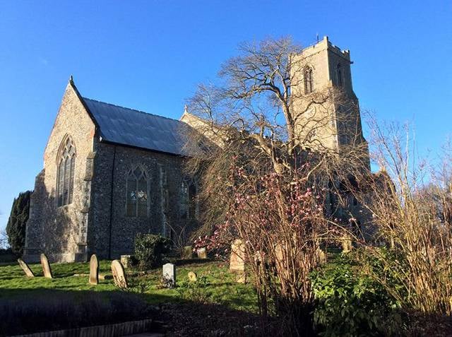
Christian church in Ranworth, England. The Church of St Helen, Ranworth, Norfolk is a church of medieval origins notable for its collection of church paintings. Known as "the cathedral of The Broads", the church dates from the 14th century, although with origins in Saxon times. It contains a major collection of medieval artefacts, in particular the rood screen and the Ranworth Antiphoner, a liturgical manuscript.
The church remains an active parish church and is a Grade I listed building.[3]
Address: Woodbastwick Road, Ranworth, Norfolk Broads
St Benet's Abbey
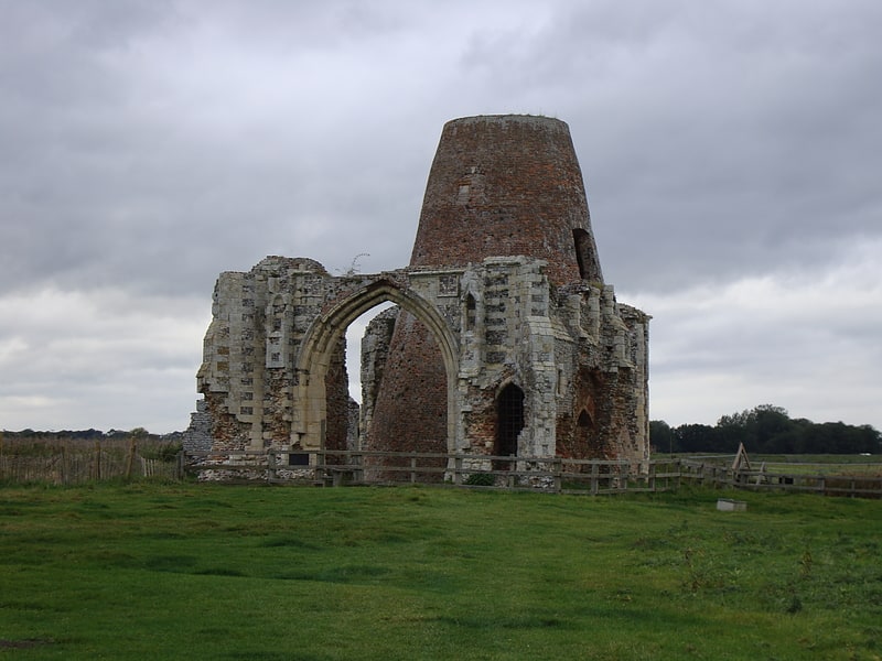
Monastery. St Benet's Abbey was a medieval monastery of the Order of Saint Benedict, also known as St Benet's at Holme or Hulme. It was situated on the River Bure within the Broads in Norfolk, England. St Benet is a medieval English version of the name of St Benedict of Nursia, hailed as the founder of western monasticism. At the period of the Dissolution of the Monasteries the abbey's possessions were in effect seized by the crown and assigned to the diocese of Norwich. Though the monastery was supposed to continue as a community, within a few years at least the monks had dispersed. Today there remain only ruins.[4]
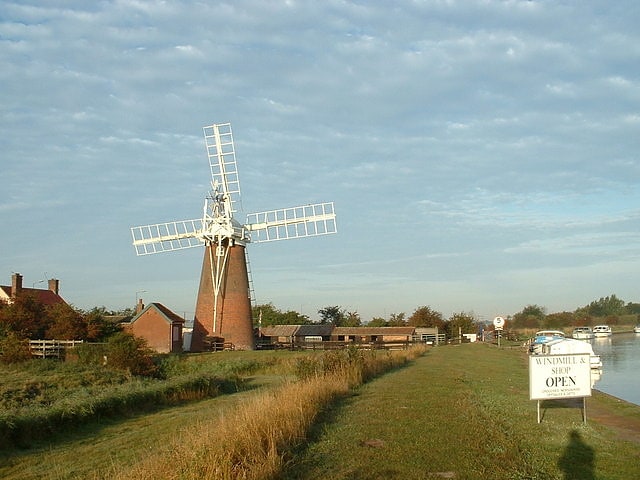
Horsey Windpump
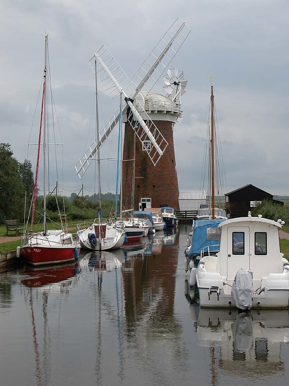
Tourist attraction in Horsey, England. Horsey Windpump is a windpump or drainage windmill in the care of the National Trust in the village of Horsey, on The Broads near Great Yarmouth, Norfolk, England. The structure is a grade II* listed building.[5]
Address: Hall Farm Highway B, NR29 4EE Horsey
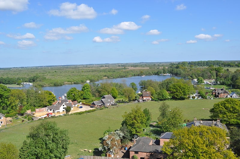
Wroxham Broad
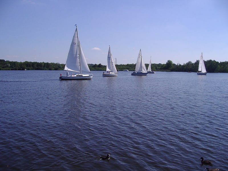
Wroxham Broad is an area of open water alongside the River Bure near the village of Wroxham in Norfolk, England within The Broads National Park. The Norfolk Broads were formed by the flooding of ancient peat workings. Wroxham Broad has an area of 34.4 hectares and a mean depth of 1.3 metres. It lies to the west of the Bure, with two navigable openings between river and broad. The village and broad lie in an area of fairly intensive agriculture, with areas of wet woodland adjoining the broad and river.
Since 1937, under lease from the Trafford estate, the broad has been home to the Norfolk Broads Yacht Club. Visiting boats are not allowed to land, but navigation is allowed.
Between 2000 and 2005 the island between the two channels linking Wroxham Broad to the Bure underwent restoration to stop erosion and improve the island's ecology, which had become degraded. The project was a joint initiative involving the Broads Authority, Norfolk Broads Yacht Club and the local landowner, Trafford Estates. Scrub was cleared and a stretch of piling installed, allowing sedge, reed and rush to grow back. By 2005 it was reported that more birds, including kingfishers, were nesting on the island and the rare Cetti's warbler was often spotted. Greater numbers of ducks, including pochard and tufted ducks, now wintered nearby and there was a greater profusion of wild flowers and marsh flora including orchids. During the course of the work, in 2004, volunteers came across an unexploded Second World War hand grenade in the dredgings, which was exploded by an army bomb disposal team.
Close to Wroxham Broad stands the early 18th century Broad House, a Queen Anne style estate house and formerly the seat of the local land-owning Trafford family. In 2006, it became a well-regarded 'boutique' hotel which closed in late 2010. There are proposals that it be reclassified as a single dwelling.
Alfred John Norman Chamberlin (1822-1883), and his wife Betsy, owned the Broad House property and most of the Wroxham Broad, before the Traffords acquired it after Alfred's death about 1885. People flocked to their property to watch the Wroxham Regatta. (See painting "Wroxham Regatta -1868" by Claude Nursey.) Alfred had inherited the 300 acre property about 1858 from his unmarried cousin, Elizabeth Foulsham (1774-1857). She had inherited it from her unmarried half-brother, William Buckle (1765-1840) who had inherited it from his maternal grandfather, John Howse (d. 1817). Howse's forebears had owned the property since 1735. Prior owners have been recorded back to 1593.
There is a locomotive at the Bure Valley Railway in Norfolk which is named after Wroxham Broad.[6]
Berney Arms Windmill
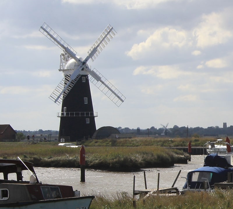
Historical landmark in England. Berney Arms Windmill is a tower mill located at Berney Arms alongside the River Yare at the south-western end of Breydon Water in the English county of Norfolk. The windmill is in an isolated spot in The Broads around 3.5 miles north-east of the village of Reedham and 4 miles south-west of Great Yarmouth. The mill has no road access but can be accessed by boat, by foot or from Berney Arms railway station. It is a Scheduled Ancient Monument under the care of English Heritage.[7]
Stracey Arms Windpump
Stracey Arms Windpump is a windpump located at Tunstall in the civil parish of Halvergate, Norfolk, England. It is a grade II* listed building.
It is a four-storey drainage mill with a tapering red brick tower and a boat shaped weatherboarded cap. The cap, cap gallery, sails, fan and tail pole are all in place. The internal machinery is in working order and drives a turbine pump. The pump was used to drain the surrounding marshland into a channel leading to the River Bure, but was superseded by an electric pump installed in an adjacent building.
The mill was built in 1883 by Robert Barnes of Great Yarmouth and was extensively modified in 1912. During the Second World War it was converted into a fortified pillbox with gun ports in the sides. It was taken out of service in 1946. From 1961 the mill was restored to working order by the Norfolk Windmills Trust, and now contains a photographic display of the history of Broads drainage mills. It is open to the public during the Spring and Summer.[8]
Address: Stracey arms, Norfolk Broads
How Hill
Nature preserve in England. How Hill is a hamlet on the River Ant within The Broads National Park in Ludham parish, Norfolk, England.
How Hill House, completed in 1903, was designed by Thomas Boardman, son of the architect Edward Boardman; he was Mayor of Norwich in 1905–1906. Since 1984 the house has been the home of How Hill Trust, an educational charity.
The How Hill Nature Reserve is administered by the Broads Authority.
Toad Hole Museum is a former marshman's cottage and also houses the Broads Information Centre.
Boardman's Windmill is a trestle or skeleton windpump, and Clayrack Drainage Mill is similar, only smaller. Just south of How Hill is Turf Fen windpump.[9]
Reedham Swing Bridge
Swing bridge in Reedham, United Kingdom. Reedham Swing Bridge, on the site of a Victorian swing bridge, is still in use at Reedham, Norfolk, England.
It carries the Wherry railway line, between Norwich and Lowestoft, across the River Yare near Reedham railway station.
The original single track bridge was commissioned by Sir Samuel Morton Peto in the 1840s to allow the passage of wherry boats, which were too tall to pass under conventional bridges. The current bridge dates from 1902–3 prior to the doubling of the track.
The bridge is operated from the 1904 Reedham Swing Bridge signal box. In a typical year, it is opened 1,300 times.[10]
St Gregory's Church
Church in England. St Gregory's Church is a redundant Anglican church in the village of Heckingham, Norfolk, England. It is recorded in the National Heritage List for England as a designated Grade I listed building, and is under the care of the Churches Conservation Trust. It stands on a small hill overlooking the River Chet.[11]
Hunsett Mill
Hunsett Mill is located on the east bank of the River Ant one mile north of Barton Broad in the English county of Norfolk. The Windmill is 1.2 miles south west of the town of Stalham. The mill structure is a grade II listed building.[12]
St Nicholas Church
St Nicholas Church is a redundant Anglican church in the village of Buckenham, Norfolk, England. It is recorded in the National Heritage List for England as a designated Grade I listed building, and is under the care of the Churches Conservation Trust. The church stands among fields to the north of the River Yare.[13]
Reedham Ferry
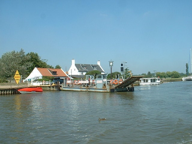
Reedham Ferry is a vehicular chain ferry across the River Yare in the English county of Norfolk, in the Broads. The ferry crosses the river near the village of Reedham and is the only crossing of the Yare between the bridge carrying the A47 on the eastern outskirts of Norwich and Great Yarmouth, saving users a journey of over 30 miles. The ferry is also the only remaining vehicle ferry in Norfolk. The current ferryboat was built in 1983 and can carry three cars at a time. Reedham Ferry is also the name of an inn standing adjacent to the ferry on the northern bank.[14]
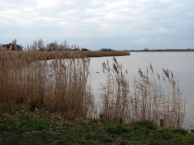
Breydon Water
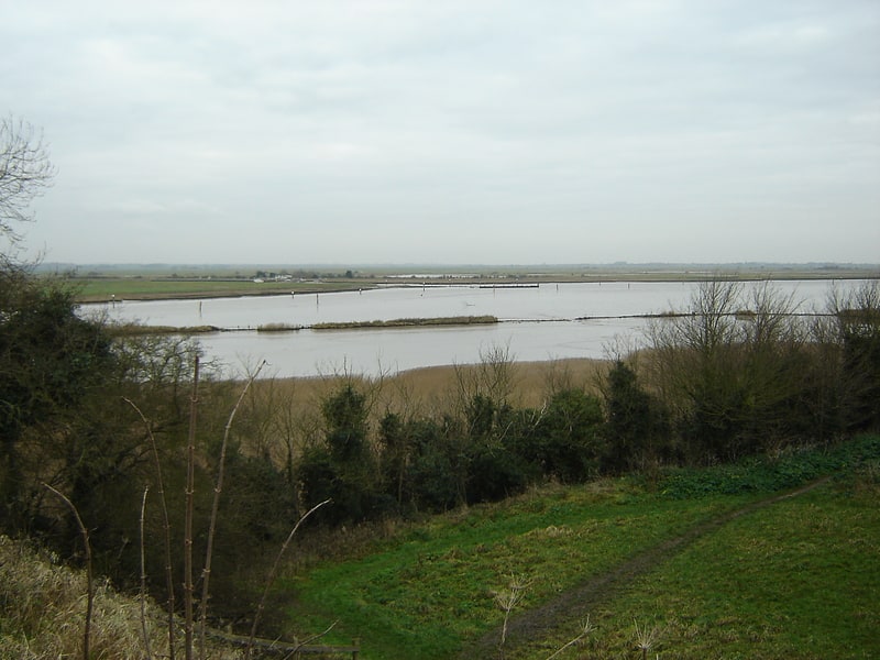
Nature preserve in Burgh Castle, United Kingdom. Breydon Water is a 514.4-hectare biological Site of Special Scientific Interest at Great Yarmouth, Norfolk. It is a Local Nature Reserve, a Ramsar site and a Special Protection Area. It is part of the Berney Marshes and Breydon Water nature reserve, which is managed by the Royal Society for the Protection of Birds.
It is a large stretch of sheltered estuary. It is at the gateway to The Broads river system on the eastern edge of Halvergate Marshes. It is the UK's largest protected wetland. It is 5 km (3 mi) long and more than 1.5 km (0.9 mi) wide in places.
Breydon Water is overlooked at the southern end by the remains of the Roman Saxon Shore fort at Burgh Castle. Centuries ago, Breydon Water would have been one large estuary facing the sea. At the western end the water may be considered to start at the confluence of the River Yare and River Waveney; smaller sources including The Fleet flow in from the surrounding marshland. Safe passage for boats is indicated by red and green marker posts. Unlike most of the navigable waterways in the Norfolk Broads, Breydon Water is not subject to a speed limit.
At the east end of Breydon Water the river returns to a narrow channel, passing under Breydon Bridge after which it is joined by the River Bure then under Haven Bridge from where it is 4.4 km (2.7 mi) through the harbour into the North Sea.[15]
Malthouse Broad
Malthouse Broad is a broad at Ranworth in the Norfolk Broads.
The "Helen of Ranworth" is a traditional reedlighter, a boat that carried away the reed harvest. Now it ferries visitors from Malthouse Broad to Ranworth Broad. Media related to Malthouse Broad at Wikimedia Commons[16]
North Cove Nature Reserve
Nature reserve in England. North Cove is a 15.5 hectare nature reserve between Beccles and Lowestoft in Suffolk. It is managed by the Suffolk Wildlife Trust. t is part of the Barnby Broad and Marshes Site of Special Scientific Interest the Broadland Ramsar internationally important wetland site, the Broadland Special Protection Area under the European Union Directive on the Conservation of Wild Birds, and The Broads Special Area of Conservation.
The site has wet woodland, grazing marsh, ponds and dykes. There are birds such as sparrowhawks, woodcocks, redpolls, siskins and the three species of woodpecker. Flora include opposite-leaved golden-saxifrage, bog pimpernel and the nationally scarce marsh fern.
There is access from a footpath between Barnby and the Angles Way.[17]
Hoveton Great Broad
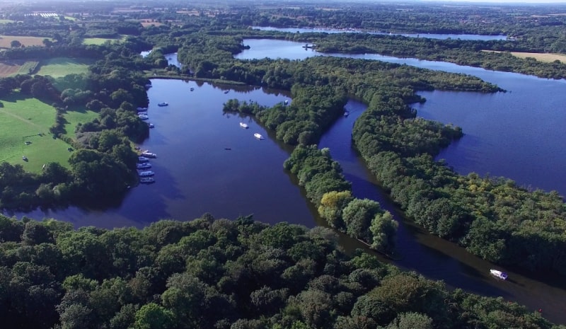
Body of water. Hoveton Great Broad lies within The Broads in Norfolk, England, between Wroxham Broad and Salhouse Broad.
The broad is connected to the River Bure, but not open to boat traffic. Hoveton Great Broad is part of an ancient navigation that has been deliberately allowed to become closed off to any public access since well before the last War. Recent changes in the official Ordnance Survey tide line mean that it is now tidal water and therefore closed illegally. A nature trail was laid out in 1968 - the first in the region. It is accessible only by boat. Mooring is allowed on the north bank of the Bure, opposite Salhouse Broad.
Natural England has established a Nature trail. From the boardwalk, one can see the broad with its adjoining fens and alder carr.
Media related to Hoveton Great Broad at Wikimedia Commons[18]
Horsey Mere
Mere. Horsey Mere is one of the Norfolk Broads in the east of England; it is one of the more northerly broads close to the North Sea coast.
It is reached by Hickling Broad and the River Thurne. The nearest settlements are Horsey and West Somerton.
Horsey Mere is part of Upper Thurne Broads and Marshes, a Site of Special Scientific Interest. The mere is owned by the National Trust, as is Horsey Windpump.[19]
Ranworth Broad
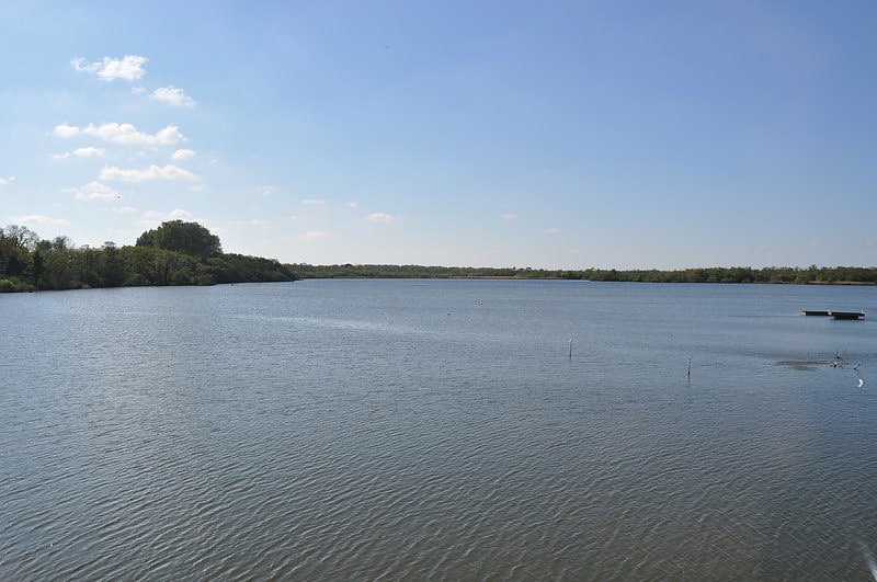
Ranworth Broad is a 136-hectare nature reserve on the Norfolk Broads north-east of Norwich in Norfolk, United Kingdom. It is managed by the Norfolk Wildlife Trust. it is part of Bure Broads and Marshes Site of Special Scientific Interest and Bure Marshes Nature Conservation Review site, Grade I and National Nature Reverse. It is also part of the Broadland Ramsar site and Special Protection Area, and The Broads Special Area of Conservation.
Many species of birds can be seen from the floating Broads Wildlife Centre such as great crested grebes, wigeons, gadwalls, kingfishers and cormorants. There are also areas of woodland and reedbeds.
The poet and critic Edward Thomas spent a holiday on a houseboat on Ranworth Broad with his son and a group of friends in the summer of 1913 at the invitation of the poet and writer Eleanor Farjeon, while Thomas's wife Helen was in Switzerland.[20]