Discover 15 hidden attractions, cool sights, and unusual things to do in Mendips (United Kingdom). Don't miss out on these must-see attractions: Mendips Raceway, Bos Swallet, and East Twin Swallet. Also, be sure to include Bath Swallet in your itinerary.
Below, you can find the list of the most amazing places you should visit in Mendips (England).
Table of Contents
Mendips Raceway
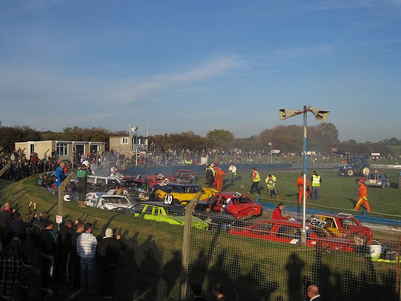
Sports venue in England. Mendips Raceway is a motorsport venue in the Mendip Hills in Somerset, England. It is located on the rim of Batts Combe quarry between Shipham and Charterhouse. The oval shaped circuit is used for racing hot rods, stock cars, Hotstox, bangers and demolition events. The circuit, which was opened in 1969, features an oval and a figure of eight layout. The latter is used for different classes of banger racing which sometimes involve towing caravans, or feature specialist vehicles such as hearses or Reliant Robins.
It hosts the West of England Championship for Rods every August. It has also hosted the BriSCA F2 World Championship Final several times[1]
Address: Warren Hill Road, BS40 7XU Shipham
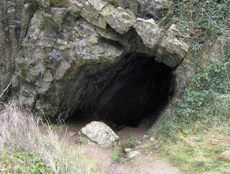
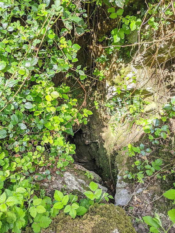
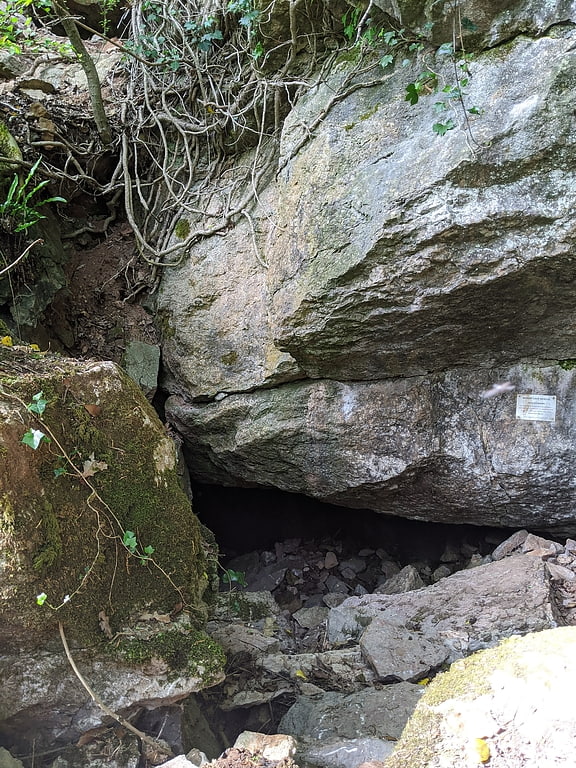
Bos Swallet
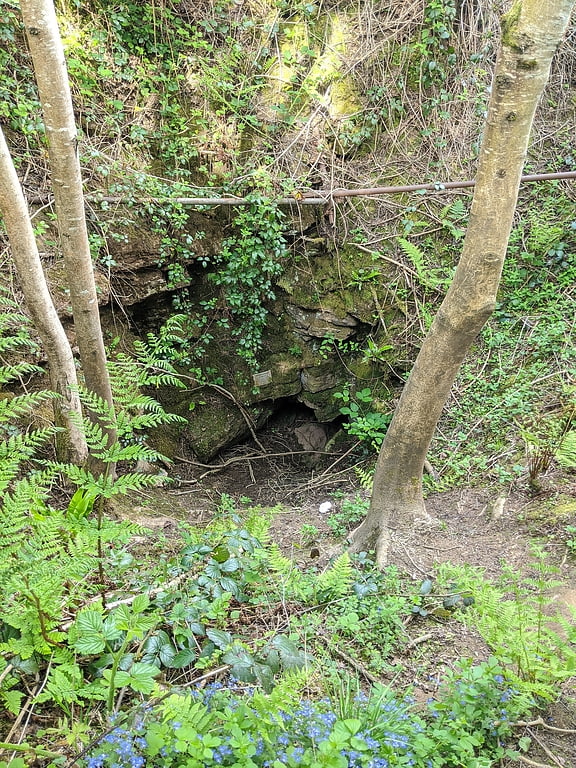
Bos Swallet is a karst cave in Burrington Combe on the Mendip Hills in Somerset, England.
It is noted for being rather steep, with a length of 78 metres (256 ft) and a depth of 42 metres (138 ft).
The cave was first discovered by schoolboys from the nearby Sidcot School in mid-1947, where they noticed the presence of "bone, flints, and pottery" which was later the site of archeological investigation, and multiple attempts to dig out the cave from 1985 to 1995 which turned up with minimal results.[2]
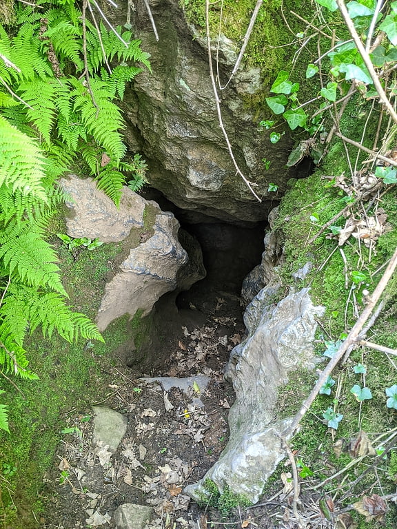
East Twin Swallet
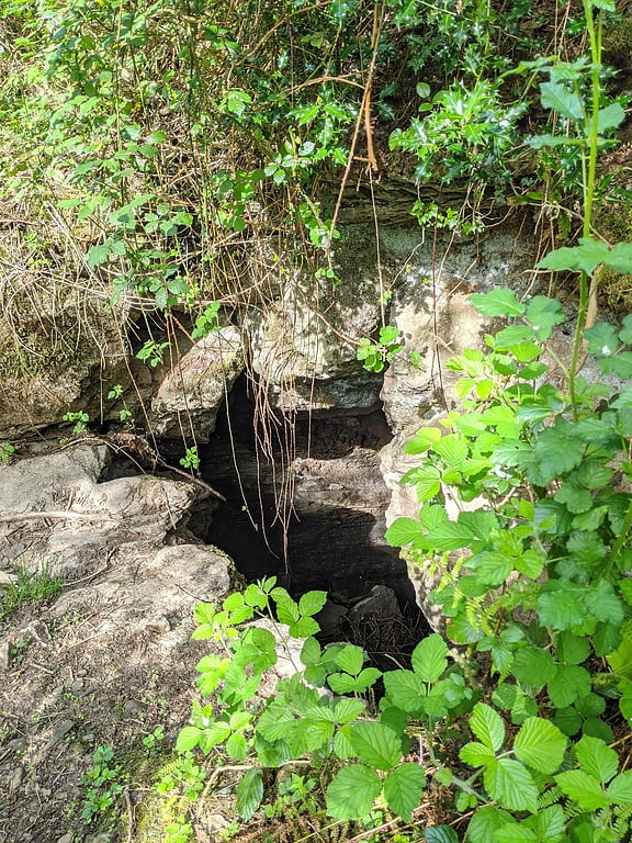
Cave in England. East Twin Swallet also known as Upper Twin Swallet is a karst cave in Burrington Combe on the Mendip Hills in Somerset, England.
The cave is not very stable. The floor is strewn with boulders under which the stream normally flows. The wall sandroof, especially in the upstream portion of the Second Chamber, consist of boulders cemented together with red mud. In the stream passage the mud contains many fossils, mainly crinoids and brachiopods, dissolved out of their limestone matrix. This is a common phenomenon in the caves of the area.[3]
Bath Swallet
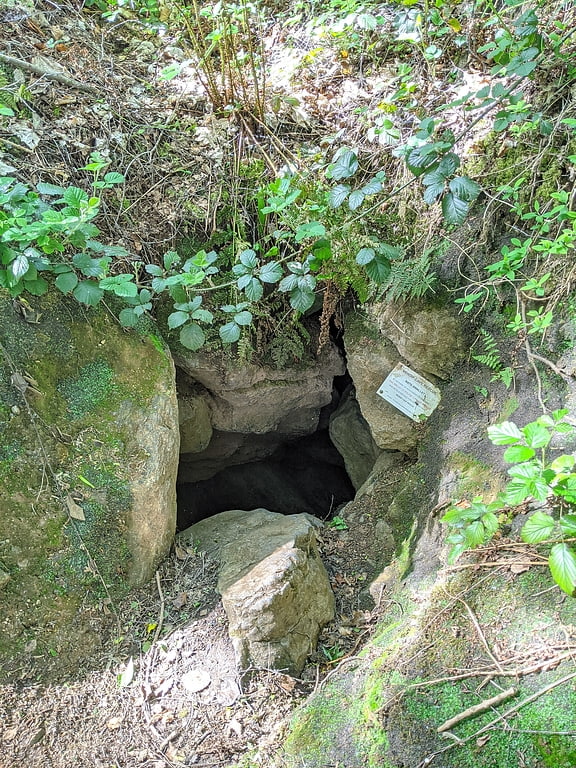
Cave in England. Bath Swallet is a karst cave in Burrington Combe on the Mendip Hills in Somerset, England.
On Wednesday 19th September 2007 members of the Wessex Cave Club and Cheddar Caving Club succeeded in connecting Bath Swallet and Rod's Pot. It had been anticipated that the upward dig in Bath would connect with the end of 'Purple Passage' in Rod's Pot and this proved to be true. This creates what is probably Mendip's third longest through trip.[4]
Aveline's Hole
Cave in England. Aveline's Hole is a cave at Burrington Combe in the limestone of the Mendip Hills, in Somerset, England.
The earliest scientifically dated cemetery in Britain, 10,200 and 10,400 years old, was found at Aveline's Hole, constituting the largest assemblage of Mesolithic human remains found in Britain. Much of the collection has been lost due to pillaging, poorly recorded investigation and war, and although more than fifty individuals are represented, there are only two complete skeletons. Perforated animal teeth, red ochre and seven pieces of fossil ammonite, suggest that some of the bodies were adorned.
A series of inscribed crosses found on the wall of the Aveline's Hole cave are believed to date from the early Mesolithic period just after the Ice Age. The pattern is said to be comparable with others known from Northern France, Germany and Denmark. A gate has been installed in the cave to protect the engraving, after consultations between English Heritage and other interested parties, including the landowner and English Nature.
The cave was rediscovered in 1797 by two men digging for a rabbit. The cave was excavated and the entrance enlarged in 1860 by William Boyd Dawkins who named it after his mentor William Talbot Aveline.
Access to the cave is controlled by the University of Bristol Spelæological Society and is restricted during the bat hibernation season.[5]
Upper Flood Swallet
Cave in England. Upper Flood Swallet which was originally known as Blackmoor Flood Swallet, is an exceptionally well-decorated cave near Charterhouse, in the carboniferous limestone of the Mendip Hills, in Somerset, England. The cave is part of the Cheddar Complex SSSI.
The entrance was revealed in the Great Flood of 1968, giving the cave its name. It was dug consistently since then with breakthroughs occurring in 1971, 1972, 1985 and 2006.
As of September 2008 it is over 3.5 km in length and around 125 m deep.[6]
Blagdon Lake
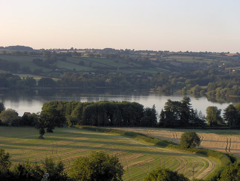
Lake in England. Blagdon Lake lies in a valley at the northern edge of the Mendip Hills, close to the village of Blagdon and approximately 10 miles south of Bristol, England. The lake was created by Bristol Water, when it dammed the River Yeo, starting construction in 1898, to designs by Charles Hawksley, and completing this in 1905. The Wrington Vale Light Railway was constructed primarily to bring building materials for the lake.
The reservoir was formed by the construction of a dam and provided water to the pumping station which originally contained four Woolf compound rotative beam pumping engines, built by Glenfield & Kennedy of Kilmarnock, which have now been replaced by electric pumps. Two of the steam engines have been preserved, with one in working order as part of the visitor centre which also includes educational facilities for children. The pumping station is now a Grade II* listed building.
The 8,456,000,000-litre (1.860×10⁹ imp gal; 2.234×10⁹ US gal) lake still provides 9,547,000,000 litres (2.100×10⁹ imp gal; 2.522×10⁹ US gal) of drinking water each year, but also acts as a fishing lake. It provides a habitat for a range of flora and fauna and is a Site of Special Scientific Interest. The original suction tanks, which formed the water supply for the steam boilers powering the pumping engines, are now used for trout rearing.[7]
Goatchurch Cavern
Goatchurch Cavern is a cave on the edge of Burrington Combe in the limestone of the Mendip Hills, in Somerset, England.[8]
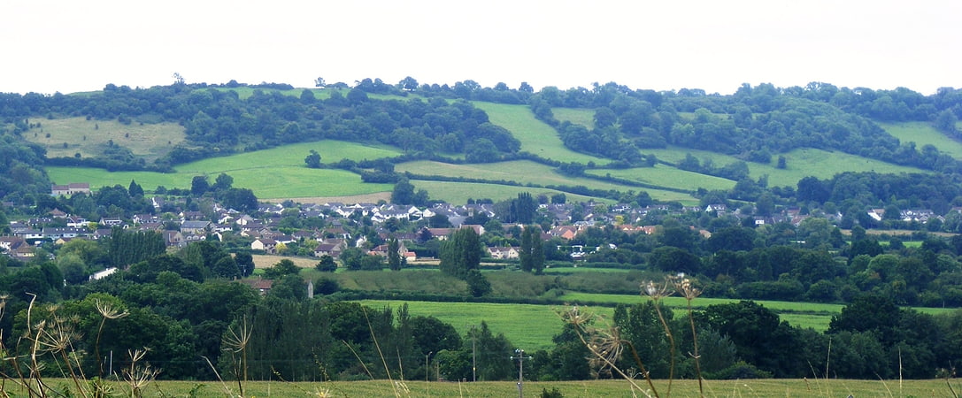
Black Down
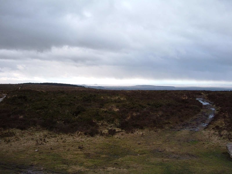
Hill in England. Black Down is the highest hill in the Mendip Hills, Somerset, in south-western England. Black Down lies just a few miles eastward of the Bristol Channel at Weston-super-Mare, and provides a view over the Chew Valley. The summit is marked with an Ordnance Survey trig point, the base of which has been rebuilt by the Mendip Hills AONB authority.
The shortest route of ascent goes from the Burrington Combe car park and is approximately 1 km long.
Black Down is an open-access area mostly consisting of moors, with dense cover of associated vegetation such as heather and bracken. According to a local organization's newsletter, the name "Black Down" comes from the Saxon word 'Blac' or 'Bloec' meaning bleak, 'Dun' meaning down or fort.[9]
Drunkard's Hole
Drunkard's Hole is a karst cave in Burrington Combe on the Mendip Hills in Somerset, England.[10]
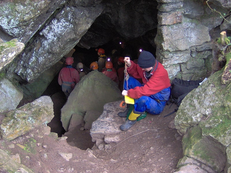
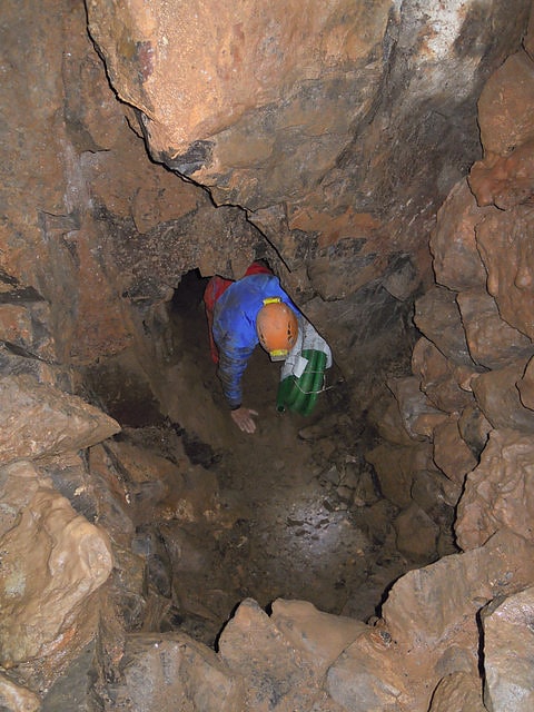
Rod's Pot
Cave in England. Rod's Pot is a limestone cave above Burrington Combe in the Mendip Hills, in Somerset, England.
The cave was first excavated in 1944 by the University of Bristol Spelæological Society. It is one of a line of swallets marking the junction of the Limestone shales with the Carboniferous Limestones where water running off the Old Red Sandstone of Blackdown finds its way underground. Further excavation has now linked Rod's Pot to nearby Bath Swallet.
The cave was originally known as Pearce's Pot after Dr Rodney Pearce.[11]
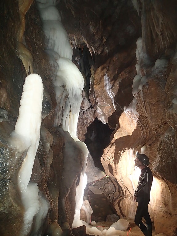
Reservoir Hole
Reservoir Hole is a cave in Cheddar Gorge in Somerset, southwest England. It contains what is believed to be the largest chamber yet found under the Mendip Hills.
The cave was first dug out in 1951 by members of Wessex Cave Club, and further progress was made in 1965 when "Moonmilk Chamber" was reached with the use of blasting. "Grand Gallery" was discovered in 1969, "Topless Aven" in 1970 and "Golgotha Rift" in 1973.
In September 2012, after four years' work clearing a 100 metres (330 ft) long passage, a group of diggers broke into a new chamber which was found to be 30 metres (98 ft) high and 60 metres (200 ft) long. Prior to the discovery, the largest void under the Mendip Hills was thought to be "Main Chamber" in GB Cave, which is 23 metres (75 ft) high.
Before the find in 2012, the cave was already noted for a number of fine formations, and the newly discovered chamber, which has been named “The Frozen Deep”, contains pure-white pillars 5 metres (16 ft) tall, as well as many stalagmites and stalactites.
The possibility of a connection between Reservoir Hole and Gough's Cave, one of the show caves in Cheddar Gorge, has been raised, as the two caves are in close proximity. The stream in Reservoir Hole emerges only a short distance down Cheddar Gorge.[12]
Burledge Hill
Burledge Hill is on the southern edge of the village of Bishop Sutton, Somerset, England. It is the site of a Site of Special Scientific Interest and an univallate Iron Age hillfort.[13]
Church of St Hugh
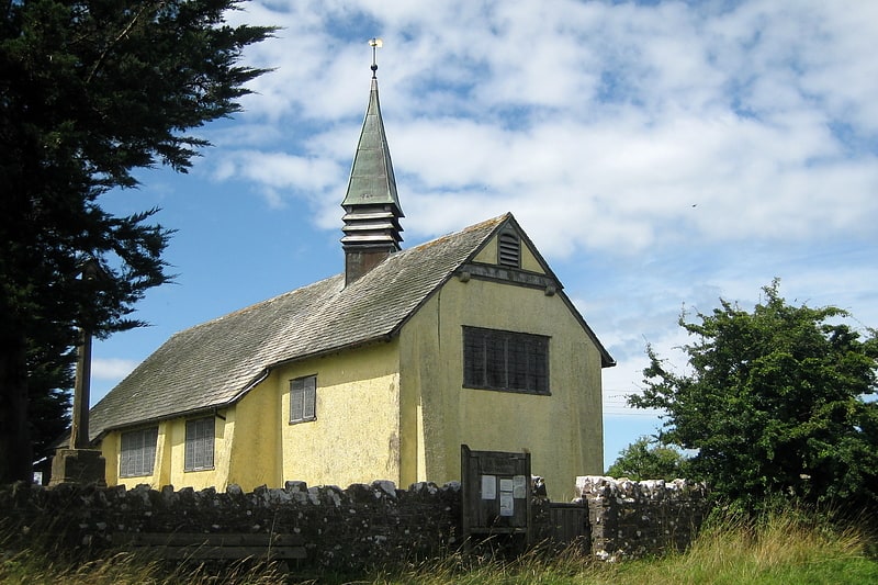
Anglican church in Charterhouse, England. The Anglican Church of St Hugh in Charterhouse, within the English county of Somerset, dates from 1908. It is a Grade II* listed building. The church is dedicated to Hugh of Lincoln. It was built in 1908 by W. D. Caröe, on the initiative of the Rev. Menzies Lambrick, from the former welfare hall for the local lead miners.
The roof-truss, screen, rood, and altar are all made of carved whitened oak, with fittings in the Arts and Crafts style. The walls are rough brick and it has a tiled roof. It includes stained glass by Horace Wilkinson showing the nativity scene.
A cross in the churchyard and the churchyard wall are also listed buildings.
It is part of the benefice of Blagdon with Compton Martin and Ubley within the Diocese of Bath and Wells.[14]
Read's Cavern
Cave in England. Read's Cavern is a cave at Burrington Combe, Somerset, England, in which traces of Iron Age occupation have been found. It lies under Dolbury Hill. Its large main chamber has a boulder ruckle floor and is parallel to a cliff face. The cave was excavated by the University of Bristol Spelæological Society in the 1920s, when relics of Iron Age occupation were found.
The UBSS excavation followed the removal of 21 tonnes of limestone material below a cliff where a stream sinks. Among the finds were ironwork described as slave shackles.
After its discovery, the cave was first known as Keltic or Celtic Cavern until the Ordnance Survey decided that it should be known as Read's Cavern, after Mr. R. F. Read, the discoverer. It has also been called "Gough's Cave".[15]