Discover 20 hidden attractions, cool sights, and unusual things to do in Kent Downs (United Kingdom). Don't miss out on these must-see attractions: Chevening, Swingfield Preceptory, and Oldbury Camp. Also, be sure to include Shorne and Ashenbank Woods in your itinerary.
Below, you can find the list of the most amazing places you should visit in Kent Downs (England).
Table of Contents
Chevening
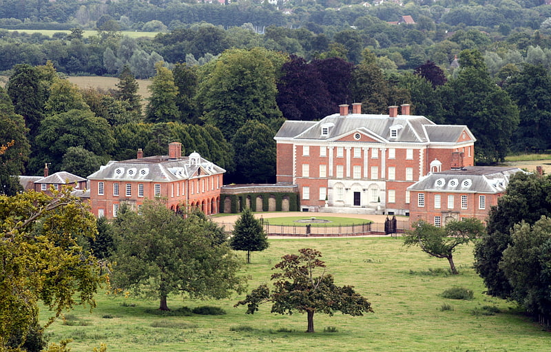
Chevening House is a large country house in the parish of Chevening in Kent, in south east England. Built between 1617 and 1630 to a design reputedly by Inigo Jones and greatly extended after 1717, it is a Grade I listed building. The surrounding gardens, pleasure grounds and park are listed Grade II*.
Formerly the principal seat of the earls Stanhope, the house and estate are owned and maintained at the expense of the trust of the Chevening Estate, under the Chevening Estate Act 1959 (amended 1987), to serve as a furnished country residence for a person nominated by the prime minister, so qualified by being a member of the Cabinet or a descendant of King George VI. The nominee pays for their own private living expenses when in residence but government departments arrange and effect official business at the estate. Chevening House is not an official residence, but has been traditionally used by the Foreign Secretary.[1]
Swingfield Preceptory
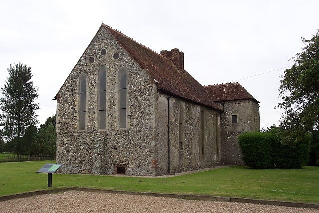
Priory. Swingfield Preceptory was a priory about 5 miles north of Folkestone, Kent on the south coast of England.[2]
Oldbury Camp
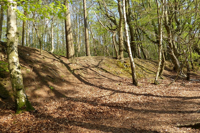
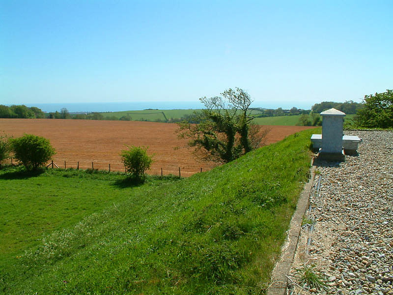
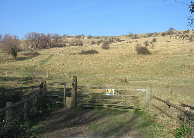
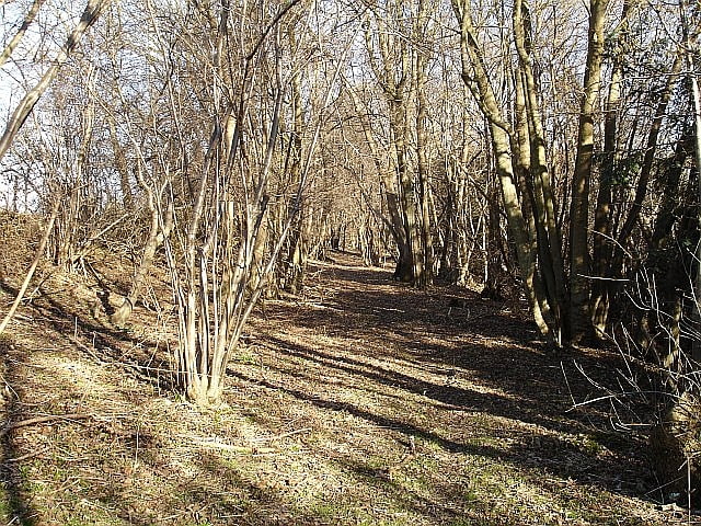
Oldbury Camp is the largest Iron Age hill fort in south-eastern England. It was built in the 1st century BC by Celtic British tribes on a hilltop west of Ightham, Kent, in a strategic location overlooking routes through the Kentish Weald. The fort comprises a bank and ditch enclosing an area of about 50 hectares, with entrances at the north-east and south ends. Wooden gates barred the entrances. Archaeological excavations carried out in the 1930s and 1980s found that the hill fort's interior had probably not been permanently occupied. It had been abandoned around 50 BC and the north-east gate had been burned down, possibly due to a Roman invasion. The wooded southern part of Oldbury Camp is now owned and managed by the National Trust and is open to the public.[3]
Shorne and Ashenbank Woods
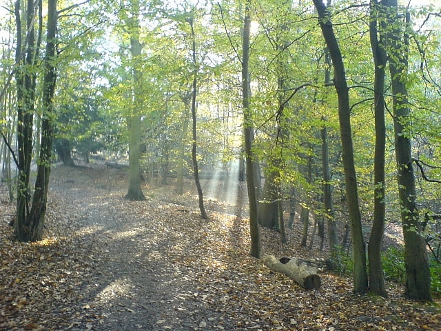
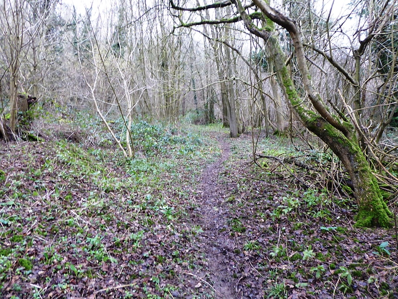
Shorne and Ashenbank Woods is a 197.4-hectare biological Site of Special Scientific Interest between Rochester and Gravesend in Kent. Part of it is Shorne Wood Country Park.
These woods have diverse and important invertebrates, especially dragonflies, beetles and true bugs, including the rare beetles Mordella holomelaena and Peltodytes caesus. Several clay workings have been landscaped to create shallow ponds designed for wildlife.
There is public access to the site.[4]
Charing Windmill
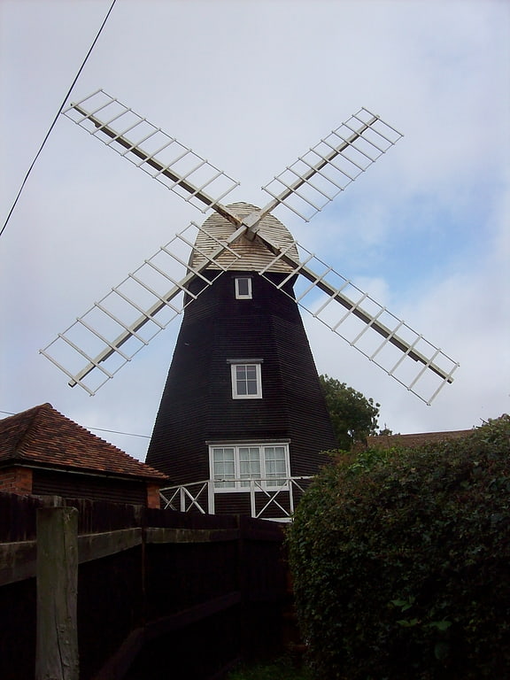
Historical place in Charing, England. Charing Windmill is a Grade II listed house converted smock mill on Charing Hill in Kent in southeast England. It is sometimes known as Field Mill, but that name was also used by a watermill in Charing.[5]
Dryhill Nature Reserve
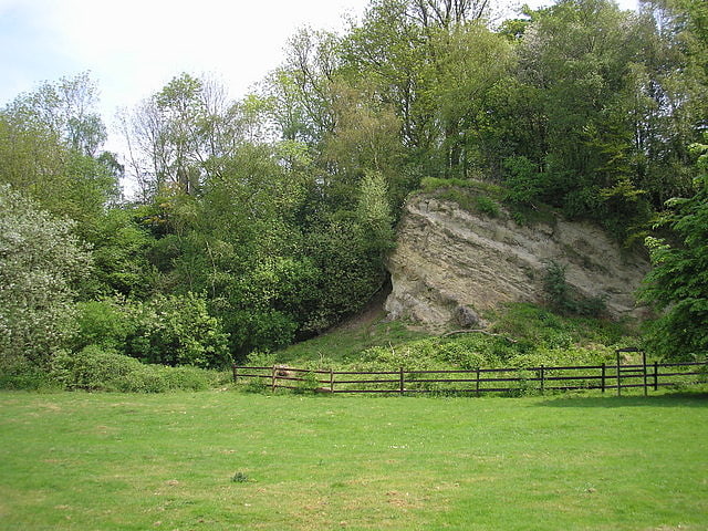
Nature preserve in England. Dryhill is an 11.7-hectare geological Site of Special Scientific Interest on the western outskirts of Sevenoaks in Kent. It is a Geological Conservation Review site, and an area of 9.5 hectares is a Local Nature Reserve
This former quarry exposes rocks dating to the Aptian stage in the early Cretaceous, around 120 million years ago. It is famous for its rich and diverse brachiopod and bivalve fossils, which are important for palaeoecological research.
There is access from Dryhill Lane.[6]
Alkham
Alkham, Lydden and Swingfield Woods is a 228.3-hectare biological Site of Special Scientific Interest north-west of Dover in Kent. Alkham Valley Woods is a Nature Conservation Review site, Grade I.
This site is composed of several steeply sloping woods on chalk soil, together with an area of chalk grassland. The ground flora is diverse, including some unusual plants such as lady orchid in the woods and burnt orchid in the meadow.
Public footpaths go through some of the woods but other areas are private land.[7]
Blue Bell Hill
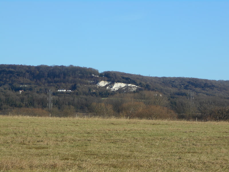
Blue Bell Hill is a chalk hill between Maidstone and Rochester in the English county of Kent. It overlooks the River Medway and is part of the North Downs. Settlements on the hill include the Walderslade suburb of Chatham and the villages of Blue Bell Hill and Kit's Coty. During the eighteenth and nineteenth centuries much of the hill was quarried for chalk.
The hill is a 5-hectare (12-acre) nature reserve which is managed by Kent Wildlife Trust. It is also part of the Kent Downs Area of Outstanding Natural Beauty and Wouldham to Detling Escarpment Sites of Special Scientific Interest and is a Nature Conservation Review site, Grade I.
A picnic area serves as a rest point for walkers on the North Downs Way which runs along the top of the hill, whilst the prehistoric trackway of the Pilgrims' Way skirts its foot. A modern crematorium also surmounts the hill.
The A229 dual carriageway follows the route of a former Roman road and climbs the hill, today linking the M2 and M20 motorways. High Speed 1 runs beneath the hill, via the North Downs Tunnel, and archaeological work in advance of it uncovered a Neolithic long house on its slopes. The Bluebell Hill transmitting station is on the hill, as is the Lower Bell pub. The Upper Bell pub was closed around March 2005 due to the reduced demand caused by the closure of a slip-lane onto the southbound A229, and then demolished in 2013.[8]
Cheriton Hill
Hill in England. Cheriton Hill is a hill overlooking the English Channel near Folkestone in the south-east corner of Kent, England. The relatively low-lying hill is covered with farmland, villages, narrow lanes, and footpaths. The highest point is on a covered reservoir next to the trig point; the highest natural point is nearby, probably close to the road to the village of Paddlesworth, near a transmitter mast, but the relatively flat summit gives no real impression of being on top of a hill.
By contrast, the southern edge of the hill is a steep escarpment which carries the ancient track named Pilgrims' Way, which is believed to date from 500–450 BC, and which runs from Folkestone along the North Downs hills. At this point the escarpment overlooks the huge Cheriton Channel Tunnel terminal, with views to France across the roofs of Folkestone. The slope of this escarpment forms part of the Folkestone Downs and is the location of the Folkestone White Horse, completed in 2003.
Cheriton Hill was the location of the discovery of the Late Spider orchid in the 19th century. At one point the number of known plants at Folkestone/Cheriton declined to just six, but with improved management of the chalk grassland by Eurotunnel and the White Cliffs Countryside Project, the population is now much healthier, estimated in 2008 to be 165 plants, some 30% of the UK population.
Cheriton Hill is one of the Marilyns identified since the publication of The Relative Hills of Britain in 1992, and is the most easterly Marilyn.[9]
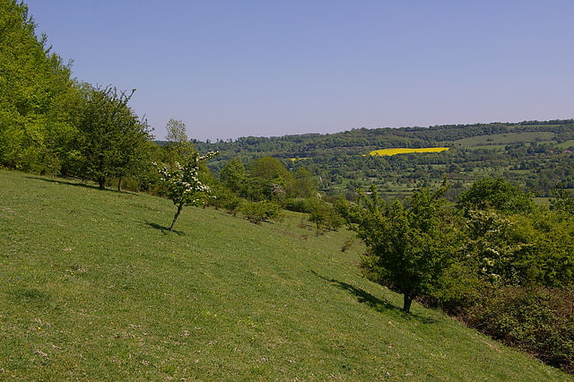
Fackenden Down
Fackenden Down is a 14-hectare nature reserve north of Sevenoaks in Kent. It is managed by the Kent Wildlife Trust. It is part of the Kent Downs Area of Outstanding Natural Beauty and the Otford to Shoreham Downs Site of Special Scientific Interest
This site is mainly chalk grassland, with some woodland and scrub. There are a variety of orchids, and butterflies such as the brown argus, common blue and dark green fritillary.
There is access from a road off Shoreham Road opposite Darenth Valley Golf Club.[10]
Jumping Downs
Nature preserve in England. Jumping Downs is a 5.7-hectare Local Nature Reserve near Aylesham, between Canterbury and Dover in Kent. It is owned by the Jumping Downs Trust and managed by the Trust and the Kentish Stour Community Partnership.
Adders, viviparous lizards and slow worms have been recorded on this chalk downland site. Mammals include wood mice and pygmy shrews.
There is access from South Barham Hill.[11]
Brockhill Country Park
Brockhill Country Park is in Saltwood, near Hythe in Kent, England. The park was a former estate with landscaped gardens and has subsequently been sub-divided. The house now forms the main building for a performing arts college, whilst the gardens and lake now form part of the country park.[12]
Saint Christopher's Church
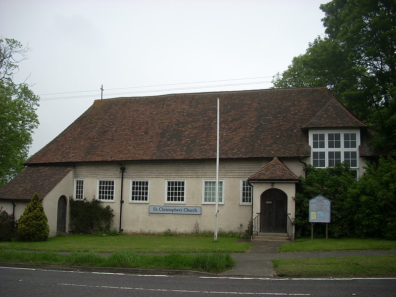
Saint Christopher's Church is a mediaeval Grade II listed church in Boughton Lees near Ashford, Kent, part of the Church of England.
The building was originally a mediaeval hall house. It was later a barn and the village school. In the 1950s, it was adopted as a chapel of ease.
On 13 August 1984, the Church was placed on the Statutory List of Buildings of Special Architectural or Historic Interest, as a Grade II building.[13]
The Roughs
Escarpment. The Roughs are an escarpment of the North Downs above Romney Marsh in Kent, on the south coast of England. The term is generally applied to the section between Hythe and West Hythe but the structure extends as far west as Bilsington, and the highest point is 106 m just west of Port Lympne Mansion
A concrete sound disk (or Sound mirror) has been built in the hillside. This was used to listen out for approaching aircraft during World War II.[14]
Polhill Bank
Nature reserve in England. Polhill Bank is a 4-hectare nature reserve south of Shoreham, which is north of Sevenoaks in Kent. It is managed by Kent Wildlife Trust. It is in Kent Downs Area of Outstanding Natural Beauty.
This chalk grassland site is on a south-east slope. There is also an area of scrub, which provides a habitat for birds such as blackcap and willow warbler. Flora include rock-rose.
The site is open to the public.[15]
Jacket's Field Long Barrow
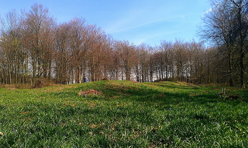
Jacket's Field Long Barrow is an unchambered long barrow located near to the village of Boughton Aluph in the south-eastern English county of Kent. It was probably constructed in the fourth millennium BCE, during Britain's Early Neolithic period. Built out of earth, the long barrow consists of a sub-trapezoidal tumulus flanked by side ditches.
Archaeologists have established that the monument was built by a pastoralist community shortly after the introduction of agriculture to Britain from continental Europe. Although representing part of an architectural tradition of long-barrow building that was widespread across Neolithic Europe, Jacket's Field Long Barrow belongs to a localised regional variant of barrows produced in the vicinity of the River Stour. Of these, it lies on the western side of the river, while Julliberrie's Grave and Shrub's Wood Long Barrow are found on the eastern side. The site was discovered in 1970, at which point it was concealed in dense woodland, although has yet to undergo thorough archaeological investigation.[16]
Sladden Wood
Sladden Wood is a 7-hectare nature reserve north of Alkham in Kent. It is managed by the Kent Wildlife Trust.
The main trees in this wood are hornbeam, field maple and hazel, and there are ground flora such as green hellebore and yellow archangel.
There is access by a footpath from Alkham.[17]
Stockbury Hill Wood
Nature reserve in England. Stockbury Hill Wood is a 5-hectare nature reserve near Stockbury, north-east of Maidstone in Kent. It is managed by the Kent Wildlife Trust.
This wood is mainly yew, hornbeam and oak. It has a variety of orchids, such as bird's-nest, lady and fly. There are orange tip and holly blue butterflies.
Access is by prior arrangement with the Trust only.[18]
Whinless Down
Nature preserve in Dover, England. Whinless Down is a 19.3-hectare Local Nature Reserve on the western outskirts of Dover in Kent. It is owned by Dover Town Council and managed by the White Cliffs Countryside Partnership.
Dover Castle can be viewed from the down, which has rare plants such as cypress spurge, horseshoe vetch and crown vetch. There are also uncommon butterflies and moths including Adonis blue, Chalkhill blue, Scarce forester moth and Silver spotted skipper.
There is access by a footpath from Kings Road and paths leading from behind Elms Vale Recreation Ground, There is also access via High Meadow and the adjoining Nemo Down.
Whinless Down, High Meadow and Nemo Down together form a network of pathways covering an area of over 60.7-hectare (150 acres).[19]
Ivy Hatch Nature Reserve
Ivy Hatch Nature Reserve in Ivy Hatch, north of Tonbridge in Kent, is a 0.5-hectare reserve managed by the Kent Wildlife Trust.
Several streams run through this small site, and there are many wetland plants, including sphagnum moss. There are many common spotted orchids, and trees such as alders and hazels.
There is access from Ismays Road.[20]