Discover 7 hidden attractions, cool sights, and unusual things to do in Ashford (United Kingdom). Don't miss out on these must-see attractions: Godinton House, Conningbrook Lakes Country Park, and Willesborough Windmill. Also, be sure to include Ashford Green Corridor in your itinerary.
Below, you can find the list of the most amazing places you should visit in Ashford (England).
Table of Contents
Godinton House
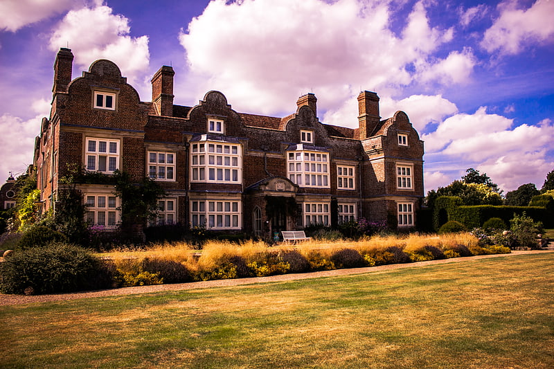
Godinton House is a stately home in the parish of Great Chart, owned by a non-profit-making trust. It is 2 miles north-west of the centreof the town of Ashford, Kent, UK.[1]
Address: Godinton House Godinton Park Godinton Lane, TN23 3BP Ashford
Conningbrook Lakes Country Park
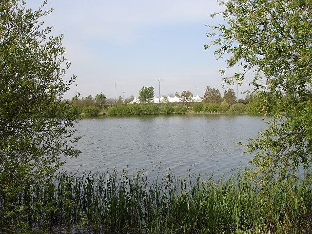
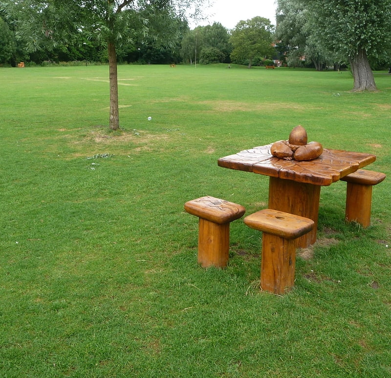
Nature reserve in England. Conningbrook Lakes Country Park is a 34.3-hectare nature reserve in Kennington, Ashford in Kent. It is managed by Kent Wildlife Trust.
There are three lakes in these former gravel pits, and other habitats are ponds, a river, grassland and wet woodland. In the winter there are migratory wildfowl and wetland birds such as wigeon, tufted duck and gadwall.
There is access from Willesborough Road.[2]
Willesborough Windmill
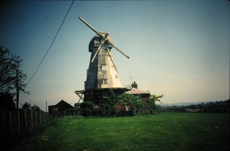
Museum in Willesborough, England. New Mill is a Grade II* listed smock mill in Hythe Road, Willesborough, Ashford, Kent. It stands just west of junction 10 of the M20 motorway. It was built in 1869 and is now a museum open to the public.[3]
Address: Willesborough Windmill Mill Lane, TN24 0QG Willesborough
Ashford Green Corridor
Nature preserve in Ashford, England. Ashford Green Corridor is a green space that runs through the town of Ashford in Kent, England. The Green Corridor is made up of parks, recreation grounds and other green spaces alongside the rivers that flow through Ashford. It is a Local Nature Reserve.
The town has been growing steadily since the early 19th century. As the town has expanded, land close to the rivers has not usually been built on, due to the risk of flooding because the Ashford Borough Council has protected it as green space.[4]
Ashford Green Corridors
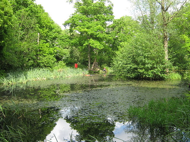
Nature reserve. Ashford Green Corridors is a 47.4-hectare Local Nature Reserve in Ashford in Kent, England. It is owned and managed by Ashford Borough Council.
This site has a lake, ponds, pollarded trees, a meadow and parkland. Birds on Singleton Lake include kingfishers.
Paths and roads go through this linear site.[5]
Ashford Warren and Hoads Wood
Ashford Warren and Hoads Wood is a 34.5-hectare nature reserve north of Ashford in Kent. It is owned by Ashford Borough Council and managed by Kent Wildlife Trust.
This site has acid grassland, which is nationally rare, and mature woodland. There are also pools which have water violets, great crested newts and grass snakes.
There is access from Warren Lane.[6]
Borough of Ashford
English non-metropolitan district. The Borough of Ashford is a local government district with borough status in Kent, England. It borders five other Kent districts, as well as East Sussex to the south-west. Ashford Borough Council's main offices are in the town of Ashford. The borough was formed on 1 April 1974, by the merger of the then Borough of Tenterden with Ashford urban district as well as the Rural Districts of East Ashford, West Ashford and Tenterden. Covering 58,000 hectares, it is the largest district by area in Kent.
The Borough is divided into 39 civil parishes, centred on the villages as well as the historic town of Tenterden.
From the 1960s onwards Ashford has experienced phases of rapid urban growth, creating new suburbs such as Stanhope and, more recently, Singleton. Today's urban growth is partially shaped by the de facto corridors created by the M20 motorway, the High Speed 1 line and several other rail lines which converge on the town's railway station; this has contributed to particular development pressure on, and the development of, greenfield sites in and adjacent to the town, especially, but not exclusively, to the south and west—for example at Sevington.[7]