Discover 11 hidden attractions, cool sights, and unusual things to do in Isle of Arran (United Kingdom). Don't miss out on these must-see attractions: Brodick Castle, Goat Fell, and Kildonan Castle. Also, be sure to include Caisteal Abhail in your itinerary.
Below, you can find the list of the most amazing places you should visit in Isle of Arran (Scotland).
Table of Contents
Brodick Castle
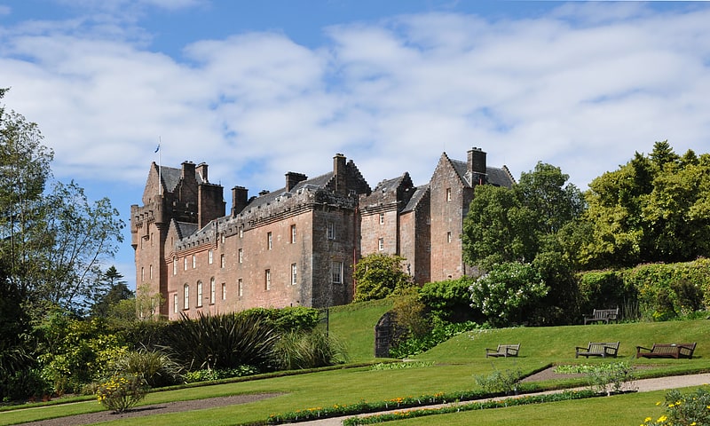
19th-century castle with formal gardens. Brodick Castle is a castle situated outside the port of Brodick on the Isle of Arran, an island in the Firth of Clyde, Scotland. It was previously a seat of the Dukes of Hamilton, but is now owned by the National Trust for Scotland. The castle is a Category A listed building and the grounds are included in the Inventory of Gardens and Designed Landscapes in Scotland.[1]
Goat Fell
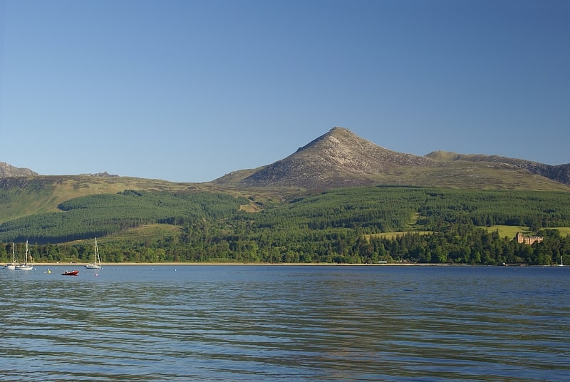
Island's highest peak for hiking. Goat Fell is the highest point on the Isle of Arran. At 874 metres, it is one of four Corbetts on the island. The mountain, along with nearby Brodick Castle, is now owned by the National Trust for Scotland.
The name is believed to mean 'Goat Mountain' (from the Norse geita).[2]
Kildonan Castle
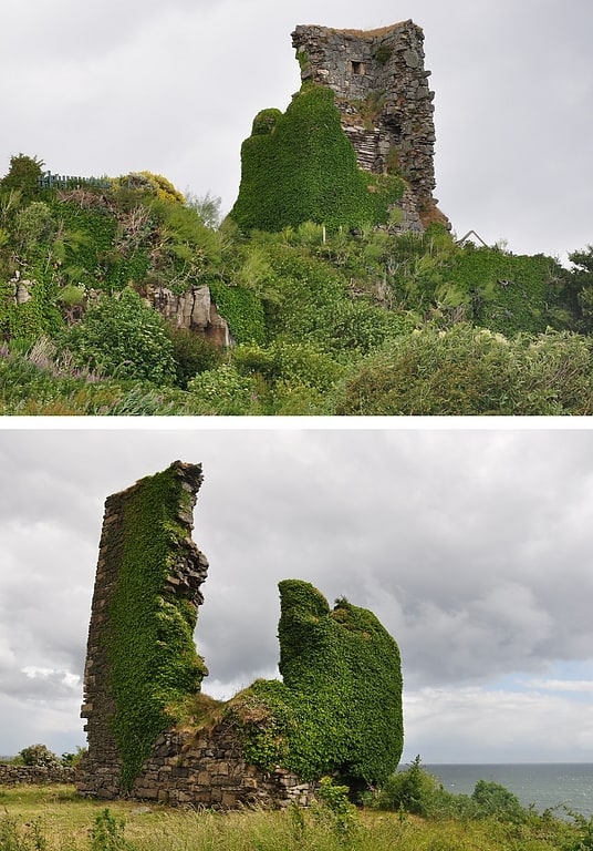
Castle in Kildonan, Scotland. Kildonan Castle stands in the small village of Kildonan on the southern coast of the Isle of Arran in Scotland. The castle's name is derived from the name of a former resident, Saint Donan, who is said to be buried on the island.
It was built in the 13th century by the MacDonalds, the Lords of the Isles. The castle stands on the cliffs, overlooking the island of Pladda and the entrance to the Firth of Clyde. It was built to defend against enemies attacking through the Firth.
It was used as a hunting lodge by the Kings of Scotland, including Robert III, when the island belonged to the crown. The castle became the property of the Earls of Arran in 1544.[3]
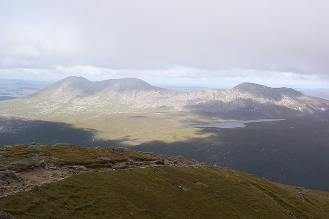
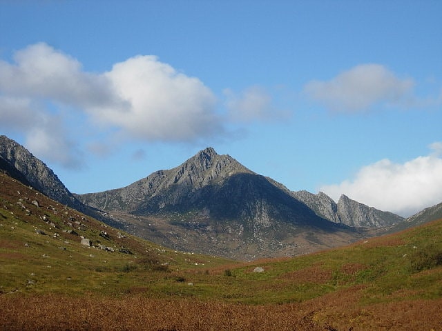
Caisteal Abhail
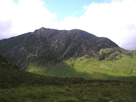
Mountain in Scotland. Caisteal Abhail is a mountain on the Isle of Arran in Scotland.
It is the northernmost Corbett on the island. The mountain forms the main part of a view known as The Sleeping Warrior due to its distinctive outline (resembling the profile of a recumbent figure) as seen from the mainland. The most notable feature of the mountain is Ceum na Caillich (often rendered as the "Witch's Step", cailleach, here in genitive also means an old woman/hag), a deep gash in the eastern ridge. It is the northernmost peak in a chain of three Corbetts: Goat Fell (the highest peak on Arran) is in fact an eastern outlier to this chain.
The summit lies at the junction of four ridges: those running east, north and northwest eventually descend, whilst the southern ridge continues on to the central summit of the range, Cìr Mhòr. The summit is crowned with a series of rocky tors, and in poor visibility it may be difficult to ascertain which one marks the highest point.
The mountain is most frequently climbed from North Glen Sannox. There is a car park on the A841 road 2 miles (3 kilometres) west of Sannox. From here, the summit can be attained via the northern, northwestern or eastern ridge. Ascent over the eastern ridge requires the walker to negotiate Ceum na Caillich, a tricky scramble that is not easily by-passed.
Ceum na Caillich and the eastern ridge may also be reached from the village of Sannox on the east coast of the island by way of Glen Sannox. The northwestern ridge can be climbed via a longer route following the Gleann Easan Biorach from Lochranza. An ascent of Caisteal Abhail is often combined with Cìr Mhòr, and indeed other Arran peaks.[4]
Beinn Bharrain
Mountain in Scotland. Beinn Bharrain is a mountain on the Isle of Arran, Scotland, located in the far northwest of the Island.
Despite being less frequently visited than its eastern neighbours, it still provides fine views from the top. The entire hill is known as Beinn Bharrain, with 'Mullach Buidhe' the highest of its summits.[5]
Giants' Graves
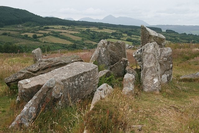
Monument in Scotland. The Giants' Graves are the remains of two Neolithic chambered tombs on the Isle of Arran in Scotland. They are situated within 40 metres of each other, and stand on a ridge 120 metres above the sea in a clearing in a forest, overlooking Whiting Bay to the south.[6]
Torrylin Cairn
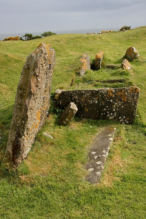
Historical landmark in Lagg, Scotland. Torrylin Cairn is the remains of a Neolithic chambered tomb. It is located near Kilmory on the Isle of Arran in Scotland.[7]
Beinn Tarsuinn
Mountain in Scotland. Beinn Tarsuinn is a mountain on the Isle of Arran, Scotland. It is the southernmost of the four Corbetts on the island, lying between Glen Rosa to the east and Glen Iorsa to the west.
Beinn Tarsuinn is often climbed in conjunction with the neighbouring peak of Cìr Mhòr, to which it is linked by a rocky ridge forming the subsidiary top of A' Chìr. The crossing of A' Chìr involves scrambling, however the two peaks can be linked without crossing A' Chìr by means of a path that traverse the ridge's western side. The simplest and shortest route up Beinn Tarsuinn is via one of the two ridges on either side of the Coire a' Bhradain; both ridges drop down into Glen Rosa, the usual access for most walkers to this group of hills.[8]
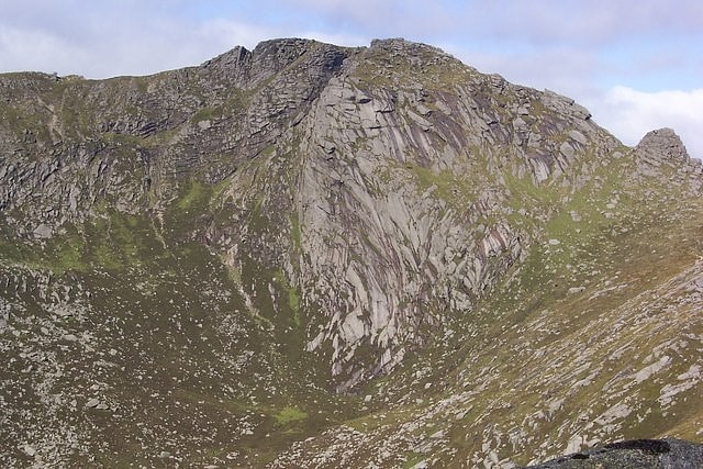
Cìr Mhòr
Peak in Scotland. Cìr Mhòr is a Corbett known as the Matterhorn of Arran. Its name means the "big comb", referring its resemblance to a cockscomb. It is separated from the island's highest peak, Goat Fell, by a col called The Saddle.[9]
Tighvein
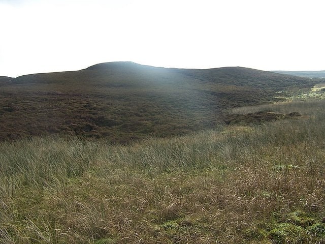
Hill in Scotland. Tighvein is a hill above Lamlash on the Isle of Arran in western Scotland. It is a Marilyn and the highest point on the south-eastern section of the island, south-east of the pass of Monambre Glen. Two miles from the nearest road, the top is a heathery, boggy moor, almost entirely ringed by thick forestry plantations. It is rarely climbed as there are no paths to the top.[10]
Torr Meadhonach
Torr Meadhonach is a hill 332 metres high at the northernmost part of the Isle of Arran in western Scotland, east of the village of Lochranza.[11]