Discover 35 hidden attractions, cool sights, and unusual things to do in Exmoor National Park (United Kingdom). Don't miss out on these must-see attractions: Tarr Steps, Church of All Saints, and Culbone Church. Also, be sure to include Scheduled monuments in West Somerset in your itinerary.
Below, you can find the list of the most amazing places you should visit in Exmoor National Park (England).
Table of Contents
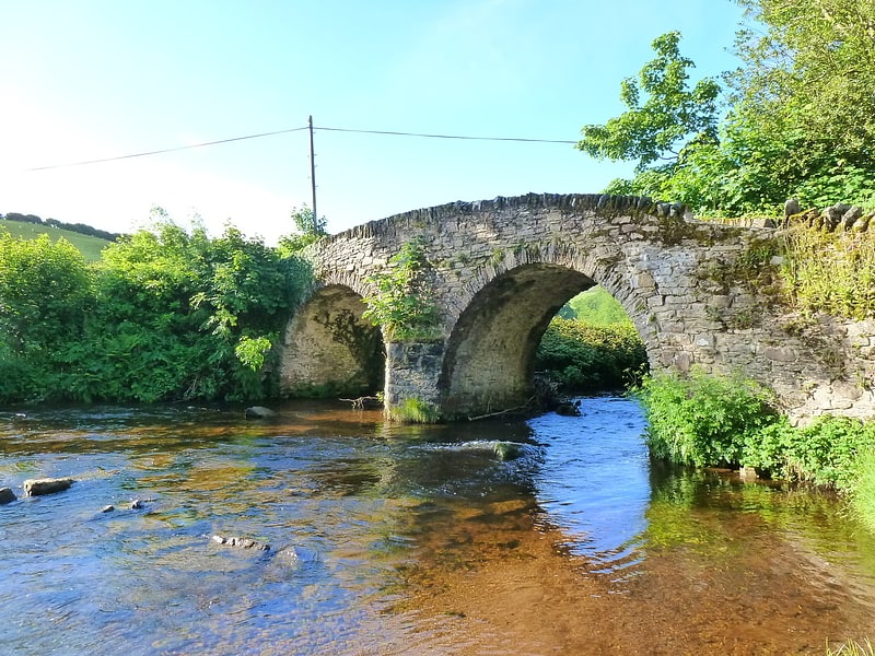
Tarr Steps
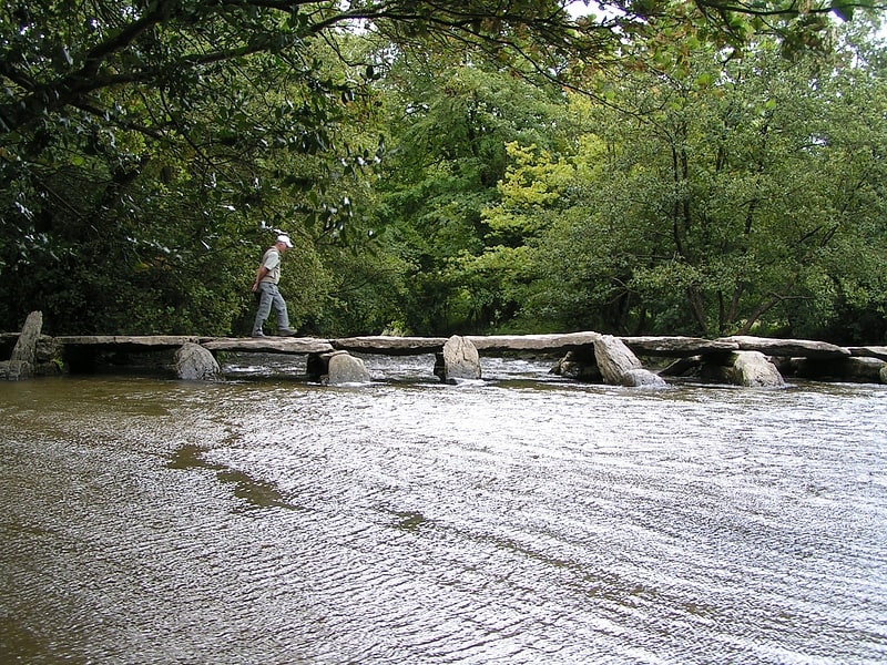
Ancient bridge made of stone slabs. The Tarr Steps is a clapper bridge across the River Barle in the Exmoor National Park, Somerset, England. They are located in a national nature reserve about 2.5 miles south east of Withypool and 4 miles north west of Dulverton.
A typical clapper bridge construction, the bridge's listing assesses it as medieval in origin. The stone slabs weigh up to two tons each. The bridge is 180 feet (55 m) long and has 17 spans. It has been designated by English Heritage as a grade I listed building and scheduled monument.[1]
Address: River Barle, Exmoor National Park
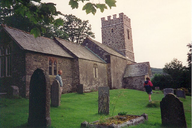
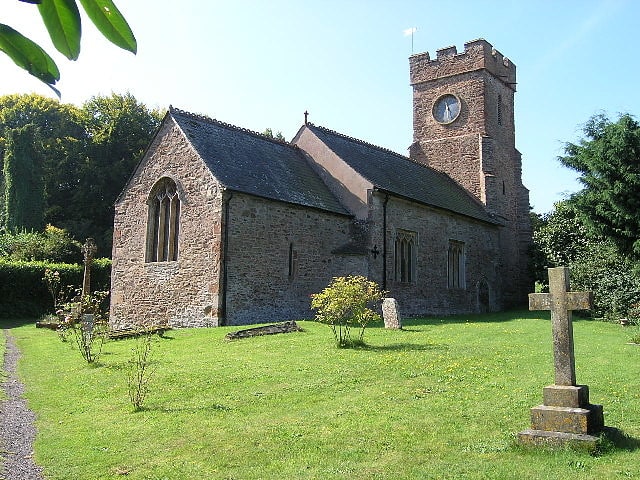
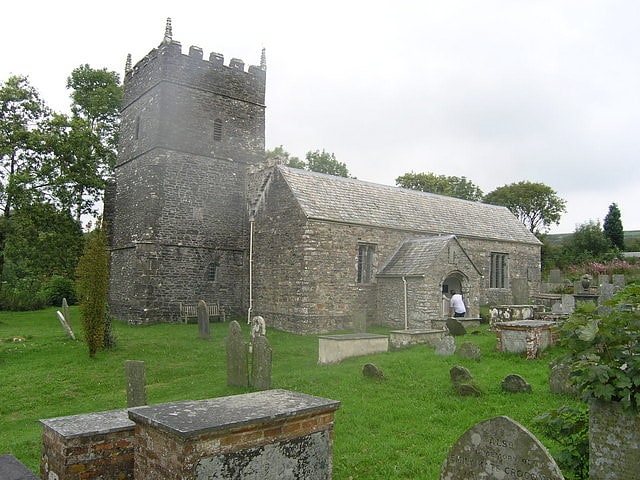
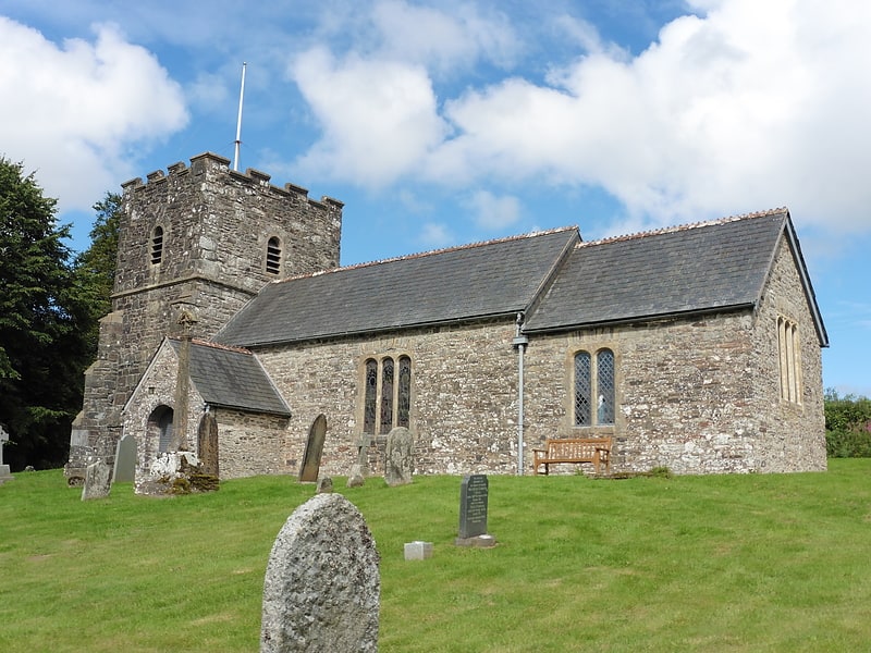
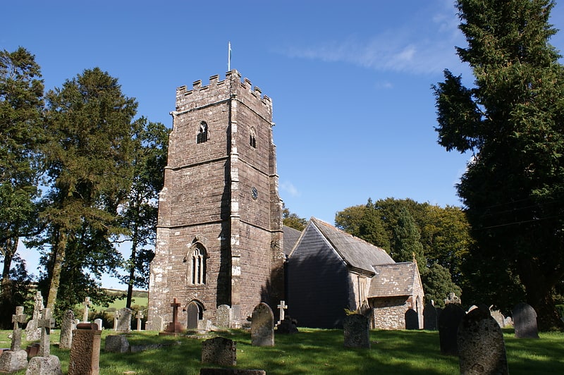
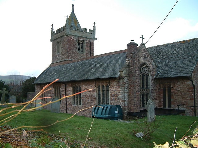
Church of All Saints
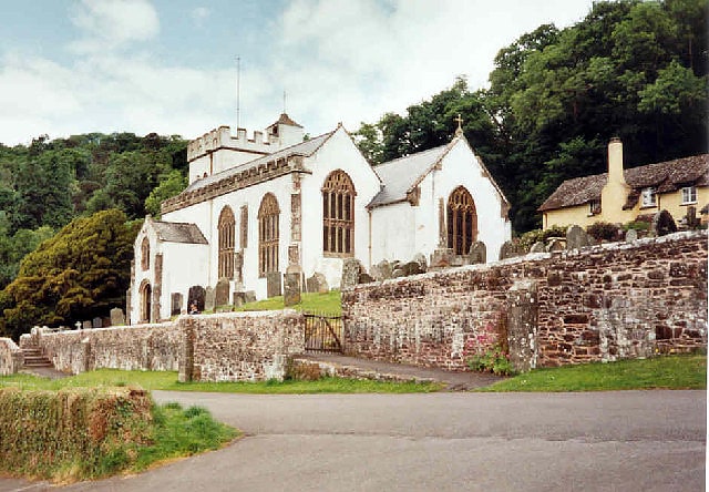
Building in England. The Church of All Saints which sits on a hillside above Selworthy, Somerset, England is a whitewashed 15th-century Church, with a 14th-century tower. It has been designated by English Heritage as a Grade I listed building.
The pulpit includes a 17th-century hourglass and the iron-bound parish chest dates from the same time. Within the church is a copy of the Chained Book of 1609 by Bishop John Jewel, entitled Defense of the Apologie of the Church of England.
In the churchyard is a medieval cross with three octagonal steps, a square socket, and an octagonal shaft. The head is missing. The churchyard provides views across the valley to Dunkery Beacon.
The WW2 cryptographer, William Clarke is buried there.[2]
Address: Selworthy Village, TA24 8TR Selworthy
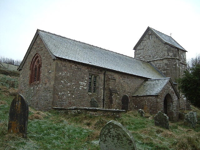
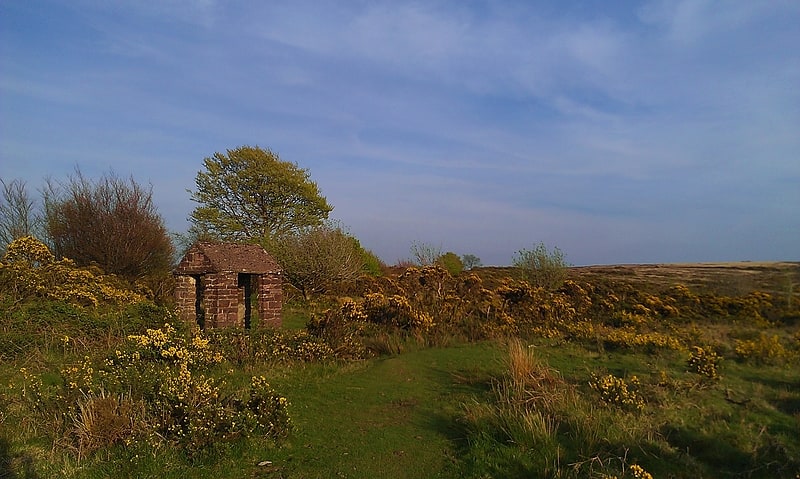
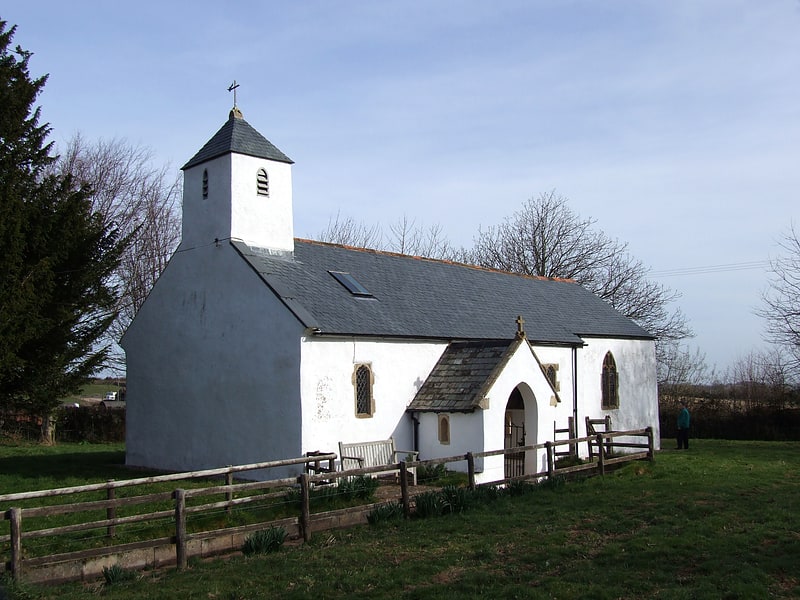
Culbone Church
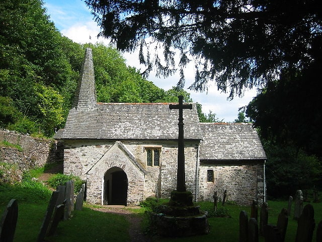
Building. Culbone Church, located in the village of Culbone in Somerset, is said to be the smallest parish church in England. The church, dedicated to the Welsh saint Beuno, has been designated by English Heritage as a Grade I listed building and the churchyard cross is Grade II*.
The church is recorded in the Domesday Book.
The church seats about 30 people, the chancel is 13.5 × 10 feet (4.1 × 3.0 m), the nave 21.5 × 12.33 feet (6.6 × 3.8 m) and the building has a total length of 35 feet (10.7 m). Services are still held there, despite the lack of access by road. The church is probably pre-Norman in origin, with a 13th-century porch and a late-15th-century nave. It was refenestrated and re-roofed around 1810 and the spirelet added in 1888. It underwent further restoration in 1928.
Joan D'Arcy Cooper, psychologist, Yoga teacher, author of Guided Meditation and the Teaching of Jesus, and wife of the potter Waistel Cooper, was organist at the church and is buried in the graveyard. The graveyard also contains a war grave of a soldier of the Welsh Guards of World War II. Sir David Calcutt QC, a barrister and public servant, is buried in the churchyard too.[3]
Scheduled monuments in West Somerset
West Somerset was a local government district in the English county of Somerset. It merged with Taunton Deane to form Somerset West and Taunton on 1 April 2019. The council covered a largely rural area, with a population of 35,075 in an area of 740 square kilometres. According to figures released by the Office for National Statistics in 2009, the population of West Somerset had the oldest average age in the United Kingdom at 52. The largest centres of population were the coastal towns of Minehead and Watchet.
A scheduled monument is a nationally important archaeological site or monument which is given legal protection by being placed on a list (or "schedule") by the Secretary of State for Culture, Media and Sport; English Heritage takes the leading role in identifying such sites. The legislation governing this is the Ancient Monuments and Archaeological Areas Act 1979. The term "monument" can apply to the whole range of archaeological sites, and they are not always visible above ground. Such sites have to have been deliberately constructed by human activity. They range from prehistoric standing stones and burial sites, through Roman remains and medieval structures such as castles and monasteries, to later structures such as industrial sites and buildings constructed for the World Wars or the Cold War.
There are 201 scheduled monuments in West Somerset. Some of the oldest, particularly on Exmoor and the Quantock Hills are Neolithic, Bronze Age or Iron Age including hillforts, cairns, bowl barrows and other tumulis. More recent sites include several motte-and-bailey castles and church or village crosses which date from the Middle Ages. The geography with large numbers of streams is reflected by the number of packhorse and other bridges included in the list. The mining history of the area is also represented by several sections of the West Somerset Mineral Railway and associated ruins of mine buildings which are now scheduled. The most recent monuments are World War II pillboxes. The monuments are listed below using the titles given in the English Heritage data sheets.[4]
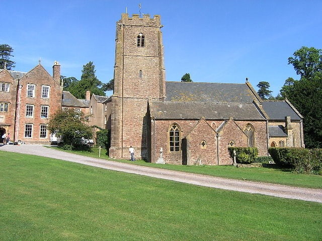
Nettlecombe Court

Outdoor activity organiser in England. Nettlecombe Court and park is an old estate on the northern fringes of the Brendon Hills, within the Exmoor National Park. They are within the civil parish of Nettlecombe, named after the house, and are approximately 3.6 miles from the village of Williton, in the English county of Somerset. It has been designated by English Heritage as a Grade I listed building.
The 16th-century Elizabethan, Tudor and Medieval architecture with Georgian refinements includes a mansion, Medieval hall, church, monumental oak grove, and a farm. It is surrounded by 60 hectares (150 acres) of estate parkland situated within the Exmoor National Park, once a part of the estate. It lays sheltered at the northeast incline of the Brendon Hills. The park surrounding the house is Grade II listed on the National Register of Historic Parks and Gardens.
Nettlecombe Park blends into woodlands, with the house serving as the Leonard Wills Field Centre run by Field Studies Council and offering residential and non-residential fieldwork for schools, colleges and universities, holiday accommodation and professional and leisure courses in natural history and arts. Today, nearby hills and woodlands, including Exmoor National Park, have provided opportunities for general scientific introductory field courses on environmental themes and botany. Habitats include marine, freshwater and heather moorland and the surrounding settlements range from hamlets to villages to the country town of Taunton. An archaeological excavation on the edge of the property, near the sea coast, has revealed the remains of Danish Vikings who were defeated there circa 900.[5]
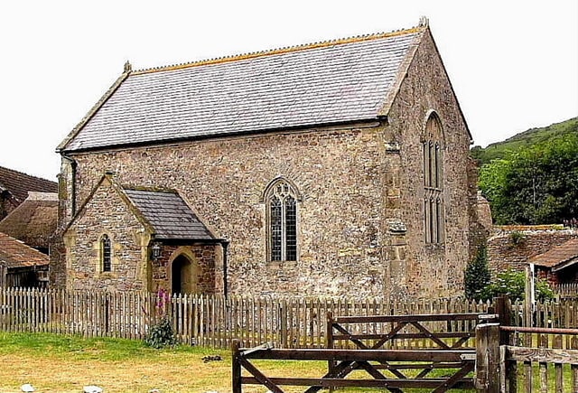
Church of All Saints
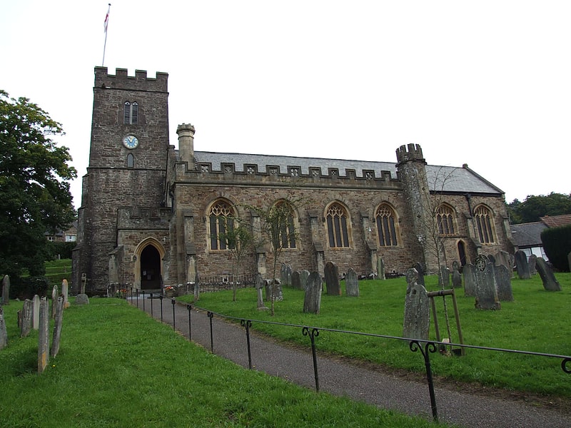
The Anglican Church of All Saints in Dulverton, Somerset, England was built in the 15th century and largely rebuilt in the 1850s. It is a Grade II* listed building.[6]
Address: Bank Square, TA22 9BU Dulverton
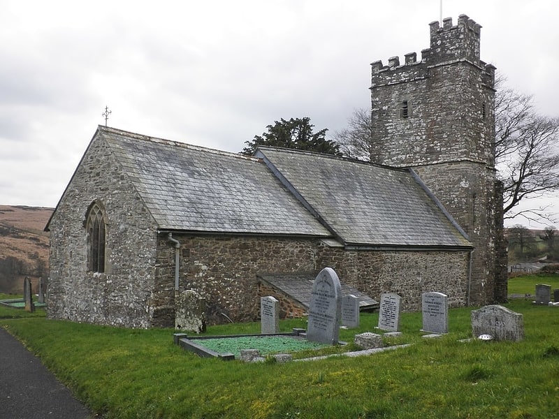
Stoke Pero Church
Church in England. Stoke Pero Church in Stoke Pero, Somerset, England was built in the 13th century. It is a Grade II* listed building. Standing 1013 feet above sea level, it is the highest church on Exmoor.[7]
Church of St Mary
The Anglican Church of St Mary in Oare, Somerset, England, was built in the 15th century. It is a Grade II* listed building.[8]
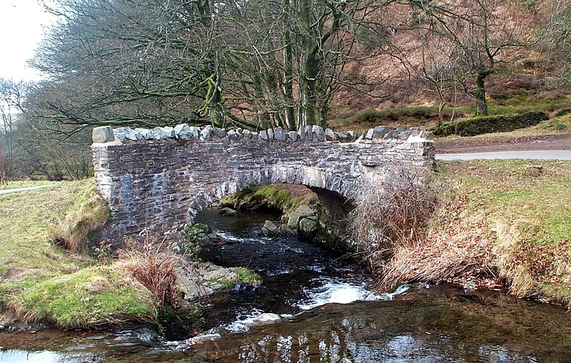
Landacre Bridge
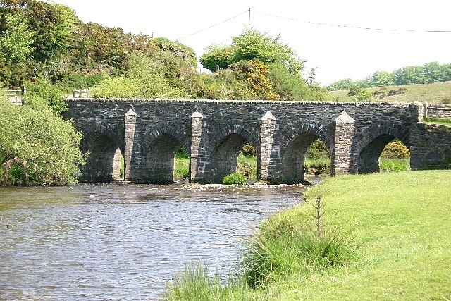
Arch bridge in England. Landacre Bridge carries Landacre Lane across the River Barle near Withypool on Exmoor in the English county of Somerset. It has been scheduled as an ancient monument and Grade II* listed building.
The stone bridge has five arches each with a span of 9 feet (2.7 m). It has pointed arches with cutwaters. On either side of the road carriageway are parapets 0.6 metres (2 ft 0 in) high.
It was built in the late medieval period with the first documentary evidence being from 1610. Restoration work was undertaken in 1875, and again following damage during flooding in 1952.
The grassy banks are grazed by sheep and provide an environment for Montbretia, Ivy-leaved Bellflower and Bottle Sedge, with the wetter areas supporting Bog-bean, Marsh Speedwell, Bog Asphodel and Round-leaved Sundew. The river itself has populations of Watermilfoil and the hybrid between Monkeyflower and Blood-drop-emlets.
The bridge has also given its name to a Morris Dance by Exmoor Border Morris, which they performed at the bridge in 2016.[9]
Church of All Saints
Building in England. The Church of All Saints in Monksilver, Somerset, England dates from the 12th century and has been designated by English Heritage as a Grade I listed building. The church has a square west tower, built in the 14th century,[10]
Robber's Bridge
Arch bridge in England. Robber's Bridge, or Robbers Bridge, is an old masonry arch bridge in the royal forest of Exmoor near Doone Valley, carrying the minor road from Porlock Hill to Oare. It crosses Weir Water and is located down a steep, wooded lane beneath overhanging trees.
Some consider it to be a popular picnic spot, accessible via a narrow, steep and winding road. In addition, from the nearby carpark, the bridge provides access to a grassland considered suitable for picnicking.[11]
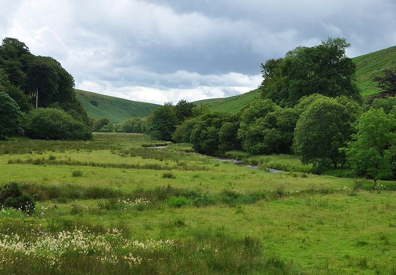
East Lyn Valley
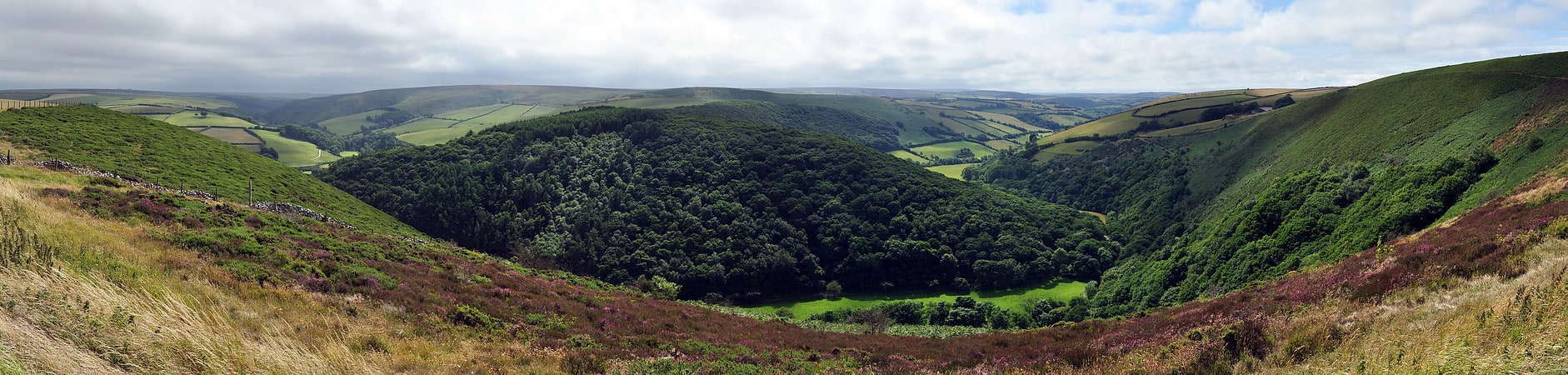
East Lyn Valley is a valley of Exmoor, covering northern Devon and western Somerset, England.
The East Lyn River is formed from several main tributaries including Hoar Oak Water beginning near Weir Water. Its mouth is at Lynmouth at the confluence with the West Lyn River. The valley is abundant with wildlife, including dippers, grey wagtails and heron. During the Ice Age glacial erosion eroded one side of the valley resulting in the steep valley which is seen today. This was responsible for floods in the valley in 1952.
The area was the setting for Lorna Doone by R. D. Blackmore and James Herbert's The Secret of Crickley Hall. The church at Oare appeared in the novel. St Brendan's church in the village of Brendon also overlooks the valley; the current building dates to 1738.[12]
Brendon Hills
Hill in England. The Brendon Hills are a range of hills in west Somerset, England. The hills merge level into the eastern side of Exmoor and are included within the Exmoor National Park. The highest point of the range is Lype Hill at 1,388 feet above sea level with a secondary summit several kilometres to the southeast at 1,350 feet. Both points are marked by Ordnance Survey trig points and are located within enclosed farmland. Early versions of the name include Brunedun and Brundon reflecting an original name of Bruna or Brune, meaning 'brown one'. Dun is a common Old English word for a fairly flat and extensive hill. This name is not connected with the village of Brendon in Devon, the name of which has a different origin.
The terrain is broken by a series of deeply incised streams and rivers running roughly southwards to meet the River Haddeo, a tributary of the River Exe. The hills are quite heavily cultivated unlike their neighbouring upland areas of Exmoor and the Quantock Hills. The Brendon Hills are largely formed from the Morte Slates, a thick faulted and folded sequence of Devonian age sedimentary rocks. An east-west aligned anticline/syncline pair known as the Brendon Anticline and Brendon Syncline folds these rocks. The fold couplet is itself offset by displacement of the rocks on the NNW-SSE aligned Timberscombe Fault System. Over the centuries they have been mined for minerals, notably ironstone from which iron is extracted for making steel. During the 19th century this activity reached a peak with the West Somerset Mineral Railway, including an 800 feet (244 m) incline, being built to take the ore to Watchet from where it was sent to Ebbw Vale for smelting. The main mining operations ended when the mines were worked out towards the end of the 19th century.
The hills are on the route of the Coleridge Way and are also crossed by the Samaritans Way.[13]
Caratacus Stone
The Caratacus Stone, sometimes known as the Caractacus Stone, is an inscribed stone on Exmoor in Somerset, England. It is thought to date from the 6th century, and it has been a scheduled monument since 1925.
The inscription, in Latin, appears to read CARAACI NEPVS, though experts have stated that a bar above the second A forms a ligature meaning that it should be read as CARATACI NEPVS. It is possible that there was more text on the stone that has weathered away.
The inscription, which can be translated as "grandson or immediate descendant of Caratacus", has led to the general opinion that the stone was probably erected as a memorial to a person who claimed the first-century British chieftain Caratacus as an ancestor.
The first mention of the stone was in 1219, when it was described in a perambulation of the Royal Forest of Exmoor as "the Langeston". In 1890 the letter N (which is reversed) was missing from the inscription, but by 1919 the missing piece had been found and was cemented back in place. In 1906 a shelter was erected over the stone, and an excavation in 1937 revealed that the stone was not associated with a burial site.[14]
Lynch Chapel Of Ease
The Anglican Lynch Chapel Of Ease in West Lynch, Selworthy, Somerset, England was built around 1530. It is a Grade II* listed building.[15]
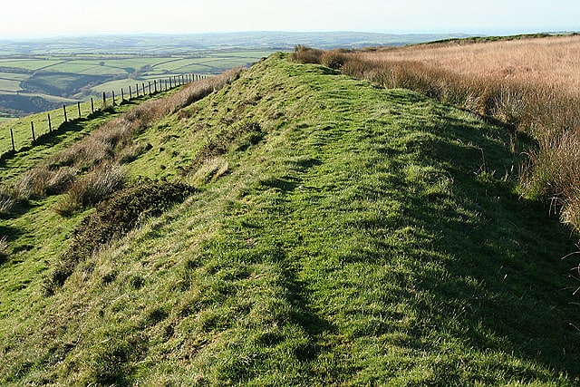
Bury Castle
Bury Castle is an Iron Age hill fort near Selworthy, Somerset, England. It has been scheduled as an ancient monument.[16]
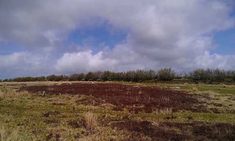
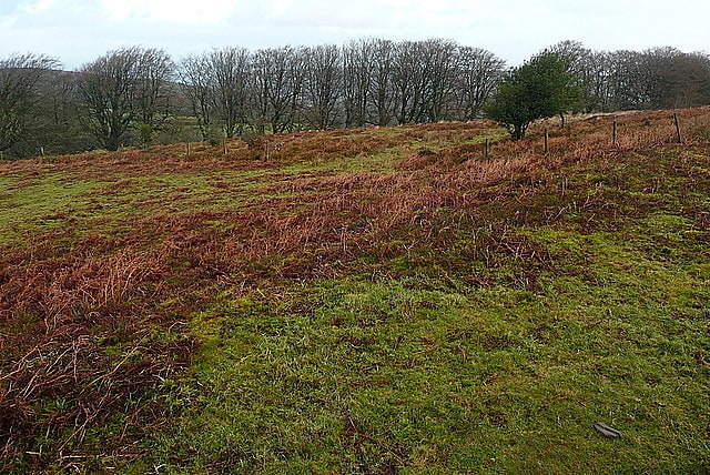
Barle Valley
Nature preserve in England. Barle Valley is a 1,540 acres Site of Special Scientific Interest within Exmoor National Park, situated in the counties of Devon and Somerset through which the River Barle flows. It was notified in its current form under the Wildlife and Countryside Act in 1988. The site includes the Somerset Wildlife Trust's Mounsey Wood Nature Reserve and the Knaplock and North Barton SSSI which has been notified since 1954.[17]
Withypool Stone Circle
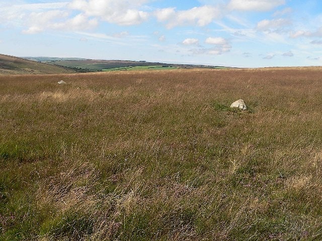
Withypool Stone Circle, also known as Withypool Hill Stone Circle, is a stone circle located on the Exmoor moorland, near the village of Withypool in the southwestern English county of Somerset. The ring is part of a tradition of stone circle construction that spread throughout much of Britain, Ireland, and Brittany during the Late Neolithic and Early Bronze Age, over a period between 3300 and 900 BCE. The purpose of such monuments is unknown, although archaeologists speculate that the stones represented supernatural entities for the circle's builders.
Many monuments were built in Exmoor during the Bronze Age, but only two stone circles survive in this area: the other is Porlock Stone Circle. The Withypool ring is located on the south-western slope of Withypool Hill, on an area of heathland. It is about 36.4 metres (119 feet 5 inches) in diameter. Around thirty small gritstones remain, although there may originally have been around 100; there are conspicuous gaps on the northern and western sides of the monument. The site was rediscovered in 1898 and surveyed by the archaeologist Harold St George Gray in 1905.[18]
Cow Castle
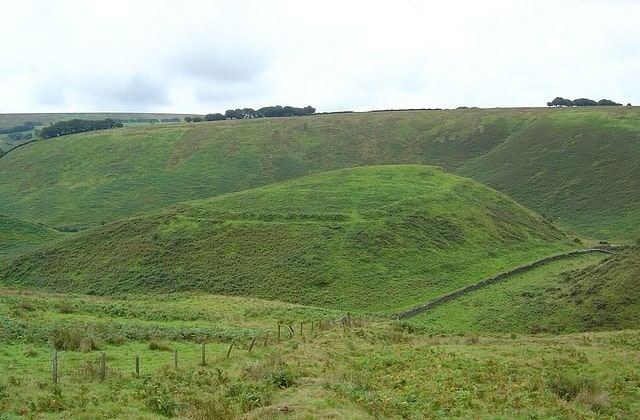
Historical landmark in England. Cow Castle is an Iron Age hillfort 5.75 kilometres West South West of Exford, Somerset, England within the Exmoor National Park. It is a Scheduled Monument. It has been added to the heritage at Risk register because of the risk from bracken.
It is situated on an isolated hilltop and has a single rampart and ditch, adapted to its location and enclosing 0.9 hectares, with a commanding position over the valley of the River Barle. It is 1.2 ha in area and surrounded by a rampart, up to 2m high.
It is in a good condition, and is expected to contain significant and environmental evidence. Legend says that the hillfort was built by fairies to protect themselves against the earth.[19]
St Petrock's Church
Building in Parracombe, England. St Petrock's Church in Parracombe, Devon, England was built in the 13th century. It is recorded in the National Heritage List for England as a designated Grade I listed building, and is now a redundant church in the care of the Churches Conservation Trust. It was declared redundant on 25 November 1969, and was vested in the Trust on 23 June 1971.
The church is dedicated to St Petrock. Parts of the building, including the chancel and the lower part of the tower remain from the 13th century but much of the current fabric dates from a reconstruction in the early 16th century.
In 1879 there were worries about the stability of the building however protests led by John Ruskin who donated £10 lead to the preservation of the church and the construction of a new one further west in the village.
The interior includes 18th-century box pews, a Georgian pulpit and a screen with a wooden tympanum above it which dates from the 18th century.[20]
Church of St Giles
Anglican church in England. The Anglican Church of St Giles in Hawkridge, Somerset, England was built in the 14th century. It is a Grade II* listed building.[21]
Malmsmead Bridge
Bridge in England. Malmsmead Bridge is a 17th-century stone bridge which crosses Badgworthy Water in the hamlet of Malmsmead, on the road between Oare and Brendon. The Badgworthy Water forms the boundary between the counties of Somerset and Devon, and the bridge is therefore shared between both counties, as well as being within the Exmoor National Park. It has been scheduled as an ancient monument and is a Grade II listed building.
The bridge has two round arches each of which is 8 feet 6 inches (2.59 m) wide.[22]
Church of St Martin
Building in England. The Church of St Martin in Elworthy, Somerset, England, is dedicated to St Martin of Tours. It dates from the 13th century and is recorded in the National Heritage List for England as a designated Grade II* listed building.
Whilst the unbuttressed 2-stage crenellated tower is from the 13th century the porch and nave roof are from the late 15th century. The chancel was rebuilt in 1695 and again in 1846. It is built of red sandstone with Ham stone dressings and a slate roof. Within the church is an unusual alabaster font made with stone from a quarry near Watchet.
In 1969 the parish became a chapelry of Monksilver, within the benefice of Monksilver with Brompton Ralph and Nettlecombe.
It is a redundant church in the care of the Churches Conservation Trust. The church was declared redundant on 1 August 1975, and was vested in the Trust on 19 December 1979.[23]
Church of St Andrew
The Anglican Church of St Andrew in Withypool, Somerset, England was built in late medieval period. It is a Grade II* listed building.[24]
Withypool Bridge
Bridge. The Withypool Bridge is an arch bridge that carries a small road over the River Barle at Withypool in Somerset, England. It is a Grade II* listed building.
The red sandstone bridge was built in the 19th century. It replaced an earlier bridge 100 metres (330 ft) upstream of the current site and is therefore shown on some maps as "New Bridge".
The bridge was restored in 1866 and again in 1983.[25]
Porlock Stone Circle
Porlock Stone Circle is a stone circle located on Exmoor, near the village of Porlock in the south-western English county of Somerset. The Porlock ring is part of a tradition of stone circle construction that spread throughout much of Britain, Ireland, and Brittany during the Late Neolithic and Early Bronze Age, over a period between 3300 and 900 BCE. The purpose of such monuments is unknown, although archaeologists speculate that the stones represented supernatural entities for the circles' builders.
Although Exmoor witnessed the construction of many monuments during the Bronze Age, only two stone circles survive in this area, the other being Withypool Stone Circle. The Porlock circle is about 24 metres (79 feet) in diameter and contains thirteen green micaceous sandstone rocks; there may originally have been more. Directly to the north-east of the circle is a cairn connected to a linear stone row. No evidence has been found that allows for absolute dating of the monument's construction, although archaeologists have suggested that the cairn dates from the Early Bronze Age, the circle being a Middle Bronze Age addition.
A small lead wheel found inside Porlock Stone Circle suggests that the site was visited during the Romano-British period. The site was rediscovered in the 1920s and since then a variety of stones have been added to it; its current appearance is a composite of prehistoric and modern elements. In 1928 the site was surveyed and excavated by the archaeologist Harold St George Gray. A second excavation took place under the leadership of Mark Gillings in 2013.[26]
Church of St Mary Magdelene
Anglican church in Exford, England. The Anglican Church of St Mary Magdelene in Exford, Somerset, England was built in the 15th century. It is a Grade II* listed building.[27]
Shoulsbury castle
Tourist attraction in the Brayford, England. Shoulsbury Castle is an Iron Age hill fort close to Challacombe in Devon, England. It takes the form of a multi-ditch and rampart enclosure close to the top of a hill on the shoulder of Shoulsbarrow Common at an elevation of 472 metres above sea level.
Shoulsbury Castle is unusually rectangular and on a western hill spur suggesting that it is either Roman or Iron Age. (The Archaeology of Exmoor, p78) It is the largest and best known hillfort on Exmoor that over the years has been referred to as Solsbury, Shorsbery, Salusbury, Shoulsbury, Showlsborough, Shoulsbarrow in various texts over the Centuries (The Archaeology of Exmoor, p84). The area was occupied from the Iron Age into the early Saxon period by the Dumnonii people. In the 18th Century it was suggested it was the work of the druids for the celebration of religious rites or ‘feats of activity or athletick exhibitions’ (Collinson, 1791)
The fort is mainly double rampart but to the south natural topography allows only one. The unusual rectangular plan is similar to nearby Roman fortlets at Martinhoe and County Gate, leading to the suggestion that Shoulsbury may be Roman in origin. Very little evidence of Roman activity exists on Exmoor with only one Roman fort and the two fortlets identified (The Field Archaeology of Exmoor, p.56). The likely entrances are from the west and south east corner, the inner enclosure extends to four acres, the outer six. There is a circular mound evident in the north east corner. This has been described as a Bronze Age barrow and was excavated as such before 1906 with nothing found (Victoria County History, Devon Vol. I, p596). There are various lumps and bumps enclosed which may be house platforms, a nearby water supply is from the river Bray.
Its location on Exmoor is likely to have been an extremely exposed, remote and inhospitable place in the Iron Age. Referred to by Daniel Defoe (1661-1731), “The Country is called Exmore, Cambden calls it a filthy, barren Ground, and indeed, so it is”. (The Reclamation of Exmoor Forest, p6) In 1818 it was just outside an area of 20,000 acres described as, ‘His Majesty’s Allotment’ that contained one small farm and a few ancient track-ways (The Reclamation of Exmoor Forest, p.11).
Henry Wollcombe wrote in 1839, ‘Some Account of the Fortified Hills in the County of Devon, whether British, Roman, Anglo-Saxon or Danish with plans of many of them', he describes the hillfort; “The whole inclosure is a complete morass incapable of being walked on. Indeed the whole hill is a bog and marshy and requires great care even in this dry season to pick your path. The parts with double ramparts was never a ditch, it was rather an esplanade for men to draw up on” (The Reclamation of Exmoor Forest, p.7)[28]
Sweetworthy
Sweetworthy is the site of two Iron Age hill forts or enclosures at Luccombe, 4 kilometres south of Porlock, Somerset, England. They are on the north-facing slope of Dunkery Hill. One has a single rampart and external ditch, enclosing 0.25 hectares. The rampart is still visible and the ditch on the east side is used as a trackway. There was a defended settlement above the main site.
It is also the site of a deserted medieval settlement, which has been designated as an Ancient monument. It has been added to the Heritage at Risk Register because of the vulnerability to plant growth.[29]
Church of St Bartholomew
The Anglican Church of St Bartholomew in Rodhuish, Somerset, England was built in the 15th century. It is a Grade II* listed building.[30]
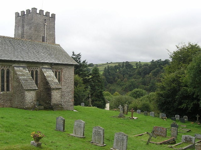
Church of St Mary the Virgin
Building in England. The Church of St Mary the Virgin in Nettlecombe, Somerset, England dates from the 13th and 14th centuries, and has been designated as a Grade I listed building.
The church which lies within the grounds of Nettlecombe Court, which was built as a large country manor house, becoming a girls' boarding school in the early 1960s and since 1967 has been the Leonard Wills Field Centre run by the Field Studies Council. The house is surrounded by Nettlecombe Park, a 90.4 hectares (223 acres) Site of Special Scientific Interest (SSSI). The house and park are set in a secluded valley on the northern fringes of the Brendon Hills, within the Exmoor National Park.
Although there was a previous church in the village the current red sandstone building was dedicated in 1440. The chancel includes a north chapel and south organ chamber. The nave has a clerestory with north and south aisles, north porch, and west tower. Restoration work was carried out around 1820 by Richard Carver, with further work undertaken between 1858 and 1870 by Charles Edmund Giles.
Within the church is a seven sided font with the sacraments of the church and Christ in Glory carved into each of the faces.
The parish is within the Quantock Towers benefice which is part of the Quantock deanery.[31]
St Peter's Church
Church in England. The Anglican St Peter's Church at Exton within the English county of Somerset has a 13th-century tower and 15th century aisle. It is a Grade II* listed building.
Some of the original Norman stonework can still be identified in the nave. The rest of the building has been reconstructed with the crenellated two-stage tower being added in the 13th century and the aisle in the 15th. It was restored and the chancel rebuilt in 1876.
In the churchyard is a 14th-century cross with a tapering octagonal stone shaft. The upper part of the shaft was restored in 1875.
The parish is within the Exmoor benefice and the archdeaconry of Taunton.[32]
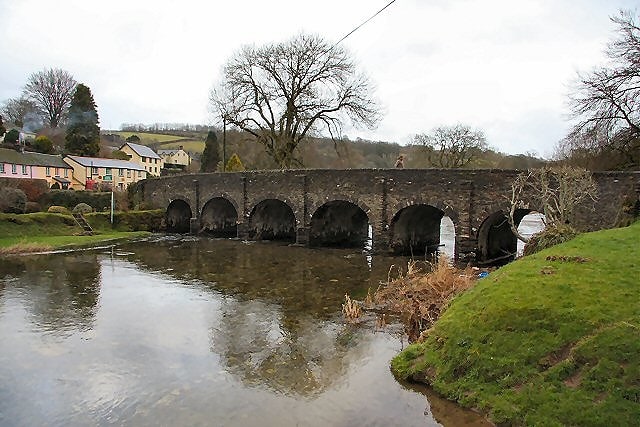
Barle Bridge
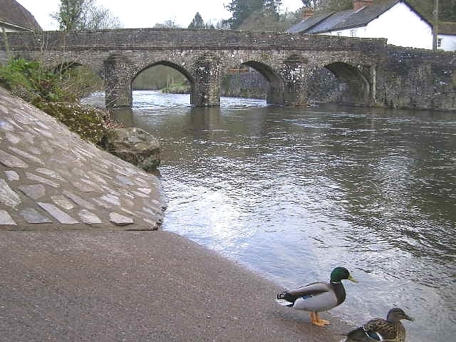
Bridge in Dulverton, England. Barle Bridge is a five span stone arch bridge over the River Barle in Dulverton within the English county of Somerset, which is medieval in origin. It has been scheduled as an ancient monument and is a Grade II listed building.[33]
Church of St Petrock
Building in Wheddon Cross, England. The Church of St Petrock in Timberscombe, Somerset, England has a 15th-century tower, the rest of the building dating from 1708. It has been designated by English Heritage as a Grade I listed building.
The church is dedicated to Saint Petroc, who probably visited the parish in the 6th century.
The chancel dates from around 1450, however sections of the nave walls may survive from an earlier building. Above the south doorway is a mural of David which dates from the Protestant Reformation. The font is 15th century and the pulpit from the 17th.
The tower which was built in the early 18th century, has a peel of eight bells.
The parish is part of the benefice of Dunster, Carhampton, Withycombe with Rodhuish, Timberscombe and Wootton Courtenay within the Exmoor deanery.[34]
Culbone Stone
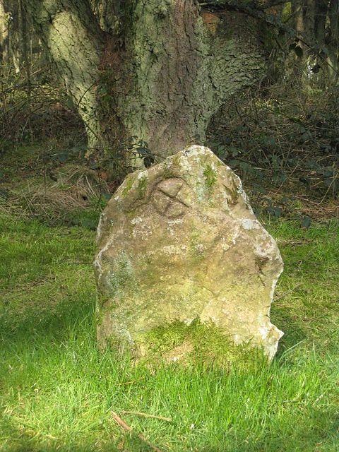
Monument in Culbone, England. The Culbone Stone, an early mediaeval standing stone, is close to Culbone in the English county of Somerset. The stone is made from Hangman grit, a local sandstone, and has a wheeled ring cross carved into it. The stone has been scheduled as an ancient monument.[35]