Discover 6 hidden attractions, cool sights, and unusual things to do in Devils Postpile National Monument (United States). Don't miss out on these must-see attractions: Tioga Pass, Hot Creek, and Kearsarge Pass. Also, be sure to include Deadman Summit in your itinerary.
Below, you can find the list of the most amazing places you should visit in Devils Postpile National Monument (California).
Table of Contents
Tioga Pass
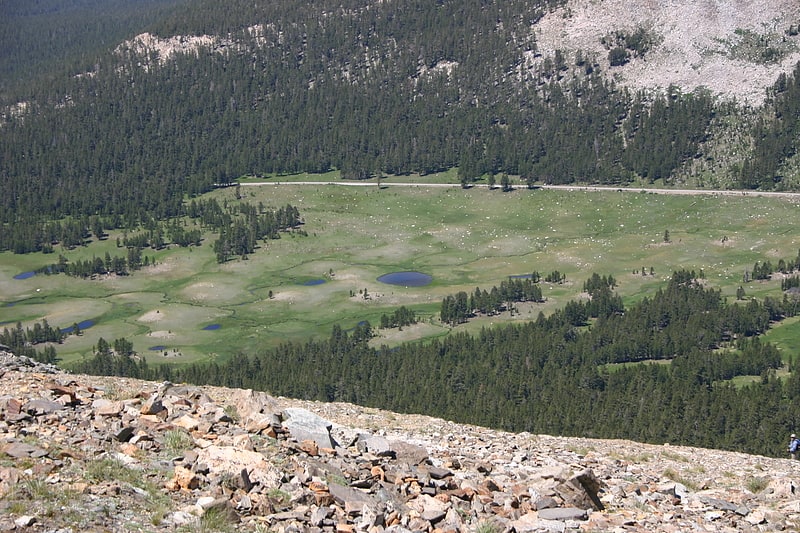
California's highest vehicle crossing. Tioga Pass is a mountain pass in the Sierra Nevada of California. State Route 120 runs through it, and serves as the eastern entry point for Yosemite National Park, at the Tioga Pass Entrance Station. It is the highest highway pass in California and in the Sierra Nevada. Mount Dana is to the east of the pass. There are several trailheads into the Yosemite backcountry which begin at Tioga Pass, including the trail to the Gaylor Lakes to the west/northwest, and the rough trail to the summit of Mount Dana. Dana Meadows is immediately south of the pass alongside the highway, as the pass itself is roughly angled north–south as opposed to east–west. Dana Meadows contains several small lakes.
This pass, like many other passes in the Sierra Nevada, has a gradual approach from the west and drops off to the east dramatically, losing more than 3,000 feet (910 m) by the time the road reaches U.S. Route 395.
Tioga Pass is named after Tioga Mine, whose name came from the Tioga River in New York: Tioga is an Iroquois and Mohawk term meaning "where it forks".
The pass is subject to winter closure, due to high snowfall, normally from around the end of October until the end of May the following year, though these dates are subject to considerable variation. In heavy snow years, the road has closed in early October, and has remained closed as late as early July. In light snow years, the road may remain open until December and open as early as April.
Tioga Pass is the most direct route from Bishop or Mammoth Lakes, California to Fresno, Merced, and Stockton. There are four highway passes to the north, between Yosemite and Lake Tahoe, but none to the south for about 200 miles (320 km), until Sherman Pass in southern Tulare County.[1]
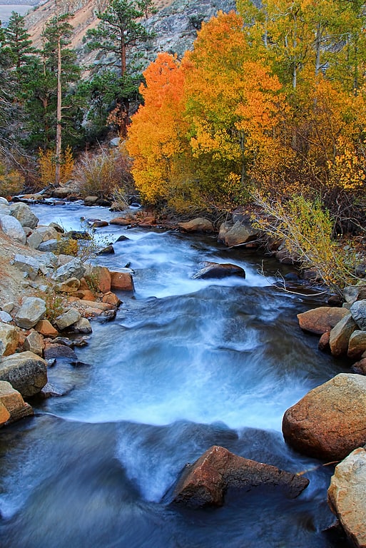
Hot Creek
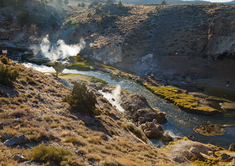
Stream in California. Hot Creek, starting as Mammoth Creek, is a stream in Mono County of eastern California, in the Western United States. It is within the Inyo National Forest.[2]
Kearsarge Pass
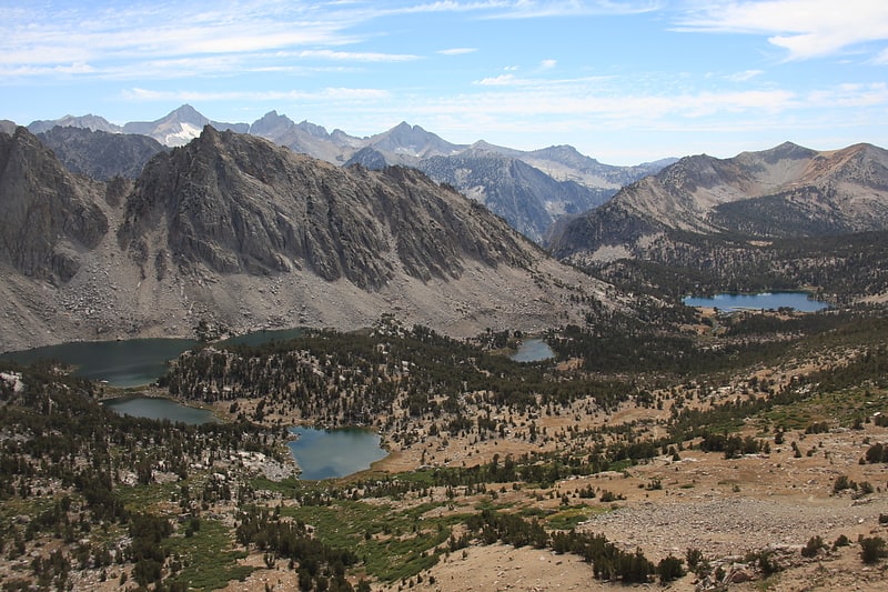
Kearsarge Pass is a pass in the Sierra Nevada of California. The pass lies on the Sierra Crest at 11,709 feet. The pass permits foot traffic between Kings Canyon National Park and the John Muir Wilderness.
The pass was named after the Kearsarge mine to the east, which was named by its owners after the USS Kearsarge, the ship that destroyed the CSS Alabama. The Alabama Hills were named after the latter ship, and the mine was named in reaction. The first known crossing of Kearsarge Pass was in 1864.[3]
Deadman Summit
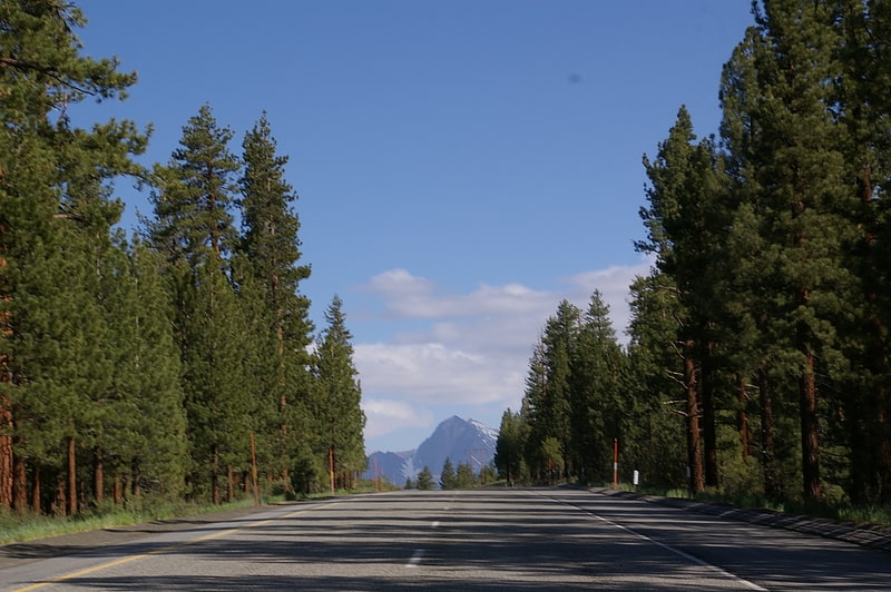
Mountain pass in California. Deadman Summit is a mountain pass in the Sierra Nevada in Mono County, California. It crosses the northern rim of the Long Valley Caldera, connecting the northern end of the Owens River watershed with Mono Lake via U.S. Highway 395. The pass, and the nearby creek with the same name, were named for the decapitated body of a murder victim found in the vicinity around 1868.
Deadman Summit is commonly traversed by travelers from Southern California seeking recreation in the June Lake, June Mountain, and Mono Lake areas.[4]
Bishop Creek
Stream in California. Bishop Creek is also a dated variant of Baxter Creek in Richmond/El Cerrito, California
Bishop Creek is a 10.1-mile-long stream in Inyo County, California. It is the largest tributary of the Owens River. It has five hydroelectric plants owned by Southern California Edison, Bishop Creek #2–6. Bishop Creek #1 was never completed. Parts of the creek run through pipelines, or penstocks, to increase output at the power plants.
Bishop Creek has three forks, North, Middle and South. All have their headwaters in the eastern Sierra Nevada, near the border with Fresno County. The forks all flow into lakes while still at high elevations. The North Fork flows into North Lake, the Middle Fork flows into Lake Sabrina. The North and Middle forks combine above and flow through the community of Aspendell and below it the combined creeks are dammed at Intake Two, a reservoir. The South Fork flows into South Lake and continues through the community of South Fork (aka Habegger's) and then joins the Middle Fork below the Intake Two reservoir. Bishop Creek then begins its steep descent to the Owens Valley. The creek runs roughly North then Northeast and then continues East, flowing past the city of Bishop before its confluence with the Owens River.
The creek was named after Owens Valley settler Samuel Addison Bishop.[5]
Sherwin Summit
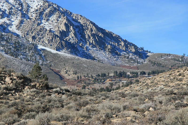
Mountain pass in California. Sherwin Summit is a mountain pass on U.S. Highway 395.
It is located east of Tom's Place and Crowley Lake in the eastern part of the Sierra Nevada range. South of the summit, the road starts on its long 2,400 foot (610 m) descent into the 4,000 ft (1,200 m) high Owens Valley. The Owens River generally follows the road from this summit through the Owens Valley. Motorists who come from the south usually cross this summit in order to go to the high-altitude towns like Mammoth Lakes to the northwest to escape the smothering summer heat in the deserts. The pass receives snowfall during the winter, although the region receives relatively little precipitation annually.
The 1946 film My Pal Trigger was filmed here.[6]