Discover 35 hidden attractions, cool sights, and unusual things to do in Yosemite National Park (United States). Don't miss out on these must-see attractions: Yosemite Valley, Glacier Point, and Bridalveil Fall. Also, be sure to include John Muir Trail in your itinerary.
Below, you can find the list of the most amazing places you should visit in Yosemite National Park (California).
Table of Contents
Yosemite Valley
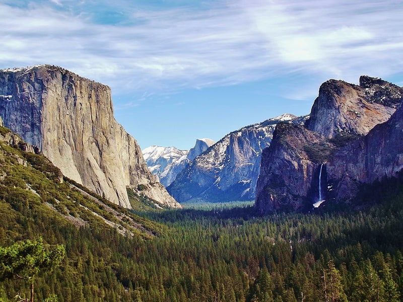
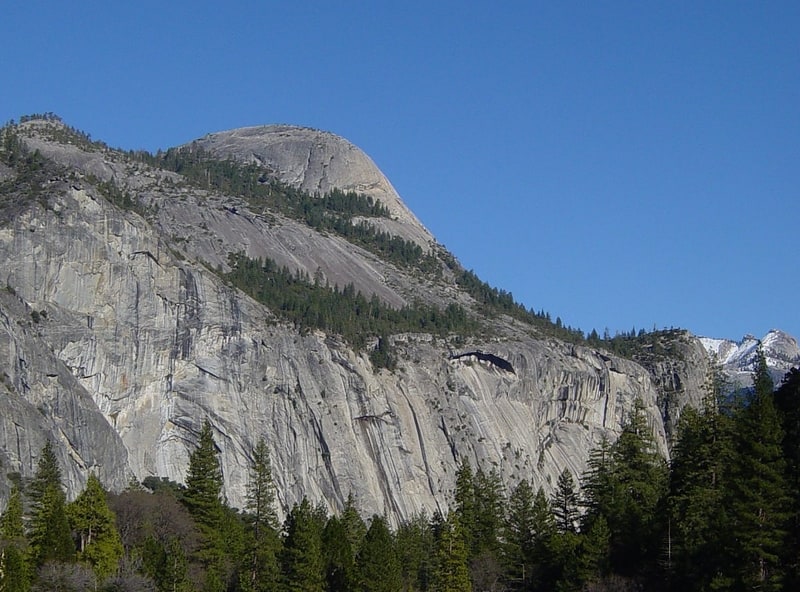
National park's iconic glacial valley. Yosemite Valley is a glacial valley in Yosemite National Park in the western Sierra Nevada mountains of Central California. The valley is about 7.5 mi long and 3,000–3,500 ft deep, surrounded by high granite summits such as Half Dome and El Capitan, and densely forested with pines. The valley is drained by the Merced River, and a multitude of streams and waterfalls flow into it, including Tenaya, Illilouette, Yosemite and Bridalveil Creeks. Yosemite Falls is the highest waterfall in North America and is a big attraction especially in the spring, when the water flow is at its peak. The valley is renowned for its natural environment and is regarded as the centerpiece of Yosemite National Park.
The valley is the main attraction in the park for the majority of visitors and a bustling hub of activity during tourist season in the summer months. Most visitors enter the valley from roads to the west and pass through the Tunnel View entrance. Visitor facilities are in the center of the valley. There are both hiking trail loops that stay within the valley and trailheads that lead to higher elevations, all of which afford glimpses of the park's many scenic wonders.[1]
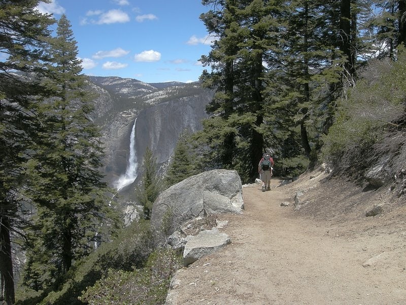
Glacier Point
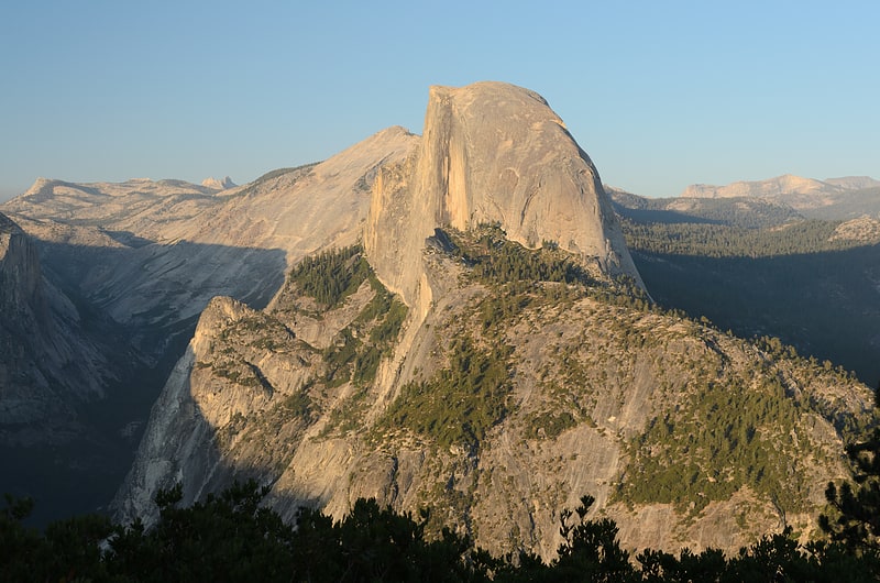
Views of iconic Yosemite from up high. Glacier Point is a viewpoint above Yosemite Valley in the U.S. state of California. It is located on the south wall of Yosemite Valley at an elevation of 7,214 feet, 3,200 feet above Curry Village. The point offers a superb view of several of Yosemite National Park's well-known landmarks, including Yosemite Valley, Yosemite Falls, Half Dome, Vernal Fall, Nevada Fall, and Clouds Rest. Between 1872 and 1968, it was the site of the Yosemite Firefall.[2]
Address: Glacier Point Rd, 95389 Yosemite Valley
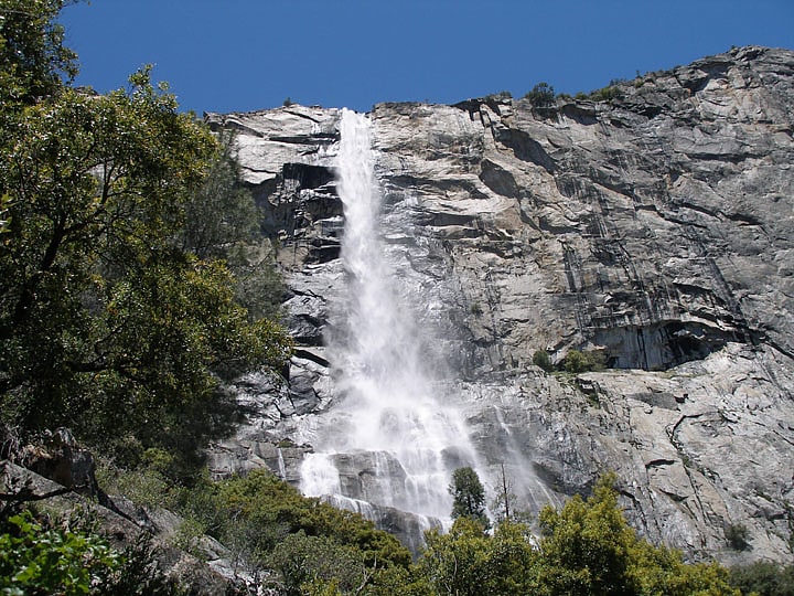
Bridalveil Fall
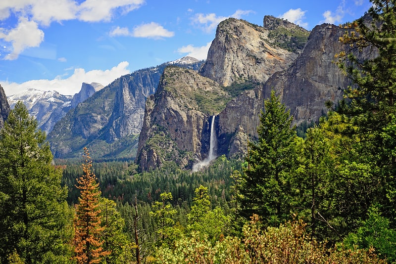
617-ft-tall plunge waterfall in Yosemite. Bridalveil Fall is one of the most prominent waterfalls in the Yosemite Valley in California. The waterfall is 188 metres in height and flows year round.[3]
John Muir Trail
The John Muir Trail is a long-distance trail in the Sierra Nevada mountain range of California, passing through Yosemite, Kings Canyon and Sequoia National Parks. From the northern terminus at Happy Isles in Yosemite Valley and the southern terminus located on the summit of Mount Whitney, the trail's length is 213.7 miles, with a total elevation gain of approximately 47,000 feet. For almost all of its length, the trail is in the High Sierra backcountry and wilderness areas. For about 160 miles, the trail follows the same footpath as the longer Pacific Crest Trail. It is named after John Muir, a naturalist.
The vast majority of the trail is situated within designated wilderness. The trail passes through large swaths of alpine and high mountain scenery, and lies almost entirely at or above 8,000 feet (2,400 m) in elevation. The trail has been described as "America's most famous trail"; the trail sees about 1,500 thru-hiking attempts each year (including Pacific Crest Trail thru-hikers), many fewer than the number of attempts on comparable walks such as the southern portion of Appalachian Trail or the Way of St. James.[4]
Curry Village
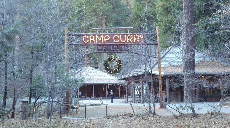
Curry Village is a resort in Mariposa County, California in Yosemite National Park within the Yosemite Valley.
A rockfall in 2008 damaged a number of structures, and about one third of visitor units were closed because of risk. In 2012, eight visitors to the park developed hantavirus pulmonary syndrome, and three died.
In 2016, the name was temporarily changed to Half Dome Village due to a trademark dispute between the National Park Service and a private concessions company, Delaware North. The name was restored in 2019 along with others in Yosemite, upon settlement of the dispute.[5]
Address: 9010 Curry Village Dr, Yosemite National Park
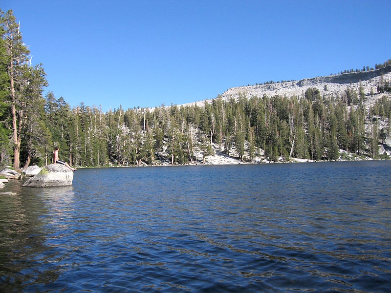
Mirror Lake
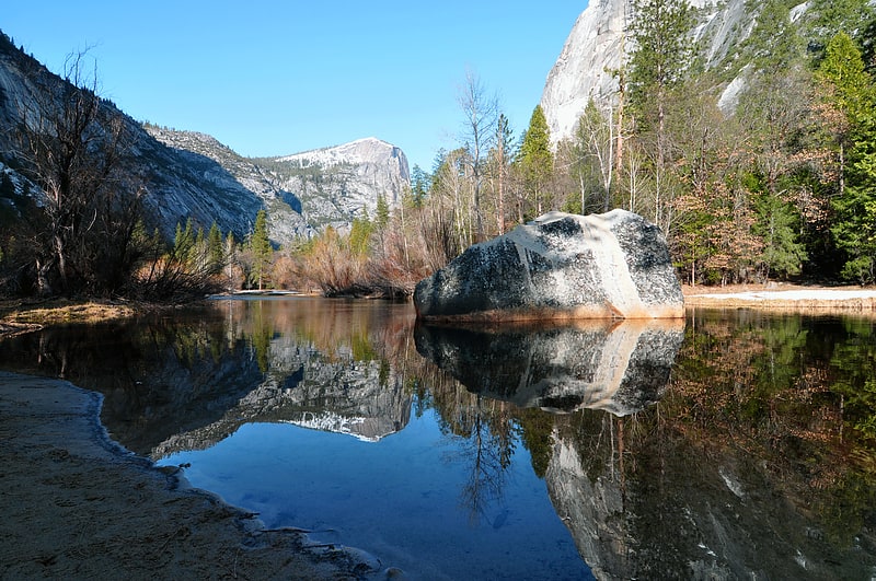
Lake in California. Mirror Lake is a small, seasonal lake located on Tenaya Creek in Yosemite National Park. Situated in Tenaya Canyon directly between North Dome and Half Dome, it is the last remnant of a large glacial lake that once filled most of Yosemite Valley at the end of the last Ice Age, and is close to disappearing due to sediment accumulation.[6]
Address: Yosemite Valley, Yosemite National Park
Emerald Pool
Emerald Pool is the name of several locations.[7]
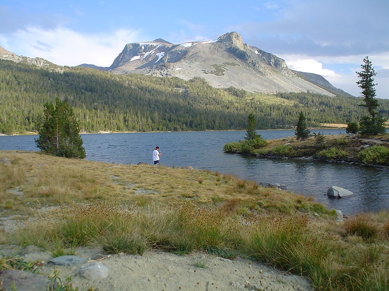
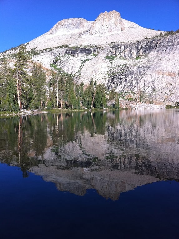
Tenaya Lake
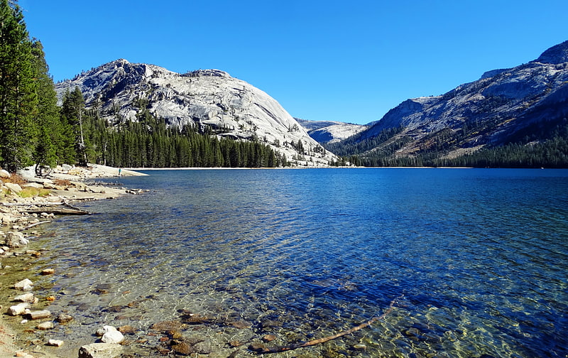
Glacial lake with fishing and boating. Tenaya Lake is an alpine lake in Yosemite National Park, located between Yosemite Valley and Tuolumne Meadows. The surface of Tenaya Lake has an elevation of 8,150 feet. The lake basin was formed by glacial action, which left a backdrop of light granite rocks, whose beauty was known to the Native Americans. Today, Tenaya Lake is easily accessible by State Route 120 and is a popular lake for water activities.[8]
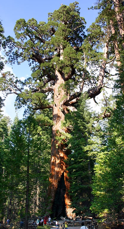
Mariposa Grove
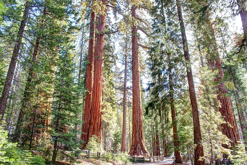
Park with giant sequoias and a museum. Mariposa Grove is a sequoia grove located near Wawona, California, United States, in the southernmost part of Yosemite National Park. It is the largest grove of giant sequoias in the park, with several hundred mature examples of the tree. Two of its trees are among the 30 largest giant sequoias in the world. The grove closed on July 6, 2015, for a restoration project and reopened on June 15, 2018.
The Mariposa Grove was first visited by non-natives in 1857 when Galen Clark and Milton Mann found it. They named the grove after Mariposa County, California, where the grove is located.
The giant sequoia named Grizzly Giant is between probably 1900–2400 years old: the oldest tree in the grove. It has a volume of 34,010 cubic feet (963 m3), and is counted as the 25th largest tree in the world. It is 210 feet (64 m) tall, and has a heavily buttressed base with a basal circumference of 28 m (92 ft) or a diameter of 30 feet (9.1 m); above the buttresses at 2.4 m above ground, the circumference is only 23 m. Grizzly Giant's first branch from the base is 2 m (6 ft) in diameter. Another tree, the Wawona Tree, had a tunnel cut through it in the nineteenth century that was wide enough for horse-drawn carriages and early automobiles to drive through. Weakened by the large opening at its base, the tree fell down in a storm in 1969.
Abraham Lincoln signed an Act of Congress on June 30, 1864, ceding Mariposa Grove and Yosemite Valley to the state of California. Criticism of stewardship over the land led to the state's returning the grove to federal control with the establishment of Yosemite National Park.
The Mariposa Grove Museum is listed on the National Register of Historic Places.[9]
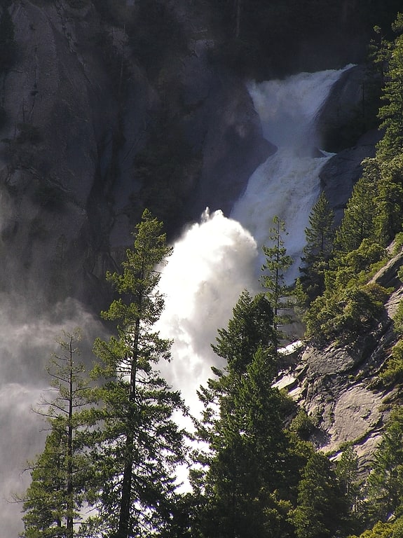
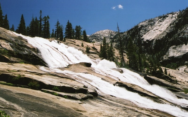
Wapama Falls
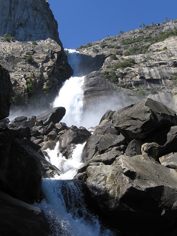
Waterfall in California. Wapama Falls is the larger of two waterfalls located on the northern wall of Hetch Hetchy Valley in Yosemite National Park. It flows almost year-round and during peak flow has been known to inundate the trail bridge crossing its base, making the falls impossible to pass. The falls consist of two primary drops angled roughly 60 degrees to each other, and a broad cascade at its base. Wapama Falls is fed by Lake Vernon, a few miles to the north, and is below Hetch Hetchy Dome.
Wapama Falls descends just under 1,100 feet. Like Yosemite Falls, it has three distinct parts. The topmost is a free drop of perhaps 300 feet, followed by a steeply-cascading stream which descends 600 feet in a steep-sided gorge, much like the stream between Upper and Lower Yosemite Fall. These cascades cannot be seen in their entirety from the trail: such a view is seen from across the Valley high on Kolana Rock. Finally, the bottom drop, seen from the dam and intimately from the trail, is one of about 200 feet down an escarpment that is not vertical, but in high water the water shoots outward to clear this descent.
Visitors can reach Wapama Falls by hiking 2.5 miles (4.0 km) up Hetch Hetchy Reservoir Trail from O'Shaughnessy Dam.[10]
Address: O'Shaughnessy Dam to the base of Wapama Falls, Yosemite National Park
Four Mile Trail
Four Mile Trail is a moderate to strenuous trail leading from Yosemite Valley to Glacier Point. The trail begins at the valley floor west of the Swinging Bridge recreation area, and climbs the south side 4.8 miles up to Glacier Point, an elevation change of 3,200 feet.
Four Mile Trail was originally constructed in 1872 and was 4 miles (6.4 km) in length. In the early 1900s the trail was reconstructed and lengthened to 4.8 miles (7.7 km), yet the original name remained. This trail is remarkable because it offers views of most of the Yosemite Valley landmarks. The trail begins at the base of the Sentinel Rock. The first four miles are full of grand views of El Capitan and Yosemite Falls, as well as the Merced River as it runs through the valley. The second half of the trail provides several good views of Half Dome and Tenaya Canyon.
The trail becomes dangerous in winter conditions and is closed December through May, and the upper quarter of the trail (about a mile walk to the Glacier Point) remains extremely hazardous and is usually closed through May. There is no potable water along the trail.[11]
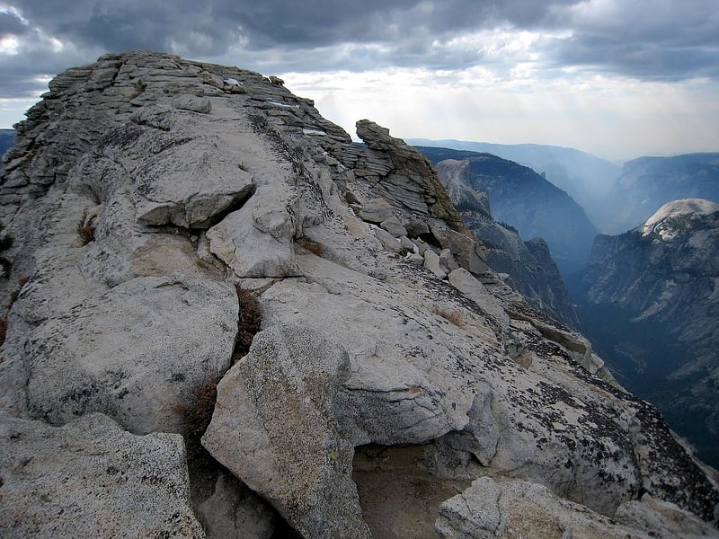
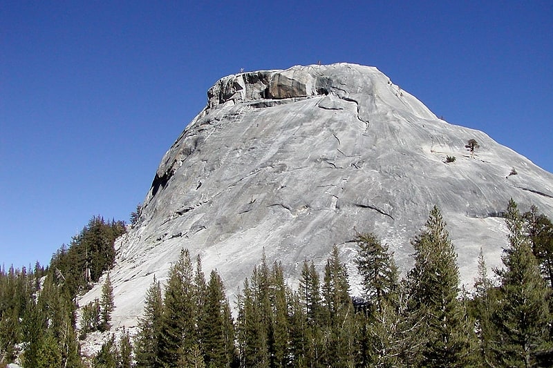
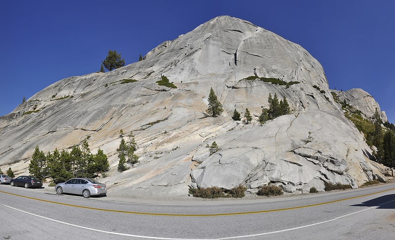
Sentinel Dome
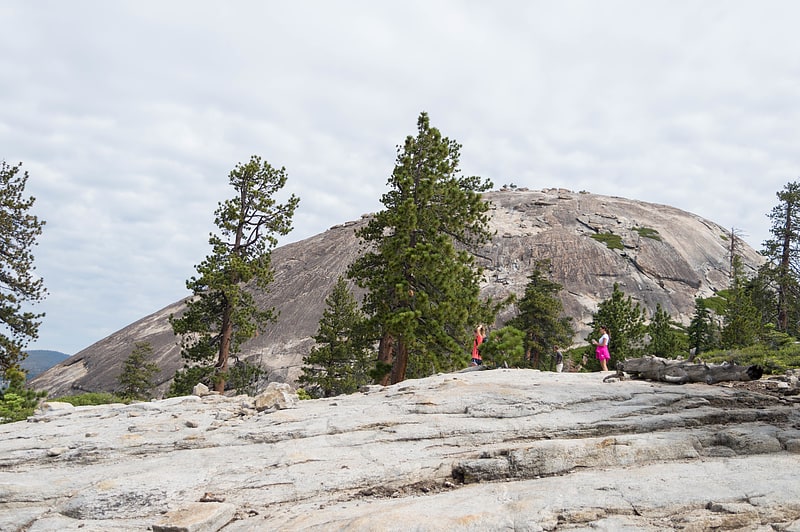
Hiking, park, and outdoor recreation. Sentinel Dome is a granite dome in Yosemite National Park, United States. It lies on the south wall of Yosemite Valley, 0.8 miles southwest of Glacier Point and 1.4 miles northeast of Profile Cliff.
Sentinel Dome is known for a Jeffrey Pine that grew from its peak (see photograph). The pine was photographed as early as 1867 by Carleton Watkins, and was the subject of a well-known photograph by Ansel Adams. The tree died during the drought of 1976, but remained standing until August 2003.[12]
Tioga Lake
Glacial lake in California. Tioga Lake is a small glacial lake in the Inyo National Forest of Mono County, California, about two miles north of the Tioga Pass entrance to Yosemite National Park. The lake bed is alongside State Route 120 in the Sierra Nevada of California.[13]
Tuolumne Grove
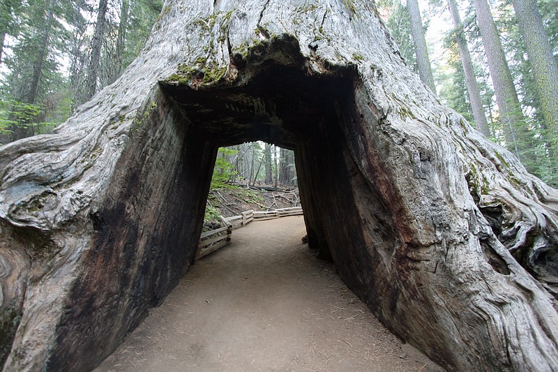
Tuolumne Grove is a giant sequoia grove located near Crane Flat in Yosemite National Park, at the southeastern edge of the Tuolumne River watershed. It is about 16 miles west of Yosemite Village on Tioga Pass Road. The grove contains many conifers, including a few Sequoiadendron giganteum as well as Abies concolor and Pinus lambertiana.
The grove hosts about six visible giant sequoias amongst a dense understory of dogwood. The grove also features the "Dead Giant", a fallen giant sequoia with a stagecoach-sized tunnel cut through it.[14]
Tenaya Canyon
Tenaya Canyon is a dramatic and dangerous canyon in Yosemite National Park, California, USA, that runs from the outlet of Tenaya Lake 10 miles down to Yosemite Valley, carrying water in Tenaya Creek through a series of spectacular cascades and pools and thence into a deep canyon below Cloud's Rest, a giant granite mountain adjacent to Half Dome. Waterfalls on the creek inside the canyon include Pywiack Cascade and Three Chute Falls, near Mirror Lake.
The top of the canyon can be seen from Tioga Pass Road (Route 120), which goes through Tuolumne Meadows and Tioga Pass. From Olmsted Point (a roadside viewing area), Clouds Rest and Yosemite's signature Half Dome dominate the canyon. At the bottom of the canyon, in Yosemite Valley, lies Mirror Lake, accessible by shuttle bus and a short walk. The Quarter Domes are not far, up Tenaya Canyon.
The canyon has no foot trail and is notoriously difficult to navigate, particularly in spring and summer when water levels are high. Signs warn against hiking in the canyon. The American Canyoneering Association gives Tenaya Canyon a rating of 3B V. The 3 is an "intermediate" rating on a scale of 1 to 4, with 4 most difficult; B is a measure of water volume on a scale of A to C; and the V indicates that the trip will take one and a half days.
The canyon has achieved notoriety because of a curse Chief Tenaya reportedly invoked in the 1850s as a result of the death of his son at the hands of a battalion intending to deport the natives of Yosemite Valley. Those who believe in the curse cite accidents, mysterious deaths, and disappearances. For example, in 1996, two hikers died in the canyon. Some park rangers have reportedly referred to Tenaya Canyon as the Bermuda Triangle of Yosemite.
Hiking the canyon involves dangerous exposure to heights, and even if there is minimal water in Tenaya Creek, mandatory swims, dangerous waterfalls, and cascades. Wet and slippery glacially polished granite adds to the likelihood of falling.[15]
Tueeulala Falls
Waterfall in California. Tueeulala Falls is located on the north side of Hetch Hetchy Valley in Yosemite National Park. At roughly 880 feet it is the smaller of two large waterfalls that spill into Hetch Hetchy Reservoir, the other being Wapama Falls. It is, however, the larger of the two in terms of greatest free-fall distance, as Wapama is split into two falls. Tueeulala Fall drops free for 600 feet, hits a ledge, then slides steeply down 280 feet further. The hike to the top of the falls is off trail but fairly brush free and straightforward.
The waterfall is highly seasonal and is one of the most irregular waterfalls in the park. This is due to it being located on a channel of Falls Creek, the waterfall which Wapama Falls is on, that only flows during spring snowmelt when water from the creek overflows the bank. This can turn Tueeulala Falls into one of the most powerful waterfalls in the park during certain times, however it can also lose flow faster than any other waterfall in Yosemite.[16]
Chilnualna Falls
Waterfall in California. Chilnualna Falls is a series of waterfalls totaling 690 feet, located on Chilnualna Creek in the southern section of Yosemite National Park.
The falls are a popular horseback riding destination. Chilnualna Falls consists of five tiers ranging from 30 to 300 feet (9–91 m) in height. The first tier is 90–120 feet (27–36 m) high. The second is a 30-foot (9 m) high cascade. The third and largest is 300 feet (91 m) high. The fourth is 60 feet (18 m) high. The final tier is a 180–210 foot (54–64 m) high cascade.
The trailhead to the falls is in the eastern extremity of Wawona, at the end of Chilnualna Creek Road. The trailhead elevation is approximately 4,000 feet (1,200 m), and the trail reaches the main portion of the waterfall at 6,200 feet (1,900 m).[17]
Clouds Rest
Mountain in California. Clouds Rest is a mountain in Yosemite National Park east northeast of Yosemite Village, California. Although there are many peaks in the park having far greater elevation, Clouds Rest's proximity to the valley gives it a very high degree of visual prominence.[18]
Yosemite Museum
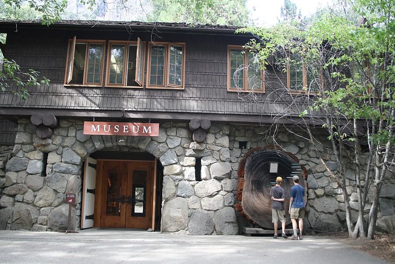
Museum. The Yosemite Museum is located in Yosemite Valley in Yosemite National Park in California. Founded in 1926 through the efforts of Ansel Franklin Hall, the museum's displays focus on the heritage and culture of the Ahwahnechee people who lived in the valley. The collection also includes both utilitarian and made-for-sale baskets dating from c. 1870 to present and is one of the only existing collections encompassing this depth and time span for any group in California.
The adjacent Yosemite Valley Visitor Center features exhibits about the park's geology, wildlife, Native American and other settlers, John Muir, and the park's history.[19]
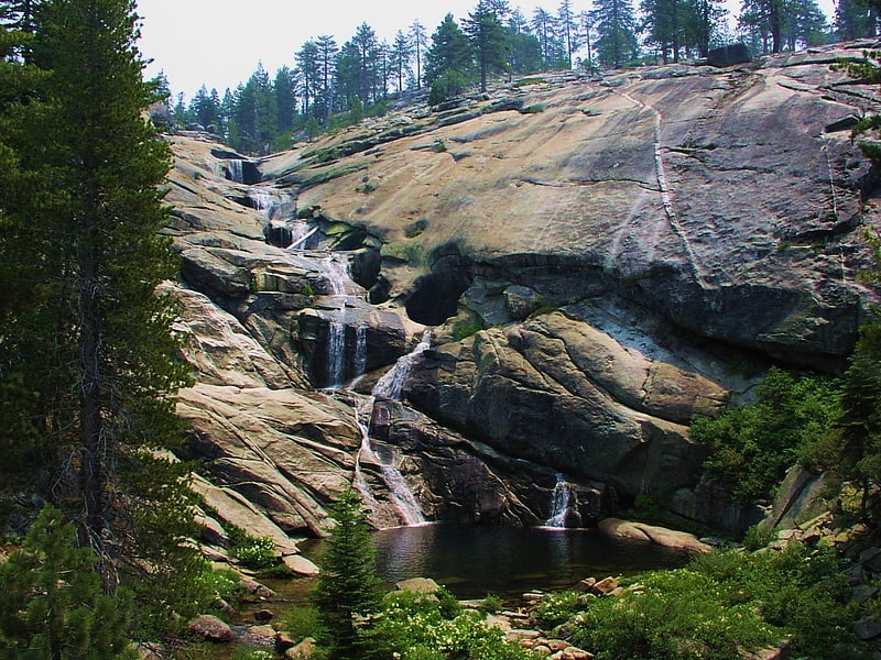
Snow Creek Falls
Cascade in California. Snow Creek Falls is a long series of cascades located in Yosemite National Park toward the eastern extent of Yosemite Valley. It descends a steep gorge on a sizeable stream that originates in May Lake to the north, dropping east of the trail that leaves the Valley above Mirror Lake en route to North Dome and other north-rim destinations. Snow Creek Falls is the second highest waterfall in Yosemite National Park.[20]
Waterwheel Falls
Waterfall in California. Waterwheel Falls is a waterfall in the Sierra Nevada of California, located in Yosemite National Park. It is the largest of the many waterfalls of the Tuolumne River. Its upper part contains a series of small ledges, each of which creates a small plume as the water is deflected away from the rock face. A regular phenomenon appears at the first and largest of these ledges during the high-water season of early summer. Strong gusts of wind can lift part of the spray and blow it back upward, causing it to reenter the falls above the ledge. This cyclic "waterwheel" gives the falls their name.[21]
Pothole Dome
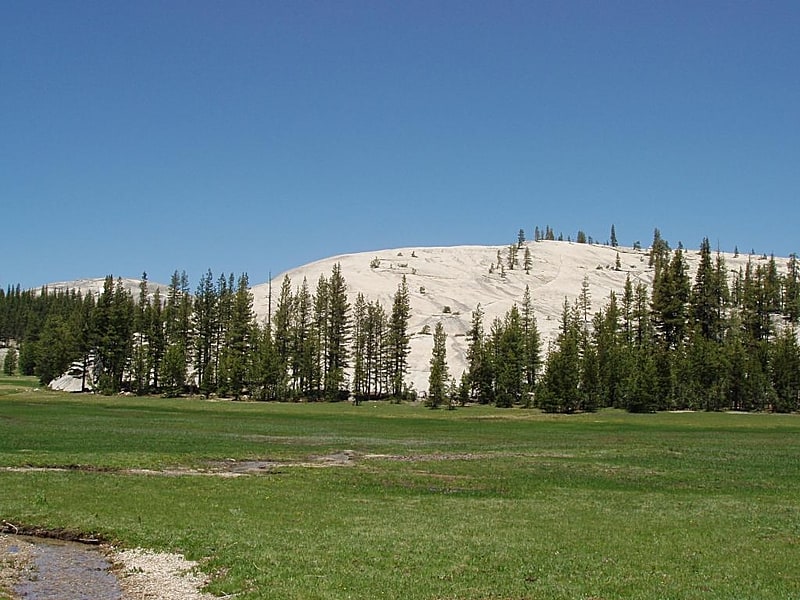
Granite dome in California. Pothole Dome is a granite dome on the west side of Tuolumne Meadows, in Yosemite National Park located at Tioga Road mile marker 18. Near Pothole Dome is Marmot Dome. The summit of the dome is easily accessible by foot from a parking area on the Tioga Road at mile marker 18. The view from the summit includes most of Tuolumne Meadows and in the distance, Cathedral Peak. The dome gives evidence of many of the geologic processes at work in Yosemite during and after the last ice age. In particular, the stranded, rounded boulders from a glacier that has long since retreated, and the water-eroded "potholes" provide evidence of two ways that water can interact with granite.[22]
North Dome
Granite dome in California. North Dome is a granite dome in Yosemite National Park, California. It is the southernmost summit of Indian Ridge, 0.6 miles north of Washington Column and the Royal Arches on the northeastern wall of Yosemite Valley. It can be reached by trail from the Tioga Pass Road, or by going up the Yosemite Falls trail and heading east. It can also be reached from Mirror Lakes by the Snow Creek Falls trail going north around Indian Rock and then south again on the Tioga Pass Road trail. The South Face is precipitous.[23]
Grizzly Giant
Historical landmark in Mariposa County, California. The Grizzly Giant is a giant sequoia in Mariposa Grove, located in Yosemite National Park. The tree has been measured many times, most recently in 1990 by Wendell Flint. It has a volume of 34,005 cubic feet, which makes it the 26th largest giant sequoia living today and could be considered the 25th largest depending on how badly Ishi Giant atrophied during the Rough Fire in 2015.[24]
Ostrander Lake
Lake in California. Ostrander Lake is located in Yosemite National Park, approximately 10 miles south of Yosemite Valley and 10 miles east of the Badger Pass Ski Area, at an elevation of 8,500 feet. The lake is a popular destination for cross-country skiers during the winter. It is the primary source of Bridalveil Creek, which feeds Bridalveil Falls.[25]
May Lake
Lake in California. May Lake is a lake in Yosemite National Park, as well as a High Sierra Camp where backpackers can stay in tent cabins located near the lake. There are eight cabins that accommodate a total of thirty six guests. The hike to May Lake is from a parking area off Tioga Pass Road and is 1.2 miles. The lake is overlooked by Mount Hoffmann.
May Lake was named by Charles F. Hoffmann, for Lucy Mayotta ("May") Browne, who became his wife in 1870.[26]
Pywiack Dome
Granite dome in California. Pywiack Dome is a prominent 600 foot granite dome in Yosemite National Park, located 0.7 miles north-east of Tenaya Lake, 4 miles west of Tuolumne Meadows and 200 feet from the Tioga Road. It is quite near Harlequin Dome, and North and South Whizz Domes are north.
Josiah Whitney the head of California Geological Survey wrote in 1863 about Pywiack Dome in Geology:
At the head of Lake Tenaya is a very conspicuous conical knob of bare granite, about 800 feet high, the sides of which are everywhere finely polished and grooved by former glaciers.[27]
Echo Peaks
Echo Peaks consists of nine peaks, in the Tuolumne Meadows region of Yosemite National Park, California. They are near Echo Ridge.[28]
Lembert Dome
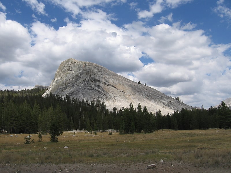
Lembert Dome is a granite dome rock formation in Yosemite National Park in the US state of California. The dome soars 800 feet above Tuolumne Meadows and the Tuolumne River and can be hiked starting at the Tioga Road in the heart of Tuolumne Meadows, 8 miles west of the Tioga Pass Entrance to Yosemite National Park. The landform is an example of a rôche moutonnée with clear lee and stoss slopes.
Lembert Dome was named for Jean Baptiste Lembert, sometimes mistakenly referred to as John Lambert, who took up a homestead in a section of Tuolumne Meadows in 1865. By 1879 the Wheeler Survey referred to it as Soda Springs Dome. John Muir called it Glacier Rock.
Lembert Dome is near Puppy Dome, is also close to Dog Dome.
Rock climbers can scale the face from the parking lot just off the Tioga Road, but hikers can simply walk up the back side or take the challenging steeper trek up the face starting from just east of the parking lot. Many technical free climbing routes have been put up.[29]
Pioneer Yosemite History Center
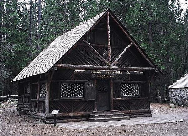
Historical landmark in Mariposa County, California. The Pioneer Yosemite History Center is an assembled collection of historic buildings from Yosemite National Park that is located in Wawona, California. Visitors can walk around the buildings year round, and the interiors are open in the summer on a limited basis. There are also special programs and carriage rides in the summer.
The buildings include:
- Acting Superintendent's Headquarters
- Blacksmith shop
- Cavalry office
- Chris Jorgenson Studio
- Degnan's Bakery
- George Anderson Pioneer Home
- Hodgdon Homestead Cabin
- Powderhouse and jail
- Ranger patrol cabin
- Wawona Covered Bridge
- Yosemite Transportation Company Office (aka Wells Fargo Office)
The Acting Superintendent's Headquarters, the Chris Jorgenson Studio, the Hodgdon Homestead Cabin, the Wawona Covered Bridge, and the Yosemite Transportation Company Office are all listed on the National Register of Historic Places.[30]
Address: Route 41, 95389 Wawona
Mount Lyell
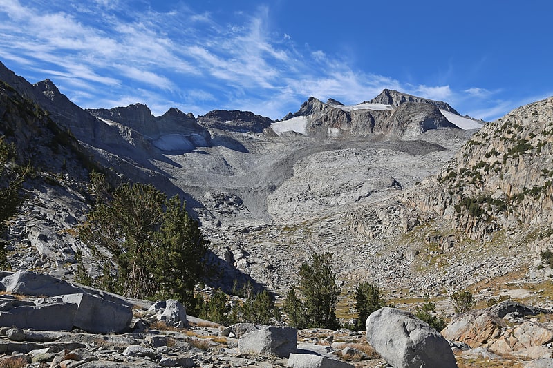
Peak in California. Mount Lyell is the highest point in Yosemite National Park, at 13,114 feet. It is located at the southeast end of the Cathedral Range, 1.2 miles northwest of Rodgers Peak. The peak as well as nearby Lyell Canyon is named after Charles Lyell, a well-known 19th century geologist. The peak had one of the last remaining glaciers in Yosemite, Lyell Glacier. The Lyell Glacier is currently considered to be a permanent ice field, not a living glacier. Mount Lyell divides the Tuolumne River watershed to the north, the Merced to the west, and the Rush Creek drainage in the Mono Lake Basin to the southeast.[31]
Stately Pleasure Dome
Stately Pleasure Dome is the unofficial name for the prominent south-southwestern portion of Polly Dome, a granite dome on the northwest side of Tenaya Lake and Tioga Road in the Yosemite high country. Stately Pleasure Dome consists of glaciated and exfoliated granite rock that rises steeply 900 feet from the lake shore; the very steep east side of the dome is popular with rock climbers, who gave the dome its name.
The name presumably comes from the poem Kubla Khan by Samuel Taylor Coleridge:[32]
Puppy Dome
Puppy Dome is a granite dome in Tuolumne Meadows, Yosemite National Park, California.[33]
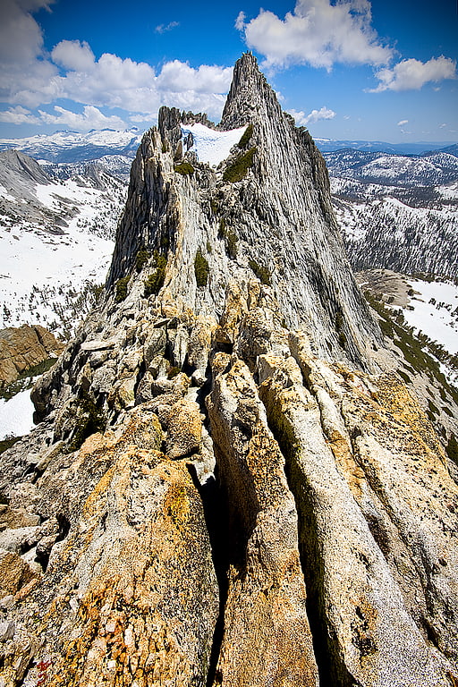
Cathedral Peak
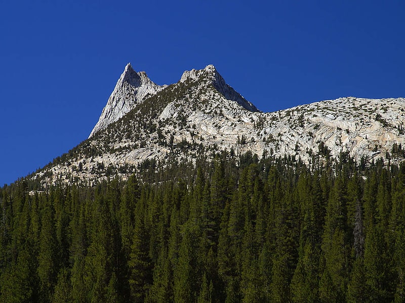
Mountain in California. Cathedral Peak is part of the Cathedral Range, a mountain range in the south-central portion of Yosemite National Park in eastern Mariposa and Tuolumne Counties. The range is an offshoot of the Sierra Nevada. The peak which lends its name to the range derives its name from its cathedral-shaped peak, which was formed by glacial activity: the peak remained uneroded above the glaciers in the Pleistocene.[34]
Young Lakes
Lake in California. Young Lakes are three lakes, north of Tuolumne Meadows, in Yosemite National Park, California.[35]