Discover 11 hidden attractions, cool sights, and unusual things to do in Sierra National Forest (United States). Don't miss out on these must-see attractions: Courtright Reservoir, Fresno Dome, and Shaver Lake. Also, be sure to include Huntington Lake in your itinerary.
Below, you can find the list of the most amazing places you should visit in Sierra National Forest (California).
Table of Contents
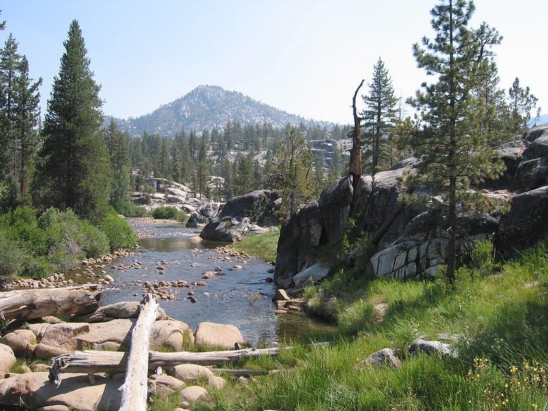
Courtright Reservoir
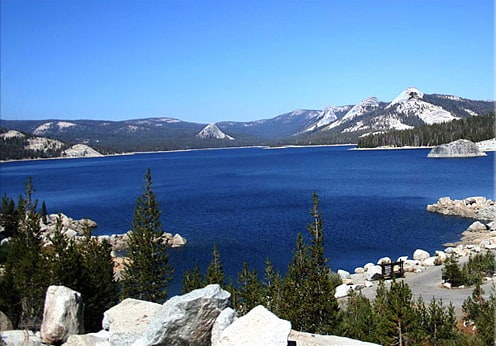
Reservoir in California. Courtright Reservoir is a reservoir in Fresno County, California. The reservoir is at an elevation of 8,170 feet in the Sierra National Forest, in the Sierra Nevada Mountain Range, bordering the John Muir Wilderness.
The high Sierra reservoir is formed by Courtright Dam in Helms Creek canyon and has a capacity of 123,300 acre-feet (152,100,000 m3). The dam is composed of rock-fill and is 315 feet (96 m) tall, measured from the crest to the original streambed. It was completed in 1958 and is owned by Pacific Gas and Electric. Its primary purpose is hydroelectricity production.
The lake is an "off-river" (or "off-channel") storage reservoir. In addition to the small amount of conventional hydroelectricity production from the flow of Helms Creek, Courtright Reservoir serves mainly as the upper reservoir for the Helms Pumped Storage Plant. Wishon Reservoir, an on-channel reservoir a couple of miles downstream on the Kings River, is the lower reservoir and main water source. During times of peak demand for electricity, when it is most expensive, water is drained from Courtright Reservoir, run through the 1,212 MW Helms Power Plant and empties into Wishon Reservoir. When demand and prices for electricity are low, water is pumped from Wishon Reservoir to Courtright Reservoir using the power plant's reversible turbines. Helms Power Plant is 1,000 feet (300 m) underground in a chamber carved out of solid granite at the north end of Wishon Lake. It is similar to Southern California Edison's Eastwood Powerhouse near Shaver Lake, which is also a pumped-storage plant.
Courtright Reservoir is a haven for weekend and outdoor enthusiasts seeking to camp, fish, hike, boat, swim, rock climb, and 4x4 among others. It is surrounded by unique domes of granite that are essentially in the center of the Sierra Batholith and are highly sought after by rock climbers from all around. It is also used during warmer-weather months by local astronomers, such as members of the Central Valley Astronomers, who take advantage of its 8,170 feet (2,490 m) elevation and excellent location for night sky viewing free from light and air pollution.[1]
Fresno Dome
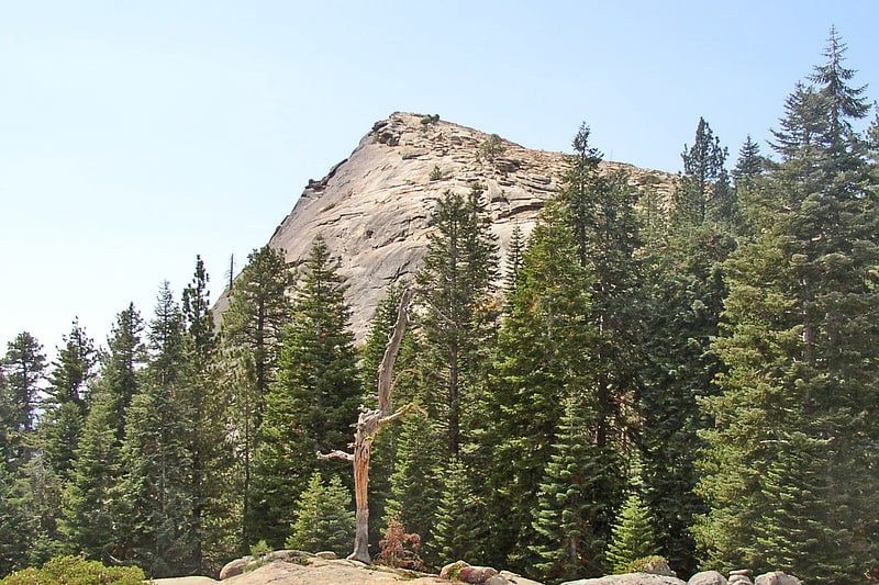
Summit in California. Fresno Dome is a dominant granite dome rising in isolation above the forest of Soquel Meadow in the Sierra National Forest in Madera County, California.
The dome as known to the Mono Indians as "the greeting place" ("wah-me-yelo"). John Muir encountered Fresno Dome, calling it "Wamello", in the 1870s, and used its summit to locate Fresno Grove (now known as Nelder Grove).
It is accessible by a trailhead which is a three-mile drive from the Sierra Vista Scenic Byway (part of the National Scenic Byway system). The nearest town is Bass Lake, California, 9.1 miles (14.6 km) to the south.
At its base, sits the Fresno Dome campground, a backwoods campground accessible only by jeep trails. The campground is a favorite spot for deer hunters and is largely empty other than during deer season. The dome offers several technical free climbs rated class 5 or better, with "Guides in a Snowbank" rated at 5.10a.[2]
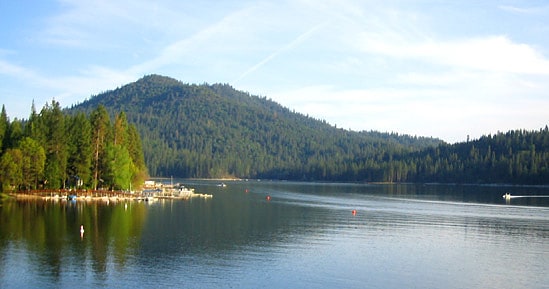
Shaver Lake
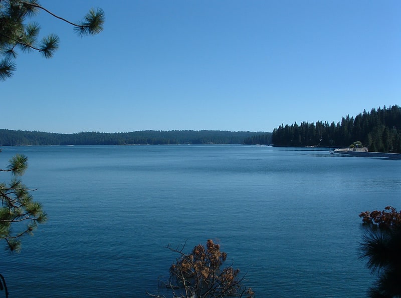
Lake in California. Shaver Lake is an artificial lake on Stevenson Creek, in the Sierra National Forest of Fresno County, California. At elevation 5,500 ft, several smaller streams also flow into the lake, and it receives water from the tunnels of Southern California Edison's Big Creek Hydroelectric Project. The town Shaver Lake is located on its south-west shore.[3]
Huntington Lake
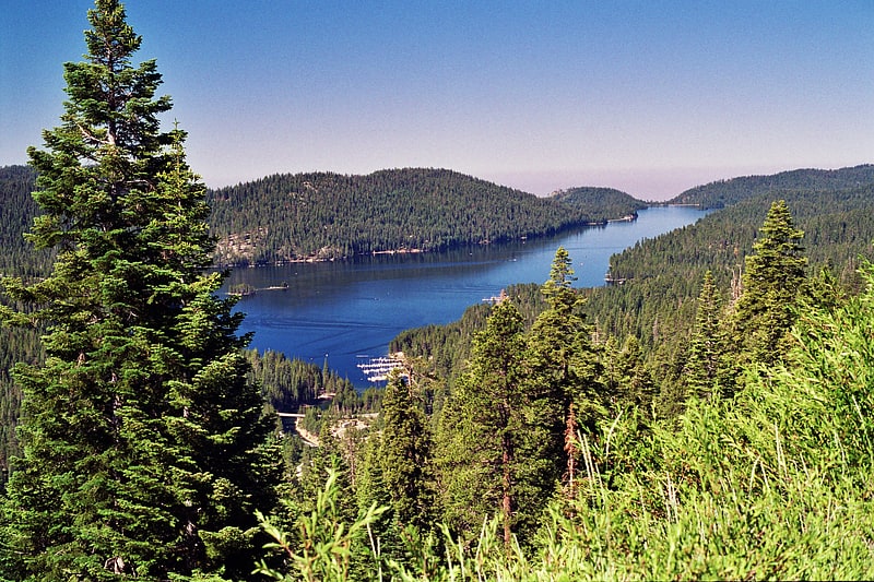
Reservoir in California. Huntington Lake is a reservoir in Fresno County, California on Big Creek, located in the Sierra Nevada at an elevation of 7000 ft. The lake receives water from Southern California Edison's Big Creek Hydroelectric Project, as well as the many streams that flow into the lake. Some water leaving the lake flows to Big Creek, while some is diverted to nearby Shaver Lake. The lake is home to a variety of recreational activities, including camping, horse-back riding, skiing, sailing, fishing and more. It is drained and refilled through the Big Creek dam system each year, with winter water levels often dipping below 50 percent of the lake's capacity.[4]
Bass Lake
Lake in California. Bass Lake is located in the Sierra National Forest, of Madera County, California, approximately 14 mi south of the entrance to Yosemite National Park. The lake is approximately four miles long and one-half mile wide.
The lake is formed by the construction of the Crane Valley Dam across Willow Creek, a tributary to the San Joaquin River, and is referenced as Crane Valley Lake. Releases from the dam drive the hydro-electric powerplant operated by Pacific Gas and Electric Company. The 145 ft (44 m) concrete gravity dam was completed in 1910 by Pacific Gas and Electric.
Most of the land around the lake is part of the Sierra National Forest. The U.S. Forest Service designated the lake an official Recreation Area and has developed campgrounds and picnic areas on the south shore of the lake. The north shore of the lake is primarily made up of private cabins and homes of the unincorporated community, Bass Lake, California, with a year-round population of 575.[5]
Lake Thomas A Edison
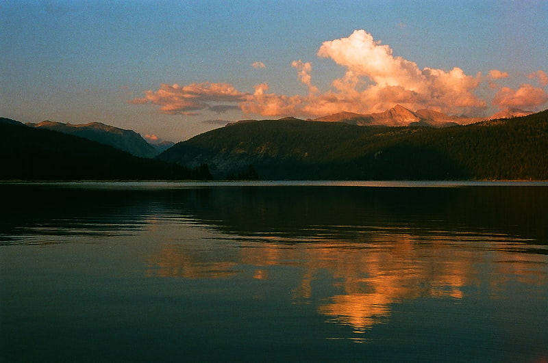
Reservoir in California. Lake Thomas A Edison is a reservoir in the Sierra National Forest and in Fresno County, California. It is in the Sierra Nevada, and near the Pacific Crest Trail.
The reservoir's waters are impounded by Vermilion Valley Dam (National ID CA00441), which was completed in 1954. The reservoir and dam are part of the Big Creek Hydroelectric Project.[6]
Address: 507 West St, Sierra National Forest
Dinkey Creek Bridge
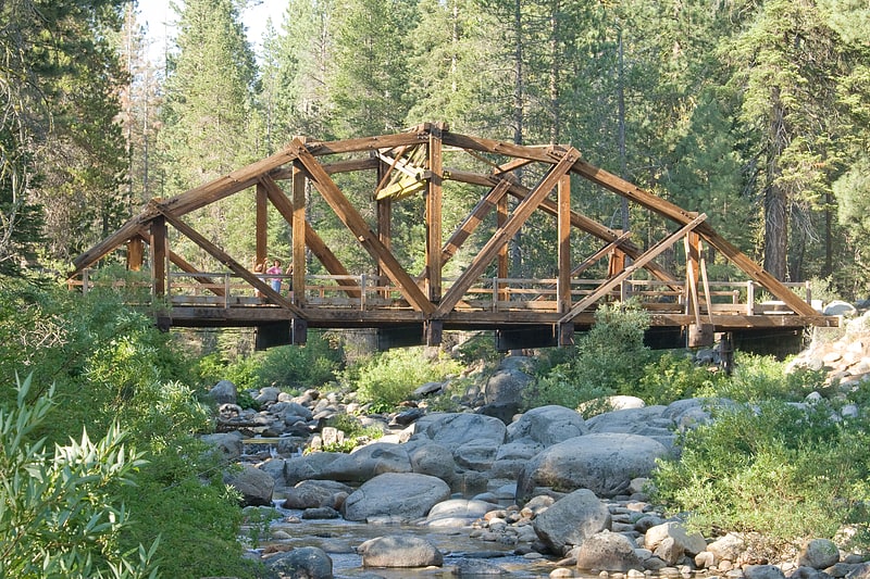
Bridge in Fresno County, California. The Dinkey Creek Bridge, also known as Fresno County Bridge No. 42C-04, is a single-span, timber bowstring arch truss bridge that crosses Dinkey Creek in Fresno County, California, within Sierra National Forest. Built in 1938, it closed to automobile traffic in 1965 and was renovated in 1988 to replace rotting timbers. Designed by T.K. May, it was built by the U.S. Forest Service with Civilian Conservation Corps labor. The structure was listed on the National Register of Historic Places in 1996.[7]
Mammoth Pool Dam
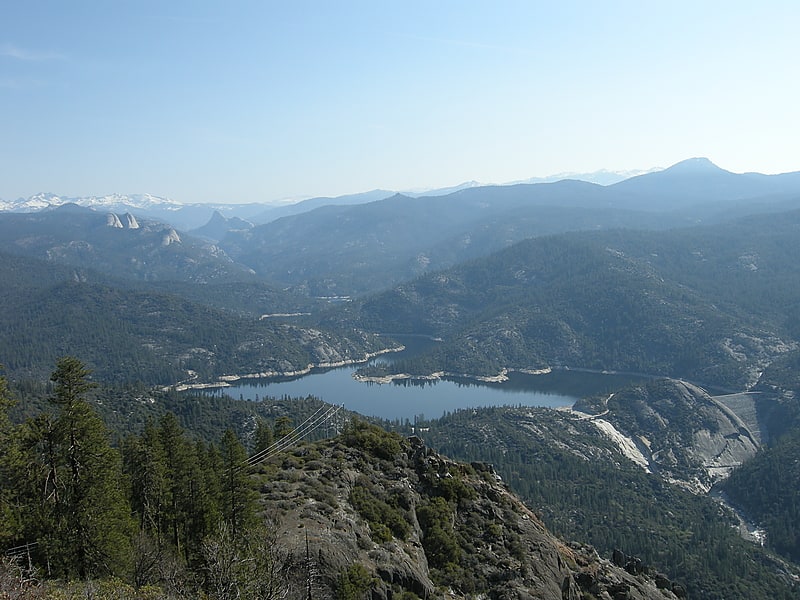
Mammoth Pool Dam is a hydroelectric dam located on the San Joaquin River in the southern Sierra Nevada mountain range of California, about 45 miles northeast of Fresno. It forms Mammoth Pool Reservoir and lies within the Sierra National Forest. The dam and reservoir were named after a large natural pool in the river that was once located above the present dam site.[8]
Nelder Grove
Campground in Madera County, California. Nelder Grove, formerly known as Fresno Grove when it was within a much larger 19th-century Fresno County, is a Giant sequoia grove located in the western Sierra Nevada within the Sierra National Forest, in Madera County, California.
The grove is a 1,540-acre (6.2 km2) tract containing over 100 mature Giant Sequoia (Sequoiadendron giganteum) trees, the largest concentration of giant sequoias in the Sierra National Forest. It also contains a number of sequoia stumps, remaining from when the grove's ancient trees were logged in the late 1870s to 1890s, before being protected by its United States Forest Service acquisition in 1928. A Sierra National Forest campground is located at the Nelder Grove.
Nelder Grove is relatively remote, especially compared to nearby Mariposa Grove which is accessible by paved roads and shuttle buses. Visitors can reach Nelder Grove under ideal conditions within two hours from the Fresno area traveling north, or from Yosemite National Park, traveling south on Highway 41 to Road 632, also known as Sky Ranch Road. The dirt road leading into the grove is often muddy and rutted and blocked by deep snow in the winter months.
In 2017, nearly half of the grove's mature sequoias were killed by the Railroad Fire.[9]
Mono Hot Springs
Mono Hot Springs is a summer resort and campground at a group of hot springs in Fresno County, central California. It is located within the Sierra National Forest, 70 miles northeast of Fresno via California State Route 168.[10]
Ferguson landslide
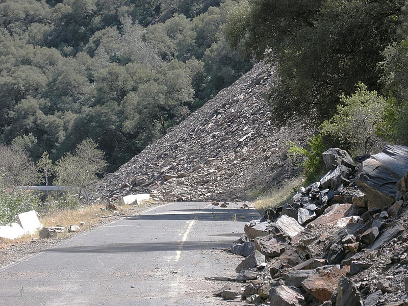
The Ferguson landslide, also commonly called the Ferguson Slide, is an active landslide in the Merced River canyon in Mariposa County, California, United States. In 2006, rocks and debris slid off Ferguson Ridge, blocking California State Route 140, a primary access road to Yosemite National Park. The slide still blocked the original road as of late 2021, although temporary bridges allow one-way traffic around the slide and into the park. The slide is a natural phenomenon, and resulted from the erosion dynamics of the river valley.[11]