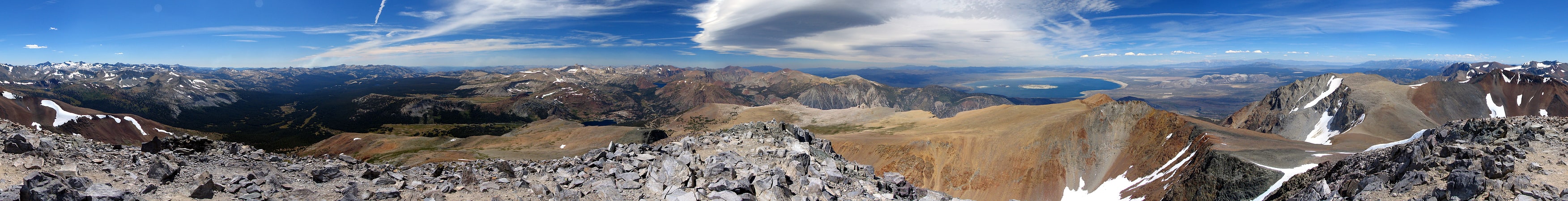
Discover 11 hidden attractions, cool sights, and unusual things to do in Ansel Adams Wilderness (United States). Don't miss out on these must-see attractions: Mount Dana, Thousand Island Lake, and Banner Peak. Also, be sure to include Minaret Lake in your itinerary.
Below, you can find the list of the most amazing places you should visit in Ansel Adams Wilderness (California).
Table of Contents
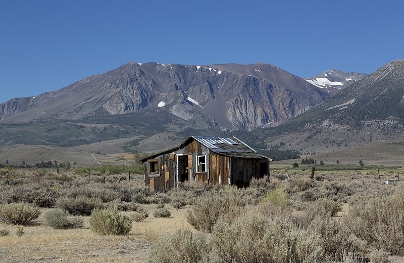
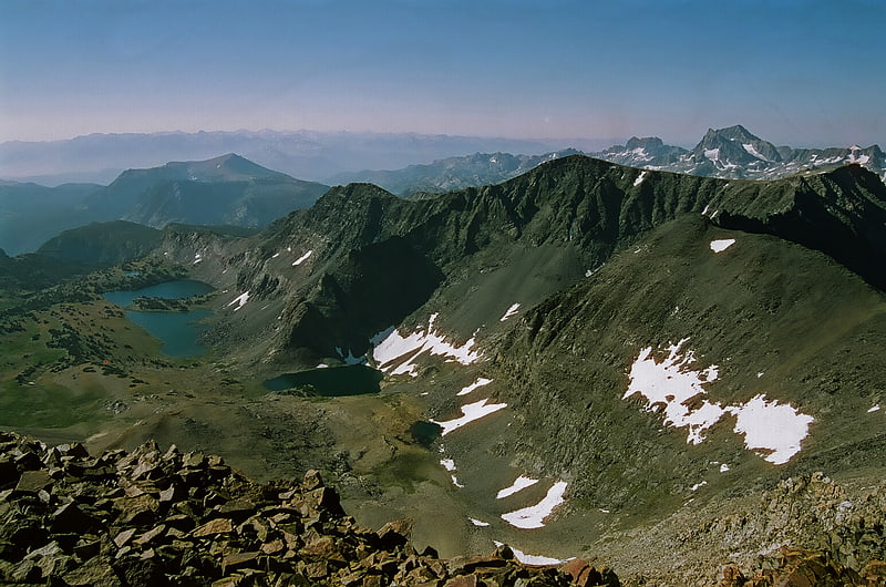
Mount Dana
Mountain in California. Mount Dana is a mountain in the U.S. state of California. Its summit marks the eastern boundary of Yosemite National Park and the western boundary of the Ansel Adams Wilderness. At an elevation of 13,061 feet, it is the second highest mountain in Yosemite, and the northernmost summit in the Sierra Nevada which is over 13,000 feet in elevation. Mount Dana is the highest peak in Yosemite that is a simple hike to the summit. The mountain is named in honor of James Dwight Dana, who was a professor of natural history and geology at Yale.
Mount Dana is composed of prebatholithic rock that is mostly reddish metamorphic rock, which was composed by metavolcanics of surfacing magma from the Mesozoic Era.
Mount Dana's northern face includes a small, receding glacier known as the Dana Glacier. The Dana Meadows lie at the foot of the mountain. From the top, lakes throughout Dana Meadows, Mono Lake, Tioga Peak and many other mountains are in view.[1]
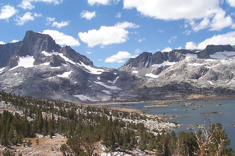
Thousand Island Lake
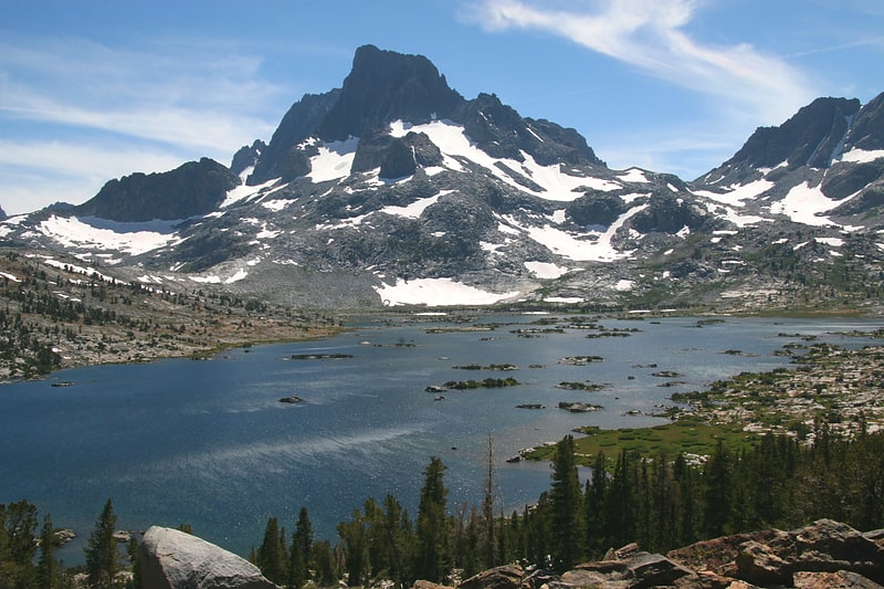
Lake in California. Thousand Island Lake is a large alpine lake in the Sierra Nevada, within the Ansel Adams Wilderness in eastern Madera County, California.
The lake is named for the many small rocky islands that dot its surface. Theodore Solomons probably established the 'Thousand Island' name, as this appears on his 1896 map. John Muir called it by "Islet Lake."[2]
Banner Peak

Peak in California. Banner Peak is the second tallest peak in the Ritter Range of California's Sierra Nevada. The mountain is 12,942 feet tall, and there are several glaciers on its slopes. It lies within the boundaries of the Ansel Adams Wilderness; at the foot of the peak lie Garnet Lake, Lake Ediza, and the famous Thousand Island Lake. Banner Peak is near the town of Mammoth Lakes; from there, climbers can hike to the foot of the mountain where various routes reach the summit, the easiest of which is a class 2 from the west end of Thousand Island Lake and then the saddle between Banner Peak and the slightly taller Mount Ritter. Other nearby lakes include Lake Catherine and Shadow Lake.
The peak was named in 1883 by USGS topographer Willard D. Johnson who observed a banner cloud streaming from the summit.[3]
Minaret Lake
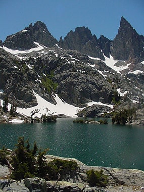
Lake in California. Minaret Lake is a lake in the Ritter Range, a subrange of the Sierra Nevada, in California. It is located in extreme northeastern Madera County, within the Ansel Adams Wilderness of the Inyo National Forest.
Minaret Lake is notable for being on the Sierra High Route.
It is near the fatal 2007 airplane crash site of Steve Fossett (Fossett's plane crashed north of the lake, near the Minaret Mine).[4]
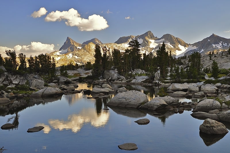
Mount Ritter
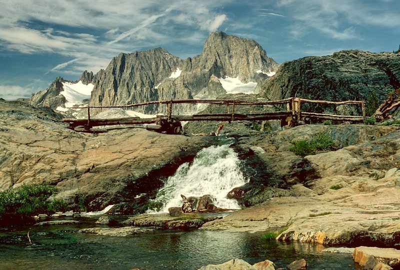
Mountain in California. Mount Ritter is the highest mountain in Madera County, California, in the Western United States, at an elevation of 13,149 feet. It is also the highest and most prominent peak of its namesake, the Ritter Range, a subrange of the Sierra Nevada in the Ansel Adams Wilderness of the Inyo and Sierra National Forests. Mount Ritter is the 15th highest mountain peak in California with at least 500 meters of topographic prominence.[5]
Minarets
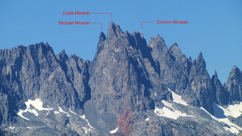
Peak in California. The Minarets are a series of jagged peaks located in the Ritter Range, a sub-range of the Sierra Nevada Mountains in the state of California. They are easily viewed from Minaret Summit, which is accessible by auto. Collectively, they form an arête, and are a prominent feature in the Ansel Adams Wilderness which was known as the Minaret Wilderness until it was renamed in honor of Ansel Adams in 1984.
The peaks were named in 1868 by the California Geographical Survey, which reported: "To the south of Mount Ritter are some grand pinnacles of granite, very lofty and apparently inaccessible, to which we gave the name of 'the Minarets.'" Seventeen of the Minarets have been given unofficial names, including Michael Minaret, Adams Minaret, Leonard Minaret, and Clyde Minaret. Clyde Minaret, named after Norman Clyde, is the tallest of the spires. The Southeast Face Route of Clyde Minaret is a technical rock climb featured in Fifty Classic Climbs of North America.
The area is notable for two fatalities:
- Walter A. Starr, Jr. author of Starr’s Guide to the John Muir Trail and the High Sierra Region, fell to his death while solo-climbing the northwest face of Michael Minaret in 1933.
- Steve Fossett, an American aviator and adventurer, died in a plane crash near the Minarets in 2007.
Mount Gibbs
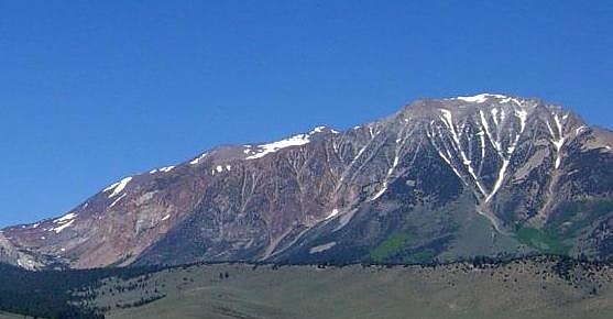
Mount in California. Mount Gibbs is located in the Sierra Nevada of the U.S. state of California, 2.6 miles south of Mount Dana. The mountain was named in honor of Oliver Gibbs, a professor at Harvard University and friend of Josiah Whitney. The summit marks the boundary between Yosemite National Park and the Ansel Adams Wilderness, and Mount Gibbs is the sixth-highest mountain, of Yosemite.
The peak is accessible either from the west, starting at Tioga Pass Road, or from the east, via Bloody Canyon from the trailhead at Walker Lake. Overnight camping is not permitted on the western side of the mountain, which is part of the protected watershed of Dana Meadows and Tioga Pass. In the summer the mountain has only patchy snow, on the northern slope. The easiest ascent is via the ridge extending west from the peak; there is a steep section of loose, unstable rock, leading to the gentle ridge that forms the top of the mountain. Although the top is above the tree line, there is some sparse plant life, including wildflowers. The view of Mono Lake from the summit is partially obstructed by an outcropping to the northeast.[7]
Mount Davis
Peak in California. Mount Davis is a prominent peak in the Ansel Adams Wilderness on the Inyo National Forest and south of Yosemite National Park. The peak was named in honor of Lieutenant Milton Fennimore Davis, who was with the first troops detailed to guard Yosemite National Park. Davis was the first person to climb the peak.[8]
Kuna Peak
Summit in California. Kuna Peak is a summit on the boundary between Mono and Tuolumne counties, in the United States, is the highest point on Kuna Crest. With an elevation of 13,008 feet, Kuna Peak is the 146st-highest summit in the state of California, and is the third-highest mountain in Yosemite National Park.[9]
Koip Peak
Summit in California. Koip Peak is a 12,968-foot-elevation summit in Mono County, California, in the United States. It is located in the Ansel Adams Wilderness, on land managed by Inyo National Forest. It is approximately 0.25 miles outside of Yosemite National Park's eastern boundary, and 1.0 mile west of Parker Peak.
Koip is derived from a Western Numic name meaning "mountain sheep". Bighorn sheep roam in the area.[10]
Ritter Range
Mountain range in California. The Ritter Range is a small mountain range within California's Sierra Nevada. Most of the mountain range lies within the Ansel Adams Wilderness.
The John Muir Trail passes by many lakes within the Ritter Range. The most prominent peaks of the Ritter Range are Mount Ritter, at 13,143 feet, Banner Peak, at 12,936 feet, Rodgers Peak, and the Minarets, a group of sharp peaks south of Mt. Ritter. Thousand Island Lake, Ediza Lake, Garnet Lake, Lake Catherine, Minaret Lake, Cecile Lake, and Shadow Lake all lie within the Ritter Range, and are accessible by trail.
The range is named for Carl Ritter, who had been a teacher of Josiah Whitney when he was a student in Berlin in the 1840s."
The Ritter Range, near the Minarets and Minaret Lake, was the site of the plane crash of Steve Fossett in 2007.[11]