Discover 20 hidden attractions, cool sights, and unusual things to do in John Muir Wilderness (United States). Don't miss out on these must-see attractions: The Hermit, Mount Fiske, and Mount Tom. Also, be sure to include Mount Warlow in your itinerary.
Below, you can find the list of the most amazing places you should visit in John Muir Wilderness (California).
Table of Contents
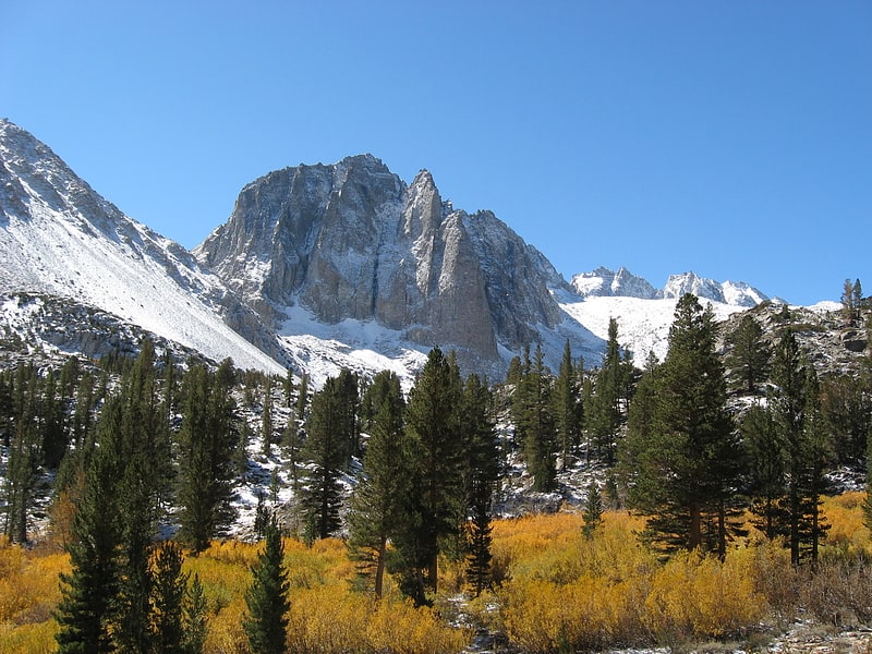
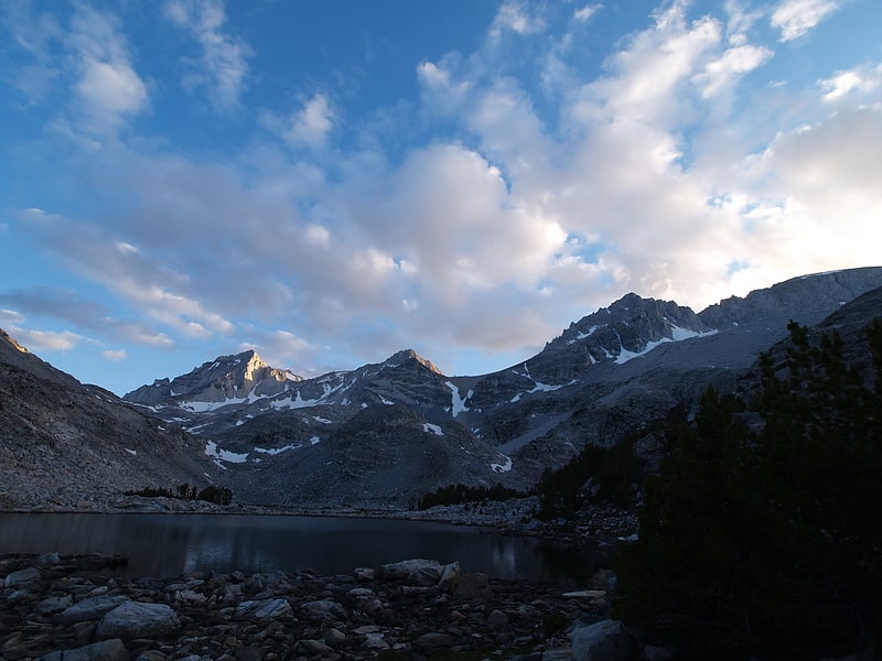
The Hermit
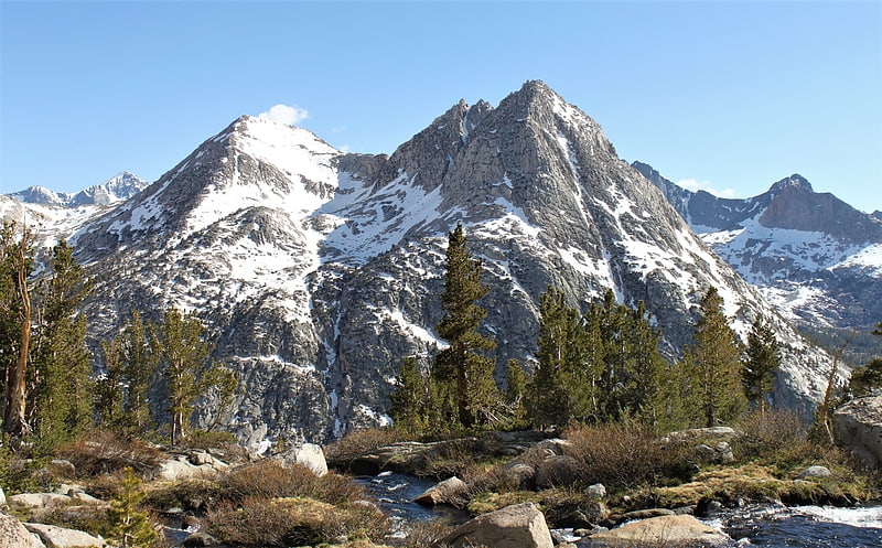
The Hermit is a 12,328-foot-elevation mountain summit located west of the crest of the Sierra Nevada mountain range, in Fresno County of northern California, United States. It is situated in northern Kings Canyon National Park, 2.5 miles east of Emerald Peak, and 2.5 miles west of Mount Darwin. Topographic relief is significant as the north aspect rises 2,500 feet above Evolution Valley in less than one mile. The John Muir Trail passes to the east and north of this landmark, providing an approach. This geographical feature was named by Sierra Club explorer Theodore Solomons in 1895 as he wrote: "The traveler will be greatly attracted by a very sharp peak or butte that rises on the south wall. From its isolated position as viewed from the valley we called it the Hermit."[1]
Mount Fiske
Mount Fiske is a 13,503-foot-elevation mountain summit located near the crest of the Sierra Nevada mountain range, in Fresno County of northern California, United States. It is situated in northern Kings Canyon National Park, 23 miles west of the community of Big Pine, 0.83 miles east of Mount Huxley, and two miles south of Mount Darwin, which is the nearest higher neighbor. Mount Fiske ranks as the 60th highest summit in California.[2]
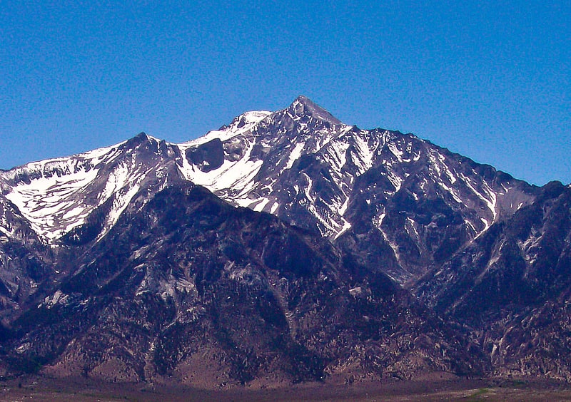
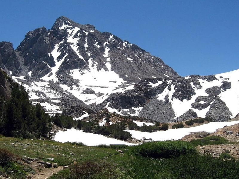
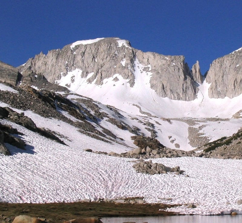
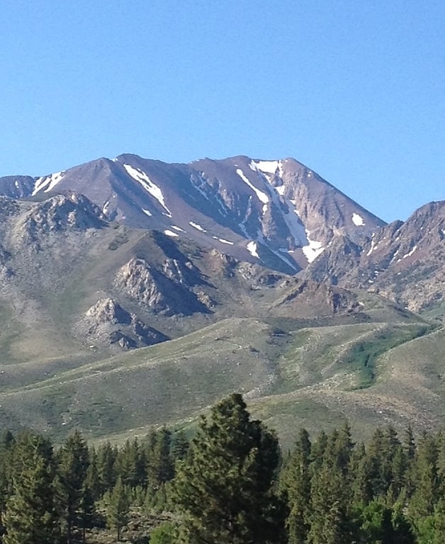
Mount Tom
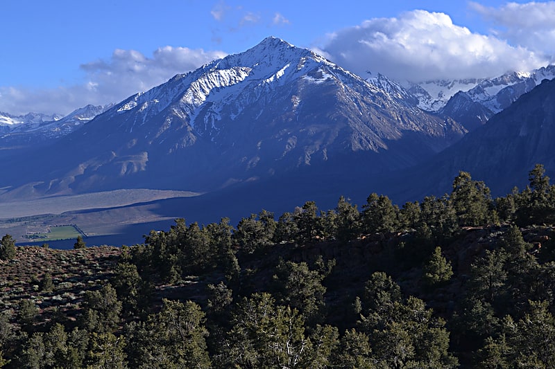
Peak in California. Mount Tom is a large and prominent peak near the city of Bishop in Inyo County of eastern California. It is in the Sierra Nevada and east of the Sierra Crest. The mountain is also in the John Muir Wilderness.
Along with its neighbor to the south, Basin Mountain, it dominates the western skyline from the upper Owens Valley.[3]
Mount Warlow
Mount Warlow is a 13,206-foot-elevation mountain summit located 1.5 miles west of the crest of the Sierra Nevada mountain range, in Fresno County of northern California, United States. It is situated on the Goddard Divide in northern Kings Canyon National Park, 1.2 miles north of Muir Pass, 0.69 miles southeast of Mount Huxley, and 0.68 miles southwest of Mount Fiske, which is the nearest higher neighbor. Mount Warlow ranks as the 108th highest summit in California. The approach to this remote peak is made via the John Muir Trail.[4]
Mount Williamson
Mountain in California. Mount Williamson, at an elevation of 14,379 feet, is the second-highest mountain in both the Sierra Nevada range and the state of California, and the sixth-highest peak in the contiguous United States.[5]
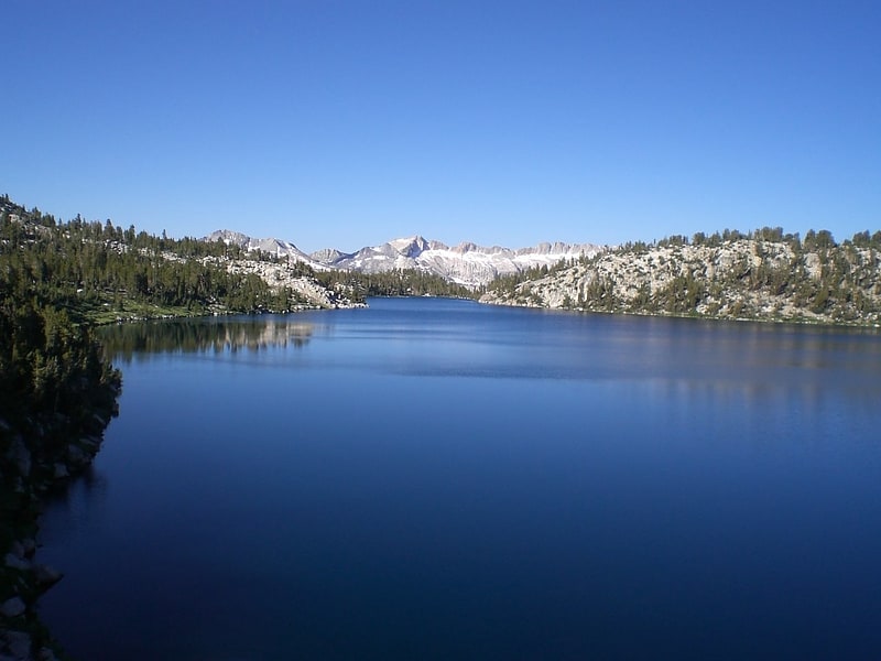
Loch Leven
Lake in California. Loch Leven is the name of several lakes in California, United States, in the Sierra Nevada.[6]
Mount McGee
Mount McGee is a 12,944-foot-elevation mountain summit located west of the crest of the Sierra Nevada mountain range, in Fresno County of northern California, United States. It is situated in Kings Canyon National Park, 0.6 miles southeast of Peter Peak, 2 miles southwest of The Hermit, and 2.6 miles north-northwest of Mount Goddard, the nearest higher neighbor. Topographic relief is significant as the west aspect rises 3,100 feet above Goddard Canyon in two miles. This geographical feature was named for William John McGee, well-known American geologist and anthroplogist. This mountain's name has been officially adopted by the United States Board on Geographic Names. The first ascent of the summit was made in July 1923 by Roger N. Burnham, Robert E. Brownlee, Ralph H. Brandt, and Leonard Keeler.[7]
Peter Peak
Peter Peak is a 12,490-foot-elevation mountain summit located west of the crest of the Sierra Nevada mountain range, in Fresno County of northern California, United States. It is situated in Kings Canyon National Park, 2 miles southwest of The Hermit, and 0.6 mile northwest of Mount McGee, the nearest higher neighbor. Topographic relief is significant as the west aspect rises 2,900 feet above Goddard Canyon in 1.5 mile. The John Muir Trail passes to the east, providing an approach. This geographical feature was named by the Sierra Club in 1938 in memory of one of their own, Peter Grubb, who made the first ascent of this peak in 1936. Peter died at Capri, age 18, while traveling on a bicycle tour of Italy. This mountain's name has been officially adopted by the United States Board on Geographic Names.[8]
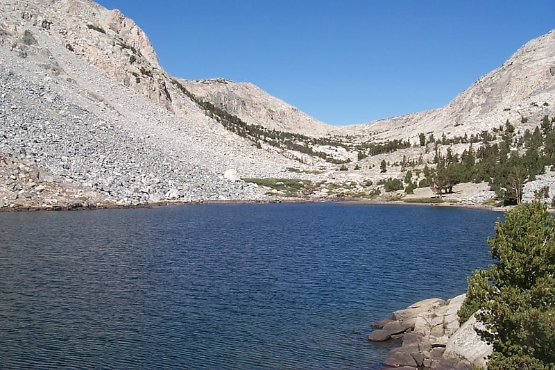
Lake Virginia
Lake in California. Lake Virginia is a lake located in the Sierra Nevada in Fresno County, California. It drains into Fish Creek, in the Cascade Valley. The John Muir Trail passes along its northern shore. It is not to be confused with Virginia Lakes, a cluster of lakes lying to the north.[9]
Mount Agassiz
Peak in California. Mount Agassiz, at 13,899 feet, is one of the twenty highest peaks of California. It is the northernmost and easiest to climb of the major Palisades summits. This peak is not to be confused with the 9967ft peak by the same name in Desolation Wilderness, also in the California Sierra.[10]
Squaw Lake
Lake in California. Squaw Lake is a small lake in the eastern Sierra Nevada, near the John Muir Trail in John Muir Wilderness. It is located 1.8 miles west-northwest of Mount Izack Walton and 5 miles north-northeast of Lake Thomas A Edison. at an altitude of 10,315 feet. The outflow of Squaw Lake becomes Fish Creek, which eventually joins the Middle Fork of the San Joaquin River. The name is controversial because squaw is an ethnic and sexual slur, historically used for indigenous North American women.
The California Office of Environmental Health Hazard Assessment has issued a safe eating advisory for any fish caught at Squaw Lake due to elevated levels of mercury, PCBs, and selenium.[11]
Split Mountain

Peak in California. Split Mountain is a fourteener in the Sierra Nevada of the U.S. state of California, near the southeast end of the Palisades group of peaks. It is the only fourteener in the watershed of the South Fork Kings River, and rises to 14,064 ft, making it the eighth-highest peak in the state.[12]
Lone Pine Peak
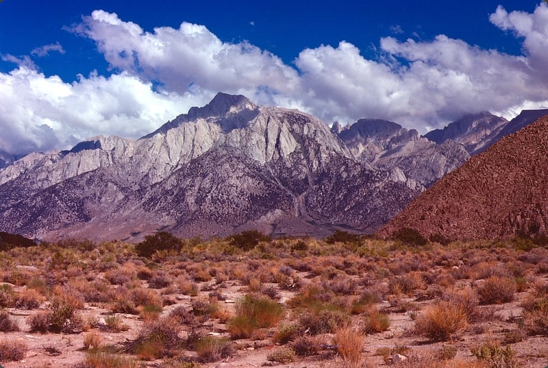
Summit in California. Lone Pine Peak is located on the east side of the Sierra Nevada range just west of the town of Lone Pine, California in Inyo County, in eastern California in the southwestern United States. The summit marks the eastern boundary of the John Muir Wilderness in the Inyo National Forest. Lone Pine Peak is the mountain in the photo for the default desktop of macOS Sierra.[13]
Temple Crag
Mountain in California. Temple Crag is a mountain peak in the Palisades group of peaks of the Sierra Nevada with an elevation of 12,982 feet. The peak lies east of the Sierra Crest, between Mount Gayley and Mount Alice, straddling the drainages of the North and South Forks of Big Pine Creek. The peak's north face forms the backdrop for part of the North Fork Big Pine Creek hiking trail in the John Muir Wilderness and Inyo National Forest. It is also a rock climbing destination, with its arêtes hosting the routes Venusian Blind, Moon Goddess Arete, Sun Ribbon Arete, and Dark Star.[14]
Mount Abbot
Mountain in California. Mount Abbot is a mountain in California's Sierra Nevada, in the John Muir Wilderness. It is located between Mount Mills and Mount Dade along the Sierra Crest and straddles the border between Fresno and Inyo counties.
The peak was named for Henry Larcom Abbot who, in 1855, was a member of the Williamson party of the Pacific Railroad Surveys in California and Oregon. He retired from the United States Army as a brigadier general in 1904.[15]
Mount Morgan
Mountain in California. Mount Morgan is a mountain located in northwestern Inyo County, California, in the John Muir Wilderness of the Inyo National Forest.[16]
Thunderbolt Peak
Peak in California. Thunderbolt Peak is a peak in the Palisades group of peaks in the Sierra Nevada in the U.S. state of California. It rises to 14,009 feet and could be considered the thirteenth-highest peak in the state, but since the peak has less than 300 feet of prominence it is usually considered a subsidiary peak of North Palisade. But if it is considered a separate mountain peak, Thunderbolt Peak is the northernmost fourteener in the Sierra Nevada.
The first ascent was attempted by a party of very well-known climbers. During the climb, a lightning bolt struck very close to Jules Eichorn, breaking his concentration. The mountain was named in commemoration of this event.[17]
Mount Mills
Peak in California. Mount Mills is a Thirteener and California 4000 meter peak, on the Sierra Crest, north of Mount Abbot and south of Mono Pass in the Sierra Nevada.
The mountain is located within the John Muir Wilderness area. The 13,457 feet (4,102 m) summit marks the boundary between northwestern Inyo County and eastern Fresno County.
The Mono Recesses are to the west of Mount Mills.[18]
Bloody Mountain
Mountain in California. Bloody Mountain is located in the Sierra Nevada 1 mile South East of Mammoth Lakes in eastern California in the southwestern United States.[19]
Palisade Glacier
Glacier in California. The Palisade Glacier is a glacier located on the northeast side of the Palisades within the John Muir Wilderness in the central Sierra Nevada of California. The glacier descends from the flanks of four fourteeners, or mountain peaks over 14,000 ft in elevation, including North Palisade, the highest peak of the Palisades group and the third highest peak in the Sierra Nevada overall.
The cirque containing the Palisade Glacier has a history of thousands of years of glaciation. The modern glacier attained its last maximum extent during the Little Ice Age, between 250 and 170 years ago (a period also known as the Matthes glaciation in the Sierra Nevada). It currently has an area of.31 sq mi (0.80 km2) and the glacier is.81 mi (1.30 km) long and.50 mi (0.80 km) wide. It is located between 13,400 and 12,000 ft (4,100 and 3,700 m) and moves at a rate of 20 ft (6.1 m) per year, although it is also retreating. Palisade Glacier is one of the few glaciers in California that terminates in a proglacial lake dammed by its former moraine, turquoise-colored from the glacial powder suspended in the water. The Big Pine Lakes below the glacier are also the same color. Another feature of the glacier is a moulin, which was formed in a drought during 1977, and a bergschrund.[20]