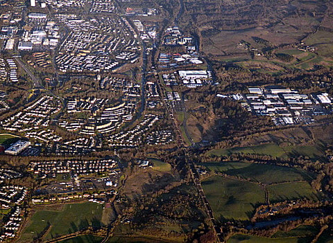
Discover 9 hidden attractions, cool sights, and unusual things to do in Cumbernauld (United Kingdom). Don't miss out on these must-see attractions: Cumbernauld House, Lenziemill, and Blairlinn. Also, be sure to include Cumbernauld College in your itinerary.
Below, you can find the list of the most amazing places you should visit in Cumbernauld (Scotland).
Table of Contents
Cumbernauld House
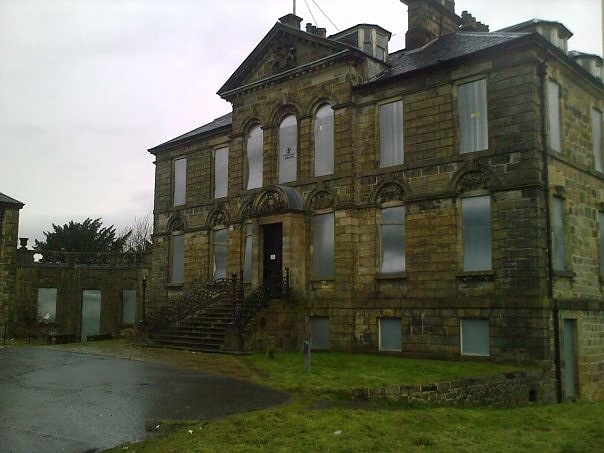
Building in Cumbernauld, Scotland. Cumbernauld House is an 18th-century Vivido Scottish country house located in Cumbernauld, Scotland. It is located near in the Cumbernauld Glen, close to Cumbernauld Village, at grid reference NS772759. The house is situated on the site of Cumbernauld Castle, which was besieged by General Monck in 1651. It was built in 1731, to designs by William Adam, for John Fleming, 6th Earl of Wigtown. In the later 20th century the house was used as offices, first by Cumbernauld Development Corporation, then North Lanarkshire Council, and latterly by DH Morris, who went into liquidation in March 2007. The building lay empty for a decade until it was developed into luxury apartments. Cumbernauld House is a category A listed building.[1]
Lenziemill
Mill in Cumbernauld, Scotland. Lenziemill is the site one of Cumbernauld's several industrial estates, built as satellite developments on the periphery of the Scottish town's residential areas.[2]
Blairlinn
Blairlinn is the site of one of Cumbernauld's several industrial estates built as satellite developments on the periphery of the Scottish town's residential areas.[3]
Cumbernauld College
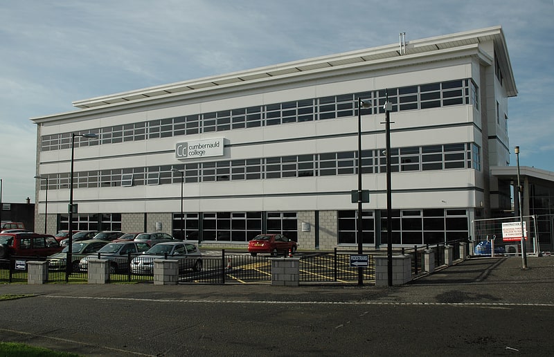
College in Cumbernauld, Scotland. New College Lanarkshire is a further education institution in Scotland in North Lanarkshire. The college was created on November 2013 from the merger of Cumbernauld College and Motherwell College, and in 2014 it absorbed Coatbridge College. It has over 25,000 students.[4]
Cumbernauld Castle
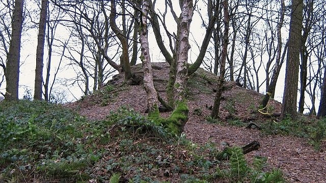
Cumbernauld Castle was the predecessor of Cumbernauld House in the Park in Cumbernauld. The Motte of the earliest castle survives, and stones of the second castle are incorporated in the present house.[5]
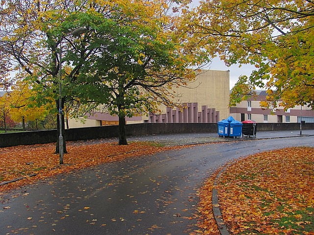
Carbrain
Carbrain /kar 'bren/ is a neighbourhood in Cumbernauld, North Lanarkshire in Scotland. It gets a brief mention on William Roy's eighteenth century map of the Scottish Lowlands. In the nineteenth century it was no more than a farm steading. An early map shows just a few buildings existed in 1864. By the start of the First World War it had not grown significantly, although there was a school near the railway station. It was sometimes spelled Carbrane. Even in 1956 Carbrain was mostly farmland with a small burn flowing through it. The map seems to show this flowing possibly down the Gully and eventually feeding the Red Burn in the Vault Glen. This burn isn't named so can't be identified with the Horseward Burn from historic maps.
Derek Lyddon and James Latimer designed much of the housing in the 1960s. Construction of Cumbernauld began in 1963, and most areas of Carbrain were inhabited by the early 1970s. For the first several years, Carbrain was considered to be highly desirable as an escape from poor housing in the Glasgow area. As newer developments have been constructed in the Cumbernauld area, Carbrain has fallen into disrepair despite periods of renovation. For example over £70 million was spent building new houses around Beechwood Court watched over by Andy Scott's artwork Vitruvian Girl. Most recently there have been proposals to renovate Millcroft Road.
Carbrain contains ten residential areas (Carbrain 1, 2, 3 & 4, 5, 6, 9, 11, 12, 13, 14), four churches (Carbrain Baptist Church, Cumbernauld Free Church, Cumbernauld United Reformed Church and St. Joseph's), two pubs (The Twa Corbies and The Jack Snipe), several local shops located throughout the site, along with a number of community buildings like the Red Cross Centre. Carbrain is supposed to have the Town Centre as its focus, so there was thought to be no need for serious scale entertainment or grocery shops.
Carbrain was split into two sections: North and South. North Carbrain, which was built first, included Glenhove Road, Torbrex Road, Stonylee Road, Craigieburn Road, Beechwood Road and Glenacre Road. North Carbrain is within five minutes walking distance from the Town Centre, health centre and sports centre. South Carbrain includes Millcroft Road, Greenrigg Road, Kilbowie Road, Broomlands Road, and Sandyknowes, some of which are a five-minute walk from the train station. The town centre is approximately a ten-minute walk from South Carbrain.
Carbrain was designed around pedestrians and, as such, has paths intertwining among its many streets. It is possible to get from one part of Carbrain to another using only footpaths. It was also designed so that pedestrians never had to walk alongside or cross a road.
Hillcrest was never part of Carbrain although Carbrain Temporary School became, the now demolished, Hillcrest Primary in 1971. For that reason there is a community council for "Carbrain and Hillcrest" rather than just Carbrain.
There were three primary schools within this area. Most children who lived in these areas would have attended Langlands Primary, St Joseph's Primary or Carbrain Primary (which celebrated its 50th birthday in 2016). These primaries were feeder schools for Cumbernauld High School, Greenfaulds High School or Our Lady's High School. St Margaret of Scotland Primary replaced St Joseph's Primary during a period of reorganisation.
Carbrain Boys Club is a voluntary football club who are organising a festival in June 2017.[6]
Kildrum
Kildrum was the first area to be constructed in Cumbernauld new town, North Lanarkshire, Scotland. It provided housing for the workers at the Burroughs factory at Old Inns, the first factory in Cumbernauld New Town.
The main road is in the shape of an arc with residential streets leading from it. Inside the arc are ex-corporation houses and there is better quality, mostly private, housing on the outside. The street names of Kildrum are taken from places associated with Robert Burns.
Facilities include Cumbernauld High School, primary school, special school, health centre, YMCA, four shops, hairdressers, chemist, three churches/chapels, Salvation Army.
Kildrum's history did not begin with the new town since as far back as 1 October 1310 Robert the Bruce wrote to Edward II of England from Kildrum trying, unsuccessfully, to establish peace between Scotland and England. There was also a farm about which some records exist. The Town Centre and Carbrain lie to the west of Kildrum. To the north is Seafar, to the east Cumbernauld Park and to the south Cumbernauld Glen.[7]
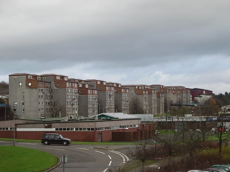
Seafar
Seafar is an area of the town of Cumbernauld. The original Seafar sand pit and farm were in the middle of what is now the A8011. Early in the new town's history Seafar was more distinct from Ravenswood and Muirhead than it now is possibly due to the building schedule and signage on paths. Recently Seafar is more dominant, perhaps because neither Ravenswood nor Muirhead appear on road signs.
Seafar is south of the M80 motorway and is bordered by Seafar wood, planted at the time of the construction of the town. The area was the second built in the new town of Cumbernauld, its many streets are named after famous Scottish artists and writers. St Mary's is its local Roman Catholic primary school. Seafar Primary School was demolished and replaced by sheltered housing in 2004. There is a Kingdom Hall of Jehovah's Witnesses next to St Mary's Primary school. The demolition of multistorey flats gave rise to a new housing development by Sanctuary Homes. Over a hundred new houses in Berryhill Road and Hume Road are due for completion in March 2018.[8]
Cumbernauld Village
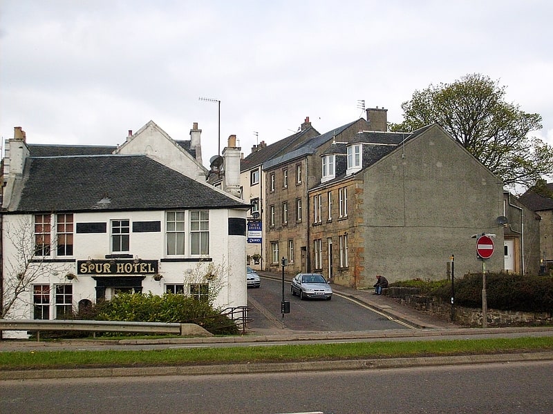
Cumbernauld Village is an area of Cumbernauld. Whilst Cumbernauld was designated a new town in 1955, the Village itself has a pre-mediaeval history, with a Roman settlement being built in the area due to its proximity to the Antonine Wall. After the Roman period the settlement remained and grew to such an extent that the Comyn family built their chapel there. It is recorded that, in 1500, the Black Death led to a special plea from the surviving people of Cumbernauld to the church authorities in Glasgow to allow them to establish their own cemetery rather than taking all their dead to St. Ninian's in Kirkintilloch. This source is also quoted in "Excavations at 3-11 Main Street, Cumbernauld". The villagers were granted permission to do so, and used the ground at the existing Comyns' chapel which dates from the end of the 12th century. Farming in long strips or Lang Riggs was carried out in the village.
The Flemings (who would become the Earls of Wigtown) later took over the Comyns' castle in Cumbernauld. In the 18th century this was replaced by Cumbernauld House
By the Seventeenth century the main industry of the Village was hand loom weaving, but this subsequently changed as due to the village's proximity to the Forth and Clyde canal and rich source of natural minerals and stone it became a site of mining and quarrying. The Village was also the site of a number of tenant held farms on the Flemings' estate. The 19th century Groome's Gazetteer states that Cumbernauld is:
"A picturesque old place, sheltered to E and SE by the grounds of Cumbernauld House, it was created a burgh of barony in 1649, and has a post office under Glasgow, a branch of the Royal Bank, a local savings' bank, 2 chief inns, gas-works, many new handsome villas, and a cattle-fair on the second Thursday of May. The parish church here is an old building, containing 660 sittings; the Free church dates from 1826, having belonged to the Original Secession, but has been lately almost rebuilt; and there is also a new U.P. church. Handloom weaving of checks and other striped fabrics is still carried on, but mining and quarrying are the staple industry. Pop. (1861) 1561, (1871) 1193, (1881) 1064."Cumbernauld had one of the oldest curling societies in the world which was established in the 18th century. The curling pond was near the Spur Inn, on the other side of the Bog Stank to the village.
October 1878 was a difficult time locally made worse by the failure of the Bank of Glasgow in which much of the village's money was invested. As the mining industry declined the village was further boosted by the decision to site a new town in the vicinity, with Cumbernauld lending its name to this new town.[9]