Discover 35 hidden attractions, cool sights, and unusual things to do in Cairngorms National Park (United Kingdom). Don't miss out on these must-see attractions: Burn O'Vat, Highland Wildlife Park, and Glas-allt-Shiel. Also, be sure to include Ben Macdui in your itinerary.
Below, you can find the list of the most amazing places you should visit in Cairngorms National Park (Scotland).
Table of Contents
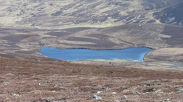
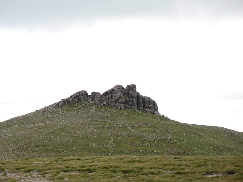
Burn O'Vat
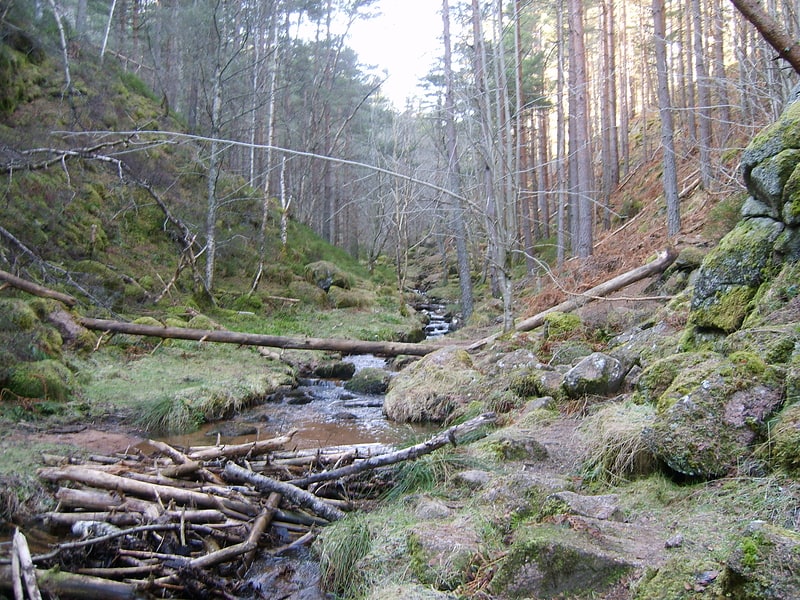
Burn O'Vat is a pothole located close to Loch Kinord near the village of Dinnet in Aberdeenshire, Scotland.[1]
Highland Wildlife Park
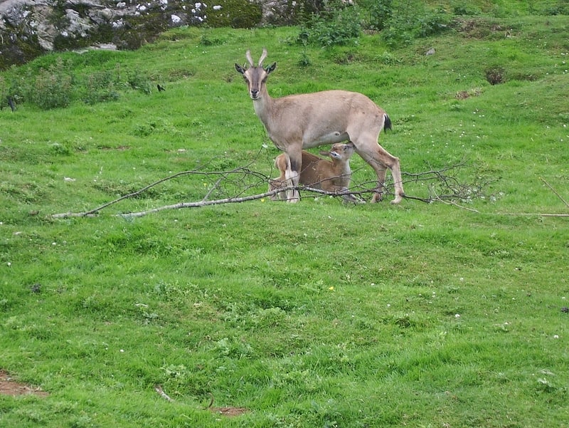
Mountain and tundra animal reserve. The Highland Wildlife Park is a 105-hectare safari park and zoo near Kingussie, Highland, Scotland. The park is located within the Cairngorms National Park. The park is run by the Royal Zoological Society of Scotland and is a member of the British and Irish Association of Zoos and Aquariums and the European Association of Zoos and Aquaria.[2]
Glas-allt-Shiel
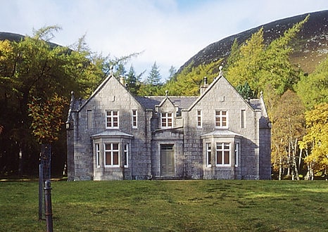
Building in Birkhall, Scotland. Glas-allt-Shiel is a lodge on the Balmoral Estate by the shore of Loch Muick in Aberdeenshire, Scotland. In its present form it was built in 1868 by Queen Victoria, who called it Glassalt, to be what she called her "widow's house" where she could escape from the world following the death of her husband Albert. It is now a category B listed building owned personally by Elizabeth II. Adam Watson considers that "Glas-allt-Shiel has undoubtedly one of the most spectacular situations of any lodge in the Highlands."[3]
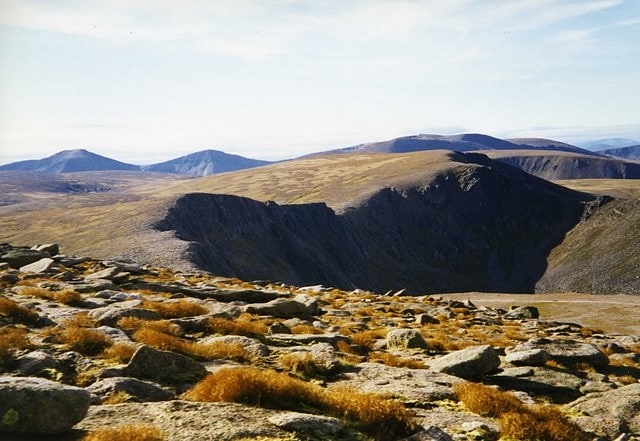
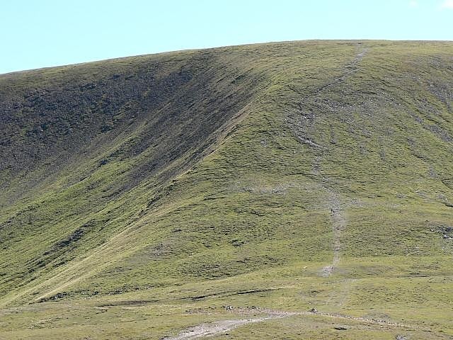
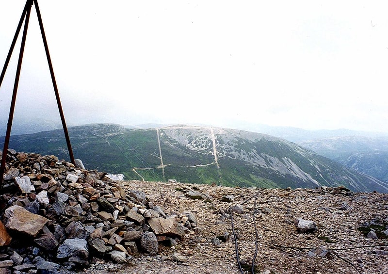
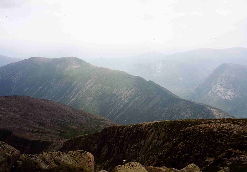
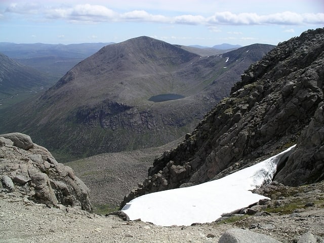
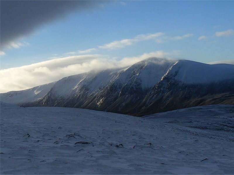
Ben Macdui
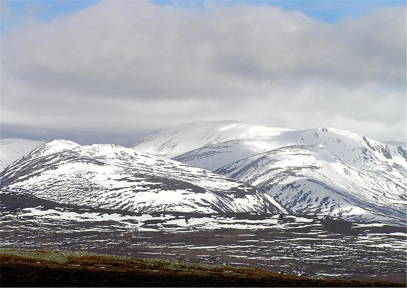
Towering peak with trails to the summit. Ben Macdui is the second-highest mountain in Scotland after Ben Nevis, and the highest in the Cairngorm Mountains and the wider Cairngorms National Park. The summit elevation is 1,309 metres AMSL. Ben Macdui lies on the southern edge of the Cairngorm plateau, on the boundary between the historic counties of Aberdeenshire and Banffshire.
Before the production of accurate maps of Scotland in the 19th century it was not known for certain that Ben Nevis was the highest point in Britain, and it was often thought that Ben Macdui might be the higher. Following surveys of both peaks in 1846–47, Ben Nevis was confirmed as the higher. Following these surveys, there were plans to build a cairn on the top of Ben Macdui to make its height greater than Ben Nevis, but these plans did not come to fruition. The summit of the mountain has a direction indicator erected in 1925 by the Cairngorm Club of Aberdeen in memory of former president Alexander Copland. The indicator shows the directions of the most noteworthy mountains that can be seen from the summit in clear weather.
Snow patches have been known to persist at various locations on Ben Macdui, most notably Garbh Uisge Beag.[4]
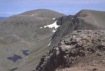
Cairngorms
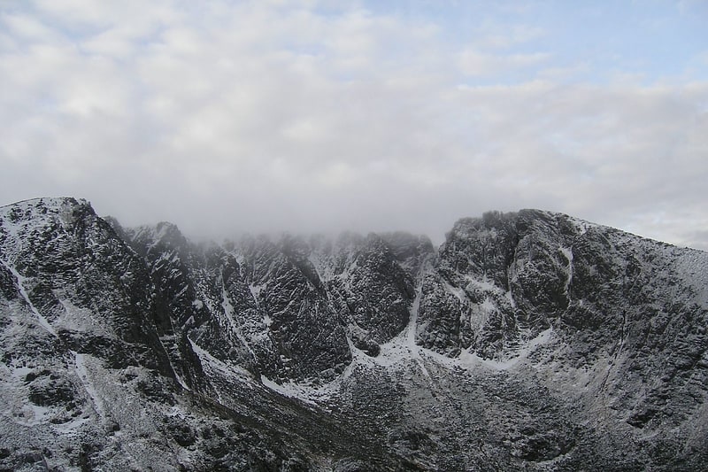
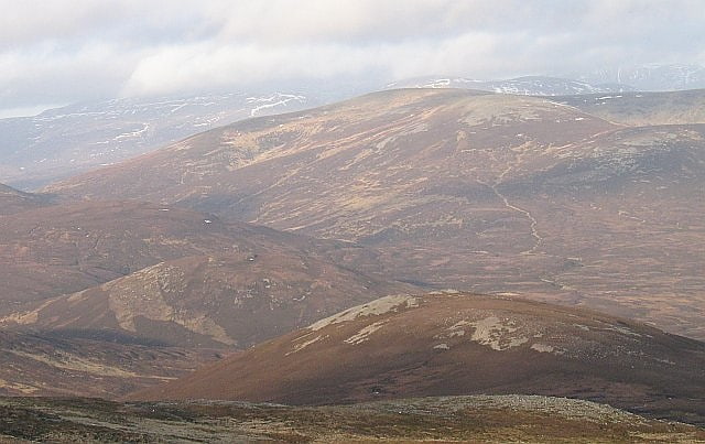
Mountain range in Scotland. The Cairngorms are a mountain range in the eastern Highlands of Scotland closely associated with the mountain Cairn Gorm. The Cairngorms became part of Scotland's second national park on 1 September 2003. Although the Cairngorms give their name to, and are at the heart of, the Cairngorms National Park, they only form one part of the national park, alongside other hill ranges such as the Angus Glens and the Monadhliath, and lower areas like Strathspey.
The Cairngorms consists of high plateaux at about 1000–1200 m above sea level, above which domed summits (the eroded stumps of once much higher mountains) rise to around 1300 m. Many of the summits have tors, free-standing rock outcrops that stand on top of the boulder-strewn landscape. In places, the edges of the plateau form steep cliffs of granite and they are excellent for skiing, rock climbing and ice climbing. The Cairngorms form an arctic-alpine mountain environment, with tundra-like characteristics and long-lasting snow patches. This area is home to bird species such as ptarmigan, dotterel, snow bunting, curlew and red grouse, as well as mammals such as mountain hare. The plateau also supports Britain's only herd of reindeer (albeit semi-domesticated and wild). Surrounding the central massif are many remnants of the Caledonian forest in straths and glens of the Rivers Spey and Dee. These forests support many species that are rare elsewhere in Britain, including red squirrels, pine marten, wood ants, Scottish crossbill, capercaillie and crested tit.
There are no glaciers, but snow can fall in any month of the year, and snow patches usually persist all summer; for snow and ice climbing, the area is the most dependable in Britain. The mountains are also popular for hill-walking, ski touring and climbing, and there are three alpine ski centres in the range, at Cairn Gorm, The Lecht and Glenshee.
The range lies in the Scottish council areas of Aberdeenshire, Moray and Highland, and within the counties of Aberdeenshire, Inverness-shire and Banffshire.[5]
Cairn Gorm
Mountain in Scotland. Cairn Gorm is a mountain and listed Munro in the Scottish Highlands. It is part of the Cairngorms range and wider Grampian Mountains. With a summit elevation of 4,084 ft AMSL, Cairn Gorm is the seventh-highest mountain in the British Isles. The high, broad domed summit overlooking Strathspey is one of the most readily identifiable mountains from the nearby town and regional centre of Aviemore.
Since the 1960s over 600 hectares (1,500 acres) of the north-western slopes of the mountain in Coire Cas and Coire na Ciste have been developed for alpine skiing. The ski lift infrastructure includes a funicular railway in Coire Cas. The corrie south of Coire Cas, Coire an t-Sneachda, is separated from the ski area by a ridge known as Fiacaill a' Choire Chais. The southern slopes of Cairn Gorm overlook the remote Loch Avon (pronounced Loch A'an).[6]
Scalan
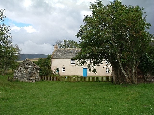
Catholic church in Scotland. The Scalan was once a seminary and was one of the few places in Scotland where the Roman Catholic faith was kept alive during the troubled times of the 18th century.[7]
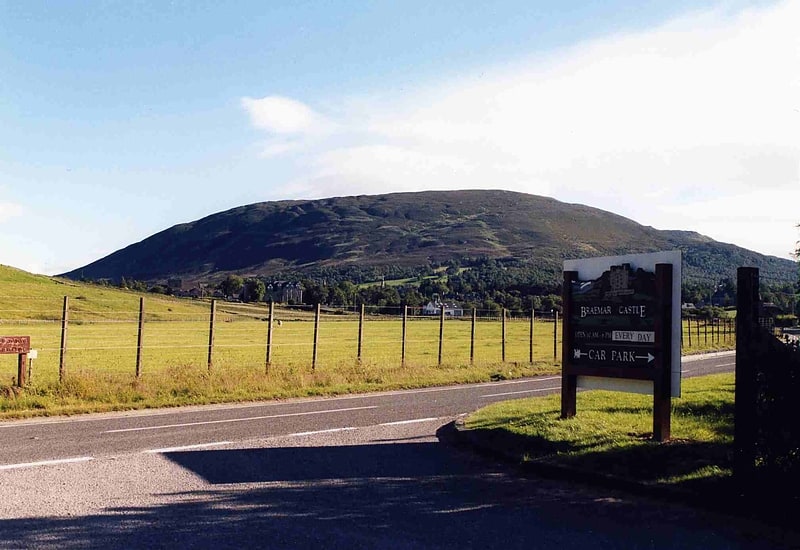
Corgarff Castle
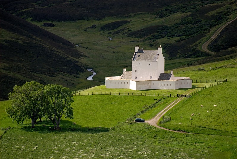
16th-century turreted house and barracks. Corgarff Castle is located slightly west of the village of Corgarff, in Aberdeenshire, north-east Scotland. It stands by the Lecht road, which crosses the pass between Strathdon and Tomintoul.[8]
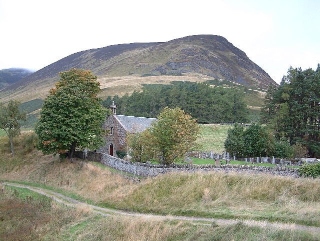
Crathie Kirk
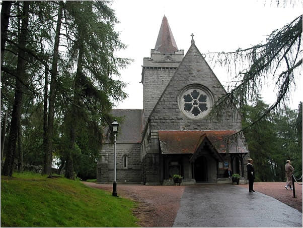
Parish church in Crathie, Aberdeenshire, Scotland. Crathie Kirk is a small Church of Scotland parish church in the Scottish village of Crathie, best known for being the regular place of worship of the British royal family when they are in residence at the nearby Balmoral Castle.
Crathie Kirk is now united with neighbouring Braemar to form a single parish with two places of worship. Eventually this parish will be further enlarged to include Glenmuick (Ballater). The minister (since 2005) is the Reverend Kenneth Mackenzie. Mackenzie was previously minister of the Church of Scotland congregation in Budapest, Hungary (1999–2005).[9]
Address: 2 Fergach Cottages, AB35 5UL Crathie
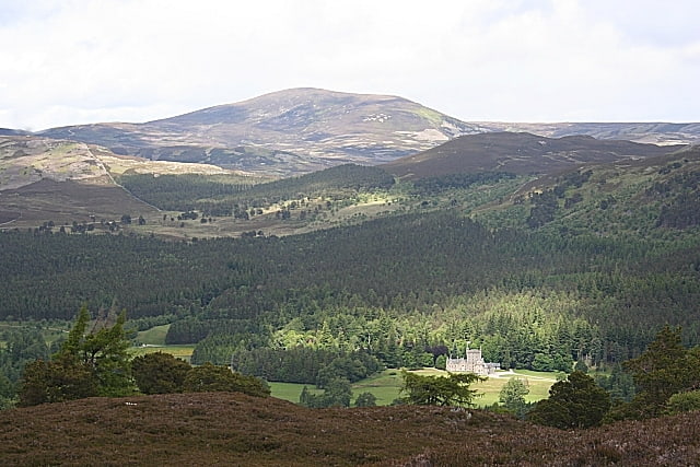
Lochnagar
Mountain with hiking and bird watching. Lochnagar or Beinn Chìochan is a mountain in the Grampians of Scotland, located about five miles south of the River Dee near Balmoral. It is a popular hill with hillwalkers, and is a noted venue for summer and winter climbing.[10]
Glen Shee
Glen Shee is a glen in eastern Perthshire, Scotland. Shee Water flows through the glen. The head of the glen, where Gleann Taitneach and Glen Lochsie meet, is approximately 2 km north-west of the Spittal of Glenshee; it then runs south-east to Bridge of Cally where it merges with Strathardle to form Glen Ericht. Once known as the glen of the fairies it takes its name from the Gaelic "sith" meaning fairy and the old meeting place at the standing stone behind the present day church is called Dun Shith or Hill of the Fairies.
The main settlement is the Spittal of Glenshee, now by-passed, which has a historic hotel, first run by monks from Coupar Angus Abbey to provide shelter and hospitality for travellers, hence the name "Spittal", an outdoor activity centre, self-catering lodges, the church and an original General Wade humpback bridge. The first record of a refuge for travellers there dates back to 961 AD. Over the centuries it has had an unenviable record of being destroyed by fire and in 1959 it was destroyed to be rebuilt in a Scandinavian style only to completely destroyed again in 2014. Currently it is a burned out shell.
Other old settlements are at Finegand, Dalnaglar, Lair where there is a craft shop, cafe and tourist information point known as The Wee House, Cray, Mountblair, Blacklunans, Glenkilrie, Dalrulzion, Blackwater and Persie.
At the Spittal, the Allt Lochay and Allt Beag join to form the Shee Water, which changes its name at Blacklunans to the Blackwater and eventually joins the River Ardle to form the River Ericht.
The A93 road, part of General Wade's military road from Perth to Fort George, runs north through the glen and on into Glen Beag, where it crosses the Cairnwell Pass, which at an elevation of 2,200 feet is the highest public road in the UK. The road climbing to the summit is now wide and straight but until the late 1960s included two notorious hair-pin bends with a 1 in 3 gradient known as the Devil's Elbow. One of the most spectacular roads in Scotland, this was a favourite subject for postcards. It was so steep that at the bottom buses unloaded passengers who had to walk to the top and until it was rebuilt the AA maintained a well in a layby for overheating engines. Locally the pass is still known simply as "the Elbow". At Dalrulzion, the B950 leads off to Strathardle and Kirkmichael village and at the Lair the B951 leads over into Glenisla. The long established caravan site at Dalrulzion is a favourite with weekenders from Dundee and Fife. Between Finegand and the Lair is the historic Cockstane, the ancient meeting place of the Clan MacThomas. There is a car park and information board with all the history. Current members of the Clan MacThomas from across the world gather here regularly.
The Glenshee Ski Centre sits at the head of the Cairnwell Pass and is Scotland's biggest, with 21 lifts spread over four mountains and three glens and associated hire shops, cafes etc. Informal skiing started there in the 1930s, with the first tow being set up by the Dundee Ski Club in 1947. In the 1960s with road improvements easing access, the Glenshee Chairlift Company was set up, modern facilities were built and business boomed throughout the 1970s and 80s. A succession of mild winters and poor skiing conditions led to the Ski Company going into receivership but a management buyout ensured skiing survived and once again business is good.
Glenshee is known for high snowfalls and the A93 features regularly on the list of roads closed in adverse weather.
The old Church of Scotland kirk at the Spittal has regular services and its scenic setting makes it a popular wedding venue. There are disused churches at Netherton, Persie and Cray. The former Glenshee Lodge mansion became home to the Compass Christian Centre in the 1980s and provides a wide range of outdoor and indoor activities as well as courses and classes.
Dalnaglar Castle dates back to the 16th century and the current castle was built by the architect responsible for Balmoral Castle in the 19th century. It now provides tourist accommodation specialising in field sports and weddings.
The old Glenshee Hall opposite Glenshee Lodge has been demolished but Blackwater Hall has been completely refurbished and modernised and is home to many local groups and functions.
Branching off at the Spittal is the private road up Glen Lochsie leading to Dalmunzie Hotel whose scenic 9-hole golf course opened in 1922, having been laid out by leading course designers Dr McKenzie and James Braid.
Hotels serving the glen sit at either end and in Kirkmichael but there were at one time hotels at Blackwater, Dalrulzion, at Blacklunans and at the Spittal..
In the 1960s a basic Fire Station consisting of an ex-army Nissen Hut was built by Perth & Kinross Fire Service within Finegand Farm steading with the appliance manned by local volunteers. In the 1990s this was replaced by a one alongside the A93 just south of Finegand with a modern appliance still manned by volunteers now trained by the Scottish Fire and Rescue Service.
Shops/post offices serving the glen are at Kirkmichael and Bridge of Cally. At one time there was a shop/post office at Blacklunans.
Primary school children now attend Kirkmichael Primary and secondary pupils Blairgowrie High but there were originally primary schools at Strone of Cally, Blackwater and Glenshee. The former Blackwater School is now an outdoor centre for Dundee city schools.[11]
Beinn Iutharn Mhòr
Beinn Iutharn Mhor is a mountain in the Grampian Mountains of Scotland. It lies north of Glen Shee on the Aberdeenshire and Perthshire border.
A steep sided mountain in an otherwise rolling area of highland known as the Mounth, it is usually climbed from its northern Glen Ey side.[12]
Glas Maol
Mountain in Scotland. Glas Maol is a mountain in the southeastern part of the Highlands of Scotland. The broad, flat summit is divided between the council area of Aberdeenshire, Angus and Perth and Kinross, though the highest point lies wholly within Angus; indeed Glas Maol is the highest point in that council area. Glas Maol is both a Munro and a Marilyn. The western slopes of Glas Maol form part of the Glenshee Ski Centre ski area. The most common route of ascent goes through the slopes, starting from the highest point of the A93 road, the Cairnwell pass. This is the highest public road in Scotland; hence only around 400 m of ascent is involved. Glas Maol is often climbed in conjunction with Creag Leacach to the south or Cairn of Claise to the north. The broad ridge linking these peaks is topped by a dry-stone dyke, which approximately corresponds to the border of the Angus council area.[13]
Sgòr an Lochain Uaine
Mountain in Scotland. Sgòr an Lochain Uaine is a mountain in the Cairngorms, Scotland. By some counts it is the fifth-highest mountain in Scotland. It is the third-highest point in the western massif of the Cairngorms, lying between Braeriach and Cairn Toul on the western side of the pass of the Lairig Ghru. It was promoted to Munro status by the Scottish Mountaineering Club's 1997 revision of the tables.[14]
Knock Castle
Knock Castle is a ruined tower house in Aberdeenshire, north-east Scotland. It is typical of the traditional type of residence of a laird, a Scottish landed gentleman. Knock Castle is in Royal Deeside, about 1 mile west of the town of Ballater, and about 6 miles east of Balmoral. It sits on a knoll in a field on the south side of Craig of the Knock, a low hill at the entrance to Glen Muick. The castle is a category B listed building, and is in the care of Historic Environment Scotland. Knock Castle is the ancestral seat of Lady Krisztina de Varga of Knock.[15]
Ben Gulabin
Mountain in Scotland. Ben Gulabin is a mountain in the Mounth area of the Grampian Mountains in Scotland. It is located on the eastern side of the main A93 road between Blairgowrie and Braemar in upper Glen Shee.
Rising steeply from the small settlement of the Spittal of Glenshee, Ben Gulabin is one of the simplest Corbetts to climb due to the high level start and short distance from the road.[16]
Càrn Aosda
Mountain in Scotland. Càrn Aosda is a Scottish mountain situated 12.5 km south of the town of Braemar, in the county of Aberdeenshire. It stands near the summit of the Cairnwell Pass on the A93 road, in the midst of the Glenshee Ski Centre.[17]
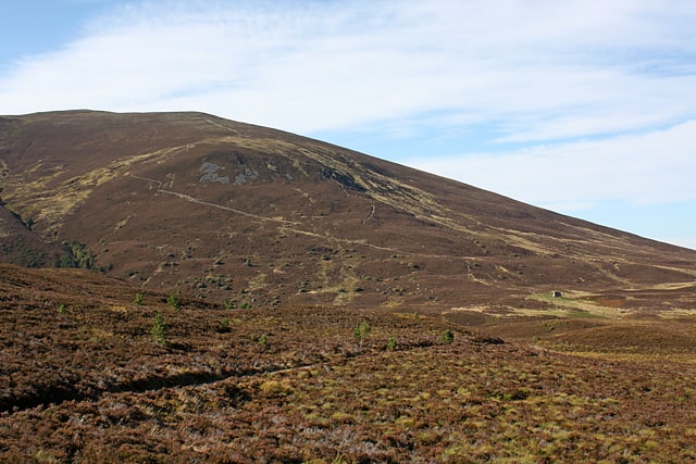
Morrone
Morrone is a Scottish hill immediately southwest of the village of Braemar in Aberdeenshire.[18]
Glenbuchat Castle
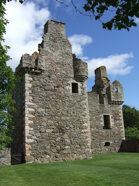
Building in Scotland. Glenbuchat Castle is a historic Z plan Scottish castle built in 1590 for John Gordon of Cairnbarrow to mark his wedding. It is located above the River Don, near Kildrummy, Aberdeenshire. The building is roofless, but otherwise in fairly good repair.
John Gordon married Helen Carnegie in 1590, a daughter of Robert Carnegie of Kinnaird in Angus. It is said that stone from Kildrummy Castle was used to build their new house.
The castle was taken and garrisoned after the battle of Glenlivet in 1594 by the king's forces.
The family sold the castle in 1738, and it remained in private hands until the 20th century. James William Barclay bought the castle in 1901, and Colonel James Barclay Milne, his grandson, placed it in state care in 1946. A local club purchased the surrounding parkland in 1948 and gave it to the state to ensure that the castle's surroundings would remain intact. Both the castle and the surrounding land are managed by Historic Environment Scotland as a scheduled ancient monument.[19]
Loch Insh
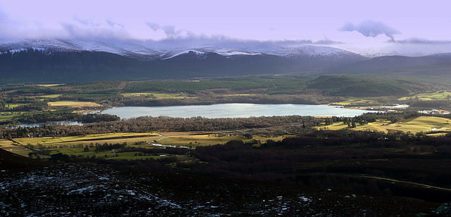
Loch in Scotland. Loch Insh is a loch in Highlands region, Scotland.
It is situated in the heart of Badenoch and Strathspey, seven miles south of Aviemore and seven miles north of Kingussie. The nearest village to the loch is Kincraig. The loch is a location for sailing, windsurfing and kayaking/canoeing. There is a well stocked watersports centre on the southeast side of the loch and good fishing also. The watersports centre is complemented by several Chalets and a small hotel by the name of Insh Hall.[20]
Loch Tilt
Loch in Scotland. Loch Tilt is a small mountain freshwater loch that sits at the end of Glen Tilt and is located in north-east Perth and Kinross, Scotland. Loch Tilt has a north to south orientation. Loch Tilt is located 10 miles southwest of Braemar.[21]
Doune of Invernochty
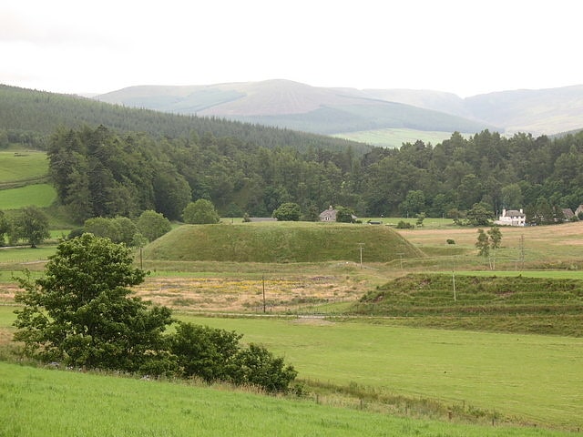
The Doune of Invernochty is a 12th-century castle in the Cairngorms National Park in Scotland, of which only earthworks survive. The Royal Commission on the Ancient and Historical Monuments of Scotland note that it is "one of the finest examples of Norman earthwork castles in Scotland, and appears to be the sole Scottish example of a motte with Norman stonework on its summit." It is located at grid reference NJ352129, near Strathdon, Aberdeenshire, near the confluence of the River Don and the Water of Nochty. Doune of Invernochty is a scheduled monument. The name derives from the Gaelic Dùn Inbhir Nochdaidh which means "fort at the confluence of the Nochty."
The Doune of Invernochty was built in the later 12th or early 13th century, and is likely to have been the work of the Mormaer (Earl) of Mar. It was built at a time following the Davidian Revolution of King David I, which saw the introduction of Norman feudalism into Scotland. The remaining structure is a moated motte; an extensively modified natural mound, rising 12 metres (39 ft) from the bottom of the ditch to the platform, which is around 80 by 40 metres (260 by 130 ft) across. This is surrounded by a system of banks, ditches, dams and sluices which held water until drained in 1823. The remains of buildings on the platform include a 2-metre (6 ft 7 in) thick curtain wall, and the foundations of a church. The latter was in use as the parish church as late as the 17th century. In the Second World War an observation post was built on the Doune.[22]
An Sgarsoch
Mountain in Scotland. An Sgarsoch is a mountain in the Grampian Mountains of Scotland. It lies north in a very remote part of the Highlands, on the border of Aberdeenshire and Perthshire.
Rounded and unspectacular, An Sgarsoch is noted mainly for its isolation, situated where it is between the Cairngorms and the Mounth, miles away from any villages or towns. The most common approach to the mountain is from the upper reaches of the River Dee.[23]
St Ninian's Chapel
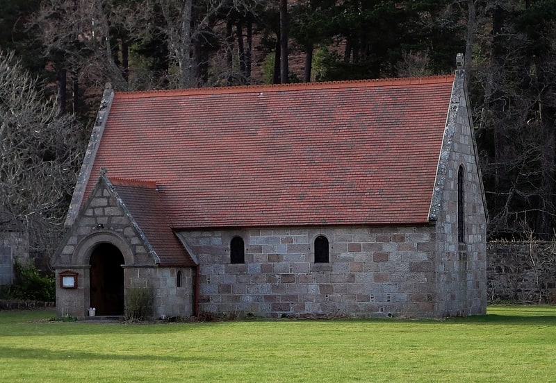
Church in Scotland. St Ninian's Chapel in Braemar, Aberdeenshire, Scotland, is a Grade B listed Anglican chapel located in the grounds of the Mar Lodge Estate. Built from 1895 to 1898 for use as a private chapel by the family of Alexander Duff, 1st Duke of Fife, owners of Mar Lodge, it has been the property of the Diocese of Aberdeen and Orkney in the Scottish Episcopal Church since 1899. St Ninian's Chapel is the most westerly church in the Diocese.[24]
Càrn a' Mhàim
Mountain in Scotland. Càrn a' Mhàim is a Scottish mountain situated in the inner part of the Cairngorms range, some 15 kilometres west of Braemar in the county of Aberdeenshire.[25]
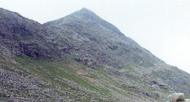
The Devil's Point
Mountain in Scotland. The Devil's Point is a mountain in the Cairngorms of Scotland, lying to the west of the Lairig Ghru pass. The Gaelic name means "Penis of the Demon". The English name is a result of a visit to the area by Queen Victoria. She asked her local ghillie, John Brown, to translate the name; to avoid embarrassment he gave a euphemistic answer.
Although The Devil's Point is strikingly distinct when seen from the south, it is a subsidiary peak of Cairn Toul, the summit of which lies some three kilometres (two miles) to the north. The easiest route is to follow the path leading up the Coire Odhar from Corrour Bothy, on the eastern side of the mountain. To reach the bothy requires a long walk in; the most usual route is to follow the Lairig Ghru from Linn of Dee, a distance of some 12 km (7+1⁄2 mi).
The Devil's Point is often climbed along with Cairn Toul. Sgòr an Lochain Uaine, which lies to the north of Cairn Toul is sometimes called The Angel's Peak, in contrast to The Devil's Point.[26]
Sgairneach Mhòr
Mountain in Scotland. Sgairneach Mhòr is a Scottish mountain which lies in a group of seven Munros near the summit of the Pass of Drumochter and are known as the Drumochter mountains or informerly as the “A9 Munros”. The mountain is situated 13 km SSW of Dalwhinnie and four km east of the large Loch Ericht.[27]
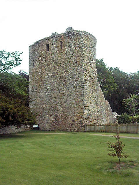
Invermark Castle
Castle in Scotland. Invermark Castle is an oblong tower house dating from the 16th century, at the east of Loch Lee, Angus, Scotland. It is near the head of Glen Esk.[28]
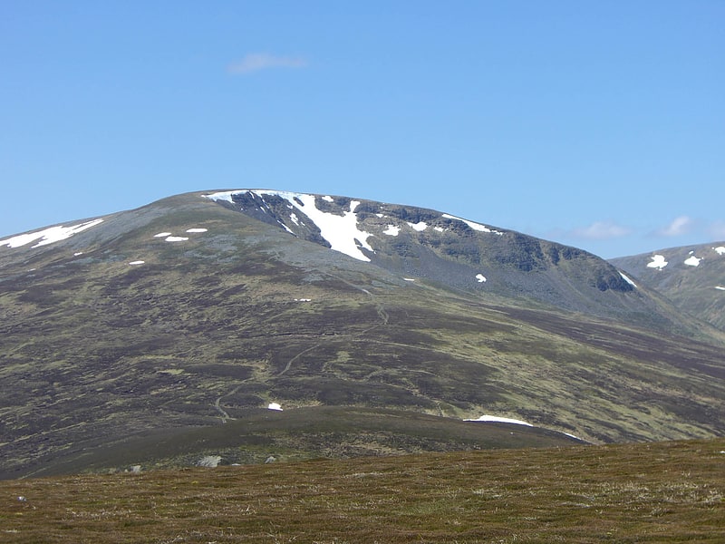
Ben Avon
Mountain in Scotland. Ben Avon is a mountain in the Cairngorm mountains of Scotland. The highest point of the massif, known as Leabaidh an Dàimh Bhuidhe is classified as both a Munro and a Marilyn.
Ben Avon is a very large and complex mountain sprawling over more than 30 km2 (12 sq mi). The summit plateau is dominated by granite tors, one of which forms the summit. From the broad summit plateau ridges lead in almost every direction, allowing access from Glen Avon to the north, from Beinn a' Bhùird to the west and from Gleann an t-Slugain in the south. To the west of the summit lies the massive corrie, Slochd Mòr, with its rocky cliffs, and the approaches from the south and west take you close to the corrie rim.
The most common ascent route is via the path in the deep glen that separates Ben Avon and Beinn a' Bhùird, or from Beinn a' Bhùird itself. The summit tor itself must be climbed in order to "bag" the mountain, though it is an easy scramble.[29]
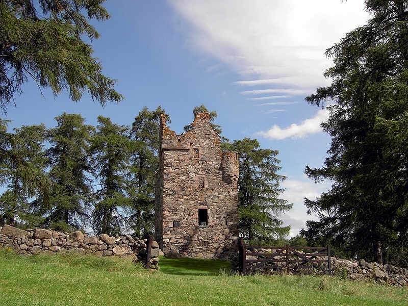
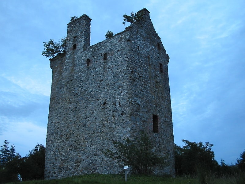
Drumin Castle
Castle in Scotland. Drumin Castle is a ruined tower house near Glenlivet, Moray, Scotland. The castle is situated on a ridge above the junction of the Livet and Avon Rivers. It is a designated scheduled monument.[30]
Address: Glenlivet Estate, AB37 9EX Tomintoul
Culardoch
Mountain in Scotland. Culardoch is a mountain in the Cairngorms of Scotland, located northeast of Braemar in Aberdeenshire.
A smooth and heathery peak southeast of the Munro Ben Avon, its summit provides wide views over Aberdeenshire.[31]
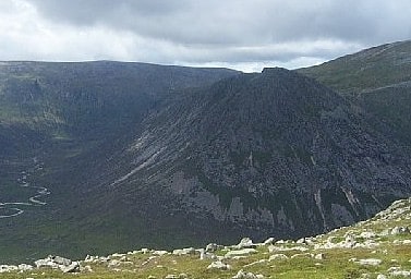
Cairn Toul
Mountain in Scotland. Cairn Toul is the fourth highest mountain in Scotland, The United Kingdom, and The British Isles, after Ben Nevis, Ben Macdui and Braeriach. The summit elevation is 1,291 metres AMSL. It is the second highest point in the western massif of the Cairngorms, linked by a bealach at about 1125 m above sea level to Braeriach.
The mountain towers above the western side pass of the Lairig Ghru.
Cairn Toul is often climbed in conjunction with other peaks. From the south, it may be combined with The Devil's Point, which lies about 2.5 kilometres south-southeast. Alternatively, it may be climbed from the north, including Braeriach and Sgor an Lochain Uaine. Both routes are long days by Scottish standards: around 15 km (plus return) regardless of whether one starts from Coire Cas above Speyside, or Linn of Dee to the south.
The mountain may also be climbed from the west, starting from Achlean in Glen Feshie. This provides for a slighter shorter route (around 27 km for the round trip), though the walker must negotiate a large expanse of undulating boggy plateau in order to reach the Breariach-Cairn Toul massif.
There is a bothy, Corrour, at the point below Cairn Toul in the defile of the Lairig Ghru.[32]
Sgòr Gaoith
Mountain in Scotland. Sgòr Gaoith is a mountain in the western massif of the Cairngorms, and is separated from the Braeriach massif by the broad valley of Glen Einich. The second-highest summit of the mountain is Sgoran Dubh Mòr, which lies 1.3 km away due NNE along the summit ridge. The eastern side of Sgòr Gaoith is girded by steep cliffs which plunge down to Loch Einich; the western side is composed of heather slopes and a number of shallow corries.
The two most commonly used routes up Sgòr Gaoith start from Glen Feshie to the west. One ascends the mountain via a track starting in the pine woods, leading up into Coire Ruadh and thence to the summit by a number of indistinct paths. The other starts further south down Glen Feshie from a car-park just before the farm of Achlean and reaches the summit via the lower peak of Carn Ban Mòr (1,052 m).[33]
Meall a' Bhuachaille
Mountain in Scotland. Meall a' Bhuachaille is a mountain in the Cairngorms in Scotland. It is situated 10 km east of Aviemore, to the north of Loch Morlich and Glenmore Forest.[34]
Beinn a' Chaorainn
Mountain in Scotland. Beinn a' Chaorainn is a Scottish mountain in the heart of the Cairngorms range. It is quite a remote hill, being located roughly 19 kilometres south east of Aviemore and 14 kilometres north west of Braemar. The mountain stands on the border of the Moray and Aberdeenshire council areas. The hill's name used to be spelt as Beinn a' Chaoruinn, but the spelling of the word caorunn was altered to caorann by the Gaelic Orthographic Convention's attempts to standardise spelling.[35]