Discover 11 hidden attractions, cool sights, and unusual things to do in Whalsay (United Kingdom). Don't miss out on these must-see attractions: Whalsay Parish Church, Huxter Fort, and Standing Stones of Yoxie. Also, be sure to include Loch of Huxter in your itinerary.
Below, you can find the list of the most amazing places you should visit in Whalsay (Scotland).
Table of Contents
Whalsay Parish Church
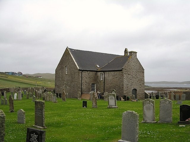
Church in Marrister, Scotland. Whalsay Parish Church or Whalsay Kirk is a Church of Scotland parish church on the island of Whalsay, Shetland Islands, Scotland. It lies to the north of the village of Brough, on the southern part of a promontory known as Kirk Ness, connected to the mainland by a neck of land. It is the main burial ground for villagers of Whalsay. It is one of three churches in the Parish of Nesting, the others being at Nesting and Lunnesting. The church is a category B Listed Building.[1]
Huxter Fort
Huxter Fort is an Iron Age fortification on the island of Whalsay, in the Shetland islands of Scotland, dating to around 300 BC. It is on an islet in the Loch of Huxter, connected to the shore by a causeway.[2]
Standing Stones of Yoxie
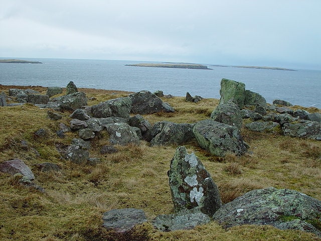
The Standing Stones of Yoxie is a Neolithic site in the parish of Nesting on the northeastern coast of Whalsay, in the Shetland islands of Scotland. It is located approximately 100 yards to the southeast of Benie Hoose, not far from the steep cliffs of Yoxie Geo. The site is also known as "Yoxie Biggins". The structure is the remains of a building in a neolithic settlement called Pettigarths Field, about 4,000 years old, which also includes a megalithic tomb and Benie Hoose. The site has been compared to that of Hal Tarxien.[3]
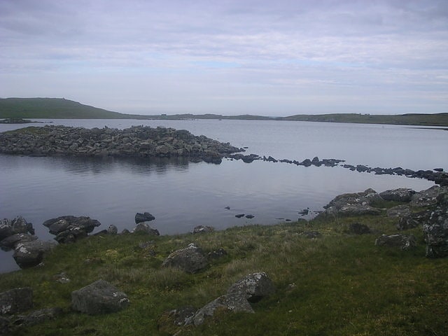
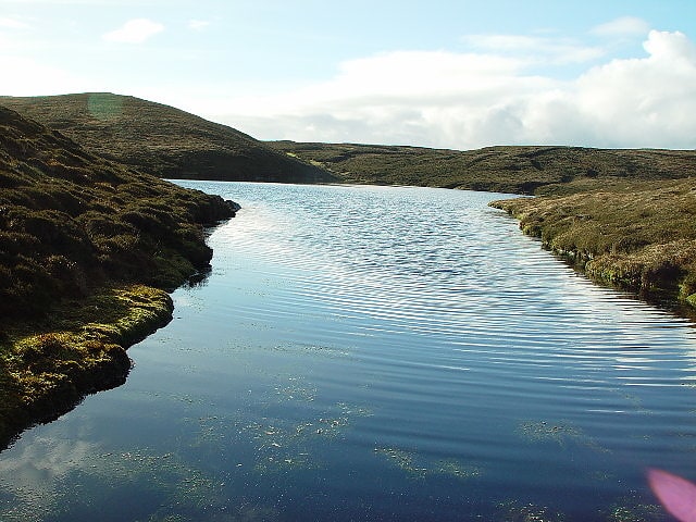
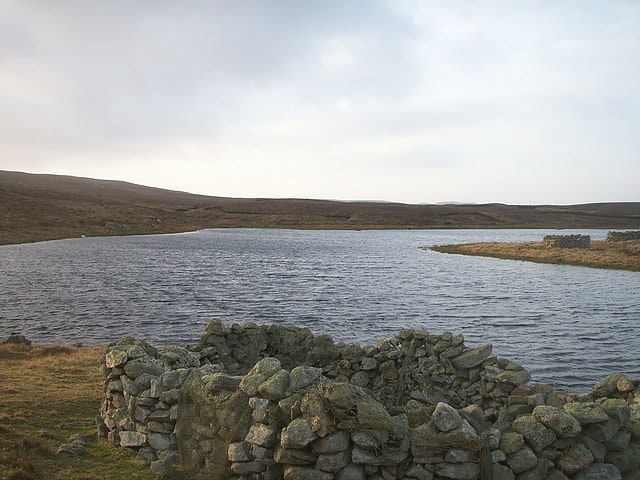
Loch of Huxter
Loch of Huxter is a loch of southeastern Whalsay, Shetland Islands, Scotland, to the southwest of the village of Huxter. There is a water pumping station on its bank. Huxter Fort is located on an islet to the southeast of the loch, connected by a causeway.[4]
Little Water
Little Water is a small loch of southern-central Whalsay, Shetland Islands, Scotland. It is located to the north of the Loch of Livister, south of the Loch of Houll, and west of the Loch of Stanefield.[5]
Loch of Houll
Loch in Scotland. Loch of Houll is a loch on Whalsay, one of the Shetland islands of Scotland. It is located to the southeast of Brough and on the eastern side of Setter Hill. An eastern tributary of the Scarfmoor Burn passes into the western side of the loch. It is described as a "large shallow loch with brown trout averaging 8-10 oz and some over 2 lbs." On the western side of the loch is Peerie Roonie House, a ruined stone house, which still has traces of the inner face of a drystone wall and drain. Archaeologists excavating at the site discovered stone tools dated to the Neolithic period and peat ash.[6]
Loch of Livister
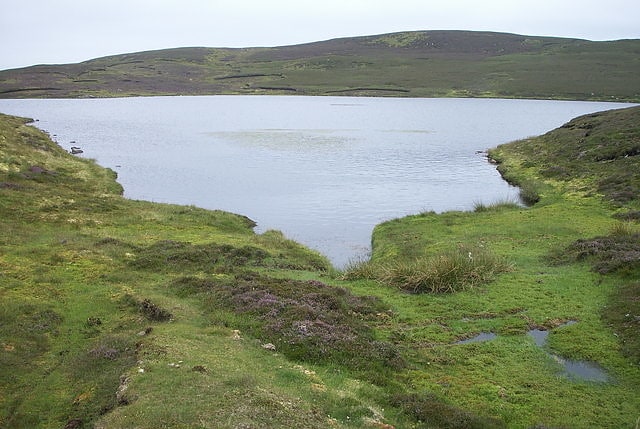
Loch of Livister is a loch of southern-central Whalsay, Shetland Islands, Scotland, located to the north of the Loch of Huxter. Though the Loch of Livister is a much smaller loch than the Loch of Huxter, it has richer biodiversity, with Notonectidae, Coleoptera kotifera, and others.[7]
Loch of Isbister
Loch in Scotland. Loch of Isbister is a loch of Whalsay, Shetland Islands, Scotland, located on the northern side of Isbister on the eastern side of the island.[8]
Symbister House
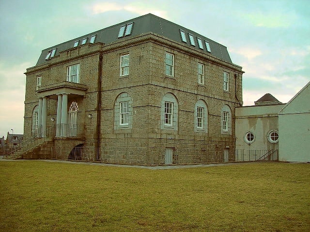
Building. Symbister House is a former country house in Symbister, Whalsay island, in the Shetland islands of Scotland. It was built in 1823 by the Bruce family who were lairds of the island for about 300 years from the 16th century. Since 1964 it has been the Whalsay Secondary School, after it fell into disuse following the death of the last of the landlord occupants of the house in 1944. Built in an elegant Georgian architectural style, it is categorized officially as a category B Listed Building and heritage structure.[9]
West Loch of Skaw
West Loch of Skaw is a loch of northern-central Whalsay, Shetland Islands, Scotland, to the southwest of the village of Skaw, Whalsay.[10]
Nuckro Water
Nuckro Water is a loch of southeastern Whalsay, Shetland Islands, Scotland. It is located to the east of the Loch of Stanefield, northwest of Treawick and southwest of Isbister, passes by the main road on its eastern side. Also known as Nuckra, Nyker, or Nyuggle, the name comes from the water spirit said to haunt lonely places. There is a disused quarry just to the northeast and the remains of a prehistoric house nearby. On the southeastern side, across the road near the source of Falsa Burn is an unroofed building, which was probably used as a mill; it was shown on the 1st OS map of Orkney and Shetland in 1882. In the southeastern corner of the loch there are stepping stones across the water.[11]