Discover 5 hidden attractions, cool sights, and unusual things to do in Tremadog (United Kingdom). Don't miss out on these must-see attractions: Moel y Gest, Peniel Chapel, and St Cynhaearn's Church. Also, be sure to include St Beuno's Church in your itinerary.
Below, you can find the list of the most amazing places you should visit in Tremadog (Wales).
Table of Contents
Moel y Gest
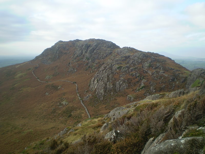
Hill in Wales. Moel y Gest is a 263 m hill to the west of Porthmadog in North Wales. It is a very rocky hill with high topographic prominence because of the lower land that surrounds it on all sides, and qualifies as a Marilyn. The views from the top are far ranging and include the Llŷn Peninsula, the Rhinogydd, Moelwynion, Moel Hebog, and Snowdon.[1]
Peniel Chapel
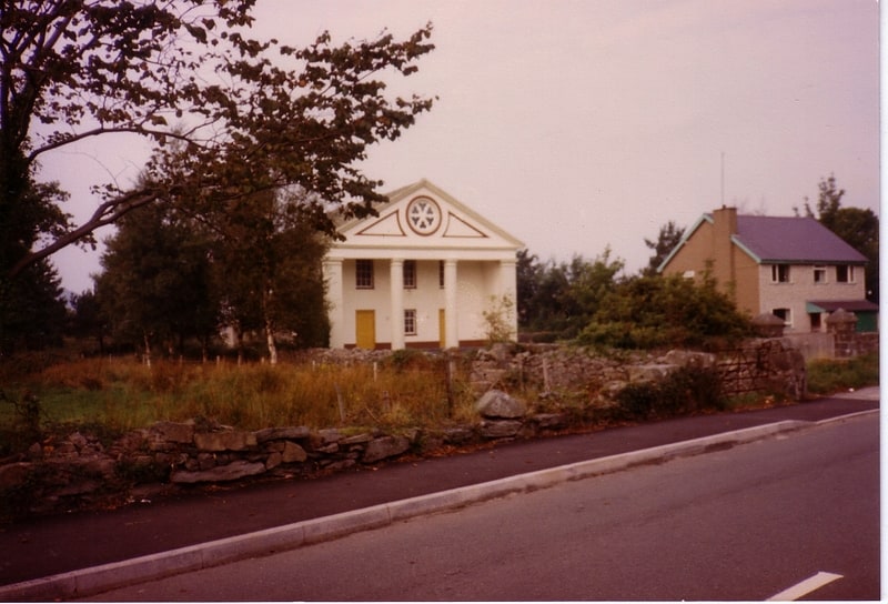
Chapel in Tremadog, Wales. Peniel Chapel is a former Calvinistic Methodist chapel in Tremadog, Gwynedd. It is one of five Grade I-listed nonconformist chapels in Wales. It is in a neoclassical style inspired by mid-17th century St Paul's Church in Covent Garden, London. Its interior theater auditorium concept influenced Welsh church architecture from the nineteenth century.[2]
St Cynhaearn's Church
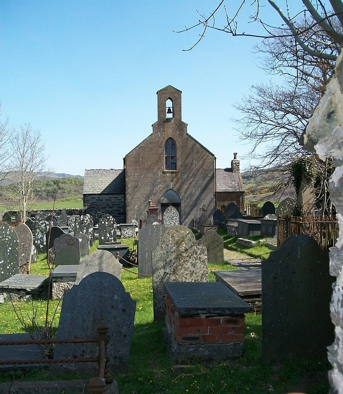
Church in Wales. St Cynhaearn's Church is a redundant church standing in an isolated position on Ynyscynhaearna, a former island in Llyn Ystumllyn, 900 metres south of the village of Pentrefelin, near Criccieth in Gwynedd, Wales. It is designated by Cadw as a Grade II* listed building. The church is approached from the village by an ancient causeway, and is in the care of the Friends of Friendless Churches.[3]
St Beuno's Church
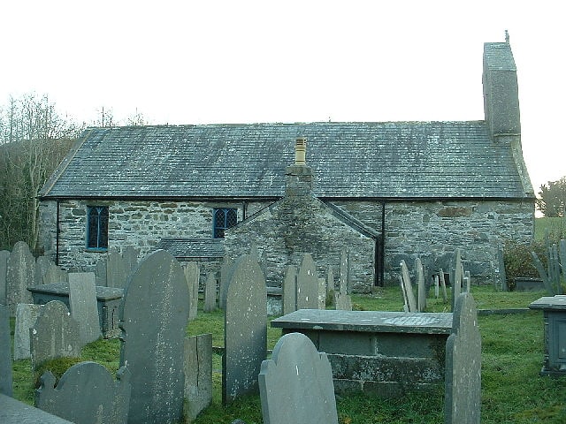
Church in Dolbenmaen, Wales. St Beuno's Church, Penmorfa, is a redundant church near the settlement of Penmorfa, some 2 miles to the northwest of Porthmadog, Gwynedd, Wales. It is designated by Cadw as a Grade II* listed building, and is under the care of the Friends of Friendless Churches.[4]
Traeth Mawr
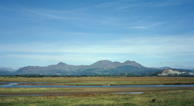
Traeth Mawr is a polder near Porthmadog in Gwynedd in Wales. The area was formerly the large tidal estuary of the Afon Glaslyn. It was created after large-scale land reclamation occurred in the late 18th century and the early 19th century. A large embankment, called the Cob, separates the area from the sea and carries a road and railway line.[5]