Discover 6 hidden attractions, cool sights, and unusual things to do in Sligachan (United Kingdom). Don't miss out on these must-see attractions: Sgùrr nan Gillean, Am Basteir, and Beinn Dearg Mhor. Also, be sure to include Belig in your itinerary.
Below, you can find the list of the most amazing places you should visit in Sligachan (Scotland).
Table of Contents
Sgùrr nan Gillean
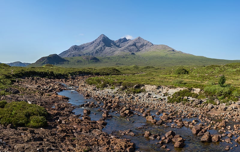
Mountain with hiking and climbing routes. Sgùrr nan Gillean is a mountain in the northern section of the Cuillin range on the Isle of Skye in Scotland. With a height of 966.1 metres, it is one of eleven Munros in the Cuillin ridge. It is the Munro closest to Sligachan, and its impressive triangular profile is visible behind the Sligachan hotel, making it perhaps the most recognised peak in the Cuillin range.[1]
Am Basteir
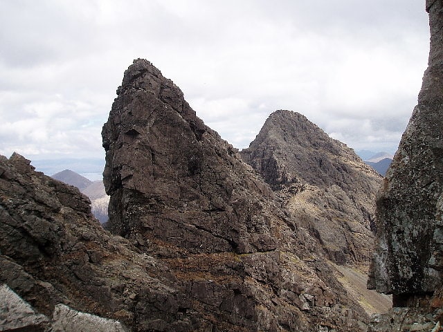
Mountain in Scotland. Am Basteir is a mountain in the northern Cuillin range on the Isle of Skye in Scotland. It is 934 metres high and classed as a Munro. It forms a narrow blade of rock, which bears comparison with the Inaccessible Pinnacle.
The easiest route to the summit starts from Sligachan following a path along the left bank of the Allt Dearg Beag (small red burn) for 5 kilometres (3 miles) to a small lochan in the Coire a' Bhasteir, then up a gruelling scree slope to the bealach on the main ridge between Sgurr nan Gillean and Am Basteir. A scramble of approximately 200 m (660 ft) along the east ridge will bring you to the summit although care should be taken near the top as there is a "bad step", a 3-metre-high (10-foot) notch in the ridge to negotiate. This could be scrambled down until recently but a rockfall now means it must be avoided, downclimbed or abseiled. The bad step is most easily avoided via an elusive moderate scrambling route on the south face but can be reascended (i.e. on descent from the summit) without difficulty. The western end of Am Basteir is vertical, though it is possible for a walker coming from the direction of Bruach na Frìthe to reach the top by skirting below Am Basteir to reach the bealach mentioned above.
At the foot of the western side there is large prominent pinnacle, similar in shape to Am Basteir itself, known as the Basteir Tooth.[2]
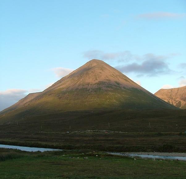
Beinn Dearg Mhor
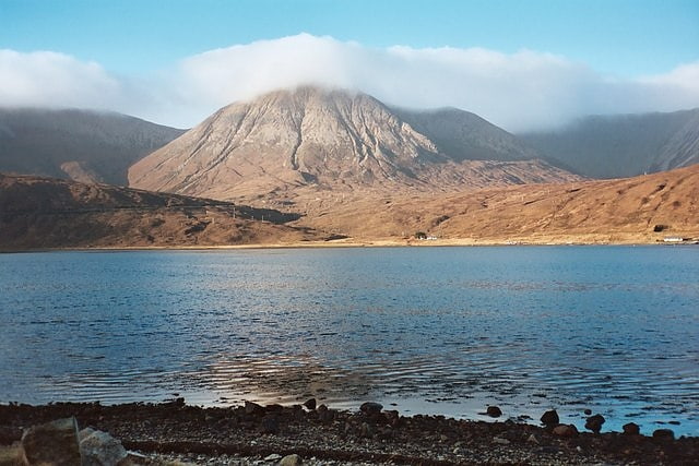
Mountain in Scotland. Beinn Dearg Mhor, is a mountain in the Red Cuillin mountains of the Isle of Skye. It is located between Loch Ainort and the settlement of Sligachan.
Beinn Dearg Mhor is the middle summit of the three big Red Hills near Sligachan, along with Marsco and Glamaig, the latter of which it is usually climbed in conjunction with. A fine, conical peak, its slopes are steep and covered in scree.[3]
Belig
Belig, is a mountain in the Cuillin mountains of the Isle of Skye. It is located in the centre of the island, northeast of the main Black Cuillin range.
A fine and sharp peak, Belig's summit is the culmination of three ridges. It is often climbed in conjunction with its neighbour Garbh-bheinn. The nearest village is Dunan to the east.[4]
Glamaig
Summit in Scotland. Glamaig is the northernmost of the Red Hills on the Isle of Skye in Scotland. It lies immediately east of Sligachan. It is one of only two Corbetts on Skye.
From many angles the hill resembles a perfect cone of scree, though it is linked to the rest of the Red Hills by way of a bealach, the Bealach na Sgairde (pronounced b'ya-loch na skaar-st'ya), meaning the pass of scree.
In 1889, a Gurkha named Harkabir Tharpa scaled Glamaig in 37 minutes; his total time for the round trip, starting and finishing at sea level in the bar of the Sligachan Inn was 55 minutes. Legend has it that he ran it in bare feet, and his record stood until the 1980s, despite being attempted by Olympians such as Chris Brasher in the 1950s.
From Sligachan one route of ascent (whether running or hillwalking) is simply to head up the scree aiming for the summit - this climb is very arduous, due to the unrelenting gradient and the slipperiness of the scree. Descent may be made by way of ascent; alternatively one may continue along the Red Cuillin ridge to take in other peaks to the south.
A slightly less arduous (but longer) climb approaches the mountain from its eastern end at Sconser. Climb first to the secondary summit, An Coileach (The Cockerel), then follow the whaleback ridge to the primary summit, Sgurr Mhairi (Mary's Peak). Once An Coileach is reached at 673 metres (2,208 ft), the more-or-less level ridge allows some respite from the gradient, with a gentler ascent of the final 102 metres (335 ft) to Sgurr Mhairi.
From the summit there are excellent views of both the Black Cuillin and the Isle of Raasay.[5]
Eas a' Bhradain
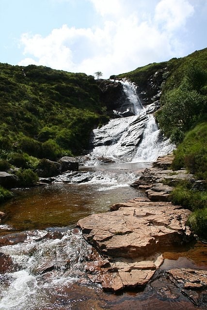
Waterfall in Scotland. Eas a' Bhradain is a waterfall of Scotland.
It is located between Marsco and Loch Ainort on the Allt Coire nam Bruadaran of the island of Skye at grid reference NG531262[6]