Discover 11 hidden attractions, cool sights, and unusual things to do in Mull (United Kingdom). Don't miss out on these must-see attractions: Torosay Castle, Ben More, and Rubha nan Gall. Also, be sure to include Glengorm Castle in your itinerary.
Below, you can find the list of the most amazing places you should visit in Mull (Scotland).
Table of Contents
Torosay Castle
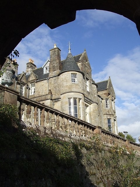
Castle in Scotland. Torosay Castle is a large house situated 1+1⁄2 miles south of Craignure on the Isle of Mull, in the Scottish Inner Hebrides.[1]
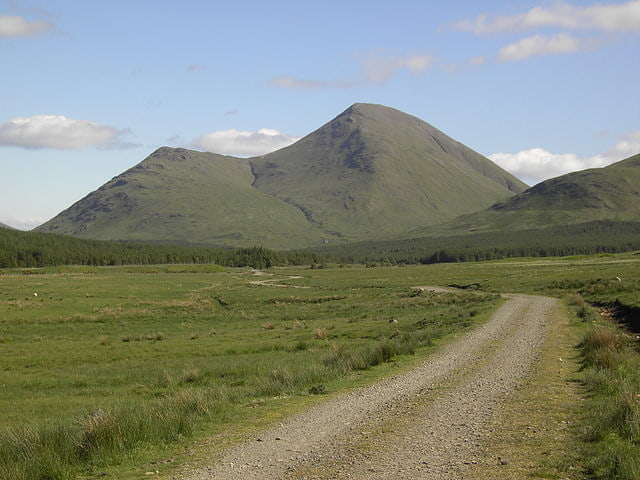
Ben More
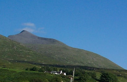
Well-known peak with hiking trails. Ben More is the highest mountain and only Munro on the Isle of Mull, Scotland. It is also the highest peak in the Scottish isles – and the only Munro – apart from those on the Isle of Skye. The mountain is situated close to the centre of the island, above the shores of Loch na Keal.[2]
Rubha nan Gall
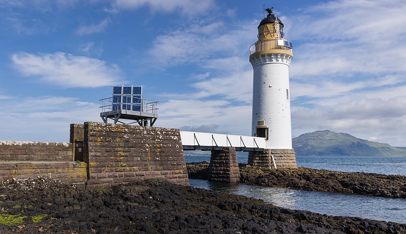
Lighthouse. Rubha nan Gall lighthouse is located north of Tobermory on the Isle of Mull beside the Sound of Mull. The name means "Stranger's Point" in Scottish Gaelic. It was built in 1857 by David and Thomas Stevenson and is operated by the Northern Lighthouse Board. The lighthouse was automated in 1960 and the nearby former keepers' cottages are privately owned.
In August 2013, the former keepers' cottages were sold and after extensive renovation work, one is a private home and the other is a self-catering cottage. Access is by sea or a 1.3-mile (2.1-kilometre) footpath from Tobermory along the steep wooded coastline. The cottages have no mains electricity or water; instead a private spring supplies water, while an off-grid solar system provides power.[3]
Glengorm Castle
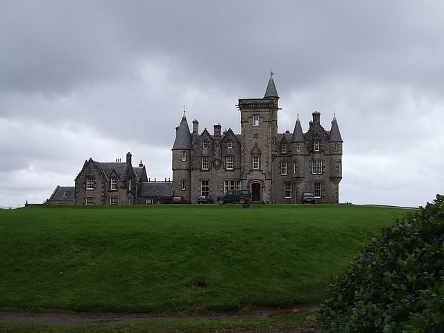
Housing. Glengorm Castle, also known as Castle Sorn, is a 19th-century country house on the Isle of Mull, Scotland. Located in Mishnish, 6 kilometres northwest of Tobermory at the end of a dead end road, the house is protected as a Category B listed building.
The Mishnish estate was purchased in 1856 by James Forsyth of Quinish. He cleared the existing township of Sorne to make way for the new house, which was completed in 1860. The house was designed by Kinnear and Peddie in a Scots Baronial style. It is now operated as a guest house and wedding venue, with a café and shop in the former stables. The castle overlooks the Atlantic Ocean. On a clear day the Outer Hebrides and islands of Rùm and Canna can be viewed from the castle, as well as Coll on most days. It is currently managed by the Nelson family who operate the property as bed and breakfast accommodation.[4]
Address: Glengorm Castle, Mull
Beinn Talaidh
Peak in Scotland. Beinn Talaidh is a peak on the Isle of Mull, Scotland, located in the mountainous centre of the Island.
The mountain is shaped like a symmetrical cone and can be climbed from the steep facing south side, or more gentle northern side along Glen Forsa. Beinn Talaidh was for many years classed as a Corbett before a resurvey found it to be slightly lower than expected, and it was thus demoted to Graham status; however it is the highest of the 219 Grahams in Scotland.[5]
Dùn da Ghaoithe
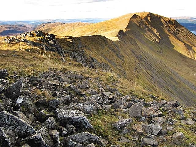
Mountain in Scotland. Dùn da Ghaoithe is the second highest mountain on the Isle of Mull, western Scotland, and the island's only Corbett. It reaches 766 metres high, but "its long ridge and deep corries make it seem far higher". It boasts sea views "in almost every direction", and is the main mountain seen by visitors to the island on leaving the Caledonian MacBrayne ferry from Oban at Craignure.[6]
Lochdon Free Church
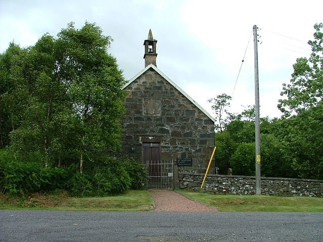
The Lochdon Free Church is a place of worship of the Free Church of Scotland in Lochdon on the Isle of Mull, Scotland. The church was built in 1852.[7]
Loch Bà
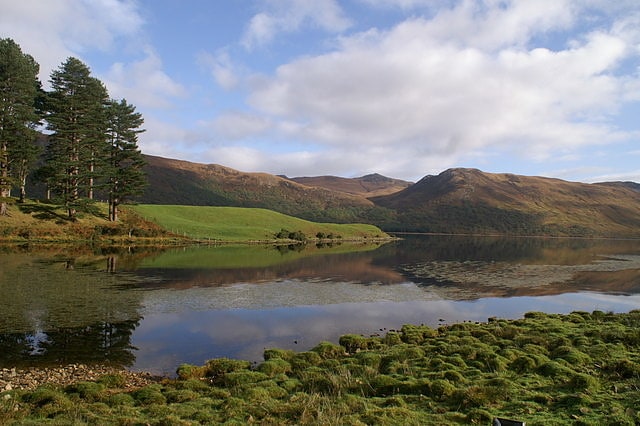
Loch. Loch Bà is a freshwater loch, about 5 km long, in the centre of the Isle of Mull, in Scotland. It is drained by the River Bà, flowing into Loch na Keal, a sea loch on the west of Mull.[8]
Carsaig Arches
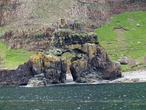
Nature preserve in Isle of Mull, Scotland. Carsaig Arches are natural arch cliff formations on the Ross of Mull in the south of the Isle of Mull, on the west coast of Scotland. They are situated below Malcolm's Point, at the base of the Rudha Fhaoilean cliffs. To the east are Carsaig Bay, and Eas na Dabhaich.
The coastal cliff formations are the result of the erosion of oolitic rock beds located to the west of the entrance to Loch Bay. Reached via a road from the Carsaig Pier, the track is strewn with volcanic rocks and boulders and involves about 4 miles of walking to reach it.
The first arch is visible at the end of the trek while descending from the ridge and looks as if it is opening into the sea and the second one is hidden. The openings created by wave action have been likened to cave entrances that "lead to another planet." They are most easily approached during low tides. Of the two arches seen below the cliff, one has been described as being like a railway tunnel "deep and dark" and the other rises high and overlain by debris which is conjectured as being of an earlier collapsed arch. One of the formations is a pyramidal mass of rock, perforated through the middle by an unusually shaped arch (called the "keyhole"), and surmounted by the solitary shaft of a basaltic pillar. Another arch ("tunnel") is massive, with columnar basalts appearing to hang from the top.) It is 20 metres (66 ft) in height over a length of 43 metres (141 ft) with a width of 20 metres (66 ft). Wild goats, golden eagles, breeding fulmars, and kittiwakes frequent the area.[9]
Address: Isle of Mull, Mull
Ross of Mull
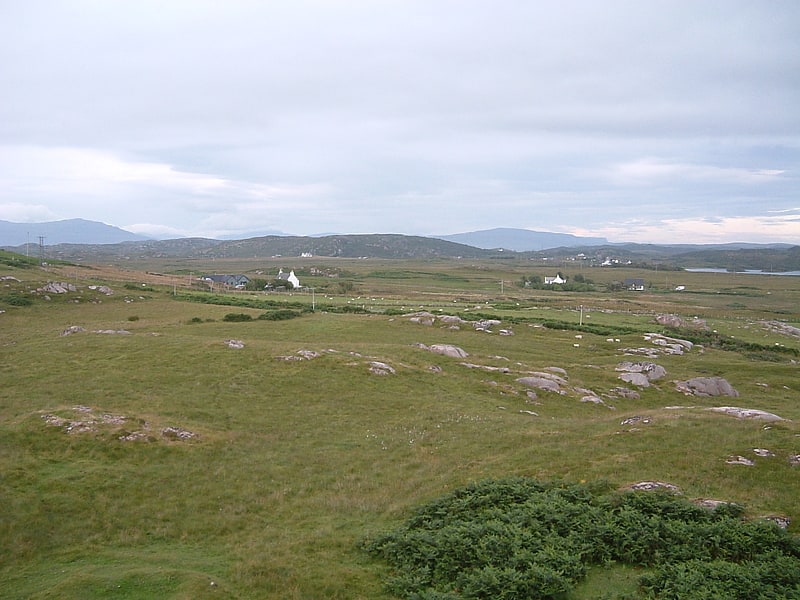
The Ross of Mull is the largest peninsula of the Isle of Mull, about 28 kilometres long, and makes up the south-western part of the island. It is bounded to the north by Loch Scridain and to the south by the Firth of Lorne. The main villages are Bunessan and Fionnphort, with smaller settlements including Ardtun, Camas, Carsaig, Knockan, Pennyghael and Uisken. Knocknafenaig, Suidhe, and Shiaba are three of the many cleared settlements on the Ross.
Historically the area's main industries consisted of crofting, fishing, kelp, and granite quarries. By 2011 this had shifted with tourism becoming the greatest employer accounting for 29% of employment, while between them farming and fishing made up 15%.
The 1886 novel Kidnapped by Robert Louis Stevenson is partially set on the island of Erraid, a tidal island to the south west of the Ross of Mull.
The 1945 film I Know Where I'm Going!, directed by Michael Powell and Emeric Pressburger, was principally shot on Mull, using Carsaig as a headquarters, and references the fictional "Isle of Kiloran", which was based on Colonsay. Other scenes were shot at Duart Castle and Calgary. Also shot there was The Silent Storm, starring Damian Lewis and Andrea Riseborough.[10]
Shiaba
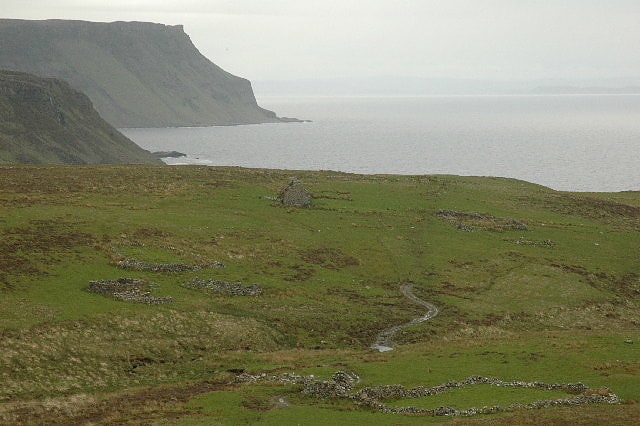
Shiaba is a ruined township located on the southwestern peninsula of the Isle of Mull, Scotland. It lies about 8 km to the east of the village of Bunessan, beyond Loch Assapol and Scoor House. It was awarded the status of Scheduled monument in 1993 due to its significance as a source of information about 18th and 19th century rural life in Scotland.[11]