Discover 4 hidden attractions, cool sights, and unusual things to do in Manning Provincial Park (Canada). Don't miss out on these must-see attractions: Lightning Lake, Frosty Mountain, and Hozameen Range. Also, be sure to include Allison Pass in your itinerary.
Below, you can find the list of the most amazing places you should visit in Manning Provincial Park (British Columbia).
Table of Contents
Lightning Lake
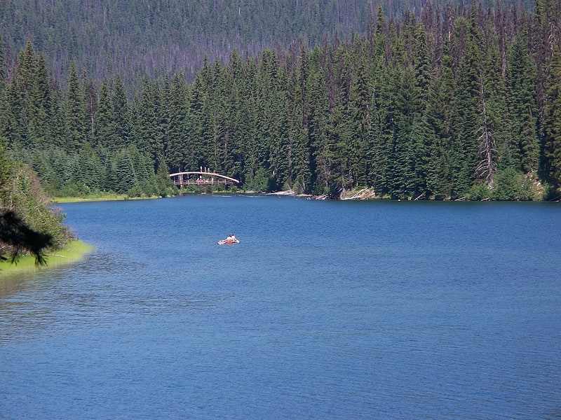
Lake in British Columbia, Canada. Lightning Lake is a lake located in E. C. Manning Provincial Park, British Columbia, Canada. The lake is freshwater and is located within the Similkameen-Okanagan forest district. The lake is unusual as it drains in two directions, into Flash Lake in the south and the Similkameen River to the north. The current lake is not a naturally occurring lake, as at the north end, near the day-use area, there is an earthen dam. The lake is very shallow and near the end of the summer season, the narrows under the Rainbow Bridge are either very shallow or dry.[1]
Frosty Mountain
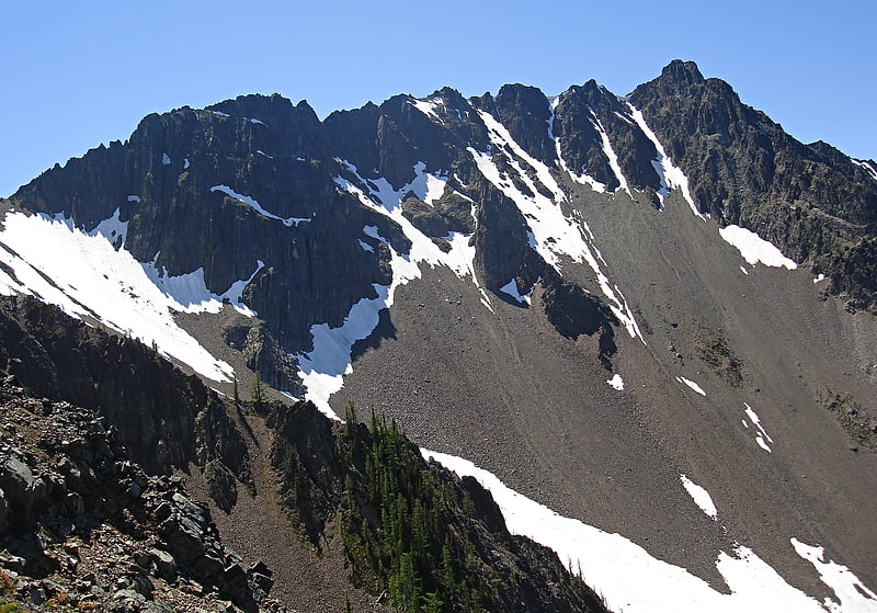
Frosty Mountain is a 2,426-metre mountain summit located in the Canadian Cascades of southwestern British Columbia, Canada. It is situated 4 km south of Lightning Lake, 1.3 km north of the Canada–United States border, and 3.6 km north-northeast of Castle Peak, which is its nearest higher peak. Frosty Mountain is the highest peak in E. C. Manning Provincial Park, and is part of the Hozameen Range which is a subrange of the Cascade Range. It has a lower elevation subsidiary peak known as Frosty Mountain East which is labelled as Frosty Mountain on some maps. The Frosty Mountain name was officially adopted on March 31, 1924, by the Geographical Names Board of Canada. The peak was first climbed on September 2, 1904, by Sledge Tatum and George Loudon Jr. two members of a Boundary Survey group led by Edward C. Barnard. Precipitation runoff from the peak drains into headwaters of Frosty Creek, as well as other tributaries of the Similkameen River.[2]
Hozameen Range
Mountain range in British Columbia, Canada. The Hozameen Range is a mountain range in southwestern British Columbia and northern Washington, straddling the division between the Coast and Interior regions of that province. It is a subrange of the North Cascades and is neighboured on the east by the Okanagan Range and on the northwest by the unofficially-named Coquihalla Range, which lies between that river and the Fraser. In the northwest part of the range is the one named subrange, the Bedded Range.
There are differences of opinion about the location and boundaries of the subranges of the northern Cascades, although early geologists and topographers had a fundamental agreement on the topic. The Hozomeen Range was seen as bounded by the Skagit River on the west and extending east to the Pasayten River (east of the Sumallo River) and Coquihalla River. The core of the Hozomeen Range under this definition marks the divide between streams in British Columbia that flow west to the Fraser River and those that flow via longer routes via the Nicola River, Thompson River, and Similkameen River tributaries into the Fraser or Okanagan River. This early nomenclature defined the Hozomeen Range as extending south of the US border and including the peaks of the Hozomeen Mountain area.
BCGNIS defines the range as extending south from the Coquihalla River and west of the Tulameen River and Pasayten River, and bounded to the west by the Skagit Range.
Peakbagger.com defines the Hozameen Range as bounded on the west by the Skagit River, the Coquihalla River to the northwest, the Tulameen River to the northeast, and the Similkameen River to the east.[3]
Allison Pass
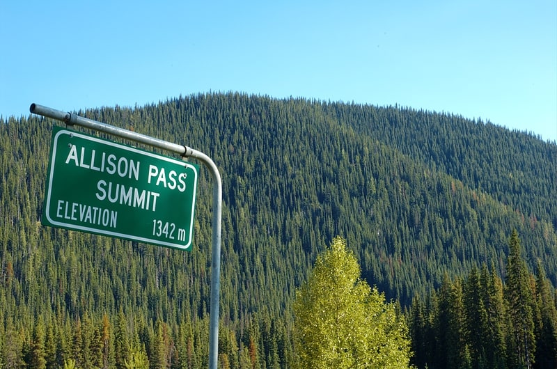
Pass in British Columbia, Canada. Allison Pass is a highway summit along the Crowsnest Highway in British Columbia, Canada. It is the highest point on the highway between the cities of Hope and Princeton. It is located in the middle of Manning Park, at the divide between the Skagit & Similkameen River drainages, as well as on the boundary between the Fraser Valley and Okanagan-Similkameen Regional Districts, approximately 12 km west of the Manning Resort and 54 km from Hope. The Skagit originates at the pass while the Similkameen originates just north of it.
Cyclists and motorists alike find this stretch of road difficult because of the steep grades and high altitudes. On the way from Hope to Allison Pass, one must ascend the 7% (1 in 14) grades up to the Hope Slide before one can start up to Allison Pass, leaving many trucks waiting at the side of the road for their engines to cool down.[4]