Discover 11 hidden attractions, cool sights, and unusual things to do in Lincolnshire Gate (United Kingdom). Don't miss out on these must-see attractions: St Helen's Church, St John the Baptist's Church, and Wolds Top. Also, be sure to include St Michael's Church in your itinerary.
Below, you can find the list of the most amazing places you should visit in Lincolnshire Gate (England).
Table of Contents
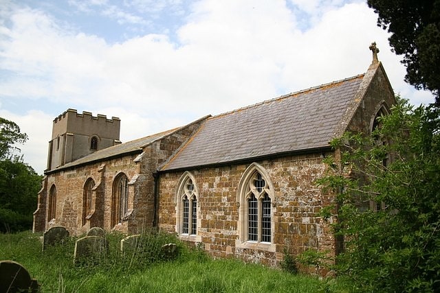
St Helen's Church
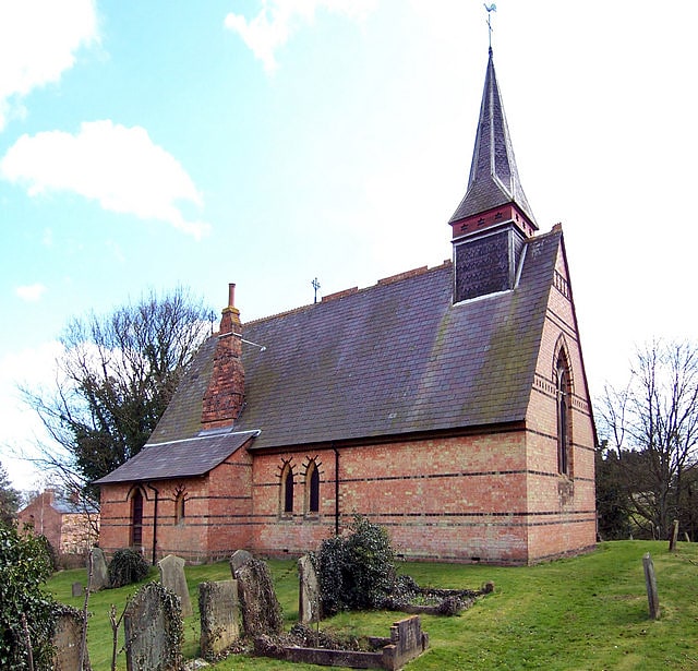
Building. St Helen's Church is a redundant Anglican church in the village of Little Cawthorpe, Lincolnshire, England. It is recorded in the National Heritage List for England as a designated Grade II listed building, and is under the care of the Churches Conservation Trust. Little Cawthorpe is about 1 mile southwest of the village of Legbourne, and 3 miles southeast of Louth.[1]
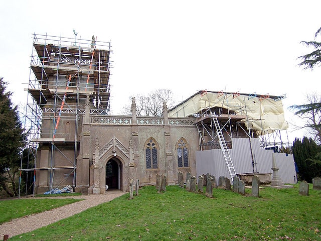
St John the Baptist's Church
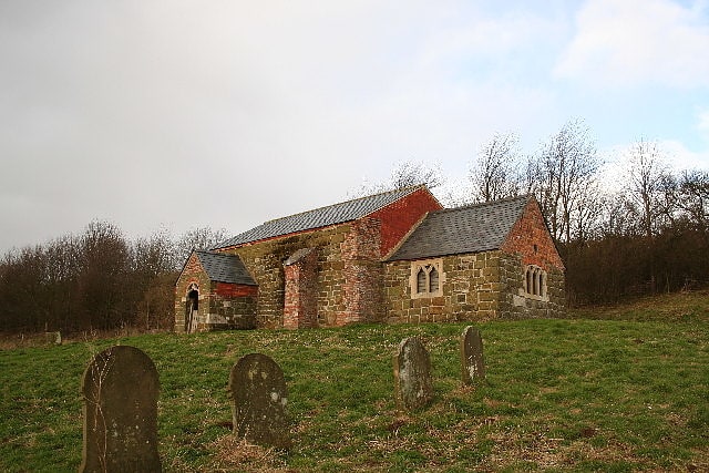
Building in the United Kingdom. St John the Baptist's Church is a redundant Anglican church in the village of Sutterby, Lincolnshire, England. It is recorded in the National Heritage List for England as a designated Grade II listed building, and is under the care of the Friends of Friendless Churches.[2]
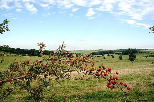
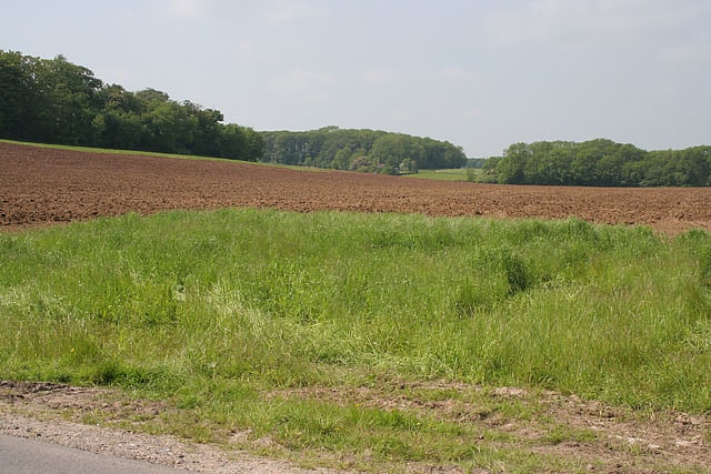
Wolds Top
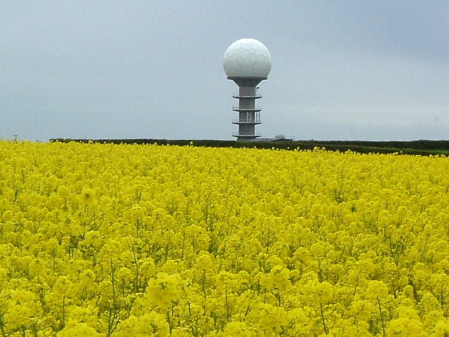
Summit in England. Wolds Top, also known as Normanby Hill, is the highest point of the Lincolnshire Wolds. The summit elevation is 168 m. It lies some distance to the north of the village of Normanby le Wold in Lincolnshire. The Viking Way passes close by, on a minor road, and there is a radio mast near the summit. The summit is marked with an Ordnance Survey triangulation station, which was erected in 1936, and is now used as part of the Ordnance Survey National GPS System.
Wolds Top is within the Lincolnshire Wolds Area of Outstanding Natural Beauty.[3]
St Michael's Church
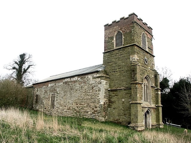
Church in Burwell, England. St Michael's Church is a redundant Anglican church in the village of Burwell, Lincolnshire, England. It is recorded in the National Heritage List for England as a designated Grade I listed building, and is under the care of the Churches Conservation Trust. It stands on a hillside by the A16 road as it passes through the village.[4]
Lincolnshire Wolds
The Lincolnshire Wolds are a range of low hills in the county of Lincolnshire, England which run roughly parallel with the North Sea coast, from the Humber Estuary in the north-west to the edge of the Lincolnshire Fens in the south-east. They are a designated Area of Outstanding Natural Beauty, and the highest area of land in eastern England between Yorkshire and Kent.[5]
East Wykeham
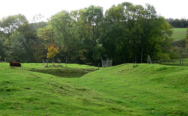
Village. East Wykeham is a deserted medieval village or DMV, seen as earthworks, in the East Lindsey district of Lincolnshire, England. The earthworks are situated about 7 miles north-west of the town of Louth, and 9 miles east of the town of Market Rasen.
East Wykeham is also mentioned in 1316, and formed a single parish with West Wykeham. It became part of Ludford in 1396, and only one family survived in 1563. By 1603-04 the church was in ruins.
Wykeham Hall survived the abandonment of the village, and still stands. The drive passes through the site of East Wykeham. The ruined church, possibly re-built as a folly around 1800, now contains monuments to the Child family of Wykeham Hall.[6]
Biscathorpe
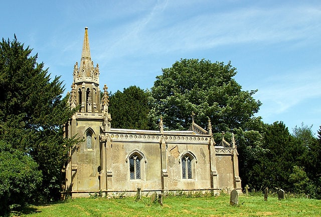
Village in England. Biscathorpe is an ecclesiastical parish and site of Biscathorpe medieval village. It lies in the East Lindsey district of Lincolnshire, England, on the River Bain, 1 mile south-west of Gayton le Wold, 6.5 miles west of Louth, and to the south of the A157. It is a Conservation Area managed by DEFRA, and is traversed by the Viking Way.
Biscathorpe has three buildings adjacent to the site of the medieval village, Biscathorpe House, Church Cottage, converted to luxury holiday accommodation in 2013 and the Grade II* listed Anglican parish church dedicated to St Helen. The church was built in the early 1840s, rebuilt in 1850, and restored in 1913.[7]
Somersby Grange
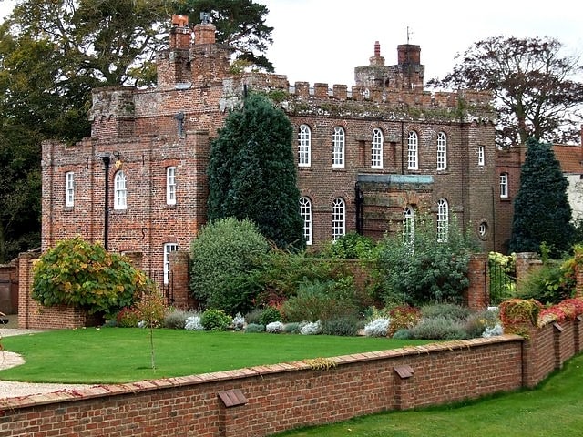
Somersby Grange is a Grade I listed Georgian country house in Somersby, Lincolnshire.
The house was built in 1722 for Robert Burton, the local lord of the manor. It is built in red brick to a rectangular plan with two storeys over a basement and has four square corner towers and a hipped slate roof behind a parapet. The parapet is embattled on the north front above the main entrance, to which a porch was later added. A two-storey extension was added to the east side to provide additional accommodation. Although in the style of Sir John Vanbrugh, the house was probably designed by Robert Alfray.
Adjacent to the house is the rectory, now called Somersby House, where Alfred Lord Tennyson was born and raised.[8]
Raithby cum Maltby
English civil parish. Raithby cum Maltby is a civil parish in the East Lindsey district of Lincolnshire, England. It is situated about 1 mile south-west from the market town of Louth The parish comprises the hamlets of Raithby and Maltby, and is situated in the Lincolnshire Wolds, an Area of Outstanding Natural Beauty.
The Grade II listed parish church at Raithby is dedicated to St Peter and dates from the late 13th century, although it was rebuilt in rendered brick in 1839 by W. A. Nicholson, paid for by Revd Henry Chaplin. It includes a late-13th-century north arcade, a 15th-century font, and some 16th-century imported glass. The chancel was restored in 1883 by C. H. Fowler.[9]
Calcethorpe with Kelstern
English civil parish. Calcethorpe with Kelstern is a civil parish in the East Lindsey district of Lincolnshire, England. It is situated west from the market town of Louth, and in the Lincolnshire Wolds, an Area of Outstanding Natural Beauty.
The parish includes the hamlets of Calcethorpe to the south of Kelstern, and Lambcroft to the north. The Kelstern with Calcethorpe parish is now incorporated into the larger grouping of the Binbrook Group of Parishes.
Calcethorpe church was dedicated to Saint Faith but had disappeared by about 1450.
Kelstern Grade II listed parish church is also dedicated to St Faith and is Early English in origin, but was restored in 1886.[10]
Acthorpe
Hamlet in England. Acthorpe is a hamlet in the East Lindsey district of Lincolnshire, England. It is situated approximately 2 miles north-west from the town of Louth, and in the Lincolnshire Wolds, a designated Area of Outstanding Natural Beauty. Acthorpe is part of the civil parish of Elkington.
Acthorpe does not appear in the Domesday Book and is considered a deserted medieval village.
Acthorpe Farm House is a Grade II listed building of red brick, dating from 1740, with 19th- and 20th-century alterations.
Acthorpe Wood is an area of semi-natural ancient woodland.[11]