Discover 20 hidden attractions, cool sights, and unusual things to do in Letcombe Valley (United Kingdom). Don't miss out on these must-see attractions: Chepstow Castle, The Kymin, and King Arthur's Cave. Also, be sure to include Upper Wye Gorge in your itinerary.
Below, you can find the list of the most amazing places you should visit in Letcombe Valley (England).
Table of Contents
Chepstow Castle
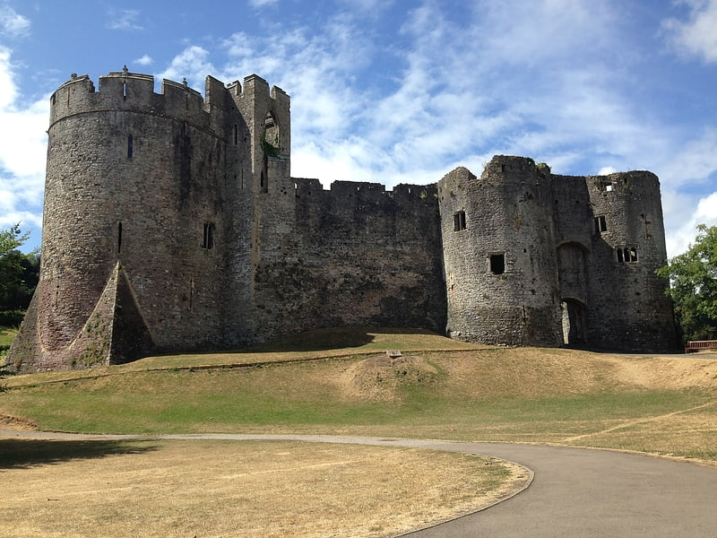
Ruins of a centuries-old fortification. Chepstow Castle at Chepstow, Monmouthshire, Wales is the oldest surviving post-Roman stone fortification in Britain. Located above cliffs on the River Wye, construction began in 1067 under the instruction of the Norman Lord William FitzOsbern. Originally known as Striguil, it was the southernmost of a chain of castles built in the Welsh Marches, and with its attached lordship took the name of the adjoining market town in about the 14th century.
In the 12th century the castle was used in the conquest of Gwent, the first independent Welsh kingdom to be conquered by the Normans. It was subsequently held by two of the most powerful Anglo-Norman magnates of medieval England, William Marshal and Richard de Clare. However, by the 16th century its military importance had waned and parts of its structure were converted into domestic ranges. Although re-garrisoned during and after the English Civil War, by the 1700s it had fallen into decay. With the later growth of tourism, the castle became a popular visitor destination.
The ruins were Grade I listed on 6 December 1950.[1]
Address: 1-48 Bridge St, NP1 6 5 Chepstow
The Kymin
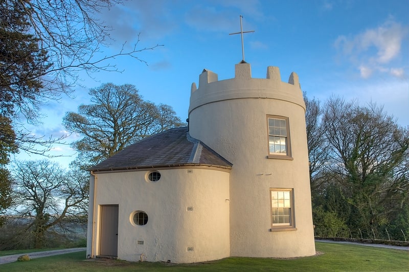
Hill in Wales. The Kymin, is a hill overlooking Monmouth, in Monmouthshire, Wales. It is located approximately one mile east of Monmouth, on the eastern side of the River Wye and adjacent to the border with the Forest of Dean and England. The summit of the hill, about 800 feet above sea level, is known for its neo-classical monuments, the Roundhouse and the Naval Temple, built between 1794 and 1800. The site is within a designated Area of Outstanding Natural Beauty and is owned by the National Trust.[2]
Address: The Round House 15 The Kymin, NP25 3SF Monmouth
King Arthur's Cave
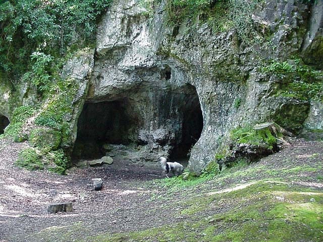
Historical landmark in Great Doward, England. King Arthur's Cave is a limestone cave at the foot of a low cliff at the north-western end of Lord's Wood in The Doward, near Symonds Yat, Herefordshire, about four miles northeast of Monmouth, in the Wye Valley. The cave entrance lies about 285 feet above the River Wye on a hill, with a double interconnected entrance and two main chambers. It is protected as a nature reserve under the Herefordshire Nature Trust. There is evidence that the cave was occupied by man during the Upper Palaeolithic era, and flint tools and woolly mammoth bones have been unearthed within and around the caves.[3]
Upper Wye Gorge
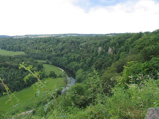
Upper Wye Gorge is a Site of Special Scientific Interest, noted for its biological and geological characteristics, around Symonds Yat in the Wye Valley on the Wales–England border. The site is listed in the 'Forest of Dean Local Plan Review' as a Key Wildlife Site.[4]
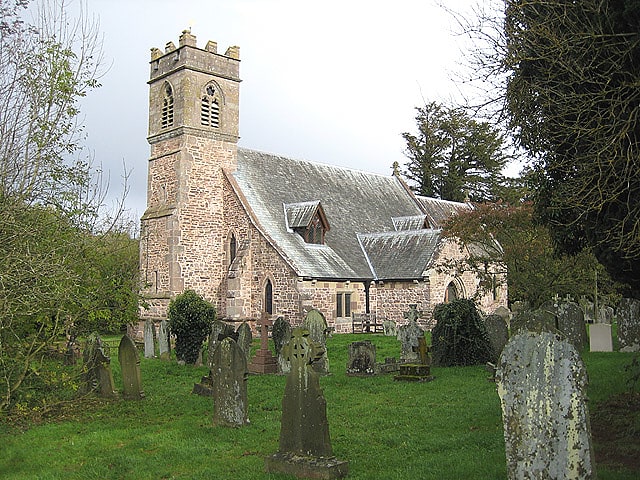
St Cuthbert's Church
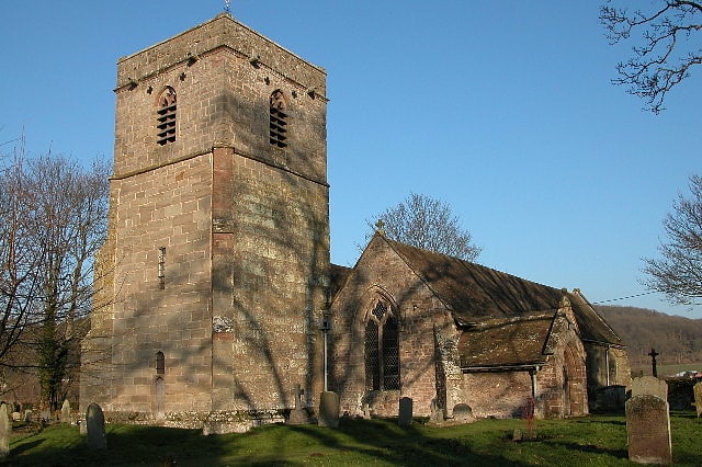
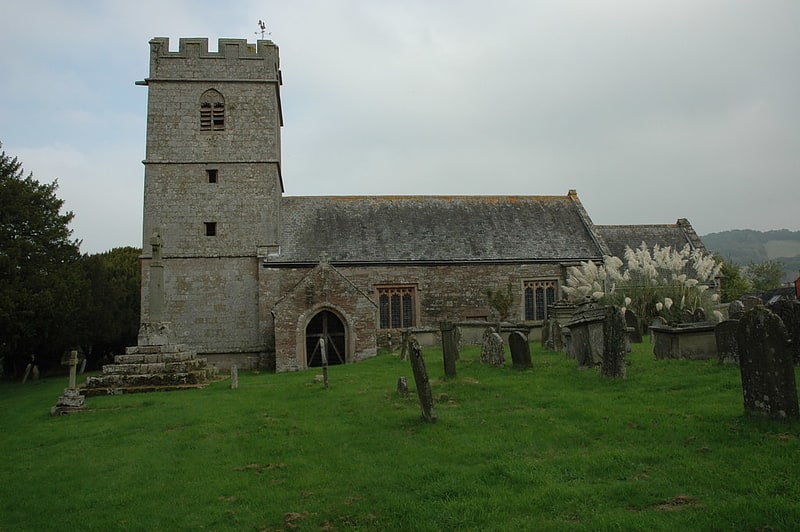
Church in England. St Cuthbert's Church is a redundant Anglican church about 1 mile to the southeast of the village of Holme Lacy, Herefordshire, England. It stands in an isolated position at the end of a lane in a bend of the River Wye. It is designated in the National Heritage List for England as a Grade I listed building, and is under the care of the Churches Conservation Trust.[5]
Bigsweir Bridge
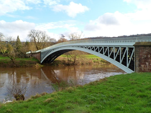
Bridge in Wales. Bigsweir Bridge is an 1827 road bridge crossing the River Wye, straddling the boundary between the parish of St. Briavels, Gloucestershire, England, and Llandogo, Monmouthshire, Wales. It carries the A466 road, and is located about 2 miles north of the village of Llandogo, 2 miles south of Whitebrook, and 3 miles west of the village of St Briavels. It is the Normal Tidal Limit of the River Wye, and navigation below this point falls under the jurisdiction of the Gloucester Harbour Trustees.[6]
Church of St Nicholas
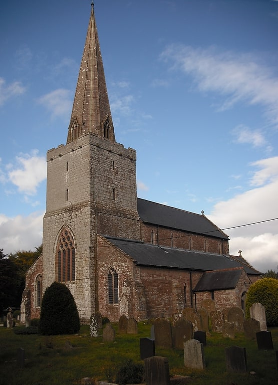
Church in Wales. The Church of St Nicholas, Trellech, Monmouthshire is a parish church with its origins in the 14th century. The historical and architectural evidence suggests that it was constructed largely in a single building period c.1300. The style is Decorated Gothic. The church was extended and repaired in the 18th century, and underwent two major reconstructions in 1893 and 1992. An "exceptionally fine and well preserved medieval church", it is a Grade I listed building. It remains an active parish church in the parish of Trellech and Penallt.[7]
Address: The Babington Centre (Trellech Village Hall), Letcombe Valley
St Catherine's Church
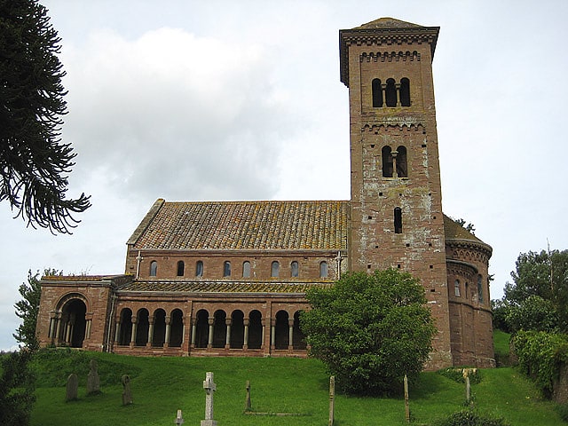
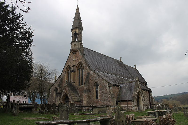
Building in Hoarwithy, Herefordshire, England. The Church of St Catherine is a Church of England parish church at Hoarwithy in the English county of Herefordshire. Brooks and Pevsner describe it as "the most impressive Victorian church in the county. Designed in an Italian Romanesque style by the architect John Pollard Seddon for the Revd William Poole, vicar of Hentland with Hoarwithy, it is a Grade I listed building.[8]
Coppet Hill
Coppet Hill or Coppett Hill is a local nature reserve in the parish of Goodrich near Ross-on-Wye in Herefordshire.[9]
Penallt Viaduct
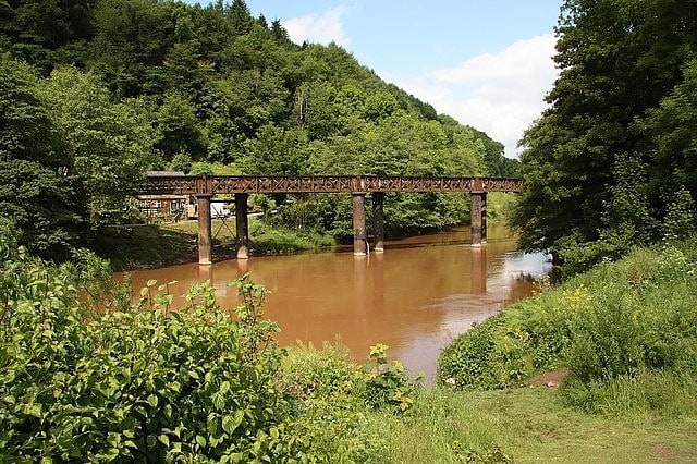
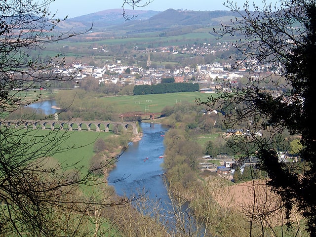
Viaduct in England. Penallt Viaduct is a viaduct that formerly carried the Wye Valley Railway over the River Wye, which at this location forms the border between England and Wales. The 14-mile Wye Valley Railway opened on 1 November 1876.
The viaduct is a single-track curved structure of five girder spans supported on four pairs of cast iron columns, located between Redbrook on Wye and Penallt Halt stations. Passenger services ceased on the railway in 1959, but the viaduct is still open to carry a public footpath over the Wye between the villages of Redbrook and Penallt.[10]
Piercefield House
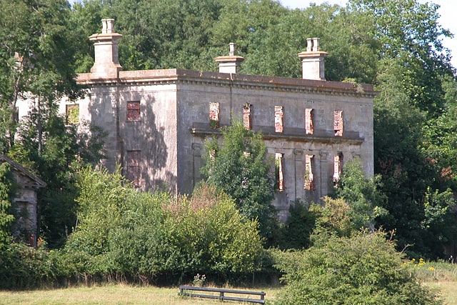
Building in Wales. Piercefield House is a largely ruined neo-classical country house near St Arvans, Monmouthshire, Wales, about 1.5 miles north of the centre of Chepstow. The central block of the house was designed in the very late 18th century, by, or to the designs of, Sir John Soane. It is flanked by two pavilions, of slightly later date, by Joseph Bonomi the Elder. The house sits within Piercefield Park, a Grade I listed historic landscape, that was created in the 18th century as a notable Picturesque estate.
The estate has links to colonialism and slavery. After long ownership by the Walter family, in 1740 it was bought by Valentine Morris, a slaver and planter from Antigua. His son, also Valentine, developed the park and grounds into one of the 18th century’s most famous Picturesque landscapes. His prodigality ruined him, and the estate was sold to a banker, George Smith, who began the present house. He was in turn bankrupted and Piercefield was bought by Sir Mark Wood, a nabob who had made his fortune in Bengal. In 1802, the estate was bought by Nathaniel Wells, son of William Wells, a slaver from Saint Kitts, and Juggy, later Joardine Wells, his enslaved house servant. Nathaniel and his mother both received their freedom and he inherited the bulk of his father’s wealth. Establishing himself at Piercefield, Nathaniel Wells became, in turn, a Justice of the Peace, a Lieutenant in the Chepstow Yeomanry, and Deputy lieutenant and High Sheriff of Monmouthshire, a notable series of firsts, or near firsts, for a black man in Georgian England.
The house is now a shell, along with its extensive stable block, but its status as a Grade II* listed building reflects its importance. It is currently owned by the Reuben brothers, London-based property developers. A campaign to save and restore the building was launched by SAVE Britain's Heritage in 2013. The house has been repeatedly marketed for sale since the early 2000s but no sale has been concluded. Despite emergency stabilising work in 2008/9, the condition of the house continues to deteriorate.[11]
Beacon Hill
Hill. Beacon Hill is the highest hill in eastern Monmouthshire, South Wales. It is located 0.6 miles due east of the village of Trellech, and 1 mile north-west of Llandogo. Its crowning point at 306m / 1006 ft above sea level is marked by an Ordnance Survey triangulation pillar. The summit, eastern slopes and uppermost western slopes are owned by Natural Resources Wales which manages the area not only for timber production but for recreation also.[12]
Church of St Oudoceus
The Church of St Oudoceus, Llandogo, Monmouthshire is a parish church built in 1859–1861. The church is dedicated to St Oudoceus, an early Bishop of Llandaff who retired to Llandogo and was reputed to have died there in about AD 700. Designed by the ecclesiastical architect John Pollard Seddon, the church has a notable painted interior. It is an active parish church and a Grade II* listed building.[13]
Church of St Catwg
Parish church. The Church of St Catwg in Cwmcarvan, Monmouthshire, Wales, is a parish church dating from the late 13th or early 14th century. It is dedicated to Saint Catwg or Cadoc, a 5th/6th-century Welsh saint. The existing building dates mainly from the 15th century, including its Tudor tower dating from 1525. The church was extensively restored by John Prichard in 1872–1879. It is an active parish church and a Grade II* listed building.[14]
Penallt Old Church
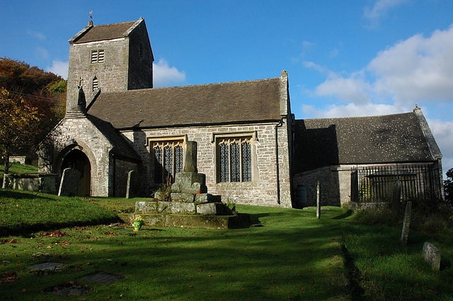
Church in Wales. Penallt Old Church is located just outside the village of Penallt, Monmouthshire, Wales. It is a Grade I listed building as of 19 November 1953.[15]
Wye Valley
The Wye Valley Area of Outstanding Natural Beauty is an internationally important protected landscape straddling the border between England and Wales.
The River Wye (Welsh: Afon Gwy) is the fifth-longest river in the United Kingdom. The upper part passes through Rhayader, Builth Wells and Hay-on-Wye, but the area designated as an AONB covers 326 square kilometres (126 sq mi) surrounding a 72-kilometre (45 mi) stretch lower down the river, from just south of Hereford to Chepstow.
This area covers parts of the counties of Gloucestershire, Herefordshire and Monmouthshire, and is recognised in particular for its limestone gorge scenery and dense native woodlands, as well as its wildlife, archaeological and industrial remains. It is also historically important as one of the birthplaces of the modern tourism industry. The area is predominantly rural, and many people make a living from tourism, agriculture or forestry. Ross-on-Wye is the only town within the AONB itself, but Hereford, Monmouth, Coleford and Chepstow lie just outside its boundaries.[16]
Highbury Wood
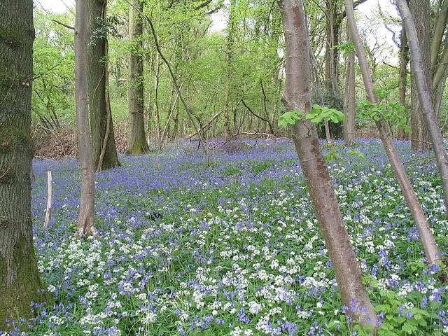
Highbury Wood is a 50.74-hectare biological Site of Special Scientific Interest in Gloucestershire, notified in 1983.
The site is listed in the 'Forest of Dean Local Plan Review' as a Key Wildlife Site (KWS).[17]
Miss Grace's Lane
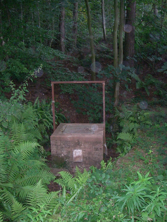
Miss Grace's Lane, near Tidenham in the Forest of Dean, Gloucestershire, England, is a natural cave system, the entrance to which was excavated between 1994 and 1997 by members of the Royal Forest of Dean Caving Club.
Entry to the cave is via a locked manhole cover, the keys to which are held by the RFDCC, which has an access agreement with the landowners, the Forestry Commission. A 30-metre (98 ft) shaft with a fixed ladder gives access to the first chamber known as "Autumn Frenzy".
The cave is approximately 4 kilometres (2.5 mi) long and is the second-longest cave in the Forest of Dean area, the longest being Slaughter Stream Cave at 13 kilometres (8.1 mi).[18]
St Michael and All Angels
Parish church in Mitchel Troy, Wales. The Church of St Michael and All Angels, is a parish church in the village of Mitchel Troy, Monmouthshire, Wales. The Grade II* listed building stands in the centre of the village, on the north side of the old road from Monmouth to Raglan, 2.5 miles south-west of Monmouth.[19]
Lower Wye Gorge SSSI
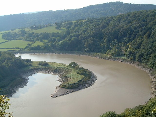
Lower Wye Gorge is a 65-hectare biological and geological Site of Special Scientific Interest in Gloucestershire, notified in 1954 and renotified 1987. The site includes two Gloucestershire Wildlife Trust nature reserves being Ban-y-gor Wood and Lancaut. The Natural England citation states a revision for Lancaut inclusion.
The site (Lancaut and Ban-y-gor) is listed in the 'Forest of Dean Local Plan Review' as a Key Wildlife Site (KWS).
Wye Valley Woodlands/ Coetiroedd Dyffryn Gwy are recognised as a Special Area of Conservation (SAC) under the EU Habitats Directive.[20]