Discover 11 hidden attractions, cool sights, and unusual things to do in Algonquin Provincial Park (Canada). Don't miss out on these must-see attractions: Mew Lake, Algonquin Radio Observatory, and North Tea Lake. Also, be sure to include Grand Lake in your itinerary.
Below, you can find the list of the most amazing places you should visit in Algonquin Provincial Park (Ontario).
Table of Contents
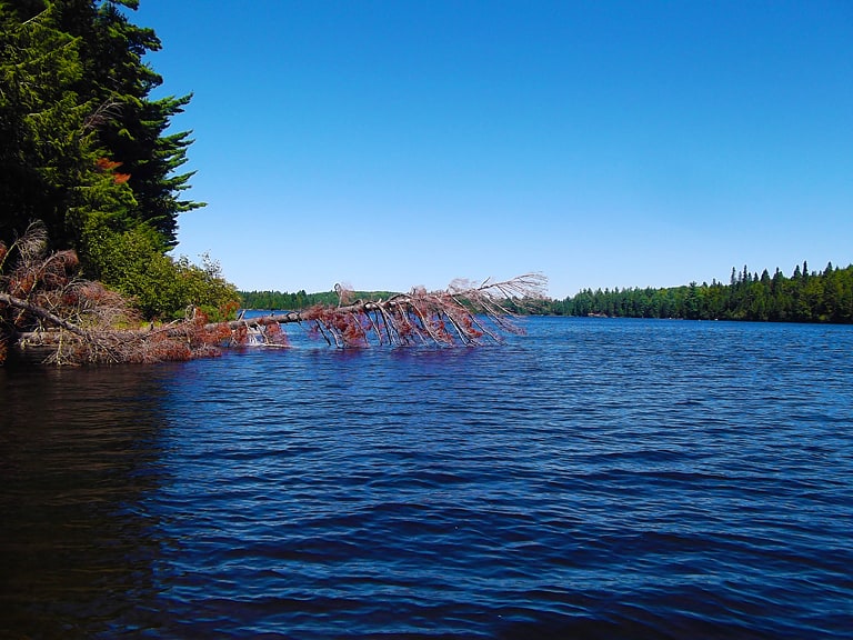
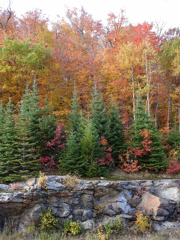
Mew Lake
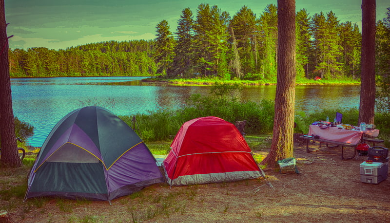
Lake in Ontario, Canada. Mew Lake is a lake in Nipissing District in Northeastern Ontario, Canada. The lake is in Algonquin Provincial Park, is part of the Saint Lawrence River drainage basin, and lies astride Ontario Highway 60.
The primary inflow, arriving at the southwest, and outflow, leaving at the northwest, is Jack Creek. A secondary, unnamed inflow arrives from Pewee Lake at the southwest. Jack Creek flows via the North Madawaska River, the Madawaska River and the Ottawa River to the Saint Lawrence River. The lake is at an elevation of 399 metres (1,309 ft).
The Mew Lake Campground at Algonquin Provincial Park is on the lake. It is open year-round, with campsites with electrical hookup, radio-free and dog-free zones, and seven roofed accommodation yurts.[1]
Algonquin Radio Observatory
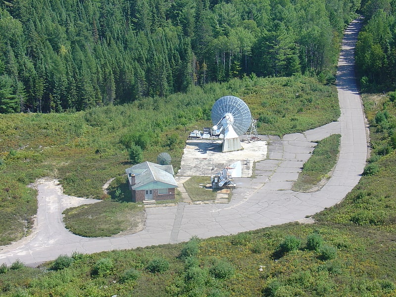
Observatory in Ontario, Canada. The Algonquin Radio Observatory is a radio observatory located in Algonquin Provincial Park in Ontario, Canada. It opened in 1959 in order to host a number of the National Research Council of Canada's ongoing experiments in a more radio-quiet location than Ottawa.
In 1962 it was selected as the site for the Algonquin 46m radio telescope, which has been the site's primary instrument through most of its history. An earlier 10 m instrument was set up in 1961 though was not equipped with a drive mechanism until 1964. The site also hosts a hydrogen maser, a standard feature for radio telescopes that can also serve to receive telemetry from deep space missions. Other instruments formerly at the site included a solar-observing array of thirty-two 10 ft (3 m) dishes, and a single 1.8 m solar flux monitor observing at 10.7 cm wavelength, and an 18 m radio telescope from the University of Toronto.
In the late 1980s, as a part of an ongoing shift of operations from the NRC, operations of the ARO were passed to the Institute for Space and Terrestrial Science (ISTS, later renamed the Center for Research in Earth and Space Technology (CRESTech)). The multi-dish solar observatory was sold in the early 2000s, and the second solar observatory antenna was moved to the Dominion Radio Astrophysical Observatory in British Columbia. The Observatory's main uses today are in very long baseline interferometry (VLBI) experiments mostly in geodesy, a primary global positioning system site, some use for satellite downlink, and other general experiments. Since 2007, the site has been operated by Thoth Technology Inc.[2]
North Tea Lake
Lake in Ontario, Canada. North Tea Lake is a lake in the Ottawa River drainage basin in the geographic townships of Ballantyne and Wilkes in the Unorganized South Part of Nipissing District in Northeastern Ontario, Canada. It is on the Amable du Fond River and lies in the northwest of Algonquin Provincial Park. The lake is a popular destination for canoeists.
The primary inflow is the Amable du Fond River arriving from Kawawaymog Lake at the west. The primary outflow is the Amable du Fond River, at the northeast to Manitou Lake, which flows via the Mattawa River to the Ottawa River.[3]
Grand Lake
Lake in Ontario, Canada. Grand Lake is a lake in the Ottawa River drainage basin in the geographic townships of Barron and Stratton in the Unorganized South Part of Nipissing District in Northeastern Ontario, Canada.
The lake is long and narrow and lies in an east–west orientation, mostly in Barron Township except for the southeastern end which is in Stratton Township; it is entirely within Algonquin Provincial Park. The primary inflows are the Barron River from its source at Clemow Lake at the west and Carcajou Creek at the large Carcajou Bay at the southeast, and primary outflow is the Barron River, controlled by the Grand Lake Dam, which flows at the east to Stratton Lake and further via the Petawawa River to the Ottawa River.
Grand Lake is crossed in the middle by the originally Canadian Northern Railway, later Canadian National Railway, main line, now abandoned. The Achray park campground, formerly a station on the railway, is located on the north shore, and the unincorporated place of Hydro is on the former railway line at the western tip of the lake, near where a Hydro One hydroelectricity transmission line passes.[4]
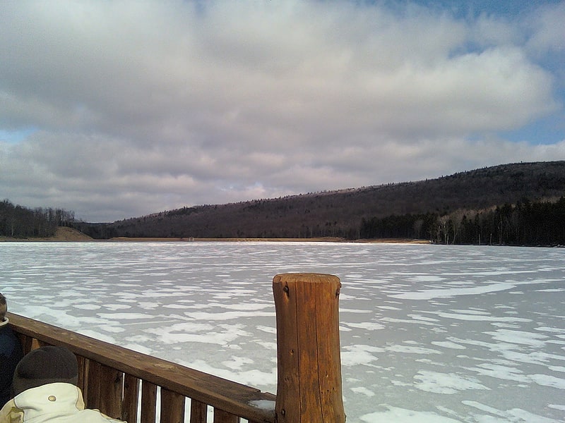
Opeongo Lake
Lake in Ontario, Canada. Opeongo Lake is a lake in the Saint Lawrence River drainage basin in the geographic townships of Bower, Dickson, Preston and Sproule in the Unorganized South Part of Nipissing District in Northeastern Ontario, Canada. It is the largest lake in Algonquin Provincial Park and the source of the Opeongo River. The lake's name comes from the Algonquian word opeauwingauk meaning "sandy narrows".
It has three arms, North, East and South, joined by narrows into a Y shape. The total area is 58 km2 (22.4 sq mi), the average depth 14.6 m (48 ft) and the maximum depth 49.4 m (162 ft). The primary outflow is the Opeongo River at the southeast tip of Annie Bay on the East Arm, controlled by the Opeongo Lake Dam, which flows via the Madawaska River to the Ottawa River.
A store with camping supplies and dock, Algonquin access point 11 and the Harkness Laboratory of Fisheries Research are located on Sproule Bay at south end of South Arm and are all accessible from Ontario Highway 60. Consequently, the lake is a popular starting point for canoe trips into the interior of the park.
Opeongo lake was to have been the endpoint of the Opeongo Line, one of a series of settlement roads built to open up this section of the province. It was the endpoint of the Whitney and Opeongo Railway, used for logging operations until the 1920s. Portions of this route now form part of Ontario Highway 60 and the access road connecting the lake to Highway 60.[5]
Snowshoe Lake
Lake in Ontario, Canada. Snowshoe Lake is a lake in the Lake Huron drainage basin in Algonquin Provincial Park in Nipissing District, Ontario, Canada. It is about 790 metres long and 100 metres wide, and lies at an elevation of 466 metres. The primary outflow is an unnamed creek to West Harry Lake, which flows via the Big East River, the Muskoka River and the Moon and Musquash rivers into Lake Huron.
A second Snowshoe Lake in the Big East River system, Snowshoe Lake (Cripple Creek, Ontario), is 18.5 kilometres (11.5 mi) northeast.[6]
Canoe Lake
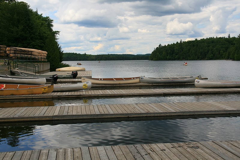
Lake in Ontario, Canada. Canoe Lake is a lake located in Algonquin Provincial Park in Nipissing District, Ontario, Canada. Canoe Lake is a major access point for many canoeists entering Algonquin Park as well as being home to many cottages. Important to note is that Canoe Lake is situated on the traditional territory of the Anishinaabeg, specifically the Chippewa, Ojibwa and Potawatomi peoples, under the terms of the Robinson-Huron Treaty #61 of 1850, and the Williams Treaties of 1923.
At km 14.1 of Highway 60 is the short road that leads to the Canoe Lake Access Point for canoe trippers and visitors. The access point consists of a large parking area, a Ministry office to obtain tripping permits for the park interior and the regionally well-known Portage Store. The "P-store" as it is often colloquially known, is a well stocked outfitters and canoe equipment rental operation that includes one of the few commercial restaurants available in Algonquin Park. They serve a variety of meals and offer an ice cream counter as well. The Portage Store also offers a number of outfitting and guiding packages to support peoples' canoe-tripping endeavours. A gift shop is attached offering souvenirs, t-shirts and other items for sale. Canoe Lake is also home to the Taylor-Statten summer camps; Camp Ahmek, an all-boys camp, and Camp Wapomeo, an all-girls camp.
Influential Canadian artist Tom Thomson drowned in Canoe Lake on July 8, 1917 during a canoeing trip; his body was discovered in the lake eight days later, washed up on the Island of Little Wapomeo, the initial home of the summer camp. Canoe Lake was a very influential place for Tom Thompson's artwork, as well as a very special place for him. He resided in Canoe Lake throughout different parts of his career, and frequently canoed the area.[7]
Camp Pathfinder
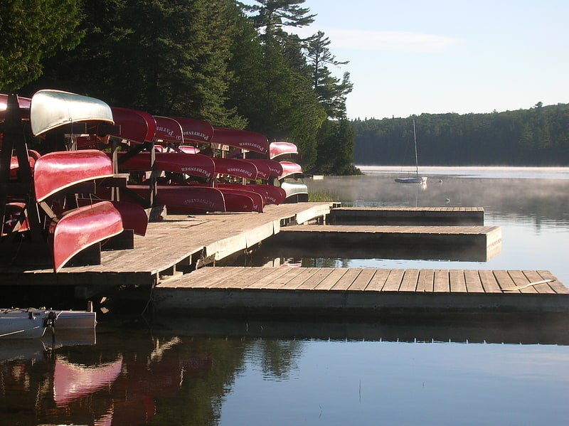
Camp Pathfinder is a boys' Summer camp in Algonquin Provincial Park, Ontario, Canada. The camp is best known for its canoe tripping program. Pathfinder follows a tradition of using wood and canvas canoes. Several other camps in Algonquin and elsewhere follow a similar tradition of tripping with, building and restoring canvas canoes. Pathfinder's canoes are painted a distinctive bright red. The current director is Michael Sladden.[8]
Algonquin Provincial Park
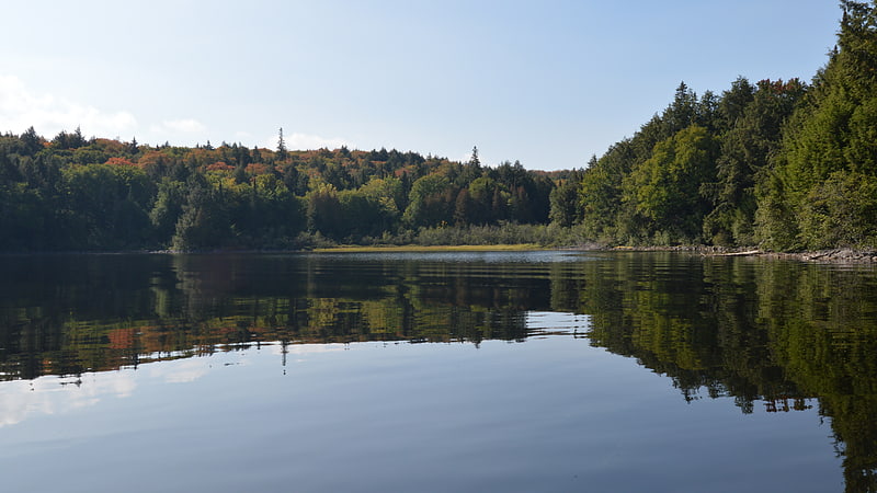
Provincial park in Ontario, Canada. Algonquin Provincial Park is a provincial park located between Georgian Bay and the Ottawa River in Ontario, Canada, mostly within the Unorganized South Part of Nipissing District. Established in 1893, it is the oldest provincial park in Canada. Additions since its creation have increased the park to its current size of about 7,653 km2. The park is contiguous with several smaller, administratively separate provincial parks that protect important rivers in the area, resulting in a larger total protected area.
Its size, combined with its proximity to the major urban centres of Toronto and Ottawa, makes Algonquin one of the most popular provincial parks in the province and the country. Highway 60 runs through the south end of the park, while the Trans-Canada Highway bypasses it to the north. Over 2,400 lakes and 1,200 kilometres of streams and rivers are located within the park. Some notable examples include Canoe Lake and the Petawawa, Nipissing, Amable du Fond, Madawaska, and Tim rivers. These were formed by the retreat of the glaciers during the last ice age.
The park is considered part of the "border" between Northern Ontario and Southern Ontario. The park is in an area of transition between northern coniferous forest and southern deciduous forest. This unique mixture of forest types, and the wide variety of environments in the park, allows the park to support an uncommon diversity of plant and animal species. It is also an important site for wildlife research.
Algonquin Park was named a National Historic Site of Canada in 1992 in recognition of several heritage values including: its role in the development of park management; pioneering visitor interpretation programs later adopted by national and provincial parks across the country; its role in inspiring artists, which in turn gave Canadians a greater sense of their country; and historic structures such as lodges, hotels, cottages, camps, entrance gates (the West Gate was designed by George H. Williams, Chief Architect and Deputy Minister of Public Works for the Province of Ontario), a railway station, and administration and museum buildings.
Algonquin Park is the only designated park within the province of Ontario to allow industrial logging to take place within its borders.[9]
Algonquin Art Centre
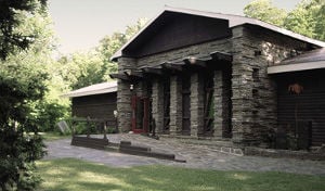
Art gallery, Art museum
Address: Highway 60 at Km 20, P1H 2L4 Algonquin Provincial Park
Algonquin 46m radio telescope
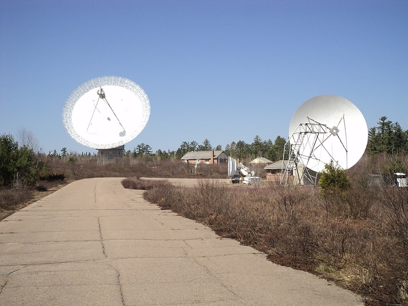
The Algonquin 46m radio telescope is a radio telescope at the Algonquin Radio Observatory, Canada. This radio telescope is historically famous for taking part in the first successful very long baseline interferometry experiment in the 1960s, where it was experimentally arrayed with the 26-metre Telescope at the Dominion Radio Astrophysical Observatory near Penticton, British Columbia.[10]