Discover 35 hidden attractions, cool sights, and unusual things to do in Tatra National Park (Poland). Don't miss out on these must-see attractions: Morskie Oko, Czarny Staw pod Rysami, and Giewont. Also, be sure to include Wielki Staw Polski in your itinerary.
Below, you can find the list of the most amazing places you should visit in Tatra National Park (Lesser Poland).
Table of Contents
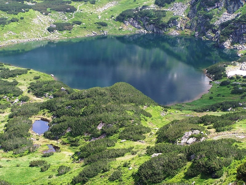
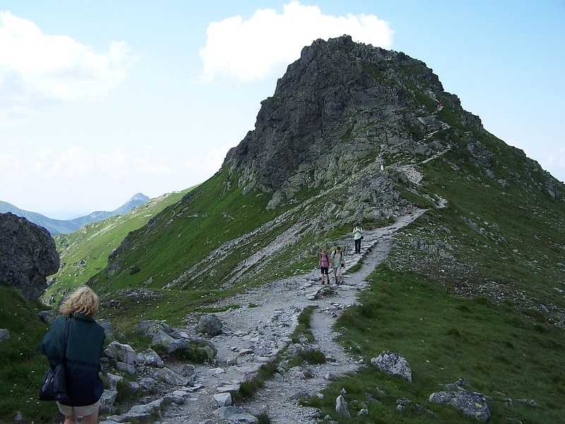
Morskie Oko
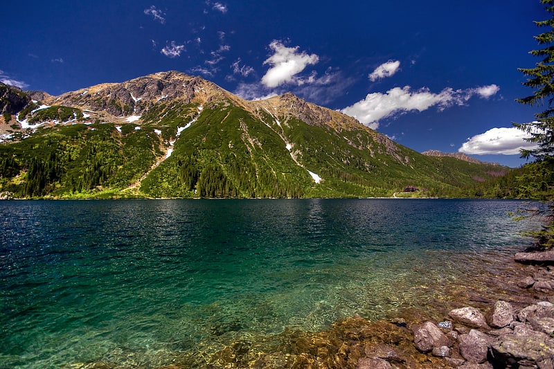
Large mountain lake with dramatic views. Morskie Oko, or Eye of the Sea in English, is the largest and fourth-deepest lake in the Tatra Mountains, in southern Poland. It is located deep within the Tatra National Park in the Rybi Potok Valley, of the High Tatras mountain range at the base of the Mięguszowiecki Summits, in Lesser Poland Voivodeship.[1]
Czarny Staw pod Rysami
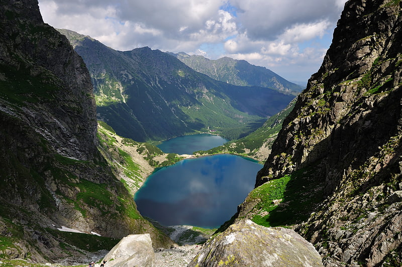
Scenic mountain lake known for hiking. Czarny Staw pod Rysami is a mountain lake on the Polish side of Mount Rysy in the Tatra mountains. At 1,583 m above sea level, it overlooks the nearby lake of Morskie Oko. Its maximum depth is 76 m. A walking path circumnavigates the lake, and leads up to Mount Rysy, or down to Morskie Oko.
To get to Czarny Staw from Morskie Oko you must follow the red trail on the Eastern side of Morskie Oko. Once you have reached about half-way you will see a signpost that has directions on how to get to Czarny Staw. After crossing the rocky inclined path, you will arrive at Czarny Staw. The trip takes about 50 mins going up from Morskie Oko and 40 mins going back down.[2]
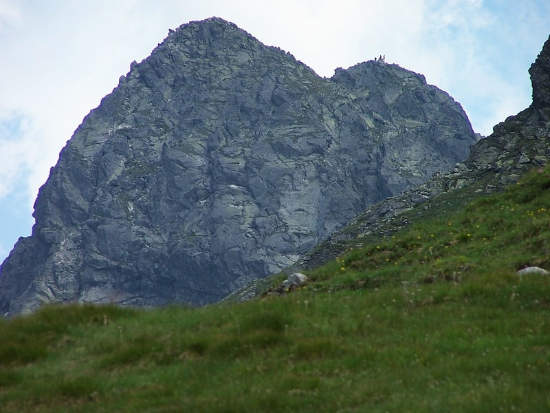
Giewont
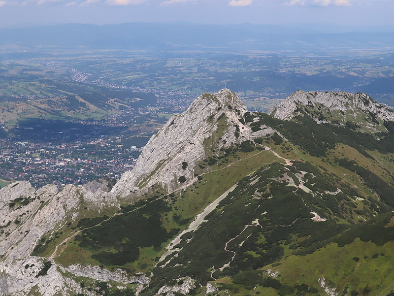
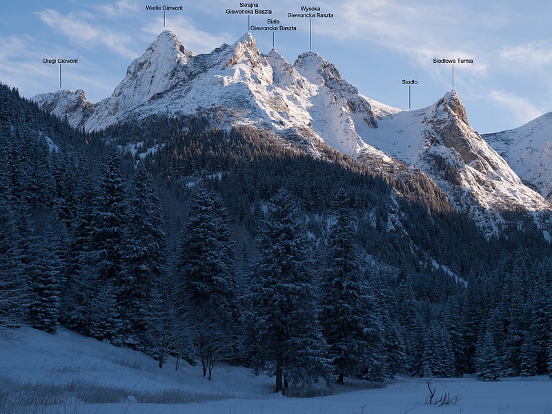
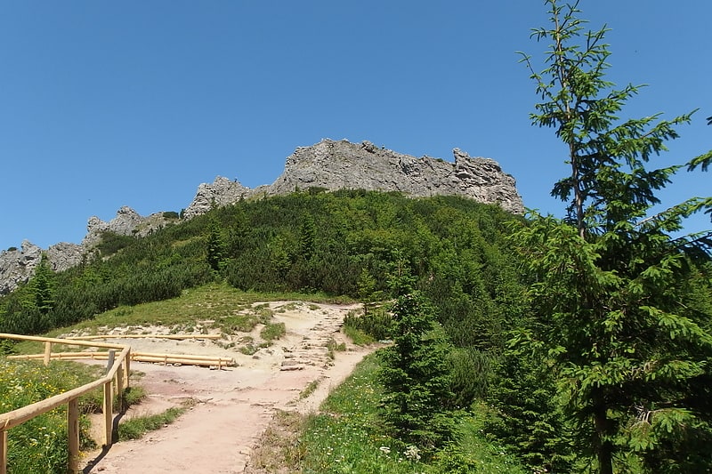
Mountain massif with hiking trails. The Giewont is a mountain massif in the Tatra Mountains of Poland. Its highest peak, Great Giewont, is 1,895 metres above sea level and the highest peak of the Western Tatras located entirely within Poland's borders. The mountain is regarded as the symbol of Zakopane, the Polish Tatras and Podhale throughout history has been the subject of many legends, poems and works of art.[3]
Address: Tatry Zachodnie, Tatra National Park
Wielki Staw Polski
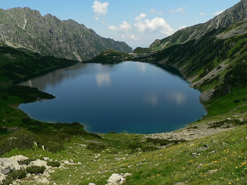
Tarn in Poland. Wielki Staw Polski - is a tarn located in the High Tatras, at an elevation of 1,665 metres above sea level in the Valley of the Five Polish Lakes, by the slope of the Miedziane. The lake is the second-largest lake by area in the Tatra Mountains after the Morskie Oko. The lake is located in the Lesser Poland Voivodeship; in Poland.
Wielki Staw Polski is the deepest and longest (998 metres) lake in the Tatra Mountains, and the third-deepest lake in Poland (the deepest lake is Hańcza. The lake's volume is around 13 million m³ of water, and it is the largest lake by volume in the Tatra Mountains (its volume makes up one third of all lakes in the Tatra Mountains lakes). The highest temperature of the lake's water was 11.2 °C (52.2 °F).[4]
Świnica
Peak offering a marked path for climbing. Świnica or Svinica is a mountain in the main crest of the High Tatras, on the Polish-Slovak border. The main peak is at 2,301 m AMSL. A marked trail leads through the summit. The Polish name Świnica was given to this summit in the mid 19th century. It probably refers to the resemblance of the peak to silhouette of a swine. Another, doubtful explanation, is that the summit was difficult to reach.[5]
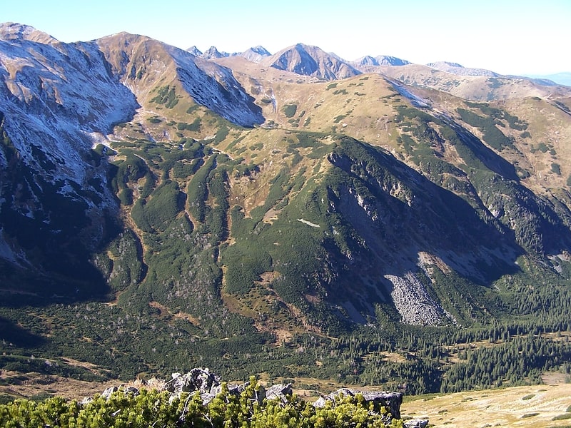
Kasprowy Wierch
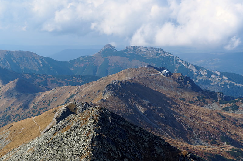
Scenic destination for skiing and hiking. Kasprowy Wierch is a peak of a long crest in the Western Tatras one of Poland's main winter ski areas. Its dominant southern crests, WSW and ESE, mark the border with Slovakia. It is accessible in most conditions by foot and daily by cablecar.[6]
Kościeliska Valley
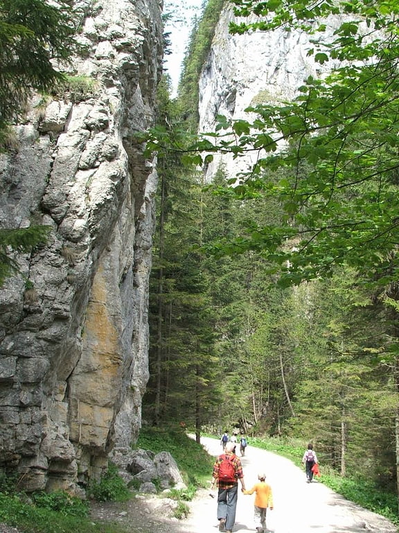
The Kościeliska is a valley in Poland, in Tatra Mountains, Western Tatras, Poland. It stretches from the village of Kiry, about 9 km, right up to the main ridge of the Tatras. Halfway up is the Ornak mountain refuge, built in 1948. Is reached by road from Zakopane - 7 km.[7]
Jaskinia Wielka Śnieżna
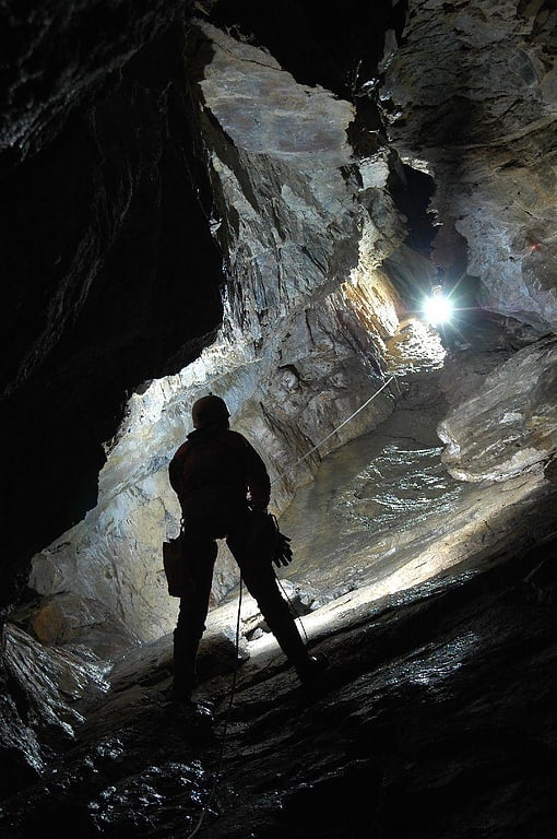
Park in Poland. Jaskinia Wielka Śnieżna is a limestone cave system in Mount Małołączniak in the Western Tatra Mountains, of the Carpathian Mountains System, in southern Poland. The cave is within Tatra National Park.
With the length of 23.723 kilometres (14.741 mi), and vertical range of 824 metres (2,703 ft), it is the longest, largest, and deepest cave in Poland.[8]
Zielony Staw Gąsienicowy
Lake. Zielony Staw Gąsienicowy is a tarn in Poland, part of the Gąsienicowe Ponds in the High Tatras. The lake is located at an elevation of 1,672 metres in a corrie of the Skrajna pyramidal peak. The tarn was formerly named Suczy Staw. Zielony Staw Gąsienicowy is the largest lake in the Zielona Gąsienicowa Valley.[9]
Kurtkowiec Lake
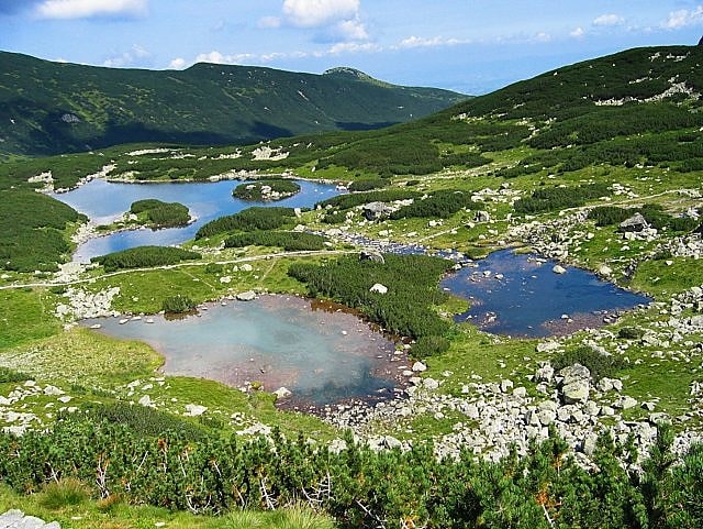
Lake. Kurtkowiec is an oligotrophic lake part of the Gąsienicowe Ponds, located in the Tatra Mountains in Poland. The lake is located in the western part of the Gąsienicowa Valley, at an elevation of 1,686 metres.[10]
Kościelec
Mountain in Poland. Kościelec is a mountain in the High Tatras in the Gąsienicowa Valley of Poland.[11]
Address: Na prawo od Zawratu, Tatra National Park
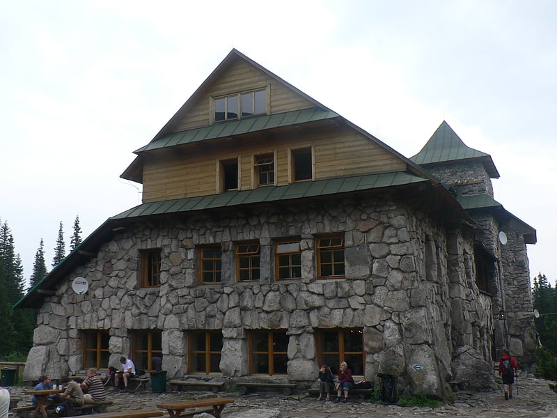
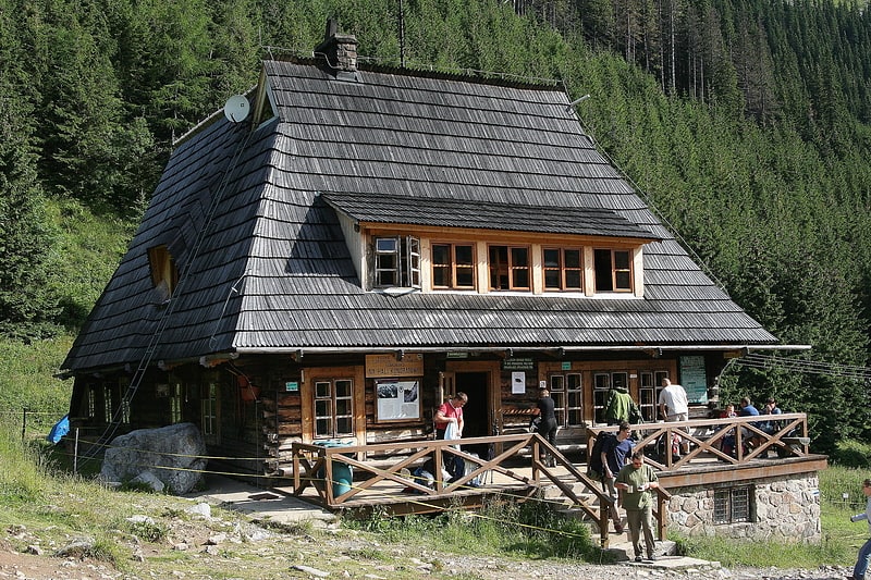
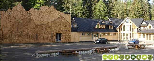
Schronisko PTTK Morskie Oko
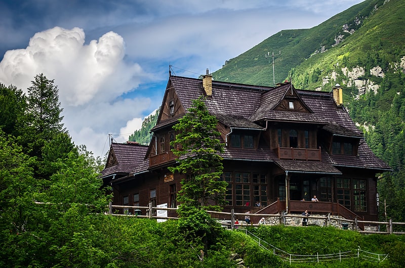
PTTK Shelter over Morskie Oko - a tourist hostel located over Morskie Oko, in the Fish Creek Valley in the High Tatras. It is located at an altitude of 1410 m above sea level on a postglacial moraine embankment. It consists of two parts: The Old Hostel dating from the 19th century and the New Hostel, built in 1908 by the Tatra Society. After the major renovation in 1988-1992 the hostel has 79 beds: 36 in the New Hostel and 43 in the Old Hostel. It also has a restaurant and bar and houses the TOPR rescue station. The building of the hostel was declared a historical monument in 1976 and is legally protected. The hostel is managed by PTTK.
The hostel is a separate tourist shelter type locality.
Address: Box 201, 34-500 Zakopane
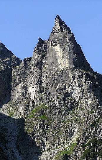
Mnich Mountain
Also known as: Mnich
Mountain in Poland. Mnich is a mountain in the Tatra Mountains on the Morskie Oko of Poland. It has an elevation of 2,068 meters above sea level.[12]
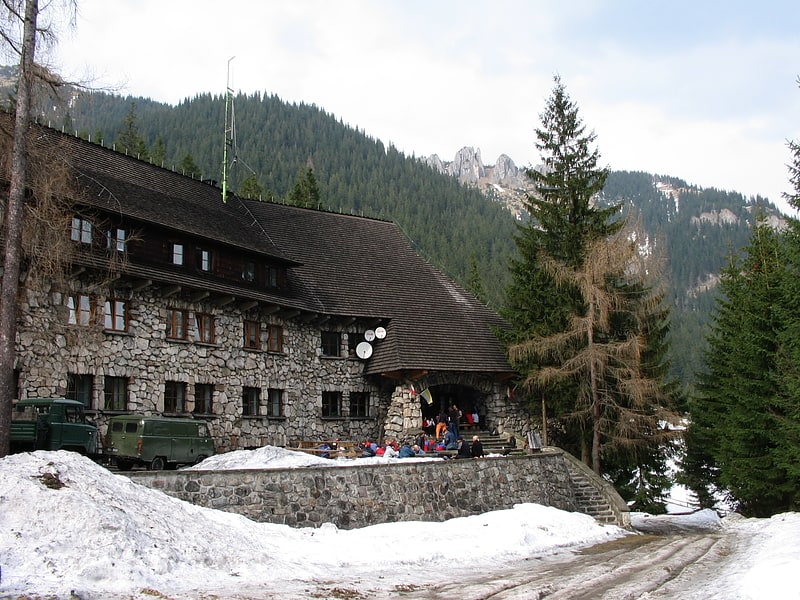
PTTK Shelter Murowaniec
PTTK "Murowaniec" Hostel on Hala Gąsienicowa - an accommodation facility in the Tatra Mountains located at an altitude of 1500 m above sea level on Hala Gąsienicowa, with the status of a hostel since 2021. The building is owned by the Polish Tourist Society and currently has 110 beds in rooms for 2 to 6 people and rooms for 10 people. On the premises of the hostel there is a TOPR duty station.
Mięguszowiecki Szczyt Wielki
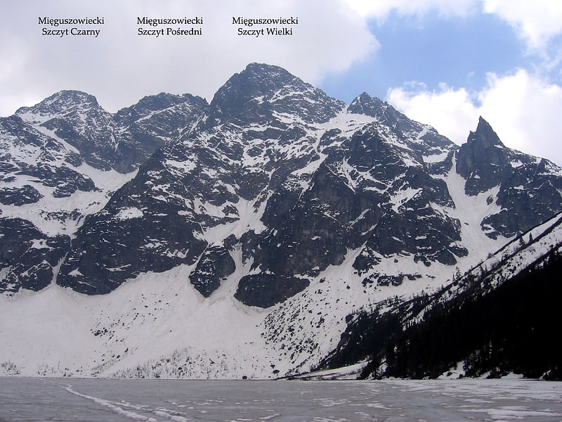
Also known as: Mięguszowiecki Szczyt
Mountain in Poland. Mięguszowiecki Szczyt Wielki or the Mięguszowiecki Grand Peak is a mountain in the Tatra Mountains, Poland, located on the Slovak-Polish border.
It is the highest of the three Mięguszowiecki Summits and the second-highest mountain in Poland after Rysy (2,499 meters, the highest peak in the Polish Tatras).[13]
Nosal
Mountain in Poland. Nosal is a mountain in the Tatra Mountains of Poland, and is 1,206 metres AMSL at its highest. It is a popular tourist destination located near the Polish town of Zakopane, particularly for skiing and gliding.[14]
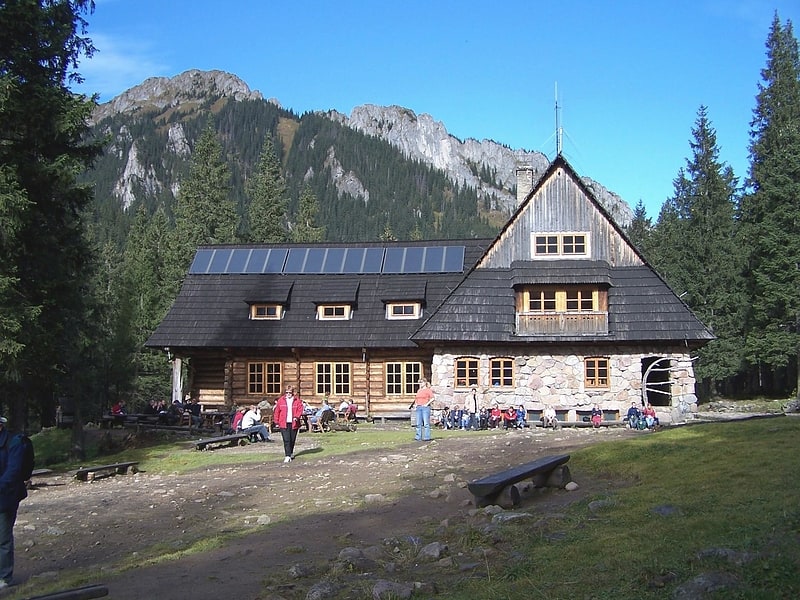
Shelter Hala Kondratowa
PTTK Shelter on Hala Kondratowa named after Władysław Krygowski - a tourist hostel located on the Kondratowa Glade in the Western Tatras, at the foot of the Giewont massif. It is located at an altitude of 1333 m on the former Kondratowa Hall. It is the smallest hostel in the Polish Tatra Mountains, with 20 places in 6- and 8-person rooms. It is managed by PTTK.
The chalet operates a ski storage room, a tavern and a buffet.
Address: Tatry Zachodnie, Tatra National Park
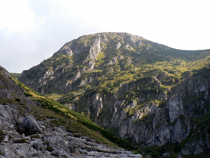
Wołoszyn
Massif in Moldova. Wołoszyn is a mountain massif in the Tatra Mountains in Poland It reaches 2,155 meters at its highest peak.
Wołoszyn is part of the Polish Tatra National Park.[15]
PTTK at Polanie Chochołowskiej
PTTK Shelter on the Chochołowska Glade - a tourist hostel located on the Chochołowska Glade in the Western Tatra Mountains, known as the Chochołowski Shelter for short. The facility is located at an altitude of 1146 m and is managed by PTTK. It is the main accommodation base in the Chocholowska Valley area.
PTTK Hala Ornak
PTTK mountain hostel in Ornak Hall - a tourist hostel located on the Mala Polanka Ornaczańska glade in the upper part of the Kościeliska Valley in the West Tatra Mountains at an altitude of 1100 m above sea level on the land formerly belonging to Ornak Hall.
The hostel is a separate village Ornak in the municipality Kościelisko (SIMC 0468654).
Address: Dolina Kościeliska, Tatra National Park
Magura Mountain
Peak. Magura is a peak located in the Kasprowy Wierch massif, part of the Western Tatras in Poland. The peak is located between the Uhrocie Kasprowe and the Mała Kopa Królowa in the Western Tatras.
The name of the peak originates from Vlachs - pastoral peoples, which introduced grazing to the Tatra Mountains. In their language, the name for the peak relates to a small, isolated peak. Formerly, the peak was named Kopa Jaworzyńska or Kopa, and was grazed on, being part of the Królowa Tundra. The slopes of the peak as a result of excess pasturage underwent strong erosion. At present the flora has regrown on the peak, covering it with creeping pine and grassland.[16]
Mięguszowiecki Summits
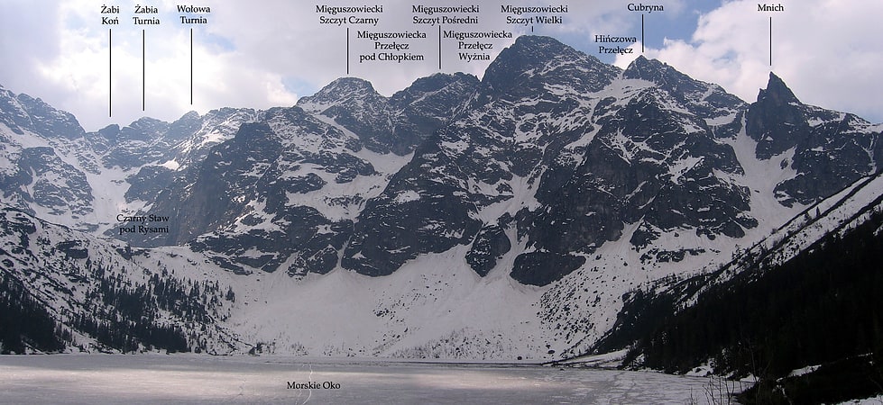
Also known as: Mięguszowieckie Szczyty
Mięguszowiecki Summits are a group of three major summits in the main ridge of the Tatra Mountains on the border between Poland and Slovakia.
The highest one is the Mięguszowiecki Grand Peak (2,438m, second highest in Poland, fifteenth in Tatra Mountains). To the east of it there is Mięguszowiecki Middle Peak (2393 m) and the Mięguszowiecki Black Peak (2410 m) further eastwards.[17]
Sowa
Sowa - a crag in the Koscieliska Valley in the Western Tatras. It is located on the western side of the valley, almost opposite the path from the cave Mroźna, below the massif of Stoł. Its steep white walls rise above the forest right next to the Koscieliska Creek to a height of about 1050 m. It is also perfectly visible from the Polana Pisana clearing located 600 m to the south. It is built of limestone and has a distinctive shape, which associated with the creators of the name with an owl. Above the Owl, 200 m from it, rises the much higher Kazalnica.
In the Owl and its immediate surroundings there are several caves, the largest of which is the Cold Gap I. In addition to it, there are also, among others: Shelter before Owl I, Shelter before Owl II, Shelter before Owl III, Owl Den I, Owl Den II, Owl Den III, Cold Gap II, Cold Gap III.
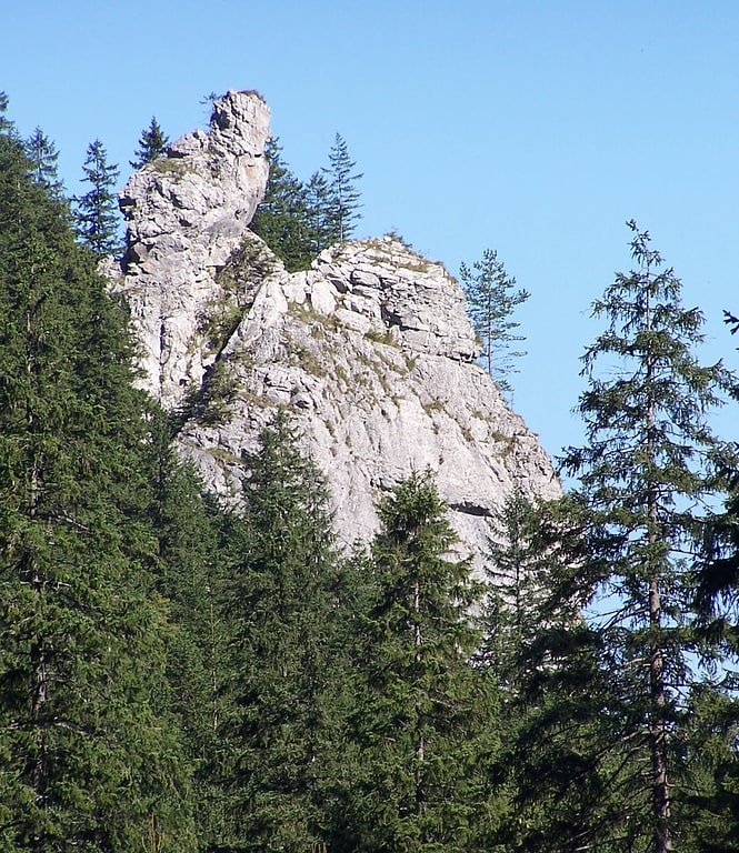
Siodłowa Turnia
Siodłowa Turnia is a crag rising in the upper part of the Mała Łąka Valley in the West Tatra Mountains, south of Mały Giewont. It is separated from him by the Saddle Pass. Forms a short, narrow ridge, in which the peak stands out, rising to a height of 1647 m above sea level. It descends by a steep cliff about 150 m to the Głaziye Żleb (Boulder Gully). Saddleback Turnia with the Small Giewont and the Great Turnia creates a panorama of peaks rising over the Great Glade in the Valley of the Small Meadow.
Formerly it was called Turnia Siadłą or Turnia Spiczastą. It is built of white limestone from the Lower Cretaceous period. In its northern slopes there are several caves. The most famous are Nysa in the Saddleback Turnia and the Sleeping Knights Cave Higher and Sleeping Knights Cave, located in the Sleeping Knights Gully. The names of the caves are connected with the legend of knights sleeping in the Tatra Mountains, who are supposed to wake up when Poland needs them.
Kapliczka Zbójnicka
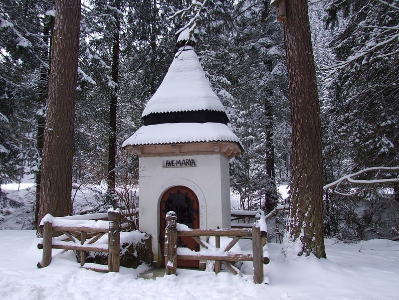
The chapel of zbójnicka - a chapel on the clearing Stare Kościeliska in the Kościeliska Valley in the Western Tatras. It is located just by the road leading through the valley, right at the beginning of the clearing, on its western side, at an altitude of about 960 m. On foot from Kir 25 min. According to legend it was founded by bandits. In fact, it was founded by miners and steelworkers who once worked in the Tatra Mountains in the extraction and melting of iron ore. In Old Kościeliski was then a steel mill, housing estate, an inn.
The chapel is made of brick and has a shingled dome, the inscription "Ave Marya" and mining emblems - two crossed hammers. It is surrounded by a wooden fence. In the left post of the entrance gate of the fence there is a carved silhouette of a robber, in the right one of a miner. Next to the shrine there are two larch trees. At a distance of 4 meters from one of them (on the right) grows a planted Douglas fir - a species of coniferous tree that does not appear in the wild here, originating from North America. Opposite the shrine, on the other side of the road, there are tables and benches for tourists.
Sanktuarium Matki Bożej Jaworzyńskiej Królowej Tatr
Marian Sanctuary on Wiktorówki, Sanctuary of Our Lady Queen of the Tatra Mountains or Our Lady of Jaworzyna - sanctuary on Wiktorówki in the High Tatras. It is located within the Tatra National Park, in the immediate vicinity of Rusinowa Polana at an altitude of about 1200 m. Directly next to it there is a blue tourist trail from Zazadnia to Rusinowa Polana.
There is an outpost of TOPR here.
Krzyż na Giewoncie
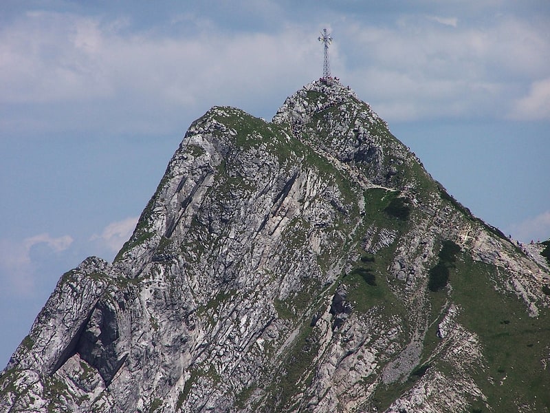
Cross on Giewont - a metal cross on top of the Great Giewont in the Giewont massif. It was installed there by parishioners from Zakopane on 19 August 1901 to commemorate the 1900th anniversary of the birth of Jesus Christ. The initiative came from the then parish priest of Zakopane, Kazimierz Kaszelewski. In order to find out how high the cross would be needed to be visible from Zakopane, a test was made: a 10.5 m high cross was made of two long poles taken from a hut - it was visible. The metal cross was made in elements by Górecki's factory in Krakow and transported by train.
The cross is 17.5 m high, of which 2.5 m is buried in the rocks, the cross arm is 5.5 m long. It consists of 400 iron elements with a total weight of 1819 kg ("Tatry" 3/2009 reports 1978 kg), which were transported by horse-drawn carts to Hala Kondratowa, and then carried to the top on the back. Half a thousand people worked on this, eighteen carts were used. In addition to the metal elements 400 kg of cement and 200 canvas water containers (from the spring below the Kondracka Pass) were carried. The assembly took 6 days. It was done by six highlanders and Górecki's workers under his personal supervision. At the crossing of the cross arms there is an inscription: Jesu Christo Deo, restitutæ per ipsum salutis MCM (Latin: Jesus Christ, God, on the 1900th anniversary of His restoration of salvation). The cross was consecrated on 19 August 1901 by the Rev. Canon Chancellor Bandurski of Cracow during a mass on Giewont, attended by about 300 people.
In 1975 the cross was renovated. Young people under the supervision of parish priest Wladyslaw Curzydla brought 1200 kg of sand, 200 kg of cement and water for concrete from Hala Kondratowa to the top of Wielki Giewont. The concrete filled the breach under the cross and strengthened the rocks of the peak by gluing them together. The mountaineer Krzysztof Szafrański painted the cross construction in celadon colour, protecting it against corrosion. In 1994 a Cracovian company repairing the tourist route (100 m of chains, buckles, steps) repainted the cross. In order to stabilize the summit dome, 14 steel anchors were mounted, sunk 1 m deep into the rock, and the loose rock fragments were glued with a special mineral glue. In 2000 a stained glass window with the Merciful Christ and the inscription "Jesus I trust in you" was installed on the cross. In June and July 2009 another renovation of the cross was carried out.
Giewont is one of the most popular Polish mountains among tourists. The cross itself on Giewont is also the object of religious pilgrimages. August 19 (the anniversary of the erection of the cross) and 14 September (on the feast of the Exaltation of the Holy Cross) is from the Holy Cross Church in Zakopane pilgrimage to the cross on Giewont.
Cross standing on Giewont towering over Zakopane is a characteristic and well recognizable element. You can observe it through a telescope from the top of Gubałówka.
It is very dangerous during thunderstorms. On August 19, 1937, 4 people were killed and 13 were stricken by lightning during a pilgrimage (there were 130 injured and wounded in total). The biggest accident occurred on August 22, 2019. - as a result of lightning strikes, 4 people died (including two children) and nearly 100 were stricken. It is imperative to get off the summit during an approaching storm.
On September 6, 2007 the cross was entered into the register of monuments of the Malopolska province. Since 2007 a replica of the cross, the Baltic Cross of Hope, has been standing in Pustkow on the Baltic Sea. Another copy stands on the fields of Lednica. As part of the celebrations of the Great Jubilee of the Year 2000, a replica of the cross on Giewont was placed in Wojcieszow in Lower Silesia (Millennium Cross).
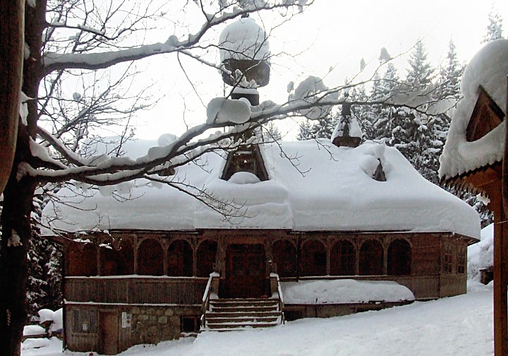
Kaplica pw. Najświętszego Serca Jezusa w Jaszczurówce
Jaszczurówka Chapel, Jaszczurówka Chapel, Sacred Heart of Jesus Chapel - a branch church of the Roman Catholic parish in Toporowa Cyrhla. The temple designed by Stanislaw Witkiewicz began construction in 1904, and was consecrated in 1907.
From the very beginning, the chapel had no permanent custodian from the church administration. Initially, it belonged to the parish of Poronin, but in practice, the care of it was provided mainly by priests staying in the Tatra Mountains for vacation. In the years 1948-1955 Marian and Salesian priests took care of the chapel, as well as the chaplain of the Ursuline sisters from Borow. In 1955 the Metropolitan Curia of Krakow entrusted the chapel to the missionaries from Olcza. Since 1983 Marian priests from Toporowa Cyrhla have been taking care of it. The formal owner of the object is the Tatra National Park, in whose territory the chapel stands.
The chapel is a typical example of the Zakopane style. The temple with a visible log structure rests on a high, stone foundation. In front it has an arcade. The shingled roof is topped with a small tower that holds a bell. The interior consists of a rectangular closed presbytery and one nave. The wooden main altar resembles a highlander's cottage. The interior is decorated with stained glass windows designed by Stefan Matejko depicting the Virgin Mary of Czestochowa and Ostrobramska, as well as the coats of arms of Poland and Lithuania. The side altars, also made of wood, date from the 1950s.
In 1963 and 1971 the arcades were partially repaired, and in 1975 the stairs were repaired and part of the shingle roofing was replaced. However, the chapel was deteriorating more and more. After the decision of the then provincial conservator from Nowy Sacz in 1977 the first major renovation of the chapel began, which lasted until 1981. It included a number of works, from strengthening the cracked foundation to repairing the turret and strengthening the fastening of iron crosses on the roof. Moulded sections of the gallery walls and columns were replaced. An additional room above the sacristy was separated, forged iron gratings were put in the arcades of the stone foundation, the facades were cleaned and a lightning protection system was installed. Jan Kowalik, parish priest from Olcza had a special role in saving the chapel.
In 1984 architecture students of the Cracow University of Technology made an inventory of the chapel, and in 1995 TPN financed the installation of a fire alarm system. In 2003 radiant heating was installed.
In 2019-2022, Orthodox services were celebrated in the chapel once a month.
The chapel is located on the Trail of Wooden Architecture in Malopolska.
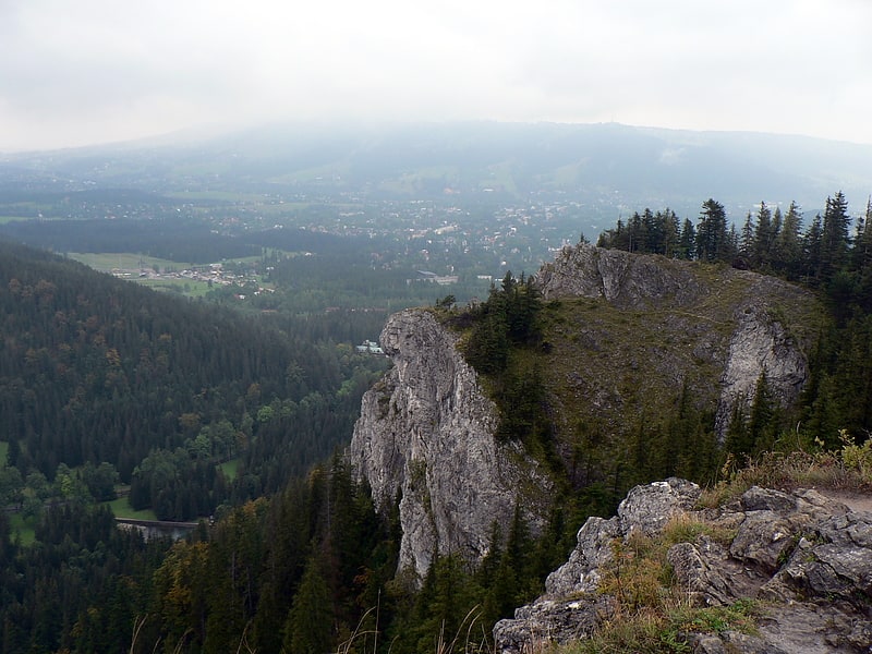
Sarnia Skała
Sarnia Skała - peak in the agglomeration belt of the Western Tatras, between the Białe Valley and the Strążyska Valley. The Geoportal map gives an altitude of 1377 m.
Bula pod Rysami
Bula pod Rysami - according to W.H. Paryski, a bula, according to W. Cywiński, a plateau lifted towards the north-west with several dominant piles of stones limiting the Kocioł pod Rysami in the Polish Tatras from the north. The left boundary of the wall, separating the Rysami Mountain from the Low Rysy Mountains massif, is the steep Orlovsky Gully. The distinctive features of the wall are: the northern rib, consisting of three faults, the highest of which is the largest and steepest; the lower spur of the rib is the lowest point of the entire wall, and the Virgin Gulch, also called (from its shape) the S-Gulch, with an elevation difference of 240 meters, finished at the bottom with a vertical 30-meter sill; the gulch was completely conquered by mountaineers as late as in March 2002 The middle of the wall is trapezoidal in shape; the lower part is made of steep slabs interspersed with grasses, above it there is a spacious lawn, and above it a 30-meter vertical wall, the western rib, called the Vigil Pillar, with an elevation difference of 200 meters and its base in the Rysy Gully.
The plateau, which is the top of the Rysy Mountain, narrows from the south-eastern side and forms a protuberance, growing into the Rysy Mountain perch at 1/3 of its height. It divides the Rysy Mountain Dome into the larger western part and the smaller eastern part. Both these parts are hydrologically distinct - the western one is drained by Żleb pod Rysami, the eastern by Żleb Orłowski. This terrain proves that Bula pod Rysami is located in the Rysy Mountains massif, not in the Nizhne Rysy Mountains massif, as it was erroneously reported in older literature (e.g. in Wielka Encyklopedia Tatrzańska).
At a distance of about 10 metres from the edge of the terrace there is Szpara pod Rysami at an altitude of 2047 m, a slot cave 16.5 m long and 7 m deep. According to W.Cywiński, the shape of the crack indicates that a huge rockfall will occur here in the future.
The flat top of Bula pod Rysami is a convenient landing site for TOPR helicopters, used during rescue operations in the area.
Mały Kościelec
Mały Kościelec - a multi-topped ridge being the end of the Kościelców Ridge, which at the height of Zawratowa Turnia deviates in the northern direction from the main ridge of the High Tatras and separates the Czarna Gąsienicowa Valley from the Dolina Zielonej Gąsienicowa. Between Maly Kościelec and Kościelec is located Karb Pass. Small Kościelec has several unproved peaks, in order from south to north: 1859 m, 1863 m, 1866 m, 1863 m, 1849 m, 1840 m, 1815 m, 1792 m, 1767 m. Massif of Mt Mały Kościelec grows from the north into the area of Hala Gąsienicowa.
Small Kościelec is a typical inter valley perch, which during the glaciation of the Tatras ice did not manage to destroy. On both sides of the mountain glaciers formed, which lower merged with each other. It is mostly covered with dwarf pine. At the foot of its eastern slopes is Kamień Karłowicza (commemorating Mieczysław Karłowicz, who died in an avalanche here) and Black Pond Gąsienicowy, while at the foot of the western slopes is Dwoisty Gąsienicowy Pond and a large flat area called Roztoka Stawiańska.
On the rocky parts of Maly Kościelec, mountaineers often practice climbing.
Hrubý štít / Szpiglasowy Wierch
Szpiglasowy Wierch - a peak of 2172 m above sea level in the main ridge of the Tatra Mountains.
Beskid / Beskyd
Beskid - the easternmost peak in the main ridge of the Western Tatras, located between Sucha Prze Przełecz and Liliowe Pass in the main ridge of the Tatras.
Wladyslaw Cywinski distinguishes also between the Beskid and the Liliowe pass Liliowa Kopka (about 1975 m), separated from the Beskid by the Wyżnie Liliowe pass (about 1965 m). The Beskydy is located in the main ridge running along the Slovak-Polish border. On the Slovakian side, the slopes of the Beskydy descend into the Cicha Valley. A little bit below the summit of the Beskid there is a perch which separates two large gullies descending to the Dolina Cichej. On the Polish side, the slopes of the Beskid descend to the Gąsienicowa Valley, and the slope of the Beskid is orographically the right limit of the Kasprowego Valley (upper floor of the Gąsienicowa Valley).
The Beskid is an unexplored peak, built of pink granites (granodiorites), which are located on sedimentary rocks. It belongs to the so-called Goryczkowa crystalline island - a group of several peaks built of granite and situated on a limestone base. A group of limestone rocks can be seen among the dwarf pine at the foot of the northern slopes. The summit itself is rocky, while its slopes are more gentle and grassy.
It is easily accessible from Kasprowy Wierch and often visited. It is located on the popular tourist route, often entered by tourists arriving by train on Kasprowy Wierch and taking a short walk along the ridge in the direction of Liliowe Pass. As a result of the mass tourist traffic tourist path is trampled into a wide track, and the vegetation is seriously damaged. From the plants that are rare in Poland there is, among others, mountain pansy (position confirmed in 2001).
In the Caterpillar Valley at the foot of the Beskid in the year 1934-36 he built a private hostel Eugeniusz Sieczka-Gąsienica. However, the opening in 1936 of the cable car Kasprowy Wierch and the restaurant caused that he went bankrupt. The remains of the walls of this shelter, called by skiers and rescuers Gienkowymi Walls, were removed only in 2006.
Łysa Skałka
Łysa Skałka - a steep rock rising to 1129 m above sea level just on the western side of Łysa Polana in the Polish High Tatras, opposite the junction of the Polish Oswald Balzer Road to Morskie Oko with the Slovakian Freedom Road. It is the easternmost elevation of the Polish Tatra Mountains. It is overgrown by a forest with rare tree species in the Tatra Mountains: sycamore, yew and Scots pine.
It is made of Middle Triassic dolomites and was modeled by erosion during the younger Tertiary and Quaternary ages. The pine trees growing on it are a glacial relict from the Holocene period (8000-6000 years B.C.). There are also very rare plant species - black iris and mossy bicolor.
Končistá / Kończysty Wierch
Kończysty Wierch or Kończysta nad Jarząbczą - peak with a height of 2002 m in the Western Tatras, lying in the main ridge of the Tatras, between Starorobociański Wierch, separated from it by Starorobociańska Przełęcz, and Jarząbczym Wierch, from which it is separated by Jarząbcza Przełęcz. Through these peaks and passes there runs the Polish-Slovakian border. Mt Kończysty Wierch is the keystone peak - in north direction runs from it north ridge of Mt Kończystego Wierch, in which the Czubika peak and Trzydniowiański Wierch are distinguished. This ridge separates from each other valleys: Starorobociańska and Jarząbcza. From the southern side Kończysty Wierch rises over Zadnią Raczkowa Valley. Beside these three ridge descend from the Kończysty Wierch two more perches: in the north-west direction to the Jarząbcza Valley Jarząbczy Kopieniec, in the north-east to the Starorobociańska Valley nameless perch forming the southern limit of the Dudowa Kotlina.
It is made of crystalline rocks, mainly rohatian granodiorite. The domed top is covered with low grass with rush. From the northeast its slopes (Nieskorniaki), adjacent to the slopes of Czubik, are undercut by a small glacial basin called Dudowa Kotlina (Dud Valley), located in the upper part of the Starorobocinska Valley. There are several small Dudowe Stawki in it. The ridge between Mt Kończysty Wierch and Starorobociański Wierch is split in a characteristic way, there is a longitudinal ridge ditch. The name of the peak appears already on maps from 1796 as Koncisti.
The peak may be confused with the peak in the High Tatras - Kończula - as their Slovak names are identical.