Discover 11 hidden attractions, cool sights, and unusual things to do in Bieszczady National Park (Poland). Don't miss out on these must-see attractions: Krzemień, Kopa Bukowska, and Muzeum Turystyki Górskiej. Also, be sure to include Halicz in your itinerary.
Below, you can find the list of the most amazing places you should visit in Bieszczady National Park (Subcarpathian).
Table of Contents
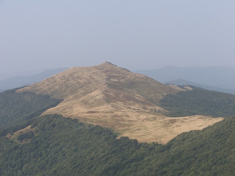
Krzemień
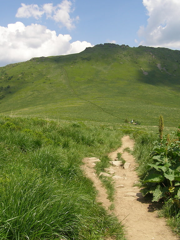
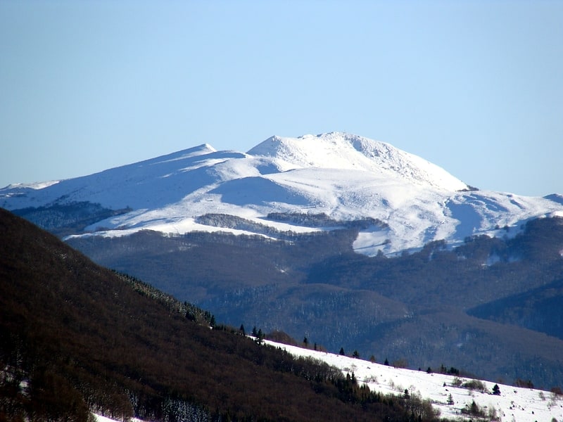
Mountain in Poland. Krzemień is a mountain in the Bieszczady Mountains of southern Poland. It has an elevation of 1,335 meters.[1]
Kopa Bukowska
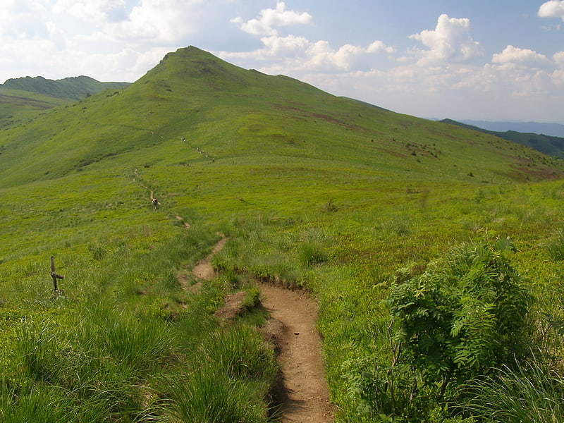
Peak in Poland. Kopa Bukowska is a peak in the Bieszczady Mountains in southern Poland. Its height is 1,320 meters.[2]
Muzeum Turystyki Górskiej
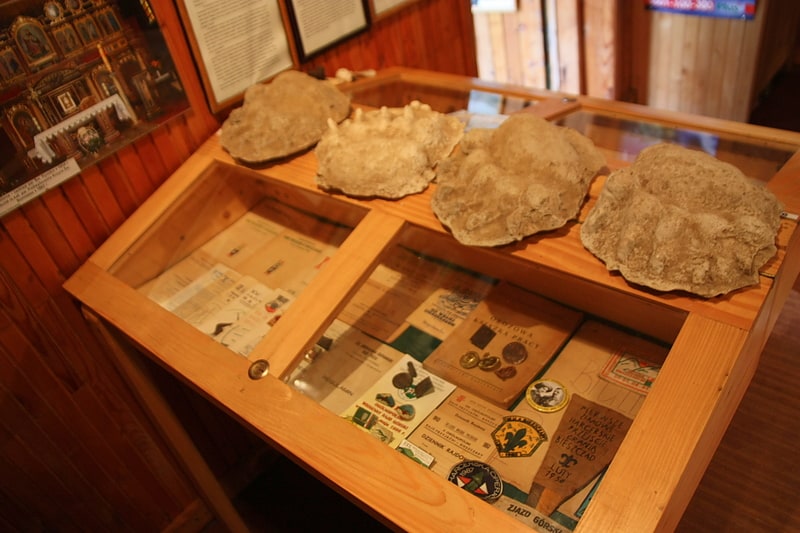
Bieszczady Mountains Tourist History Center "Zielony Domek" in Ustrzyki Górne - museum of the Polish Tourist Society with an exhibition on the history of mountain tourism in the Western Bieszczady Mountains and Eastern Carpathians, located in Ustrzyki Górne. The facility is under the care of Kazimierz Kantak's Wielkopolska PTTK Club of Mountain Tourist Guides of the Wielkopolska Corporation of PTTK Branches in Poznan.
Halicz
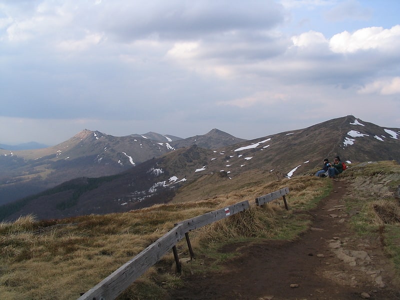
Peak in Poland. Halicz is a peak in the Bieszczady Mountains in southern Poland. Its height is 1,333 meters.
It is one of the highest peaks in the mountain range and from its summit one can look out over the rest of the Bieszczady in both Poland and Ukraine.[3]
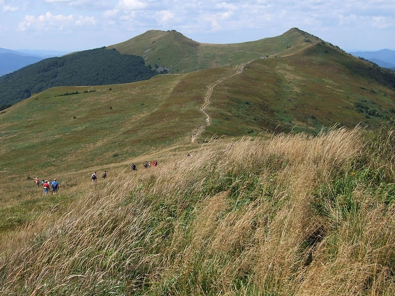
Tarnica
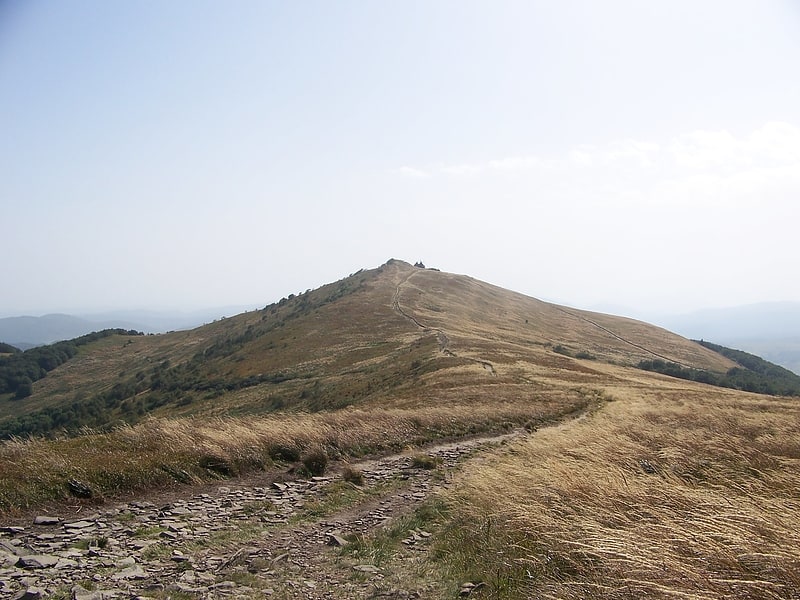
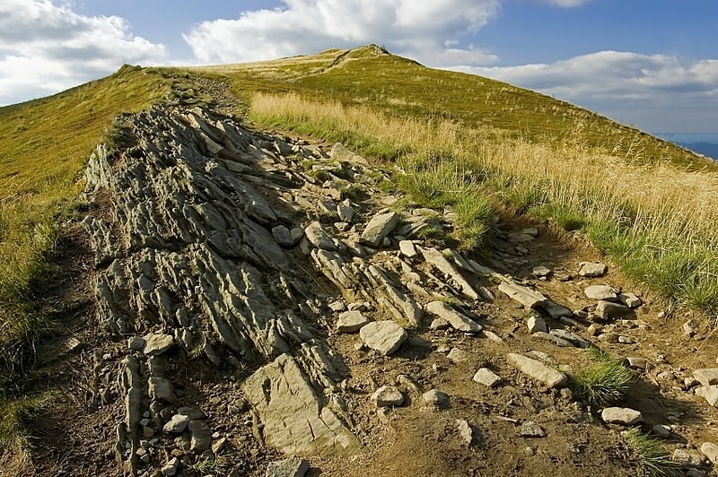
Mountain with twin peaks and valley views. Tarnica is a peak in the Bieszczady Mountains in southern Poland. Its height is 1,346 metres. It is one of the Polish Crown Peaks.
The summit towers 500 metres above the Wołosatka Valley. It can be easily told apart from its neighbours by its distinctive shape. The mountain has two separate summits, one of 1,339 and one of 1,346 metres. The southern part is a steep rocky wall, while the other side consist of less steep rocky fields.[4]
Hasiakowa Skała
Hasiakowa Skała - the easternmost peak of Połonina Wetlińska in the Bieszczady Mountains, located north of the Wyżna Pass and west of the Prowcza Creek valley. A side ridge of Jawornik and Dwernik Kamień, extending northward from the peak to the San valley. From an altitude of about 1100 m above sea level the slopes are covered by the Poloniny. A few meters south of the highest point is the shelter "Chatka Puchatka", the highest located in the Bieszczady.
The red marked Main Beskid Mountain Trail from Smerek to Berehy Górne leads through the peak and the yellow trail from the Wyżna Pass joins it. In turn, the black trail from the "Górna Wetlinka" camping site joins it (in its lower part).
Wielka Rawka
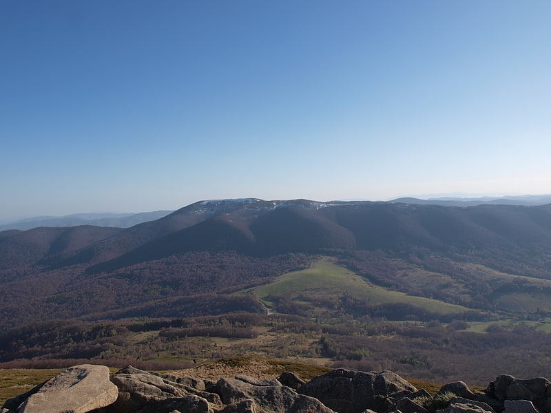
Wielka Rawka - the highest peak of the border range in the Western Bieszczady Mountains.
The massif of Mt Wielka Rawka lies in the central part of the border range; the border with Transcarpathia, which was the Kingdom of Hungary in 1945, runs along its southern slope. The summit dome has the character of a balanced ridge running NW-SE with the topline length of about 700 m. It is a lateral ridge diverging from the keystone located at the southeastern end of the summit plateau, where it joins the main ridge of the Carpathians. It runs further north, towards Mala Rawka, descending first to a shallow pass (1254 m) and then reaching the peak. In the main ridge the neighboring culminations are in the southwest Krzemieniec separated by a pass with an altitude of 1137 m, and in the southeast an unnamed peak with an altitude of 1123 m, behind which rises the Great Semenova.
The crest of Mt Wielka Rawka culminates in several indistinct peaks. The highest point is a sandstone outcrop situated in its central part, 1307 m high. A few dozen meters from this place there is a concrete pillar, an old geodesic sign. The north-western peak of 1303 m is still marked on maps. The slopes are quite steep, sometimes avalanches come down from the north-eastern slopes. Western slopes fall to the Upper Solinka valley, the north-eastern - to the Rzeczyca, while the southern, belonging to the basin of the Black Sea, drains Bystry Potok in the basin of the Uzh river.
Wielka Rawka is the most outstanding, that is, characterized by the highest minimum relative denivelation, elevation of the Western Bieszczady. The height of the peak 1307 m and the Beskid Pass 784 m, 523 m is due to the fact that there are no higher peaks in the area, and the Beskid Pass, against which this factor is calculated, lies relatively low. Also the altitudes in relation to the bottoms of the neighboring valleys are high - from 450 m (Upper Solinka) to 800 m (Bystry Potok).
The top parts of the mountain are covered by the Poloniny, the lower border of which runs extremely high - from about 1200 to over 1260 meters. This is due to the fact that due to the steep slopes here were not grazing cattle. However, due to the lack of forest on the peak, as well as the location and elevation above the surrounding terrain, Wielka Rawka is an attractive scenic spot. From here stretches a panorama of all massifs of the Poloniny range, the border range, the Eastern Bieszczady, Poloniny Rivne, and the mountains of Slovakia, including Wyhorlat.
On the crest of Mt Wielka Rawka there is a yellow liaison tourist trail from Mt Mala Rakawka, on the keystone it connects with the blue trail (Rzeszow - Grybow) leading from Ustrzyki Dolne along the border range, through Krzemieniec to Nowy Lupkow.
Of the plant species rare in Poland, rock cherry and Carpathian tocia were found.
Kruhly Wierch
Kruhly Wierch - one of the four peaks of Połonina Caryńska in the Western Bieszczady Mountains, forming its highest elevation.
From Kruhle Peak there is an excellent view of the Sanocko-Turczańskie Mountains, Połonina Wetlinska and the massif of Mala and Wielka Rawka.
Smerek
Smerek - a peak in the Western Bieszczady. This is the name under which it is most often described on maps and in guidebooks. On some maps, however, it is described as Wysoka.
Osadzki Wierch
Osadzki Wierch - the second highest and highest trail accessible peak in the Połonina Wetlinska range in the Western Bieszczady Mountains.
The summit is a short, rocky ridge with steep slopes covered with grehots. On Osadzki Wierch the ridge of Połonina Wetlinska changes direction (looking from the east) from NE-SW to NW-SE; moreover, the side ridge culminating in Hnatowy Brod diverges to the west. Due to the presence of the Poloniny, the peak is a vantage point overlooking the surrounding ranges of the Bieszczady and the Sanocko-Turczańskie Mountains.
Mała Rawka
Mala Rawka - a mountain that is the culmination of the Dział ridge. It is located near the village Ustrzyki Górne in the Western Bieszczady. To the northeast diverges the ridge, through the Wyżniańska Pass running towards Połonina Caryńska. It lies 15 minutes by mountain trail from Mt Wielka Rawka, separated from it by a high mountain pass, on which the highest forest in the Polish Bieszczady grows. Its summit is covered by a small forest, which is an excellent view point on the most famous massifs of Bieszczady: the Tarnica group, Połonina Wetlinska and Caryńska. Getting to the top of Mala Rawka involves overcoming an altitude of about 300 meters from its foot.
From plant species that are rare in Poland the occurrence of Carpathian tocia and rock cherry