Discover 20 hidden attractions, cool sights, and unusual things to do in Kings Canyon National Park (United States). Don't miss out on these must-see attractions: Tehipite Valley, Mount Bago, and Mount Rixford. Also, be sure to include East Vidette in your itinerary.
Below, you can find the list of the most amazing places you should visit in Kings Canyon National Park (California).
Table of Contents
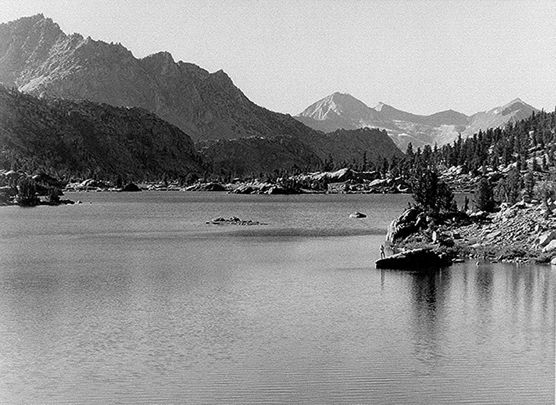
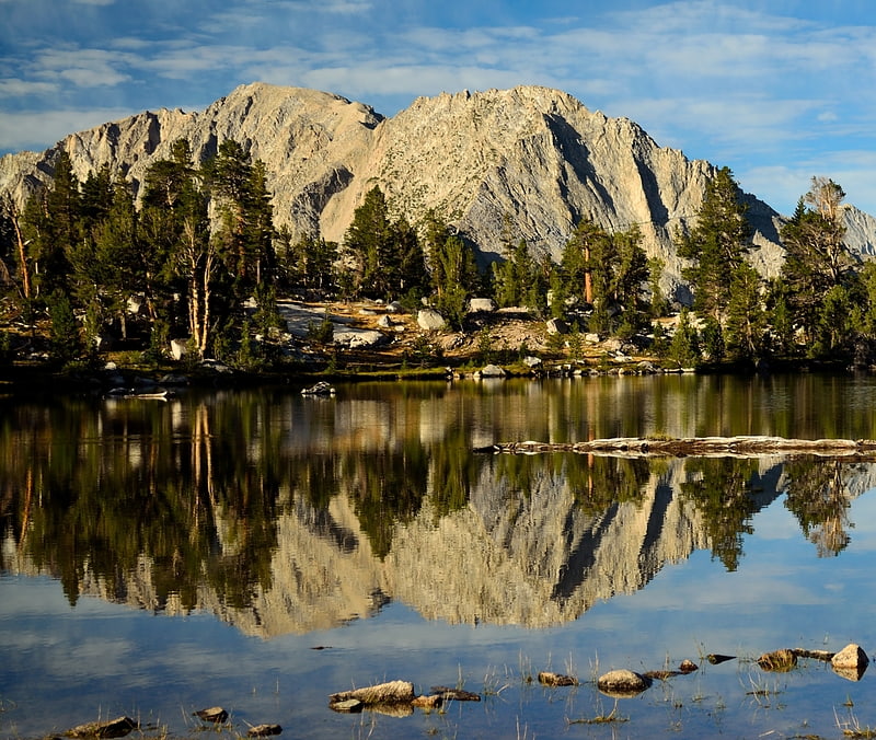
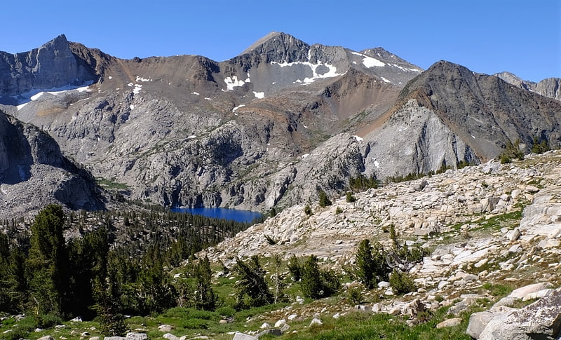
Tehipite Valley
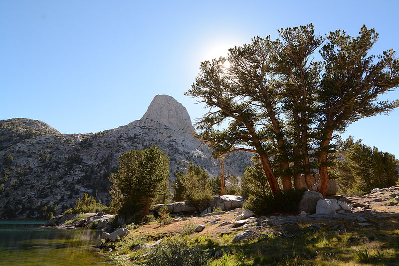
Tehipite Valley, a glacial valley of the Middle Fork Kings River, is located in Kings Canyon National Park in the Sierra Nevada of California. The valley is in Fresno County about 45 miles southwest of Bishop and 60 miles east of Fresno and is known for its Yosemite-like scenery and its extreme isolation.[1]
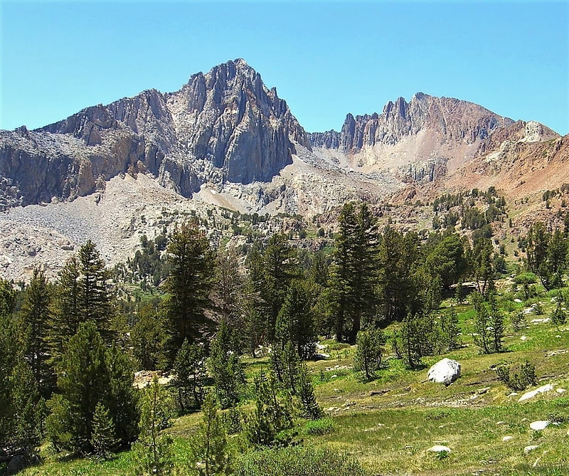
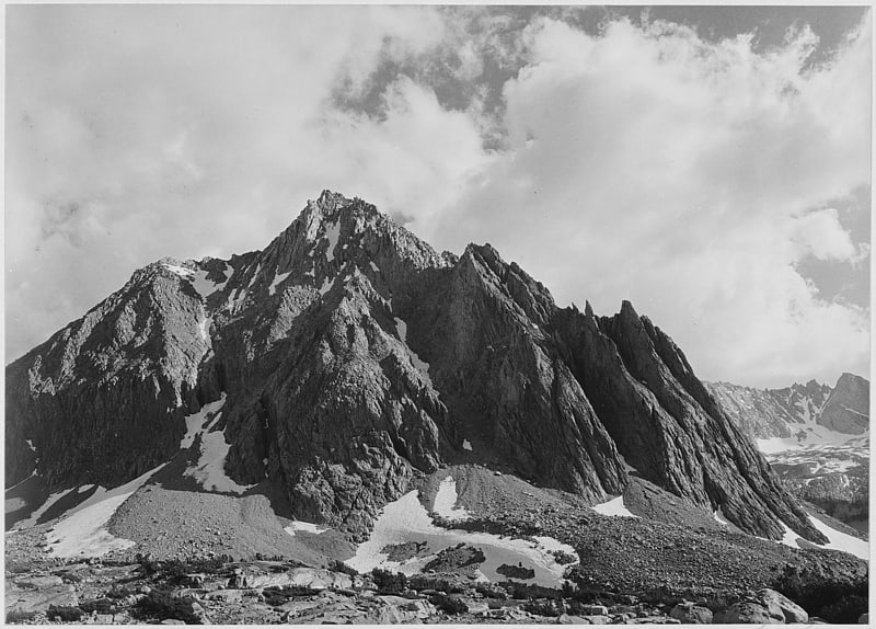
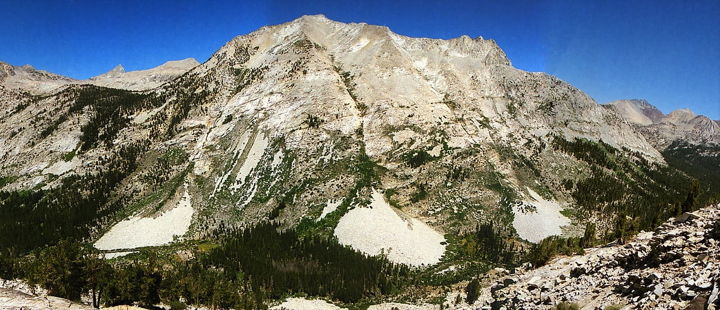
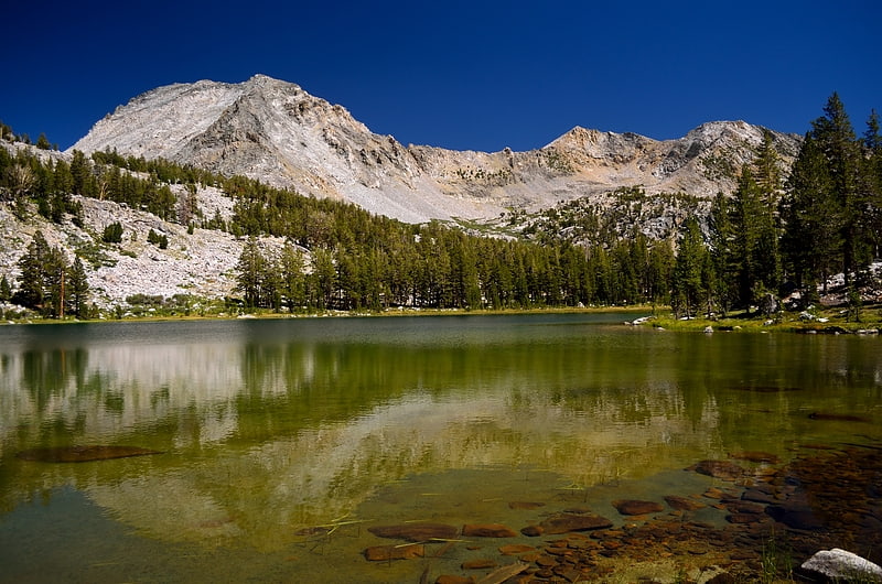
Mount Bago
Mount Bago is an 11,870-foot-elevation mountain summit located west of the crest of the Sierra Nevada mountain range, in the southeast corner of Fresno County, in northern California. It is situated in Kings Canyon National Park, 14 miles west of the community of Independence, 2.3 miles west of the Kearsarge Pinnacles, and 2.4 miles southwest of Mount Rixford. Topographic relief is significant as the south aspect rises 3,675 feet above Junction Meadow in one mile. The John Muir Trail passes to the northeast of this remote geographical feature. The first ascent of the summit was made July 11, 1896, by Joseph Nisbet LeConte and Wilson S. Gould.[2]
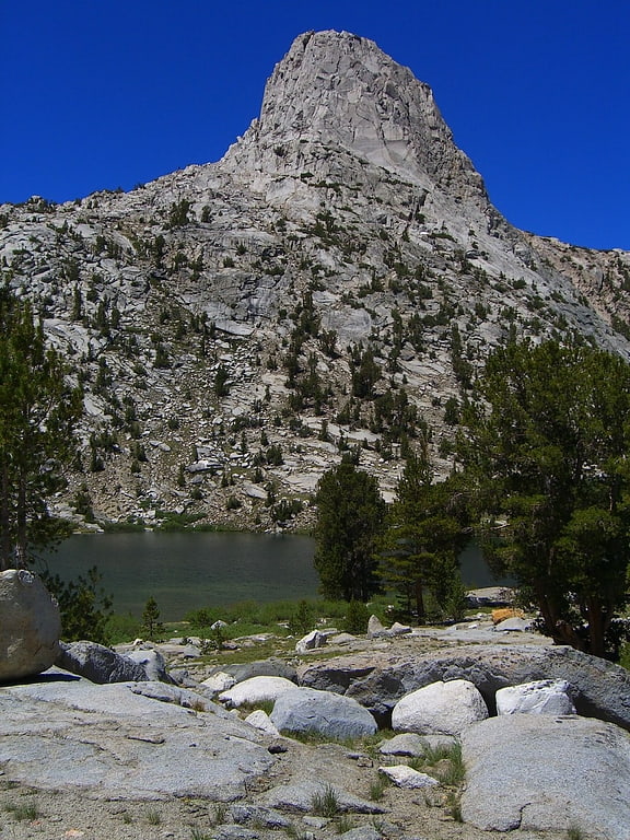
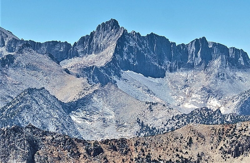
Mount Rixford
Mount Rixford is a 12,887-foot-elevation mountain summit located one mile west of the crest of the Sierra Nevada mountain range, in the southeast corner of Fresno County, in northern California. It is situated in Kings Canyon National Park, 11.5 miles west of the community of Independence, and one mile north of the Kearsarge Pinnacles and Kearsarge Lakes. Topographic relief is significant as the north aspect rises 2,346 feet above Rae Lakes in one mile. The John Muir Trail crosses Glen Pass one mile to the west of this mountain. Mt. Rixford ranks as the 183rd highest summit in California. Painted Lady is a subsidiary summit at the end of Rixford's north ridge.[3]
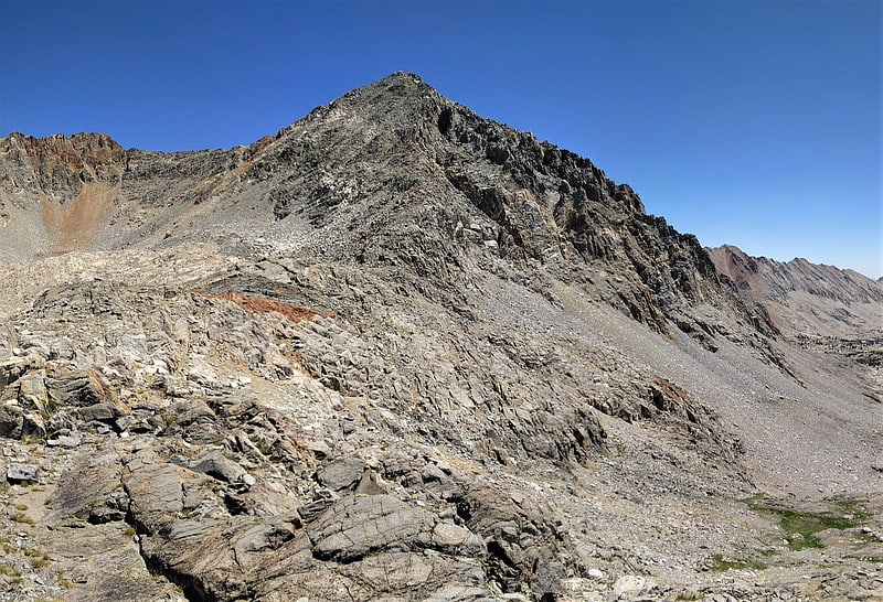
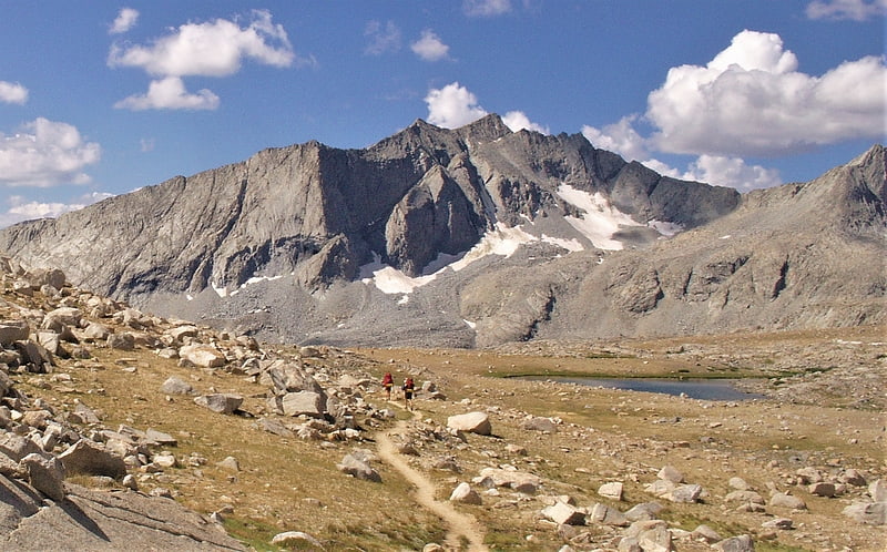
East Vidette
East Vidette is a 12,356-foot-elevation mountain summit located two miles west of the crest of the Sierra Nevada mountain range, in the northeast corner of Tulare County in northern California. It is situated in Kings Canyon National Park, 12.5 miles west-southwest of the community of Independence, and one mile southwest of the Kearsarge Pinnacles. Topographic relief is significant as the north aspect rises nearly 2,800 feet above Vidette Meadow in less than one mile. The John Muir Trail traverses below the north and east aspects of this remote peak. The first ascent of the summit was made in 1910 by a Sierra Club party via the East Ridge.[4]
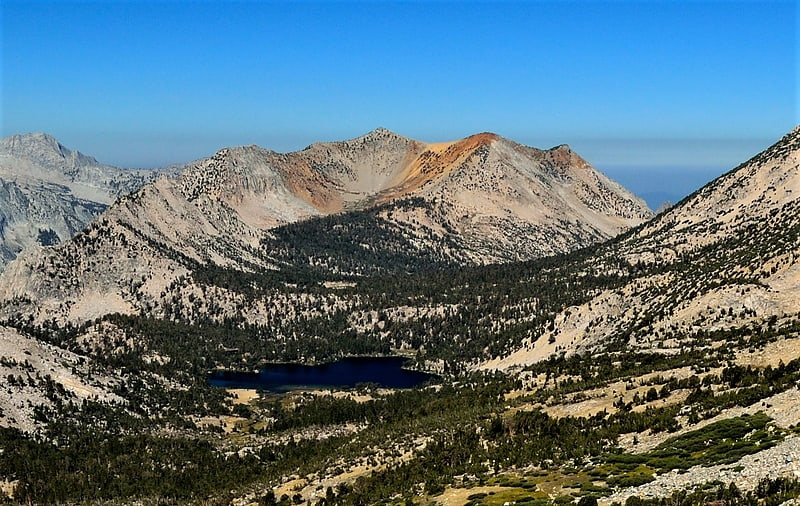
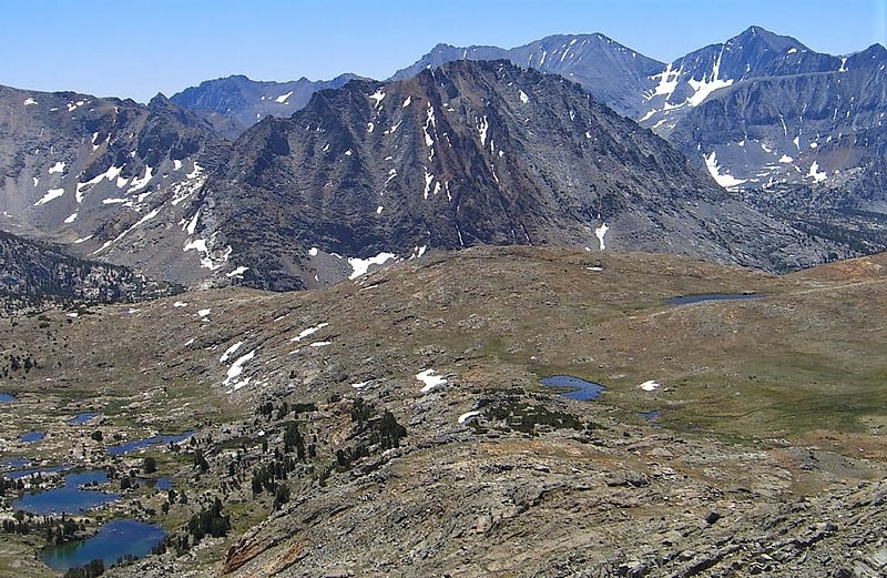
Rae Lakes
Lake in California. Rae Lakes is a series of lakes in the Sierra Nevada, located in Kings Canyon National Park, eastern Fresno County, California. The lakes are located on the John Muir Trail at the base of Black Mountain.[5]
Crater Mountain
Mountain in California. Crater Mountain is a 12,874-foot-elevation mountain summit located west of the crest of the Sierra Nevada mountain range, in Fresno County of northern California, United States. It is situated in eastern Kings Canyon National Park, 15.5 miles northwest of the community of Independence, one mile immediately southwest of Pinchot Pass, and 1.3 miles southeast of Mount Ickes, which is the nearest higher neighbor. Other nearby peaks include Mount Wynne, 1.5 miles to the northeast, and Mount Cedric Wright, 2.2 miles to the southeast. Crater Mountain ranks as the 186th highest summit in California. Topographic relief is significant as the west aspect rises 2,000 feet in less than one mile. The approach to this remote peak is made via the John Muir Trail which passes below the east aspect of the mountain. The first ascent of the summit was made July 19, 1922, by W. H. Ink, Meyers Butte, Frank Baxter, and Captain Wallace. This mountain has no crater as the name implies.[6]
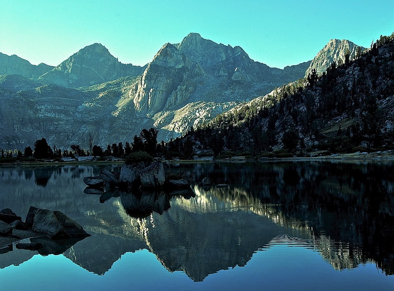
Fin Dome
Fin Dome is an 11,673-foot-elevation granite summit located 1.5 mile west of the crest of the Sierra Nevada mountain range, in the southeast corner of Fresno County, in northern California. It is situated in the Rae Lakes area of Kings Canyon National Park, approximately 15.5 miles west of the community of Independence. Nearby peaks include Black Mountain 1.9 miles to the east, and Mount Rixford 2.1 miles to the south-southeast. Topographic relief is significant as the east aspect rises 1,135 feet above Rae Lakes in one-quarter mile. The John Muir Trail passes to the east of this landmark, providing an approach. This geographical feature was named by Bolton Brown in 1899 when he explored the lake basin in its vicinity, because it resembled the fin of a sea serpent. The first ascent of the summit was made in 1910 by James Rennie, one of the foremost mountaineers of the Sierra Club.[7]
Mount Wynne
Mount Wynne is a 13,179-foot-elevation mountain summit located one mile west of the crest of the Sierra Nevada mountain range, in Fresno County of northern California, United States. It is situated in eastern Kings Canyon National Park, 31 miles northwest of the community of Lone Pine, 0.4 mile immediately east of Pinchot Pass, and 0.66 miles south of Mount Pinchot, which is the nearest higher neighbor. Mt. Wynne ranks as the 116th highest summit in California. Topographic relief is significant as the south aspect rises nearly 2,000 feet above the surrounding terrain in approximately one mile. The approach to this remote peak is made via the John Muir Trail. The first ascent of the summit was made in 1935 by a Sierra Club party.[8]
West Vidette
West Vidette is a 12,533-foot-elevation mountain summit located three miles west of the crest of the Sierra Nevada mountain range, in the northeast corner of Tulare County in northern California. It is situated in Kings Canyon National Park, 13.5 miles west-southwest of the community of Independence, and 1.27 miles west of East Vidette. Topographic relief is significant as the north aspect rises 4,300 feet above Junction Meadow in two miles. The John Muir Trail passes below the north aspect of this remote peak. The first ascent of the summit was made September 19, 1926, by Norman Clyde, who is credited with 130 first ascents, most of which were in the Sierra Nevada.[9]
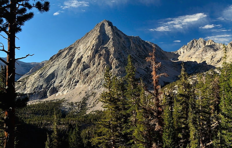
Center Peak
Center Peak is a 12,760-foot-elevation mountain summit located one mile west of the crest of the Sierra Nevada mountain range, in the northeast corner of Tulare County in northern California. It is situated in eastern Kings Canyon National Park, 11 miles southwest of the community of Independence, 1.8 miles south of University Peak, and two miles north of Forester Pass. Topographic relief is significant as the north aspect rises 2,230 feet above Bubbs Creek in one mile. The John Muir Trail which traverses below the west slope of this remote peak provides an approach.[10]
North Guard
North Guard is a remote 13,327-foot-elevation mountain summit located near the northern end of the Great Western Divide of the Sierra Nevada mountain range, in Tulare County of northern California. It is situated in Kings Canyon National Park, 0.9 miles southeast of Mount Farquhar, and 0.6 miles north-northwest of Mount Brewer, which is the nearest higher neighbor. Topographic relief is significant as the east aspect rises 3,858 feet above East Lake in three miles. North Guard ranks as the 87th highest summit in California, and the second highest point of the northern Great Western Divide. It's not as high as Mount Brewer, but offers better climbing and is considered one of the classic climbing routes in the Sierra Nevada.[11]
Mount Sill
Peak in California. Mount Sill is one of the fourteeners of the Sierra Nevada in California. It is located in the Palisades, a group of striking rock peaks with a few small glaciers on their flanks. Mount Sill is located 0.6 miles east of North Palisade, the high point of the group. The two peaks are connected by a high, rocky ridge, on the north side of which lies the Palisade Glacier. Mount Sill lies on the main Sierra Crest, but is at a point where the crest turns sharply, giving it particularly striking summit views. On one side is Kings Canyon National Park and Fresno County; on the other is the John Muir Wilderness, Inyo National Forest and Inyo County.
Routes on Mount Sill are found on all sides of the peak and range in difficulty from scrambles (class 2-3) to a moderately technical rock climbs (class 5.7).
The mountain is called Nen-i-mish ("the Guardian of the Valley") by the indigenous Northern Paiute people. Its English name was coined, in 1904, by Joseph LeConte, a noted mountaineer, in honor of American poet Edward Rowland Sill.[12]
Marion Peak
Marion Peak is a remote 12,719-foot-elevation mountain summit located in Kings Canyon National Park, in Fresno County of northern California, United States. It is situated on Cirque Crest which is west of the crest of the Sierra Nevada mountain range, 2.13 miles northeast of State Peak, and 2.6 miles northwest of Arrow Peak, the nearest higher neighbor. Topographic relief is significant as the north aspect rises 2,400 feet above Marion Lake in one mile, and the southeast aspect rises 3,500 feet above South Fork Kings River in less than two miles.[13]
Vennacher Needle
Vennacher Needle is a 12,995-foot-elevation mountain summit located in Kings Canyon National Park, in Fresno County of northern California, United States. It is situated west of the crest of the Sierra Nevada mountain range, and 1.4 miles north of Mount Ruskin. Topographic relief is significant as the east aspect rises nearly 2,300 feet above the Upper Basin of South Fork Kings River in one mile. The John Muir Trail, which passes one mile to the east of this mountain, provides one possible approach option. This mountain's name has been officially adopted by the United States Board on Geographic Names.[14]
South Guard
South Guard is a remote 13,232-foot-elevation mountain summit located near the northern end of the Great Western Divide of the Sierra Nevada mountain range, in Tulare County of northern California. It is situated in Kings Canyon National Park, 1.63 miles south of North Guard, and one mile south of Mount Brewer, which is the nearest higher neighbor. Topographic relief is significant as the west aspect rises 4,600 feet above Cloud Canyon in 3.5 miles, and the east aspect rises 3,200 feet above Lake Reflection in two miles. South Guard ranks as the 103rd highest summit in California, and the third-highest point of the northern Great Western Divide.[15]
Mount Ickes
Mount Ickes is a 12,959-foot-elevation mountain summit located west of the crest of the Sierra Nevada mountain range, in Fresno County of northern California, United States. It is situated in eastern Kings Canyon National Park, 13.5 miles northwest of the community of Independence, 1.5 mile west of Pinchot Pass, and 2 miles west of Mount Wynne, which is the nearest higher neighbor. Other nearby peaks include Crater Mountain 1.3 miles to the southeast, Striped Mountain 3 miles to the northeast, Arrow Peak, three miles to the west, and Mount Ruskin four miles to the northwest. Mount Ickes ranks as the 159th highest summit in California. Topographic relief is significant as the north aspect rises 3,080 feet in 2.5 miles. The approach to this remote peak is made via the John Muir Trail which passes to the east of the mountain. The mountain's name was officially adopted in 1964 by the United States Board on Geographic Names to honor Harold L. Ickes, who was responsible for implementing much of President Franklin D. Roosevelt's New Deal as Secretary of the Interior from 1933 to 1946 and was instrumental in establishing Kings Canyon National Park.[16]
Mount Ruskin
Mount Ruskin is a 12,920-foot-elevation mountain summit located in Kings Canyon National Park, in Fresno County of northern California, United States. It is situated west of the crest of the Sierra Nevada mountain range, immediately east of Cartridge Pass, and 1.4 miles south of Vennacher Needle, the nearest higher neighbor. Topographic relief is significant as the south aspect rises over 3,280 feet above South Fork Kings River in 1.5 mile.[17]
Mount Cedric Wright
Mount Cedric Wright is a 12,372-foot-elevation mountain summit located one mile west of the crest of the Sierra Nevada mountain range, in Fresno County of northern California, United States. It is situated in eastern Kings Canyon National Park, 13 miles northwest of the community of Independence, 2.2 miles southeast of Crater Mountain, and 2.5 miles south-southeast of Mount Wynne and Pinchot Pass. Topographic relief is significant as the west aspect rises nearly 2,000 feet above the surrounding terrain in approximately one mile. The John Muir Trail traverses below the west aspect of this remote peak. The first ascent was made August 25, 1935, by Norman Clyde.[18]
Mount Jordan
Mount Jordan is a remote 13,343-foot-elevation mountain summit located on the Kings–Kern Divide of the Sierra Nevada mountain range, in Tulare County of northern California. It is situated on the shared boundary of Kings Canyon National Park with Sequoia National Park, 3.1 miles southwest of Mount Stanford, and one mile west of Mount Genevra, which is the nearest neighbor. Topographic relief is significant as the north aspect rises 3,313 feet above Lake Reflection in 1.3 mile. Mount Jordan ranks as the 84th highest summit in California, and the fifth-highest peak on the Kings–Kern Divide.[19]
State Peak
State Peak is a remote 12,620-foot-elevation mountain summit located in Kings Canyon National Park, in Fresno County of northern California, United States. It is situated on Cirque Crest which is west of the crest of the Sierra Nevada mountain range, 3.03 miles west of Arrow Peak, and 2.13 miles southwest of Marion Peak, the nearest higher neighbor. Topographic relief is significant as the west aspect rises 2,100 feet above State Lakes in 1.5 mile, and the southeast aspect rises 4,000 feet above South Fork Kings River in 1.5 mile.[20]